Benelux - Collectibles and Curiosities

to
4,837
6,824
15,105
11,564
6,772
38
14
115
31
29
28
27
19
17
14
13
12
6
4
4
4
3
2
2
3,247
2,599
926
52
381
205
67
84
20
10
17
7
33
44
29
14
7
5,808
518
362
108
98
1,273
352
261
151
108
6,824
6,823
6,823
104
59
20
14
14
Item Ships From: Benelux
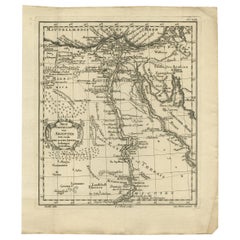
Original Antique Map of Egypt by Van Dùren '1749'
Located in Langweer, NL
Decorative German antique engraving with titled 'Neue Vorstellung von Aegypten (..)'. It concerns a rare original antique map of Egypt. This map o...
Category

Mid-18th Century Antique Benelux - Collectibles and Curiosities

Materials

Paper

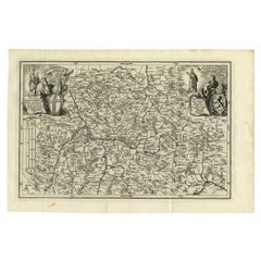
Antique Map of the Franconia Region by Scherer, 1699
Located in Langweer, NL
Antique map titled 'Franconia multa numerat loca deiparae sacra in quibus magna recipit à dei matre beneficia.' Detailed uncommon map of the Franconia region in Germany. Source unkno...
Category

17th Century Antique Benelux - Collectibles and Curiosities

Materials

Paper

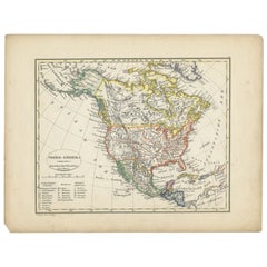
Antique Map of North America from an Old Dutch School Atlas, 1852
Located in Langweer, NL
Antique map titled 'Noord-Amerika'. Map of North America. This map originates from 'School-Atlas van alle deelen der Aarde' by Otto Petri. Artists and Engra...
Category

19th Century Antique Benelux - Collectibles and Curiosities

Materials

Paper

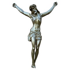
Large & Impressive Antique Bronze Corpus of Christ w. Amazing Details and Patina
Located in Lisse, NL
Stunning and beautifully handcrafted, work of religious art. Large bronze crucifixes are a rare find and to have been given the opportunity to purchase one of such beautiful quality and details made us grateful. The well portrait anatomy and the perfect patination of this large Christ sculpture are truly marvelous and we could see this antique go to both private collectors/worshippers and to a church or monastery. Mounted on the wall this rare size corpus will make a lasting impression, also from further away. So if you are looking for a unique and aesthetically pleasing Christ sculpture to grace your house of worship or home shrine then this meaningful Christian relic...
Category

Late 19th Century German Gothic Revival Antique Benelux - Collectibles and Curiosities

Materials

Bronze

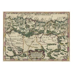
Copper-Engraved Map Showing the Algerian Coast of North Africa, Published 1683
Located in Langweer, NL
Antique map titled 'Partie de Barbarie, ou est le Royaume d'Alger (..)'. Copper-engraved map showing the Algerian coast of North Africa. Published 1683. Artists and Engravers:...
Category

1680s Antique Benelux - Collectibles and Curiosities

Materials

Paper

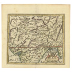
1692 Engraved Map: Detailed Mogul Empire, India to Afghanistan, Hand-Colored
Located in Langweer, NL
1692 Map of the Mogul Empire by Jacques Peeters This finely engraved map, published in 1692 by Jacques Peeters, showcases the Mogul Empire region, covering areas from northern India...
Category

1690s Antique Benelux - Collectibles and Curiosities

Materials

Paper

Bird's-Eye View of Blâmont in Lorraine by Braun and Hogenberg, 1597
Located in Langweer, NL
Title: Bird's-Eye View of Blâmont in Lorraine by Braun and Hogenberg, 1597 This copperplate engraving, published in 1597 by Braun and Hogenberg, depicts a bird's-eye view of the t...
Category

16th Century Antique Benelux - Collectibles and Curiosities

Materials

Paper

Antique Print with a View of Amsterdam from the IJ Dock by H. Schouten
Located in Langweer, NL
This rare authentic old antique print / plate originates from: 'Nieuwe atlas, van de voornaamste gebouwen en gezigten der stad Amsterdam, met derzelver beknopte beschryvingen.' (tran...
Category

Late 18th Century Antique Benelux - Collectibles and Curiosities

Materials

Paper

Ancient Cartography of the Indian Subcontinent, Published in 1880
Located in Langweer, NL
This map is titled "INDIA," and it provides a detailed view of the Indian subcontinent with various inset maps that offer additional historical and geographical context. The main ma...
Category

1880s Antique Benelux - Collectibles and Curiosities

Materials

Paper

Antique Map of France in Ancient Roman Times, 1880
Located in Langweer, NL
Antique map titled 'Gaule indépendante et Romaine'. Old map of Gaul or France in ancient Roman times. The map covers from the southern part of England (Britannia) to the north of S...
Category

19th Century Antique Benelux - Collectibles and Curiosities

Materials

Paper

Antique Architectural Print of Pavilions for English Gardens by Le Rouge, 1776
Located in Langweer, NL
Antique print titled 'Pavillons Grottes pour les Jardins Anglais'. Copper engraving showing pavilions for English gardens. This print originates from 'J...
Category

18th Century Antique Benelux - Collectibles and Curiosities

Materials

Paper

Pl. 2 Antique Print of Vauxhall Gardens by Le Rouge, c.1785
Located in Langweer, NL
Antique print titled 'Vue d'une partie du Voxhal de Londres'. Copper engraving of Vauxhall gardens, London. This print originates from 'Jardins Anglo-Chinois à la Mode' by Georg Loui...
Category

18th Century Antique Benelux - Collectibles and Curiosities

Materials

Paper

Antique Architectural Print of Villa a Deauville in France, Chabat, c.1900
Located in Langweer, NL
Antique print titled 'Villa a Deauville, Mr. H. Blondel Architecte, Mr. Breney Architecte'. This print depicts the design of a building in France. Originates from 'La Brique et La Te...
Category

20th Century Benelux - Collectibles and Curiosities

Materials

Paper

17th-Century Antique Map of Jiangxi (Kiangsi) Province, China – by Blaeu
Located in Langweer, NL
Title: 17th-Century Antique Map of Jiangxi Province, China – "Kiangsi" by Blaeu, Detailed and Vibrantly Colored Description: This detailed 17th-century map of Jiangxi Province, historically referred to as "Kiangsi," was created by Johannes Blaeu and published in 1655 as part of the *Novus Atlas Sinensis*. Jiangxi, located in southeastern China, is known for its cultural heritage, scenic landscapes, and significant contributions to Chinese history. The map meticulously charts Jiangxi’s geography, including mountain ranges, rivers, and cities, with place names rendered in Latin. Poyang Lake, one of the largest freshwater lakes in China, is prominently depicted, emphasizing the region’s ecological and economic importance. The map also highlights key cities such as Nanchang, the provincial capital, which has long been a cultural and political center, and Jingdezhen, globally famous as the center of Chinese porcelain production. The decorative cartouche in the lower-right corner features traditional Chinese figures, adding cultural depth to the map. Blaeu’s craftsmanship is evident in the precise copperplate engraving and the vibrant hand-coloring, which enhances the boundaries and natural features, making this map both a functional document and a work of art. Condition: Nearly excellent. Sharp impression with vivid hand-coloring. Wide margins with minor age-toning appropriate for its age. Framing Tips: Use a neutral double mat and an ornate gilt or dark wood frame to highlight the map’s historical and artistic value. UV-protective glass is recommended to preserve the hand-coloring and intricate details. Jiangxi, historically referred to as "Kiangsi," is famous for its rich cultural history, stunning landscapes, and economic contributions. It has been a key region for porcelain production, with Jingdezhen renowned as the "Porcelain Capital" of the world. Poyang Lake, featured prominently on the map, is vital for fishing, transportation, and its ecological significance. The province’s location along the Gan River has historically made it an important transportation corridor. Nanchang, the provincial capital, is noted for its historical landmarks and political significance in modern Chinese history. Keywords include: antique map of Jiangxi, Kiangsi map, Poyang Lake, Jingdezhen porcelain, 17th-century China map...
Category

1650s Antique Benelux - Collectibles and Curiosities

Materials

Paper

Antique Map of The United States Southern Section by A & C. Black, 1870
Located in Langweer, NL
Antique map titled 'United States Southern Section'. Original antique map of Map of The United States Southern Section. This map originates from ‘Black's General Atlas of The World’....
Category

Late 19th Century Antique Benelux - Collectibles and Curiosities

Materials

Paper

The 1649 Haderschleben Map of Western Jutland and North Sea Islands
Located in Langweer, NL
This is a beautiful example of an antique map, titled "Westertheil des Amptes Haderschleben Zusambt Rieben und dem Loehmcloster Anno 1649." It's a hand-colored copper etching by Matt...
Category

1640s Antique Benelux - Collectibles and Curiosities

Materials

Paper

Original Antique Map of Turkey, Asia Minor and Cyprus
By Gerard Mercator
Located in Langweer, NL
Antique map titled 'Natoliae sive Asia Minor'. Original old map of Turkey, Asia Minor and Cyprus. Includes a decorative cartouches, sailing ship, sea mon...
Category

Early 17th Century Antique Benelux - Collectibles and Curiosities

Materials

Paper

Old Map of the Eastern Region of the Kingdom of Algiers, Algeria, 1773
Located in Langweer, NL
Antique map titled 'Kaart van het Oostelyke Deel van het Ryk van Algiers'. Old map of the eastern region of the Kingdom of Algiers, Algeria. Originates from the first Dutch edito...
Category

1770s Antique Benelux - Collectibles and Curiosities

Materials

Paper

Original 17th-Century Antique Map of Fujian (Fokien) Province, China – by Blaeu
Located in Langweer, NL
17th-Century Antique Map of Fujian Province, China – "Fokien" by Blaeu, with Decorative Cartouches Description: This stunning 17th-century map of Fujian Province, historically ref...
Category

1650s Antique Benelux - Collectibles and Curiosities

Materials

Paper

Very Rare Antique Print of the Kings Celebrations in Pegu, Myanmar, 1682
Located in Langweer, NL
Plate: 'Konings feesten tot Pegu.' (Kings celebrations in Pegu.) On this plate: 1. The King. 2. And the Queen, sprinkling water on each other. 3. Their children. 4. Officers. 5. ...
Category

1680s Antique Benelux - Collectibles and Curiosities

Materials

Paper

Antique Map of Java 'Indonesia' by Chatelain, 1719
Located in Langweer, NL
Antique map titled 'Carte de l'Ile de Java: Partie Occidentale, Partie Orientale, Dressee tout Nouvellement Sur Les Memoires Les Plus Exacts (..)'. This beautiful map of Java exists ...
Category

Early 18th Century Antique Benelux - Collectibles and Curiosities

Materials

Paper

Map of Western Australia & Swan River, insets of Perth, Aboriginals, Sheep, 1851
Located in Langweer, NL
Antique map titled 'Western Australia, Swan River'. Map of Western Australia and Swan River, surrounded by illustrations of Perth, Aborigines and sheep shea...
Category

1850s Antique Benelux - Collectibles and Curiosities

Materials

Paper

Antique Mobil Dentist Rinsing Sink Stainless Steel, Belge
Located in Mortsel, BE
Elevate your space with this Antique Dentist Rinsing Sink crafted from stainless steel, showcasing Belgian craftsmanship. This unique piece is a testament to the bygone era of dentis...
Category

Mid-20th Century Belgian Benelux - Collectibles and Curiosities

Materials

Metal, Steel

Antique Map of Japan, the Kurile Islands and Liu Kiu Islands, 1886
Located in Langweer, NL
The map is an exquisite piece, showcasing Japan's vibrant geography. Engraved by J. Bartholomew and published by George Philip & Son in London & Liverpool, it presents a detailed and...
Category

Late 19th Century Antique Benelux - Collectibles and Curiosities

Materials

Paper

Antique Map of Italy with Hand-Colored Borders, 1852
Located in Langweer, NL
Antique map titled 'Italië'. Map of Italy. This map originates from 'School-Atlas van alle deelen der Aarde' by Otto Petri. Artists and Engravers: Published by A. Baedeker (Otto Petr...
Category

19th Century Antique Benelux - Collectibles and Curiosities

Materials

Paper

Silver Jewish Torah Pointer or Yad
Located in Delft, NL
A silver Jewish Torah pointer or Yad A silver yad is a Jewish ritual pointer, known as a Torah pointer, used by the reader to follow the text during the Torah reading from the parchment Torah scrolls...
Category

Late 19th Century European Antique Benelux - Collectibles and Curiosities

Materials

Silver

Antique Map of the City of Copenhagen in Denmark c.1720
Located in Langweer, NL
Antique map titled 'Copenhagen'. Original antique map of the city of Copenhagen, Denmark. This map originates from 'Unterschiedliche dieser Zeit Beruffene Laender, Gegenden, Staedte ...
Category

18th Century Danish Antique Benelux - Collectibles and Curiosities

Materials

Paper

Reference Book Chinese Art - Chinese Art Hardcover, 1961
Located in Amsterdam, Noord Holland
Bronzes, pottery, porcelain, ivories, jades, sculpture and paintings-all these mediums of the Chinese creative genius are presented in this volume in full color. Rarely has such a co...
Category

20th Century Benelux - Collectibles and Curiosities

Materials

Paper

Original Antique Engraving of Algiers in Algeria, 1773
Located in Langweer, NL
Antique print titled 'Algiers'. Old print with a view of Algiers, Algeria. With Dutch legend. Originates from the first Dutch editon of an interesting travel account of Northern Afri...
Category

18th Century Antique Benelux - Collectibles and Curiosities

Materials

Paper

Antique Map of Vermont
Located in Langweer, NL
Antique map titled 'Vermont'. Original antique map of Vermont, United States. This print originates from 'Encyclopaedia Britannica', Ninth Edition. Publ...
Category

Late 19th Century Antique Benelux - Collectibles and Curiosities

Materials

Paper

Antique Map of Vermont
$274 Sale Price
20% Off
Old Ptolemaic Map of the Region Between the Persian Gulf and Caspian Sea, 1598
Located in Langweer, NL
"Tabula Asiae V", Ptolemy/Ruscelli Subject: Persia - Iran Period: 1598 (published) Publication: Geografia di Claudio Tolomeo Allessadrino… Claudius Ptolemy was a mathematician, ast...
Category

16th Century Antique Benelux - Collectibles and Curiosities

Materials

Paper

Rare Hand-Colored Map of Champagne and Brie, France, by Frederik De Wit c. 1688
Located in Langweer, NL
Title: Rare Hand-Colored Map of Champagne and Brie by Frederik De Wit c. 1688 Description: This exquisite 17th-century map, "Champagne et Brie," beau...
Category

1680s Antique Benelux - Collectibles and Curiosities

Materials

Paper

1748 Homann Heirs Double Map of the East Indies and Southeast Asia
Located in Langweer, NL
Title: 1774 Homann Heirs Double Map of the East Indies and Southeast Asia Description: This stunning 1774 double map by the Homann Heirs showcases the East Indies and Southeast ...
Category

1740s Antique Benelux - Collectibles and Curiosities

Materials

Paper

1880 Map of the Caribbean and Central America by Adolf Stieler
Located in Langweer, NL
This is a detailed map titled "West-Indien und Central-Amerika," created by Adolf Stieler and published in Gotha in 1880. The map covers the Caribbean islands and the Central America...
Category

1880s Antique Benelux - Collectibles and Curiosities

Materials

Paper

Antique Map of the Island of Psara by Dapper, 1688
Located in Langweer, NL
Antique map titled 'Sara.' Map of Psara ( Psyra or Ipsera) Island (North East Aegean Islands), Greece. This map originates from 'Nauwkeurige Beschrijving der eilanden in de Archipel ...
Category

17th Century Antique Benelux - Collectibles and Curiosities

Materials

Paper

Antique Print of Graves Near the City of Nanjing in China, 1665
Located in Langweer, NL
Antique print titled 'Graf-Steden'. Old print depicting graves near the city of Nanjing, China. This print originates from 'Het gezantschap der Nee^rlandtsche Oost-Indische Compagnie...
Category

17th Century Antique Benelux - Collectibles and Curiosities

Materials

Paper

Antique Print of Phineus, Son of Poseidon or Phoenix, 1733
Located in Langweer, NL
Antique print titled 'Phinée délivré des Harpyes (..)'. This print depicts Phineus delivered from the Harpies by Calais & Zethes. Phineas was said to be a son of Poseidon, or of Phoenix, and had the gift of prophecy. Zeus, angry that Phineas revealed too much of the plans of the gods, punished him by blinding him and setting him on an island with a buffet of food. However, he could eat none of it because the harpies, vicious, winged women, stole the food out of his hands right before he could eat. This continued until the arrival of Jason and the Argonauts...
Category

18th Century Antique Benelux - Collectibles and Curiosities

Materials

Paper

Minho: A Legacy of Lush Landscapes and Living Traditions in Portugal, 1903
Located in Langweer, NL
Ths authentic print is a historical map of the Minho region in the northwestern part of Portugal. The map includes detailed geographical features, such as rivers, mountain ranges, an...
Category

Early 1900s Antique Benelux - Collectibles and Curiosities

Materials

Paper

17th Century Cartographic Marvel: A Detailed Engraving of Guangzhou (Kanton)
Located in Langweer, NL
This engraving of Guangzhou ("Kanton") is from a French edition of Olfert Dapper's work. The French edition titled "Description de l’Empire de la Chine" was published in 1674. It is ...
Category

1670s Antique Benelux - Collectibles and Curiosities

Materials

Paper

Antique Map of the Region of Bengkulu in Indonesia, 1900
Located in Langweer, NL
Antique map of the region of Benkulu, Sumatra. Also depicting Enggano Island. This map originates from 'Atlas van Nederlandsch Oost- en West-Indië' by I. Dornseiffen. Artists and E...
Category

20th Century Benelux - Collectibles and Curiosities

Materials

Paper

Gaucho Spurs – Hand-forged Iron And Silver Inlay – Argentina, 18th Century
Located in Bilzen, BE
Gaucho Spurs – Hand-forged Iron And Silver Inlay – Argentina, 18th Century" Antique 18th-Century Gaucho Spurs – Hand-Forged Iron with Silver Inlay (Argentina, c.1750–1800) Descriptio...
Category

18th Century Argentine Other Antique Benelux - Collectibles and Curiosities

Materials

Silver, Iron

Antique Plan of Ancient Syracuse, Plan of ancient Syracuse, Sicily, Italy
Located in Langweer, NL
Antique print titled 'Plan de l'Ancienne Ville de Syracuse'. Plan of ancient Syracuse, Sicily, Italy. This print originates from 'Histoire Universelle (..)'. Artists and Engravers...
Category

18th Century Antique Benelux - Collectibles and Curiosities

Materials

Paper

Antique Engravings of Mauritius and Indonesia, incl de Banda Islands, c.1730
Located in Langweer, NL
Title on page: "Ins. de Cerno a. Nostatibus Mauritius Nominata [on sheet with] Gunnanappi Labetacq [and] Civitas Gammelamme [and] Rex Tubatus", Le Clerc, Jean This sheet includes fo...
Category

1730s Antique Benelux - Collectibles and Curiosities

Materials

Paper

Antique Map of Friesland, Province in The Netherlands, 1864
Located in Langweer, NL
Antique map titled 'De Provincie Friesland'. Map of the province of Friesland, the Netherlands. This map originates from 'F. C. Brugsma's Atlas van het Koninkrijk der Nederlanden (.....
Category

19th Century Antique Benelux - Collectibles and Curiosities

Materials

Paper

Antique Hand-Colored Print of a Greek Monk in Poland and a Slavonic Monk, c.1845
Located in Langweer, NL
Description: antique print titled 'Moine Grec en Pologne et Moine Esclavon'. Print of a Greek Monk. This print originates from 'Histoire et Costumes des...
Category

1840s Antique Benelux - Collectibles and Curiosities

Materials

Paper

Crossroads of Empires: A John Tallis Map of the Isthmus of Panama, 1851
Located in Langweer, NL
The Tallis map of the Isthmus of Panama is a beautifully detailed work, characteristic of the maps produced by John Tallis & Company, which was one of the last cartographic firms to ...
Category

1850s Antique Benelux - Collectibles and Curiosities

Materials

Paper

Antique Map of Russia in Asia and Siberia, with Frame Style Border
Located in Langweer, NL
Antique map titled 'Sibérie ou Russie d'Asie'. Attractive map of Russia in Asia and Siberia. This map originates from Maison Basset's 1852 edition of 'Atlas Illustre Destine a l'ense...
Category

Mid-19th Century Antique Benelux - Collectibles and Curiosities

Materials

Paper

Antique Map of Russia in Europe by Lowry, 1852
Located in Langweer, NL
Antique map titled 'Russia in Europe'. Original map of Russia in Europe. This map originates from 'Lowry's Table Atlas constructed and engraved from the most recent Authorities' by J...
Category

Mid-19th Century Antique Benelux - Collectibles and Curiosities

Materials

Paper

Old Map of The Kurile Islands, from Hokkaido, Japan to Kamchatka, Russia, c.1750
Located in Langweer, NL
Antique map titled 'Carte des Iles Kouriles'. Original antique map of the Kuril Islands. The Kuril Islands or Kurile Islands are a volcanic archipelago that stretches approximate...
Category

1750s Antique Benelux - Collectibles and Curiosities

Materials

Paper

French ear clips by Guy Laroche, 1980s
Located in Delft, NL
French ear clips by Guy Laroche, 1980s A set of earrings by Guy Laroche with clip system. Silver metal earrings with green enamel. Round earrings with an anchor in the middle surrou...
Category

20th Century French Benelux - Collectibles and Curiosities

Materials

Metal

Antique Architecture Print of a Composite Portico by Neufforge, c.1770
Located in Langweer, NL
Antique print titled 'Plan et Elevation d'un Portique Composite (..)'. Old print showing the design of a Composite portico. This print originates from 'Recueil Élémentaire d?Architec...
Category

18th Century Antique Benelux - Collectibles and Curiosities

Materials

Paper

Original Antique Map of Italy with an Inset of Sardinia, 1882
Located in Langweer, NL
Embark on a historical odyssey with an original Antique Map of Italy from the esteemed 'Comprehensive Atlas and Geography of the World,' meticulously crafted in 1882. This captivatin...
Category

1880s Antique Benelux - Collectibles and Curiosities

Materials

Paper

Detailed Decorative Antique Map of the Coast of Malabar and Coromandel, India
Located in Langweer, NL
Antique map titled 'Carte des Côtes de Malabar et de Coromandel'. Finely engraved map of the southern part of India, first issued in 1723 by acclaimed French mapmaker Guillaume De L’Isle. It focuses on trade routes within India, as well as the Coromandel and Malabar Coasts...
Category

Mid-18th Century Antique Benelux - Collectibles and Curiosities

Materials

Paper

Scarce Antique Map of the Middle East, Surrounded by Latin Text, 1624
Located in Langweer, NL
Antique map titled 'Lumen Historium per Orientem (..).' Scarce map of the Middle East, surrounded by Latin text. The two insets show Israel and an oval world map. This map (from the last edition of Ortelius Theatri Orbis Terrarum Parergon, 1624) was engraved by Franciscus Hareio. Later, this map was copied by Hornius for his World Atlas (1653). Artists and Engravers: Franciscus Haraeus (Latinised form of Franciscus Verhaer; also known as Frans Verhaer), (Utrecht 1555? - Leuven, 11 January 1631), was a Dutch theologian, historian, and cartographer. He is best known for his history (from a Catholic point of view) of the Dutch Revolt...
Category

1620s Antique Benelux - Collectibles and Curiosities

Materials

Paper

Original Antique Map showing Southern India, Northern Sri Lanka & Malabar, 1652
Located in Langweer, NL
Antique map titled 'Presqu'Isle de l'Inde deca le Gange (..)'. Old map showing the southern part of India, including the northern part of Sri Lanka. With inset map of Southern India (Malabar). This map covers the subcontinent from the Bay of Bengal and the Gulf of Cambay to Ceylon. The Mogul Empire can be found in the north. Further south...
Category

1650s Antique Benelux - Collectibles and Curiosities

Materials

Paper

Antique Print of a Bathroom Design for Hotel De Jansen in Paris, France, c.1785
Located in Langweer, NL
Antique print titled 'Projets d'une Salle de Bains'. Copper engraving showing the design of a bathroom. This print originates from 'Jardins Anglo-Chinois à la Mode' by Georg Louis le...
Category

18th Century Antique Benelux - Collectibles and Curiosities

Materials

Paper

Trás-os-Montes: A Cartographic Exploration of Portugal's Hidden Province in 1903
Located in Langweer, NL
This print is an original historical map of the Trás-os-Montes region in the northeastern part of Portugal, dated 1903. Trás-os-Montes is often translated as "behind the mountains," ...
Category

Early 1900s Antique Benelux - Collectibles and Curiosities

Materials

Paper

Hello 2000 Good-Bye 1999, boxed bears, Steiff Limited Edition 1999
By Steiff
Located in Delft, NL
Hello 2000 Good-Bye 1999, boxed bears, Steiff Limited Edition 1999 A set of Steiff collectors bears, boxed in original box. The title of the Steiff Bears ...
Category

20th Century German Benelux - Collectibles and Curiosities

Materials

Mohair

Antique Map of India to Southeast Asia
Located in Langweer, NL
Antique map titled 'Indes en-decà et au-delà du Gange'. Original old map of India to Southeast Asia, showing India, Nepal, Bhutan, Sri Lanka (Ceylon), Myanmar (Birma), part of Indone...
Category

Mid-19th Century Antique Benelux - Collectibles and Curiosities

Materials

Paper

Rare Part of a Poem of the Battle of Ptolemy against Alexander the Great, 1721
Located in Langweer, NL
Antique print titled 'Mr. A. Alewyns dichtkundige uitbreiding over den Veldslag van Ptolomeus tegens Alexander (..)'. Antique print depicting the Battle of Ptolemy against Alexander the Great. This print originates from 't Groot waerelds tafereel, waar in de heilige en waereldsche geschiedenissen en veranderingen zedert de schepping des waerelds'. Artists and Engravers: Published by J...
Category

1720s Antique Benelux - Collectibles and Curiosities

Materials

Paper

Read More

Medal-Worthy Memorabilia from Epic Past Olympic Games

Get into the games! These items celebrate the events, athletes, host countries and sporting spirit.

Ahoy! You’ve Never Seen a Collection of Sailor Art and Kitsch Quite Like This

French trendsetter and serial collector Daniel Rozensztroch tells us about his obsession with objects related to seafaring men.

Pamela Shamshiri Shares the Secrets behind Her First-Ever Book and Its Effortlessly Cool Interiors

The sought-after designer worked with the team at Hoffman Creative to produce a monograph that beautifully showcases some of Studio Shamshiri's most inspiring projects.

Moroccan Artworks and Objects Take Center Stage in an Extraordinary Villa in Tangier

Italian writer and collector Umberto Pasti opens the doors to his remarkable cave of wonders in North Africa.

Montecito Has Drawn Royalty and Celebrities, and These Homes Are Proof of Its Allure

Hollywood A-listers, ex-pat aristocrats and art collectors and style setters of all stripes appreciate the allure of the coastal California hamlet — much on our minds after recent winter floods.

Whaam! Blam! Pow! — a New Book on Pop Art Packs a Punch

Publishing house Assouline and writer Julie Belcove have teamed up to trace the history of the genre, from Roy Lichtenstein, Andy Warhol and Yayoi Kusama to Mickalene Thomas and Jeff Koons.

What Makes a Gem-Encrusted Chess Set Worth $4 Million?

The world’s most opulent chess set, weighing in at 513 carats, is literally fit for a king and queen.

Tauba Auerbach’s Geometric Pop-Up Book Is Mighty Rare, Thanks to a Hurricane

This sculptural art book has an epic backstory of its own.
Recently Viewed

View All