Items Similar to Rare Part of a Poem of the Battle of Ptolemy against Alexander the Great, 1721

Want more images or videos?
Request additional images or videos from the seller
1 of 6
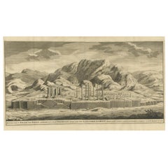
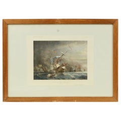
Rare Part of a Poem of the Battle of Ptolemy against Alexander the Great, 1721
About the Item
Antique print titled 'Mr. A. Alewyns dichtkundige uitbreiding over den Veldslag van Ptolomeus tegens Alexander (..)'.
Antique print depicting the Battle of Ptolemy against Alexander the Great.
This print originates from 't Groot waerelds tafereel, waar in de heilige en waereldsche geschiedenissen en veranderingen zedert de schepping des waerelds'.
Artists and Engravers: Published by J. Lindenberg.
- Dimensions:Height: 13.78 in (35 cm)Width: 9.65 in (24.5 cm)Depth: 0 in (0.02 mm)
- Materials and Techniques:
- Period:1720-1729
- Date of Manufacture:1721
- Condition:Condition: Very good, general age-related toning. Please study image carefully.
- Seller Location:Langweer, NL
- Reference Number:
About the Seller
5.0
Platinum Seller
These expertly vetted sellers are 1stDibs' most experienced sellers and are rated highest by our customers.
Established in 2009
1stDibs seller since 2017
1,932 sales on 1stDibs
Typical response time: <1 hour
- ShippingRetrieving quote...Ships From: Langweer, Netherlands
- Return PolicyA return for this item may be initiated within 14 days of delivery.
More From This SellerView All
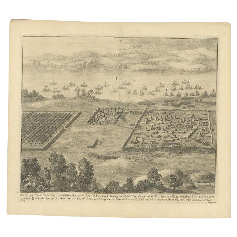
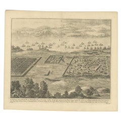
- Antique Roman Battle Print of Ptolemy's Camp by Duncan, c.1753Located in Langweer, NLAntique battle map showing Ptolemy's Camp. With detailed legend explaining the various elements of the print. This print most likely originates fro...Category
Antique 18th Century Prints
MaterialsPaper
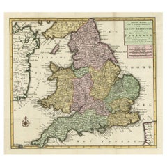
- Antique Map of the South Part of Great Britain by Tirion, c.1750By Isaak TirionLocated in Langweer, NLAntique map titled 'Nieuwe Kaart van 'T Zuider Gedeelte van Groot Britannie behelzende Het Koningryk Engeland (..).' Attractive map showing the south part of Great Britain; the K...Category
Antique 18th Century Maps
MaterialsPaper
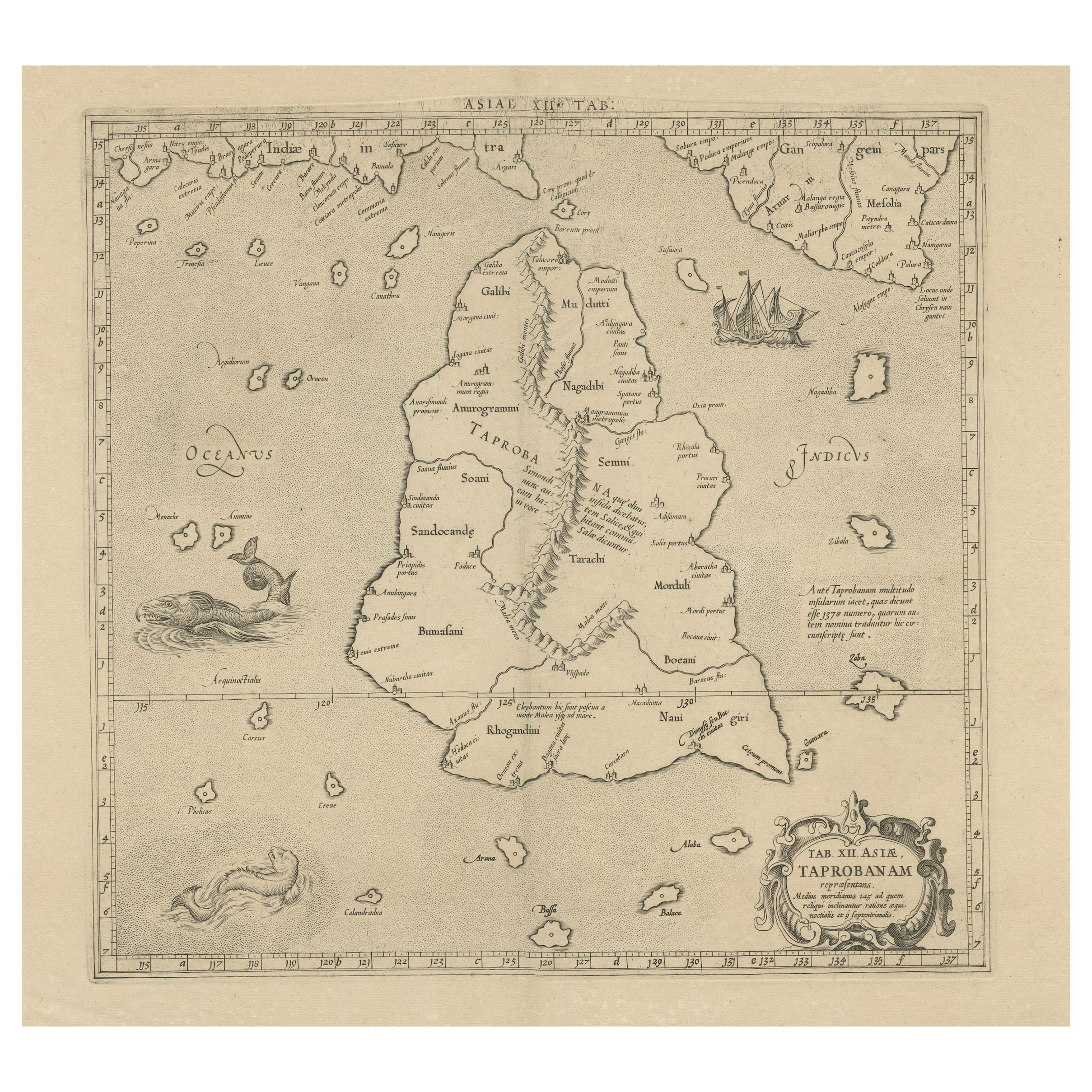
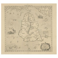
- Rare Original Antique Ptolemy Map of Ceylon, Present Day Sri LankaLocated in Langweer, NLOriginal antique map titled 'Tab XII Asiae Taprobanam (..)'. For this map of Toprobana (Sri Lanka), Ptolemy drew on the accounts of travelers and sailors and though the information was secondhand and often inaccurate, it represented the most advanced account of the world's geography at that time. This map depicts the island with the typical misconceptions of the period with the enlarged island straddling the Equator and nearly divided by a ridge of mountains. A small part of India is incorrectly shown in the northeast corner of the map and a spurious coastline labeled Gangem fills the upper right corner. The stipple engraved sea contains an oriental ship...Category
Antique Late 17th Century Maps
MaterialsPaper
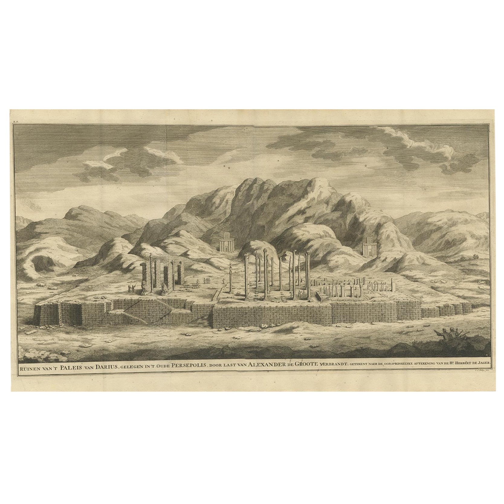
- Antique Engraving of Persepolis, a City Sacked by Alexander the Great, 1726Located in Langweer, NLAntique print titled 'Ruinen van 't Paleis van Darius, gelegen in 't oude Persepolis, door last van Alexander de Groote verbrandt (..)'. Persepolis was sacked by the troops of Al...Category
Antique 1720s Prints
MaterialsPaper
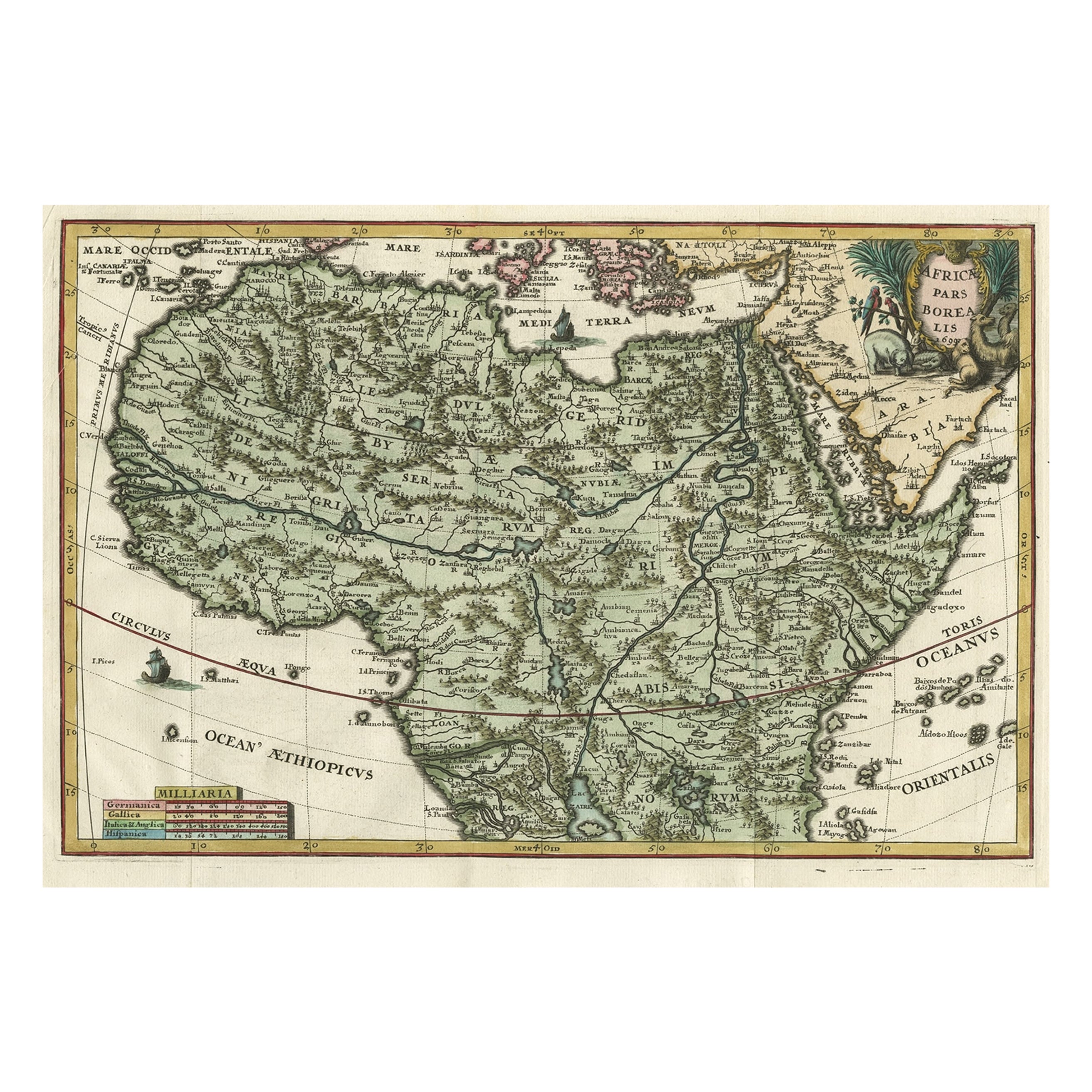
- Very Decorative Rare Antique Map of the Northern Part of Africa, 1702Located in Langweer, NLAntique map titled 'Africae Pars Borealis.' Very decorative antique map of the northern part of Africa by Heinrich Scherer. The map is full of the spurious geography of the perio...Category
Antique Early 1700s Maps
MaterialsPaper
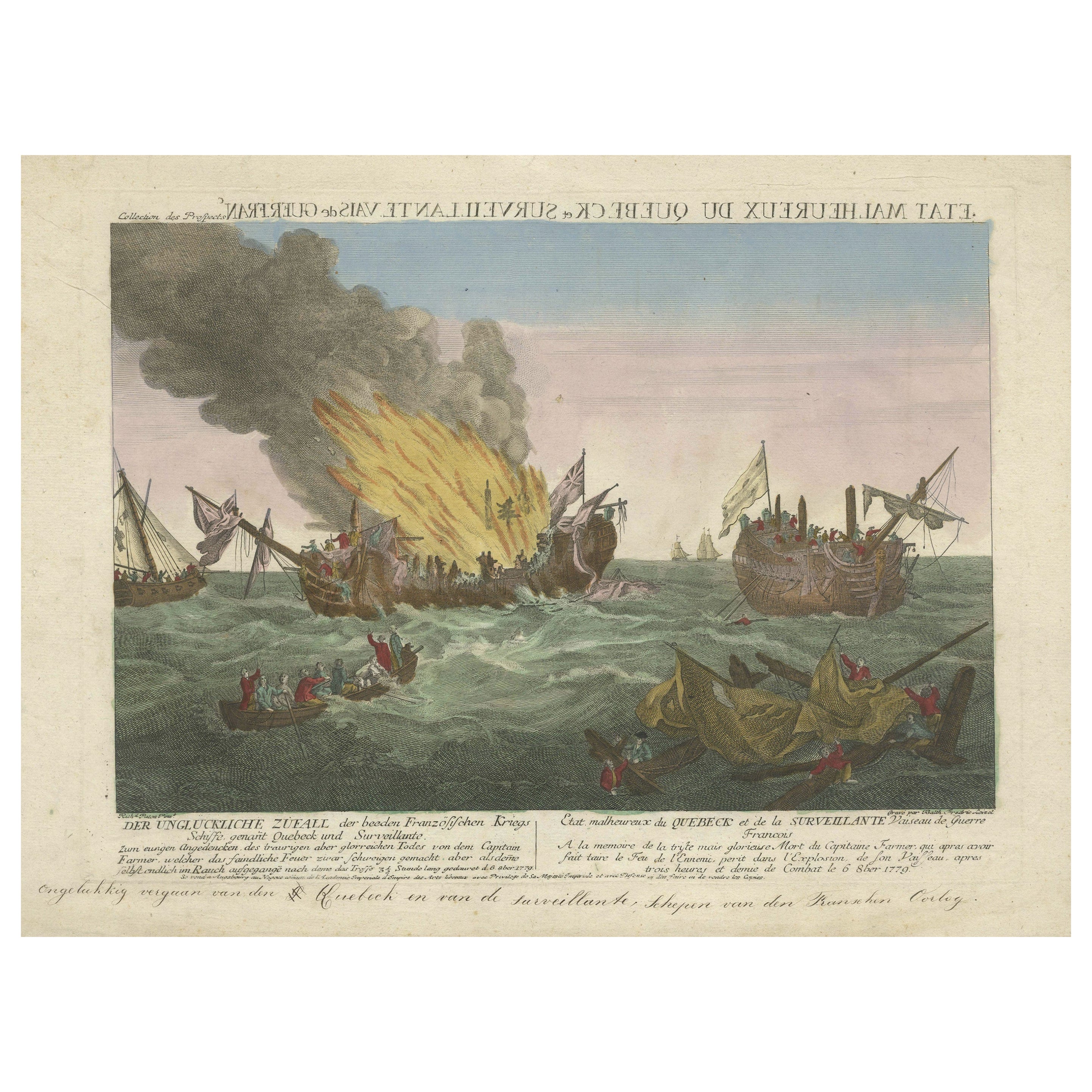
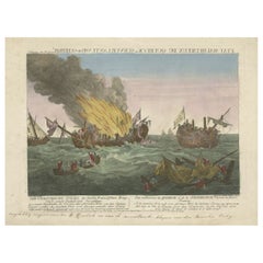
- Rare Engraving of a Famous Battle Near Ushant Between the French and BritishLocated in Langweer, NLAntique print titled 'Der ungluckliche Zufall der beeden Frazösischen Kriegs (..) - Etat malheureux de Quebeck et de la Surveillante (..)'. An engraving of a painting by Richard Paton of the three and a half hour long naval battle of 6 October 1779 which was fought off Ushant between HMS Quebec, under the command of Captain George Farmer, and the Surveillante, under the command of Captain Couédic de Kergoaler. The Quebec caught fire and exploded, and the British crew were rescued by the French. Captain George Farmer (b.1732) died in the battle. American War of Independence...Category
Antique Late 18th Century Prints
MaterialsPaper

You May Also Like
- 1900s Vintage Lithographic Print of the Naval Battle of Beziers, Oak Wood FrameLocated in Milan, ITLithographic print of the Naval Battle of Beziers on 10th July 1690, taken from the book Historical Gallery of Versailles 319bis. Skelton is the engraver. Original print by Victor Gilbert Théodore Gudin...Category
Early 20th Century French Nautical Objects
MaterialsPaper
- Antique Lithographic Print of the Diamond Rock Battle Early 1900s, Oakwood FrameLocated in Milan, ITLithographic print of the diamond rock battle, the main port of the island of Martinique, taken from the book Historical Gallery of Versailles 112. Chacoane is the engraver. Original...Category
Early 20th Century French Nautical Objects
MaterialsPaper
- Vintage Lithographic Print of Battle of Cape Lèzard, Early 1900s, Oakwood FrameLocated in Milan, ITLithographic print of the battle of Cape Lèzard on 21st October 1707, taken from the book Historical Gallery of Versailles. Skelton is the engraver. Original print by Victor Gilbert Théodore Gudin...Category
Early 20th Century French Nautical Objects
MaterialsPaper
- Extremely Rare Copy of the Venezuelan Declaration of Independance, 1811Located in Amsterdam, NLExtremely rare copy of the Venezuelan Declaration of Independance 'Declaracion de Independencia de las Siete Provincias Unidas de Venezuela en Congreso de 5 de Julio de 1811' By Lorenzo Lüthy (c. 1811-1877), printed in Philadelphia, Peter S. Duval, 1841. Lithograph on laid paper, mounted in passepartout, H. 84 x W. 64.5 cm (with mount H. 96,5 x W. 77 cm.) Large and extremely rare lithographed broadside Declaration of Independence of Venezuela by American immigrant...Category
Antique Early 19th Century Venezuelan Prints
MaterialsPaper
- "On the March to the Sea" Print by Alexander Hay Ritchie, after F.O.C DarleyBy Alexander Hay RitchieLocated in Colorado Springs, COThis color print of On The March to the Sea by Felix O.C. Darley, and engraved by A.H. Ritchie, is a stunning portrayal of William T. Sherman’s notorious Georgia Campaign. Originally...Category
Antique 1860s American Prints
MaterialsPaper
- England, Scotland & Ireland: A Hand Colored Map of Great Britain by TirionBy Isaak TirionLocated in Alamo, CAThis is a hand-colored double page copperplate map of Great Britain entitled "Nieuwe Kaart van de Eilanden van Groot Brittannien Behelzende de Kon...Category
Antique Mid-18th Century Dutch Maps
MaterialsPaper

Recently Viewed
View AllMore Ways To Browse
J Alexander
T Alexander
J Alexander Furniture
J Lindenberg
Antique Chests With Marble Top
Pair Of Mahogany Chest Of Drawers
Pair Of Matching Cabinets
Pair Mahogany Chest Of Drawers
Marquetry France Chest
Chest With Gallery
Antique Blue Chest
French Chest Marquetry
Large Snake
Antique Chinese Cabinet Elm
Antique Chinese Elm Cabinet
Display Cabinet 1900
Pair Of Deco Cabinets
French Two Drawer Chest Commode