Benelux Maps
to
4,163
5,156
5,544
200
5,155
1
1
2,834
2,008
313
1
181
8
67
3
3
3
1
2
5,146
10
8
2
2
492
186
110
89
60
5,156
5,156
5,156
104
58
20
14
13
Item Ships From: Benelux
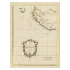
Antique Map of the Coast of Guinea and the Cape Verde Islands
Located in Langweer, NL
Antique map titled 'Carte de la Guinée (..)'. This map was originally part of a 2 sheet larger map of Eastern Africa, showing the Cape Verde Islands and Senegal. This map originates ...
Category
Late 18th Century Antique Benelux Maps
Materials
Paper
$459 Sale Price
40% Off
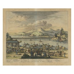
Original Copper Engraving Depicting Dutch Merchants visting China, ca.1700
Located in Langweer, NL
Title: 'The departure of the Empirour Hockflieuw to the Emprial Court at Peking' with further description in Dutch.
The Dutch man Pieter van Hoorn, his son...
Category
Early 1700s Antique Benelux Maps
Materials
Paper
$229 Sale Price
20% Off
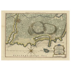
Antique Map Plan of Town and Mole of CAP D'agde & Fort De Brescou, France, 1759
Located in Langweer, NL
Antique Plan titled 'Plan of the Town and Mole of Agde with the Fort de Brescou'. Antique town plan of Agde, engraved for the Geographical Dictionary, by Rol...
Category
Mid-18th Century Antique Benelux Maps
Materials
Paper
$468 Sale Price
20% Off
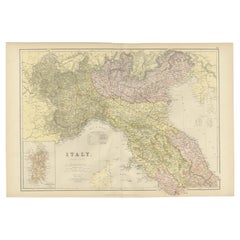
Original Antique Map of Italy with an Inset of Sardinia, 1882
Located in Langweer, NL
Embark on a historical odyssey with an original Antique Map of Italy from the esteemed 'Comprehensive Atlas and Geography of the World,' meticulously crafted in 1882. This captivatin...
Category
1880s Antique Benelux Maps
Materials
Paper
$200 Sale Price
20% Off
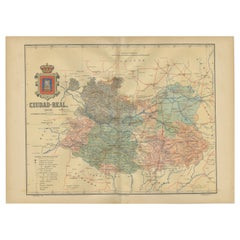
Ciudad Real 1902: A Detailed Cartographic Survey of La Mancha in Spain
Located in Langweer, NL
This original antitque map presents the province of Ciudad Real, located in the autonomous community of Castilla-La Mancha in central Spain, as of 1902. It includes several notable f...
Category
Early 1900s Antique Benelux Maps
Materials
Paper
$325 Sale Price
20% Off
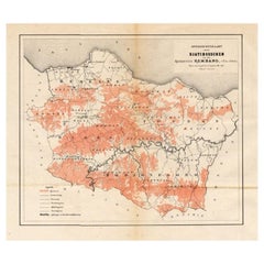
Antique Map of the Djati 'teak wood' Forest Near Rembang, Java by Stemler, 1875
By Stemler
Located in Langweer, NL
Antique map titled 'Overzichtskaart van de Djatibosschen in de Residentie Rembang, Java.' This scarce map shows the Djati (teak) Forest on the indonesian island of Java. Originates f...
Category
19th Century Antique Benelux Maps
Materials
Paper
$258 Sale Price
20% Off
Rare Antique Map of Leeuwarden, Friesland, The Netherlands, by P. Bast, 1603
By P. Bast
Located in Langweer, NL
Very rare plan of Leeuwarden, Friesland, The Netherlands. With several cartouches and coat of arms. With a legend and compass rose at bottom right. Made by 'Pieter Bast' after the su...
Category
Early 17th Century Antique Benelux Maps
Materials
Paper
$3,497 Sale Price
35% Off
Antique Print of the Chief Temple in Hakodate in Japan, 1856
Located in Langweer, NL
Antique print titled ‘Chief Temple Hakodadi‘. View of the chief temple in Hakodate, Japan. This print originates from 'Narrative of the expedition of an American squadron to the Chin...
Category
19th Century Antique Benelux Maps
Materials
Paper
$248 Sale Price
20% Off
Antique Map of the Region of Touraine in France by Janssonius, 1657
By Johannes Janssonius
Located in Langweer, NL
Antique map titled 'Touraine - Turonensis Ducatus'.
Decorative map of the Touraine region. This map originates from 'Atlas Novus, Sive Theatrum Orbis Orbis Terrarum: In quo Galli...
Category
17th Century Antique Benelux Maps
Materials
Paper
Gateway to the Steppes: Tallis's Masterpiece Map of Indepent Tartary, 1851
Located in Langweer, NL
The map is of "Independent Tartary," a historical region in Central Asia that covered parts of what are now Kazakhstan, Uzbekistan, Turkmenistan, and surrounding areas. The map was p...
Category
1850s Antique Benelux Maps
Materials
Paper
$315 Sale Price
20% Off
Antique Map of New Zealand by Arrowsmith '1844'
Located in Langweer, NL
Antique map titled 'Map of the colony of New Zealand from official documents'. A scarce map of New Zealand. First issued in the 1830s, this state sh...
Category
Mid-19th Century Antique Benelux Maps
Materials
Paper
$1,569 Sale Price
24% Off
Antique Map of Romania and Bulgaria Centered on the Danube River
Located in Langweer, NL
Antique map titled 'Vetus descriptio Daciarum nec non Moesiarum'. Impressive map of the area of Romania and Bulgaria centered on the Danube River. The map is based on Ortelius' map o...
Category
Mid-17th Century Antique Benelux Maps
Materials
Paper
$660 Sale Price
20% Off
Gascogne and Guyenne Map - Hand-Colored 17th-Century Engraving by De Wit, c.1688
Located in Langweer, NL
Title: Gascogne and Guyenne Map - Hand-Colored 17th-Century Engraving by Frederik De Wit c. 1688
Description: This remarkable map, "Gouvernement de la Guyenne & Gascogne," captures ...
Category
1680s Antique Benelux Maps
Materials
Paper
Hand Colored Antique Map of the Department of Cher, France
By Victor Levasseur
Located in Langweer, NL
Antique map titled 'Dépt. du Cher'. Map of the French department of Cher, France. This area of France is known for its production of Selles Sur Cher, a goats-milk cheese. The whole i...
Category
Mid-19th Century Antique Benelux Maps
Materials
Paper
$325 Sale Price
20% Off
1645 Blaeu Map of Westmorland, Northern England – Hand Colored, Decorative
Located in Langweer, NL
This map, "Westmoria Comitatus; Anglice Westmorland", was created by the esteemed Dutch cartographer Willem Blaeu and was published around 1645 in 'Le Theatre du Monde ou Nouvel Atlas'. It provides a detailed look at Westmorland, a historic county in northern England, based on John Speed’s earlier map. The map features numerous place names, parks, and estates, including Brigster Park, Colnhead Park, Crosbye, and Midleton, along with a detailed depiction of Windermere (spelled Wynandermere) and the surrounding regions.
Additional Features:
- Hand-colored map, with vibrant and detailed colors that bring out the topographical and decorative features.
- Includes intricate cartouches, such as the royal coat of arms, a decorative title cartouche topped with putti (cherubic figures), and six coats of arms (two left blank).
- Depicts the region’s rich landscape, including the rolling hills and mountainous terrain of northern England.
- French text on the verso, indicative of the publication period from 1645-1648, part of Blaeu’s highly sought-after atlases.
- Map shows precise details of small towns, estates, and parks, such as Brigster Park, Colnhead Park, Crosbye, and Wynandermere (now Windermere Lake).
This map would be of particular interest to collectors of English county maps, antique maps of northern England, 17th-century cartography, and the decorative works of Willem Blaeu. Blaeu's maps are renowned for their accuracy, artistic beauty, and historical significance.
Keywords: Willem Blaeu, Westmorland map, northern England, 17th-century map, antique map, English county map, John Speed, Windermere, decorative cartography, hand-colored map, rare map, antique cartography...
Category
1640s Dutch Antique Benelux Maps
Materials
Paper
$1,046 Sale Price
30% Off
George Philip's Large Relief Map of the World 150x110cm
By George Philip & Son
Located in Linkebeek, BE
George Philip's Large Relief Map of the World 150x110cm
PHILIP, George Relief Map of the World. George Philip and Son Limited, c. 1950. Large 3D relief map of the world. Shaded relie...
Category
20th Century British Benelux Maps
Materials
Plastic, Wood
Set of 21 Antique Prints Illustrating the Travels to Cenderawasih Bay, 1875
Located in Langweer, NL
Set of 21 antique prints illustrating the travels to Cenderawasih Bay, also known as Sarera Bay (Indonesian: Teluk Sarera) and formerly Geelvink Bay (Dutch: Geelvinkbaai), a large bay in northern Province of Papua and West Papua...
Category
Late 19th Century Antique Benelux Maps
Materials
Paper
Rare City View of London and Westminster, Showing Many Battles Ships, 1804
Located in Langweer, NL
Title: The Cities of London & Westminster, accurately copied from the table of the Camera Obscura in the Royal Observatory at Greenwich
This is a rare plate from a serie of 22 landmarks taken from Modern London, published in 1804 by Richard Phillips...
Category
Early 1800s Antique Benelux Maps
Materials
Paper
$746 Sale Price
20% Off
Old Print of Farmers Harvesting Cinnamon on the Island Ceylon or Sri Lanka, 1672
Located in Langweer, NL
Antique print, titled: 'Hoe men de Caneel schilt opt Eyland Ceylon.'
This rare original plate shows a group of farmers harvesting cinnamon on the island of Ceylon / Sri Lanka. Du...
Category
1670s Antique Benelux Maps
Materials
Paper
$363 Sale Price
20% Off
Rare 16th Century Original Handcolored Miniature Map of Java, Indonesia, 1616
Located in Langweer, NL
Very handsome original old coloured copper engraving by Bertius of the island of Java in the early days of the Dutch colonisation - at that time named The Dutch East Indies or nowada...
Category
1610s Antique Benelux Maps
Materials
Paper
$468 Sale Price
20% Off
Original 17th-Century Antique Map of Henan (Honan) Province, China – by Blaeu
Located in Langweer, NL
17th-Century Antique Map of Henan Province, China – "Honan" by Blaeu, with Detailed Cartography and Artistic Cartouches
Description: This exceptional 17th-century map of Henan Province, historically referred to as "Honan," was created by Johannes Blaeu and published in 1655 as part of the *Novus Atlas Sinensis*. Henan, located in central China, is known as the cradle of Chinese...
Category
1650s Antique Benelux Maps
Materials
Paper
Antique 17th Century Map of the Islands Near Ceylon or Sri Lanka, 1672
Located in Langweer, NL
Antique map titled 'Eyland Ceylon.' Map of the islands near Ceylon or Sri Lanka. Dutch text on verso. Source unknown, to be determined.
Artists and Engravers: Philip Baldaeus (1632-...
Category
17th Century Antique Benelux Maps
Materials
Paper
$239 Sale Price
20% Off
Old German Map of the United States, Central America and the West Indies, c.1870
Located in Langweer, NL
Antique map titled 'Westindien, Mittelamerica und Vereinigte Staten'. Old map of the United States, Central America and the West Indies. This map originates from 'H. Kiepert's Kleine...
Category
19th Century Antique Benelux Maps
Materials
Paper
1885 Shinsen Tokyo Zenzu: Rare Meiji-Era Map of Tokyo by Sakai Kinzaburo
Located in Langweer, NL
Title: Detailed Edo Period Map of Tokyo (Edo), Featuring Neighborhoods and Landmarks
This beautifully detailed patina rich map, titled "Shinsen Tokyo Zenzu" (Newly Selected Complete...
Category
1880s Antique Benelux Maps
Materials
Paper
Antique Engraving of the Islands Wanooa, Wateeoo, Mangeea, Toobouai, Cook, 1803
Located in Langweer, NL
Antique map South Pacific Islands, Polynesia. Originates from 'Reizen Rondom de Waereld door James Cook (..)'.
Artists and Engravers: Translated by J.D. Pasteur. Published by Hon...
Category
19th Century Antique Benelux Maps
Materials
Paper
$267 Sale Price
20% Off
Mapping History: The Decorative Cartography of Indre-et-Loire by Levasseur, 1856
Located in Langweer, NL
An original hand-colored map of the Département d'Indre-et-Loire created by Victor Levasseur in 1856. As an antique steel engraved map, it showcases the detailed craftsmanship and technology of mid-19th century map making. The method of steel engraving allowed for precise and intricate details to be captured, making this map not only a navigational tool but also a work of art.
The addition of outline hand colouring is particularly noteworthy. This technique, where colours are applied by hand to the engraved map, was a common practice at the time to highlight certain features such as boundaries, rivers, and cities. The hand colouring on this map would have been done meticulously, adding vibrancy and clarity to the engraved lines and making it easier to differentiate various geographical and political demarcations.
The map's wide margins are characteristic of the period's presentation style, offering space for additional annotations or simply serving to frame the map aesthetically when displayed. Such margins also suggest that the map was intended for a discerning audience, possibly for educational or decorative purposes in a library or study.
Victor Levasseur was renowned for his decorative maps, often embellished with artistic elements that went beyond mere geographical information. These elements could include vignettes, allegorical figures, and detailed illustrations surrounding the map itself, reflecting the cultural, historical, and economic aspects of the depicted area. While the description does not detail these decorative aspects, it's common for Levasseur's works to feature such embellishments, making his maps highly prized among collectors and historians for both their artistic value and cartographic accuracy.
This map of Département d'Indre-et-Loire, with its combination of technical precision in steel engraving and the beauty of hand colouring, represents a fascinating intersection of art and science in the 19th century. It is a testament to the era's dedication to detail, craftsmanship, and the aesthetic presentation of information.
The Département d'Indre-et-Loire, located in the central part of France within the region known as the Centre-Val de Loire, is rich in historical and cultural significance, with numerous important places highlighted on a map from 1856 by Victor Levasseur. Based on the region's known historical sites and cities, the following places are likely to be featured or of importance:
1. **Tours**: As the capital city of the Département d'Indre-et-Loire, Tours is a central hub of history, culture, and architecture. It is known for its old town, the Place Plumereau, Tours Cathedral, and its proximity to the Loire River, making it a likely focal point on the map.
2. **Amboise**: This town is famous for the Château d'Amboise, which is closely linked to French royal history and offers panoramic views of the Loire River. Leonardo da Vinci is buried here in the Chapel of Saint-Hubert, associated with the château.
3. **Chinon**: Known for its medieval fortress, the Château de Chinon, this town has deep historical roots, including connections to Joan of Arc and King Charles VII. The fortress and town would be significant landmarks.
4. **Villandry**: The Château de Villandry is renowned for its beautiful Renaissance gardens, which are some of the most impressive in France. While the château might be less emphasized in an 1856 map compared to cities and towns, it's an important site in the region.
5. **Loches**: This town features the Château de Loches, a medieval castle, and the Royal Lodge, noted for its Renaissance architecture. The town's history and architectural landmarks make it a place of interest.
6. **Azay-le-Rideau**: The Château d'Azay-le-Rideau is set on an island in the middle of the Indre River, showcasing the French Renaissance architectural...
Category
1850s Antique Benelux Maps
Materials
Paper
$229 Sale Price
20% Off
18th-Century Map of Tyrol and Surrounding Regions by Johann Baptist Homann
Located in Langweer, NL
18th-Century Map of Tyrol and Surrounding Regions by Johann Baptist Homann
Description: This striking 18th-century map by Johann Baptist Homann depicts the County of Tyrol (Tirol)...
Category
1720s Antique Benelux Maps
Materials
Paper
Original 18th-Century Map of Southern Austria, Carinthia, Carniola, and Styria
Located in Langweer, NL
title: 18th-Century Map of Southern Austria, Carinthia, Carniola, and Styria by Robert de Vaugondy
Description: This finely engraved 18th-century map by Gilles Robert de Vaugondy ...
Category
1750s French Antique Benelux Maps
Materials
Paper
Antique Map of Asian Turkey, Levant, and Mesopotamia by Tardieu, circa 1802
Located in Langweer, NL
This is an original antique map titled "Carte de la Turquie Asiatique," depicting the Asian territories of the Ottoman Empire. Created by Pierre Antoine Tardieu, this map illustrates...
Category
Early 1800s French Antique Benelux Maps
Materials
Paper
$420 Sale Price
20% Off
Anrtique Map of the Province of Valladolid, Central Spain, 1902
Located in Langweer, NL
A historical or archival map of the province of Valladolid, Spain, from the year 1902. Valladolid is a province located in the central part of Spain, within the autonomous community ...
Category
Early 1900s Antique Benelux Maps
Materials
Paper
$306 Sale Price
20% Off
Almería 1901: Coastal Contours and Landscapes in a Map of Southeastern Spain
Located in Langweer, NL
An original antique map of the province of Almería, Spain, from the year 1901.
The Mediterranean Sea, labeled as "Mar Mediterraneo," forms the southeastern boundary of the province...
Category
Early 1900s Antique Benelux Maps
Materials
Paper
$306 Sale Price
20% Off
Rare and Early Map of the Seventeen Provinces, Published in circa 1640
Located in Langweer, NL
Antique map titled 'Carte Generale des Dixsept Provinces des Pais Bas'. Rare and Early map of the Seventeen Provinces. The Seventeen Provinces were the Imperial states of the Habsbur...
Category
Mid-17th Century Antique Benelux Maps
Materials
Paper
$2,104 Sale Price
20% Off
Álava in Northern Spain: The Geography of Basque Heritage and Terrain, 1902
Located in Langweer, NL
This original antique map is a historical depiction of the province of Álava (in Basque: Araba), which is one of the provinces of the Basque Country in northern Spain, as indicated b...
Category
Early 1900s Antique Benelux Maps
Materials
Paper
$277 Sale Price
20% Off
Antique Map of London Showing the Area from Essex to Surrey, England, 1741
Located in Langweer, NL
Antique map titled 'Regionis quae est circa Londinum specialis repraesentatio (..)'
Very detailed map showing the area from Essex to Surrey and shows a lovely view of London with a high level of detail, stretching from Old London Bridge...
Category
18th Century Antique Benelux Maps
Materials
Paper
$1,386 Sale Price
20% Off
Extremely Large Hand-Drawn Manuscript Map of Surinam, 1830, History of Slavery
Located in Amsterdam, NL
A unique large hand-drawn map of Surinam by Albrecht Helmut Hiemcke (German, 1760-1839)
?
'Colonie Surinaame', 1830
A large hand-drawn and coloured map of the colony of Suri...
Category
Mid-19th Century Surinamer Antique Benelux Maps
Materials
Paper
Gallipoli Fortifications: A 1688 Engraved Bird’s-Eye Map by Mattheus Merian
Located in Langweer, NL
Gallipoli Fortifications: A 1688 Bird’s-Eye Map by Mattheus Merian
Description: This exquisitely detailed map of Gallipoli, crafted by the renowned engraver Mattheus Merian, offers ...
Category
1680s German Antique Benelux Maps
Materials
Paper
Antique Print with Coastal Views of Asia by Cook, c.1784
Located in Langweer, NL
Antique print titled 'Views of the Coast of Asia (..)'. Antique print depicting various coastal views of Asia including Kamchatka. Originates from an edition of Cook's Voyages.
A...
Category
18th Century Antique Benelux Maps
Materials
Paper
$344 Sale Price
20% Off
Antique 1830 Map of Eastern England with Suffolk, Norfolk Cambridge, Huntingdon
Located in Langweer, NL
Title: Antique 1830 Map of Eastern England with Suffolk, Norfolk, Cambridge, and Huntingdon
Description: This 1830 German-language map, titled Britisches Reich – A. Kon: England,...
Category
1830s Antique Benelux Maps
Materials
Paper
Rare Theodore Danckerts Map of the Lower Rhine and Moselle River Regions
Located in Langweer, NL
Original antique map titled 'Accuratissima Rheni Inferioris Mosae et Mosellae Tabula'. Rare Theodore Danckerts map of the Lower Rhine and Moselle River Regions. The map covers the lo...
Category
Early 18th Century Antique Benelux Maps
Materials
Paper
$2,104 Sale Price
20% Off
Old Map of the Western Region of the Kingdom of Algiers, Algeria, 1773
Located in Langweer, NL
Antique map titled 'Kaart van het Westelyk Gedeelte van het Ryk van Algiers'.
Old map of the western region of the Kingdom of Algiers, Algeria. Originates from the first Dutch ed...
Category
1770s Antique Benelux Maps
Materials
Paper
$363 Sale Price
20% Off
Antique Map of Germany from a 17th Century Pocket Atlas, 1685
Located in Langweer, NL
Antique map titled 'Nova Totius Germaniae descriptio.' Miniature map of Germany, from the pocket atlas 'Introductionis in Universam Geographiam tam Veterem...
Category
17th Century Antique Benelux Maps
Materials
Paper
$119 Sale Price
20% Off
Old Engraving the City and Harbour of Pathmos, Patmos or Patimo in Greece, 1725
Located in Langweer, NL
Antique print, titled: 'Gezicht van het eiland en de haven van Pathmos (…).'
This plate shows a view of the city and harbour of Pathmos, Patmos or Patimo in Greece. This plate or...
Category
1720s Antique Benelux Maps
Materials
Paper
$889 Sale Price
20% Off
Old Genuine Antique Map of Tartary in the Russian Far East
Located in Langweer, NL
Original antique map titled 'Tartaria sive Magni Chami Imperium'. This great map of Tartary covers all of eastern Asia between the Caspian Sea and northern China and Manchuria. Being...
Category
Mid-17th Century Antique Benelux Maps
Materials
Paper
$1,339 Sale Price
20% Off
Antique Map of Canada, The Province of Ontario and Part of Quebec, 1882
Located in Langweer, NL
This is a historical map from the 1882 Blackie Atlas, this time detailing "The Province of Ontario, and Part of Quebec" in Canada. The map presents a detailed illustration of Ontario...
Category
1880s Antique Benelux Maps
Materials
Paper
$239 Sale Price
20% Off
Antique Map of Great Britain and Ireland by Brion de la Tour, 1766
Located in Langweer, NL
Antique map titled 'Les Isles Britanniques (..).'
Attractive map of Great Britain surrounded by an engraved border printed from a separate coppe...
Category
18th Century Antique Benelux Maps
Materials
Paper
$526 Sale Price
20% Off
Antique Map of the Region of Aigues-Mortes and Camargue, France
Located in Langweer, NL
Antique map titled 'Environs d'Aiguemortes de Peccais &a et la petite Camargue'. Original map of the region of Aigues-Mortes and Camargue, France. This map originates from 'Le Petit ...
Category
Mid-18th Century Antique Benelux Maps
Materials
Paper
$325 Sale Price
20% Off
Antique Map of Vermont
Located in Langweer, NL
Antique map titled 'Vermont'. Original antique map of Vermont, United States. This print originates from 'Encyclopaedia Britannica', Ninth Edition. Publ...
Category
Late 19th Century Antique Benelux Maps
Materials
Paper
$277 Sale Price
20% Off
Antique Map of Bavaria, Bayern, with original Hand Coloring
Located in Langweer, NL
Antique map titled 'Bavariae Circulus atq Electoratus tam cum Adiacentibus quam insertis Regionibus'. Original old map of Bavaria, Bayern, Germany. The map stretches south to Innsbru...
Category
Late 17th Century Antique Benelux Maps
Materials
Paper
$449 Sale Price
20% Off
Antique Map of India and Ceylon, along with the Maldives
Located in Langweer, NL
Antique map titled 'Stato del Mogol con l'Isole di Ceilan e Maldive'. Beautiful map of India and Ceylon, along with the Maldives. Includes a large decorative title cartouche. The map...
Category
Late 18th Century Antique Benelux Maps
Materials
Paper
$516 Sale Price
20% Off
Antique Map of Africa with Mountain Ranges and other details
Located in Langweer, NL
Antique map titled 'Carte générale et Politique de l'Afrique'. Original antique map of Africa. Highlights numerous mountain ranges, lakes and rivers, regions, countries and places. P...
Category
Late 18th Century Antique Benelux Maps
Materials
Paper
$765 Sale Price
20% Off
Antique Map of the Arabian Peninsula by Bonne 'c.1780'
Located in Langweer, NL
Antique map titled 'Carte de l'Arabie, du Golfe Persique, et de la Mer Rouge (..)'. Original antique map of the Arabian Peninsula, including the horn...
Category
Late 18th Century Antique Benelux Maps
Materials
Paper
$526 Sale Price
20% Off
Antique Map of Port Pallisers & Kersmis by Cook, c.1781
Located in Langweer, NL
Antique map Kerguelen titled 'Sketch of Port Palliser on Kerguelen's Land (..)'. Antique map of Port Pallisers & Kersmis, Kerguelen or Desolation Islands. Originates from an edition ...
Category
18th Century Antique Benelux Maps
Materials
Paper
$220 Sale Price
20% Off
Old Map of the East Indonesian Islands Borneo, Celebes, New Guinea, Bali, 1792
Located in Langweer, NL
Antique map titled 'Partie de la Nouvelle Grande Carte des Indes Orientales, contenant les Isles de Borneo, Iava, Celebes, Mindanao (..)'.
Detailed map of the Indonesian islands ...
Category
1790s Antique Benelux Maps
Materials
Paper
$1,195 Sale Price
20% Off
Old Map of the UK & Ireland, Insets of Orkney, Shetland and Faroe Islands, 1786
Located in Langweer, NL
Title: "Les Isles Britanniques qui contiennent les Royaumes d'Angleterre, Escosse, et Irlande".
Hand-colored engraved map with 2 (large) decorative cartouches, inset map of the Ork...
Category
1780s Antique Benelux Maps
Materials
Paper
$1,291 Sale Price
20% Off
Antique Map of the British Isles with Contemporary Hand Coloring
Located in Langweer, NL
Antique map titled 'Les Isles Britanniques'. Original antique map of the British Isles, with original/contemporary hand coloring. Published by Crepe, circa 1767.
Category
Late 18th Century Antique Benelux Maps
Materials
Paper
$267 Sale Price
20% Off
Antique Map of Southern Syria by Fullarton & Co, circa 1860
Located in Langweer, NL
Antique map titled 'Syria south part'. Published by Fullarton & Co, Glasgow, circa 1860.
- Title: Syria South Part
- Publisher: Fullarton & Co, Glasgow
- Date of Publication: Circa ...
Category
Mid-19th Century English Antique Benelux Maps
Materials
Paper
Antique Map of Western and Eastern Barbary in Africa, c.1744
Located in Langweer, NL
Antique map titled 'A New & Accurate Map of the Western Parts of Barbary' and 'A New & Accurate Map of the Eastern Parts of Barbary'. Decorative maps of North Africa and the Southern...
Category
18th Century Antique Benelux Maps
Materials
Paper
Antique Map of Japan and Korea by Johnston '1909'
Located in Langweer, NL
Antique map titled 'Japan and Korea'. Original antique map of Japan and Korea. With inset maps of the Japanese Empire, Port Arthur, Formosa ,Tokyo and Yoko...
Category
Early 20th Century Benelux Maps
Materials
Paper
$334 Sale Price
20% Off
18th Century Cartographic Depiction of Upper India and Ceylon, 1835
Located in Langweer, NL
An exquisite set of two maps, 'Carte de la Partie Superieure De L'Inde en de Cadu Gange,' masterfully crafted by the renowned 18th-century French cartographer, Charles Marie Rigobert...
Category
1830s Antique Benelux Maps
Materials
Paper
$420 Sale Price
20% Off
Detailed Map of Friesland, Groningen and Drenthe, The Netherlands, 1706
Located in Langweer, NL
Antique map tited 'Frisiae Dominium vernacule Friesland verdeeld met de hoofd-deelen van Oostergoo, Westergoo en Sevenwolden (..)'. Detailed map of Friesland, Groningen and Drenthe, ...
Category
18th Century Antique Benelux Maps
Materials
Paper
$908 Sale Price
20% Off
Recently Viewed
View AllMore Ways To Browse
Greek Key Dresser
Green Glass Bud Vase Vintage
Gucci Tray
Half Moon Shelves
Handblown Glass Decanter
Heart Shaped Glass Dish
Hepplewhite Drop Leaf Table
Herend Cup
Hermes Dish
Horse Head Barware
Horse Mantel Clock
Large Limoges Platter
Michelangelo David Statue
Michelin Guide
Persian Khatam
Royal Worcester Aesthetic
Russell Woodard Aluminum
Russian Silver Niello
