Netherlands - Collectibles and Curiosities

to
2,756
6,183
14,751
11,431
6,144
26
13
52
24
19
18
16
6
5
5
4
2
1
1
1
3,076
2,387
681
39
286
112
34
79
5
6
10
6
15
29
13
5
4
5,538
353
202
83
78
583
175
99
59
44
6,183
6,182
6,182
104
59
20
14
14
Item Ships From: Netherlands
Large 1695 Hand-Colored Engraved Map of Gascony (Gascogna), France
Located in Langweer, NL
This map, created by Giacomo Cantelli da Vignola in 1695, represents the "General Government of Guyenne and Gascony" in southwest France. Cantelli da Vignola was a renowned Italian c...
Category

1690s Antique Netherlands - Collectibles and Curiosities

Materials

Paper

Antique Map of Ancient Egypt Also Depicting the Nile River and Red Sea, 1845
Located in Langweer, NL
Antique map Egypt titled 'General Karte von Alt Aegypten von A.H. Brué'. Large map of Egypt also depicting the Nile river and Red Sea. Source unknown...
Category

19th Century Antique Netherlands - Collectibles and Curiosities

Materials

Paper

Antique Sea Chart of North America by Ottens, circa 1745
Located in Langweer, NL
Antique map titled 'Septemtrionaliora Americae a Groenlandia (..)'. Sea chart of the northern waters of North America, including the coast of Labrador and pa...
Category

Mid-18th Century Antique Netherlands - Collectibles and Curiosities

Materials

Paper

Antique Bronze Religious Art Sculpture / Statue Depicting Christ with Children
Located in Lisse, NL
19th century finest bronze group statue. This excellent quality and very refined sculpture of Christ with children is another one of our recent great finds. Anyone who knows what it takes to create a bronze sculpture from start to finish realizes how special these works of art really are. For us to have found this rare, antique specimen more than made our day. Firstly, because we love the subject matter and secondly, because antique bronzes always are the best when it comes to the details and the patina. Both the serenity in Jesus' face and the way His cloth is perfectly draped around His sitting body are details that never fail to impress. The angelic faces of the two children who are clearly enjoying to be in His presence, make this meaningful and striking sculpture even more pleasant to look at. This handcrafted and antique work of beauty simply warms your heart and it will look marvelous, no matter where you decide to have it on display. Our price for this work of religious art...
Category

Mid-19th Century French Gothic Revival Antique Netherlands - Collectibles and Curiosities

Materials

Bronze

A Catalonian Cartographic Depiction of Tarragona Province, 1901
Located in Langweer, NL
This image depicts a historical map of the province of Tarragona, which is in the northeastern part of Spain, within the autonomous community of Catalonia. The map is dated 1901, sug...
Category

Early 1900s Antique Netherlands - Collectibles and Curiosities

Materials

Paper

Old Print Depicting the Buddhist Festival of Souls 'Obon', 1758
Located in Langweer, NL
Antique print religion titled 'La Fête des Ames - 't Feest der Zielen'. Old print depicting the Buddhist festival of souls (Obon). This print originates from 'Histoire générale d...
Category

18th Century Antique Netherlands - Collectibles and Curiosities

Materials

Paper

Original Rare Antique Print of Two Ruins in Mexico, 1857
Located in Langweer, NL
Two images on one sheet depicting ruins in Mexico. This print originates from 'Die Kunstwerke vom Alterthum bis auf die Gegenwart, oder, Wegweiser durch das ganze Gebiet der bildende...
Category

19th Century Antique Netherlands - Collectibles and Curiosities

Materials

Paper

Antique Map of South Italy and the Island of Sardinia by Johnston (1909)
Located in Langweer, NL
Antique map titled 'South Italy and the Island of Sardinia'. Original antique map of South Italy and the Island of Sardinia. With inset map of Naples. Th...
Category

Early 20th Century Netherlands - Collectibles and Curiosities

Materials

Paper

Very Rare Antique Engraving of Christian Monastery Saint Jeremias in Egypt, 1673
Located in Langweer, NL
Antique print titled 'S. Ieremias'. Old print of S. Jeremias, below a decorative cartouche with lettered key. This print originates the very rare travel book 'Hierusalemsche Reyse' b...
Category

17th Century Antique Netherlands - Collectibles and Curiosities

Materials

Paper

Pl. 12 Antique Print of an Orangery and Garden Plan by Le Rouge, c.1785
Located in Langweer, NL
Antique print titled 'Jardins de Bessingen (..)'. Copper engraving showing a garden plan and orangery (or orangerie). This print originates from 'Jardins A...
Category

18th Century Antique Netherlands - Collectibles and Curiosities

Materials

Paper

Decorative Map of Hanover, Lower Saxony by Lodge, ca. 1785
Located in Langweer, NL
Title: Decorative Map of Hanover, Lower Saxony by Lodge, ca. 1785 This decorative map, titled "A New & Correct Plan of Hanover, a City in the circle of Lower Saxony," was engraved b...
Category

1780s Antique Netherlands - Collectibles and Curiosities

Materials

Paper

Antique & Rare Pair of Church Brackets for Saint Statues with Angel Sculptures
Located in Lisse, NL
All handcrafted and matching pair of colorful & meaningful church wall brackets / shelfs. If you are a private collector of ecclesiastical art or if you are looking for the perfect ...
Category

Early 20th Century European Gothic Revival Netherlands - Collectibles and Curiosities

Materials

Wrought Iron

Impressive Large Size and Deeply Carved Oak Gothic Church Wall Bracket / Corbel
Located in Lisse, NL
Antique large Gothic Revival wall bracket with carved acanthus leafs This handcrafted and hand-carved, Gothic Revival wall bracket is one of the largest we ever had the pleasure of offering. Together with the natural flowing and deeply carved, acanthus leafs and the Gothic rosettes around the upper rim it also has the most wonderful organic shape. The sheer size of this church relic, its striking design and its ancient patina makes it an absolute joy to own and look at. This is a great bracket for displaying a large saint statue...
Category

Early 19th Century French Gothic Revival Antique Netherlands - Collectibles and Curiosities

Materials

Oak

Antique Wall Display Cabinet with a Rare Mary & Child Jesus Sculpture Fragment
Located in Lisse, NL
One of a kind, handcrafted display cabinet with a rare religious artefact. This excellent wall display cabinet still opens and closes perfectly and it comes with the original antique glass in the door. Finding antiques with the original glass with that beautiful ripple in it, always makes those pieces extra desirable (in our view). The striking acorn and leaf motifs in the handcrafted, molded borders of the door too are very stylish features to enjoy. Over the decades the gilding has slightly warn off, which has created a marvelous patina. Given the style, age and perfect fit, we think that this antique wall cabinet was specifically made for the rare religious fragment that it is holding. If you like this unique display cabinet then you will love the rare fragment it is holding. From the missing pieces on the sides you can see that this Virgin Mary and child Jesus plaque...
Category

19th Century European Renaissance Revival Antique Netherlands - Collectibles and Curiosities

Materials

Plaster, Wood

Colonial Cartography: The Banda Islands - the Epicenter of the Spice Trade, 1818
Located in Langweer, NL
Antique map titled 'Kaart der Bandasche Eilanden' with a view titled 'Gezigt van het Eiland Neira en de Goening Api'. Rare and attractive map of the Banda Islands with a large view of Banda Neira and Gunung Api. One of 12 maps from ‘Atlas van Overzeesche bezittingen’ (Atlas of Oversea Possessions) by J.S. van den Bosch. J.S. van den Bosch (1780 – 1844), Major General, Knight of the 3rd Class of the Military William Order. It is a rare and visually appealing representation of the Banda Islands, a group of ten small volcanic islands in the Banda Sea, part of present-day Indonesia. The map is one of twelve from the “Atlas van Overzeesche bezittingen” (Atlas of Overseas Possessions) by J.S. van den Bosch, who was a Major General and a Knight of the Military William Order. Johannes van den Bosch, who lived from 1780 to 1844, had a significant military and administrative career, including serving as Governor-General of the Dutch East Indies. His works and collections are reflective of the Dutch colonial interest and administration in the region. The Banda Islands, depicted in this map, are particularly famous for being the sole source of nutmeg and mace before the mid-19th century. Nutmeg was highly valued in European cuisine, as a preservative, and as a medicine. The monopoly on these spices made the Banda Islands extremely important during the age of spice trade, which also led to intense colonial competition and conflict, notably between the Dutch and the British. The map itself provides a detailed topographical representation of the Banda Islands, possibly with depth soundings and navigational hazards indicated, which would have been essential information for the ships of the Dutch East India Company and other seafarers. The large view of Banda Neira and Gunung Api (literally "Fire Mountain...
Category

Early 19th Century Antique Netherlands - Collectibles and Curiosities

Materials

Paper

Antique Map of Japan and Korea by Johnston '1909'
Located in Langweer, NL
Antique map titled 'Japan and Korea'. Original antique map of Japan and Korea. With inset maps of the Japanese Empire, Port Arthur, Formosa ,Tokyo and Yoko...
Category

Early 20th Century Netherlands - Collectibles and Curiosities

Materials

Paper

19th century gold Watch-Key with each side a different stone
Located in Delft, NL
19th century gold Watch-Key with each side a different stone A watch-key, gold with each side a different stone. On one side a carnelian stone and the other side a light greenish cl...
Category

Early 19th Century Dutch Antique Netherlands - Collectibles and Curiosities

Materials

Gold

Antique Map of the Netherlands and Belgium by Homann, circa 1710
By Johann Baptist Homann
Located in Langweer, NL
Antique map titled 'Tabula Generalis Totius Belgii Provinciae XVII. Infer. Germaniae (..)'. Map of the Benelux countries by Johann Baptist Homann. Shows the area between the Seine es...
Category

Early 18th Century German Antique Netherlands - Collectibles and Curiosities

Materials

Paper

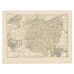
Antique Map of the State of Ohio by Titus '1871'
Located in Langweer, NL
Antique map titled 'Railroad & Township Map of the State of Ohio'. Original antique map of the State of Ohio. This map originates from 'Atlas of Preble County Ohio' by C.O. Titus. Pu...
Category

Late 19th Century Antique Netherlands - Collectibles and Curiosities

Materials

Paper

Antique Print of the Porcelain Pagoda in Nanjing, China, 1736
Located in Langweer, NL
Antique print titled 'La Tour de Porcelaine, Arc de Triomphe'. Old print depicting the Porcelain Pagoda in the Chinese city of Nanjing. It no longer ...
Category

18th Century Antique Netherlands - Collectibles and Curiosities

Materials

Paper

Bird's-Eye Views of Dunkerque, Gravelines, and Bourbourg by Braun and Hogenberg
Located in Langweer, NL
Bird's-Eye Views of Dunkerque, Gravelines, and Bourbourg by Braun and Hogenberg, 1597 This antique print, published in 1597 by Braun and Hogenberg, showcases three detailed bird's...
Category

16th Century Antique Netherlands - Collectibles and Curiosities

Materials

Paper

Persia Unveiled: Antique Map of Iran, Afghanistan, and Beyond, 1852
Located in Langweer, NL
The antique map titled 'Royaumes de Perse Herat & Kaboul' is an attractive map of Persia. Here are the key details and features of the map: 1. **Geographic Coverage**: - The map ...
Category

Mid-19th Century Antique Netherlands - Collectibles and Curiosities

Materials

Paper

Steiff wool miniature Toy Raven Crow, Germany 1938-43
By Steiff
Located in Delft, NL
Steiff wool miniature Toy Raven Crow, Germany 1938-43 This Raven Crow bird made of wool and felt fabric with iron feet was made in Germany by Steiff in the ...
Category

20th Century German Netherlands - Collectibles and Curiosities

Materials

Fabric

Antique Map of Mecklenburg-Vorpommern in Germany by J.B. Homann, c.1720
Located in Langweer, NL
Antique Map of Mecklenburg-Vorpommern by J.B. Homann, c.1720 Old colored antique map of Mecklenburg-Vorpommern by Johann Baptist Homann. This stunning map, titled "Ducatus Meklenbur...
Category

1720s Antique Netherlands - Collectibles and Curiosities

Materials

Paper

Antique Engraving of Malaysia, Brunei, Singapore, Java, Borneo, Sumatra, c.1750
Located in Langweer, NL
Nice decorative and detailed map from the Gulf of Siam and Mindoro to Timo, Java and Sumatra Borneo and Roy de Siam. Large compass rose and nice cartouche. Title: Carte des Isles ...
Category

Mid-18th Century Antique Netherlands - Collectibles and Curiosities

Materials

Paper

Spanish Moorish Mortar and Pestle 16th/17th century
By Estadio of Spain
Located in DELFT, NL
Spanish - Moorish Gothic bronze mortar and pestle with ribs, most likely from Andalusia. Of conical shape, resting on a circular uneven base, the exterior decorated with a series of ...
Category

17th Century Spanish Gothic Antique Netherlands - Collectibles and Curiosities

Materials

Bronze

19th Century Dutch Art Nouveau silver watch-key, 1890
Located in Delft, NL
19th Century Dutch Art Nouveau silver watch-key, 1890 A silver watch key with Art Nouveau leaf pattern. The key is Dutch silver hallmarked with "Boar...
Category

Late 19th Century Dutch Antique Netherlands - Collectibles and Curiosities

Materials

Silver

Genuine Antique Map of European Turkey by Pierre Antoine Tardieu (1784-1869)
Located in Langweer, NL
This is an original antique map titled "Carte de la Turquie d'Europe," which depicts the European territories of the Ottoman Empire. The map features detailed geographical and political boundaries, showcasing various regions, cities, rivers, and mountains within the Ottoman European territories. The map was created by Pierre Antoine Tardieu, a renowned French engraver, steel engraver, and cartographer known for his high-quality work. Map Details: - **Title**: Carte de la Turquie d'Europe - **Creator**: Pierre Antoine Tardieu (1784-1869) - **Publication Date**: Early 19th century - **Dimensions**: Approximately 34.5 x 43.5 cm (13.5 x 17.25 inches) - **Features**: The map includes a detailed representation of the European territories of the Ottoman Empire, with place names, rivers, mountains, and regions clearly marked. The title cartouche is located in the upper left corner, and the mile scale is presented in the lower left. Around the year 1800, the region referred to as "European Turkey" or "Ottoman Europe" was a significant part of the Ottoman Empire, which was one of the most powerful empires in the world at the time. Here are some key aspects of European Turkey during this period: ### Geographic Scope European Turkey included a large part of Southeastern Europe, encompassing modern-day: - Greece - Bulgaria - Romania (specifically the regions of Dobruja and parts of Wallachia) - Serbia - Albania - Montenegro - Bosnia and Herzegovina - Parts of Croatia, Macedonia, and Hungary Political Structure - **Ottoman Administration**: The region was governed by the Ottoman administrative system, which divided territories into provinces (vilayets) and smaller administrative units (sanjaks). Each province was overseen by a governor (pasha) appointed by the Sultan. - **Autonomy and Vassal States**: Some areas within European Turkey had varying degrees of autonomy or were vassal states. For example, Wallachia and Moldavia (in modern-day Romania) were vassal principalities that retained local rulers under Ottoman suzerainty. Society and Demographics - **Ethnic Diversity**: The region was extremely diverse, home to numerous ethnic groups, including Turks, Greeks, Bulgarians, Serbs, Albanians, Vlachs (Romanians), and Jews, among others. - **Religious Diversity**: There was significant religious diversity, with Islam being the dominant religion due to Ottoman rule, but large Christian (Eastern Orthodox, Roman Catholic) and Jewish populations coexisted. Economy - **Agriculture**: The economy was largely agrarian, with agriculture being the primary occupation. Key crops included grains, tobacco, and cotton. - **Trade and Commerce**: European Turkey was strategically important for trade, connecting the Mediterranean with Central Europe and the Black Sea. Major cities like Constantinople (modern-day Istanbul), Thessaloniki, and Belgrade were key commercial hubs. Culture - **Cultural Influence**: The region was a melting pot of various cultures, influenced by Byzantine, Slavic, and Ottoman traditions. This mix was reflected in architecture, cuisine, music, and customs. - **Education and Language**: The official language of administration was Ottoman Turkish, but many local languages were spoken. Education was often conducted in religious institutions, with different communities maintaining their own schools. Challenges and Conflicts - **Internal Strife**: The Ottoman Empire faced numerous internal challenges, including administrative inefficiency, corruption, and local uprisings. - **External Threats**: The empire was also under pressure from external forces, particularly from the Habsburg Empire, Russia, and later from nationalist movements within the Balkans, which sought independence or autonomy from Ottoman rule. Decline of Ottoman Power By 1800, the Ottoman Empire was experiencing a gradual decline, which would intensify throughout the 19th century. This period saw increasing nationalist sentiments among various ethnic groups within European Turkey, leading to uprisings and eventual wars of independence, such as the Serbian Revolution (1804-1835) and the Greek War of Independence (1821-1829). Overall, European Turkey around 1800 was a complex and diverse region under the Ottoman Empire's waning control, characterized by a rich tapestry of cultures, economic activities, and political structures. Condition Overview: 1. **Paper Quality**: The map exhibits signs of aging, such as yellowing along the edges, which is typical for documents of this age. The paper remains in good condition without major tears or damage. 2. **Edges and Corners**: The edges are slightly worn, with minor fraying and a few small tears that do not significantly impact the map's readability or aesthetic value. 3. **Center Fold**: There is a visible center fold, common for maps that were folded for storage or publication. The fold is in good condition without significant wear but with splits on both sidess. 4. **Color and Print Quality**: The colors used to outline the boundaries remain vibrant and clear. The print quality is excellent, with sharp, legible text and detailed illustrations. 5. **Staining and Spots**: There are a few spots and stains, particularly near the edges and along the fold. These do not obscure any critical details of the map. Historical and Artistic Value: Pierre Antoine Tardieu was known for his meticulous craftsmanship and contributions to cartography. His work drew the attention of prominent figures such as Alexander von Humboldt...
Category

Early 1800s Antique Netherlands - Collectibles and Curiosities

Materials

Paper

New Vintage 1970 Backgammon Rare Etienne Aigner Handmade Soft Leather Set
By Etienne Aigner
Located in Vis, NL
New vintage 1970 backgammon rare Etienne Aigner handmade soft leather complete set with instruction booklet, a rare find since they were just a few made guaranteeing the maximum leve...
Category

1970s French Arts and Crafts Vintage Netherlands - Collectibles and Curiosities

Materials

Leather

Antique Print of the Dutch VOC Bombing Palembang, Sumatra (Indonesia), ca.1700
By Pieter Van Der Aa
Located in Langweer, NL
Antique print titled 'La Ville de Palimbang dans L’Ile de Sumatra.' A very decorative, impressive engraving of Palembang in Sumatra. Two views on one sheet. In the upper part the ove...
Category

Early 18th Century Antique Netherlands - Collectibles and Curiosities

Materials

Paper

Antique Map of Southeast Asia by Ortelius '1587'
By Abraham Ortelius
Located in Langweer, NL
Antique map titled 'Indiae Orientalis Insularumque Adiacientium Typus'. Ortelius includes early European depictions of both Japan and China and is the first to name Formosa (Taiwan). The Philippines and East Indies or Spice Islands are shown based upon Portuguese and Spanish sources, and before their penetration by the Dutch. Japan is shown in kite form, as a large oval island...
Category

16th Century Antique Netherlands - Collectibles and Curiosities

Materials

Paper

Antique Religion Print of the Seven Sacraments, Eucharist '1913'
Located in Langweer, NL
Large antique print of the seven sacraments. Published by Mosella-Verlag, 1913. This print originates from a series titled 'Kathol. Schulbibelwerk von Dr. Ecker'.
Category

Early 20th Century Netherlands - Collectibles and Curiosities

Materials

Paper

Antique Map of Jura, a Famous Wine Area in France, 1854
Located in Langweer, NL
Antique map titled 'Dépt. du Jura'. Map of the French department Jura, France. Jura is a department in the Bourgogne-Franche-Comté region in Eastern France. Named after the Jura Mo...
Category

19th Century Antique Netherlands - Collectibles and Curiosities

Materials

Paper

Antique Map of Indiana by Johnson, 1872
Located in Langweer, NL
Antique map titled 'Johnson's Indiana'. Original map of Indiana. This map originates from 'Johnson's New Illustrated Family Atlas of the World' by A.J. ...
Category

Late 19th Century Antique Netherlands - Collectibles and Curiosities

Materials

Paper

Antique Map of South America by Philip & Son, 1875
Located in Langweer, NL
Antique map titled 'South America'. Old map of South America. Source unknown, to be determined. Artists and Engravers: George Philip (1800–1882) was a cartographer, map publisher...
Category

19th Century Antique Netherlands - Collectibles and Curiosities

Materials

Paper

Rare Antique Print of the Chinese Cavalry, 1668
By Johannes Nieuhof
Located in Langweer, NL
Antique print China titled 'Ordo equitanis exercitus'. Old print depicting the cavalry. This print originates from the Latin edition of Nieuhof's w...
Category

17th Century Antique Netherlands - Collectibles and Curiosities

Materials

Paper

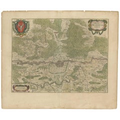
1663 Blaeu's Engraved Map of Frankfurt with Decorative Coats of Arms
Located in Langweer, NL
This map, titled "Novam Hanc Territorii Francofurtensis Tabulam," is an exquisite hand-colored engraved map from around 1663, created by the renowned cartographers J. and C. Blaeu of...
Category

1660s Antique Netherlands - Collectibles and Curiosities

Materials

Paper

1855 Colton's Map of Patagonia with South Atlantic Islands Insets
Located in Langweer, NL
Title: 1855 Colton's Map of Patagonia with South Atlantic Islands Insets Description: This is an 1855 map titled "Colton's Patagonia," published by J.H. Colton & Co. in New York. Th...
Category

1850s Antique Netherlands - Collectibles and Curiosities

Materials

Paper

French Guiana and Cayenne: Mid-19th Century Map from France Pittoresque Series
Located in Langweer, NL
This map titled "Guyane" is part of the France Pittoresque series and provides a detailed view of French Guiana along with a plan of the city of Cayenne. Features: - The map showcases the broader region of French Guiana, indicating key rivers, settlements, and the coastline along the Atlantic Ocean. - To the left, there's an inset labeled "Plan de la Ville de Cayenne", which shows the street layout, squares, and main buildings of the capital city, Cayenne. This inset provides a more detailed view of the urban area, highlighting its geometric grid layout near the coast. - The larger map outlines geographical features such as rivers (e.g., Oyapock and Maroni), forests, and territories in the surrounding area, including the neighboring Brazilian Empire...
Category

1850s Antique Netherlands - Collectibles and Curiosities

Materials

Paper

1874 Map of the United States with Territorial Boundaries
Located in Langweer, NL
Title: 1874 Map of the United States with Territorial Boundaries Description: This is an 1874 map titled "Map of the United States," showcasing the country during a period of rapid ...
Category

1870s Antique Netherlands - Collectibles and Curiosities

Materials

Paper

Copper Engraving of a Section of the Royal Botanic Gardens, Kew, London, 1776
Located in Langweer, NL
Antique print titled 'Coupe sur la longueur d'une partie de la Galerie des Antiques dans les jardins de Kew'. Copper engraving showing a section of the Royal Botanic...
Category

1770s Antique Netherlands - Collectibles and Curiosities

Materials

Paper

1579 Ornate Map of Burgundy County by Ferdinand de Lannoy
Located in Langweer, NL
1579 Ornate Map of Burgundy County by Ferdinand de Lannoy Description of the Map: This is a beautifully detailed map of the Burgundy region, titled "Bvrgvndiae Comitatus Recentiss....
Category

16th Century Antique Netherlands - Collectibles and Curiosities

Materials

Paper

1882 Detailed Map of South America showing Political and Geographical Features
Located in Langweer, NL
This 1882 map of South America, published by Blackie and Son as part of the 'Comprehensive Atlas and Geography of the World,' showcases the continent in remarkable detail. It provide...
Category

1880s Antique Netherlands - Collectibles and Curiosities

Materials

Paper

18th Century Polynesian Hardwood Ula Tavatava or Throwing War Club from Fiji
Located in Amsterdam, NL
A Polynesian hardwood Ula tavatava or throwing war club Fiji, probably 18th century All-over decorated in incised pattern, the bulbous top seems to have a stone grown into it. H. 42 cm Including museum-quality powder-coated stand. Provenance: Private collection, France Polynesian culture is traditionally a culture of power and prestige, and there was a fine line between battle and ceremony. Warrior people par excellence, the Fijians had at their disposal a large panoply of weapons, each for a specific use. The elegant Gata are called gun-sticks by Europeans due to the recognizable form. However, they are designed after a snake, gata in Fijian language. The Ula throwing clubs...
Category

18th Century Fijian Antique Netherlands - Collectibles and Curiosities

Materials

Hardwood

Spectacular View of the Siege of Jerusalem by King Nebuchadnezzar, ca.1730
Located in Langweer, NL
Antique print titled 'Belegering van Jerusalem door Nebucadnezar (..)'. This original antique print shows the siege of Jerusalem by King Nebucha...
Category

1730s Antique Netherlands - Collectibles and Curiosities

Materials

Paper

1864 Johnson's Map of New York State with City Insets
Located in Langweer, NL
Title: 1864 Johnson's Map of New York State with City Insets Description: This 1864 map, titled "Johnson's New York," was published by Johnson and Ward and features a detailed depic...
Category

1860s Antique Netherlands - Collectibles and Curiosities

Materials

Paper

Antique Decorative Coloured Map of North America, 1882
Located in Langweer, NL
This original antique map of North America is from the Blackie & Son Atlas published in 1882. Here are several points of interest about this map: 1. **Political Borders**: The map l...
Category

1880s Antique Netherlands - Collectibles and Curiosities

Materials

Paper

Antique Map of France at the Beginning of the 17th Century by Zannoni, 1765
By G. A. Rizzi-zannoni
Located in Langweer, NL
Antique map France titled 'Carte pour servir à intelligence de l'Histoire de France (..)'. Beautiful old map of France. This map originates from 'At...
Category

18th Century Antique Netherlands - Collectibles and Curiosities

Materials

Paper

Original Old Map East of Stockholm, the Island Ljusterö and Värmdö, Sweden, 1720
Located in Langweer, NL
Antique map titled 'Accurate Carte der Upländischen Scheren mit der Situation und Gegend umb die Konigle Schwedisch Haupt und Residentz Stadt Stockholm.' Map of the area east of ...
Category

1720s Antique Netherlands - Collectibles and Curiosities

Materials

Paper

Historical Map of Canaan with Insets of Jerusalem and Surrounding Regions, 1880
Located in Langweer, NL
The map titled "CANAAN" depicts the historical region known as Canaan, located in the Levant, which corresponds to modern-day Israel, Palestinian territories, Lebanon, and parts of S...
Category

1880s Antique Netherlands - Collectibles and Curiosities

Materials

Paper

Colonial Silver VOC 'East-India Company' Ingot
Located in Amsterdam, NL
A silver 'V.O.C. AMSTERDAM' ingot circa 1738, with monogram and the assay mark of the Amsterdam Grill family With V.O.C. monogram and the A for Amsterdam. L. approx. 15.5 cm Weight approx. 2000 grams Note: The ingots were salvaged in 2004 from the wreck of the VOC indiaman Rooswijk, equipped by the Amsterdam VOC Chamber. The Rooswijk sank on its second voyage to the Dutch East Indies off the English coast on the Goodwin Sands...
Category

18th Century Dutch Antique Netherlands - Collectibles and Curiosities

Materials

Sterling Silver

Oriental Realms: A Detailed Map of Persia, Afghanistan, and Beloochistan, 1882
Located in Langweer, NL
This historical map from the 1882 atlas published by Blackie & Son is a comprehensive depiction of Persia (modern-day Iran), Afghanistan, and Baluchistan (the region that includes pa...
Category

1880s Antique Netherlands - Collectibles and Curiosities

Materials

Paper

Large Folding Map of Paris, France, on Linen, 36 Segments, Published in 1836
Located in Langweer, NL
Antique map Paris titled 'Carte Topographique des Environs de Paris Nouvelle edition rectifié d'apres les travaux de la Nouvelle Carte De France'. ...
Category

1830s Antique Netherlands - Collectibles and Curiosities

Materials

Paper

Mapping the Heart of France: Willem Blaeu's 17th Century Île-de-France, ca.1650
Located in Langweer, NL
This original antique map titled "Le Gouvernement de l'Isle de France" represents the Île-de-France region, which historically was one of the provinces of France and contained the ci...
Category

1650s Antique Netherlands - Collectibles and Curiosities

Materials

Paper

1817 Map of Puerto Rico and the Virgin Islands with Original Hand Coloring
Located in Langweer, NL
The title provided for this map is "Porto Rico and Virgin Isles," and it is an antique map from an early 19th century atlas, dated 1817, featuring original hand coloring. This histor...
Category

Early 19th Century Antique Netherlands - Collectibles and Curiosities

Materials

Paper

Antique Map of Scotland With an Inset Map of the Shetland Islands, 1854
Located in Langweer, NL
Stunning Map of Scotland that will look beautiful in any setting framed on the wall. Description: Large Antique map titled 'Scotland with its Islands, drawn from the Topographical surveys...
Category

1850s Antique Netherlands - Collectibles and Curiosities

Materials

Paper

Antique Map of the Holy Land, Showing the Location of the Various Tribes
Located in Langweer, NL
Antique map titled 'Judaea seu Terra Sancta quae Hebraeorum sive Israelitarum (..)'. Map of The Holy Land, showing the location of the various tribes, in two kingdoms, Judah and Isra...
Category

Early 18th Century Antique Netherlands - Collectibles and Curiosities

Materials

Paper

Religious Antique Print of a Knight of the Order of Santiago, 1845
Located in Langweer, NL
Antique print titled 'Chevalier de l'Ordre de St. Jaques de l'Epee'. Print of a Knight of the Order of Santiago, Order of St. James of the Sword. This print originates from 'Histoire...
Category

19th Century Antique Netherlands - Collectibles and Curiosities

Materials

Paper

Read More

Medal-Worthy Memorabilia from Epic Past Olympic Games

Get into the games! These items celebrate the events, athletes, host countries and sporting spirit.

Ahoy! You’ve Never Seen a Collection of Sailor Art and Kitsch Quite Like This

French trendsetter and serial collector Daniel Rozensztroch tells us about his obsession with objects related to seafaring men.

Pamela Shamshiri Shares the Secrets behind Her First-Ever Book and Its Effortlessly Cool Interiors

The sought-after designer worked with the team at Hoffman Creative to produce a monograph that beautifully showcases some of Studio Shamshiri's most inspiring projects.

Moroccan Artworks and Objects Take Center Stage in an Extraordinary Villa in Tangier

Italian writer and collector Umberto Pasti opens the doors to his remarkable cave of wonders in North Africa.

Montecito Has Drawn Royalty and Celebrities, and These Homes Are Proof of Its Allure

Hollywood A-listers, ex-pat aristocrats and art collectors and style setters of all stripes appreciate the allure of the coastal California hamlet — much on our minds after recent winter floods.

Whaam! Blam! Pow! — a New Book on Pop Art Packs a Punch

Publishing house Assouline and writer Julie Belcove have teamed up to trace the history of the genre, from Roy Lichtenstein, Andy Warhol and Yayoi Kusama to Mickalene Thomas and Jeff Koons.

The Sparkling Legacy of Tiffany & Co. Explained, One Jewel at a Time

A gorgeous new book celebrates — and memorializes — the iconic jeweler’s rich heritage.

What Makes a Gem-Encrusted Chess Set Worth $4 Million?

The world’s most opulent chess set, weighing in at 513 carats, is literally fit for a king and queen.
Recently Viewed

View All