Netherlands - Collectibles and Curiosities

to
4,836
6,365
15,008
11,550
6,324
28
13
55
25
19
18
16
11
6
5
4
2
1
1
1
3,130
2,455
739
41
338
115
38
79
6
6
10
6
17
31
14
7
5
5,702
363
209
81
80
824
242
184
82
61
6,365
6,364
6,364
104
59
20
14
14
Item Ships From: Netherlands
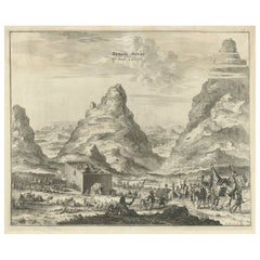
Rare Engraving of Mount Sinai with St. Catherine's Monastery and Bedouins, 1680
Located in Langweer, NL
Rare antique print titled ‘Bergh Sinai of Sint Catryn’. This engraving shows Mount Sinai (also known as Mount Horeb) with St. Catherine's Monastery at the foot of the mountains a...
Category

1680s Antique Netherlands - Collectibles and Curiosities

Materials

Paper

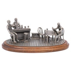
Vintage Tin Etain Zinn Pewter, Bar Scene, 1970s
By Etaind'art
Located in Den Haag, NL
Very rare large Pewter bar scene. Signed Tin Etain Zinn Pewter, several figures and furniture in a bar. Standing on a oak base. 1970s Dutch.  
Category

1970s Dutch Mid-Century Modern Vintage Netherlands - Collectibles and Curiosities

Materials

Pewter

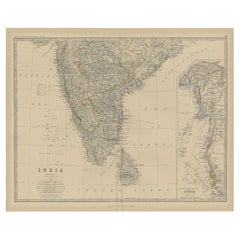
Old Map of Southern India and Ceylon 'Sri Lanka', 1882
Located in Langweer, NL
Antique map titled 'India (Southern Sheet)'. Old map of Southern India and Ceylon (Sri Lanka). With an inset map of the South-Eastern Provinces of India. This map originates from...
Category

1880s Antique Netherlands - Collectibles and Curiosities

Materials

Paper

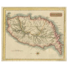
Copper Engraved Grenada Map by John Thompson Published in 1810
Located in Langweer, NL
John Thomson's original antique map of Grenada, dating back to 1810 and hailing from Edinburgh, stands as a testament to meticulous cartography. This historical piece, adorned with o...
Category

Early 19th Century Antique Netherlands - Collectibles and Curiosities

Materials

Paper

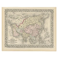
Antique Map of Asia Showing Its Political Divisions, 1874
Located in Langweer, NL
Antique map titled 'Map of Asia showing its Gt. Political Divisions and also the various routes of Travel between London & India, China & Japan & c'. This map covers from the Arabian...
Category

19th Century Antique Netherlands - Collectibles and Curiosities

Materials

Paper

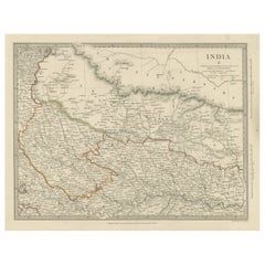
Original Antique Map of Part of the Bahar Region (India), 1834
Located in Langweer, NL
Antique map titled 'India X'. Old steel engraved map of part of the Bahar region, it also shows part of Nepal. Artists and Engravers: Engraved by J. & C. Walker. Published under th...
Category

19th Century Antique Netherlands - Collectibles and Curiosities

Materials

Paper

Fine Art Japanese Vase Arita Artist Fujii Shumei Winter Landscape, 19th/20th C.
By Fujii Shumei
Located in Amsterdam, Noord Holland
Lovely and rare piece. A superb blue and white porcelain vase, with a winter landscape. Made by Fuji Shumei. Fujii Mr. Aki Fujii’s specialty is the technique of drawing a mountain ...
Category

20th Century Japanese Showa Netherlands - Collectibles and Curiosities

Materials

Bronze

A Gold Highlighted Antique Map of Northamptonshire by Blaeu '1659'
Located in Langweer, NL
Antique map titled 'Comitatus Northantonensis vernacule Northamtonshire'. Original antique map of Northamptonshire, England. This map originates from 'Atlas Universal y Cosmographico...
Category

Mid-17th Century Antique Netherlands - Collectibles and Curiosities

Materials

Paper

Antique Map of New Zealand, 1895
Located in Langweer, NL
Antique map titled 'Neu-Seeland.' Map of New Zealand. With inset maps of the large cities. This attractive original old antique print / plate / map ...
Category

19th Century Antique Netherlands - Collectibles and Curiosities

Materials

Paper

Antique Map of New Zealand, 1895
$111 Sale Price
20% Off
Map of Northern European Russia: Early 19th Century - 1802 Tardieu Atlas
Located in Langweer, NL
Title: Russie Européenne: Partie Septentrionale. Deuxieme Carte. **Publication Details:** - **Atlas Title:** Nouvel Atlas Universel de Géographie Ancienne et Moderne - **Purpose:**...
Category

Early 1800s Antique Netherlands - Collectibles and Curiosities

Materials

Paper

Antique Map of Alabama
Located in Langweer, NL
Antique map titled 'Alabama'. Original antique map of Alabama, United States. This print originates from 'Encyclopaedia Britannica', Ninth Editi...
Category

Late 19th Century Antique Netherlands - Collectibles and Curiosities

Materials

Paper

Antique Map of Alabama
$270 Sale Price
20% Off
German Antique Map of Oceania, 1895
Located in Langweer, NL
Antique map titled 'Oceanie.' Map of Oceania. This attractive original old antique print / plate / map originates from 1885-1907 editions of a famous German encyclopedia: 'Meyers grosses Konversations-Lexikon.', published in Leipzig and Vienna. Meyers Konversations-Lexikon was a major German encyclopedia that existed in various editions from 1839 until 1984, when it merged with the Brockhaus encyclopedia. Several of the plates were also used in Dutch Encyclopedia's like Winkler Prins...
Category

19th Century Antique Netherlands - Collectibles and Curiosities

Materials

Paper

Dutch 18th Century Fob seal with coat of arms
Located in Delft, NL
Dutch 18th Century Fob seal with coat of arms A Dutch 18th Century silver fob seal with coat of arms. A lacquer seal/signet to seal a letter or deed. Signets are wax stamps, also ca...
Category

18th Century Dutch Antique Netherlands - Collectibles and Curiosities

Materials

Silver

Beira Alta: A Cartographic Journey Through Portugal's Heartland in 1903
Located in Langweer, NL
The uploaded image is a historical map of the Beira Alta region in Portugal. The map is detailed, showing the topography, hydrography, and transportation networks of the region, incl...
Category

Early 1900s Antique Netherlands - Collectibles and Curiosities

Materials

Paper

Antique Map of the Caspian Sea, Uzbekistan, Northern Persia Etc, C.1735
Located in Langweer, NL
Antique map titled 'Nova Maris Caspii et Regions Usbeck (..).' Detailed map of Central Asia centered on the Caspian Sea, showing Uzbekistan to the east of ...
Category

18th Century Antique Netherlands - Collectibles and Curiosities

Materials

Paper

Antique Map of the Ternate Islands by Van den Bosch '1818'
Located in Langweer, NL
Antique map titled 'Kaart der Ternataansche Eilanden'. Rare and attractive map of the Ternate Islands with a large view of Ternate Island. One of 12 maps from 'Atlas van Overzeesche ...
Category

Early 19th Century Antique Netherlands - Collectibles and Curiosities

Materials

Paper

Antique Map of the City of Groningen by Merian, 1659
Located in Langweer, NL
Antique map titled 'Gröningen'. This print depicts the city of Groningen, the Netherlands. This print originates from 'Topographia Germaniae Inferioris (..)' by C. Merian. Artist...
Category

17th Century Antique Netherlands - Collectibles and Curiosities

Materials

Paper

Hand-colored Nautical Chart: St. George's Channel and the Irish Sea, 1744
Located in Langweer, NL
The map was engraved by Richard William Seale, a notable British engraver. This map is a fine example of 18th-century cartography, particularly focused on maritime navigation. The m...
Category

1740s Antique Netherlands - Collectibles and Curiosities

Materials

Paper

Old Original Antique German Map of North America, ca.1870
Located in Langweer, NL
Antique map titled 'Nord-America'. Old map of North America. This map originates from 'H. Kiepert's Kleiner Atlas der Neueren Geographie für Schule und Haus'. Artists and Engrave...
Category

1870s Antique Netherlands - Collectibles and Curiosities

Materials

Paper

Antique Map of the Northern Part of Scotland by Black '1854'
Located in Langweer, NL
Antique map titled 'Scotland'. Original map of the northern part of Scotland. With an inset map of the Orkney Isles. This map originates from 'General Atlas Of The World: Containing ...
Category

Mid-19th Century Antique Netherlands - Collectibles and Curiosities

Materials

Paper

Antique Map of the World by Ferrario '1831'
Located in Langweer, NL
Original antique map of the world. This print originates from 'Costume Antico e Moderno: Palestine, China, India, Oceania' by Ferrario. Publis...
Category

Mid-19th Century Antique Netherlands - Collectibles and Curiosities

Materials

Paper

Rare Detailed Antique Map of Prague and Its North West Environs, ca.1760
Located in Langweer, NL
Description: original antique map of the environs of North West Prague. This map originates from the 'Gentlemans Magazine'. Published circa 1760. Artists and Engravers: Engraved ...
Category

1760s Antique Netherlands - Collectibles and Curiosities

Materials

Paper

Antique Map of the Holy Land, c.1717
Located in Langweer, NL
Antique map Israel titled 'Tabula Geographica Terrae Sanctae'. Rare edition made after a map of the Holy Land by J. Bonfrerius. The map is oriented ...
Category

18th Century Antique Netherlands - Collectibles and Curiosities

Materials

Paper

Pl. 465 Antique Print of Roof Structures by Bell, c.1810
Located in Langweer, NL
Antique print titled 'Plate CCCCLXIV Roofs'. Old print depicting various roof structures. This print originates from 'Encyclopedia Britannica'. Artists and Engravers: Engraved by A. ...
Category

19th Century Antique Netherlands - Collectibles and Curiosities

Materials

Paper

Vintage School Chart of Coal Mining Operation Plus Cross Section on Verso, 1931
Located in Langweer, NL
Title: De Mijn Maurits bij Sittard (The Maurits Mine near Sittard). On the verso 'Doorsnede van een kolen mijn in Limburg'. Translated: Cross Section of a Coalmine in Limburg (a province in the South of The Netherlands). Sittard is a city in the province of Limburg, in the south of Holland. In 1947 this coal mine was connected to another mine: the Emma Mine, by a 13 km straight tunnel. In the second half of the 1940s and in the 1950s the mine was expanded, and mining reached a depth of 810 m. A third shaft was completed in 1958. At the time of completion of the third shaft, the Maurits mine was the largest two-shafts mine in the world. It was the largest coal mine in the Netherlands. When in the beginning of the 1960s the economic tide for coal mining...
Category

Early 20th Century European Netherlands - Collectibles and Curiosities

Materials

Other

Antique Engraved Map of the Friendly Islands or Tonga, ca.1785
Located in Langweer, NL
Antique map titled 'Carte des Isles des Amis'. Map of the Friendly Islands / Tonga. The Tongan people first encountered Europeans in 1616 when the Dutch vessel Eendracht, captain...
Category

1780s Antique Netherlands - Collectibles and Curiosities

Materials

Paper

Antique Print of the Rialto Bridge in Venice in Italy, 1835
Located in Langweer, NL
Antique print titled 'The Rialto at Venice'. Old print of the Rialto Bridge (or Ponte di Rialto) in Venice, Italy. This print originates from 'One Hundred and Fifty Wood Cuts selecte...
Category

19th Century Antique Netherlands - Collectibles and Curiosities

Materials

Paper

Architectural French Print of Villa a Fontainebleau, Chabat, c.1900
Located in Langweer, NL
Antique print titled 'Villa a Fontainebleau Mr. Brunnarius Architecte'. This print depicts the design of a building in France. Originates from 'La Brique et La Terre Cuite' by P. Cha...
Category

20th Century Netherlands - Collectibles and Curiosities

Materials

Paper

Old Prints of Costumes of Hungary, Tyrol, Sweden, Romania, Holland, Etc., Ca1875
Located in Langweer, NL
Antique costume print including many different costumes including costumes of Hungary, Tyrol, Sweden and others. This print originates from 'Blätter für Kostümkunde. Historische ...
Category

1870s Antique Netherlands - Collectibles and Curiosities

Materials

Paper

Antique Map of Germany by T. Kitchin, circa 1770
Located in Langweer, NL
Antique map titled 'An Accurate Map of Germany (..) '. Drawn from the best Authorities by T.Kitchin Geogr." Rare edition, drawn and etched by Thomas Kitchin, published, circa 1770.
Category

Mid-18th Century Antique Netherlands - Collectibles and Curiosities

Materials

Paper

Antique Map of the Kanton Luzerne 'Switzerland' by Homann Heirs, 1763
Located in Langweer, NL
Antique map titled 'Canton Lucern (..)'. Fine decorative copper plate engraved antique map of the Canton of Lucerne in Central Switzerland with pictorial cartouche in top right corne...
Category

Mid-18th Century Antique Netherlands - Collectibles and Curiosities

Materials

Paper

Colorful Detailed Antique Map of The British Islands and `The North Sea, 1882
Located in Langweer, NL
Discover 'The British Islands and The North Sea' Map with Insets of Orkney, Shetland, and Channel Islands! This captivating original antique map offers a detailed view of the British...
Category

1880s Antique Netherlands - Collectibles and Curiosities

Materials

Paper

Antique Map of Peloponnesus, Greece by Pierre Antoine Tardieu, 1797
Located in Langweer, NL
This antique map, titled "Carte Ancienne d'Allemagne," represents ancient Germany and surrounding regions. It was published by the well-known Parisian mapmakers and publishers Jean-Baptiste-Louis Clouet and Alexandre Aimé Vuillemin in the late 18th century, specifically in 1787. The map covers the extensive geographical area of ancient Germany, highlighting various tribes and regions known at the time. Key features include: 1. **Geographical Boundaries**: The map outlines the territorial extents of ancient Germany, bordered by Gallia (France) to the west, Sarmatia (parts of Eastern Europe) to the east, and the Italian regions to the south. The northern boundary reaches the Oceanus Germanicus (North Sea) and the Sarmatian Sea (Baltic Sea). 2. **Tribal Regions**: It details numerous ancient Germanic...
Category

1790s Antique Netherlands - Collectibles and Curiosities

Materials

Paper

Engraving of Roman Punishments of Mass Crucifixion Outside the City Wall, 1690
Located in Langweer, NL
Antique print titled 'd'Aal-oude Kruis-straffen der Romeinen: hoedanige door Constantyn de Groot, uit eerbied voor het Kruis des Saligmakers, afgeschaft zyn'. Antique print of the ancient punishment by crucifixion which was abolished by Constantine the Great in deference to the cross of Jesus...
Category

17th Century Antique Netherlands - Collectibles and Curiosities

Materials

Paper

Small Detailed Antique Map of France, with Decorative Title Cartouche, 1754
Located in Langweer, NL
Antique map France titled 'An Accurate Map of France drawn from the best authorities'. Small, detailed map of France. With decorative title cartouche. ...
Category

1750s Antique Netherlands - Collectibles and Curiosities

Materials

Paper

Antique Print of a Nun of Order of Visitation of Holy Mary in Flandres, Belgium
Located in Langweer, NL
Antique print titled 'Visitandine en Flandre'. Print of a Nun of the Order of the Visitation of Holy Mary in Flandres. This print originates from 'Histoire et Costumes des Ordres Rel...
Category

19th Century Antique Netherlands - Collectibles and Curiosities

Materials

Paper

Roman Balkans: Pannonia, Illyricum, Dacia, Moesia, Thracia, Macedonia and Thyris
Located in Langweer, NL
This original antique map showcases the Roman provinces in the Balkan region and parts of Central and Eastern Europe. The title "PANNONIA, ILLYRICUM DACIA, MOESIA, THRACIA, MACEDONIA...
Category

1880s Antique Netherlands - Collectibles and Curiosities

Materials

Paper

Antique Map of Denmark with the Danish Royal Crest, c.1730
By Homann Heirs
Located in Langweer, NL
Antique map titled 'Regni Daniae in quo sunt Ducatus Holsatia and Slesuicum Insulae Danicae Jutia, Scania Blekingia (..).' Map of Denmark and islands, part of Sweden and Germany, dra...
Category

18th Century Antique Netherlands - Collectibles and Curiosities

Materials

Paper

Antique Print of Garden Buildings from Garden Architecture by Van Laar, 1802
Located in Langweer, NL
Untitled print of garden architecture. It shows garden buildings. This print originates from 'Magazijn van tuin-sieraden'. The book is compiled by Gijs...
Category

19th Century Antique Netherlands - Collectibles and Curiosities

Materials

Paper

Antique Map of Denmark with An Inset of Iceland, 1852
Located in Langweer, NL
Antique map titled 'Denemarken'. Map of Denmark, with a small inset map of Iceland. This map originates from 'School-Atlas van alle deelen der Aarde' by Otto Petri...
Category

19th Century Antique Netherlands - Collectibles and Curiosities

Materials

Paper

Antique Map of South Australia, Victoria, Queensland and New South Wales, c.1860
Located in Langweer, NL
Antique map Australia titled 'South Australia, New South Wales, Victoria & Queensland'. Old map depicting South Australia including New South Wal...
Category

19th Century Antique Netherlands - Collectibles and Curiosities

Materials

Paper

Antique Print of 'Madonna del Gran Duca' Made after Perugino 'c.1890'
Located in Langweer, NL
Antique print titled 'Madonna del Gran Duca'. Original antique print on chine collé, made after the painting by Raphael. Source unknown, to be determined. Published circa 1890.
Category

Late 19th Century Antique Netherlands - Collectibles and Curiosities

Materials

Paper

Dutch Set Blood Coral and Gold by Leesener, Amsterdam
Located in Delft, NL
A Dutch set blood coral and gold by Leesener, Amsterdam A set of a necklace and bracelet with red blood coral with gold lock. The necklace has 3 rows with red coral and gold lock ...
Category

Mid-20th Century Dutch Netherlands - Collectibles and Curiosities

Materials

Gold

Antique Map of the Area Around Venice in Italy by H. Hondius, circa 1606
By Gerard Mercator, Jodocus Hondius
Located in Langweer, NL
Attractive and early map of the area around Venice, Italy. With South-Tirol in the North, areas of Krain (Slovenia), Croatia, Ferrara, Modena and Piacenza. In the east with areas aro...
Category

Early 17th Century Dutch Antique Netherlands - Collectibles and Curiosities

Materials

Paper

Print of a Dutch VOC Fort on the Peninsula Trincomalee, Ceylon (Sri Lanka), 1726
Located in Langweer, NL
Dutch print with the title: Platte Grond van t'Fort Tricoen male met de daar aangelegen Pagoods-Berg (Trincomalee, Sri Lanka) The map is taken from: 'Oud en Nieuw Oost-Indiën' van...
Category

1720s Antique Netherlands - Collectibles and Curiosities

Materials

Paper

Antique Map of the Islands in the Atlantic Ocean including Bermuda & Cape Verde
Located in Langweer, NL
Antique map titled 'Islands in the Atlantic'. Steel engraved map of the islands in the Atlantic Ocean. It shows 16 individual maps on one sheet. Covers the Azores or Western Isles, Faeroe Isles, Madeira Isles, Princes Island, Canary Islands, Fernando Po, Anno Bon, St. Thomas, Bermuda Isles, Trinidade Isles, Fernando Noronha, Cape Verde Isles, Ascension Island, St. Helena, Tristan d'Acunha Isles and the Falkland Isles. Engraved by J. & C. Walker. Published by George Cox...
Category

Mid-19th Century Antique Netherlands - Collectibles and Curiosities

Materials

Paper

Map of Sevilla Province, 1901: A Depiction of The Spanish Cultural Heartland
Located in Langweer, NL
The print for sale here depicts a historical map of the province of Sevilla (Seville) from the year 1901. Sevilla is located in the southern part of Spain and is part of the autonomo...
Category

Early 1900s Antique Netherlands - Collectibles and Curiosities

Materials

Paper

Antique Map of Asia by Dufour, circa 1834
Located in Langweer, NL
Antique map titled 'Asie par A.H. Dufour'. Uncommon map of Asia. Published by or after A.H. Dufour, circa 1834. Source unknown, to be determined.
Category

Mid-19th Century Antique Netherlands - Collectibles and Curiosities

Materials

Paper

Antique Map of the Northern Hemisphere, 1782
Located in Langweer, NL
Antique map titled 'Hémisphère Septentrional pour voir plus distinctement les Terres Arctiques (..)'. Map of the Northern Hemisphere, originall...
Category

1780s Antique Netherlands - Collectibles and Curiosities

Materials

Paper

Antique Plan of the City of Damietta Egypt by C. Niebuhr, 1774
Located in Langweer, NL
Antique print titled 'Grundris der Stadt Damiât'. This print originates from 'Reisebeschreibung nach Arabien und andern umliegenden Ländern' by C. Niebuhr, 1774.
Category

Late 18th Century Antique Netherlands - Collectibles and Curiosities

Materials

Paper

Antique Map of Cities of the Jiangsu Region in China, c.1760
By Jacques-Nicolas Bellin
Located in Langweer, NL
Antique map titled 'Plan de l' Enceinte de la Ville de Nan-King ou Kyang-Ning-Fou et plan de la ville de Su-Tcheou-Fou.' A map of the city of Nanking or Nanjing and a second map show...
Category

18th Century Antique Netherlands - Collectibles and Curiosities

Materials

Paper

Topographical and Infrastructure Map of the Province of Valencia, 1901
Located in Langweer, NL
A historical map of the province of Valencia, dated 1901. The map includes intricate details such as topographical features, with mountain ranges and river systems prominently marked...
Category

Early 1900s Antique Netherlands - Collectibles and Curiosities

Materials

Paper

Antique Map of the Gambia River by J. Van Schley, circa 1750
Located in Langweer, NL
"Carte de la Riviere de Gambra ou Gambie. Depuis son Embouchure Jusqu a Eropina". Orig. copper-engraving after Capt. J. Leach's map of the region from 1732. With ornamental title cartouche and Dutch...
Category

Mid-18th Century Antique Netherlands - Collectibles and Curiosities

Materials

Paper

Antique Map of the Rhine centered on Cologne, Germany
Located in Langweer, NL
Antique map titled 'Archiepsiscopatus et Electoratus Coloniensis (..)'. Original antique map of the Rhine river, centered on Cologne, Germany. The Rhine River cuts across this map fr...
Category

Early 18th Century Antique Netherlands - Collectibles and Curiosities

Materials

Paper

Antique Religious Print 'The Law is Given by Moses' by A. Calmet, 'circa 1725'
By A. Calmet
Located in Langweer, NL
Antique print titled 'De wet is door Mozes gegeven, de genade en de waarheid is door Jesus Christus geworden.' The law is given by Moses, Mercy and Truth established by Jesus Christ....
Category

Early 18th Century Dutch Antique Netherlands - Collectibles and Curiosities

Antique Map of Africa Made after Hondius, circa 1655
Located in Langweer, NL
Antique map titled 'Africa Nova Tabula Auct Jud. Hondio'. Beautiful and rare paneled map of Africa, Based Upon Hondius' map. The first derivative of the map was issued separately by ...
Category

Mid-17th Century Antique Netherlands - Collectibles and Curiosities

Materials

Paper

Antique Map of Harrison County 'Ohio' by Titus, 1871
Located in Langweer, NL
Antique map titled 'Harrison'. Original antique map of Harrison, Ohio. This map originates from 'Atlas of Preble County Ohio' by C.O. Titus. Published, 1871.
Category

Late 19th Century Antique Netherlands - Collectibles and Curiosities

Materials

Paper

Antique Map of Japan, the Kurile Islands and Liu Kiu Islands, 1886
Located in Langweer, NL
The map is an exquisite piece, showcasing Japan's vibrant geography. Engraved by J. Bartholomew and published by George Philip & Son in London & Liverpool, it presents a detailed and...
Category

Late 19th Century Antique Netherlands - Collectibles and Curiosities

Materials

Paper

Antique Map of Côte d'Or ‘France’ by V. Levasseur, 1854
By Victor Levasseur
Located in Langweer, NL
Antique map titled 'Dépt. de la Côte d'Or'. Map of the French department of Cote D’Or, France. Part of France's Burgundy or Bourgogne wine region, a premier wine-growing region of Fr...
Category

Mid-19th Century Antique Netherlands - Collectibles and Curiosities

Materials

Paper

The Principality of Dombes: A 17th-Century Cartographic Jewel by Jan Jansson
Located in Langweer, NL
The text on the map "La principaute de Dombes; J. van den Eynde sculpit.; La Principavte de Dombes" indicates that it is a map of the principality of Dombes, engraved by J. van den E...
Category

1630s Antique Netherlands - Collectibles and Curiosities

Materials

Paper

Read More

Medal-Worthy Memorabilia from Epic Past Olympic Games

Get into the games! These items celebrate the events, athletes, host countries and sporting spirit.

Ahoy! You’ve Never Seen a Collection of Sailor Art and Kitsch Quite Like This

French trendsetter and serial collector Daniel Rozensztroch tells us about his obsession with objects related to seafaring men.

Pamela Shamshiri Shares the Secrets behind Her First-Ever Book and Its Effortlessly Cool Interiors

The sought-after designer worked with the team at Hoffman Creative to produce a monograph that beautifully showcases some of Studio Shamshiri's most inspiring projects.

Moroccan Artworks and Objects Take Center Stage in an Extraordinary Villa in Tangier

Italian writer and collector Umberto Pasti opens the doors to his remarkable cave of wonders in North Africa.

Montecito Has Drawn Royalty and Celebrities, and These Homes Are Proof of Its Allure

Hollywood A-listers, ex-pat aristocrats and art collectors and style setters of all stripes appreciate the allure of the coastal California hamlet — much on our minds after recent winter floods.

Whaam! Blam! Pow! — a New Book on Pop Art Packs a Punch

Publishing house Assouline and writer Julie Belcove have teamed up to trace the history of the genre, from Roy Lichtenstein, Andy Warhol and Yayoi Kusama to Mickalene Thomas and Jeff Koons.

The Sparkling Legacy of Tiffany & Co. Explained, One Jewel at a Time

A gorgeous new book celebrates — and memorializes — the iconic jeweler’s rich heritage.

What Makes a Gem-Encrusted Chess Set Worth $4 Million?

The world’s most opulent chess set, weighing in at 513 carats, is literally fit for a king and queen.
Recently Viewed

View All