Netherlands - Collectibles and Curiosities

to
2,756
6,183
14,751
11,431
6,144
26
13
52
24
19
18
16
6
5
5
4
2
1
1
1
3,076
2,387
681
39
286
112
34
79
5
6
10
6
15
29
13
5
4
5,538
353
202
83
78
583
175
99
59
44
6,183
6,182
6,182
104
59
20
14
14
Item Ships From: Netherlands
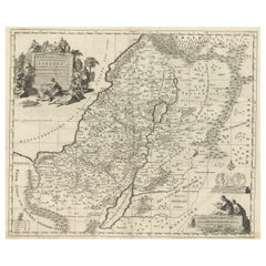
1767 D’Anville Map of the Holy Land: Ancient Divisions and Biblical Geography
Located in Langweer, NL
Ancient Map of Palestine or the Holy Land by D'Anville (1767) This detailed map, created by the renowned French cartographer Jean Baptiste Bourguignon d'Anville in 1767, depicts the...
Category

1670s Antique Netherlands - Collectibles and Curiosities

Materials

Paper

Antique Map of Switzerland by J. Tallis, circa 1851
Located in Langweer, NL
A decorative and detailed mid-19th century map of Switzerland which was drawn and engraved by J. Rapkin (vignettes by A. H. Wray & J. B. Allen) and published in John Tallis's Illustr...
Category

Mid-19th Century Antique Netherlands - Collectibles and Curiosities

Materials

Paper

1930s Deluxe Leather Suitcase or Business Case with Realistic Alligator Pattern
Located in Lisse, NL
Practical size and fine looking briefcase for the urban professionals. This wonderful and slim design vintage briefcase is in very good condition. All hinges, clasps and also the lo...
Category

Mid-20th Century German Netherlands - Collectibles and Curiosities

Materials

Metal

Antique Map of Warwickshire in England by Speed, c.1614
Located in Langweer, NL
Antique map titled 'The Counti of Warwick the Shire Towne and Citie of Coventre described'. Map of Warwickshire, England. Includes inset town plans of Warwic...
Category

17th Century Antique Netherlands - Collectibles and Curiosities

Materials

Paper

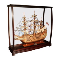
Museum-Quality, Fully Assembled Replica of H.M.S. Sovereign of the Seas
Located in Eindhoven, NL
This is museum-quality, fully assembled replica of H.M.S. Sovereign of the Seas, a first-rate ship in the British Royal Navy for more than 50 years in the 1600s. Master craftsmen using historical photographs, drawings or original plans meticulously handcraft these highly detailed wood models from scratch. They are built to scale with high-grade wood such as: western red cedar, and mahogany. They are 100% hand built individually using plank-on-frame construction method and are similar to the building of actual ships. Each model requires hundreds of hours to finish and must go through a demanding quality control process before leaving the workshop. This magnificent Sovereign of the Seas model...
Category

2010s Central Asian Netherlands - Collectibles and Curiosities

Materials

Mahogany

Antique Engraving - Crucifixion Christ - Silver Plated Copper - After Van Dyck
By Anthony van Dyck
Located in Casteren, Noord-Brabant
A late 19th century engraving, depicting the crucifixion of Jesus Christ and cherubs "Christ aux Anges". Engraved on a copper panel, silver plated. After Anthony Van Dyck (1599-1641)...
Category

1880s French Baroque Antique Netherlands - Collectibles and Curiosities

Materials

Silver Plate, Copper

Rare 1757 Jesuit Map of California and Baja, Dedicated to the King of Spain
Located in Langweer, NL
Title: Rare 1757 Jesuit Map of California and Baja, Dedicated to the King of Spain This rare and detailed map, titled *Carte de la Californie Levee par la Société des Jésuites*, wa...
Category

1750s Antique Netherlands - Collectibles and Curiosities

Materials

Paper

Circa 1691 Frederick de Wit Map: Middle East with Arabia, Persia & More
Located in Langweer, NL
Circa 1691 Frederick de Wit Map: Middle East with Arabia, Persia & More This exquisite hand-colored map, circa 1691, by Frederick de Wit, illustrates the Middle East, spanning from Turkey and Egypt to Afghanistan, with a detailed representation of the Arabian Peninsula. The map's detailing in Arabia is based on Nicolas Sanson's influential 1654 map, which was one of the most accurate and detailed depictions of the region up to the mid-seventeenth century. The decorative title cartouche is richly adorned with images of exotic figures, animals, and a merchant ship, symbolizing the region's historical trade importance. Additionally, a mapmaker is shown working with traditional tools, adding a touch of authenticity to the cartographic art. This is the fourth state of the map, published between 1691 and 1696. The map measures 21.8 inches in width by 18.5 inches in height, featuring a sharp impression, with minimal staining and a carefully repaired centerfold separation at the bottom. Keywords: - Middle East historical map - Frederick de Wit map - 17th century maps - Arabian Peninsula map - Persia (Iran) map - Turkey and Egypt map...
Category

1690s Antique Netherlands - Collectibles and Curiosities

Materials

Paper

Antique Map of South Sweden 'Scandinavia' by F. de Wit, 1680
Located in Langweer, NL
Antique map titled 'Accurata Scaniae, Blekingae et Hallandiae Descriptio per F. de Wit Amstelodami'. This map shows South Sweden with an inset of Halmstad and vicinity. Contemporary ...
Category

Late 17th Century Antique Netherlands - Collectibles and Curiosities

Materials

Paper

Decorative Antique Print of Nice Near Mont Boron in France, c.1865
Located in Langweer, NL
Antique print titled 'Nice, vue prise de l'extremité du Mont Boron'. View of the city of Nice, near Mont Boron, France. This print originates from 'Nice Et Savoie, Sites Pittoreques,...
Category

19th Century Antique Netherlands - Collectibles and Curiosities

Materials

Paper

Rare Hand-Colored Map of Lorraine and Barrois, France by Frederik De Wit c. 1688
Located in Langweer, NL
Title: Rare Hand-Colored Map of Lorraine and Barrois by Frederik De Wit c. 1688 Description: This remarkable 17th-century map, titled "Generalis Lotharingiae Ducatus," offers a deta...
Category

1680s Antique Netherlands - Collectibles and Curiosities

Materials

Paper

Antique Map of Venezuela by Montanus, 1671
By Arnoldus Montanus
Located in Langweer, NL
Antique map titled 'Venezuela cum parte Australi Novae Andalusiae'. The map extends from Coquibocoa to the Orinoque River, centered on Bariquicemento and Cape de Curiacao. Large cart...
Category

Mid-17th Century English Antique Netherlands - Collectibles and Curiosities

Materials

Paper

Old Map of The Mughal Empire and the Indian Peninsula South of the Ganges, 1787
Located in Langweer, NL
This is a historical map titled "L'Empire Du Mogol, Et La Presqu Isle De L'Inde En Deca Du Gange." An original authentic map, created by Rigobert Bonne (1727-1794), an influential ...
Category

1780s Antique Netherlands - Collectibles and Curiosities

Materials

Paper

19th Century Carved Wooden Figural Nutcracker of Otto Von Bismarck
Located in Delft, NL
19th century carved wooden figural nutcracker of Otto Von Bismarck A wooden nutcracker with figural scene of Otto Von Bismarck In working condition,...
Category

19th Century European Antique Netherlands - Collectibles and Curiosities

Materials

Wood

Stylish Early 1900s Art Deco Bronze Wall Plaque of Jesus Christ by S. Norga
By Sylvain Norga
Located in Lisse, NL
Beautifully handcrafted and meaningful religious plaque. This heavy and high quality bronze wall plaque depicts Christ with a realistic crown of thorns and a stylized Art Deco halo ...
Category

Early 20th Century Belgian Art Deco Netherlands - Collectibles and Curiosities

Materials

Bronze

Italian Alabaster Bust of a Young Woman, Possibly Saint Catherine of Siena c1890
Located in Lisse, NL
Museum quality sculpture of a serene possibly Saint Catherine of Siena. This exquisite Italian alabaster bust, carved circa 1890 and set upon a dark, polished marble base, emanates ...
Category

Late 19th Century Belgian Gothic Revival Antique Netherlands - Collectibles and Curiosities

Materials

Alabaster, Marble

Original Antique Map of Greece and part of Turkey
Located in Langweer, NL
Original antique map titled 'La Grece ou partie meridionale de la Turquie d'Europe'. Small map of Greece and part of Turkey. This map originates from 'Le nouveau et curieux Atlas Geo...
Category

Early 18th Century Antique Netherlands - Collectibles and Curiosities

Materials

Paper

Antique Map of South America by De la Harpe '1780'
Located in Langweer, NL
Antique map titled 'Carte de l'Amerique Méridionale'. Original antique map of South America. Note the 'Laguna de Xarayes' is illustrated as the source of the Paraguay river. The laguna is now known as Pantanal, world's largest tropical wetland area. This map orginates from 'Abrégé de l'histoire générale des Voyages' by J.F. de la Harpe.
Category

Late 18th Century Antique Netherlands - Collectibles and Curiosities

Materials

Paper

Original Antique Hand-coloured Fish Print of the Whiting, Merling & Saithe, 1842
Located in Langweer, NL
Antique print, titled: 'Poissons Plate 6 - Le Merlan Commun (Gadus merlangus) - Le Gade Verdatre (Gadus virens).' This rare plate shows the Merlangius merlangus, commonly known a...
Category

1840s Antique Netherlands - Collectibles and Curiosities

Materials

Paper

Celtic Illuminative Art by Rev. Stanford F.H. Robinson, '1908'
Located in Langweer, NL
'Celtic Illuminative Art in the gospel books of Durrow, Lindisfarne, and Kells' by the Rev. Stanford F.H. Robinson, M.A. Published 1908. 51 plates, eac...
Category

20th Century Netherlands - Collectibles and Curiosities

Materials

Paper

Rare 1681 Map of Batavia: Detailed Dutch Colonial Era Cartography, 1681
Located in Langweer, NL
The map of Batavia (modern-day Jakarta) from 1681, attributed to Frederick de Wit holds significant historical importance for several reasons: Historical Context 1. Colonial Era: This map dates back to the Dutch colonial era when Batavia served as the administrative and commercial hub of the Dutch East India Company (VOC). The VOC was a powerful trading entity that played a crucial role in the global spice trade and colonization in Southeast Asia. 2. Strategic Importance: Batavia was strategically located on the northwestern coast of Java, providing the Dutch with a critical base for their maritime operations. The city became the center of Dutch political and military control in the region. Cartographic Significance 1. Detailed Urban Layout: The map meticulously details the layout of Batavia, including its fortifications, canals, streets, and significant buildings. This level of detail provides insights into the urban planning and architectural styles of the period. 2. Military Engineering: The fortifications shown on the map illustrate the advanced military engineering techniques used by the Dutch to protect their valuable colony. The walls, bastions, and moats indicate the strategic considerations taken to defend against potential invasions. 3. Maritime Activity: The depiction of ships in the harbor highlights Batavia's role as a major maritime center. The VOC's fleets were essential for trade routes connecting Europe, Africa, and Asia, making Batavia a crucial node in global commerce. Artistic and Cultural Value 1. Artistic Elements: The decorative elements, such as the lion holding a shield and the intricate cartouches, reflect the artistic trends of Dutch Golden Age cartography. These embellishments were not only informative but also served to display the cartographer's skill and the map's prestige. 2. Cultural Exchange: Maps like this one provide evidence of cultural exchange between the Dutch and the indigenous populations of Java. The blending of Dutch and local influences can be seen in various aspects of the map and the architecture of the city. Rarity and Preservation 1. Rarity: Maps from the 17th century, especially those in good condition, are relatively rare and highly valued by collectors and historians. Each map provides a unique snapshot of historical geography and urban development. 2. Preservation of History: This map serves as a historical document, preserving knowledge about Batavia's cityscape, infrastructure, and colonial governance. It helps historians and scholars understand the socio-economic and political dynamics of the period. Conclusion The map of Batavia from 1681 is special due to its detailed depiction of one of the most important colonial cities in Southeast Asia during the Dutch Golden Age. It reflects the strategic, economic, and cultural significance of Batavia, serving as a valuable resource for understanding the history of Dutch colonialism and its global impact. The map's artistry and precision make it an important artifact in the history of cartography. --------------- The map is an original and historical map of Batavia (present-day Jakarta) on the island of Java, dated 1681. There are several details to consider when evaluating its origins and possible authorship: 1. **Style and Detail**: The intricate details and style are reminiscent of maps created by Frederick de Wit, a prominent Dutch cartographer and engraver of the 17th century. He was known for his detailed city maps and sea charts. 2. **Lack of Signature**: The absence of "F. de Wit, Excudit" could indicate either an omission or a different engraver. However, it is essential to note that some maps from that period were reproduced or copied by other engravers and cartographers. This was not uncommon, as map-making was a collaborative effort, and copies of popular maps were frequently made. 3. **Map Characteristics**: - The depiction of ships and the detailed fortifications are typical of Dutch cartography in the late 17th century. - The decorative elements, such as the lion holding a shield, are also characteristic of Dutch map engravers. 4. **Other Possible Engravers**: While Frederick de Wit is a strong candidate, other notable Dutch engravers from that period include Joan Blaeu and Willem Janszoon Blaeu. They also produced highly detailed maps and could potentially be the creators or inspirers of this map. To determine the precise authorship, you might consider: - **Comparing** this map with other confirmed works of Frederick de Wit and his contemporaries to identify stylistic similarities and differences. - **Historical Records**: Consulting historical records or publications related to Dutch cartography in the 17th century might provide more context or even direct references to this particular map. If you have access to additional details or higher-resolution images of specific sections, it might help further pinpoint the map's origin and authorship. ------------- Frederick de Wit (1629–1706) was a prominent Dutch cartographer, engraver, and publisher known for his detailed and decorative maps, atlases, and globes. He played a significant role in the Dutch Golden Age of cartography, contributing to the wealth of geographic knowledge and artistic achievement during this period. Here are key aspects of his life and work: ### Biography - **Early Life**: Frederick de Wit was born in Gouda, Netherlands, in 1629. Little is known about his early years, but he moved to Amsterdam, the epicenter of Dutch cartography, in the mid-17th century. - **Career Beginnings**: De Wit began his career as an engraver and publisher, initially producing maps that were reissues of earlier works by other cartographers, such as Joan Blaeu and Willem Janszoon Blaeu. ### Contributions to Cartography - **Mapmaking**: De Wit was known for his meticulous attention to detail and artistic flair. He produced a wide range of maps, including world maps, regional maps, city plans, and maritime charts...
Category

1680s Antique Netherlands - Collectibles and Curiosities

Materials

Paper

Ko Verzuu for Ado Dutch Doll House Furniture, 1922-1945, Model 568 and 614
By Ko Verzuu, ADO
Located in Delft, NL
Ko Verzuu for Ado Dutch doll house furniture, 1922-1945, model 568 and 614 Ado wooden furniture doll house toys, designed by Ko Verzuu, during 1922-1...
Category

Early 20th Century Dutch Netherlands - Collectibles and Curiosities

Materials

Wood

1667 Melchior Tavernier Map of the Patriarchate of Constantinople – Black Sea, G
Located in Langweer, NL
This 1667 map titled "Patriarchatus Constantinopolitani Geographica Descriptio" was crafted by renowned French cartographer Melchior Tavernier, who was a prominent map engraver during the 17th century. This rare and historically significant map focuses on the territories under the ecclesiastical jurisdiction of the Patriarchate of Constantinople, one of the most important centers of the Eastern Orthodox Church. It covers regions around the Black Sea (Pontus Euxinus), parts of Greece, and adjacent areas in Asia Minor and the Balkans, which were historically vital during the Byzantine and Ottoman Empires. The map is filled with ancient place names, making it a valuable resource for both historical and cartographic enthusiasts. Key Features: - Antique ecclesiastical map illustrating the influence of the Orthodox Patriarchate of Constantinople in the 17th century. - Features beautifully detailed ancient coastlines, rivers, and terrains, providing a comprehensive geographical view of the region. - Rich with historic place names - like Byzantium, Nicomedia, Nicaea, Cyzicus, Bithynia, Pontus, Macedonia, and Thrace - that date back to the classical era, offering insights into the ancient geography of the eastern Mediterranean. - A finely engraved strapwork cartouche in the lower right corner with Baroque-style decoration, featuring two putti (cherubic figures) – a hallmark of 17th-century map art. - The map extends to include the Mediterranean Sea (Mare Mediterraneum) to the south and the Black Sea to the north, highlighting its ecclesiastical and geopolitical significance. - Original hand coloring may still be present, enhancing the decorative appeal for collectors of antique maps. This rare map offers a unique perspective on the religious influence and historical geography of the Eastern Mediterranean during the late 17th century. It would appeal to collectors interested in: - **Byzantine history** - **Ottoman Empire** - **Eastern Orthodox Church** - **Antique cartography...
Category

1660s Antique Netherlands - Collectibles and Curiosities

Materials

Paper

Coat of Arms of the Netherlands, Including Coats of Arms of the Provinces, 1864
Located in Langweer, NL
Antique print titled 'Je Mantiendrai'. Coat of arms of the Netherlands, also includes coats of arms of the individual Dutch provinces. This print origi...
Category

1860s Antique Netherlands - Collectibles and Curiosities

Materials

Paper

Original Antique Map of Canaan, Armenia, Syria, Mesopotamia and Arabia, 1709
Located in Langweer, NL
Antique map titled 'Descriptio Paradisi et Terrae Canaan'. Original antique map of Canaan, Armenia, Syria, Mesopotamia and Arabia. It displays the Middle East from the eastern Mediterranean Sea to the Persian Gulf...
Category

Early 1700s Antique Netherlands - Collectibles and Curiosities

Materials

Paper

Old German Antique Map of Iran and Arabia, 1866
Located in Langweer, NL
Antique map titled 'Vorder-Asien oder Iran, Turan, Arabien, Kleinasien und die Kaukasus Länder'. Large map centered on Iran. It shows the area from Turkey to Mumbai in India. Include...
Category

19th Century Antique Netherlands - Collectibles and Curiosities

Materials

Paper

Antique Print of a Canoe of Chukotka, Tartary, 1800
Located in Langweer, NL
Antique print titled 'A Canoe of Tchoka, or Segalian Island, opposite the East Coast of Tartary first explored by M. de la Perouse'. Engraving of a canoe of Chukotka, Russia. Source ...
Category

18th Century Antique Netherlands - Collectibles and Curiosities

Materials

Paper

Antique Map of the Savoy and Piedmont Regions, Centered on Torino, ca.1735
Located in Langweer, NL
Antique map titled 'Ducatus Sabaudiae, Principatus Pedemontium et ducatis Montisferrati (..).' Map of the Savoy and Piedmont regions, centered on Torino. The map coverage extends...
Category

1730s Antique Netherlands - Collectibles and Curiosities

Materials

Paper

Collection of Dutch miniature dollhouse pewter, 17th - 18th century
Located in Delft, NL
Collection of Dutch miniature dollhouse pewter, 17th - 18th century A collection of 4 pieces of antique miniature pewter from the periods 17th century and 18th century A porringer ...
Category

17th Century Dutch Antique Netherlands - Collectibles and Curiosities

Materials

Pewter

Antique Map of Prussia by Blaeu, circa 1635
By Willem Blaeu
Located in Langweer, NL
Antique map titled 'Prussiae Nova Tabula'. Rare early edition of Blaeu's map of Prussia, embellished with a gorgeous large format cartouche, compass ros...
Category

Mid-17th Century Antique Netherlands - Collectibles and Curiosities

Materials

Paper

1808 C. Smith Map of Hindoostan – British India with Intricate Details
Located in Langweer, NL
Title: 1808 C. Smith Map of Hindoostan – British India with Intricate Details This map, titled "Hindoostan," was published by C. Smith, a prominent London map seller, on January 6, ...
Category

Early 1800s Antique Netherlands - Collectibles and Curiosities

Materials

Paper

Antique Religion Print of the Seven Sacraments, Penance '1913'
Located in Langweer, NL
Large antique print of the seven sacraments. Published by Mosella-Verlag, 1913. This print originates from a series titled 'Kathol. Schulbibelwerk von Dr. Ecker'.
Category

Early 20th Century Netherlands - Collectibles and Curiosities

Materials

Paper

Biblia Cum Concordantijs Veteris & Novi Testamenti & Sacrorum Canonum, 1519
Located in Delft, NL
Biblia cum concordantijs veteris & novi testamenti & sacrorum canonum, 1519 A Bible by auteur Alberto da Castello, printed by Luca-Antonio Giunta, Latin Anno 1519, Venice 27-532-55 pages First alphabetical list- Tabula Tertia, after that comes the 1st full page woodblock plate. This title page in red and black with a surrounded frame in woodcut. Above the page “San Jerome” illustrated and below the page the printers mark “ Giunti’s Mark” from the family of printers in Florentine. The initials L A of Luca-Antonio Giunta. After this page starts a full-page woodcut illustration after that are 3 pages not numbered and then starts numbered page 2 – 532 On page 401 is also a full-page woodcut plate There are ca 345 small woodcuts...
Category

16th Century Italian Antique Netherlands - Collectibles and Curiosities

Materials

Paper

Grossé Silver bracelet, 1973
By Grosse
Located in Delft, NL
Grossé Silver bracelet, 1973 A Grossé bracelet with lock chain pattern. 1 charm lock between the closure of the bracelet. If you look at the pattern "lock" you will see the letter...
Category

20th Century German Netherlands - Collectibles and Curiosities

Materials

Silver

Decorative Antique Print of Traditional Weapons of the Javanese, Indonesia, 1830
Located in Langweer, NL
Antique print titled 'Waffen der Javaner'. Uncommon engraving of weapons from Java, Indonesia. Shows; a: Gollok, b: Badeh; c: Kris; d: Kris of the Madurese; e: arrow from Java; f: ar...
Category

Mid-19th Century Antique Netherlands - Collectibles and Curiosities

Materials

Paper

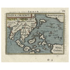
1601 Miniature Map of Southeast Asia & Nova Guinea by Ortelius, Vrients Edition
Located in Langweer, NL
This miniature map of the East Indies and Nova Guinea was created by Abraham Ortelius and published in 1601 as part of the "Epitome" by Giovanni Battista Vrients. It is a finely hand...
Category

Early 1600s Antique Netherlands - Collectibles and Curiosities

Materials

Paper

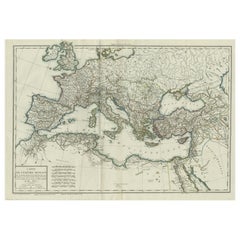
Original Antique Map of the Roman Empire
Located in Langweer, NL
Antique map titled 'Carte de l'Empire Romain'. Original antique map of the Roman Empire, two sheets joined. Engraved by Pierre Francois Tardieu and published by Edme Mentelle, circa ...
Category

Late 18th Century Antique Netherlands - Collectibles and Curiosities

Materials

Paper

Old Print of a Boxing Fight Between Two Natives of Hapaee, Tonga Islands, 1803
Located in Langweer, NL
Antique print titled 'Vuist-Gevegt van de Inboorlingen van Hapaee'. Antique print depicting a fight between two natives of Hapaee. Originates from 'Reizen Rondom de Waereld door ...
Category

Early 1800s Antique Netherlands - Collectibles and Curiosities

Materials

Paper

Antique Genealogy Chart of the Leaders of Europe by Chatelain, 1732
Located in Langweer, NL
Antique print titled 'Carte Genealogique des Souverains de l'Europe (..)'. Chart of the royal line of the great Frankish major, Aega. As early as the 14th century the Hapsburgs attem...
Category

18th Century Antique Netherlands - Collectibles and Curiosities

Materials

Paper

The World in the Assyrian Empire's Era: A Historical Map, Published in 1880
Located in Langweer, NL
This map from the "Spruner-Menke Atlas Antiquus" is titled "ORBIS TERRARVM regni Assyrii tempore," which translates to "The World at the Time of the Assyrian Kingdom." It depicts the...
Category

1880s Antique Netherlands - Collectibles and Curiosities

Materials

Paper

Engraving of St. Gallen and its Monastery, from Civitates Orbis Terrarum (1575)
Located in Langweer, NL
Description of the Engraving: Braun & Hogenberg’s "S. Galli Opp. et Monasterium Heluetiorum" from Civitates Orbis Terrarum (1575) This is an original, hand-colored copper engraving ...
Category

16th Century Antique Netherlands - Collectibles and Curiosities

Materials

Paper

Big Eye Japanese Navy Nikon 20 × 120 Binoculars
Located in Eindhoven, NL
Large and powerful binoculars made by the Japanese company Nikon in the 1950s An elegant and stylish piece for the study or library, and very suitable to take on board your yacht. ...
Category

1950s Japanese Vintage Netherlands - Collectibles and Curiosities

Materials

Aluminum

Marvelous High-Quality Taxidermy Red Patas or Hussar Monkey
Located in Amsterdam, NL
A taxidermy red patas or hussar monkey (Erythrocebus patas) Mid 20th century, including CITES H. approx. 40 cm Provenance: Private collection, the Netherlands The patas monkey lives in multi-female groups...
Category

Mid-20th Century Dutch Netherlands - Collectibles and Curiosities

Materials

Animal Skin

Map of Ancient Gaul & Roman Provinces: Early 19th Century - 1802 Tardieu Atlas
Located in Langweer, NL
### Antique Map Description **Title:** La Gaule et Ses Grandes Dignités Romaines au Temps des Empereurs **Publication Details:** - **Atlas Title:** Nouvel Atlas Universel de Géogra...
Category

Early 1800s Antique Netherlands - Collectibles and Curiosities

Materials

Paper

19thC Terracotta "Christus Consolator" Sculpture after Thorvaldsen R&T Magdeburg
By Bertel Thorvaldsen
Located in Lisse, NL
Large 19th Century German Terracotta "Christus Consolator" Sculpture After Thorvaldsen, Scagliola Finish. This exquisite 19th-century German terracotta sculpture represents Jesus Ch...
Category

Late 19th Century German Arts and Crafts Antique Netherlands - Collectibles and Curiosities

Materials

Terracotta

1825 Buchon Map of Puerto Rico & Virgin Islands with Detailed Colonial History
Located in Langweer, NL
This map of Puerto Rico and the Virgin Islands, published by Jean Alexandre Buchon in 1825, offers a unique look at the Caribbean during a time of E...
Category

1820s Antique Netherlands - Collectibles and Curiosities

Materials

Paper

An extremely rare antique taxidermy Giant Anteater (Myrmecophaga tridactyla)
Located in Amsterdam, NL
An extremely rare antique taxidermy Giant Anteater (Myrmecophaga tridactyla) 1st half 20th century The marvellous creature in very good condition and o...
Category

Early 20th Century Dutch Netherlands - Collectibles and Curiosities

Materials

Animal Skin

Dutch Silver Miniature Table by Hooijkaas, Schoonhoven for a Doll's House
By Herman Hooijkaas
Located in Delft, NL
Dutch silver miniature table by Hooijkaas, Schoonhoven for a Doll's House Dutch silver miniature table with contoured top Dutch silver Hall marks of the "Sword, with 835" (used s...
Category

Mid-20th Century Dutch Netherlands - Collectibles and Curiosities

Materials

Silver

The Antient City of Jerusalem and Places Adjacent, Hand-Colored Map, 1699
Located in Langweer, NL
Title: "1699 Hand-Colored Bird's-Eye Plan of Jerusalem with Ancient and Biblical Landmarks" This beautifully hand-colored, imaginary bird's-eye plan of Jerusalem, published in 1699,...
Category

1690s Antique Netherlands - Collectibles and Curiosities

Materials

Paper

Hand-Colored City Plan of Cologne by Nicolas de Fer, 1705
Located in Langweer, NL
Title: Hand-Colored City Plan of Cologne by Nicolas de Fer, 1705 This hand-colored map, titled "Cologne Ville Considerable Situee sur le Bord Occidentale du Rhein Capit. de l'Electo...
Category

Early 1700s Antique Netherlands - Collectibles and Curiosities

Materials

Paper

Antique Map of Mexico by W. G. Blackie, 1859
Located in Langweer, NL
Antique map titled 'Mexico'. Original antique map of Mexico. This map originates from ‘The Imperial Atlas of Modern Geography’. Published by W. G. Blackie, 1859.
Category

Mid-19th Century Antique Netherlands - Collectibles and Curiosities

Materials

Paper

French Nun of the Order of Feuillantines, a Catholic Congregation, 1845
Located in Langweer, NL
Antique print titled 'Religieuse Feuillantine'. Print of a Nun of the order of Feuillantines, Congregation of Our Lady of the Feuillants, Cistercian. This print originates from 'Histoire et Costumes des Ordres Religieux'. The Feuillants were a Catholic congregation originating in the 1570s as a reform group within the Cistercians in its namesake Les Feuillants Abbey in France, which declared itself an independent order. In 1630 it separated into a French branch (the Congregation of Our Lady of the Feuillants) and an Italian branch...
Category

1840s Antique Netherlands - Collectibles and Curiosities

Materials

Paper

Antique Map of The United States of North America, Pacific States, 1882
Located in Langweer, NL
The map is from the same 1882 Blackie Atlas and focuses on the Pacific States of the United States of America during that period. Here are some details and historical context about t...
Category

1880s Antique Netherlands - Collectibles and Curiosities

Materials

Paper

Hand-Colored Map of West India Islands: St. Christopher's, St. Lucia and Nevis
Located in Langweer, NL
This map, titled "West India Islands," was published by John Thomson & Co. in 1821 as part of *Thomson's New General Atlas.* The map offers detailed depictions of three key islands i...
Category

1820s Antique Netherlands - Collectibles and Curiosities

Materials

Paper

Biblical Journeys: Apostle Paul's Voyages and the Israelites' Exodus, 1856
Located in Langweer, NL
Two maps in matting board. From the Pictorial Bible Atlas, published in 1856. Title for Map 1: Voyages and Travels of Apostle Paul – Illustrated Antique...
Category

1850s Antique Netherlands - Collectibles and Curiosities

Materials

Paper

Map of The East Indies with the Route of Capt. William Dampier's Voyage, 1698
Located in Langweer, NL
Antique map titled 'Kaart van Oost Indie'. Old map of the East Indies. It shows the routes of Captain William Dampier's voyage throughout the regio...
Category

1690s Antique Netherlands - Collectibles and Curiosities

Materials

Paper

Rare Hand-Colored Antique Map of Asia, 1788
Located in Langweer, NL
Antique map titled 'Kaartje van Asia'. Original antique map of Asia. This map originates from 'Nieuwe Natuur- Geschied- en Handelkundige Zak- en Reisatlas' by N.T. Gravius, 1788....
Category

1780s Antique Netherlands - Collectibles and Curiosities

Materials

Paper

Gipuzkoa 1902: A Cartographic Snapshot of the Basque Coastline and Highlands
Located in Langweer, NL
The map showcases the province of Gipuzkoa (also known as Guipúzcoa in Spanish), which is part of the autonomous community of the Basque Country in northern Spain, as of the year 190...
Category

Early 1900s Antique Netherlands - Collectibles and Curiosities

Materials

Paper

Read More

Medal-Worthy Memorabilia from Epic Past Olympic Games

Get into the games! These items celebrate the events, athletes, host countries and sporting spirit.

Ahoy! You’ve Never Seen a Collection of Sailor Art and Kitsch Quite Like This

French trendsetter and serial collector Daniel Rozensztroch tells us about his obsession with objects related to seafaring men.

Pamela Shamshiri Shares the Secrets behind Her First-Ever Book and Its Effortlessly Cool Interiors

The sought-after designer worked with the team at Hoffman Creative to produce a monograph that beautifully showcases some of Studio Shamshiri's most inspiring projects.

Moroccan Artworks and Objects Take Center Stage in an Extraordinary Villa in Tangier

Italian writer and collector Umberto Pasti opens the doors to his remarkable cave of wonders in North Africa.

Montecito Has Drawn Royalty and Celebrities, and These Homes Are Proof of Its Allure

Hollywood A-listers, ex-pat aristocrats and art collectors and style setters of all stripes appreciate the allure of the coastal California hamlet — much on our minds after recent winter floods.

Whaam! Blam! Pow! — a New Book on Pop Art Packs a Punch

Publishing house Assouline and writer Julie Belcove have teamed up to trace the history of the genre, from Roy Lichtenstein, Andy Warhol and Yayoi Kusama to Mickalene Thomas and Jeff Koons.

The Sparkling Legacy of Tiffany & Co. Explained, One Jewel at a Time

A gorgeous new book celebrates — and memorializes — the iconic jeweler’s rich heritage.

What Makes a Gem-Encrusted Chess Set Worth $4 Million?

The world’s most opulent chess set, weighing in at 513 carats, is literally fit for a king and queen.
Recently Viewed

View All