Netherlands - Collectibles and Curiosities

to
4,820
6,394
15,028
11,538
6,353
28
13
55
25
19
18
16
11
6
5
4
2
1
1
1
3,129
2,486
738
41
337
116
38
79
6
6
10
6
17
32
14
7
5
5,732
361
210
79
79
906
245
212
117
72
6,394
6,393
6,393
104
59
20
14
14
Item Ships From: Netherlands
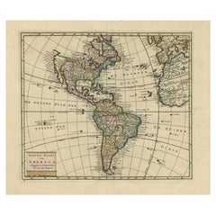
Antique Hand-Coloured Map of North and South America, ca.1765
Located in Langweer, NL
Description: Antique map titled 'Nieuwe Kaart van Amerika.' Attractive map of North and South America, the western part of Africa and south west Europe. Source unknown, to be determi...
Category

1760s Antique Netherlands - Collectibles and Curiosities

Materials

Paper

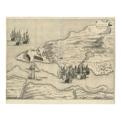
Dutch Conquest of Rio Grande, Brazil (1633) Under Prince Frederick Hendrick
Located in Langweer, NL
The image is an engraving titled “VEROVERINGE VAN RIO GRANDE IN BRASIL ANNO 1633.” This historical print depicts the Dutch conquest of Rio Grande in Brazil, known today as Natal, dur...
Category

1690s Antique Netherlands - Collectibles and Curiosities

Materials

Paper

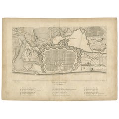
Plan of Pondicherry Fortifications and Attacks, France, c.1750
Located in Langweer, NL
Plan of Pondicherry Fortifications and Attacks, France, c.1750 This finely engraved map depicts the fortified city of Pondicherry, titled "Plan de Pondichéry et de ses attaques." It...
Category

Mid-18th Century French Antique Netherlands - Collectibles and Curiosities

Materials

Paper

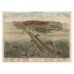
Spectacular 1770 Bird's-Eye View of Dunkirk Harbor by Basset, with 66 Landmarks
Located in Langweer, NL
This engraving, titled *Vue de Dunkerque du coté de la Mer*, is a spectacular bird's-eye view of Dunkirk from the sea, published by Basset around 1770. It provides a detailed panor...
Category

1770s Antique Netherlands - Collectibles and Curiosities

Materials

Paper

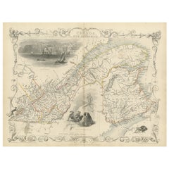
Decorative 1850s Map of Eastern Canada and New Brunswick with Historic Vignettes
Located in Langweer, NL
Decorative 1850s Map of Eastern Canada and New Brunswick with Historic Vignettes This beautifully crafted 19th-century map of Eastern Canada and New Brunswick, drawn and engrave...
Category

1850s Antique Netherlands - Collectibles and Curiosities

Materials

Paper

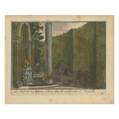
Antique Hand-Colored Print of the Labyrinth of Versailles, c.1720
Located in Langweer, NL
Antique print titled 'Le Serpent à plusieurs Testes: dans le Labyrinte de Versailles'. This print illustrates the fable 'The Snake with several heads' of the labyrinth of Versailles ...
Category

18th Century Antique Netherlands - Collectibles and Curiosities

Materials

Paper

1864 Johnson's Map of New York State with City Insets
Located in Langweer, NL
Title: 1864 Johnson's Map of New York State with City Insets Description: This 1864 map, titled "Johnson's New York," was published by Johnson and Ward and features a detailed depic...
Category

1860s Antique Netherlands - Collectibles and Curiosities

Materials

Paper

Rare Religious Antique Print Depicting the Death of Armenian Christians, 1730
Located in Langweer, NL
Description: Antique religious print titled 'La Commemoration des Morts chez les Armeniens'. This print depicts the commemorating of the death of the Armenian christians. This pr...
Category

1730s Antique Netherlands - Collectibles and Curiosities

Materials

Paper

Rare Antique Print of the Famous Westminster Abbey, London, England, C.1800
Located in Langweer, NL
Antique print titled 'An ancient View of St. James's (..)'. Old print of Westminster, the old Westminster Abbey in the centre, with St James's Palace on the right. Westminster Abb...
Category

18th Century Antique Netherlands - Collectibles and Curiosities

Materials

Paper

Antique Map of the Region of Algiers, Algeria
Located in Langweer, NL
Antique map titled 'Alger'. This map shows the region of Algiers, Algeria. With a small inset map of the region of Algiers and a decorative vignette with a harbor view. Originates fr...
Category

Mid-19th Century Antique Netherlands - Collectibles and Curiosities

Materials

Paper

Old Print of a Mosque in a Kampung Java or Village of Javanese, Indonesia, 1874
Located in Langweer, NL
Antique print titled 'Missigit in Kampong Djawa'. Antique print depicting a scene in Indonesia. Originates from 'De Oorlog tusschen Nederland en Atchin' by G.L. Klepper. Artis...
Category

1870s Antique Netherlands - Collectibles and Curiosities

Materials

Paper

Omega Seamaster 120m Automatic Chronograph 1973 a.k.a. Big Blue
By Omega
Located in Weesp, NL
Discover the Omega Seamaster Automatic 120m Chronograph (Ref. 176.004) - a.k.a. as "Big Blue" Step into the world of vintage luxury with this remarkable Omega Seamaster Automatic 1...
Category

1970s Swiss Mid-Century Modern Vintage Netherlands - Collectibles and Curiosities

Materials

Stainless Steel

17th Century Dutch Book, Oost-Indien, 1694
Located in Delft, NL
17th Century Dutch Book, Oost-Indien, 1694 by Frikius, Hesse and Schweitzer, Simon de Vries Dutch translation by Simon de Vries of the accounts of three Ge...
Category

Late 17th Century Dutch Antique Netherlands - Collectibles and Curiosities

Materials

Paper

Rare Engraving with a View of the City of Kom in Egypt
Located in Langweer, NL
This is an original antique print of the city of Kom in Egypt.
Category

Late 18th Century Antique Netherlands - Collectibles and Curiosities

Materials

Paper

Antique Print of Vietnamese Men, c.1830
Located in Langweer, NL
Antique print titled 'Cochinchine'. Two portaits of Vietnamese men one showing in military attire and the second in civilian dress. Originates from the series 'Voyage autour du monde par les mers...
Category

19th Century Antique Netherlands - Collectibles and Curiosities

Materials

Paper

1625 Petrus Plancius / Cloppenburg Map of the Holy Land with Biblical Vignettes
Located in Langweer, NL
1625 Petrus Plancius / Johannes Cloppenburg Map of the Holy Land with Biblical Vignettes This exquisite 1625 map by Petrus Plancius and Johannes Cloppenburg represents the Holy Lan...
Category

1620s Antique Netherlands - Collectibles and Curiosities

Materials

Paper

Rare Antique Pair of Gothic Revival and Medieval Style Cloister or Church Chairs
Located in Lisse, NL
Unique and impressive, Gothic style chairs with an amazing patina. These rare and solid oak church or monastery chairs have a beautiful patination ...
Category

Early 19th Century European Gothic Revival Antique Netherlands - Collectibles and Curiosities

Materials

Brass

Antique Bible Print of the Lost Sheep by Kronheim 'c.1860'
Located in Langweer, NL
Antique bible print titled 'The Lost Sheep'. This print most likely originates from an illustrated bible, published by J.M. Kronheim & Co, circa 1860.
Category

Mid-19th Century Antique Netherlands - Collectibles and Curiosities

Materials

Paper

Saint-Domingue (French Section): 18th Century Map from France Militaire Series
Located in Langweer, NL
This map is titled "St. Domingue (Partie Française)" and is part of the France Militaire series. It focuses on the French portion of Saint-Domingue, which corresponds to modern-day H...
Category

1790s Antique Netherlands - Collectibles and Curiosities

Materials

Paper

Antique Engraving of the Dead Chief of Tahiti Island in the Pacific, 1803
By James Cook
Located in Langweer, NL
Antique print titled 'Het Lijk van Thee, Opperste van O-Tahiti, zoodanig als men zulks na zijnen dood bewaarde'. Antique print depicting the remnents of Thee, Chief of Tahiti. Origin...
Category

19th Century Antique Netherlands - Collectibles and Curiosities

Materials

Paper

The Antient City of Jerusalem and Places Adjacent, Hand-Colored Map, 1699
Located in Langweer, NL
Title: "1699 Hand-Colored Bird's-Eye Plan of Jerusalem with Ancient and Biblical Landmarks" This beautifully hand-colored, imaginary bird's-eye plan of Jerusalem, published in 1699,...
Category

1690s Antique Netherlands - Collectibles and Curiosities

Materials

Paper

Old Map Depicting Turkey, Persia, Arab and Black Sea Etc, 1778
Located in Langweer, NL
Antique map titled 'Turquie d'Asie, Arabie, Perse, Tartarie Independante'. Old map of Turkey in Asia. The map shows all of Turkey and the Black Sea, and extends east to include t...
Category

1770s Antique Netherlands - Collectibles and Curiosities

Materials

Paper

Antique Map Illustrating Solar Eclipses by Scherer, C.1703
Located in Langweer, NL
Antique map of an hemisphere and several figures illustrating the position of the earth, moon and sun. Printed for Scherer's 'Atlas Novus' (1702-1710). Artists and Engravers: Heinrich Scherer (1628-1704) was a Professor of Hebrew, Mathematics and Ethics at the University of Dillingen until about 1680. Thereafter he obtained important positions as Official Tutor to the Royal Princes...
Category

18th Century Antique Netherlands - Collectibles and Curiosities

Materials

Paper

Optical View Depicting the Siege of Barcelona, Spain, ca.1765
Located in Langweer, NL
Antique print Barcelona titled 'Aggressio et Circumunitio in via cooperta'. Optical view depicting the siege of Barcelona (Spain) which took place between 25 July 1713 and 11 September 1714. With Latin, French, Italian and German caption. Artists and Engravers: Georg Balthasar Probst (1732 - 1801) was a German artist, engraver and publisher in Augsburg. The Siege of Barcelona (Catalan: Setge de Barcelona) was a battle at the end of the War of Spanish Succession, which pitted Archduke Charles of Austria (backed by Great Britain and the Netherlands, i.e. the Grand Alliance) against Philip V of Spain, backed by France in a contest for the Spanish crown. The surrender of the pro-Archduke forces to the Franco-Spanish army in 1714 was not only the end of the war, but also a phase in the centralization of various monarchies on the European continent which had been going on for two centuries. With the War of the Spanish Succession completed, Spain evolved from a personal union of different states to a centralized kingdom. The defenders of the city were buried in a cemetery, now a plaça (Catalan: square) called Fossar de les Moreres, where Catalans gather every 11 September, known as the National Day of Catalonia or la Diada. The former market hall Mercat del Born covers archaeological ruins which were part of the La Ribera district of Barcelona that was demolished after the defeat of Catalonia in 1714. The alleged abandonment of the Catalans defenders of Barcelona was one of the criticisms made by his opponents during the British Parliament...
Category

1760s Antique Netherlands - Collectibles and Curiosities

Materials

Paper

Antique Religious Print 'No. 49' Discovering the True Cross, circa 1840
Located in Langweer, NL
Antique print titled ‘Histoire Sainte, Nouveau Testament, Découverte de la vraie Croix.’ This plate shows a scene from the New Testament; St. Helena Discovering the True Cross...
Category

Mid-19th Century Antique Netherlands - Collectibles and Curiosities

Materials

Paper

Italian Silver Miniature Printing Press by Menegatti Brothers
Located in Delft, NL
An Italian silver miniature printing press by Menegatti Brothers. A silver miniature printing press on a marble base, after an example of a printing ...
Category

20th Century Italian Netherlands - Collectibles and Curiosities

Materials

Marble, Silver

Antique Map of the Holy Land, Showing the Location of the Various Tribes
Located in Langweer, NL
Antique map titled 'Judaea seu Terra Sancta quae Hebraeorum sive Israelitarum (..)'. Map of The Holy Land, showing the location of the various tribes, in two kingdoms, Judah and Isra...
Category

Early 18th Century Antique Netherlands - Collectibles and Curiosities

Materials

Paper

Antique Map of Spain and Portugal by Tirion, c.1760
Located in Langweer, NL
Antique map titled 'Nieuwe Kaart van Spanje en Portugal.' Attractive detailed map showing Spain and Portugal. Including Majorca, Minorca and Ibiza. Title in block-style cartouche wit...
Category

18th Century Antique Netherlands - Collectibles and Curiosities

Materials

Paper

Antique Religious Print 'No. 16' The Pharisee and the Publican, circa 1840
Located in Langweer, NL
Antique print titled ‘Histoire Sainte, Nouveau Testament, Le Pharisien et le Publicain.’ This plate shows a scene from the New Testament; The Pharisee and the Publican.’ This prin...
Category

Mid-19th Century Antique Netherlands - Collectibles and Curiosities

Materials

Paper

Antique Map of the region of Siberia, Mongolia and Manchuria
Located in Langweer, NL
Antique map titled 'Siberia and Chinese Tartary'. Detailed antique map of the region of Siberia, Mongolia and Manchuria. Engraved by J. & C. Walker. Published 1838.
Category

Mid-19th Century Antique Netherlands - Collectibles and Curiosities

Materials

Paper

Antique Portrait of Algernon Percy, 10th Earl of Northumberland, 4th Baron Percy
Located in Langweer, NL
Antique portrait titled 'Algernoon Piercy, Earl of Northumberland'. Old portrait of Algernon Percy. Algernon Percy, 10th Earl of Northumberland, 4th Baron Percy, (1602-1668) was an E...
Category

18th Century Antique Netherlands - Collectibles and Curiosities

Materials

Paper

Very Rare Antique Print of the City of Nice in France, c.1700
Located in Langweer, NL
Antique print titled 'Nicaea Civitas'. Original antique print with a view of the city of Nice, France. Rare in this edition. Source unknown, to be determined. Artists and Engraver...
Category

17th Century Antique Netherlands - Collectibles and Curiosities

Materials

Paper

Antique Print of Nice Near Villa Venanson Near Nice in France, c.1865
Located in Langweer, NL
Antique print titled 'Nice, vue prise de la Villa Venanson'. View of the city of Nice, near Villa Venanson, France. This print originates from 'Nice Et Savoie, Sites Pittoreques, Mon...
Category

19th Century Antique Netherlands - Collectibles and Curiosities

Materials

Paper

Decorative 1864 Civil War Era Map of Indiana with Lake Michigan Detail
Located in Langweer, NL
Title: Rare 1864 Civil War Era Map of Indiana with Lake Michigan Detail Description: This finely detailed antique map, titled "Johnson's Indiana," was published in 1864 by Johnson a...
Category

1860s Antique Netherlands - Collectibles and Curiosities

Materials

Paper

Original Antique Plan of the Harbor of Nettuno, Near Rome, by Munster, c.1580
By Sebastian Münster
Located in Langweer, NL
Antique map titled 'Der Statt Neptun (.).' Detailed plan of the Harbor of Nettuno, near Rome, from Munster's Cosmographia, one of the most influential cartographic works of the 16th century. The antique map titled 'Der Statt Neptun (.),' originating from Munster's renowned Cosmographia, unveils a detailed plan of the Harbor of Nettuno, situated near Rome. This influential cartographic work, crafted in the 16th century, stands as a testament to Munster's mastery in cartography and geographic depiction. The map meticulously portrays the Harbor of Nettuno, capturing its coastal features, the layout of the harbor, and possibly key landmarks or structures in the vicinity. Munster's expertise in cartography shines through in this intricate representation, offering a visual insight into the strategic maritime site near Rome. Being part of the Cosmographia, one of the era's most influential cartographic compilations, this map holds historical significance. Munster's work was esteemed for its accuracy and influence in shaping geographic knowledge during the 16th century. Adorned with Munster's characteristic artistic touches and possibly embellishments, this antique print not only serves as a navigational aid but also stands as a testament to the era's cartographic expertise, preserving the Harbor of Nettuno's significance in the maritime landscape near Rome. Artists and Engravers: Made by 'Sebastian Munster...
Category

16th Century Antique Netherlands - Collectibles and Curiosities

Materials

Paper

Original Antique View of the City of Damietta, Egypt, 1774
Located in Langweer, NL
Antique print, titled: 'Prospect der Stadt Damiat.' - Tab VIII. View of the city of Damietta, Egypt. From 'Reisebeschreibung von Arabien und anderen umliegenden Landern (1774-1778)...
Category

1770s Antique Netherlands - Collectibles and Curiosities

Materials

Paper

Empire of the Parthians: Historical Cartographic Masterpiece by d'Anville, 1819
Located in Langweer, NL
Description: Ancient map of the Parthian Empire (19th century), original engraving extracted from the atlas of the history of the emperors from 1819, based on the history of the Rom...
Category

1810s Antique Netherlands - Collectibles and Curiosities

Materials

Paper

Original Antique Map of Dresden, Germany by J. Stockdale, 1800
Located in Langweer, NL
Vintage Map of Dresden, Germany by J. Stockdale, 1800 This vintage map titled "A Plan of the City of Dresden" was published by J. Stockdale in Piccadilly, London, in 1800. It provid...
Category

Early 1800s Antique Netherlands - Collectibles and Curiosities

Materials

Paper

Antique Map of Java in 4 sheets by Dornseiffen, 1884
Located in Langweer, NL
Detailed map of Java in 4 sheets, with an inset map of Batavia (Jakarta). This map originates from 'Atlas van Nederlandsch Oost- en West-Indie' by Dr. I. Dornseiffen. Published by Se...
Category

Late 19th Century Antique Netherlands - Collectibles and Curiosities

Materials

Paper

Map of Groningen from The Genealogy of the Illustrious Counts of Nassau (1615)
Located in Langweer, NL
Title: Map of Groningen from "The Genealogy of the Illustrious Counts of Nassau" (1615) Description: This antique map, titled "Gronenga," offers a detailed depiction of the forti...
Category

1610s Antique Netherlands - Collectibles and Curiosities

Materials

Paper

Antique Religion Print of the Seven Sacraments, Confirmation, '1913'
Located in Langweer, NL
Large antique print of the seven sacraments. Published by Mosella-Verlag, 1913. This print originates from a series titled 'Kathol. Schulbibelwerk von Dr. Ecker'.
Category

Early 20th Century Netherlands - Collectibles and Curiosities

Materials

Paper

Early Woodcut Bird's Eye View of Rouffach, France, by Sebastian Münster, 1554
Located in Langweer, NL
Early Woodcut Bird's Eye View of Rouffach, France, by Sebastian Münster, 1554 Description: This rare 1554 woodcut is a bird's eye view of Rouffach, a town in the Haut-Rhin departmen...
Category

16th Century Antique Netherlands - Collectibles and Curiosities

Materials

Paper

Vintage, Good Size & Stunning Hand-Carved Bali, Indonesia Wedding Couple Statue
Located in Lisse, NL
Artistically carved sculpture of newly weds from 1940-1950. This beautifully executed and romantic sculpture is of a madly in love Balinese male and female. This all-handcarved out of a dense hardwood work of art has the most beautiful and warm patina. This rare & unusually intimate sculpture is in excellent condition and it must has taken a skilled craftsman an enormous amount of time, focus and dedication to create. The 'Loro Blonyo...
Category

Mid-20th Century Balinese Netherlands - Collectibles and Curiosities

Materials

Wood

An Original Antique Mid-17th Century Blaeu Map of Styria in Southeastern Austria
Located in Langweer, NL
This is an antique map of Styria (referred to as “Stiria” or “Steyrmarck”), published by the renowned Dutch cartographer Willem Janszoon Blaeu (often simply “Blaeu”). The first editi...
Category

1640s Antique Netherlands - Collectibles and Curiosities

Materials

Paper

Map of The Italian Peninsula with the islands of Sicily, Sardinia, Corsica, 1880
Located in Langweer, NL
This map, titled "ITALIA, Sicilia, Sardinia, Corsica," represents the Italian Peninsula along with the islands of Sicily, Sardinia, and Corsica. Inset maps offer detailed views of "R...
Category

1880s Antique Netherlands - Collectibles and Curiosities

Materials

Paper

Very Large Edwardian Display Cabinet with Sea-Birds, circa 1900
Located in Amsterdam, NL
A very large Edwardian taxidermy case with European sea-birds Early 20th century The birds perched on a rocky sea ledge with droppings and plants, naturalistically mounted...
Category

Early 20th Century English Edwardian Netherlands - Collectibles and Curiosities

Materials

Other

Antique Map of Italy by R. Bonne, circa 1780
Located in Langweer, NL
Beautiful map of Italy, Corsica, Sardinia and Sicily. Highly detailed, showing towns, rivers, some topographical features and political boundaries. Published by R. Bonne, circa 1780.
Category

Late 18th Century French Antique Netherlands - Collectibles and Curiosities

Materials

Paper

Original Antique Map of Fez and Morocco
Located in Langweer, NL
Antique map titled 'Karte von Fes und Marócos (..)'. Original old map of Fez (or Fes) and Morocco. Also shows the Strait of Gibraltar. By Friedrich Gottlieb Canzler, published 1799.
Category

Late 18th Century Antique Netherlands - Collectibles and Curiosities

Materials

Paper

Large Antique Map of Europe, Showing the Empire of Charlemagne
Located in Langweer, NL
Antique map titled 'Imperium Caroli Magni (..)'. Large antique map of Europe, showing the Empire of Charlemagne in the 8th Century. Engraved by T. Kitchin. Published J. Blair, circa ...
Category

Late 18th Century Antique Netherlands - Collectibles and Curiosities

Materials

Paper

Bird's-Eye Views of Dunkerque, Gravelines, and Bourbourg by Braun and Hogenberg
Located in Langweer, NL
Bird's-Eye Views of Dunkerque, Gravelines, and Bourbourg by Braun and Hogenberg, 1597 This antique print, published in 1597 by Braun and Hogenberg, showcases three detailed bird's...
Category

16th Century Antique Netherlands - Collectibles and Curiosities

Materials

Paper

Pl. 87 Antique Print of Decorative Art in the 18th Century by Racinet, 1869
Located in Langweer, NL
Old print of decorative art in the 18th century. This print originates from 'L'Ornement polychrome'. A beautiful work containing about 2000 patterns of all the styles of Art old and ...
Category

19th Century Antique Netherlands - Collectibles and Curiosities

Materials

Paper

Panoramic Engraved View of the Town of Longvek 'or Lavek' in Cambodia, ca.1726
Located in Langweer, NL
Description: Antique print titled 'Eauweck, Hooft Stad van Cambodia'. Decorative panoramic view of the town of Longvek (or Lavek) in Cambodia. It was the second capital city during t...
Category

1720s Antique Netherlands - Collectibles and Curiosities

Materials

Paper

Antique & Rare Pair of Church Brackets for Saint Statues with Angel Sculptures
Located in Lisse, NL
All handcrafted and matching pair of colorful & meaningful church wall brackets / shelfs. If you are a private collector of ecclesiastical art or if you are looking for the perfect ...
Category

Early 20th Century European Gothic Revival Netherlands - Collectibles and Curiosities

Materials

Wrought Iron

Original Antique Hand-coloured Fish Print of the Whiting, Merling & Saithe, 1842
Located in Langweer, NL
Antique print, titled: 'Poissons Plate 6 - Le Merlan Commun (Gadus merlangus) - Le Gade Verdatre (Gadus virens).' This rare plate shows the Merlangius merlangus, commonly known a...
Category

1840s Antique Netherlands - Collectibles and Curiosities

Materials

Paper

Spectacular View of the Siege of Jerusalem by King Nebuchadnezzar, ca.1730
Located in Langweer, NL
Antique print titled 'Belegering van Jerusalem door Nebucadnezar (..)'. This original antique print shows the siege of Jerusalem by King Nebucha...
Category

1730s Antique Netherlands - Collectibles and Curiosities

Materials

Paper

Antique Print of William Longuespee, 1842
Located in Langweer, NL
Antique print titled 'William Longuespee Earl of Salisbury'. Old print of William Longuespee, Earl of Salisbury. This print originates from 'A critical inquiry into antient armour as...
Category

19th Century Antique Netherlands - Collectibles and Curiosities

Materials

Paper

Antique Print of William Longuespee, 1842
$209 Sale Price / set
20% Off
Large 1693 Maritime Map of Irish Sea, West Coasts of Ireland, England, Scotland
Located in Langweer, NL
This is a historical sea chart titled "Carte Generale des Costes d'Irlande, et des Costes Occidentales d'Angleterre avec une Partie de celles d'Ecosse," which translates to "General Map of the Coasts of Ireland and the Western Coasts of England with a Part of Scotland." The map was first published in 1693 in the atlas "La Neptune Francois," created by Jaillot and published by Pieter Mortier in Amsterdam. This initiative was started by the French minister Colbert to improve maritime navigation. Details of the Map: 1. **Geographical Coverage:** - The map primarily focuses on the Irish coast. - It also includes the west coast of England and Wales. - Parts of the west coast of Scotland are also depicted. 2. **Inset Map:** - There is a detailed inset map showing the area around Chester and the course of the River Dee. 3. **Features:** - **Depth Soundings:** The Irish Sea is detailed with depth soundings to assist in navigation. - **Coastal Towns and Islands:** Numerous coastal towns, islands, and geographical features are indicated. - **Rhumb Lines:** The map includes extensive rhumb lines, which are lines used by navigators to plot a straight-line course. - **Key:** There is a key describing the quality of the terrain along the coast, important for navigators to understand the nature of the coastal landscape. 4. **Labels and Annotations:** - **Coastal Settlements:** Ports, forts, and villages along the coast are labeled. - **Geographical Features:** Islands and other significant features are marked. 5. **Artistic and Practical Elements:** - The map is printed on thick paper and is hand-colored, reflecting contemporary coloring techniques. - Detailed lines and soundings are included to help ships navigate around the numerous small islands and narrow inlets safely. 6. **Historical Context:** - The map was part of a significant French maritime project aimed at improving navigation and charting European waters more accurately. - It reflects the high level of cartographic skill and knowledge of the late 17th century. This map would have been a valuable tool for mariners of the time, providing them with crucial information about the coastal features, depth soundings, and safe passage routes around the complex coastlines of Ireland, England, and Scotland. About the Makers and the Atlas **1. Alexis-Hubert Jaillot (1632-1712):** - **Background:** Jaillot was a prominent French cartographer and publisher in the 17th century. He was known for his detailed and accurate maps and atlases. - **Work:** He collaborated with other notable cartographers of his time and played a key role in improving and publishing detailed maps. Jaillot's work was characterized by its precision and artistic quality. - **Contribution:** He was instrumental in the creation of "La Neptune Francois," a maritime atlas aimed at improving French naval navigation. **2. Pieter Mortier (1661-1711):** - **Background:** Mortier was a Dutch engraver, publisher, and mapmaker based in Amsterdam. He was well-known for his high-quality prints and maps. - **Work:** Mortier published several important atlases and maps, often collaborating with other cartographers and engravers. His work was recognized for its detailed craftsmanship and accuracy. - **Contribution:** Mortier published "La Neptune Francois" in Amsterdam, making significant contributions to maritime navigation by providing highly detailed sea charts. About the Atlas "La Neptune Francois": **1. Purpose:** - The atlas was created as part of an initiative led by Jean-Baptiste Colbert, the French minister of finance under King Louis XIV. The goal was to enhance the accuracy and availability of maritime charts for French naval and commercial vessels. - "La Neptune Francois" was designed to be a comprehensive and detailed reference for navigators, covering various European waters with a focus on the French coast and adjacent regions. **2. Content:** - The atlas includes a series of sea charts, each providing detailed information on coastal regions, depth soundings, rhumb lines, and other navigational aids. - The maps were printed on high-quality paper and hand-colored, reflecting the artistic standards of the time. **3. Historical Significance:** - "La Neptune Francois" was a landmark in the history of cartography, representing a significant advancement in the accuracy and detail of maritime maps...
Category

1690s Antique Netherlands - Collectibles and Curiosities

Materials

Paper

19th Century Brass and Gold Watch-Key with yellow clear and Heliotrope Stones
Located in Delft, NL
19th Century Brass and Gold Watch-Key with yellow clear and Heliotrope Stones 19th century very small brass and gold Watch-Key with each side a different stone A brass watch key , g...
Category

Early 19th Century Dutch Antique Netherlands - Collectibles and Curiosities

Materials

Gold, Brass

Antique Map of Saxony, Germany
Located in Langweer, NL
Original antique map titled 'Circulus Saxoniae Superioris'. Original antique map of Saxony, Germany. The cities of Leipzig, Freiburg and many others are highlighted in gold. This map originates from 'Atlas Novus Terrarum Orbis...
Category

Early 18th Century Antique Netherlands - Collectibles and Curiosities

Materials

Paper

Antique Map of Saxony, Germany
$571 Sale Price
20% Off
Map of Independent Tartary with Vignettes of the Region's Culture, 1851
Located in Langweer, NL
The map of Independent Tartary is part of the collection by John Tallis & Company, which were unique for their elaborate decorative elements and detailed illustrations. **The Maker ...
Category

1850s Antique Netherlands - Collectibles and Curiosities

Materials

Paper

Read More

Medal-Worthy Memorabilia from Epic Past Olympic Games

Get into the games! These items celebrate the events, athletes, host countries and sporting spirit.

Ahoy! You’ve Never Seen a Collection of Sailor Art and Kitsch Quite Like This

French trendsetter and serial collector Daniel Rozensztroch tells us about his obsession with objects related to seafaring men.

Pamela Shamshiri Shares the Secrets behind Her First-Ever Book and Its Effortlessly Cool Interiors

The sought-after designer worked with the team at Hoffman Creative to produce a monograph that beautifully showcases some of Studio Shamshiri's most inspiring projects.

Moroccan Artworks and Objects Take Center Stage in an Extraordinary Villa in Tangier

Italian writer and collector Umberto Pasti opens the doors to his remarkable cave of wonders in North Africa.

Montecito Has Drawn Royalty and Celebrities, and These Homes Are Proof of Its Allure

Hollywood A-listers, ex-pat aristocrats and art collectors and style setters of all stripes appreciate the allure of the coastal California hamlet — much on our minds after recent winter floods.

Whaam! Blam! Pow! — a New Book on Pop Art Packs a Punch

Publishing house Assouline and writer Julie Belcove have teamed up to trace the history of the genre, from Roy Lichtenstein, Andy Warhol and Yayoi Kusama to Mickalene Thomas and Jeff Koons.

What Makes a Gem-Encrusted Chess Set Worth $4 Million?

The world’s most opulent chess set, weighing in at 513 carats, is literally fit for a king and queen.

Tauba Auerbach’s Geometric Pop-Up Book Is Mighty Rare, Thanks to a Hurricane

This sculptural art book has an epic backstory of its own.
Recently Viewed

View All