Netherlands Maps
to
4,202
5,081
5,472
200
5,080
1
2,804
1,969
307
1
179
6
68
3
3
3
2
5,075
8
6
2
1
355
113
81
77
45
5,081
5,081
5,081
104
59
20
14
13
Item Ships From: Netherlands
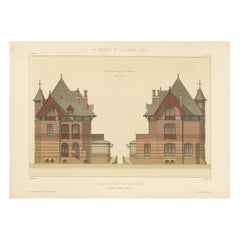
French Villa Architecture – Antique Brickwork Print by Chabat, c.1900
Located in Langweer, NL
French Villa Architecture – Antique Brickwork Print by Chabat, c.1900
This antique architectural print titled “Villa à Pont à Mousson – Mr. Pierre Chabat Architecte” is a beautifull...
Category
20th Century French Netherlands Maps
Materials
Paper
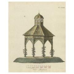
Beautiful Antique Print of Garden Architecture by Van Laar, 1802
Located in Langweer, NL
Untitled print of garden architecture. It shows a garden building.
This print originates from 'Magazijn van tuin-sieraden'. The book is compile...
Category
19th Century Antique Netherlands Maps
Materials
Paper
$123 Sale Price
20% Off
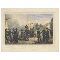
Handcolored Antique Print of the Marine Administration of the Belgium Army, 1833
Located in Langweer, NL
One nicely hand coloured print of an original serie of 23 plates, showing marine officers and soldiers discussing matters on the seaside. published in 1833. Rare.
From a serie of beautiful lithographed plates with Belgian military costumes after Madou and printed by Dero-Becker. Comes from a Belgian military costume album, dedicated to the Belgian King, and financed by subscribers, some 90 Belgian nobility and officers of the Belgian Army...
Category
1830s Antique Netherlands Maps
Materials
Paper
$209 Sale Price
20% Off
Antique Map of the Island of Java, Indonesia
Located in Langweer, NL
Antique map titled 'Nouvelle Carte de l'Isle de Java (..) - Nieuwe Kaart van het Eiland Java (..)'. Chart of the island of Java, depicting soundings around the coast, all principal h...
Category
Late 18th Century Antique Netherlands Maps
Materials
Paper
$428 Sale Price
20% Off
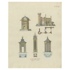
Antique Print of Garden Architecture by Van Laar, 1802
Located in Langweer, NL
Untitled print of garden architecture. It shows garden buildings. This print originates from 'Magazijn van tuin-sieraden'. The book is compiled by Gijsbert van Laar, providing a surv...
Category
19th Century Antique Netherlands Maps
Materials
Paper
Original Antique Map of England and Wales with Large Cartouche
Located in Langweer, NL
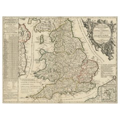
Antique map titled 'Le Royaume d'Angleterre divisé en plusieurs Parties (..)'. Large and rare map of England and Wales by J.B. Nolin after Coronelli. With decorative cartouche, table...
Category
Late 17th Century Antique Netherlands Maps
Materials
Paper
$418 Sale Price
20% Off
Antique Map of Asia Minor with Cyprus, Syria and Turkey and the Black Sea, 1747
Located in Langweer, NL
Antique map Middle East titled 'A New and accurate map of Anatolia or Asia Minor, with Syria and such other provinces of the Turkish Empire (.....
Category
18th Century Antique Netherlands Maps
Materials
Paper
$428 Sale Price
20% Off
Map of Northern India and Pakistan 'Mogol', Showing Kabul, Delhi Etc., 1758
Located in Langweer, NL
Antique map titled 'Mogol'.
Map of Northern India and Pakistan ('Mogol'), showing Kabul, Delhi and surroundings. This map originates from 'Kort begrip der Oude en Nieuwe Staatkun...
Category
1750s Antique Netherlands Maps
Materials
Paper
$352 Sale Price
20% Off
Antique Print of the City of Leeuwarden, Friesland in The Netherlands, 1680
Located in Langweer, NL
Antique print titled 'Leeuwaerd'. Old bird's eye view of the city of Leeuwarden, Friesland. This print originates from 'Thooneel der Steden ende Sterckten van 't Vereenight Nederland...
Category
17th Century Antique Netherlands Maps
Materials
Paper
$418 Sale Price
20% Off
Antique Map of the City of Brielle 'The Netherlands' by L. Guicciardini, 1625
Located in Langweer, NL
Plan of Brielle, Briel, Den Briel in the Province of Zuid-Holland, The Netherlands, Holland. This map originates from the 1625 edition of 'Discrittione di tutti i Paesi Bassi', by L....
Category
Early 17th Century Antique Netherlands Maps
Materials
Paper
$171 Sale Price
20% Off
Antique Map of the City of Leeuwarden by Priorato, 1673
Located in Langweer, NL
Antique map titled 'Leverden'. This map depicts the city of Leeuwarden (Friesland, The Netherlands). This original antique print originates from 'Teatro del Belgio (…)', published in...
Category
17th Century Antique Netherlands Maps
Materials
Paper
$114 Sale Price
20% Off
Original Antique Map of the Region Between the Gulf of Lybia and the Red Sea
Located in Langweer, NL
Original antique map titled 'Aegyptus et Cyrene'. Detailed ancient map of the region between the Gulf of Lybia and the Red Sea, with marvelous detail along the Mediterranean Coastline and the Nile, Egypt. This map originates from 'Philippi Cluveri Introductionis in universam geographiam (..)' by P. Clüver. Published 1729.
Philipp Clüver was an Early Modern German geographer and historian. Cluver's Geography was one of the most enduring works of the 17th & 18th Centuries, issued by several different publishers with many different sets of maps...
Category
Early 18th Century Antique Netherlands Maps
Materials
Paper
$399 Sale Price / item
20% Off
Antique Geological Map of the World by Johnston '1850'
Located in Langweer, NL
Antique map titled 'The Geological Structure of the Globe'. Original antique geological map of the world. This map originates from 'The Physica...
Category
Mid-19th Century Antique Netherlands Maps
Materials
Paper
$285 Sale Price
20% Off
Antique Map of England and Wales by Johnson '1872'
Located in Langweer, NL
Antique map titled 'Johnson's England and Wales'. Original map of England and Wales. This map originates from 'Johnson's New Illustrated Family Atlas of the World' by A.J. Johnson. P...
Category
Late 19th Century Antique Netherlands Maps
Materials
Paper
$237 Sale Price
20% Off
Antique Map of Switzerland by Homann Heirs, c.1732
Located in Langweer, NL
Antique map titled 'Potentissimae Helvetiorum Reipublicae (..)'. Beautiful detailed map of Switzerland, showing the 13 cantons. The large title cartouche showing 13 coat of arms of t...
Category
18th Century Antique Netherlands Maps
Materials
Paper
$373 Sale Price
20% Off
Original Antique Map of the State of New Jersey Published in France
Located in Langweer, NL
Original antique map titled 'Carte Géographique Statistique et Historique du New-Jersey'. One of the earliest obtainable maps of the State of New Jersey published outside of the Unit...
Category
Early 19th Century Antique Netherlands Maps
Materials
Paper
$190 Sale Price
20% Off
Antique Map of the Santa Cruz Islands with Inset of Carteret and Gower Islands
Located in Langweer, NL
Antique map titled 'Isles de la Reine Charlotte (..)'. A detailed chart of the Santa Cruz islands, to the north of the New Hebrides, with Carteret's track in "Swallow"; including an ...
Category
Late 18th Century Antique Netherlands Maps
Materials
Paper
$285 Sale Price
20% Off
Antique Map of Western Germany with part of the Netherlands
Located in Langweer, NL
Antique map titled 'Ducatus Iuliacensis Cliviensis et Montensis (..)'. Original old map of Western Germany with part of the Netherlands. Published by M. Seutter, circa 1750.
George...
Category
Mid-18th Century Antique Netherlands Maps
Materials
Paper
$428 Sale Price
20% Off
Antique Map of the Course of the Rhine from Philippsburg to Duisburg, Germany
Located in Langweer, NL
Antique map titled 'Synopsis Circuli Rhenani Inferioris sive Electorum Rheni (..)'. This map shows the course of the Rhine from Philippsburg to Duisburg, as well as the course of the...
Category
Mid-18th Century Antique Netherlands Maps
Materials
Paper
$532 Sale Price
20% Off
Antique Map of the Area centered on the Rhine River, Germany
Located in Langweer, NL
Antique map titled 'Uterque Rheni Circulus Superior (..)'. Fine old color map of the area centered on the Rhine River, from Strassbourg to Wesel and Duisburg, Germany. With cities hi...
Category
Early 18th Century Antique Netherlands Maps
Materials
Paper
$627 Sale Price
20% Off
Old Map of the Black Sea, The Krim, Ukraine, Russia, etc in Historic Times, 1848
Located in Langweer, NL
Antique map titled 'Pontus Euxinus'. Old map of the black Sea and surroundings originating from 'Orbis Terrarum Antiquus in usum Scholarum'.
Artists and Engravers: Published by J...
Category
1840s Antique Netherlands Maps
Materials
Paper
$228 Sale Price
20% Off
Antique Map of Northwestern India by Weller, 1857
Located in Langweer, NL
Antique map titled 'India, The North West Provinces and Oude'.Detailed map of the northwestern part of India, extending to the Himalaya Mountains. Shows part of Nepal including Dharm...
Category
19th Century Antique Netherlands Maps
Materials
Paper
Antique Map of the Region of Fulda by Homann, c.1730
Located in Langweer, NL
Antique map titled 'S.R.I. Principatus Fuldensis in Buchonia'. Rare edition of the large JB Homann map of the principality of Fulda, Germany.
Artists and Engravers: Johann Baptist...
Category
18th Century Antique Netherlands Maps
Materials
Paper
$185 Sale Price
20% Off
Hand Colored Antique Map of the department of Lozere, France
By Victor Levasseur
Located in Langweer, NL
Antique map titled 'Dept. de la Lozère'. Map of the French department of Lozere, France. This remote mountainous part of Languedoc is rural, sparcely populated, and extremely beautif...
Category
Mid-19th Century Antique Netherlands Maps
Materials
Paper
$323 Sale Price
20% Off
Antique Map of the Island of Borneo by W. G. Blackie, 1859
Located in Langweer, NL
Antique map titled 'The Island of Borneo'. Original antique map of the Island of Borneo. This map originates from ‘The Imperial Atlas of Modern Geography’. Published by W. G. Blackie...
Category
Mid-19th Century Antique Netherlands Maps
Materials
Paper
$190 Sale Price
20% Off
Antique Map by Janssonius of the Dutch Province of Overijsel, ca.1650
Located in Langweer, NL
Very good, given the age. Center fold as issued with wide margins. Sharp print with beautiful old-fashioned colouring, carbon copy on verso. Paper in the margins somewhat browned.
Category
1650s Antique Netherlands Maps
Materials
Paper
$418 Sale Price
20% Off
Antique Print of Gibraltar, c.1720
Located in Langweer, NL
Antique print titled 'Gibraltar verovert door de Pr. van Hessen Darmstadt (..)'. Copper engraving of the capture of the fortified town of Gibraltar in 1704 during the War of the Span...
Category
18th Century Antique Netherlands Maps
Materials
Paper
$418 Sale Price
20% Off
Antique Map of the City of Zwolle by Guicciardini, 1613
Located in Langweer, NL
Antique map titled 'Swolla'. Map of the city of Zwolle, the Netherlands. This map originates from the 1613 edition of 'Discrittione di tutti i Paesi Bassi', by L. Guicciardini, publi...
Category
17th Century Antique Netherlands Maps
Materials
Paper
$204 Sale Price
20% Off
Beautiful View of Pulau 'Island' Onrust, Batavia 'Jakarta, Indonesia', ca.1805
Located in Langweer, NL
Antique print titled 'Het Eiland Onrust'. Beautiful view of the sea near Onrust Island, also known as Pulau Onrust or Pulau Kapal (ship island), Indonesia. Published by E. Maaskamp, ...
Category
Early 1800s Antique Netherlands Maps
Materials
Paper
$694 Sale Price
20% Off
Antique Map of the Township of Vries in the Dutch Province of Drenthe, 1865
Located in Langweer, NL
Drenthe: Gemeente Vries, Bunne, Donderen, Tijnaarloo, Zeijen. These scarse detailed maps of Dutch Towns originate from the 'Gemeente-atlas' of Jacob Kuyper. This atlas of all towns i...
Category
19th Century Antique Netherlands Maps
Materials
Paper
$133 Sale Price
20% Off
Original Antique Bird's Eye View Plan of Hoorn, The Netherlands by Blaeu, c.1700
Located in Langweer, NL
Antique map titled 'Horna vulgo Hoorn'.
Bird's eye view plan of Hoorn, The Netherlands. With title cartouche, coats of arms and key. From an atlas published by De Wit, ca. 1698-1...
Category
Early 1700s Antique Netherlands Maps
Materials
Paper
$894 Sale Price
20% Off
Antique Map of the Rhine centered on Cologne, Germany, with original coloring
Located in Langweer, NL
Antique map titled 'Archiepsiscopatus et Electoratus Coloniensis (..)'. Original antique map of the Rhine river, centered on Cologne, Germany. The Rhine River cuts across this map fr...
Category
Early 18th Century Antique Netherlands Maps
Materials
Paper
$513 Sale Price
20% Off
Antique Map of the Region of Twente, in The East of The Netherlands, 1884
Located in Langweer, NL
Antique map titled 'Twente '. Old map of the region of Twento including cities and villages like Oldenzaal, Delden and Hengelo. This map orginates from 'Atlas behoorende bij Wandelin...
Category
19th Century Antique Netherlands Maps
Materials
Paper
$152 Sale Price
20% Off
Antique Map of the South Part of Great Britain by Tirion, c.1750
By Isaak Tirion
Located in Langweer, NL
Antique map titled 'Nieuwe Kaart van 'T Zuider Gedeelte van Groot Britannie behelzende Het Koningryk Engeland (..).'
Attractive map showing the south part of Great Britain; the K...
Category
18th Century Antique Netherlands Maps
Materials
Paper
$428 Sale Price
20% Off
Antique Map of the Maluku Islands 'Ambon' by Stemler, 1874
Located in Langweer, NL
Antique map titled 'Peta deri Poeloe Poeloe Ambon ...' (The Island of Ambon.) This very scarce map shows the Maluku Islands of Ambon, Buru, Banda. South Moluccas. Originates from 'Ti...
Category
19th Century Antique Netherlands Maps
Materials
Paper
$95 Sale Price
20% Off
Antique Map of Sumatra and Java by Weller, c.1860
Located in Langweer, NL
Antique map titled 'Sumatra, Java'. A delicately presented and detailed pair of maps of the two islands. The plate appeared in the part-work "Dispatch Atlas" issued in supplements an...
Category
19th Century Antique Netherlands Maps
Materials
Paper
$117 Sale Price
20% Off
Antique Map of the City of Kampen by Guicciardini, 1613
Located in Langweer, NL
Antique map titled 'Urbis Campensis (..)'. Plan of the city of Kampen, the Netherlands. This map originates from the 1613 edition of 'Discrittione di tutti i Paesi Bassi', by L. Guic...
Category
17th Century Antique Netherlands Maps
Materials
Paper
Hand Colored Antique Map of the Department of Marne, France
By Victor Levasseur
Located in Langweer, NL
Antique map titled 'Dépt. de la Marne'. Map of the French department of Marne, France. This department is home to the Champagne region where the world's finest sparkling wine is prod...
Category
Mid-19th Century Antique Netherlands Maps
Materials
Paper
$323 Sale Price
20% Off
Leicestershire – Antique Map of Leicester by Richard Blome, Britannia 1673
Located in Langweer, NL
Leicestershire – Antique Map of Leicester by Richard Blome, Britannia 1673
This original antique map titled A Mapp of the Country of Leicester presents a detailed and decorative dep...
Category
Late 17th Century English Antique Netherlands Maps
Materials
Paper
$418 Sale Price
20% Off
Antique Map of France at the End of the Reign of Jean II by Zannoni, 1765
By G. A. Rizzi-zannoni
Located in Langweer, NL
Antique map France titled 'La France sous la fin du Regne de Jean II (..)'. Beautiful old map of France. This map originates from 'Atlas Historique de la France Ancienne et Moderne' ...
Category
18th Century Antique Netherlands Maps
Materials
Paper
$151 Sale Price
20% Off
Antique Map of the Coast of Guinea from, Cape Apollonia to the Volta River
Located in Langweer, NL
Antique map titled 'Suite de la Coste de Guinée (..) - Vervolg van de Kust van Guinée (..)'. Decorative map of the coast of Guinea from, Cape Apollonia to the Volta River. Engraved b...
Category
Mid-18th Century Antique Netherlands Maps
Materials
Paper
$342 Sale Price
20% Off
Original Engraved Antique Map of the World, Colorful and Decorative, C.1780
By Pierre François Tardieu
Located in Langweer, NL
Antique map titled 'Mappemonde en Deux Hemispheres ou l'on a Indique les Nouvelles Decouvertes' - This handsome double hemisphere map presents a ...
Category
18th Century Antique Netherlands Maps
Materials
Paper
$447 Sale Price
20% Off
Miniature Map of England and Wales with Hand Coloring
Located in Langweer, NL
Antique map titled 'England and Wales'. An attractive miniature map of England and Wales enhanced with hand coloring. Originates from Cary's 'Traveller'...
Category
Late 18th Century Antique Netherlands Maps
Materials
Paper
$247 Sale Price
20% Off
Original Antique Hand- Map of Africa by Allard '1697'
Located in Langweer, NL
Antique map titled 'Novissima et Perfectissima Africae (..)'. Beautiful large map of Africa. This is the 3rd state of the map, with climate notation add...
Category
Late 17th Century Antique Netherlands Maps
Materials
Paper
$1,159 Sale Price
35% Off
Original Antique Map of the Bay and the Island of Arguin, Mauritania, 1747
Located in Langweer, NL
Antique map titled ’Plan de la Baye et Isle d'Arguim (..) - Oppervlakte van de Baai en 't Eiland van Arguin (..)'.
Original antique map of the bay and the island of Arguin. This ...
Category
1740s Antique Netherlands Maps
Materials
Paper
$247 Sale Price
20% Off
Antique Map of the Region of Zeitz in Germany, 1749
By Schreiber
Located in Langweer, NL
Antique map titled 'Das Stifft Zeitz (..)'. Map of the region of Zeitz, Germany. Zeitz is a town in the Burgenlandkreis district, in Saxony-Anhalt, Germany. It is situated on the riv...
Category
18th Century Antique Netherlands Maps
Materials
Paper
$313 Sale Price
20% Off
Antique Map of the City of Leeuwarden by Bast, 1603
Located in Langweer, NL
Antique map titled 'Leeuwerden de hooft stadt van Frislant. Leoverdia Metropolis Frisiae (…) 1603.' Very rare plan of Leeuwarden, Friesland, The Netherlands. With several carouches a...
Category
17th Century Antique Netherlands Maps
Materials
Paper
$2,592 Sale Price
20% Off
Antique Map of Sumatra, Indonesia 'c.1780'
Located in Langweer, NL
Antique map titled 'Neue Karte von der Insel Sumatra'. Extremely rare map of Sumatra, Indonesia. Published circa 1780.
Category
Late 18th Century Antique Netherlands Maps
Materials
Paper
$2,497 Sale Price
40% Off
Antique Print of Haridwar City in Uttarakhand, India, 1837
Located in Langweer, NL
Antique print titled 'Hurduwar in Ostindien'. View of Haridwar, India, seen from the Ganges River. This print originates from 'Meyer´s Universum oder Abbildung und Beschreibung des S...
Category
19th Century Antique Netherlands Maps
Materials
Paper
$85 Sale Price
20% Off
Antique Optica Print of Amsterdam from the Old Rampart, Netherlands, C.1760
Located in Langweer, NL
Antique print titled 'A view of Amsterdam tacken from the Old Rampart'. Beautiful view of Amsterdam, the Netherlands. This is an optical print, also called 'vue optique' or 'vue d'op...
Category
18th Century Antique Netherlands Maps
Materials
Paper
$418 Sale Price
20% Off
Antique Plan of Emden in Germany by Guicciardini, 1612
Located in Langweer, NL
Antique map Emden titled 'Civitas Embda, eo modo situata cum essit controversia inter ipsam et suum Comitem anno'. Small plan of the city of Emden, Germany, Also depicted is part of ...
Category
17th Century Antique Netherlands Maps
Materials
Paper
$361 Sale Price
20% Off
Antique Map of Central Asia and India, 1904
Located in Langweer, NL
Antique map titled 'Zentralasien und Vorderindien'. Map of Central Asia and India. This large antique map is taken from; 'Andrees Allgemeiner Handatlas in 126 Haupt-Und 139 Nebenkart...
Category
20th Century Netherlands Maps
Materials
Paper
$128 Sale Price
20% Off
Antique Map of the City of Rio de Janeiro by Balbi '1847'
Located in Langweer, NL
Antique map titled 'Rio de Janeiro'. Original antique map of the city of Rio de Janeiro, Brazil. This map originates from 'Abrégé de Géographie (..)' by Adrien Balbi. Published 1847.
Category
Mid-19th Century Antique Netherlands Maps
Materials
Paper
Antique Map of the East Indies by A & C. Black, 1870
Located in Langweer, NL
Antique map titled 'Indian Archipelago and Further India including Burmah, Siam, Anam &c'. Original antique map of Indian Archipelago and Further India. This map originates from ‘Bla...
Category
Late 19th Century Antique Netherlands Maps
Materials
Paper
$261 Sale Price
20% Off
Antique Print of a Section of the Kew Gardens, London, England, c.1785
Located in Langweer, NL
Antique print titled 'Coupe sur la longueur d'une partie de la Galerie des Antiques dans les jardins de Kew'.
Copper engraving showing a section of the Royal Botanic...
Category
18th Century Antique Netherlands Maps
Materials
Paper
$342 Sale Price
20% Off
Antique Map of Turkey in Asia 'Asia Minor', 1841
Located in Langweer, NL
Antique map titled 'Turkey in Asia'. Original antique map of Asia Minor (Turkey). Source unknown, to be determined.
Artists and Engravers: Published by O...
Category
19th Century Antique Netherlands Maps
Materials
Paper
Old Map of Southern Russia, Incl the Extent of the Kingdom of Poland, 1882
Located in Langweer, NL
Antique map titled 'South-West Russia'.
Old map of southern Russia, also showing the extent of the Kingdom of Poland. This map originates from 'The Royal Atlas of Modern Geography...
Category
1880s Antique Netherlands Maps
Materials
Paper
$323 Sale Price
20% Off
Antique Map of Delfland by Cruquius, 1712
Located in Langweer, NL
Map no. 25 of a large wall map of Delfland, The Netherlands. The map covers the region of Polder Berkel. To the right, coat of arms of 'De Staten van Ho...
Category
18th Century Antique Netherlands Maps
Materials
Paper
$704 Sale Price
20% Off
Antique Map of the Township of Muntendam in Groningen, the Netherlands, 1862
Located in Langweer, NL
Groningen: Gemeente Muntendam. These scarse detailed maps of Dutch Towns originate from the 'Gemeente atlas van de Provincie Groningen in 62 kaarten.' by C. Fehse. This atlas of all ...
Category
19th Century Antique Netherlands Maps
Materials
Paper
$180 Sale Price
20% Off
Antique Map of the Region of Namur by De Lat, 1737
Located in Langweer, NL
Untitled map of the region of Namur, Charlemont, Rochefort and surroundings, Belgium. This map originates from 'Nieuw en beknopt Kaart-Boekje vertoonende de XVII. Nederlandse Provint...
Category
18th Century Antique Netherlands Maps
Materials
Paper
$121 Sale Price
20% Off
Recently Viewed
View AllMore Ways To Browse
Flemish Cabinets 17th Century
Fox Figurine
Fox Hunt Plate
French Art Deco Rosewood Buffet
French Bulldog Gold
French Louis Xvi Enfilade
French Provincial Antique Dresser
French Provincial Furniture Antique Dresser
French Zinc Bar
Frog Figurine
Georgian Mahogany Longcase Clock
German Folding Trolley
Glass And Brass Fireplace Screen
Glass Nude Woman Sculpture
Glass Parrots
Glass Poodle
Gothic Corbel
Granite Pagoda
