Collectibles and Curiosities on Sale

to
5,463
1,387
6,861
43
41
357
168
91
80
68
50
42
40
35
26
24
17
15
10
8
6
5
4
2,706
2,343
1,812
84
543
706
284
112
30
79
124
70
150
129
89
64
29
4,940
1,196
607
283
237
1,285
506
458
279
260
6,945
6,941
6,941
104
55
21
18
13
Sale Items
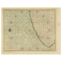
Antique Print of the Malabar Coast of India showing the VOC establishments, 1726
Located in Langweer, NL
Dutch print with the title: Platte Grond van t'Fort Tricoen male met de daar aangelegen Pagoods-Berg (Trincomalee, Sri Lanka) The map is taken from: 'Oud en Nieuw Oost-Indiën' van François Valentyn. 1) Ottens, Frederik (engraver / etcher) 2) Braam, J. van (publisher) 3) Linden, Gerard onder de (publisher) MALABAR COAST...
Category

Antique 1720s Maps

Materials

Paper

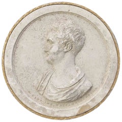
Ancient Neoclassical Cameo Intaglio, 19th Century
Located in Roma, IT
Ancient Neoclassical Cameo Intaglio in biscuit. Italy, 19th Century. Good condition.
Category

Antique 19th Century Italian Collectible Jewelry

Materials

Metal

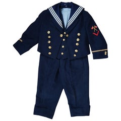
1930s German Wool Kaiserliche Marine Navy Suit Toddler Child Sailor Uniform
Located in Dayton, OH
German 1930s three piece toddler / child / doll sized uniform or sailor suit. Made of navy blue wool featuring a coat, vest and pants with white stripe and ...
Category

Vintage 1930s Historical Memorabilia

Materials

Wool

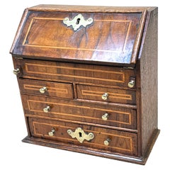
18th Century Walnut Miniature Bureau
Located in Bedfordshire, GB
A very attractive and charming 18th century, George II Period, walnut and oak miniature bureau, having elegant inlaid decoration and original brasswea...
Category

Antique Early 18th Century English George II Models and Miniatures

Materials

Walnut

18th Century Walnut Miniature Bureau
$3,095 Sale Price
30% Off
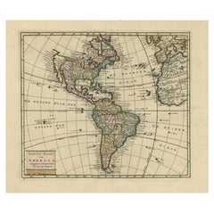
Antique Hand-Coloured Map of North and South America, ca.1765
Located in Langweer, NL
Description: Antique map titled 'Nieuwe Kaart van Amerika.' Attractive map of North and South America, the western part of Africa and south west Europe. Source unknown, to be determi...
Category

Antique 1760s Maps

Materials

Paper

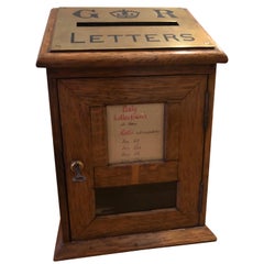
Edwardian Diminutive Post Box, Early 20th Century
Located in Spencertown, NY
The oak box with brass Royal Georgian plaque on top, pick up times on the front. The brass lock and key affixed to the door.
Category

Antique Late 19th Century English Edwardian Decorative Boxes

Materials

Brass

Antique Map of the Northern Hemisphere by Lowry, '1852'
Located in Langweer, NL
Antique map titled 'Perspective Projection of the World on the horizon of London'. Original map of the northern hemisphere. This map originates fro...
Category

Antique Mid-19th Century Maps

Materials

Paper

Mid-century Novelty "Queen of Tsawwassen" Cruise ship Enameled Lighter
Located in Van Nuys, CA
Mid-century Sarome 'Cruiser' lighter, shaped like a Cruise ship, features a chrome body enameled red and crème accents and "Queen of Tsawwassen" lettering. It includes a thumb strike...
Category

Vintage 1960s Japanese Mid-Century Modern Tobacco Accessories

Materials

Enamel, Steel, Chrome

Original Antique Map of Fez and Morocco
Located in Langweer, NL
Antique map titled 'Karte von Fes und Marócos (..)'. Original old map of Fez (or Fes) and Morocco. Also shows the Strait of Gibraltar. By Friedrich Gottlieb Canzler, published 1799.
Category

Antique Late 18th Century Maps

Materials

Paper

Rare Religious Antique Print Depicting the Death of Armenian Christians, 1730
Located in Langweer, NL
Description: Antique religious print titled 'La Commemoration des Morts chez les Armeniens'. This print depicts the commemorating of the death of the Armenian christians. This pr...
Category

Antique 1730s Prints

Materials

Paper

Old Print of a Mosque in a Kampung Java or Village of Javanese, Indonesia, 1874
Located in Langweer, NL
Antique print titled 'Missigit in Kampong Djawa'. Antique print depicting a scene in Indonesia. Originates from 'De Oorlog tusschen Nederland en Atchin' by G.L. Klepper. Artis...
Category

Antique 1870s Maps

Materials

Paper

Very Rare Antique Print of the City of Nice in France, c.1700
Located in Langweer, NL
Antique print titled 'Nicaea Civitas'. Original antique print with a view of the city of Nice, France. Rare in this edition. Source unknown, to be determined. Artists and Engraver...
Category

Antique 17th Century Prints

Materials

Paper

Suit of 16th Century Style Armour
Located in Cheshire, GB
A suit of 16th century style armour, the helmet with pierced visor, raised comb applied and twist border collar, two-piece breastplate with medial ridge, twist border shoulder plates...
Category

Antique 19th Century British Arms, Armor and Weapons

Materials

Metal

Suit of 16th Century Style Armour
$5,472 Sale Price
41% Off
1800s Carved Drapery Trompe l'oeil Panel Wall Relief Sculpture Memento Mori
Located in Hyattsville, MD
Late 19th century decorative wood panel, hand carved curtain relief.
Category

Antique 1890s American Late Victorian Religious Items

Materials

Oak

Vintage Set of Three Amber Necklaces, 1960s
Located in Oirlo, LI
Do you also want to wear something nice and especially something that others don't have, this might be something for you. These are three amber necklaces strung with irregular pie...
Category

Vintage 1960s Baltic Collectible Jewelry

Materials

Multi-gemstone

Antique Bible Print of the Lost Sheep by Kronheim 'c.1860'
Located in Langweer, NL
Antique bible print titled 'The Lost Sheep'. This print most likely originates from an illustrated bible, published by J.M. Kronheim & Co, circa 1860.
Category

Antique Mid-19th Century Prints

Materials

Paper

Original Hand-coloured Antique Map of Pomerania by Sanson '1684'
By Nicolas Sanson
Located in Langweer, NL
Antique map titled 'Le Duche de Pomeranie divise en ses Principales Parties (..)'. Large map of Pomerania. Pomerania is a historical region on the southern shore of the Baltic Sea in...
Category

Antique Late 17th Century Maps

Materials

Paper

Large 1693 Maritime Map of Irish Sea, West Coasts of Ireland, England, Scotland
Located in Langweer, NL
This is a historical sea chart titled "Carte Generale des Costes d'Irlande, et des Costes Occidentales d'Angleterre avec une Partie de celles d'Ecosse," which translates to "General Map of the Coasts of Ireland and the Western Coasts of England with a Part of Scotland." The map was first published in 1693 in the atlas "La Neptune Francois," created by Jaillot and published by Pieter Mortier in Amsterdam. This initiative was started by the French minister Colbert to improve maritime navigation. Details of the Map: 1. **Geographical Coverage:** - The map primarily focuses on the Irish coast. - It also includes the west coast of England and Wales. - Parts of the west coast of Scotland are also depicted. 2. **Inset Map:** - There is a detailed inset map showing the area around Chester and the course of the River Dee. 3. **Features:** - **Depth Soundings:** The Irish Sea is detailed with depth soundings to assist in navigation. - **Coastal Towns and Islands:** Numerous coastal towns, islands, and geographical features are indicated. - **Rhumb Lines:** The map includes extensive rhumb lines, which are lines used by navigators to plot a straight-line course. - **Key:** There is a key describing the quality of the terrain along the coast, important for navigators to understand the nature of the coastal landscape. 4. **Labels and Annotations:** - **Coastal Settlements:** Ports, forts, and villages along the coast are labeled. - **Geographical Features:** Islands and other significant features are marked. 5. **Artistic and Practical Elements:** - The map is printed on thick paper and is hand-colored, reflecting contemporary coloring techniques. - Detailed lines and soundings are included to help ships navigate around the numerous small islands and narrow inlets safely. 6. **Historical Context:** - The map was part of a significant French maritime project aimed at improving navigation and charting European waters more accurately. - It reflects the high level of cartographic skill and knowledge of the late 17th century. This map would have been a valuable tool for mariners of the time, providing them with crucial information about the coastal features, depth soundings, and safe passage routes around the complex coastlines of Ireland, England, and Scotland. About the Makers and the Atlas **1. Alexis-Hubert Jaillot (1632-1712):** - **Background:** Jaillot was a prominent French cartographer and publisher in the 17th century. He was known for his detailed and accurate maps and atlases. - **Work:** He collaborated with other notable cartographers of his time and played a key role in improving and publishing detailed maps. Jaillot's work was characterized by its precision and artistic quality. - **Contribution:** He was instrumental in the creation of "La Neptune Francois," a maritime atlas aimed at improving French naval navigation. **2. Pieter Mortier (1661-1711):** - **Background:** Mortier was a Dutch engraver, publisher, and mapmaker based in Amsterdam. He was well-known for his high-quality prints and maps. - **Work:** Mortier published several important atlases and maps, often collaborating with other cartographers and engravers. His work was recognized for its detailed craftsmanship and accuracy. - **Contribution:** Mortier published "La Neptune Francois" in Amsterdam, making significant contributions to maritime navigation by providing highly detailed sea charts. About the Atlas "La Neptune Francois": **1. Purpose:** - The atlas was created as part of an initiative led by Jean-Baptiste Colbert, the French minister of finance under King Louis XIV. The goal was to enhance the accuracy and availability of maritime charts for French naval and commercial vessels. - "La Neptune Francois" was designed to be a comprehensive and detailed reference for navigators, covering various European waters with a focus on the French coast and adjacent regions. **2. Content:** - The atlas includes a series of sea charts, each providing detailed information on coastal regions, depth soundings, rhumb lines, and other navigational aids. - The maps were printed on high-quality paper and hand-colored, reflecting the artistic standards of the time. **3. Historical Significance:** - "La Neptune Francois" was a landmark in the history of cartography, representing a significant advancement in the accuracy and detail of maritime maps...
Category

Antique 1690s Maps

Materials

Paper

Extremely Rare Antique Swedish Brass Maritime Ships Porthole Storm Cover Window
Located in Dayton, OH
Extremely unique original antique heavy solid brass maritime Ship's Porthole or Hatch. A rare find with storm door, swing plate and barking plate. Its very ...
Category

Early 20th Century Nautical Objects

Materials

Brass

Antique Print of a Canoe of Chukotka, Tartary, 1800
Located in Langweer, NL
Antique print titled 'A Canoe of Tchoka, or Segalian Island, opposite the East Coast of Tartary first explored by M. de la Perouse'. Engraving of a canoe of Chukotka, Russia. Source ...
Category

Antique 18th Century Prints

Materials

Paper

Three-Dimensional Midcentury Italian Wall Plaster Didactic Anatomical, 1950s
Located in Reggio Emilia, IT
Italian midcentury three-dimensional didactic anatomical panel in plaster with Antonio Vallardi Milano label, Italy 1950s Please note that the item is original of the period and t...
Category

Vintage 1950s Italian Mid-Century Modern Models and Miniatures

Materials

Plaster, Wood

Antique Map of Saxony, Germany
Located in Langweer, NL
Original antique map titled 'Circulus Saxoniae Superioris'. Original antique map of Saxony, Germany. The cities of Leipzig, Freiburg and many others are highlighted in gold. This map originates from 'Atlas Novus Terrarum Orbis...
Category

Antique Early 18th Century Maps

Materials

Paper

Antique Map of Saxony, Germany
$570 Sale Price
20% Off
Antique Chart of the Passage of Comets in the Southern Sky, circa 1740
Located in Langweer, NL
Antique map titled 'Motus Comtarum in Hemispaerio Australi (..)'. This uncommon chart depicts the passage of comets in the southern sky between the years 1530-1704. Centered on the ecliptic poles and shows the constellation figures based on classical mythology, without showing the stars. The paths of dozens of comets are illustrated, eincluding those sighted by Tycho Brahe...
Category

Antique Mid-18th Century Maps

Materials

Paper

X Large Leather Rhinoceros Footstool Dimitri Omersa Abercrombie & Fitch, 70's
By Abercrombie & Fitch
Located in Pemberton, NJ
Vintage XL leather rhinoceros decorative footstool designed by Dimitri Omersa for Abercrombie and Fitch, circa 1960s is hand-stitched and features aged leather. This Charming fellow is huge-much bigger than I expected. It measures 20" T x 45" L x 10" D and the seat height is 16" T. The horn, tail, and eyes are intact. The vintage leather footstool...
Category

Vintage 1970s British Mid-Century Modern Footstools

Materials

Leather

Antique Map of Japan with Scale and Compass Rose, c.1730
Located in Langweer, NL
Antique map titled 'Naauwkeurige Kaart van 'T Keizerryk Japan (..).' Attractive detailed map of Japan. With scale and compass rose. This map originates from 'Hedendaegsche historie...
Category

Antique 18th Century Maps

Materials

Paper

Antique Map of Algeria, 1880
Located in Langweer, NL
Antique map titled 'Algérie. Old map of Algeria. This map originates from 'Géographie Universelle Atlas-Migeon' by J. Migeon. Artists and Engravers: Published by J. Migeon. Review...
Category

Antique 19th Century Maps

Materials

Paper

Antique Map of Algeria, 1880
$209 Sale Price
20% Off
Antique Religious Print 'No. 49' Discovering the True Cross, circa 1840
Located in Langweer, NL
Antique print titled ‘Histoire Sainte, Nouveau Testament, Découverte de la vraie Croix.’ This plate shows a scene from the New Testament; St. Helena Discovering the True Cross...
Category

Antique Mid-19th Century Prints

Materials

Paper

Antique Religious Print 'No. 16' The Pharisee and the Publican, circa 1840
Located in Langweer, NL
Antique print titled ‘Histoire Sainte, Nouveau Testament, Le Pharisien et le Publicain.’ This plate shows a scene from the New Testament; The Pharisee and the Publican.’ This prin...
Category

Antique Mid-19th Century Prints

Materials

Paper

Original Antique Map of the Northern Baltic Region
Located in Langweer, NL
Title: "Livonia: Antique Map of the Northern Baltic Region" Description: This antique map, titled "Livonia," is a detailed representation of the northern Baltic region. Centered on ...
Category

Antique Early 17th Century Maps

Materials

Paper

Antique Original Engraving of Seasons by Le Bas, C.1780
Located in Langweer, NL
Antique astronomy print titled 'L'inégalité des Saisons et des Jours'. Interesting print explaining why there is an inequality in the length of days and seasons. Source unknown, to b...
Category

Antique 18th Century Prints

Materials

Paper

Victorian Hand Bag with Large Decorative Sterling Silver Clasp
Located in Van Nuys, CA
English hand bag featuring a large decorative sterling silver clasp with a religious scenic along the clasp. Hallmarks indicate this purse was...
Category

Antique 1880s English Late Victorian Collectible Jewelry

Materials

Sterling Silver

Regency Mahogany Miniature Chest of Drawers
Located in Bedfordshire, GB
A Very Good Quality Early 19th Century, Regency Period, Mahogany Miniature Chest, Having Well Figured Rectangular Top Over Three Long Drawers, With Replacement Brass Turned Knobs, Fl...
Category

Antique Early 19th Century English Regency Models and Miniatures

Materials

Mahogany

19th Century Victorian Painted Pine Miniature Apprentice Chest of Drawers
Located in Bedfordshire, GB
A very attractive and charming late 19th century Victorian painted pine miniature chest having two short drawers and two long drawers with original porcelain knobs raised on elega...
Category

Antique Late 19th Century English Victorian Models and Miniatures

Materials

Pine

Native American Three Strand Treasure Necklace
Located in Ferndale, MI
Native American three strand necklace stacked with art glass beads, semi-precious stones and beads, brass baubles, and three fetishes- a fox, bear, and fish. Lays on the collarbone a...
Category

Late 20th Century North American Native American Collectible Jewelry

Materials

Multi-gemstone, Metal, Brass

Georgian Mahogany Miniature Chest
Located in Bedfordshire, GB
A late 18th century mahogany miniature chest retaining good colour throughout, with rectangular top over four well figured long drawers having...
Category

Antique Late 18th Century English Hepplewhite Models and Miniatures

Materials

Mahogany

Georgian Mahogany Miniature Chest
$1,929 Sale Price
30% Off
Antique Map of The World in Hemispheres on Various Projections, 1882
Located in Langweer, NL
This stunning 1882 'Antique Map of The World in Hemispheres' showcases an exquisite blend of cartographic precision and artistic elegance. Crafted under the watchful eye of W.G. Blac...
Category

Antique 1880s Maps

Materials

Paper

Antique Print of 'Madonna and Child with Saints' Made after Perugino 'c.1890'
Located in Langweer, NL
Antique print titled 'Madonna and Child with Saints'. Original antique print on chine collé, made after the painting by Perugino. Source unknown, to be determined. Published circa 1890.
Category

Antique Late 19th Century Prints

Materials

Paper

Nicely Hand-colored Antique Print of Embossed Armour, 1842
Located in Langweer, NL
Antique print titled 'Embossed Armour, in the possession of Sir Samuel Meyrick K.H.'. Old print of embossed armour. This print originates from 'A criti...
Category

Antique 19th Century Prints

Materials

Paper

Antique Print of a Japanese Soldier Carrying Swords, 1843
Located in Langweer, NL
Antique costume print titled 'Soldat Japonais'. Original antique print of a Japanese soldier carrying swords. This print originates from 'Moeurs, usag...
Category

Antique 19th Century Prints

Materials

Paper

Orginal Antique Handcolored Map of the Turkish Empire, 1748
Located in Langweer, NL
Antique map titled 'L'Empire des Turcs'. Old map of the Turkish Empire with an inset of the North African regions. Originates from 'Atlas Nouveau Portatif' by G.L. le Rouge. Artis...
Category

Antique 18th Century Maps

Materials

Paper

Collection of Museum Mounted Industrial Eye Glass Dyes/Molds
Located in West Palm Beach, FL
Collection of Museum Mounted Industrial Eye Glass Dyes/Molds An instant collection of four unique actual industrial brass and iron molds for eyeglass fram...
Category

20th Century American Industrial Mounted Objects

Materials

Brass, Iron

Antique Map of England and Wales Depicting the Period of the Saxon Heptarchy
Located in Langweer, NL
Antique map titled 'Britain as divided under the Saxon Heptarchy'. An antique copper engraving map of England and Wales by Joseph Ellis depicting the period of the Saxon Heptarchy. E...
Category

Antique Late 18th Century Maps

Materials

Paper

Antique Map of The World in Hemispheres by W. G. Blackie, 1859
Located in Langweer, NL
Antique map titled 'The World in Hemispheres with other projections'. Original antique map of The World. This map originates from ‘The Imperial Atlas of Modern Geography’. Published ...
Category

Antique Mid-19th Century Maps

Materials

Paper

Boeing Engine part CFM56 Side Table
Located in Paris, FR
Side table Boeing Engine part CFM56 made with CFM56 engine part in titanium nickel and aluminium alloy. From Boeing 737 and Airbus A320, with polished a...
Category

21st Century and Contemporary French Side Tables

Materials

Aluminum, Nickel

Boeing Engine part CFM56 Side Table
$3,225 Sale Price
20% Off
Copper Engraving of a Section of the Royal Botanic Gardens, Kew, London, 1776
Located in Langweer, NL
Antique print titled 'Coupe sur la longueur d'une partie de la Galerie des Antiques dans les jardins de Kew'. Copper engraving showing a section of the Royal Botanic...
Category

Antique 1770s Architectural Models

Materials

Paper

Antique Print of a Ruin in Peru, South America, 1857
Located in Langweer, NL
Untitled print of a ruin in Peru. This print originates from 'Die Kunstwerke vom Alterthum bis auf die Gegenwart, oder, Wegweiser durch das ganze Gebiet der bildenden Kunst : enthalt...
Category

Antique 19th Century Prints

Materials

Paper

Antique Map of the Region of Mansfeld, Saxony-Anhalt, Germany
By Abraham Ortelius
Located in Langweer, NL
Antique map titled 'Mansfeldiae Comitatus Descriptio'. Original antique map of the region of Mansfeld, Saxony-Anhalt, Germany. Shows the area between Halle a. d. Saale, Aschersleben,...
Category

Antique Early 17th Century Maps

Materials

Paper

Rene Lalique Deux Figurines Dos a Dos Brooch C1913
By René Lalique
Located in Devon, GB
Rene Lalique Deux Figurines Dos a Dos Brooch. Green foil backed glass highlighted with green staining mounted in brass. Very good original condition. Sta...
Category

Vintage 1910s French Art Nouveau Collectible Jewelry

Materials

Glass

Vintage Automatic Vending Machine With Coin, Italy, 1980s
Located in Palermo, IT
Vintage automatic vending machine with coin, Italy, 1980s in use in a bar in my city. It works with a 50 cent (euro) coin. Intact and functional, sma...
Category

Vintage 1980s Italian Games

Materials

Metal

Antique Print of Martin Luther, 1701
Located in Langweer, NL
Antique portrait titled 'Martinus Lutherus'. Portrait of Martin Luther with an opened Bible in his hands. This print originates from 'Historie der kerken en ketteren van den beginne des Nieuwen Testaments tot aan het jaar onses Heeren 1688 ... In het Neederduyts vertaald' by G. Arnold. Artists and Engravers: Gottfried Arnold (1666 – 1714) was a German Lutheran...
Category

Antique 18th Century Prints

Materials

Paper

Antique Map of Northern Germany, Including Schleswig-Holstein and Hamburg
Located in Langweer, NL
Antique map titled 'Basse Partie de la Basse Saxe ou sont les Duchés de Sleswick, Holsace, Meckelenbourg et Lauvenbourg (..)'. Original old map of northern Germany, including Schlesw...
Category

Antique Mid-17th Century Maps

Materials

Paper

Antique Arts & Crafts Shovel with Potentiometer Diagram, circa 1900
Located in Bishop's Stortford, Hertfordshire
A very unusual and rare Arts & Crafts hand shovel of flat wide shape with a shaped oak handle, the main body in brass and attached with copper rivets. The body of the shovel has a di...
Category

Antique Early 1900s Arts and Crafts Fireplace Tools and Chimney Pots

Materials

Brass

Antique Map of Sweden by Bowen, 1747
Located in Langweer, NL
Antique map titled 'A New & Accurate Map of Sweden'. This map covers Sweden and Finland (shown as part of Sweden) as well as parts of modern day Estonia,...
Category

Antique 18th Century Maps

Materials

Paper

Large Antique County Map of Nottinghamshire, England
Located in Langweer, NL
Antique map titled 'A Map of Nottinghamshire from the best Authorities'. Original old county map of Nottinghamshire, England. Engraved by John Cary. Originates from 'New British Atla...
Category

Antique Early 19th Century Maps

Materials

Paper

Antique Print of a Landscape with Rock Formation in New Zealand by Cook, 1803
By Cook
Located in Langweer, NL
Antique print New Zealand titled 'Gezigt van eene doorboorde Rots in Nieuw-Zeeland'. Antique print depicting a landscape with rock formation,...
Category

Antique 19th Century Prints

Materials

Paper

Old Engraving of Longvek or Lavek (Eauweck), the 2nd Capital of Cambodia, 1761
Located in Langweer, NL
Antique print titled 'Eauweck, capitale de Camboye'. Decorative panoramic view of the town of Longvek (or Lavek) in Cambodia. It was the second capital city during the Cambodia's Mid...
Category

Antique 18th Century French Prints

Materials

Paper

Decorative Vintage Print, Dutch Chart of Australia, 1st Edition, 1952
Located in Langweer, NL
The vintage school chart of Australia titled "Australië," created by W. Bakker & H. Rush and published in 1952: **Title**: Australië **Creators**: W. Bakker & H. Rush **Publication ...
Category

Mid-20th Century European Maps

Materials

Canvas

Original Hand-Colored Antique Print of a Carthusian Nun, 1845
Located in Langweer, NL
Antique print titled 'Religieuse Chartreuse'. Print of a Carthusian Nun. This print originates from 'Histoire et Costumes des Ordres Religieux'. The Carthusians, also known as the...
Category

Antique 1840s Prints

Materials

Paper

Antique Pair of English Maritime Colored Etchings 1806.
Located in Vero Beach, FL
Antique Pair of English Maritime Colored Etchings 1806. English hand-colored etchings of a 90 Gun Ship at Spithead and a Collier with a view of the S...
Category

Antique 19th Century English Romantic Nautical Objects

Materials

Glass, Giltwood, Paper

Pablo Picasso Womans Magical Head Cubist Chicago Sculpture Maquette Mid-Century
By Pablo Picasso
Located in Hyattsville, MD
“Maquette” (after Pabloe Picasso) Very Old Maquette. Black enamel over different types of metal; steel, copper or brass. Unsigned.
Category

Vintage 1950s Unknown Modern Sculptures

Materials

Metal

Read More

Medal-Worthy Memorabilia from Epic Past Olympic Games

Get into the games! These items celebrate the events, athletes, host countries and sporting spirit.

Ahoy! You’ve Never Seen a Collection of Sailor Art and Kitsch Quite Like This

French trendsetter and serial collector Daniel Rozensztroch tells us about his obsession with objects related to seafaring men.

Pamela Shamshiri Shares the Secrets behind Her First-Ever Book and Its Effortlessly Cool Interiors

The sought-after designer worked with the team at Hoffman Creative to produce a monograph that beautifully showcases some of Studio Shamshiri's most inspiring projects.

Moroccan Artworks and Objects Take Center Stage in an Extraordinary Villa in Tangier

Italian writer and collector Umberto Pasti opens the doors to his remarkable cave of wonders in North Africa.

Montecito Has Drawn Royalty and Celebrities, and These Homes Are Proof of Its Allure

Hollywood A-listers, ex-pat aristocrats and art collectors and style setters of all stripes appreciate the allure of the coastal California hamlet — much on our minds after recent winter floods.

Whaam! Blam! Pow! — a New Book on Pop Art Packs a Punch

Publishing house Assouline and writer Julie Belcove have teamed up to trace the history of the genre, from Roy Lichtenstein, Andy Warhol and Yayoi Kusama to Mickalene Thomas and Jeff Koons.

What Makes a Gem-Encrusted Chess Set Worth $4 Million?

The world’s most opulent chess set, weighing in at 513 carats, is literally fit for a king and queen.

Tauba Auerbach’s Geometric Pop-Up Book Is Mighty Rare, Thanks to a Hurricane

This sculptural art book has an epic backstory of its own.
Recently Viewed

View All