Collectibles and Curiosities on Sale

to
5,732
1,315
7,042
78
54
416
146
133
95
78
51
45
40
32
27
25
16
15
11
8
7
5
4
2,720
2,412
1,910
132
536
743
337
117
32
68
113
67
192
132
115
69
44
5,009
1,223
662
263
234
1,437
481
435
311
264
7,174
7,148
7,169
104
56
21
18
18
Sale Items
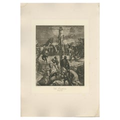
Antique Print of 'The Crucifixion' made after Tintoretto 'c.1890'
Located in Langweer, NL
Antique print titled 'The Crucifixion'. Original antique print on chine collé, made after the painting by Tintoretto. Source unknown, to be determined. Published circa 1890.
Category

Antique Late 19th Century Prints

Materials

Paper

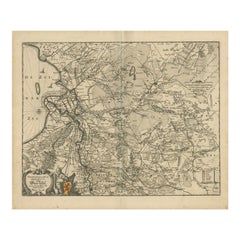
Antique Map of Overijssel by Visscher, c.1652
Located in Langweer, NL
Antique map titled 'Transisalania provincia vulgo Over-yssel'. Original antique map of the province of Overijssel, the Netherlands. Published by N. Visscher after N. ten Have, circa ...
Category

Antique 17th Century Maps

Materials

Paper

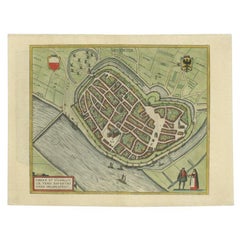
Antique Original Map of the City of Deventer, the Netherlands, 1588
Located in Langweer, NL
Antique map titled 'Liberae et Hanseaticae urbis Daventriensis delineatio'. Original bird's eye plan of the Dutch hanseatic city Deventer, on the situated IJssel river. This map ...
Category

Antique 16th Century Maps

Materials

Paper

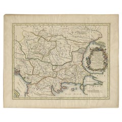
Antique Map of the Region Around the Baltic Sea by Cordier, c.1670
Located in Langweer, NL
Antique map titled 'Illyricum Orientis: In quo Partes II Moesia et Thracia'. Engraved map of the area west of the Baltic Sea, present day Bulgaria, Romania, and Turkey. The map is ba...
Category

Antique 17th Century Maps

Materials

Paper

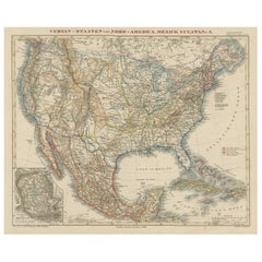
Antique Map of the United States with inset map of the region of Mexico City
Located in Langweer, NL
Antique map titled 'Verein-Staaten von Nord-America, Mexico, Yucatan u.a.'. Very detailed map of the United States of America showing the Caribbean. With an inset map of the surround...
Category

Antique Mid-19th Century Maps

Materials

Paper

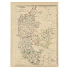
1859 Denmark and Schleswig-Holstein Map: A Historical View from Blackie's Atlas
Located in Langweer, NL
The "Antique Map of Denmark with Schleswig & Holstein" from 'The Imperial Atlas of Modern Geography', published by W. G. Blackie in 1859, is a valuable historical document that provi...
Category

Antique Mid-19th Century Maps

Materials

Paper

Hand Colored Antique Map of the Department of Vaucluse, France
By Victor Levasseur
Located in Langweer, NL
Antique map titled 'Dépt de Vaucluse'. Map of the French department of Vaucluse, France. Vaucluse is the center of wine production in the southern Rhone. Some of the smartest wines in France can be found here. There is also a very strong movement towards the adoption of organic and biodynamic viticulture and natural wine making...
Category

Antique Mid-19th Century Maps

Materials

Paper

Ancient World Map: Europe, Africa & Asia - 1802 Tardieu Atlas
Located in Langweer, NL
Antique Map Description with title: "Monde Connu Des Anciens" Publication Details: - Atlas Title: Nouvel Atlas Universel de Géographie Ancienne et Moderne - Purpose: For the Nouvel...
Category

Antique Early 1800s Maps

Materials

Paper

Antique Map of the City of Ambon by Valentijn, 1726
By F. Valentijn
Located in Langweer, NL
Antique map titled 'De Platte Grond van Amboina zoo als het was in den Jaare, 1718'. Antique map depicting the City of Ambon, Indonesia. This print originates from 'Oud en Nieuw Oost...
Category

Antique Early 18th Century Dutch Maps

Materials

Paper

Antique Engraved Map of the Northern Part of Greece and the Aegean Sea, Ca.1730
Located in Langweer, NL
Title: "GRÆCIÆ PARS Septentrionalis". Hand Coloured Engraved map by G. Delisle of the northern part of the Aegean. In the top left corner a distance scale included. Condition...
Category

Antique 1730s Maps

Materials

Paper

Antique Map of Northern India, Bengal, and Surrounding Regions by Tardieu, 1802
Located in Langweer, NL
This is an original antique map titled "Inde, Indostan Bengale &c. et Partie Septentrionale de la Presqu'isle en deça du Gange," depicting the northern part of the Indian subcontinen...
Category

Antique Early 1800s Maps

Materials

Paper

Antique Engraving of Deucalion and Pyrrha of Phthia, Thessaly, Greece, 1733
Located in Langweer, NL
Antique print titled 'Deucalion & Pyrrha (..)'. This print depicts Deucalion and Pyrrha. Deucalion, who reigned over the region of Phthia, had been forewarned of the flood by his...
Category

Antique 1730s Prints

Materials

Paper

Antique Print of the Feeding Chair of King James VI by Gibb, 1890
Located in Langweer, NL
Antique print titled 'Feeding Chair of King James VI'. Chromolithographic plate originating from 'The Royal House of Stuart. Illustrated By a Series of F...
Category

Antique 19th Century Prints

Materials

Paper

Antique Map of the Region of Hauts-de-France by Hondius, circa 1630
Located in Langweer, NL
Antique map titled 'Description du Gouvernement de la Cappelle'. Old map of the region of Hauts-de-France including the cities of Vervins, Marle, Cappelle and others. This map origin...
Category

Antique Mid-17th Century Maps

Materials

Paper

"The Big Nude" Sumo Book by Helmut Newton
By Helmut Newton
Located in Los Angeles, CA
"The Big Nude" sumo book with stand by Helmut Newton. Bound printed paper, signed and numbered to interior 'Helmut Newton'. This book is number 9,908 of 10,0...
Category

1990s German Magazine Racks and Stands

Materials

Chrome

Antique Engraving of Majorinus, Bishop of Carthage of the Donatist Sect, 1701
Located in Langweer, NL
Antique print, titled: 'Majorinus Numida' Majorinus was a bishop of Carthage in dispute with Ceacilianus. He favored the so-called Donatist sect. Het died ca. 329 AD. The background to the controversy was the wave of persecutions of Christians by the Roman Emperor Diocletian. At that time some Church leaders - unwilling to endure torture or death and become martyrs - had been ready to take such acts as worshipping the gods of the old pantheon, considered idols by Christians, or surrendering church books and property to the imperial authorities. Such people became known as 'traditors' ("surrenderers"). One of these "traditors", named Caecilian, had returned to the fold of the Church once the persecutions ended, and was consecrated Bishop of Carthage and Primate of North Africa. Those of the faithful who refused to accept the authority of such a spiritual leader raised Majorinus as a rival bishop; however, Majorinus died shortly after being consecrated, and it fell to Donatus to take his place and continue the struggle. This rare print originates from: 'Historie der Kerken en Ketteren van den beginne des Nieuwen Testaments tot aan het Jaar onses Heeren 1688. Onzydig in 't Hoogduytsch beschreeven, door den Hoog-geleerden Heer Godfried Arnold, Voor deezen Hoog-Leeraar in de Historien tot Giesen. In het Neederduyts vertaald. Vercierd met verscheyde Koopere Plaaten door den Heer Romeyn de Hooghe.' (transl.: History of Churches and Heretics from the start of the New Testament until the year of our lord 1688 ...), by Godfried Arnold, Dutch edition published by Sebastiaan Petzold, Amsterdam 1701. This edition contains portraits of heretic figures, etched by the reknown Romeyn de Hooghe. Artists and Engravers: Made by 'Romeyn de Hooghe' after an anonymous artist. Gottfried Arnold (pseud. Christophorus Irenaeus) was an important representative of the so-called radical Pietism, publicist, church historian and chants writer (so he was believed to have written the well-known Church song 'O Durchbrecher aller Bande'). Arnold studied theology in Wittenberg. From the Lutheran Orthodoxy he converted, through writings of Spener, to Pietism, associating later into a circle around the court preacher Sprögel, who was influenced by Jakok Böhm. Many medieval mystics were later re-issued by him. In addition he was clearly influenced by Grotius and the early enlightenment. His quest for the 'true' Christianity rightly brought him in the early Church. So he arranged an edition containing the sermons of the desert father Macarius. Arnold was a skilled patristicus, although he did not escape from the creation of an ideal image of the Christian life in the early Church, in his view a flowering time which ended with the reign of Constantine. His first study of the early Church ('Die erste Liebe der Gemeinen Jesu Christi') provided him a professor position in Gießen, a post which he soon left, disappointed by what he called the 'Ruhmsachtige Vernunftwesen des akademischen Lebens'. He continued as an individual scientist and he published books and poems. His main work is 'Unparteiischen Kirchen- und Ketzerhistorie' (1699-1700), of which this is the Dutch translation. He adapts in this study the reformatory decay theory, where the censure lies no longer with Constantine, but the post-Apostolic time. The decay is temporarily lifted with the Reformation, but occurres again soon, so that even the contemporary institutional Protestantism lies under the fire of his criticism. On the other hand he favours the 'Church of the spirit' that existed in all times (invisible) and is characterised by avoiding the world and asceticism. Not the orthodoxy, but the subjectivity of religious man...
Category

Antique Early 1700s Dutch Prints

Materials

Paper

Barados and St Christopher or St Kitts and Nevis Islands in the Caribbean, 1748
Located in Langweer, NL
This original map, a copperplate engraving by Le Rouge, presents two significant areas in the Caribbean. Titled "Isle St. Christophle une des Antilles aux anglois" and "La Barbade. d...
Category

Antique Mid-18th Century Maps

Materials

Paper

Antique Map of Asia and the East Indies and Korea as a Peninsula, ca.1660
Located in Langweer, NL
Antique map titled 'Asiae nova delineatio'. Decorative map of Asia and the East Indies. The map shows Korea as a peninsula. In China the Great Wall is depicted, as well as a long str...
Category

Antique 17th Century Maps

Materials

Paper

Antique Map of German Colonies by Meyer, 1895
Located in Langweer, NL
Antique map titled 'Deutsche Kolonien.' Lithographed map of the German Colonies. German East-Africa, German Southeast-Africa, Cameroon, Marshall-Islands, German Colonies in the Pacif...
Category

Antique 19th Century Maps

Materials

Paper

Detailed Map of Dutch Rivers, with the Rhine, Maas, de Merwe en de Lek, C.1750
Located in Langweer, NL
Antique map titled 'Kaart van den Loop der Rivieren de Rhyn, de Maas, de Waal, de Merwe en de Lek, door de Provincien van Gelderland, Holland en Utrecht'. ...
Category

Antique 1750s Maps

Materials

Paper

Old Engraving of The Catching of Horses on Jafnapatnam, Ceylon 'Sri Lanka', 1672
Located in Langweer, NL
Antique print, titled: 'Paardevangst op Jafnapatnam' - This plate shows the catching of horses on Jafnapatnam. The province of Jaffna , and specially the fort at Jaffnapatnam were th...
Category

Antique 1670s Prints

Materials

Paper

Detailed Map of the Island of Gorée off of the Coast of Dakar, Senegal, 1747
Located in Langweer, NL
Antique plan titled 'Plan de l'Isle de Goree The island of Gorée lies off the coast of Senegal, opposite Dakar. From the 15th to the 19th century, it was the largest slave-tradin...
Category

Antique 1740s Maps

Materials

Paper

Antique Print of the Office of the Earl of Abercorn in Ireland or Scotland, 1770
Located in Langweer, NL
Antique print titled 'Elevation of the Earl of Abercorn's Offices (..)'. Old engraving of the office of the Earl of Abercorn. James Hamilton, 8th Earl of Abercorn PC (Ire) (22 Oc...
Category

Antique 18th Century Prints

Materials

Paper

Rare Engraving of New Caledonia & New Hebrides from Capt. Cook's Travels, 1777
Located in Langweer, NL
Antique map titled 'Chart of Discoveries made in the South Pacific Ocean'. Rare engraving from the official British Admiralty sanctioned edition of the accounts of Cook’s second voyage. All other later copies made of this image by other publishers were unauthorised, usually smaller and inferior in quality. Made after Cook's discovery of the island group on 4 September 1774, which he named New Caledonia...
Category

Antique 1770s Maps

Materials

Paper

Antique Map of Lower Saxony in Germany, c.1740
Located in Langweer, NL
Antique map titled 'Nieuwe Kaart van de Neder Saxise Kreits (..).' Attractive detailed map showing Lower Saxony, Germany, including Mekelenburg, Lauwenburg, Holstein, Bremen, Verden ...
Category

Antique 18th Century Maps

Materials

Paper

Antique Print of the Dutch VOC Bombing Palembang, Sumatra (Indonesia), ca.1700
By Pieter Van Der Aa
Located in Langweer, NL
Antique print titled 'La Ville de Palimbang dans L’Ile de Sumatra.' A very decorative, impressive engraving of Palembang in Sumatra. Two views on one sheet. In the upper part the ove...
Category

Antique Early 18th Century Prints

Materials

Paper

Antique Print of the Ryukyu Islands in Japan, 1856
Located in Langweer, NL
Antique print titled ‘Lew Chew'. Lithograph of the Ryukyu Islands, from about 1829 until the mid-20th century, the islands' English name was spelled Luchu, Loochoo, or Lewchew. The R...
Category

Antique 19th Century Prints

Materials

Paper

Map of Europe Highlighting Ancient and Modern Geographical Divisions (1794)
Located in Langweer, NL
Map of Europe Highlighting Ancient and Modern Geographical Divisions (1794). Germany, France, Italy, Spain, and the British Isles – Map by D’Anville (1794). This detailed 18th-cent...
Category

Antique 1790s Maps

Materials

Paper

Antique Map of Virginia, with Inset Map of the Northern Part of West Viriginia
Located in Langweer, NL
Antique map titled 'West Virginia'. Original antique map of Virginia, United States. With inset map of the 'Panhandle' or northern part of West...
Category

Antique Late 19th Century Maps

Materials

Paper

Large Chart of the Gambier Islands, Tuamotu Archipelago, French Polynesia
Located in Langweer, NL
Antique map titled 'Carte du Groupe des Iles Manga-Reva (Archipel Pomotou)'. Large chart of the Tuamotu Archipelago, French Îles Tuamotu, also called Paumotu, island group of French ...
Category

Antique Mid-19th Century Maps

Materials

Paper

Art Deco Clip Earrings in Silver and Yellow Jade, Angel Wings, France, 1920s
Located in Esbjerg, DK
A pair of highly stylized clip-on earrings made from 830/1000 silver and set with yellow jade stones. Anonymous French silversmith circa 1925 in the ...
Category

Vintage 1920s French Art Deco Collectible Jewelry

Materials

Jade, Silver

19th C Grand Tour Painting on Porcelain View of Vatican/St. Peter's Basilica
Located in West Palm Beach, FL
19th century Grand Tour Painting on Porcelain View of Vatican/St. Peter's Basilica Italy, circa 1880s Standing in rectangular gilt bronze engraved frame with applied stylized flo...
Category

Antique Late 19th Century Grand Tour Historical Memorabilia

Materials

Bronze

Old Engraving of French Visiting Tomari, a Village in Far East Russia, 1797
Located in Langweer, NL
Plate: 'Costumes des Habitants de la Baie de Langle.' (Costumes of the inhabitants of Langle Bay, Russia). Tomari (Russian: ??????) is a coastal town and the administrative cente...
Category

Antique 1790s Prints

Materials

Paper

Antique Map of France by Lapie, 1842
Located in Langweer, NL
Antique map titled 'Carte des Gaules'. Map of France. This map originates from 'Atlas universel de géographie ancienne et moderne (..)' by Pierre M. Lapie and Alexandre E. Lapie. Pie...
Category

Antique Mid-19th Century Maps

Materials

Paper

Old Engraved Map of Hungary, European Balkan Countries, Greece and Crete, 1806
Located in Langweer, NL
Antique map titled 'Hongrie, Turquie Europe'. Decorative map of Hungary, southeast European countries in the Balkan peninsula and Greece by Robert de Vaugondy, revised and publis...
Category

Antique 19th Century Maps

Materials

Paper

Antique Portrait of Ivan IV The Terrible, 1st Csar of All Russia, 1615
Located in Langweer, NL
Antique portrait titled 'Basilius Magnus (..)'. Portrait of Ivan IV (1530-84, 'the Terrible'). This print originates from 'Tooneel der keyseren ende coningen van christenryck sedert den onderganck van het Griecks keyserdom vervatende hare beeltnissen afcomsten ende voornaemste daden (..)'. Ivan IV Vasilyevich (Russian: ???´? ????´??????; 25 August 1530 – 28 March [O.S. 18 March] 1584),[2] commonly known in English as Ivan the Terrible...
Category

Antique 17th Century Prints

Materials

Paper

Antique Map of the Rivers and Mountains in Asia, c.1895
By Meyer
Located in Langweer, NL
Antique map titled 'Asien. Fluss- und Gebirgssysteme.' Map of Asia, showing river- and mountain systems. This map originates from 'Meyers grosses Konversations-Lexikon.', published in Leipzig and Vienna. Meyers Konversations-Lexikon was a major German encyclopedia that existed in various editions from 1839 until 1984, when it merged with the Brockhaus encyclopedia. Several of the plates were also used in Dutch Encyclopedia's like Winkler Prins...
Category

Antique 19th Century Maps

Materials

Paper

Uncoulored Original Antique Map of Western Africa, 1749
Located in Langweer, NL
Interesting detailed German antique map titled 'Neue Vorstellung der Abendlaendischen Küsten von Africa (..)'. Original antique map of Western Africa. This map originates from 'Neue ...
Category

Antique Mid-18th Century Maps

Materials

Paper

Interesting Original Antique Hemisphere Map Showing the Latest Discoveries
Located in Langweer, NL
Antique world map titled 'A Map of the World from the best Authorities'. Detailed map of the World, showing tracks of Captain James Cook in his 3 voyages in great detail. The map is ...
Category

Antique Late 18th Century Maps

Materials

Paper

Three Antique Leather & Brass Photo Albums with Photos 19thC
Located in Big Flats, NY
Three Antique Leather & Brass Photo Albums with Photos 19thC Small Brown - 9 1/4" x 8 1/8" x 2 5/8" Green - 11 5/8" x 9" x 2 1/2" Large Brown - 11 1/2" x 9" x 3"
Category

Antique 19th Century Books

Materials

Paper

Antique Plan of Aigues-Mortes, France
Located in Langweer, NL
Antique map titled 'Plan d'Aiguesmortes et environs'. Original plan of the region of Aigues-Mortes, France. This map originates from 'Le Petit Atlas Maritime (..)' by J.N. Bellin. Pu...
Category

Antique Mid-18th Century Maps

Materials

Paper

Antique Map of the Tunquin River and Bay to Cacho, the Capital City, Siam, 1758
Located in Langweer, NL
Antique map titled ‘Kaart van den Loop der Rivier van Tonkin van Cacho tot aan de Zee / Carte du Cours de la Riviere de Tunquin Depuis Cacho jusqu'à la Mer J. v. Schley direx.’ Detailed map of the Tunquin River and Bay, extending north to Cacho, the capital...
Category

Antique 18th Century Maps

Materials

Paper

Antique Map of the British Isles by Covens & Mortier, 1730
By Covens & Mortier
Located in Langweer, NL
Covens and Mortier's attractive double-page engraved map of the British Isles, based on the 1702 De L'Isle map. The map features a large car...
Category

Antique Mid-18th Century Maps

Materials

Paper

War of the Worlds
Located in London, GB
Original British front of house card for The War of the Worlds 1953 it was used inside the foyer of the cinema. This artwork featuring the invading spacecraft is the best card from the set of 8. The film is one of the most famous science fiction films ever made. It was directed by Byron Haskin and starred Gene Barry, Ann Robinson...
Category

Vintage 1950s British Posters

Materials

Paint

War of the Worlds
War of the Worlds
$1,035 Sale Price
20% Off
Antique Print of two Synagogues in Amsterdam, The Netherlands, c.1760
Located in Langweer, NL
Antique print titled 'De Twee groote Synagogen der Hoogduitsche Jooden en het Oude-Zyds-Huiszitten-Aalmoesseniers-Huis van agteren, in 't verschiet'. Old print depicting two large large synagogues of German jews...
Category

Antique 18th Century Prints

Materials

Paper

Midcentury Modern Porcelain Ashtray Cigarette Holder Set
Located in New York, NY
A Hungarian porcelain ashtray and loose cigarette vessel holder set, Mid-Century Modern, circa early to mid-20th century, Hungary by Hollohaza. Set has a triangular shape with gold a...
Category

Mid-20th Century Hungarian Mid-Century Modern Ashtrays

Materials

Porcelain

18th Century Cartographic Depiction of Upper India and Ceylon, 1835
Located in Langweer, NL
An exquisite set of two maps, 'Carte de la Partie Superieure De L'Inde en de Cadu Gange,' masterfully crafted by the renowned 18th-century French cartographer, Charles Marie Rigobert...
Category

Antique 1830s Maps

Materials

Paper

Antique Map of the Adour River, Near Bayonne, France
Located in Langweer, NL
Antique map titled 'Cours de la riviere de l'Adour depuis la mer jusqua Bayonne'. Original old map of the Adour river, near Bayonne, France. This map originates from 'Le Petit Atlas ...
Category

Antique Mid-18th Century Maps

Materials

Paper

Antique Print of 'Pietà' Made after Francia 'c.1890'
Located in Langweer, NL
Antique print titled 'Pietà'. Original antique print on chine collé, made after the painting by Francia. Source unknown, to be determined. Published circa 1890.
Category

Antique Late 19th Century Prints

Materials

Paper

Superior Lapin Husky Plush by Muchi Decor, Made in Italy
By Muchi Decor by LA-RI S.r.l.
Located in Poviglio, IT
This Collectible Plush Husky Dog was conceived by Muchi Decor as refined but light-hearted decoration for your room.  This plush is made of real Superior Lapin fur with 100% natural ...
Category

21st Century and Contemporary Italian Modern Toys and Dolls

Materials

Other

RONSON 1936 Art-Deco Machine Age Cigar Humidor Desk Box And Touch-Tip Striker
By Louis Vincent Aronson, Ronson Art Metal Works
Located in Miami, FL
Ronson Art Deco Combination Humidor and Touch Tip Table Lighter. This Art Deco smoking accessory is a combination humidor box and touch tip lighter by Ronson Lighter Co., back in th...
Category

Vintage 1930s American Art Deco Tobacco Accessories

Materials

Steel, Chrome

Original Hand-Colored Antique Map of Africa by Elwe '1792'
Located in Langweer, NL
Antique map titled 'l'Afrique Divisée en ses Empires, Royaumes, et Etats'. Decorative large map of Africa. The cartography is typical for the 17th century with the Nile originating i...
Category

Antique Late 18th Century Maps

Materials

Paper

Antique Print of The Roman Catholic Cathedral in Fribourg, Switzerland, 1860
Located in Langweer, NL
Antique print titled 'Abside de la Cathedrale de Fribourg'. Antique print depicting the Chancel End of Freyburg Cathedral. Fribourg Cathedral (French: Cathédrale Saint-Nicolas de Fribourg) is a Roman Catholic...
Category

Antique 19th Century French Prints

Materials

Paper

Antique Map of Camden and Sonora, 1871
Located in Langweer, NL
Antique map titled 'Camden, Sonora'. Original antique map of villages and communities of Ohio. This map originates from 'Atlas of Preble County Ohio' by C.O. Titus. Published 1871.
Category

Antique Late 19th Century Maps

Materials

Paper

Original Old Map Northeast India, incl Part of Himalayas and China, 1853
Located in Langweer, NL
Antique map titled 'India X'. Old map of the the northeast region of India, including part of Himalayas and China. Great detail of landforms, rivers and water bodies, cities, towns...
Category

Antique 1850s Maps

Materials

Paper

Antique Map of Central and Southern China by Kuyper, 1880
Located in Langweer, NL
Plate 53 : 'China, Midden en Zuid.' (China, Central and South). This lithographed map originates from: 'Wereld-atlas voor Kantoor en Huiskamer' (transl: World Atlas for the office an...
Category

Antique 19th Century Maps

Materials

Paper

Decorative Map of the French Regions of Picardy, Artois & French Flanders, c1780
Located in Langweer, NL
Antique map titled 'Carte des Gouvernements de Flandre Francoise, d'Artois, de Picardie et du Boulenois.' An attractive example of Rigobert Bonne's 1771 decorative map of the Fre...
Category

Antique 1780s Maps

Materials

Paper

Antique Map of Washington County 'Ohio' by Titus, 1871
Located in Langweer, NL
Antique map titled 'Washington'. Original antique map of Washington, Ohio. This map originates from 'Atlas of Preble County Ohio' by C.O. Titus. Published, 1871.
Category

Antique Late 19th Century Maps

Materials

Paper

Antique Map of the United States by Balbi '1847'
Located in Langweer, NL
Antique map titled 'Etats-Unis'. Original antique map of the United States. This map originates from 'Abrégé de Géographie (..)' by Ad...
Category

Antique Mid-19th Century Maps

Materials

Paper

Antique Colourful Map of the Island of Java and Madura, Indonesia, C.1760
Located in Langweer, NL
Antique map titled 'Nouvelle Carte de l'Isle de Java'. Chart of the island of Java, depicting soundings around the coast, all principal harbors, rivers and elevations, bays and p...
Category

Antique 18th Century Maps

Materials

Paper

Read More

Medal-Worthy Memorabilia from Epic Past Olympic Games

Get into the games! These items celebrate the events, athletes, host countries and sporting spirit.

Ahoy! You’ve Never Seen a Collection of Sailor Art and Kitsch Quite Like This

French trendsetter and serial collector Daniel Rozensztroch tells us about his obsession with objects related to seafaring men.

Pamela Shamshiri Shares the Secrets behind Her First-Ever Book and Its Effortlessly Cool Interiors

The sought-after designer worked with the team at Hoffman Creative to produce a monograph that beautifully showcases some of Studio Shamshiri's most inspiring projects.

Moroccan Artworks and Objects Take Center Stage in an Extraordinary Villa in Tangier

Italian writer and collector Umberto Pasti opens the doors to his remarkable cave of wonders in North Africa.

Montecito Has Drawn Royalty and Celebrities, and These Homes Are Proof of Its Allure

Hollywood A-listers, ex-pat aristocrats and art collectors and style setters of all stripes appreciate the allure of the coastal California hamlet — much on our minds after recent winter floods.

Whaam! Blam! Pow! — a New Book on Pop Art Packs a Punch

Publishing house Assouline and writer Julie Belcove have teamed up to trace the history of the genre, from Roy Lichtenstein, Andy Warhol and Yayoi Kusama to Mickalene Thomas and Jeff Koons.

The Sparkling Legacy of Tiffany & Co. Explained, One Jewel at a Time

A gorgeous new book celebrates — and memorializes — the iconic jeweler’s rich heritage.

What Makes a Gem-Encrusted Chess Set Worth $4 Million?

The world’s most opulent chess set, weighing in at 513 carats, is literally fit for a king and queen.
Recently Viewed

View All