Maps on Sale
to
4,210
18
4,233
1
3
2
2
1
1
1
1
2,334
1,667
232
1
130
12
1
67
1
3
4
2
4,224
10
8
7
7
143
41
37
32
27
4,234
4,234
4,234
104
55
18
13
11
Sale Items
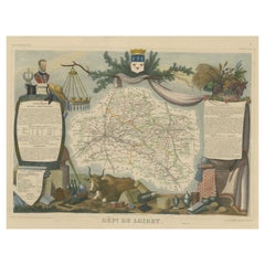
Old Map of the French Department of Loiret, France
By Victor Levasseur
Located in Langweer, NL
Antique map titled 'Dépt. du Loiret'. Map of the French department of Loiret, France. Surrounding the city of Orleans, Loiret is considered the heart of France and is a registered Unesco World Heritage Site. This area of France is also part of the Loire Valley wine region, and is especially known for its production of Pinot Noirs...
Category
Antique Mid-19th Century Maps
Materials
Paper
$324 Sale Price
20% Off
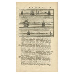
Views of Amsterdam, Middelburg and Pylsteerten Island, Indonesia, 1726
Located in Langweer, NL
Antique print from an old Dutch publication of a VOC mission to nowadays Indonesia titled 'Pylsteerten Eyland als het O.N.O. 6 Mylen van u is ; Pylsteerten Eyland als het O.Z.O. 3 Mylen van u is ; Aldus vertoond t'Eyland Amsterdam als het Oost Noort Oost 3 Mylen van u is ; Aldus vertoond't Eyland Middelburg als het Oost ten Zuyde 4 Mylen van u is'. Views of Amsterdam...
Category
Antique 18th Century Prints
Materials
Paper
$152 Sale Price
20% Off
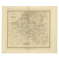
Antique Map of Belgium and Part of the Southern Netherlands, 1810
Located in Langweer, NL
Antique map titled 'Belgium, or the Netherlands divided into Departments'. Original antique map of Belgium and the southern part of the Netherlands. This map originates from 'The Mod...
Category
Antique 19th Century Maps
Materials
Paper
$238 Sale Price
20% Off
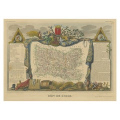
Hand Colored Antique Map of the Department of Oise, France
By Victor Levasseur
Located in Langweer, NL
Antique map titled 'Dept. de l'Oise'. Old map of the French department of Oise, France. The map proper is surrounded by elaborate decorative engravings designed to illustrate both th...
Category
Antique Mid-19th Century Maps
Materials
Paper
$324 Sale Price
20% Off
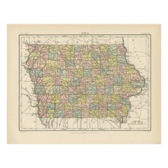
Antique Map of Iowa
Located in Langweer, NL
Antique map titled 'Iowa'. Original antique map of Iowa, United States. This print originates from 'Encyclopaedia Britannica', Ninth Edition. Published 188...
Category
Antique Late 19th Century Maps
Materials
Paper
$276 Sale Price
20% Off
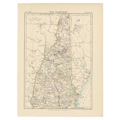
Antique Map of New Hampshire
Located in Langweer, NL
Antique map titled 'New Hampshire'. Original antique map of New Hampshire, United States. This print originates from 'Encyclopaedia Britan...
Category
Antique Late 19th Century Maps
Materials
Paper
$276 Sale Price
20% Off
Hand Colored Antique Map of the Department of Doubs, France
By Victor Levasseur
Located in Langweer, NL
Antique map titled 'Dépt. du Doubs'. Map of the French department of Doubs, France. The whole is surrounded by elaborate decorative engravings designed to illustrate both the natural...
Category
Antique Mid-19th Century Maps
Materials
Paper
$202 Sale Price
50% Off
Antique Map of Europe and Part of Asia and Africa, 1848
Located in Langweer, NL
Antique map titled 'Orbis Veteribus Notus'. Old map of the European continent, also depicting a portion of Asia and Africa. Originating from 'Orbis Terrarum Antiquus in usum Scholaru...
Category
Antique 19th Century Maps
Materials
Paper
$94 Sale Price
20% Off
Antique Map of the Bay Near Huchou Island by Van Schley, 1758
Located in Langweer, NL
Antique map titled 'Carte de la Baye d' Hocsieu et des entrees de la Riviere de Chang situees dans la Province de Foyken.' Original antique map of the bay nea...
Category
Antique 18th Century Maps
Materials
Paper
$165 Sale Price
20% Off
Antique Map of Africa, Cartouche with Elephant Tusks and Horned Serpent, 1737
Located in Langweer, NL
Antique map of Africa titled 'Africa Secundum Legitimas Projectionis Stereographicae regulas (..)'.
Johann Matthias Haas' revision of J.B. Homann's 1715 map of Africa, augmented to include important cartographic developments as recorded by Guillaume Delisle and D'Anville. The map presents a fairly accurate picture without most of the fictitious lakes and rivers of previous cartography, focusing on the known coastal regions of the continent, leaving the interior blank or marked Terra Incognito. Egypt, Nubia and Abyssinia are shown as distinct entities, Lake Nyasa is shown as Lac Marawi, and the Congo is located. The Dutch settlements of Castell Batov and Stellenbosch are shown at the Cape. The most striking feature of the map is the large title cartouche that is framed by elephant tusks and a horned serpent. In the foreground is a scene of natives negotiating with European traders, surrounded by indigenous animals. In the background is a view of Table Bay...
Category
Antique 18th Century Maps
Materials
Paper
$935 Sale Price
20% Off
Charming 18th Century Miniature Map of Greece, 1685
Located in Langweer, NL
Antique map titled 'Graeciae Descriptio.' Charming miniature map of Greece from the pocket atlas 'Introductionis in Universam Geographiam tam Veterem qu...
Category
Antique 17th Century Maps
Materials
Paper
$334 Sale Price
20% Off
Antique Map of India and Southeast Asia by Sanson '1654'
Located in Langweer, NL
Antique map titled 'Partie Meridionale de l'Inde'. Early map of India and Southeast Asia. The map shows most of modern India, Bangladesh and Burma, the whole of Sri Lanka, Thailand, ...
Category
Antique Mid-17th Century Maps
Materials
Paper
$1,146 Sale Price
20% Off
Old Street View in Guangzhou 'Canton' and Inhabitants of Guangzhou, China, 1834
Located in Langweer, NL
Antique print titled 'Une Rue de Canton - Barbier - Habitans de Canton'.
View of a street in Guangzhou (Canton) and inhabitants of Guangzhou, also includes a small image of a Chinese barber...
Category
Antique 1830s Prints
Materials
Paper
$114 Sale Price
20% Off
Hand Colored Antique Map of the department of Cantal, France
By Victor Levasseur
Located in Langweer, NL
Antique map titled 'Dépt. du Cantal'. Map of the French department of Cantal, France. This area of France is known for its production of Cantal, a firm cheese, named after the region...
Category
Antique Mid-19th Century Maps
Materials
Paper
$324 Sale Price
20% Off
Hand Colored Antique Map of the department of Indre and Loire, France
By Victor Levasseur
Located in Langweer, NL
Antique map titled 'Dépt. d'Indre et Loire'. Map of the Department de L’Indre et Loire, France. This region is known for its fine wines, agriculture, distilled spirits, and cheese. T...
Category
Antique Mid-19th Century Maps
Materials
Paper
$324 Sale Price
20% Off
Hand Colored Antique Map of the Department of Ardèche, France
By Victor Levasseur
Located in Langweer, NL
Antique map titled 'Dépt. de l'Ardèche'. Map of the Department of Ardèche, France. This region is known for its fine wines, agriculture, distilled spirits, and cheese. The capital ci...
Category
Antique Mid-19th Century Maps
Materials
Paper
$324 Sale Price
20% Off
Hand Colored Antique Map of the Department of Correze, France
By Victor Levasseur
Located in Langweer, NL
Antique map titled 'Dépt. de la Corrèze'. Map of the French department of Correze, France. This area of France is known for its production of Straw Wine, a sweet red or white wine. T...
Category
Antique Mid-19th Century Maps
Materials
Paper
$324 Sale Price
20% Off
Hand Colored Antique Map of the Department of Nord, France
By Victor Levasseur
Located in Langweer, NL
Antique map titled 'Dept. du Nord'. Map of the French department of Nord, France. This area is known for its production of Maroilles, a cow's milk cheese. This cheese is produced in ...
Category
Antique Mid-19th Century Maps
Materials
Paper
$324 Sale Price
20% Off
Hand Colored Antique Map of the Department of Calais, France
By Victor Levasseur
Located in Langweer, NL
Antique map titled 'Dépt. du Pas de Calais'. Map of the French department of Calais, France. This area is known for producing Maroilles, a soft cheese made from cow’s milk and with a...
Category
Antique Mid-19th Century Maps
Materials
Paper
$324 Sale Price
20% Off
Antique Print of Forts and Views of the East Indies by Chatelain (1719)
Located in Langweer, NL
Antique print titled 'Vue et Description de Quelques-Uns des Principaux Forts des Hollandois dans les Indes'. Interesting sheet with seven detailed views illustrating the most import...
Category
Antique 18th Century French Prints
Materials
Paper
$409 Sale Price
30% Off
Hand Colored Antique Map of the Department of Marne, France
By Victor Levasseur
Located in Langweer, NL
Antique map titled 'Dépt. de la Marne'. Map of the French department of Marne, France. This department is home to the Champagne region where the world's finest sparkling wine is prod...
Category
Antique Mid-19th Century Maps
Materials
Paper
$324 Sale Price
20% Off
Old Map of the French department of l'Aisne, France
By Victor Levasseur
Located in Langweer, NL
Antique map titled 'Dépt. de l'Aisne'. Map of the French department of l'Aisne, France. The whole is surrounded by elaborate decorative engravings designed to illustrate both the nat...
Category
Antique Mid-19th Century Maps
Materials
Paper
$324 Sale Price
20% Off
Hand Colored Antique Map of the department of Drôme, France
By Victor Levasseur
Located in Langweer, NL
Antique map titled 'Dépt. de la Drôme'. Map of the French department of Drôme, France. This area is known for its production of Picodon, a spicy goats-milk ch...
Category
Antique Mid-19th Century Maps
Materials
Paper
$324 Sale Price
20% Off
Old Map of Ancient Rome Illustrating Major Monuments and the Seven Hills, c.1704
Located in Langweer, NL
Antique map Rome titled 'Omnia Romanae cedant Miracula Terrae (..)'. Map of Ancient Rome Illustrating Major Monuments and the Seven Hills. This map or...
Category
Antique 18th Century Maps
Materials
Paper
$362 Sale Price
20% Off
Antique Map of Groningen from a 19th Century Dutch Atlas, 1864
Located in Langweer, NL
Antique map titled 'De Provincie Groningen'. Map of the province of Groningen, the Netherlands. This map originates from 'F. C. Brugsma's Atlas van het Koninkrijk der Nederlanden (.....
Category
Antique 19th Century Maps
Materials
Paper
$133 Sale Price
20% Off
Antique French Map of Asia with Original Border Colouring, c.1785
Located in Langweer, NL
Antique map titled 'L'Asie divisee en ses principaux Etats.' (Map of Asia and its principal states). This map originates from an Atlas by Didier Robert de Vaugondy or his successor D...
Category
Antique 18th Century Maps
Materials
Paper
$114 Sale Price
20% Off
Antique Map of Denmark with an Inset Map of Iceland, 1832
Located in Langweer, NL
Antique map titled 'Denmark'. Large map of Denmark with an inset map of Iceland.
Artists and Engravers: Published by J. Arrowsmith in London, 1832.
Condition: Good, general age...
Category
Antique 19th Century Maps
Materials
Paper
$333 Sale Price
20% Off
Antique Map of Germany in Roman Times, Showing Roman Provinces, 1825
Located in Langweer, NL
Antique map titled 'Germania, Vindelicia, Rhaetia et Noricum Jllyria, Pannonia, Dacie & Moesia'. Old map of Germany and surroundings originating from 'Atlas der Oude Wereld'. Artists...
Category
Antique 19th Century Maps
Materials
Paper
$117 Sale Price
20% Off
Antique Map of the Roadstead of Bantam by Van der Aa, 1725
By Pieter Van Der Aa
Located in Langweer, NL
Antique map titled 'La rade de Bantam'. (The roadstead of Bantam.) This map shows the Indonesian city of Banten / Bantam on Java, Indonesia and its roadstead. With compass rose and s...
Category
Antique 18th Century Maps
Materials
Paper
$251 Sale Price
20% Off
Antique Map of South America by Tirion, c.1765
By Thomas Kitchin
Located in Langweer, NL
Antique map titled 'Kaart van het Onderkoningschap van Peru zig uitstrekkende: over Chile, Paraguay en andere Spaansche Landen als ook van Brazil en verdere Bezittingen van Portugal ...
Category
Antique 18th Century Maps
Materials
Paper
$332 Sale Price
20% Off
Antique Map of Switzerland by Johnston, 1882
Located in Langweer, NL
Antique map titled 'Switzerland and the Alps of Savoy and Piedmont'. Old map of Switzerland and the Alps of Savoy and Piedmont. This map originates from 'The Royal Atlas of Modern Ge...
Category
Antique 19th Century Maps
Materials
Paper
$124 Sale Price
20% Off
Map of Southern Italy inlcluding Sardinia and Inset of the Bay of Naples, c.1860
Located in Langweer, NL
Antique map titled 'South Italy and the Island of Sardinia'.
Old map of Southern Italy and the island of Sardinia. With an inset map of the B...
Category
Antique 1860s Maps
Materials
Paper
$324 Sale Price
20% Off
Antique Map of the Region of Touraine, France by Janssonius, 1657
By Johannes Janssonius
Located in Langweer, NL
Antique map of France titled 'Touraine - Turonensis Ducatus'. Decorative map of the Touraine region. This map originates from 'Atlas Novus, Sive Theatrum Orbis Orbis Terrarum: In quo...
Category
Antique 17th Century Maps
Materials
Paper
$563 Sale Price
20% Off
Small Antique Map of the Asian Continent, 1841
Located in Langweer, NL
Antique map titled 'Azie.' Small map of the Asian continent. This map originates from 'De Aarde, beschouwd in haren Natuurlijken Toestand en Verdeeling (..)' by N.G. van Kampen. Publ...
Category
Antique 19th Century Maps
Materials
Paper
$238 Sale Price
20% Off
Homann Heirs Map of France – Antique Hand-Colored, circa 1745
Located in Langweer, NL
Antique map titled 'Gallia Postarum geographice designata in qua Cursus Postarum Secundum Statum (..)'. Unusual postal map of France, with coat of arms. Very detailed map showing all...
Category
Antique Mid-18th Century German Maps
Materials
Paper
$382 Sale Price
20% Off
Antique Print of a Cottage in an English Garden by Le Rouge, c.1785
Located in Langweer, NL
Antique print titled 'Exterieur de la Chaumiere du Jardin Anglais'.
Copper engraving of a cottage in an English garden. This print originates from '...
Category
Antique 18th Century Prints
Materials
Paper
$353 Sale Price
20% Off
Antique Map with Hand Coloring of the United States and the Caribbean
Located in Langweer, NL
Antique map titled 'Verein-Staaten von Nord-America, Mexico, Yucatan u.a.'. Very detailed map of the United States of America showing the Caribbean. With an inset map of the surround...
Category
Antique Late 19th Century Maps
Materials
Paper
$534 Sale Price
20% Off
Antique Map of Seram Island by Keizer & De Lat, c.1747
Located in Langweer, NL
Antique map titled 'Kaart van het eiland Ceram'. Rare and uncommon map of Seram Island, Indonesia. One of the earliest separately printed maps of the island. Artists and Engravers: P...
Category
Antique 18th Century Maps
Materials
Paper
$217 Sale Price
20% Off
Antique Map of the Region of Orleans by Homann Heirs, c.1760
By Homann Heirs
Located in Langweer, NL
Antique map titled 'Novissima Totius Aureliani Generalitatis (..) - Nouvelle Carte du Gouvernement General et Militaire d'Orleans (..).' Detailed map by Rizzi Zononi covering the vic...
Category
Antique 18th Century Maps
Materials
Paper
$214 Sale Price
20% Off
Antique Map of Ooststellingwerf by Kuyper, 1868
Located in Langweer, NL
Antique map titled 'Provincie Friesland - Gemeente Oost-Stellingwerf'. Map of the township of Ooststellingwerf including Makkinga, Oosterwolde and many other villages. This map origi...
Category
Antique 19th Century Maps
Materials
Paper
$119 Sale Price
20% Off
Antique Chart of the US Consumption Deaths, '1874'
Located in Langweer, NL
Antique chart titled 'Map showing the proportion of deaths from consumption to deaths from all causes. Compiled from the returns of mortality at the nint...
Category
Antique Late 19th Century American Maps
Materials
Paper
$477 Sale Price
20% Off
Old Print of a Large Procession of the Emperor's Niece in Japan, 1669
Located in Langweer, NL
Antique print titled 'Groote Staatsie der Kaisarlyke Nicht.'
This print shows a large procession of the Emperor's Niece. It shows a small carriage d...
Category
Antique 1660s Prints
Materials
Paper
$305 Sale Price
20% Off
Antique Map of Surrey by Speed, 1676
Located in Langweer, NL
Antique map titled 'Surrey described and divided into hundreds'. Map of Surrey, England. Includes inset elevations of Richmond and Nonsuch Palaces. This map originates from 'Theatre ...
Category
Antique 17th Century Maps
Materials
Paper
$467 Sale Price
20% Off
Small Map of Bantam with Dutch Ships and an Engraving of Portugese, 1614
Located in Langweer, NL
Two rare old miniature copper-engravings one one leaf. One showing the first arrival of the first Dutch in Indonesia, the so-called 'Houtman expedition' and on the reverse Portugese welcoming them with gifts.
The First Dutch Expedition to Indonesia was an expedition that took place from 1595 to 1597. It was instrumental in the opening up of the Indonesian spice trade...
Category
Antique Early 17th Century Maps
Materials
Paper
$716 Sale Price
20% Off
Antique Map of the Banda Islands in Indonesia by Valentijn, 1726
Located in Langweer, NL
Antique map Indonesia titled 'Kaart der Zuyd-Wester Eylanden van Banda'. Map of the islands in the southwestern part of the Banda Sea including ...
Category
Antique Mid-18th Century Dutch Maps
Materials
Paper
$477 Sale Price
20% Off
Antique Map of the Seine-et-Marne / Champagne Region by Janssonius, 1657
By Johannes Janssonius
Located in Langweer, NL
Antique map of France titled 'Valesium Ducatus Valois'. Oriented to the north of the Picardy region with Compiegne, Senlis, Meaux, Chateau-thierry and Soissons around the perimeter. ...
Category
Antique 17th Century Maps
Materials
Paper
$687 Sale Price
20% Off
Antique Print of a Handbell and Covered Tankard of Agate by Gibb, 1890
Located in Langweer, NL
Antique print titled 'Hand-Bell of Mary Queen of Scots - Covered Tankard of Agate'. Chromolithographic plate originating from 'The Royal House of Stuart. Illustrated by a Series of F...
Category
Antique 19th Century Prints
Materials
Paper
$81 Sale Price
20% Off
Antique Map of North Africa including the Sahara Desert
Located in Langweer, NL
Antique map titled 'Charte von Nord-Africa'. Scarce map of North Africa. Includes a fantastic depiction of the Sahara Desert. Published in Weimar, 1809.
Category
Antique Early 19th Century Maps
Materials
Paper
$563 Sale Price
20% Off
Antique City Plan of Rotterdam in Frame, ca.1850
Located in Langweer, NL
Antique map titled 'Grondkaart der stad Rotterdam (..)'. Original antique city plan of Rotterdam, the Netherlands. Published circa 1850.
Artists...
Category
Antique 19th Century Prints
Materials
Paper
$620 Sale Price
20% Off
Dutch Municipality of Bedum in Groningen, Fehse, 1862
Located in Langweer, NL
These scarse detailed maps of Dutch Towns originate from the 'Gemeente atlas van de Provincie Groningen in 62 kaarten.' by C. Fehse. This atlas of all towns in Groningen, the Netherl...
Category
Antique 19th Century Maps
Materials
Paper
$114 Sale Price
20% Off
Antique Map of the Region of Arnhem and Wageningen by Craandijk, 1884
Located in Langweer, NL
Antique map titled 'Omstreken van Arnhem, Wageningen'. Old map of the region of Wageningen also including cities and villages like Bennekom, Renkum and Oosterbeek. This map orginates...
Category
Antique 19th Century Maps
Materials
Paper
$83 Sale Price
20% Off
Pl. 61 Antique Print of the Monuments of Herculaneum by Bayardi, 1762
Located in Langweer, NL
Antique print titled 'Pl. 66 Road Making'. Original antique print of road making Source unknown, to be determined. Published circa 1838. Artists and Engravers: Engraved by E. Turrell...
Category
Antique 19th Century Prints
Materials
Paper
$88 Sale Price
20% Off
Antique Print of the Residence of Christian Friedrich by Stieglitz, c.1800
Located in Langweer, NL
Antique print titled 'Erlaucht dem Grafen und Herrn, Herrn Christian Friedrich (..)'. Old engraving of the residence of Christian Friedrich, count of Stollberg. This print originates...
Category
Antique 19th Century Prints
Materials
Paper
$107 Sale Price
20% Off
Antique Map of Denmark with Schleswig & Holstein by A & C. Black, 1870
Located in Langweer, NL
Antique map titled 'Denmark with Schleswig & Holstein'. Original antique map of Denmark with Schleswig & Holstein. This map originates from ‘Black's General Atlas of The World’. Publ...
Category
Antique Late 19th Century Maps
Materials
Paper
$125 Sale Price
40% Off
Antique Map of Spain and Portugal by A & C. Black, 1870
Located in Langweer, NL
Antique map titled 'Spain and Portugal'. Original antique map of General map of Spain and Portugal with inset map of Gibraltar. This map originates from ‘Black's General Atlas of The...
Category
Antique Late 19th Century Maps
Materials
Paper
$196 Sale Price
40% Off
Antique Map of Southern Brazil and Uruguay by Bonne, c.1780
Located in Langweer, NL
"Antique map titled 'Carte de la Partie Meridional du Bresil avec les Possessions Espagnoles Voisines Qui en Sont a l'Ouest.' Map of southern Brazil and present-day Uruguay from Port...
Category
Antique 18th Century Maps
Materials
Paper
$133 Sale Price
20% Off
Antique Map of the City of Sneek by Blaeu, 1649
Located in Langweer, NL
Antique map Friesland titled 'Sneeck'. Bird's-eye view plan of Sneek, the Netherlands. This map originates from 'Toneel der Steeden' published by Joan Blaeu, 1649.
Artists and Eng...
Category
Antique 17th Century Maps
Materials
Paper
$417 Sale Price
20% Off
Antique Map of Northern India by Johnston, 1882
Located in Langweer, NL
Antique map titled 'India (Northern Sheet)'. Old map of Northern India. This map originates from 'The Royal Atlas of Modern Geography, Exhibiting, in a Series of Entirely Original an...
Category
Antique 19th Century Maps
Materials
Paper
$128 Sale Price
20% Off
Map of Amersfoort and Surroundings by Covens & Mortier, published in 1747
Located in Langweer, NL
Map of Amersfoort and Surroundings by Covens & Mortier, published in 1747
Hand-coloured copper engraving titled *Carte Particulière des Environs de Amersfoort*, created by Jean Cove...
Category
Antique 1740s Maps
Materials
Paper
$229 Sale Price
20% Off
Large and Rare Antique Map of Northern India in Original Coloring, c.1825
Located in Langweer, NL
Antique map titled 'No. 82 Pays d'Ajemeer d'Agra'. Detailed map of Northern India. Originates from 'Atlas Universel' by P.M. Vandermaelen.
Artists and Engravers: Philippe Marie Van...
Category
Antique 19th Century Maps
Materials
Paper
$678 Sale Price
20% Off
Recently Viewed
View AllMore Ways To Browse
Statutes And Sculptures
Swedish Gustavian Glass Cabinet
Swiss Chalet Chairs
Tea Cup Art Nouveau
Tea Cup Holder
Teak Buddha
Teak Gentlemans
Thomasville Hollywood Regency
Thomire Clock
Three Legged Vessel
Three Tier Serving Trays
Tibet Earring
Tibetan Antique Cabinet
Tiffany And Co China
Tiffany Blue Rims
Tiffany Sterling Ice Tea Spoons
Torchiere Sculpture
Tortoise Christian Dior
