Maps on Sale
to
4,213
18
4,236
1
3
2
2
1
1
1
1
2,336
1,669
231
1
129
12
1
66
1
3
4
2
4,227
10
8
7
7
127
35
32
29
27
4,237
4,237
4,237
104
56
18
13
11
Sale Items
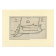
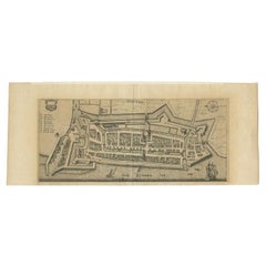
Antique Map of the City of Stavoren by Merian, 1659
Located in Langweer, NL
Antique map titled 'Staveren'. Original antique map of the city of Stavoren, Friesland, the Netherlands. This map originates from 'Topographia Germania Inferioris' by C. Merian. Publ...
Category
Antique 17th Century Maps
Materials
Paper
$147 Sale Price
20% Off
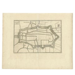
Antique Map of the City of Alkmaar by Merian, 1659
Located in Langweer, NL
Antique map titled 'Alckmaer'. This print depicts the city of Alkmaar (The Netherlands). This print originates from 'Topographia Germaniae Inferioris (..)' by C. Merian. Artists and ...
Category
Antique 17th Century Maps
Materials
Paper
$94 Sale Price
20% Off
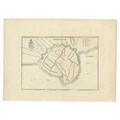
Antique Map of the City of Enkhuizen by Merian, 1659
Located in Langweer, NL
Antique map titled 'Enckhuysen'. This print depicts the city of Enkhuizen, the Netherlands. This print originates from 'Topographia Germaniae Inferioris (..)' by C. Merian. Artists a...
Category
Antique 17th Century Maps
Materials
Paper
$116 Sale Price
20% Off
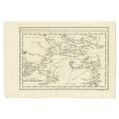
Antique Map of the Bukhari and Surroundings by Bellin, 1749
Located in Langweer, NL
Antique map titled 'Carte de la Petite Bukharie et Pays Voisins'. Old map of the Bukhari (Sinkiang in north-western China) and neighboring countries. Artists and Engravers: Jacques-N...
Category
Antique 18th Century Maps
Materials
Paper
$133 Sale Price
20% Off
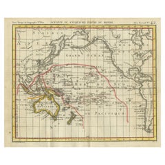
Antique Map of Oceania by Hérisson, 1816
Located in Langweer, NL
Antique map titled "Océanie ou cinquième partie du monde". This is an original antique map of Oceania, the 5th continent, by Herisson taken from atlas "Nouv. Abrége de Géographie". A...
Category
Antique 19th Century Maps
Materials
Paper
$121 Sale Price
20% Off
Antique Map of Stavoren by Merian, c.1650
Located in Langweer, NL
Antique map titled 'Stavera'. Map of the city of Stavoren, Friesland. With German legend. Trimmed, originally published on one sheet with a map of Bolsward and Hindeloopen. Artists a...
Category
Antique 17th Century Maps
Materials
Paper
$133 Sale Price
20% Off
Antique Map of the Banda Islands by Commelin, 1646
Located in Langweer, NL
Plate 15: 'Afteeckeninge van 't Eyland Banda.' Depiction of the Banda Islands, Indonesia. Rare. This attrative plate originates from: 'Title: Waerachtigh verhael van de Schipvaerd op Oost-Indien Ghedaen by de acht Schepen in den jare 1598. van Amsterdam uyt-gezeylt, onder 't beleyd van den Admirael Jacob Cornelissoon van Neck...
Category
Antique 17th Century Maps
Materials
Paper
$335 Sale Price
20% Off
Large Copper Engraved Map of the Coastline of Friesland and Terschelling, c.1670
Located in Langweer, NL
Antique print, titled: 'Dominii Frisiae Tabula, inter Flevum et Lavicum (…)'
This large copper engraved map details the coastline of Friesland and Terschelling. At east is a part...
Category
Antique 1670s Maps
Materials
Paper
$846 Sale Price
20% Off
Antique Map of the Islands in the Pacific Ocean by Wyld, '1845'
Located in Langweer, NL
Antique map titled 'Islands in the Pacific Ocean'. Original antique map of the islands in the Pacific Ocean. This map originates from 'An Atlas of the World, Comprehending Separate M...
Category
Antique Mid-19th Century Maps
Materials
Paper
$190 Sale Price
20% Off
Antique Print of the Ob River and Villages in Siberia, Russia, 1768
Located in Langweer, NL
Antique print titled 'Vue de Schorskarskoi - Pogost (..)'. Copper engraving of the Ob river and villages in Siberia. This print originates from volume 18 of 'Histoire generale des vo...
Category
Antique 18th Century Prints
Materials
Paper
$209 Sale Price
20% Off
Antique Map of the Menaldumadeel Township 'Friesland' by Halma, 1718
Located in Langweer, NL
Antique map Friesland titled 'Menalduma Deel Wesentlyk vertoont (..)'. Old map of Friesland, the Netherlands. This map depicts the region of Menaldumadeel and includes cities and vil...
Category
Antique 18th Century Maps
Materials
Paper
$313 Sale Price
20% Off
Antique Map of the Holy Land by Van Luchtenburg, c.1720
Located in Langweer, NL
Antique map titled 'Heylige Land verdeeld in de Twaalf Stammen Israels (..).' Highly detailed map of the Holy Land divided into 12 tribes of Israel...
Category
Antique 18th Century Maps
Materials
Paper
$133 Sale Price
20% Off
Antique Map of Oostergo by Tirion, 1744
Located in Langweer, NL
Antique map titled 'Oostergo'. Original antique map of Oostergo, part of the province of Friesland, the Netherlands. Published 1744. Artists and Engravers: Isaak Tirion (1705 in Utre...
Category
Antique 18th Century Maps
Materials
Paper
$179 Sale Price
20% Off
Tomb of King Edward IV – Engraving of Vault & Effigy, St George’s Chapel, 1790
Located in Langweer, NL
Tomb of King Edward IV – Engraving of Vault & Effigy, St George’s Chapel, 1790
This rare and atmospheric antique engraving captures the tomb and burial vaul...
Category
Antique 18th Century English Prints
Materials
Paper
$185 Sale Price
20% Off
Pl. 33 Antique Chart of the US Wealth Distribution in 1870 '1874'
Located in Langweer, NL
Antique chart titled 'Map showing the distribution of wealth. Compiled from the tables of "true valuation," ninth census of the United States, 1870'. Chart of the US wealth distribut...
Category
Antique Late 19th Century Maps
Materials
Paper
$475 Sale Price
20% Off
La Brique Architectural Print – Atelier de Peintre Façade by Simonet, c.1900
Located in Langweer, NL
La Brique Architectural Print – Atelier de Peintre Façade by Simonet, c.1900
This antique architectural print features a richly detailed elevation of a painter’s studio (Atelier de ...
Category
20th Century French Prints
Materials
Paper
$104 Sale Price
20% Off
Print of the Bridge of Painshill & Windsor Park, Belfast, Northern Ireland, 1785
Located in Langweer, NL
Antique print titled 'Pont de Painshill á M. Hamilton (..)'.
Copper engraving of the bridge of Painshill and Windsor Park. This print originates from 'Jardins Anglo-Chinois à la ...
Category
Antique 18th Century Prints
Materials
Paper
$370 Sale Price
20% Off
Antique Map of Austria by Lowry, 1852
Located in Langweer, NL
Antique map titled 'Austria'. Original map of Austria. This map originates from 'Lowry's Table Atlas constructed and engraved from the most recent Autho...
Category
Antique Mid-19th Century Maps
Materials
Paper
$95 Sale Price
20% Off
Antique Map of Oceania by Johnston, 1882
Located in Langweer, NL
Antique map titled 'Oceania'. Old map of Oceania with inset maps of Western Australia, Tasmania and New Zealand. This map originates from 'The Royal Atlas of Modern Geography, Exhibi...
Category
Antique 19th Century Maps
Materials
Paper
$123 Sale Price
20% Off
Original French Antique Map of the Russian Empire, 1837
Located in Langweer, NL
Antique map titled 'Tableau Historique et Géographique de L'Empire de Russie'.
Original antique map of the Russian Empire will detailed written information about the chronology, ...
Category
Antique 1830s Maps
Materials
Paper
$275 Sale Price
20% Off
Pl. XIV Remise De Locomotives, Chabat, c.1900
Located in Langweer, NL
Antique print titled 'Remise de Locomotives'. This print depicts the design of locomotives and a station. Originates from 'La Brique et La Terre Cuite' by P. Chabat. Artists and Engr...
Category
20th Century Prints
Materials
Paper
$109 Sale Price
20% Off
Antique Print of a Chair and Footstool by Gibb, 1890
Located in Langweer, NL
Antique print titled 'Chair and Footstool'. Chromolithographic plate originating from 'The Royal House of Stuart. Illustrated by a Series of Forty Plates in Colours Drawn from Relics...
Category
Antique 19th Century Prints
Materials
Paper
$80 Sale Price
20% Off
View of the Island of Tahiti, with Outrigger Canoes and Sailing Catamarans, 1803
Located in Langweer, NL
Antique print Polynesia titled 'Gezigt van het eiland Otahiti op den afstand van eene zee-mijl in het Z.O'.
View of the island of Tahiti, with outrigger canoes...
Category
Antique Early 1800s Prints
Materials
Paper
$627 Sale Price
20% Off
Two Antique Sea Charts of the Thousand Islands between Batavia and Bantam, c1734
Located in Langweer, NL
Antique maps titled 'A large draught of the Coast of Iava from Bantam Point to Batavia'. Two seperate sheets, joined together they depict the island of Java, Indonesia.
Condition...
Category
Antique 1730s Maps
Materials
Paper
$1,568 Sale Price / set
20% Off
Old Original Copper Engraving Depicting a Viceroy with Entourage in China, 1735
Located in Langweer, NL
Original handtinted copper engraving with title: 'Cortege d'un Viceroy tout les fois qu'il sort de son palais'.
Translate in English: 'Procession of a Viceroy whenever he leaves h...
Category
Antique 1730s Prints
Materials
Paper
$342 Sale Price
20% Off
Rare Antique Print of Garden Architecture by Van Laar, 1802
Located in Langweer, NL
Untitled print of garden architecture. It shows garden buildings and garden gates/fences. This print originates from 'Magazijn van tuin-sieraden'. ...
Category
Antique 19th Century Prints
Materials
Paper
$133 Sale Price
20% Off
Antique Map of the Hainaut Region by Visscher, c.1690
By Nicolaes Visscher II
Located in Langweer, NL
Antique map titled 'Comitatus Hannoniae et Archiepiscopatus Cameracensis Tabula'. Large map of the Hainaut region, France.
Artists and Engravers: Nicolaes Visscher II (1649, Amst...
Category
Antique 17th Century Maps
Materials
Paper
$308 Sale Price
20% Off
Antique Map of Switzerland by Cluver, 1685
Located in Langweer, NL
Antique map titled 'Helvetiae Conterminarumque Terrarii, antiqua descriptio.' Miniature map of Switzerland, from the pocket atlas 'Introductionis in...
Category
Antique 17th Century Maps
Materials
Paper
$109 Sale Price
20% Off
Antique Map of the Russian Empire in Europe by Vaugondy, 1750
Located in Langweer, NL
Antique map titled 'Partie Occidentale de l'Empire de Russie (..)'. Detailed map of the western part of Russia, extending south to the Caspian and east to Irkurkoy and Ilimskoy.
A...
Category
Antique 18th Century Maps
Materials
Paper
$323 Sale Price
20% Off
Antique Map of the Region of Luik by Veelwaard, c.1840
Located in Langweer, NL
Antique map titled 'Kaart van Luik'. Original antique map of the region of Luik (Liege), Belgium. Source unkown, to be determined. Published circa 1840.
Artists and Engravers: E...
Category
Antique 19th Century Maps
Materials
Paper
$118 Sale Price
20% Off
Antique Print of Water Fountains in Paris by Perelle, c.1660
Located in Langweer, NL
Antique print titled 'Fontaine de la Ruë St. Louis au Marais - Fontaine de la Porte St. Germain - Fontaine St. Ovide'. Elevations of water fountains in Paris, France. Source unknown,...
Category
Antique 17th Century Prints
Materials
Paper
$104 Sale Price
20% Off
Antique Map of Estates of The Year 1669 in Amsterdam, Published c.1767
Located in Langweer, NL
Antique map titled 'Kaart der Landerijen, gelegen aan of onder de rooyinge der honderd gaarden (..)'. Map showing estates in Amsterdam in 1669. Published by Yntema and Tieboel, 1767....
Category
Antique 18th Century Maps
Materials
Paper
$332 Sale Price
20% Off
Regional Antique Map of the Baltic, Extending from Stralsund to Dantzig, ca.1720
Located in Langweer, NL
Antique map titled 'Ducatus Pomeraniae (..)'. Regional map of the Baltic, extending from Stralsund and Rugia in the west to Dantzig and Culman on the Vistula in the east. Large carto...
Category
Antique 1720s Maps
Materials
Paper
$846 Sale Price
20% Off
Antique Map of the Netherlands and Belgium by Hérisson, 1829
Located in Langweer, NL
Title: 'Carte Routière du Royaume des Pays-Bas comprenant la Hollande et la Belgique'
**Publisher**: Eustache Hérisson
**Publication Year**: 1829
This original antique map is a detailed depiction of the Netherlands and Belgium, dating back to 1829. As a 'Carte Routière', it focuses on the road networks of the region, providing valuable historical insights into the transportation and geographical understanding of the early 19th century. The map's delineation of the Kingdom of the Netherlands, including both Holland and Belgium, is particularly noteworthy as it represents the political geography of the period shortly before Belgium's independence in 1830.
The map is sectionalised and laid on linen, a common practice in the 19th century for preserving and reinforcing maps, making them more durable and portable. This method of mounting also suggests that the map was intended for practical use, possibly by travelers or for educational purposes.
**Artist and Publisher**: Eustache Hérisson, the publisher of this map, was a known figure in the cartographic and publishing world of the early 19th century. His work is characterized by attention to detail and accuracy, making this map not only a beautiful piece of art but also a reliable historical document.
This map is a valuable historical artifact, offering insights into the geographical and political landscape of the Netherlands...
Category
Antique Mid-19th Century Maps
Materials
Paper
$712 Sale Price
20% Off
Copper Engraving with a View on the Volga River in Russia, 1714
Located in Langweer, NL
Antique print titled 'Gezicht op de Rivier'.
Copper engraving with a view on the Volga river. This print originates from 'Reizen over Moskovie, door Persie en Indie (..)' by C. d...
Category
Antique 1710s Maps
Materials
Paper
$180 Sale Price
20% Off
Antique Map of the Region of Salzburg by Ortelius 'circa 1606'
Located in Langweer, NL
Antique map titled 'Salisburgensis Iurisdictionis'. Original antique map of the region of Salzburg, Austria. Published by A. Ortelius, circa 1606.
Category
Antique Early 17th Century Maps
Materials
Paper
$712 Sale Price
20% Off
Original Hand-Coloured Nautical Chart of West-Africa, c.1680
Located in Langweer, NL
NIEUWE PASKAERT VAN DE KUST VAN GENEHOA (Senegal) alsmede een gedeelte van Gambia beginnende an C. Blanco tot C. Verde (...). Amsterdam, Johannus van Keulen, c. 1680.
Large folio...
Category
Antique 17th Century Maps
Materials
Paper
$1,378 Sale Price
20% Off
Antique Map of Piedmonte and Savoie 'Italy' by N. Visscher, circa 1683
Located in Langweer, NL
Antique map titled 'Regiae Celsitudinis Sabaudicae Status consistens in Sabaudiae ac Montisferrati Ducatus, Pedemontii Principatum (..). This map originates from 'Atlas Minor Sive Ge...
Category
Antique Late 17th Century Dutch Maps
Materials
Paper
$589 Sale Price
20% Off
Antique Map of Spain and Part of Africa by Kiepert, C.1870
Located in Langweer, NL
"Antique map titled 'Hispania Mauretania et Africa'. Old map of Spain, also depicting part of Africa. This map originates from 'Atlas Antiquus, twaalf kaarten behoorende bij de Oude ...
Category
Antique 19th Century Maps
Materials
Paper
$118 Sale Price
20% Off
Antique Map of the Vermandois Region by Janssonius, circa 1650
By Johannes Janssonius
Located in Langweer, NL
Antique map titled 'Vermandois'. Old map of the Vermandois region, France. Vermandois was a French County that appeared in the Merovingian period. Its na...
Category
Antique Mid-17th Century Maps
Materials
Paper
$427 Sale Price
20% Off
Antique City View and Map of IJlst, City in Friesland, Holland, Framed, 1664
Located in Langweer, NL
Antique map titled 'Ylst'. Old map and city view of the city of IJlst, Friesland. This map originates from 'Beschrijvinge van de Heerlyckheydt van Frieslandt' by B. Schotanus à Sterr...
Category
Antique 17th Century Maps
Materials
Paper
$475 Sale Price
20% Off
Set of 2 Costume Prints and a Map of Spain and Portugal, circa 1720
Located in Langweer, NL
Set of two costume prints and a map of Spain and Portugal. The costume prints show costumes of Portugal and Spain and originate from Nouvelle méthode pour apprendre la géographie uni...
Category
Antique Early 18th Century Maps
Materials
Paper
$427 Sale Price
20% Off
Antique Map of Northamptonshire by Speed, 1676
Located in Langweer, NL
Antique map titled 'Norhamtonshire'. Map of Norhamptonshire, England. Includes inset town plans of Peterborough and Northampton. This map originates from 'Theatre of Great Britaine' ...
Category
Antique 17th Century Maps
Materials
Paper
$522 Sale Price
20% Off
Engraving of an Orang-Utan on Borneo 'Kalimantan' or Sumatra, Indonesia, 1739
Located in Langweer, NL
Antique print titled 'Orang-Oetang of Bosch-mensch'. This print depicts an Orang-Utan on Borneo or Sumatra, Indonesia. Originates from 'Hedendaagsche Historie, of tegenwoordige staat...
Category
Antique 1730s Prints
Materials
Paper
$133 Sale Price
20% Off
Sea Chart Titled 'Baya de Saldanha' with Robben Island in South Africa, 1726
Located in Langweer, NL
Antique map titled 'Baya de Saldanha'.
Sea chart covering the South African coast from the Cape of Good Hope to Saldanha Bay. This print originates from 'Oud en Nieuw Oost-Indiën...
Category
Antique 1720s Maps
Materials
Paper
$1,064 Sale Price
20% Off
Antique Map of the Atlantic Islands, 1817
Located in Langweer, NL
Antique map titled 'Atlantic Islands'. Large map of the Atlantic Islands include the Cape Verde islands, Canary islands, Azore islands and Madeira islands. Also included a view of th...
Category
Antique Early 19th Century Maps
Materials
Paper
$427 Sale Price
20% Off
Antique Map of the East Indies by Walker, c.1840
Located in Langweer, NL
Original antique map of the East Indies including Borneo, Celebes, Java, Sumatra and surrounding islands. Published circa 1840.
Artists and Engravers: Engraved by J. & C. Walker
...
Category
Antique 19th Century Maps
Materials
Paper
$228 Sale Price
20% Off
Antique Map of ancient France by Zannoni, 1765
Located in Langweer, NL
Antique map France titled 'Galliae Veteris (..)'. Beautiful old map of France. This map originates from 'Atlas Historique de la France Ancienne et Moderne' ...
Category
Antique 18th Century Maps
Materials
Paper
$304 Sale Price
20% Off
Antique Map of South America by Petri, c.1873
By Thomas Kitchin
Located in Langweer, NL
Antique map titled 'Zuid-Amerika'. Old map depicting South America, with an inset map of the highland of Quito. This map originates from 'School-Atlas van alle Deelen der Aarde'. Art...
Category
Antique 19th Century Maps
Materials
Paper
$118 Sale Price
20% Off
Antique Map of the Upper and Lower Rhine by Cary '1811'
By John Cary
Located in Langweer, NL
Antique map titled 'A New Map of the Circles of the Upper and Lower Rhine'. Antique map covering an area from Westphalia and Lower Saxony in the north to France and Swabia in the south.
Category
Antique Early 19th Century Maps
Materials
Paper
$237 Sale Price
20% Off
Antique Map of the Region of Blois by Janssonius, 'circa 1640'
By Johannes Janssonius
Located in Langweer, NL
Antique map titled 'Description du Blaisois'. Old map of the region of Blois, France. It shows the city of Blois, Amboise, the Loire River and more. Published by J. Janssonius, circa...
Category
Antique Mid-17th Century Maps
Materials
Paper
$386 Sale Price
35% Off
Antique Print of the South-East Facade of the Mansion at Kirtlington Park, c1770
Located in Langweer, NL
Antique print titled 'South East Front of Kirtlington Park (..)'.
View of the south-east facade of the mansion at Kirtlington Park, Oxfordshire. This print originates from 'Vitru...
Category
Antique 18th Century Prints
Materials
Paper
$532 Sale Price
20% Off
Antique Print of the Pass of Pancorbo in Spain, 1840
Located in Langweer, NL
Antique print titled 'Der Pass von Pancorvo in Spanien'. View of the Pass of Pancorbo, Spain. Originates from 'Meyers Universum'.
The Battle of Pancorbo was a battle that took pl...
Category
Antique 19th Century Prints
Materials
Paper
$114 Sale Price
20% Off
Antique Map of the Bay of Chin Chew by Child, 1747
Located in Langweer, NL
Antique map titled 'A Chart of the Bay of Chin-Chew or Chang-Chew in China'. Small but very early and interesting map, engraved by G. Child for 'The Universal Traveller', by Thomas S...
Category
Antique 18th Century Maps
Materials
Paper
$161 Sale Price
20% Off
Antique Map of the Maluku Islands by Van der Aa, 1725
By Pieter Van Der Aa
Located in Langweer, NL
Antique map titled 'Les Iles Moluques (..).' (The Moluccan Islands, Maluku, Moluccas, Spice Islands, Indonesia.) Extremely rare in this edition. This plate originates from the very s...
Category
Antique 18th Century Maps
Materials
Paper
$250 Sale Price
20% Off
Antique Map of the Sanaga River, Senegal, 1747
Located in Langweer, NL
Antique map titled 'Cours De La Riviere De Sanaga Ou Senegal (..) - Kaart van den Loop der Riviere Sanaga (..)'. Attractive double map of the Sanaga River, Senegal, Africa. This map ...
Category
Antique 18th Century Maps
Materials
Paper
$323 Sale Price
20% Off
Antique Map of Friesland at a Time the Franks Left and Saxons Came, 1718
Located in Langweer, NL
Antique map Friesland titled 'Summaria descriptio Fresiae Universae (..)'.
Old map of Friesland, the Netherlands. Depicts the general delineation of Friesland during its widest s...
Category
Antique 18th Century Maps
Materials
Paper
$342 Sale Price
20% Off
Antique Map of Oostergo, Friesland by Tirion, 1785
Located in Langweer, NL
Antique map Friesland titled 'Oostergo'. Antique map of part of Friesland depicting the 'Oostergo' region. Decorative titled cartouche with horse and plough. Originates from 'Tegenwo...
Category
Antique 18th Century Maps
Materials
Paper
$185 Sale Price
20% Off
Engraved Map of Northern England, Focusing on Northumberland, 1658
Located in Langweer, NL
Antique map titled 'Ancien Royaume de Northumberland, aujourdhuy Provinces de Nort (..)'.
Engraved map of northern England, focusing on Northumber...
Category
Antique 1650s Maps
Materials
Paper
$418 Sale Price
20% Off
Antique Map of the Harbour of Samganoodha by Cook, c.1781
Located in Langweer, NL
Antique map titled 'Sketch of the Harbour of Samganooda (..)'. Antique map of the Harbour of Samganoodha, Oonalaska, North America. Originates from an edition of Cook's Voyages.
Art...
Category
Antique 18th Century Maps
Materials
Paper
$132 Sale Price
20% Off
Recently Viewed
View AllMore Ways To Browse
Statutes And Sculptures
Swedish Gustavian Glass Cabinet
Swiss Chalet Chairs
Tea Cup Art Nouveau
Tea Cup Holder
Teak Buddha
Teak Gentlemans
Thomasville Hollywood Regency
Thomire Clock
Three Legged Vessel
Three Tier Serving Trays
Tibet Earring
Tibetan Antique Cabinet
Tiffany And Co China
Tiffany Blue Rims
Tiffany Sterling Ice Tea Spoons
Torchiere Sculpture
Tortoise Christian Dior
