Maps on Sale
to
4,213
18
4,236
1
3
2
2
1
1
1
1
2,336
1,669
231
1
129
12
1
66
1
3
4
2
4,227
10
8
7
7
127
35
32
29
27
4,237
4,237
4,237
104
56
18
13
11
Sale Items
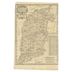
Antique Map of the Shanxi Province of China by Du Halde, 1738
Located in Langweer, NL
Antique map titled 'Province IX Shan-Si'. Old map depicting the Shanxi province of China. Originates from 'A description of the Empire of China and Chinese-Tartary' by J.B. du Halde....
Category
Antique 18th Century Maps
Materials
Paper
$323 Sale Price
20% Off
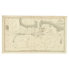
Antique Map of the Northern Coast of Tongatapu by Benard, c.1785
Located in Langweer, NL
Antique map titled 'Plan du Havre de Tongataboo'. Original antique map of Tongapatu's northern coast. This map originates from 'A New, Authentic and Complete Collection of Voyages Ro...
Category
Antique 18th Century Maps
Materials
Paper
$118 Sale Price
20% Off
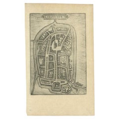
Antique Map of the City of Franeker by Guicciardini, 1613
Located in Langweer, NL
Antique map titled 'Franicher'. Plan of the city of Franeker, Friesland, the Netherlands. This map originates from the 1613 edition of 'Discrittione di tutti i Paesi Bassi', by L. Gu...
Category
Antique 17th Century Maps
Materials
Paper
$114 Sale Price
20% Off
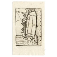
Antique Map of Stavoren by Coronelli, 1706
Located in Langweer, NL
Antique map titled 'Staveren'. Rare antique map of the city of Stavoren, Friesland, the Netherlands. This map originates from 'Teatro della Guerra' by P. Coronelli, 1706. Artists and...
Category
Antique 18th Century Maps
Materials
Paper
$107 Sale Price
20% Off
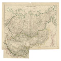
Antique Map of Northern Asia by Arrowsmith, 1834
Located in Langweer, NL
Antique map titled 'Northern Asia, from the Himalaya Mountains to the Arctic Ocean'. Large and detailed map of Northern Asia, taking in Mongolia, Tibet, Bhutan, Tartary, Siberia and ...
Category
Antique 19th Century Maps
Materials
Paper
$247 Sale Price
20% Off
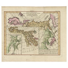
Map of North and East coast of Asia with Japan & inset maps of Kamchatka, c1750
Located in Langweer, NL
Antique map titled 'Nouvelle representation des Cotes Nord et Est de L'Asie.'
Map the north and east coast of Asia, showing an oddly shaped Japan and inset maps of Kamchatka. Thi...
Category
Antique 1750s Maps
Materials
Paper
$902 Sale Price
20% Off
Antique Print of the Waterfalls of Exton Park, England, c.1785
Located in Langweer, NL
Antique print titled 'Cascades du Parc d'Exton (..)'.
Copper engraving showing the waterfalls of Exton park. This print originates from 'Jardins Anglo-Chinois à la Mode' by Georg...
Category
Antique 18th Century Prints
Materials
Paper
$323 Sale Price
20% Off
Antique Map of Southern Italy by Janssonius, C.1650
Located in Langweer, NL
"Antique map titled 'Itala nam tellus Graecia Maior erat Ovid. IV. Fastor. Haec Italiae pars nunc primum de prica aerugine est abstersa (..)'. Beautiful map of Southern Italy...
Category
Antique 17th Century Maps
Materials
Paper
$703 Sale Price
20% Off
Detailed Original Antique Map of the Russian Empire in Asia, 1750
Located in Langweer, NL
Antique map titled 'Partie Orientale de l'Empire de Russie en Asie (..)'.
Detailed map of the Russian Empire in Asia.
Artists and Engravers: Gilles Robert de Vaugondy (1688-1766) was the head of a leading family of geographers in eighteenth century France. Gilles got his start when he jointly inherited the shop of Pierre-Moullart Sanson, grandson of the famous geographer Nicholas Sanson. The inheritance included the business, its stock of plates, and a roller press...
Category
Antique 1750s Maps
Materials
Paper
$560 Sale Price
20% Off
Decorative Antique Print of Fully Uniformed Generals of the Belgium Army, 1833
Located in Langweer, NL
One nicely hand coloured print of an original serie of 23 plates, showing generals discussing matters. published in 1833. Rare.
From a serie of beautiful lithographed plates with Belgian military costumes after Madou and printed by Dero-Becker. Comes from a Belgian military costume album, dedicated to the Belgian King, and financed by subscribers, some 90 Belgian nobility and officers of the Belgian Army...
Category
Antique 1830s Arms, Armor and Weapons
Materials
Paper
$323 Sale Price
20% Off
Two Maps of Asia on One Sheet, India, Bangladesh and Malaysia & Burma etc., 1617
Located in Langweer, NL
Antique map titled 'Tabula Asiae'.
Two maps of Asia on one sheet, recto and verso. The recto features an interesting map of India, Bangladesh and the Ganges River. On the verso, ...
Category
Antique 1610s Maps
Materials
Paper
$608 Sale Price
20% Off
Rare Hand-Colored Print of a Belgium Army Regiment Near a Windmill, 1833
Located in Langweer, NL
One nicely hand coloured print of an original serie of 23 plates, showing officers and soldiers resting. published in 1833. Rare.
From a serie of beautiful lithographed plates with Belgian military...
Category
Antique 1830s Arms, Armor and Weapons
Materials
Paper
$304 Sale Price
20% Off
Antique Map of New South Wales and Victoria by W. G. Blackie, 1859
Located in Langweer, NL
Antique map titled 'New South Wales and Victoria'. Original antique map of New South Wales and Victoria. This map originates from ‘The Imperial Atlas of Modern Geography’. Published ...
Category
Antique Mid-19th Century Maps
Materials
Paper
$237 Sale Price
20% Off
Antique Print of Elements of Stowe Park, Stowe, Buckinghamshire, England, c.1785
Located in Langweer, NL
Antique print titled 'Stowe - L'Arc Corinthien - Obelisque du Général Wolfe (..)'.
Copper engraving showing several elements of Stowe Park, Buckingha...
Category
Antique 18th Century Prints
Materials
Paper
$361 Sale Price
20% Off
Antique Map of Southeast Asia by Chatelain, c.1732
Located in Langweer, NL
"Antique map titled 'La Royaume de Siam avec les Royaumes qui luy sont Tributaires et les Isles de Sumatra Andemaon'. It shows: Southeast Asia; Borneo, Java, Siam (Thailand), Malacca...
Category
Antique 18th Century Maps
Materials
Paper
$736 Sale Price
20% Off
Antique Map of France by A & C. Black, 1870
Located in Langweer, NL
Antique map titled 'France'. Original antique map of France with inset map of France as divided into provinces, before the revolution of 1789 and map of Corsica...
Category
Antique Late 19th Century Maps
Materials
Paper
$261 Sale Price
20% Off
Antique Map of the Region of Oranjewoud by Kuyper, 1868
Located in Langweer, NL
Antique map titled 'Provincie Friesland - Gemeente Schoterland (Oranjewoud)'. Map of the township of Schoterland with a focus on the region of Oranjewoud. This map originates from 'G...
Category
Antique 19th Century Maps
Materials
Paper
$109 Sale Price
20% Off
Antique Map of the City of Coevorden by Blaeu, 1649
Located in Langweer, NL
Antique map titled 'Coeverden'. Original map of the city of Coevorden, the Netherlands. This map originates from 'Novum Ac Magnum Theatrum Urbium Belgicae Liberae Ac Foederatae' publ...
Category
Antique 17th Century Maps
Materials
Paper
$215 Sale Price
20% Off
Antique Map of the Region of Osaka and Hirado Island in Japan, 1725
By Pieter Van Der Aa
Located in Langweer, NL
Antique map titled 'Description exacte et fidele des villes, bourgs et villages qui les Ambassadeurs de Hollande ont rencontrez dans leur voyage par terre de la ville Osacca jusqu'a ...
Category
Antique 18th Century Maps
Materials
Paper
$1,259 Sale Price
20% Off
Antique Map of South America by Tyrer, 1821
By Thomas Kitchin
Located in Langweer, NL
Antique map titled 'South America'. Beautiful antique map of South America engraved by Tyrer. Artists and Engravers: Published by J. Soute...
Category
Antique 19th Century Maps
Materials
Paper
$121 Sale Price
20% Off
Antique Map of the City of Muiden by Merian, 1659
Located in Langweer, NL
Antique map titled 'Muyden'. Original antique map of the city of Muiden, the Netherlands. This map originates from 'Topographia Germania Inferioris' by C. Merian. Published 1659.
...
Category
Antique 17th Century Maps
Materials
Paper
$147 Sale Price
20% Off
Antique Print of Various Mirrors, C.1700
Located in Langweer, NL
Antique print titled 'Spiegel und Wand Leuchter vor Bildhauer und Goldtschmidt'. This print shows decorative mirrors/wall decoration. Artists and Engravers: Made after P. Decker.
...
Category
Antique 18th Century Prints
Materials
Paper
$101 Sale Price
20% Off
Antique Map of the Beaujolais Region by Homann Heirs, 1762
Located in Langweer, NL
Antique map titled 'La Generalite Proprie Taire De Lyon (..) - Propriae Lugudunensis Generalitatis (..)'. Detailed regional map of the Beaujolais region including the cities of Lyon,...
Category
Antique 18th Century Maps
Materials
Paper
$299 Sale Price
20% Off
Antique Colourful and Decorative County Map of Bedfordshire, England, 1804
Located in Langweer, NL
Antique county map of Bedfordshire first published c.1800. Villages, towns, and cities illustrated include Bedford, Todington, and Potton.
Charl...
Category
Antique Early 1800s Maps
Materials
Paper
$308 Sale Price
20% Off
Antique Map of Sneek by Kuyper, 1868
Located in Langweer, NL
Antique map titled 'Provincie Friesland - Gemeente Sneek'. Map of the township of Sneek, Friesland. This map originates from 'Gemeente-Atlas van Nederland' by J. Kuyper. Artists and ...
Category
Antique 19th Century Maps
Materials
Paper
$120 Sale Price
20% Off
Antique Map of Stavoren by Blaeu, 1649
Located in Langweer, NL
Antique map titled 'Staveren'. Original antique map of the city of Stavoren, Friesland, The Netherlands. This map originates from 'Novum Ac Magnum Theatrum Urbium Belgicae Liberae Ac...
Category
Antique 17th Century Maps
Materials
Paper
$443 Sale Price
20% Off
Map of Region Near the Baltic Sea, Present Day Bulgaria, Romania & Turkey, c1670
Located in Langweer, NL
Antique map titled 'Illyricum Orientis: In quo Partes II Moesia et Thracia'.
Engraved map of the area west of the Baltic Sea, present day Bulgaria, Romania, and Turkey. The map i...
Category
Antique 1670s Maps
Materials
Paper
$1,283 Sale Price
20% Off
Antique Map of Northern Scotland by Johnston, 1882
Located in Langweer, NL
Antique map titled 'Scotland'. Old map of Northern Scotland. This map originates from 'The Royal Atlas of Modern Geography, Exhibiting, in a Series of Entirely Original and Authentic...
Category
Antique 19th Century Maps
Materials
Paper
$99 Sale Price
20% Off
Antique Map of Sloten, IJlst, Workum & Hindeloopen by Blaeu, 1652
Located in Langweer, NL
Antique map titled: 'Sloten - Ylst - Worcum - Hinloopen.' - Three plans and a bird's eye view on one sheet. The plans show the Frisian cities Sloten, IJlst, Workum and the view shows...
Category
Antique 17th Century Maps
Materials
Paper
$494 Sale Price
20% Off
Antique Map of Brabant 'The Netherlands' by N. Visscher, circa 1690
Located in Langweer, NL
Antique map titled 'Brabantiae Batavae pars orientalis, comprehendens Tetrarchiam sive majoratum sylvaeducensem in ejusdem subjacentes ditiones (..)'. Map of the Dutch province 'Brab...
Category
Antique Mid-18th Century Maps
Materials
Paper
$570 Sale Price
20% Off
Antique Map of the Region of Guyenne by Janssonius, 1657
By Johannes Janssonius
Located in Langweer, NL
Antique map of France titled 'Description du Guienne'. Decorative map of Guyenne region. Guyenne or Guienne was an old French province which corresponded roughly to the Roman provinc...
Category
Antique 17th Century Maps
Materials
Paper
$340 Sale Price
20% Off
Antique Chart of the Pacific Coast '1874'
Located in Langweer, NL
Antique chart titled 'Maps of the Pacific Coast exhibiting various subjects. Compiled from the statistics of the eight and ninth census of the United Sta...
Category
Antique Late 19th Century Maps
Materials
Paper
$475 Sale Price
20% Off
Antique Map of the East Indies by Dornseiffen, 1900
Located in Langweer, NL
Title page of 'Atlas van Nederlandsch Oost- en West-Indië' by I. Dornseiffen. It shows the regions of the various maps included in this atlas. Included are the Dutch East Indies and ...
Category
20th Century Maps
Materials
Paper
$133 Sale Price
20% Off
Antique Map of the City of Leeuwarden by Guicciardini, 1613
Located in Langweer, NL
Antique map tited 'Lewardum'. Plan of the city of Leeuwarden, Friesland, the Netherlands. This map originates from the 1613 edition of 'Discrittione di tutti i Paesi Bassi', by L. Gu...
Category
Antique 17th Century Maps
Materials
Paper
$135 Sale Price
20% Off
Antique Map of Sweden and Norway by Russell, 1814
Located in Langweer, NL
Antique map Scandinavia titled 'Sweden & Norway'. Antique map of Scandinavia with a focus on Sweden and Norway. Artists and Engravers: Engrave...
Category
Antique 19th Century Maps
Materials
Paper
$85 Sale Price
20% Off
Antique Map of England and Ireland by Lattre, 1789
Located in Langweer, NL
Antique map titled 'Les Royaumes d'Angleterre d'Ecosse et d'Irlande'. Original antique map of England and Ireland. Originates from 'Petit Atlas ...
Category
Antique 18th Century Maps
Materials
Paper
$166 Sale Price
20% Off
Antique Map of the Circle of Bavaria by Homann, c.1703
Located in Langweer, NL
Antique map titled 'Bavariae circulus et electorat (..)'. Map of the Circle of Bavaria, Germany. Extends from Bamberg to Innsbruck. Artists and Engravers: Johann Baptist Homann (1663...
Category
Antique 18th Century Maps
Materials
Paper
$304 Sale Price
20% Off
Antique Map of Friesland with Elaborate Cartouche by Mapmaker Ortelius, c.1570
Located in Langweer, NL
Antique map titled 'Oost end West Vrieslandts beschrijvinghe. Utriusque Frisiorum Regionis Noviss: Descriptio. 1568.' Detailed map of Friesland, the Netherlands. Includes a larger co...
Category
Antique 16th Century Maps
Materials
Paper
$902 Sale Price
20% Off
Antique Map of Canada, New Brunswick and Nova Scotia by Lowry, 1852
Located in Langweer, NL
Antique map titled 'Canada, New Brunswick & Nova Scotia'. Two individual sheets of Canada, New Brunswick and Nova Scotia. This map originates from 'Lowry...
Category
Antique Mid-19th Century Maps
Materials
Paper
$190 Sale Price / set
20% Off
Antique Map of Taluti Bay by Stemler, C.1875
Located in Langweer, NL
Antique map titled 'Kaart der Teloeti Baai op Ceram.' This scarce map shows the Taluti Bay on the Moluccan island of Ceram. Originates from 'Tijdschrift Aardrijkskundig Genootschap',...
Category
Antique 19th Century Maps
Materials
Paper
$116 Sale Price
20% Off
Antique Map of the Ancient British Isles by Janssonius 'circa 1640'
Located in Langweer, NL
Antique map titled 'Insularum Britannicarum Acurata Delineatio'. Original antique map of the ancient British Isles. England and Wales are labelled as B...
Category
Antique Mid-17th Century Maps
Materials
Paper
$902 Sale Price
20% Off
Antique Map of the Netherlands by Guicciardini, 1612
Located in Langweer, NL
Antique map titled 'Belgicarum Provinciarum Nova Descriptio'. Beautiful old map of the Netherlands. With decorative cartouche including the coat...
Category
Antique 17th Century Maps
Materials
Paper
$426 Sale Price
20% Off
Antique Map of the Region of Aiguillon by Janssonius, c.1650
Located in Langweer, NL
Antique map titled 'Le Duche d'Aiguillon'. Beautiful map of the Aiguillon region of France. It shows the region between the Lot and Garonne rivers.
Artists and Engravers: Johanne...
Category
Antique 17th Century Maps
Materials
Paper
$311 Sale Price
20% Off
Antique Map of the Netherlands by Brugsma, c.1870
Located in Langweer, NL
Antique map titled 'Het Koningrijk der Nederlanden'. Map of the Netherlands. This map originates from 'F. C. Brugsma's Atlas van het Koninkrijk der Nederlanden (..)'.
Artists and...
Category
Antique 19th Century Maps
Materials
Paper
$71 Sale Price
20% Off
Antique Map of France under the Reign of Philip III by Zannoni, 1765
Located in Langweer, NL
Antique map France titled 'Tableau du Domaine Royal (..)'. Beautiful old map of France. This map originates from 'Atlas Historique de la France Ancienne et Moderne' by M. Rizzi Zanno...
Category
Antique 18th Century Maps
Materials
Paper
$140 Sale Price
20% Off
Antique Map of the Lemsterland Township 'Friesland' by Halma, 1718
Located in Langweer, NL
Antique map Friesland titled 'Lemsterland de Seste Grietenije der Zevenwolden (..)'. Old map of Friesland, the Netherlands. This map depicts the region of Lemsterland and includes ci...
Category
Antique 18th Century Maps
Materials
Paper
$230 Sale Price
20% Off
Antique Map of the Region of Leeuwarden and Dokkum in The Netherlands, 1791
Located in Langweer, NL
Antique map titled 'Der Provinz Oostergo fünf nördliche Grietenyen mit der Stadt Leeuwaarden und Dokkum'. Map of the region of Leeuwarden and Dokkum, Friesland, the Netherlands. This...
Category
Antique 18th Century Maps
Materials
Paper
$149 Sale Price
20% Off
Antique Map of the Region of Henneberg by Schreiber, 1749
Located in Langweer, NL
Antique map titled 'Die Gefürstete Henneberg'. Map of the region of Henneberg, Germany. This map originates from 'Atlas Selectus von allen Konigreichen und L...
Category
Antique 18th Century Maps
Materials
Paper
$88 Sale Price
20% Off
Antique Map of the Coast of Southwest Asia by Kitchin, c.1770
By Thomas Kitchin
Located in Langweer, NL
Antique map titled 'Chart of the Coast of Persia, Malabar & c'. Antique map of the coast of Southwest Asia. It shows the Maldives and part of Persia and India. Published for the 'Lon...
Category
Antique 18th Century Maps
Materials
Paper
$107 Sale Price
20% Off
Antique Map of Russia in Europe by T. Kitchin, circa 1770
Located in Langweer, NL
Antique map titled 'Russia or Moscovy in Europe, drawn from the latest authorities (..)'. An interesting and attractive early 19th century map of Russia in Europe which was engraved ...
Category
Antique Late 18th Century Maps
Materials
Paper
$152 Sale Price
20% Off
Antique Map of France under the Reign of Henry and Francois II by Zannoni, 1765
Located in Langweer, NL
Antique map France titled 'Tableau de la France sous les Règnes d'Henri (..)'. Beautiful old map of France. This map originates from 'Atlas Historique de la France Ancienne et Modern...
Category
Antique 18th Century Maps
Materials
Paper
$151 Sale Price
20% Off
Antique Map of the Bay of Cordes and Surroundings by Hawkesworth, 1774
Located in Langweer, NL
Antique print titled 'Baye et Havre de Cordes (..)'. Four maps on the one sheet of; Cordes Bay, Port Famine, Woods Pay, Port Gallant, Fortescue Bay, Chile based on the voyage of John...
Category
Antique 18th Century Maps
Materials
Paper
$106 Sale Price
20% Off
Pl. 6 Antique Print of the Interior of a Garden Pavilion by Schübler, c.1724
Located in Langweer, NL
Antique print titled 'Innere Verkleidung der Promenadend und Seiten Gebäu (..)'. Copper engraving showing the interior of a garden pavilion. This print...
Category
Antique 18th Century Prints
Materials
Paper
$88 Sale Price
20% Off
The New Bridge and Arsenal of Kingston, Hull, Yorkshire, Great Britain, ca.1770
Located in Langweer, NL
Antique print, titled: 'Vue de l'Est du Pont et Nouvel-Arsenal de Kingiston sur l'Hull.' - View of the New Bridge and arsenal of Kingston, Hull, Yorkshire, Great Britain. This is an ...
Category
Antique 1770s Prints
Materials
Paper
$712 Sale Price
20% Off
Antique Map of the City of Alkmaar by Priorato, 1673
Located in Langweer, NL
Antique map titled 'Alcmaer'. Original map of the city of Alkmaar, the Netherlands. This map originates from 'Teatro del Belgio', by G. Gualdo Priorato. Artists and Engravers: Author: Galeazzo Gualdo Priorato (1606-1678) entered military service at a very young age and served in Flanders under the Prince of Orange. After his retirement, he authored several historical accounts including the Teatro del Belgio, which described the Catholic/Protestant wars in Belgium and Netherlands during the seventeenth century. His superb plans do not show the internal layout of the cities, except for showing the locations of the major churches. Instead the emphasis is on the fortification, as well as on the surrounding site, rivers and canals...
Category
Antique 17th Century Maps
Materials
Paper
$177 Sale Price
20% Off
Antique Map of Spain by Funke, 1825
Located in Langweer, NL
Antique map titled 'Hispania'. Old map of Spain originating from 'Atlas der Oude Wereld'. Artists and Engravers: Published by C. Ph. Funke and W. van Boek...
Category
Antique 19th Century Maps
Materials
Paper
$116 Sale Price
20% Off
Antique Map of Russia by Tyrer, 1821
Located in Langweer, NL
Antique map titled 'Russia'. Beautiful antique map of Russia engraved by Tyrer. Artists and Engravers: Published by J. Souter, London.
Artist...
Category
Antique 19th Century Maps
Materials
Paper
$109 Sale Price
20% Off
Antique Map of Russia in Asia by Weller, 1882
Located in Langweer, NL
Antique map titled 'Russia in Asia'. Old map of Russia originating from Blackie's The Comprehensive Atlas & Geography of the World'. Artists and Engravers: Engraved by E. Weller. Pub...
Category
Antique 19th Century Maps
Materials
Paper
$99 Sale Price
20% Off
Antique Map of the Provinces of Madrid, Toledo and La Mancha by Homann, 1781
Located in Langweer, NL
Antique map titled 'Castilliae Novae pars Occidentalis provincias Madrit, Toledo et Mancha (..)'. Antique map of the central Spanish provinces of Madrid, Toledo and La Mancha with pi...
Category
Antique 18th Century Maps
Materials
Paper
$368 Sale Price
20% Off
Antique Map of the West Indies and Central America by W. G. Blackie, 1859
Located in Langweer, NL
Antique map titled 'The West India Island & Central America'. Original antique map of the West Indies and Central America, with inset map of Jamaica. Th...
Category
Antique Mid-19th Century Maps
Materials
Paper
$237 Sale Price
20% Off
Recently Viewed
View AllMore Ways To Browse
Statutes And Sculptures
Swedish Gustavian Glass Cabinet
Swiss Chalet Chairs
Tea Cup Art Nouveau
Tea Cup Holder
Teak Buddha
Teak Gentlemans
Thomasville Hollywood Regency
Thomire Clock
Three Legged Vessel
Three Tier Serving Trays
Tibet Earring
Tibetan Antique Cabinet
Tiffany And Co China
Tiffany Blue Rims
Tiffany Sterling Ice Tea Spoons
Torchiere Sculpture
Tortoise Christian Dior
