Items Similar to The New Bridge and Arsenal of Kingston, Hull, Yorkshire, Great Britain, ca.1770

Want more images or videos?
Request additional images or videos from the seller
1 of 7
The New Bridge and Arsenal of Kingston, Hull, Yorkshire, Great Britain, ca.1770
About the Item
Antique print, titled: 'Vue de l'Est du Pont et Nouvel-Arsenal de Kingiston sur l'Hull.' - View of the New Bridge and arsenal of Kingston, Hull, Yorkshire, Great Britain. This is an optical print, also called 'vue optique' or 'vue d'optique', which were made to be viewed through a Zograscope, or other devices of convex lens and mirrors, all of which produced an optical illusion of depth.
Published by Georg Balthasar Probst (1732 - 1801) who was a German artist, engraver and publisher in Augsburg, a major European publishing center in the 17th and 18th centuries. He produced architectural views of places around the world, including vues d'optique, which were published in various places during the last half of the 18th century, including Paris, Augsburg and London.
Artists and Engravers: Made by 'B. F. Leizel' after 'Georg Balthasar Probst'.
Condition: Good, given age. Several creases and crinkles. Margins with a few worm holes, one tiny hole in caption area. A few minor spots. General age-related toning and/or occasional minor defects from handling. Please study scan carefully.
- Dimensions:Height: 15.56 in (39.5 cm)Width: 20.08 in (51 cm)Depth: 0 in (0.02 mm)
- Materials and Techniques:
- Period:1770-1779
- Date of Manufacture:circa 1770
- Condition:Good, given age. Several creases and crinkles. Margins with a few worm holes, one tiny hole in caption area. A few minor spots. General age-related toning and/or occasional minor defects from handling. Please study scan carefully.
- Seller Location:Langweer, NL
- Reference Number:Seller: PCT-59238 1stDibs: LU3054326752802
About the Seller
5.0
Platinum Seller
These expertly vetted sellers are 1stDibs' most experienced sellers and are rated highest by our customers.
Established in 2009
1stDibs seller since 2017
1,922 sales on 1stDibs
Typical response time: <1 hour
- ShippingRetrieving quote...Ships From: Langweer, Netherlands
- Return PolicyA return for this item may be initiated within 14 days of delivery.
Auctions on 1stDibs
Our timed auctions are an opportunity to bid on extraordinary design. We do not charge a Buyer's Premium and shipping is facilitated by 1stDibs and/or the seller. Plus, all auction purchases are covered by our comprehensive Buyer Protection. Learn More
More From This SellerView All
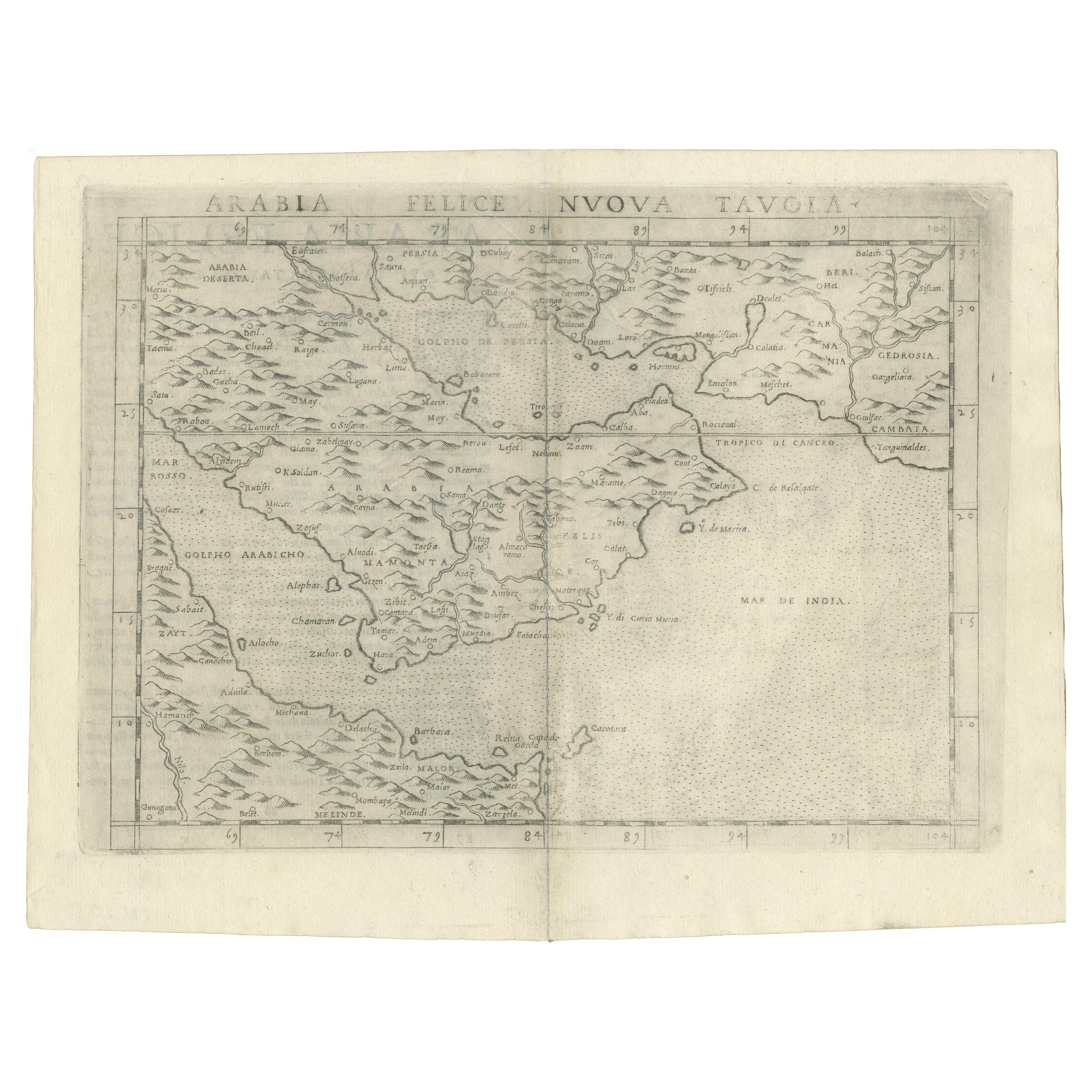
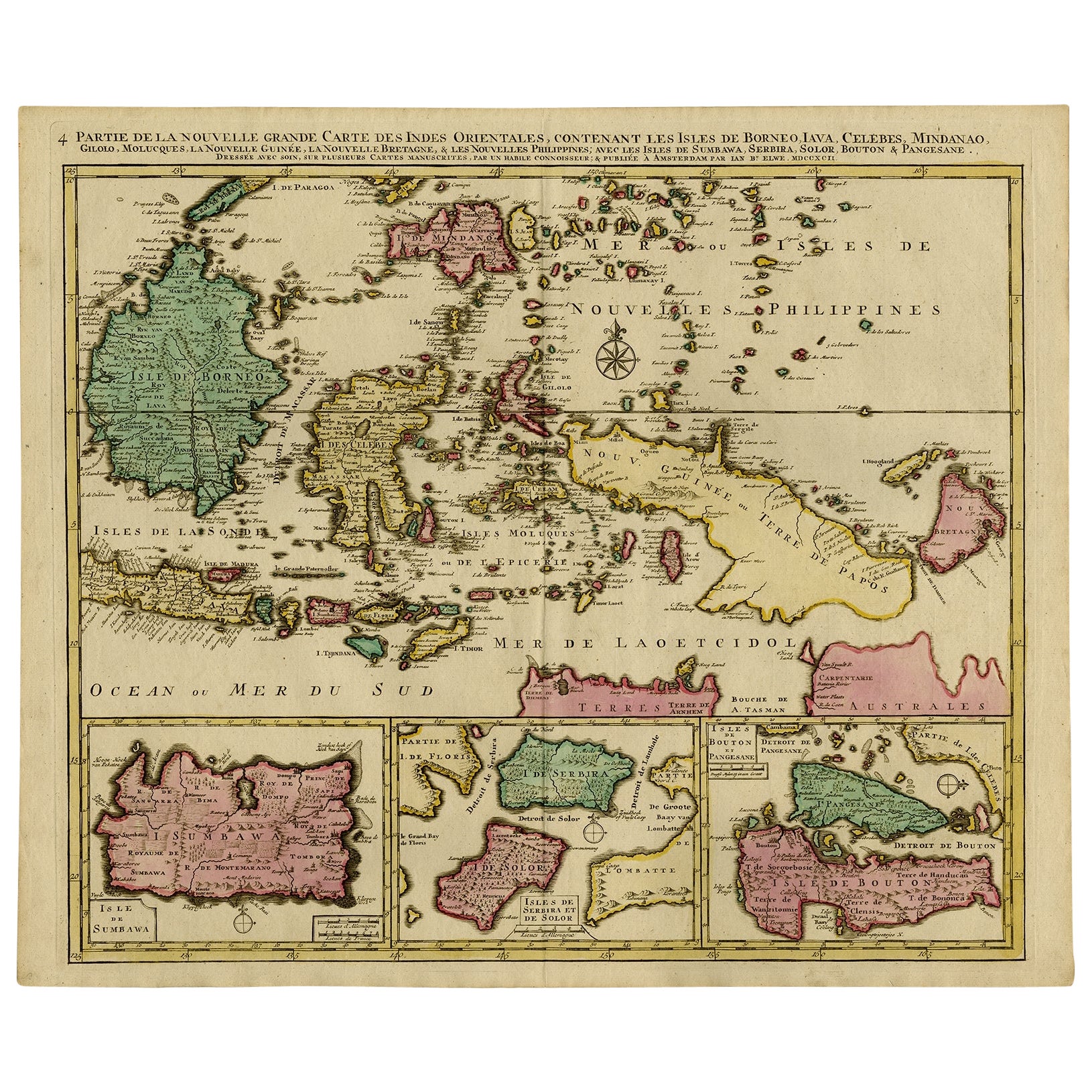
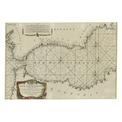
- Large Decorative Antique Map of the Mediterranean, ca.1770Located in Langweer, NLAntique map titled 'Carte de la Mer Mediterranee en Douze Feuilles'. First map out of twelve fine engraved double-page and folding maps that join to create a large wall map...Category
Antique 1770s Maps
MaterialsPaper
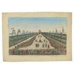
- Antique Optical View of The Coronation Ceremony of The Emperor of China, ca.1770Located in Langweer, NLAntique print China titled 'Vue perspective de la grande Ceremonie du couronnement de l'Empereur de la Chine'. Optical view of the coronation c...Category
Antique 1770s Prints
MaterialsPaper
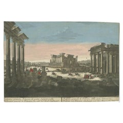
- Rare Antique Print of the Ruins of Palmyra in Syria, ca.1770By Georg Balthasar ProbstLocated in Langweer, NLAntique print titled 'Prospetto generalle di Palmira (..)'. Beautiful view of the ruins of Palmyra, Syria. This is an optical print, also called 'vue optique' or 'vue d'optique',...Category
Antique 18th Century Prints
MaterialsPaper
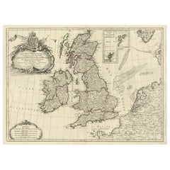
- Attractive Map of the British Isles with an Inset of the Shetland Islands, c1770Located in Langweer, NLAntique map titled 'Les Isles Britanniques Comprenant les Royaumes D'Angleterre D'Ecosse et D'Irlande, Divises en Grandes Provinces Subdivise par Comptes (…).' Attractive map of the British Isles. With inset map including the Orcade and Shetland Islands. Good detail throughout including coastal...Category
Antique 1770s Maps
MaterialsPaper
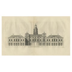
- Antique Print of the Horse Guards at Whitehall, Westminster, London, ca.1770Located in Langweer, NLDescription: Antique print titled 'East Front of the Horse Guards at Whitehall'. Architectural elevation of the Horse Guards at Whitehall....Category
Antique 1770s Prints
MaterialsPaper
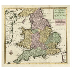
- Antique Map of the South Part of Great Britain by Tirion, c.1750By Isaak TirionLocated in Langweer, NLAntique map titled 'Nieuwe Kaart van 'T Zuider Gedeelte van Groot Britannie behelzende Het Koningryk Engeland (..).' Attractive map showing the south part of Great Britain; the K...Category
Antique 18th Century Maps
MaterialsPaper
You May Also Like
- England, Scotland & Ireland: A Hand Colored Map of Great Britain by TirionBy Isaak TirionLocated in Alamo, CAThis is a hand-colored double page copperplate map of Great Britain entitled "Nieuwe Kaart van de Eilanden van Groot Brittannien Behelzende de Kon...Category
Antique Mid-18th Century Dutch Maps
MaterialsPaper
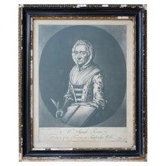
- Sarah Porter, "Queen of the Touters at Tunbridge Wells" Engraving, circa 1770Located in Lowestoft, GBAfter Vander Smissen 'Mrs Sarah Porter, Queen of the Touters at Tunbridge Wells', a mezzotint, engraved by William Pether circa 1770, glazed in ebonised, ...Category
Antique Late 18th Century English Prints
MaterialsGlass, Pine, Paper
- Lithographic print on paper, depicting the atlas of the hand, France 1850 ca.Located in Milan, ITAn anatomical lithographic print on paper, depicting the anatomical atlas of the hand. Black lacquered fir wood frame with golden ramin wood batting. N. H. Ja...Category
Antique Mid-19th Century French Prints
MaterialsGlass, Wood, Paper
- Large 17th Century Hand Colored Map of England and the British Isles by de WitBy Frederick de WitLocated in Alamo, CAA large hand colored 17th century map of England and the British Isles by Frederick de Wit entitled "Accuratissima Angliæ Regni et Walliæ Principatus", published in Amsterdam in 1680. It is a highly detailed map of England, Scotland, the Scottish Isles...Category
Antique Late 17th Century Dutch Maps
MaterialsPaper
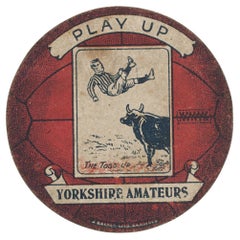
- Baines Football Trade Card, Yorkshire Amateurs Play UpLocated in Oxfordshire, GBBaines football trade card, Yorkshire Amateurs play up. A rare circular football trade card in the shape of a leather football ball. Made by the toy shop owner from Bradford, John B...Category
Vintage 1910s Sporting Art Sports Equipment and Memorabilia
MaterialsPaper
- New Map of North America from the Latest Discoveries, 1763Located in Philadelphia, PAA fine antique 18th century map of the North American seaboard. Entitled "A New Map of North America from the Latest Discoveries 1763". By the Cartographer/Engraver - John Spil...Category
Antique Mid-18th Century English Georgian Maps
MaterialsPaper


Recently Viewed
View AllMore Ways To Browse
London Antique Furniture Area
Antique Mirror Paper
Antique 17th Century Mirrors
Georg Mirror
Tiny Wall Mirror
British Antique Mirrors
Convex Lens
Antique Kingston
Antique Furniture Kingston
Wall Sculptures Plaque
Metal Display Cabinet
Main Door
Mid Century Carved Wood Door
American Antique Cabinet
Antique Built In Cabinets
Antique Built In Cabinet
Midcentury China Cabinet
Brass Cabinet Nightstand