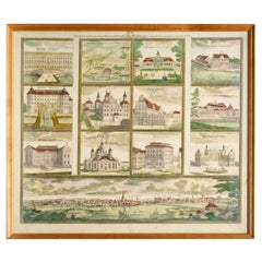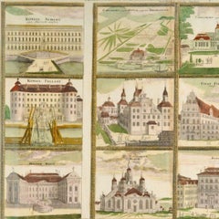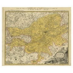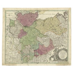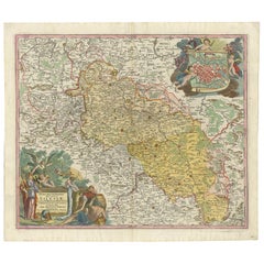
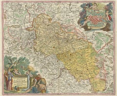
Antique Map of Silesia, Southwest Poland and a City View of Wroclaw, c 1720
$1,029
H 21.66 in W 24.81 in D 0.02 in
Antique Map of Silesia, Southwest Poland and a City View of Wroclaw, c 1720
By Johann Baptist Homann
Located in Langweer, NL
Antique map titled 'Superioris et Inferioris ducatus Silesiae (..)'. Detailed map of Silesia by Johann Baptist Homann. Shows the Southwestern part of Poland between Frankfurt Oder ...
Category
Early 18th Century Antique Johann Baptist Homann
Materials
Paper