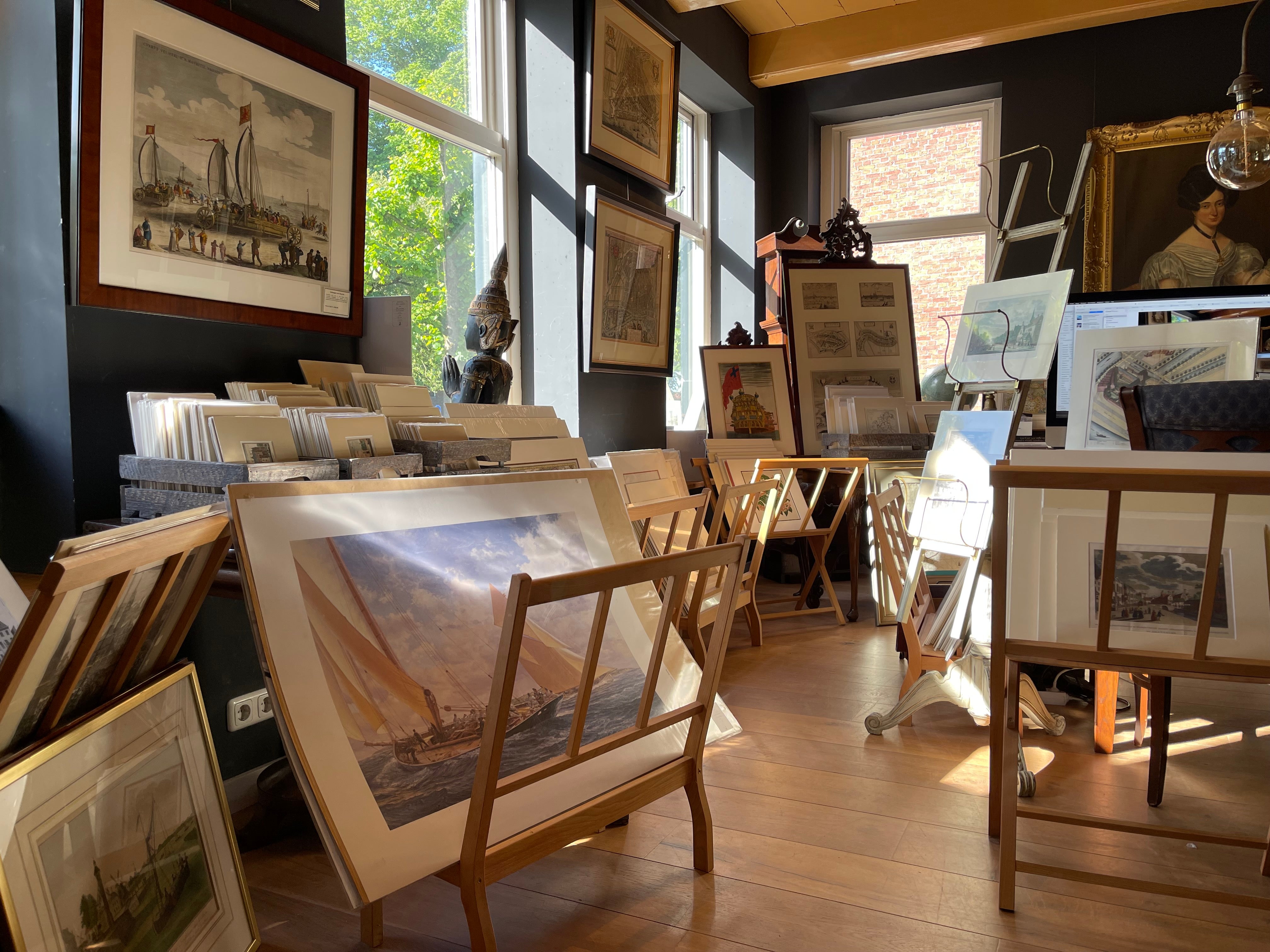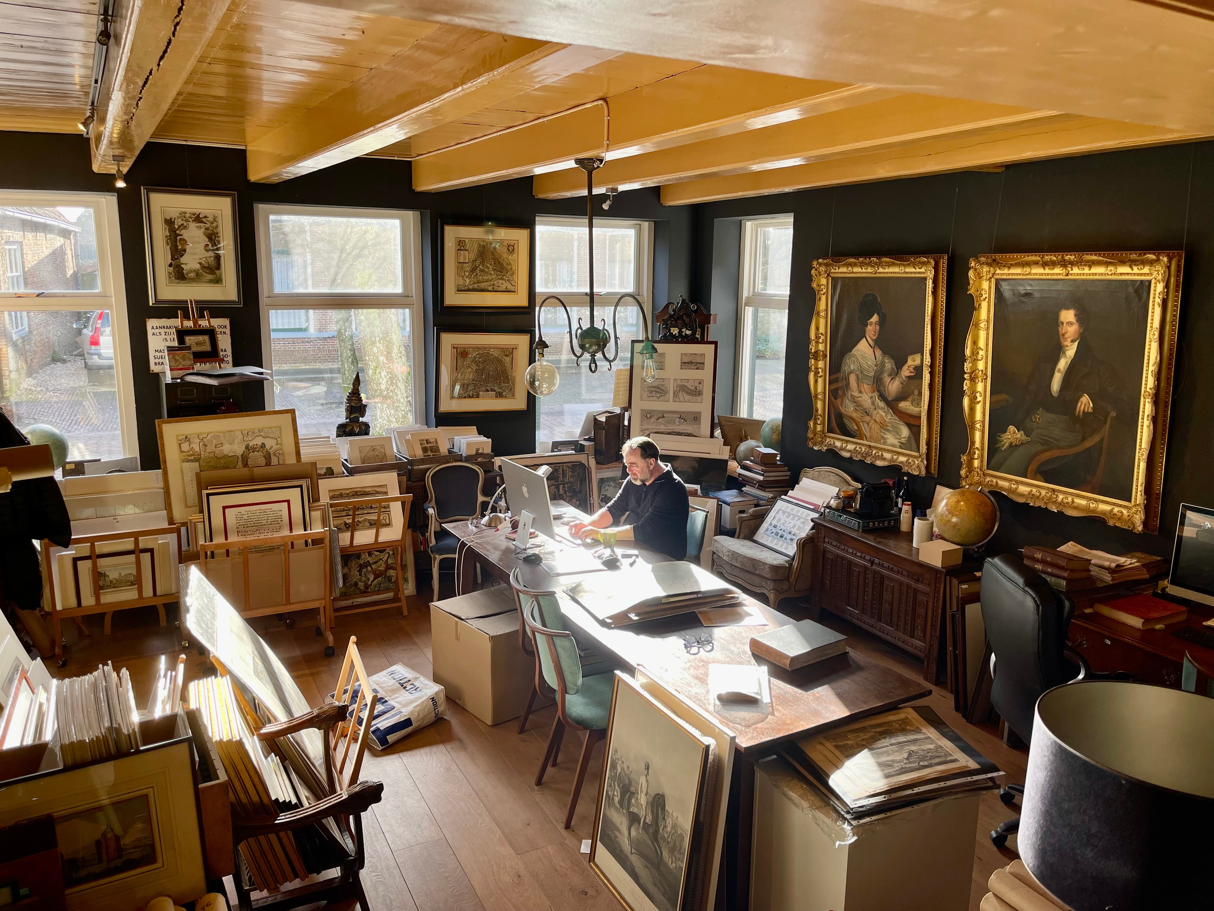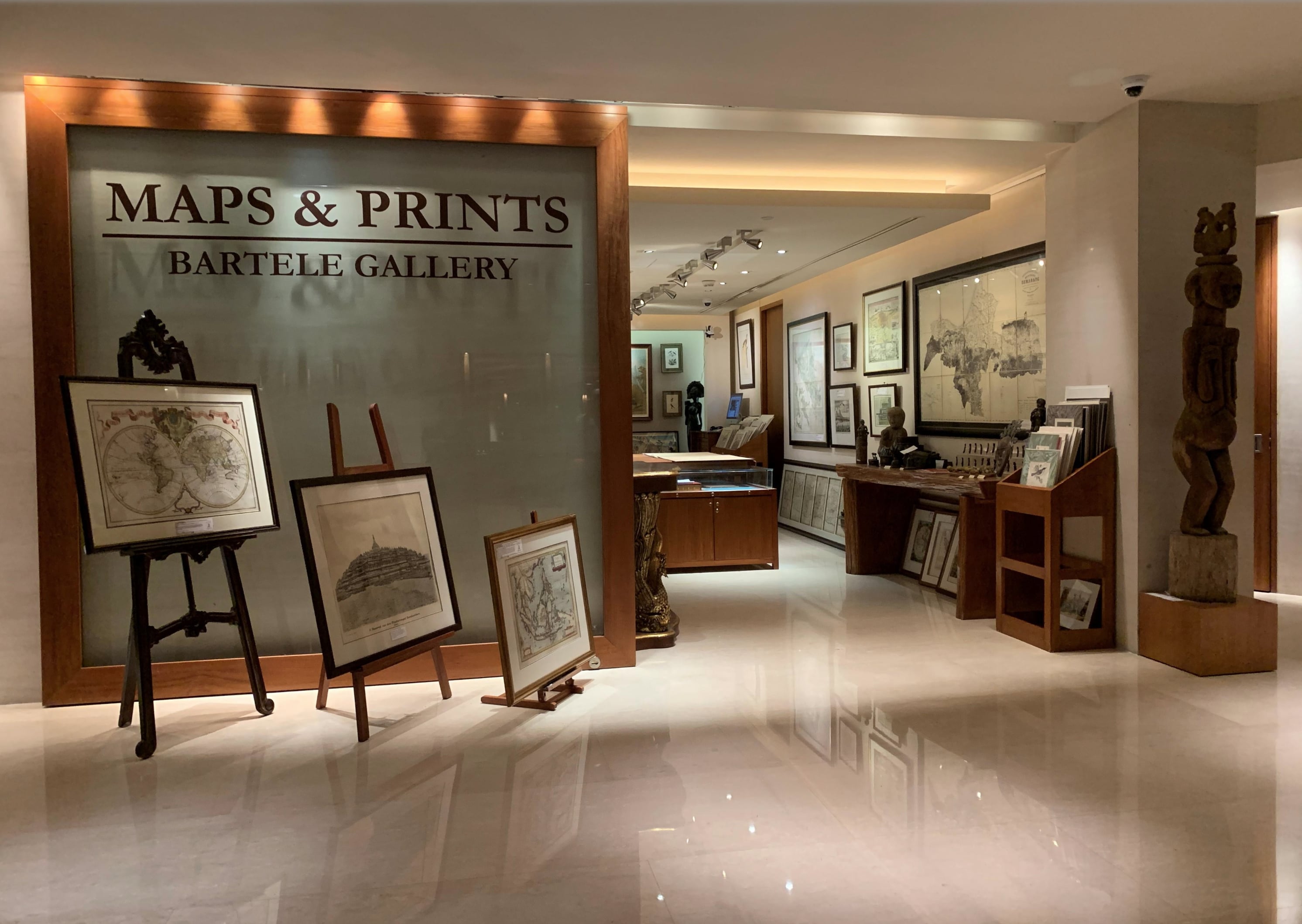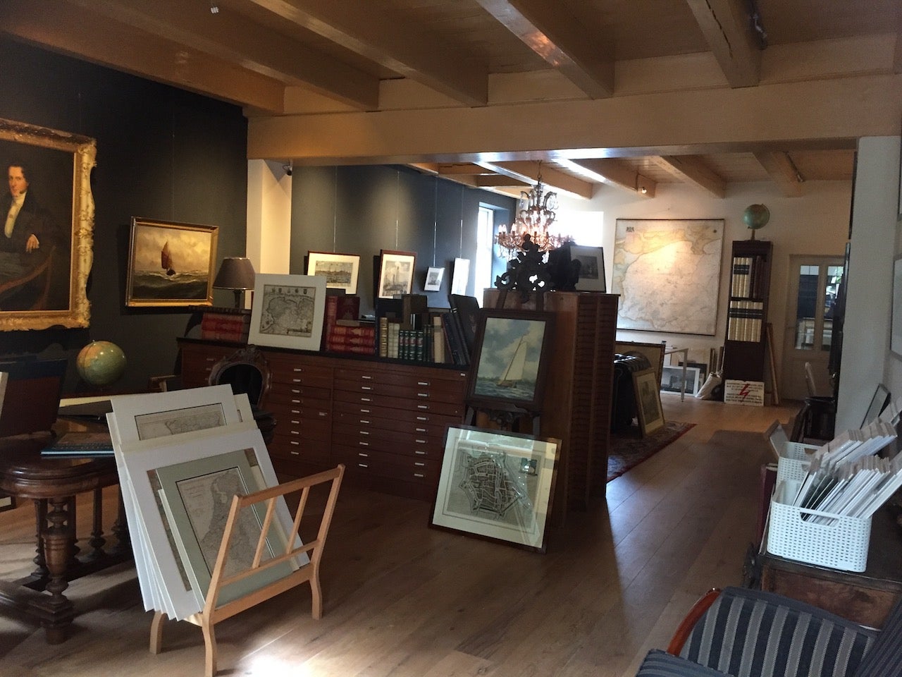
About Bartele Gallery
Bartele Gallery offers a wide range of antique maps, prints and rare books. Our extensive collection of antique maps covers every part of the world. Whilst cartography holds a special place in our collection, we also offer thousands of antique prints covering fields of interest as diverse as architecture, natural history, religion, ethnology and many more. Bartele Gallery is managed by Bartele Santema, in 2009 he founded the first gallery in Indonesia. This gallery is located in the Kempinski Hotel Jakarta and supported by curator Dr. David Parry, who wrote 'The Cartogra...Read More
Established in 20091stDibs seller since 2017
Featured Pieces
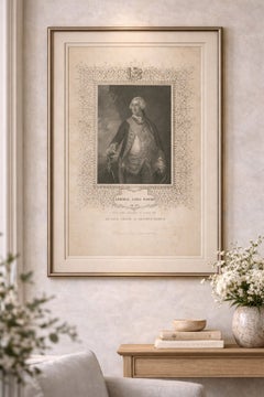
Antique Portrait Admiral Lord Hawke – British Naval Hero Engraving c.1850
Located in Langweer, NL
Antique Portrait Admiral Lord Hawke – British Naval Hero Engraving c.1850
A finely executed and highly decorative mid-19th century engraved portrait of Admiral Edward Hawke, 1st Bar...
Category
Antique Mid-19th Century British Prints
Materials
Paper
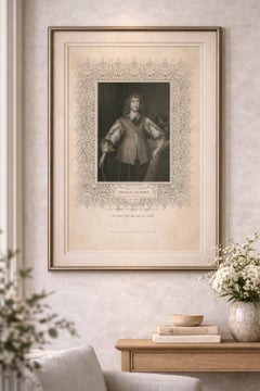
Antique Portrait Prince Rupert – English Civil War Commander, c.1850
Located in Langweer, NL
Antique Portrait Prince Rupert – English Civil War Commander, c.1850
A finely engraved and highly decorative mid-19th century portrait of Prince Rupert of the Rhine, one of the most...
Category
Antique Mid-19th Century British Prints
Materials
Paper
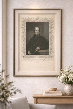
Antique Portrait Lord John Russell – British Prime Minister Engraving c.1850
Located in Langweer, NL
Antique Portrait Lord John Russell – British Prime Minister Engraving c.1850
A refined and highly decorative mid-19th century engraved portrait of Lord John Russell, one of the most...
Category
Antique Mid-19th Century British Prints
Materials
Paper
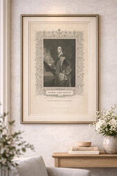
Antique Portrait Lord Rodney – British Naval Hero Engraving c.1850
Located in Langweer, NL
Antique Portrait Lord Rodney – British Naval Hero Engraving c.1850
A finely executed and highly decorative mid-19th century engraved portrait of George Brydges Rodney, 1st Baron Rod...
Category
Antique Mid-19th Century British Prints
Materials
Paper
Antique Portrait Queen Anne – Tallis Engraving, British Royalty c.1850
Located in Langweer, NL
Antique Portrait Queen Anne – Tallis Engraving, British Royalty c.1850
A refined and highly decorative mid-19th century engraved portrait of Queen Anne, the last monarch of the Hous...
Category
Antique Mid-19th Century British Prints
Materials
Paper

Antique Portrait William Pitt – Earl of Chatham, Tallis Engraving c.1850
Located in Langweer, NL
Antique Portrait William Pitt – Earl of Chatham, Tallis Engraving c.1850
A refined and highly decorative mid-19th century engraved portrait of William Pitt, 1st Earl of Chatham, one...
Category
Antique Mid-19th Century British Prints
Materials
Paper

Antique Portrait Sir Francis Drake – Tallis Engraving, c.1850
Located in Langweer, NL
Antique Portrait Sir Francis Drake – Tallis Engraving, c.1850
A highly decorative and finely engraved mid-19th century portrait of Sir Francis Drake, the legendary English naval com...
Category
Antique Mid-19th Century British Prints
Materials
Paper

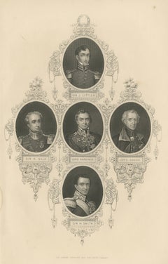
Antique British Military Portrait Print – Sikh War Generals, c.1850
Located in Langweer, NL
Antique British Military Portrait Print – Sikh War Generals, c.1850
A refined and highly decorative mid-19th century engraving featuring a composite arrangement of five prominent Br...
Category
Antique Mid-19th Century British Prints
Materials
Paper
Antique India Print – Tipu Sultan Sons Surrender, Mysore War, c.1850
Located in Langweer, NL
Antique India Print – Tipu Sultan Sons Surrender, Mysore War, c.1850
A powerful and historically charged mid-19th century engraving depicting The Surrender of the Two Sons of Tippoo...
Category
Antique Mid-19th Century British Prints
Materials
Paper

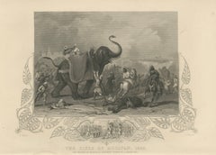
Antique India Battle Print – Siege of Mooltan 1849, Elephant War Scene
Located in Langweer, NL
Antique India Battle Print – Siege of Mooltan 1849, Elephant War Scene
A striking and highly decorative mid-19th century historical engraving depicting The Siege of Mooltan, 1849, o...
Category
Antique Mid-19th Century British Prints
Materials
Paper
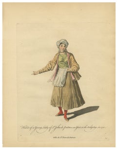
Antique Costume Print Young Lady of St John of Patmos Jefferys, 1749
Located in Langweer, NL
Antique Costume Print Young Lady of St John of Patmos Jefferys 1749
This finely detailed engraving depicts a young lady of St. John of Patmos, an island in the archipelago, rendered in traditional attire. Published by Thomas Jefferys in London in 1749, the print reflects European interest in regional Mediterranean cultures.
The figure wears layered garments with apron and shawl, complemented by soft hand coloring in muted tones. Her poised stance and the refined engraving give the composition a quiet elegance.
This piece combines ethnographic interest with decorative charm, making it a desirable collectible.
Condition: Good overall condition with age toning and light spotting. Minor edge wear and small marginal losses. Plate mark visible.
Framing tips: A warm or dark wood frame with a wide mat enhances the understated palette and elegance.
Special note: This is an original 18th-century engraving, not a reproduction. All items we offer are authentic period works of art over 100 years old. The print is sold unframed; any framed images are shown for presentation and interior inspiration only and may not always be on scale with the original.
Technique: Engraving with original hand color
Maker: Thomas Jefferys, London, 1749
Keywords: antique print, patmos, greek island costume, ethnographic print, 18th century engraving, thomas jefferys, mediterranean dress...
Category
Antique Mid-18th Century British Prints
Materials
Paper
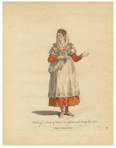
Antique Costume Print Lady of Paros Traditional Dress Jefferys, 1749
Located in Langweer, NL
Antique Costume Print Lady of Paros Traditional Dress Jefferys 1749
This elegant engraving portrays a lady of Paros in traditional island dress. Published by Thomas Jefferys in London in 1749, the print forms part of a wider series documenting regional costumes.
The figure is depicted in layered garments with apron and veil, rendered in soft reds and neutrals. The delicate hand coloring and refined engraving create a balanced and graceful composition.
Such prints were widely collected for their ethnographic interest and remain timeless decorative works.
Condition: Good condition with age-related toning and light spotting. Minor edge wear and marginal losses. Plate mark visible.
Framing tips: A darker frame with a wide ivory mat enhances contrast and highlights the figure.
Special note: This is an original 18th-century engraving, not a reproduction. All items we offer are authentic period works of art over 100 years old. The print is sold unframed; any framed images are shown for presentation and interior inspiration only and may not always be on scale with the original.
Technique: Engraving with original hand color
Maker: Thomas Jefferys, London, 1749
Keywords: antique print, paros, greek island costume, ethnographic print, 18th century engraving, thomas jefferys, mediterranean dress...
Category
Antique Mid-18th Century British Prints
Materials
Paper
More About Bartele Gallery