Maps
to
4,244
5,459
194
5,658
3
75
35
18
13
6
5
5
4
4
3
1
1
2,927
2,256
475
3
290
34
10
126
10
37
9
2
5
4
3
3
5,571
122
55
34
32
716
324
211
148
136
5,661
5,661
5,661
104
59
28
21
15
Maps For Sale
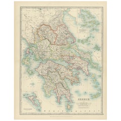
Antique Map of Greece and the Cyclades, 1903, with Many Details and Inset Maps
Located in Langweer, NL
Title: Antique Map of Greece and the Cyclades, 1903, with Intricate Detail and Inset Maps
Description: This antique map, titled "Greece with Its Islands, Including the Cyclades," wa...
Category
Early 20th Century Maps
Materials
Paper
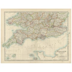
Antique Map of Southern England & Wales, 1903, with Coastal Details and Railways
Located in Langweer, NL
Title: Antique Map of Southern England and Wales, 1903, with Coastal Details and Railways
Description:
This detailed antique map, titled "England and Wales (Southern Sheet I)," was ...
Category
Early 20th Century Maps
Materials
Paper
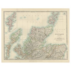
Antique Map of Northern Scotland, 1903, with Intricate Coastal Features
Located in Langweer, NL
Title: Antique Map of Northern Scotland and Islands, 1903, with Intricate Coastal Features
Description:
This striking antique map, titled "Scotland (Northern Sheet I)," was engraved...
Category
Early 20th Century Maps
Materials
Paper
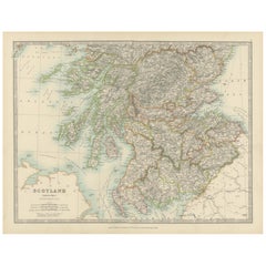
Antique Map of Southern Scotland, 1903, with Coastal and Inland Details
Located in Langweer, NL
Title: Antique Map of Southern Scotland, 1903, with Coastal and Inland Details
Description:
This exquisite antique map, titled "Scotland (Southern Sheet I)," was engraved and publis...
Category
Early 20th Century Maps
Materials
Paper
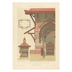
French Pavillon de la Grande Tuilerie, Chabat, Architectural Print, c.1900
Located in Langweer, NL
Antique print titled 'Pavillon de la Grande Tuilerie de Bourgogne (de Montghanin) Exposition Universelle de 1889, Mrs. Wulliam et Farge Architectes'. This print depicts the design of...
Category
20th Century Maps
Materials
Paper
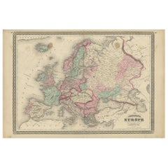
Antique Map of Europe by Johnson, '1872'
Located in Langweer, NL
Antique map titled 'Johnson's Europe'. Original map of Europe. This map originates from 'Johnson's New Illustrated Family Atlas of the World' by A.J. Johnson. Published 1872.
Category
Late 19th Century Antique Maps
Materials
Paper
$330 Sale Price
20% Off
Antique Map of the Township of Zuidhorn in The Netherlands, 1862
Located in Langweer, NL
Groningen: Gemeente Noordhorn-Zuidhorn. These scarse detailed maps of Dutch Towns originate from the 'Gemeente atlas van de Provincie Groningen in 62 kaarten.' by C. Fehse. This atla...
Category
19th Century Antique Maps
Materials
Paper
$179 Sale Price
20% Off
Antique Map of South Africa showing the Travels of Truter and Somerville
Located in Langweer, NL
Antique map titled 'Charte von Süd-Afrika'. Original antique map of South Africa showing the travels of Truter and Somerville. Published ci...
Category
Early 19th Century Antique Maps
Materials
Paper
$396 Sale Price
20% Off
Antique Map of the West-Frisian part of independent Friesland by Halma, 1718
Located in Langweer, NL
Antique map Friesland titled 'ars I. Frisiae Liberae quae Westfresia post eluviones seculi XIII (..)'. Old map of the West-Frisian part of the independent Friesland, the Netherlands ...
Category
18th Century Antique Maps
Materials
Paper
Striking Antique Map Centered on the Malay Peninsula
Located in Langweer, NL
Antique map titled 'D'Indiaanze Landschappen Zeen en Eylanden, van Couchin af tot in de Moluccos (...)'. Striking map of the region from the Philippines and Formosa to India and the ...
Category
Early 18th Century Antique Maps
Materials
Paper
$1,131 Sale Price
20% Off
Antique Map of the Middle East by Mortier, 1700
Located in Langweer, NL
Antique map titled 'Carte de la Situation du Paradis Terrestre (..)'. Detailed map of the Holy Land and the Middle East, centered on the Garden of Eden and including a large Cyprus. ...
Category
18th Century Antique Maps
Materials
Paper
$226 Sale Price
20% Off
Antique Map of the Mediterranean Sea and Surroundings by Keizer & de Lat, 1788
Located in Langweer, NL
Antique map titled 't Wester Deel van de Middelandse Zee (..)'. Uncommon original antique map of the Mediterranean Sea and surroundings. This map originates from 'Nieuwe Natuur- Gesc...
Category
Late 18th Century Antique Maps
Materials
Paper
$330 Sale Price
20% Off
Antique Map of Africa with a Decorative Dedication to the Dauphin, 1717
Located in Langweer, NL
Antique map titled 'L'Afrique, Dressée Selon les Dernieres Relat. et Suivant les Nouvelles Decouvertes (..).'
This map is a reduced derivative of De Fer's wall map of Africa (1696-98) with its characteristic thickened west coast. Unusual islands appear in the Atlantic and Indian Oceans including a mythical second island of St. Helena. Monomotapa is shown in the south and the southwest coastline is distorted and there is an incorrect placement and shape of the Cape of Good Hope. In Central Africa is a paragraph concerning the origin of the Nile in Abyssinia, however, the two sub-equatorial Ptolemaic lakes are still shown on the map. The map is graced with a decorative dedication to the Dauphin and a title cartouche featuring lime kilns. The map was first published in 1700. This scarse map originates from: 'Introduction a la geographie - avec unde description historique sur toutes...
Category
18th Century Antique Maps
Materials
Paper
$662 Sale Price
25% Off
1718 Holy Land Map - Twelve Tribes, Six Provinces, Hand-Colored, Antique Map
Located in Langweer, NL
Title: Terra Sancta in XII olim Tribus nunc VI Provincias Dispertita
Cartographer: Christoph Weigel the Elder (1654–1725)
Publisher: Johann Ernst Adelbulner
Publication Locatio...
Category
1710s Antique Maps
Materials
Paper
Hand Colored Antique Map of the Department of Haute Loire, France
Located in Langweer, NL
Antique map titled 'Dept. de la Haute Loire'. Map of the French department of Haute Loire, France. This area of France is part of the Loire Valley wine growing...
Category
Mid-19th Century Antique Maps
Materials
Paper
$320 Sale Price
20% Off
Early Antique Map of Gelderland and Overijssel in the Netherlands, c.1625
Located in Langweer, NL
Antique map titled 'Geldria et Transysulana'.
One of the earliest maps of Gelderland and Overijssel in the Netherlands, prepared by Gerard Mercator.
Artists and Engravers: Gerard...
Category
17th Century Antique Maps
Materials
Paper
$612 Sale Price
20% Off
Old Map of South East Asia Showing the Malay Archipelago, incl Borneo etc, 1922
Located in Langweer, NL
Antique map of South East Asia titled 'Malay Archipelago'.
Old map of South East Asia depicting the Malay Archipelago including Sumatra, Java...
Category
1920s Vintage Maps
Materials
Paper
$179 Sale Price
20% Off
Antique Map of the County of Burgundy by Johann Baptist Homann circa 1710
Located in Langweer, NL
Antique Map of the County of Burgundy by Johann Baptist Homann circa 1710 Hand-Colored
This finely detailed antique map titled Comitatus Burgundia depicts the historic region of t...
Category
1720s Antique Maps
Materials
Paper
Antique Sea Chart of Hudson Bay and Arctic Canada by Van Keulen, circa 1681
Located in Langweer, NL
Antique map titled 'Pascaarte vande Noorderzee Custen van America (..)'. Sea chart of Hudson Bay and Arctic Canada. Compass roses, loxodromic lines, and ships decorate the oceans and...
Category
Late 17th Century Antique Maps
Materials
Paper
Original Antique Map of United States, Grattan and Gilbert, 1843
Located in St Annes, Lancashire
Great map of United States
Drawn and engraved by Archer
Published by Grattan and Gilbert. 1843
Original colour
Unframed.
Category
1840s English Antique Maps
Materials
Paper
1788 Map of Europe - France, Italy, Spain, Germany, Great Britain & Ireland
Located in Langweer, NL
Title: "1788 Map of Europe - France, Italy, Spain, Germany, Great Britain & Ireland by D'Anville"
Description:
This detailed map of Europe, titled "First Part of the Map of Europe...
Category
1780s Antique Maps
Materials
Paper
$1,056 Sale Price
20% Off
1621 Ptolemy & Magini Map of Taprobana (Sumatra) with Elephant Inset
Located in Langweer, NL
Title: 1620 Ptolemy and Magini Map of Taprobana (Sumatra) with Elephant Inset, Italian Edition
Description: This rare and beautifully hand-colored 1620 map engraving, Tavola Duode...
Category
1620s Antique Maps
Materials
Paper
Rare Old Map of the British Solomon Islands Protectorate, 1925
Located in Langweer, NL
Antique map titled 'British Solomon Islands Protectorate'.
Old map of the British Solomon Islands Protectorate.
Artists and Engravers: Published by Waterlow & Sons, London & D...
Category
1920s Vintage Maps
Materials
Paper
$254 Sale Price
20% Off
Original Antique Plan of the Fortress of Charedsch in Persia or Iran, ca.1780
Located in Langweer, NL
Antique map, titled: 'Plan de la Citadelle de la Ville de Charedsch.'
Plan of the fortress of Charedsch, Iran / Persia. This original antique print originates from 'Reize naar Ar...
Category
1780s Antique Maps
Materials
Paper
$301 Sale Price
20% Off
Antique Engraved Map of Hungary and Transylvania or Romania, c.1710
Located in Langweer, NL
Antique map titled 'Hungary and Transilvania'. Original antique map of Hungary and Transylvania (modern day Romania), centered on Budapest. Artists and ...
Category
18th Century Antique Maps
Materials
Paper
$264 Sale Price
20% Off
Empire's Crossroads: An 1882 Map of Turkey in Asia by Blackie & Son
Located in Langweer, NL
This map, titled "Turkey in Asia," is another detailed illustration from the 1882 atlas by Blackie & Son. It showcases the vastness of the Asian territories of the Ottoman Empire, sp...
Category
1880s Antique Maps
Materials
Paper
$233 Sale Price
40% Off
1638 Plancius Detailed Map of Sri Lanka or Ceylon with Decorative Cartouches
Located in Langweer, NL
"1638 Plancius Detailed Map of Sri Lanka with Decorative Cartouches"
This beautifully detailed map of Sri Lanka, titled "Ins. Ceilan," was engraved by P. Plancius from a design by C...
Category
1630s Antique Maps
Materials
Paper
$1,357 Sale Price
20% Off
Old Original Map of Russia in Europe, 1849
Located in Langweer, NL
Antique map titled 'Russia in Europe'.
Old map of Russia in Europe. This map originates from 'Sharpe's Corresponding Atlas (..)' by J. Sharpe.
Artists and Engravers: Published by Chapman and Hall.
Category
1840s Antique Maps
Materials
Paper
$169 Sale Price
20% Off
Antique Map of Boulogne-sur-Mer by Bellin '1764'
Located in Langweer, NL
Antique map titled 'Plan de la Ville de Boulogne'. Original antique map of Boulogne-sur-Mer, France. This map originates from 'Le petit atlas maritime: recueil de cartes et plans des...
Category
Mid-18th Century Antique Maps
Materials
Paper
$141 Sale Price
20% Off
17th-Century Map of the Latin Patriarchate of Jerusalem by Melchior Tavernier
Located in Langweer, NL
Title: 17th-Century Map of the Latin Patriarchate of Jerusalem by Melchior Tavernier
Description: This rare 17th-century map by Melchior Tavernier illustrates the geographical ext...
Category
1640s Antique Maps
Materials
Paper
Antique County Map, Rutlandshire, Framed Atlas Cartography, John Cary, Georgian
Located in Hele, Devon, GB
This is an antique county map of Rutlandshire. An English, framed atlas engraving of cartographic interest, dating to the Georgian period and later, circa 1790.
Superb cartography ...
Category
Late 18th Century British Georgian Antique Maps
Materials
Glass, Wood, Paper
Antique Map of the Region of 'Île de France' by Janssonius, 1657
Located in Langweer, NL
Antique map of France titled 'Ager Parisiensis vulgo l'Isle de France'. Old map of Paris and adjacent regions. This map originates from 'Atlas Novus, ...
Category
17th Century Antique Maps
Materials
Paper
$400 Sale Price
20% Off
Large Map of Russian Discoveries in Siberia, Alaska & the Bering Strait, 1784
Located in Langweer, NL
1784 Russian Discoveries in Siberia, Alaska & the Bering Strait - Gerhard Friedrich Muller
"Nouvelle Carte des Decouvertes Faites par des Vaisseaux Russiens Aux Cotes Inconnues de L'Amerique Septentrionale avec Les Pais Adiacents" is a seminal map by Gerhard Friedrich Muller, showcasing Russian discoveries in Siberia, Alaska, and the Bering Strait region. Originally published in 1754, this map served as a direct counter to Guillaume de L'Isle's speculative "fantasy" map of the same area, which prominently featured the fictitious Mer de l'Ouest (Sea of the West).
This edition, published in 1784 by the Imperial Academy of Sciences in St. Petersburg, reflects the substantial geographic knowledge gained through Russian explorations, particularly the voyages of Vitus Bering. It accurately depicts the northern Pacific coasts, focusing on Siberia, the Aleutian Islands, and the Alaskan coast. The hand-coloring remains vibrant, emphasizing key geographic details, and a richly decorated rococo cartouche adorns the upper right, indicating the map's origins.
This map is a significant artifact, illustrating the progression of cartographic accuracy and the influence of Russian expeditions in shaping the early knowledge of the North Pacific and Arctic regions.
The 1784 edition of Gerhard Friedrich Muller's map features the routes of key Russian voyages that explored the North Pacific, specifically those related to the exploration of Siberia, Alaska, and the Bering Strait. These include:
1. Vitus Bering's Voyages (1728 and 1741) - The map shows routes of Vitus Bering, a Danish explorer in the Russian Navy, who led two important expeditions:
- During his first Kamchatka Expedition (1728), Bering navigated through what is now known as the Bering Strait, proving that Siberia and Alaska were separated by a sea.
- His second Kamchatka Expedition (1741) extended further eastward to Alaska. This journey greatly expanded European knowledge of the northern Pacific and confirmed Alaska as part of the North American continent.
2. Aleksei Chirikov's Route (1741) - As part of the second Kamchatka Expedition, Aleksei Chirikov, who was Bering's second-in-command, led a separate ship and reached the Alaskan coast, discovering the southeastern parts of Alaska and providing further detailed knowledge of the area.
3. Russian Navigators in the Aleutian Islands - The map also shows the exploration routes in and around the Aleutian Islands, which were instrumental for Russian fur...
Category
1780s Antique Maps
Materials
Paper
Old Map of the UK & Ireland, Insets of Orkney, Shetland and Faroe Islands, 1786
Located in Langweer, NL
Title: "Les Isles Britanniques qui contiennent les Royaumes d'Angleterre, Escosse, et Irlande".
Hand-colored engraved map with 2 (large) decorative cartouches, inset map of the Ork...
Category
1780s Antique Maps
Materials
Paper
$1,272 Sale Price
20% Off
Dutch City Plan of Workum in Friesland by N. Van Geelkercken, hand-colored 1616
Located in Langweer, NL
Workum in Friesland by Nicolaes van Geelkercken, hand-colored map ca. 1616
This beautifully hand-colored engraving titled 'Worcum' presents an early 17th-century bird’s-eye view of ...
Category
1610s Dutch Antique Maps
Materials
Paper
Antique Map of Russia in Asia by Kuyper, c.1880
Located in Langweer, NL
Antique map plate 48 : 'Aziatisch Rusland. Balkasj Meer en omstreken.' Original antique map of Russia in Asia, showing Lake Balkhash and surroundings. This l...
Category
19th Century Antique Maps
Materials
Paper
$55 Sale Price
20% Off
Large Antique County Map of North Wales, England
Located in Langweer, NL
Antique map titled 'A Map of North Wales from the best Authorities'. Original old county map of North Wales, England. Engraved by John Cary. Originates from 'New British Atlas' by Jo...
Category
Early 19th Century Antique Maps
Materials
Paper
$169 Sale Price
20% Off
Original Antique English County Map, Warwickshire, J & C Walker, 1851
Located in St Annes, Lancashire
Great map of Warwickshire
Original colour
By J & C Walker
Published by Longman, Rees, Orme, Brown & Co. 1851
Unframed.
Category
1850s English Other Antique Maps
Materials
Paper
Antique Map of India and Ceylon, along with the Maldives
Located in Langweer, NL
Antique map titled 'Stato del Mogol con l'Isole di Ceilan e Maldive'. Beautiful map of India and Ceylon, along with the Maldives. Includes a large decorative title cartouche. The map...
Category
Late 18th Century Antique Maps
Materials
Paper
$509 Sale Price
20% Off
Antique Map of Islands in the Mediterranean by Bowen, 'c.1760'
Located in Langweer, NL
Antique map titled 'Particular Draughts of some of the chief African Islands (..)'. Eight small maps on one sheet including 'Islands of Malta Goze & Cuming, An Accurate Chart of Cape de Verde Islands…, Island of St Helena.., Island of Madera, Island of Teneriffe, The Bay of Agoa…, The Dutch Fort at the Cape of Good Hope…, A Draught of Table Bay...
Category
Mid-18th Century Antique Maps
Materials
Paper
$471 Sale Price
20% Off
Antique Map of Indiana by Johnson, 1872
Located in Langweer, NL
Antique map titled 'Johnson's Indiana'. Original map of Indiana. This map originates from 'Johnson's New Illustrated Family Atlas of the World' by A.J. ...
Category
Late 19th Century Antique Maps
Materials
Paper
$176 Sale Price
40% Off
Old Map of Anatolia, part of modern-day Turkey, Armenia and Syria, 1745
Located in Langweer, NL
Title: "Kaartje van Natolie en Syrie opgesteld door de Hr. Lucas en de Hr. Guil de L'Isle en andere auteuren"
The title "Kaartje van Natolie en Syrie opgesteld door de Hr. Lucas en...
Category
1740s Antique Maps
Materials
Paper
$414 Sale Price
20% Off
Old Antique Map of the Province of Friesland, the Netherlands, c.1580
Located in Langweer, NL
Antique map titled 'Frisia Occidentalis'. Old map of the province of Friesland, the Netherlands. This map is also known as the 'Pauwenkaart' ('peacock map'), referring to the peacock next to the inset map. Based on a manuscript map...
Category
16th Century Antique Maps
Materials
Paper
$895 Sale Price
20% Off
Antique Plan of Aigues-Mortes, France
Located in Langweer, NL
Antique map titled 'Plan d'Aiguesmortes et environs'. Original plan of the region of Aigues-Mortes, France. This map originates from 'Le Petit Atlas Maritime (..)' by J.N. Bellin. Pu...
Category
Mid-18th Century Antique Maps
Materials
Paper
$320 Sale Price
20% Off
Antique Map of New Brunswick by W. G. Blackie, 1859
Located in Langweer, NL
Antique map titled 'New Brunswick, Nova Scotia, Prince Edward Island and Part of Canada east'. Original antique map of New Brunswick, Nova Scotia,...
Category
Mid-19th Century Antique Maps
Materials
Paper
$235 Sale Price
20% Off
1616 Bertius Map of Sumatra, Singapore and the Straits of Malacca
Located in Langweer, NL
Title: "1616 Bertius Map of Sumatra and the Straits of Malacca"
Description: This is an exquisite 1616 original antique map by Petrus Bertius, titled "Sumatra Insula," showcasing Su...
Category
Early 17th Century Antique Maps
Materials
Paper
$792 Sale Price
20% Off
Antique Map of the Indonesian and Philippine Archipelagos by R. de Vaugondy
Located in Langweer, NL
Striking and highly detailed map of the region from Sumatra and Malaca and Southern China to the Philipines, New Guinea and Northern Australia, centered on Borneo. Includes a large i...
Category
Mid-18th Century Antique Maps
Materials
Paper
$1,098 Sale Price
20% Off
Antique Print of Duncombe Park by Campbell, 1725
Located in Langweer, NL
Antique print titled 'Elevation of Duncomb Park in Yorkshire (..)'. Old engraving of Duncombe Park, Yorkshire. Duncombe Park is the seat of the Duncombe family whose senior members a...
Category
18th Century Antique Maps
Materials
Paper
Large Lithograph of Princess Marie of Orleans, Duchess of Württember, 1844
Located in Langweer, NL
Antique print titled 'S.A.R. Madame Marie d'Orléans, Duchesse Alexandre de Wurtemberg'.
Large lithograph of Princess Marie of Orleans, Duchess of Württemberg with her son, Philip...
Category
1840s Antique Maps
Materials
Paper
$697 Sale Price
20% Off
Barcelona 1901: A Cartographic Portrait of Catalonia's Capital Province
Located in Langweer, NL
This orignal antique map is a historical depiction of the province of Barcelona from 1901.
It showcases the varied terrain of the province, with the Serra de Collserola ridge near the city of Barcelona and the Pyrenees to the north. The map includes the coastline along the Mediterranean Sea, indicating Barcelona's position as a coastal province. Blue lines indicate rivers, such as the Llobregat and Besòs, which are significant features in the province's geography. Dotted lines may signify the borders of the province within Catalonia.
The coat of arms of Barcelona, highlighted with gold, is prominently displayed, featuring the Cross of Saint George (Cruz de Sant Jordi), the patron saint of Catalonia, and the red and yellow bars which are a symbol of the Aragonese and Catalan heritage.
About the province of Barcelona:
The province of Barcelona is part of the autonomous community of Catalonia in northeastern Spain. It is the most economically significant region of Catalonia, playing a crucial role in the country's economy due to its port, manufacturing, and service industries. The city of Barcelona is the capital and the second most populous city in Spain, known for its rich cultural heritage, architecture by Antoni Gaudí, such as the Sagrada Família, and its influential art scene. The province enjoys a Mediterranean climate and features diverse landscapes from the beaches along the coast to the mountains in the interior. Barcelona is also known for its vibrant festivals, cuisine, fashion, and sports, particularly football, being home to FC Barcelona...
Category
Early 1900s Antique Maps
Materials
Paper
$622 Sale Price
20% Off
Dutch City Plan of Sloten in Friesland by N. Van Geelkercken, hand-colored 1616
Located in Langweer, NL
Bird’s-Eye View of Sloten in Friesland by Nicolaes van Geelkercken, ca. 1616
This captivating hand-colored engraving presents an early 17th-century bird’s-eye view of the fortified ...
Category
1610s Dutch Antique Maps
Materials
Paper
Germany and the Borders of Empire: Bodenehr’s Map of the Holy Roman World, 1710
Located in Langweer, NL
Title:
Germany and Surrounding Realms by Gabriel Bodenehr, circa 1710
This striking copperplate engraving, titled "S. Imperium Romano-Germanicum, Teutschland mit Seinen Angräntzende...
Category
1710s Antique Maps
Materials
Paper
Antique 1830 Map of Leinster, Ireland with Dublin, Kilkenny, Wexford and Kildare
Located in Langweer, NL
Title: Antique 1830 Map of Leinster, Ireland with Dublin, Kilkenny, Wexford, and Kildare
Description: This 1830 German-language map, titled Britisches Reich – C. Kon: Ireland, f...
Category
1830s Antique Maps
Materials
Paper
Antique Map of the Malay Archipelago by Walker, 1911
Located in Langweer, NL
Antique map titled 'Malay Archipelago'. Old map of the Malay Archipelago including Borneo, Celebes, New Guinea, Java, Timor and others. This map ...
Category
Early 20th Century Maps
Materials
Paper
$84 Sale Price
20% Off
18th Century Map of the Southern Balkans by Giovanni Maria Cassini
Located in Hamilton, Ontario
18th century map by Italian engraver Giovanni Maria Cassini (Italy 1745-1824).
Map of the Southern Balkans: Rome. Hand colored and copper engraved print done in the year 1788. It in...
Category
18th Century Italian Antique Maps
Materials
Paper
$795 Sale Price
36% Off
Map of the Persian Empire by Nicolas Sanson, Hand-colored, circa 1683
Located in Langweer, NL
Map of the Persian Empire by Nicolas Sanson, hand-colored, circa 1683
This finely detailed and delicately hand-colored map titled *L'Empire du Sophy des Perses* presents a late 17th...
Category
1680s Antique Maps
Materials
Paper
Old Map of Piton de la Fournaise, a Shield Volcano on Eastern Réunion Island
Located in Langweer, NL
Antique map titled 'Partie Orientale de l'Ile de Mascareigne'. This map shows the region of the Piton de la Fournaise, a Shield Volcano on Eastern Réunion Island...
Category
Early 19th Century Antique Maps
Materials
Paper
$612 Sale Price
20% Off
Antique Print of the Imperial Palace in Peking, China, 1668
Located in Langweer, NL
Antique print China titled ‘Interior aulae Imperatoriae facies'.
Antique print of the Imperial Palace in Peking, China. This print originates from ...
Category
1660s Antique Maps
Materials
Paper
$320 Sale Price
20% Off
Map Holy Promise Land Canaan Richard Palmer Richard Blome 1687 Joseph Moxon
Located in BUNGAY, SUFFOLK
Canaan comonly called the Holy Land or the Land of Promise, being the Possesion of the Israelites & travelled through by Our Lord & Saviour Iesus Christ and his Apostles. Engraven by Richard Palmer for Richard Blome. 1687
Blome, Richard, 1641-1705. London. 283 x 452 mm. Copperplate.
Probably from an English Bible...
Category
17th Century British Baroque Antique Maps
Materials
Paper
Antique Map of Northern Asia by Mallet, 1719
Located in Langweer, NL
Antique map titled 'Das Mitternächtige Theil des Alten Asien'. This sheet of five miniature maps describes the northern part of Asia in classical times, perhaps circa 150 AD. At the top, an overview map shows the main regions and territories, which are pictured in more detail below. From left to right, the four maps below depict Scythia east of the Imaus (Pamir) Mountains, Serica, Sychia west of the Pamir mountains, and Sarmatia, the last of which borders the Black Sea. Originates from Alain Manesson Mallet's 'Description de l 'Univers' (German edition). Artists and Engravers: Alain Manesson Mallet (1630-1706) was a French cartographer and engineer. He started his career as a soldier in the army of Louis XIV, became a Sergeant-Major in the artillery and an Inspector of Fortifications. He also served under the King of Portugal, before returning to France, and his appointment to the court of Louis XIV. His military engineering and mathematical background led to his position teaching mathematics at court. His major publications were Description de L'Univers (1683) in 5 volumes, and Les Travaux de Mars ou l'Art de la Guerre (1684) in 3 volumes. His Description de L'Universe contains a wide variety of information, including star maps...
Category
18th Century Antique Maps
Materials
Paper
$91 Sale Price
20% Off
Recently Viewed
View AllMore Ways To Browse
Antique Wellington Chests
Antonio Cassi Ramelli
Archimede Seguso Birds
Art Deco Coasters
Art Deco Footballer
Art Deco Music Cabinet
Art Deco Waterfall Bedroom Furniture
Art Deco Waterfall Bedroom
Art Deco Whisky
Art Foulard
Art Nouveau Sunflower
Arts And Crafts Silver Coffee Pot
Asian Pink Bowl
Avesn Vase
Baccarat Carafe
Bakelite Bird
Bakelite Cocktail Picks
Bamboo Ikebana Vase
