Paper Maps
to
4,234
5,397
170
5,569
3
55
29
14
9
5
5
1
1
1
1
1
1
2,913
2,219
437
3
280
23
5
126
8
35
7
2
3
3
2
5,572
123
55
34
32
654
282
199
137
130
5,572
5,572
5,572
104
59
28
21
15
Material: Paper
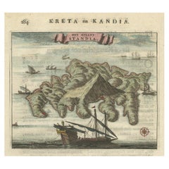
Old Print of Standia, a Greek Island 'Heraklion, Crete, Greece, Balkans', 1688
Located in Langweer, NL
Antique print Greece titled 'Het Eilant Standia'. Old print of the island Standia, near Crete, Greece. This print originates from 'Nauwkeurige Bes...
Category
17th Century Antique Paper Maps
Materials
Paper
$273 Sale Price
20% Off
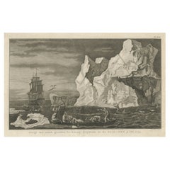
Old Print from Capt. Cooks Travels with Boats and a Ship in the South Sea, 1803
Located in Langweer, NL
Antique print titled 'Gezigt van eenen grooten Ys-klomp drijvende in de Zuid-Zee 9. jan. 1773'.
Antique print depicting boats and a ship near ice islands. Originates from 'Reizen...
Category
Early 1800s Antique Paper Maps
Materials
Paper
$301 Sale Price
20% Off
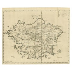
Antique Map of the Island of Borneo in Asia (Indonesia), 1726
Located in Langweer, NL
Antique map titled 'Kaart van het Eyland Borneo'. Early map of the island of Borneo. This map originates from 'Oud en Nieuw Oost-Indiën' by F. Valentijn.
Artists and Engravers: Fran...
Category
18th Century Antique Paper Maps
Materials
Paper
$3,636 Sale Price
20% Off
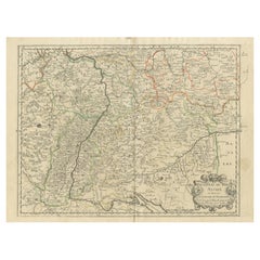
Antique Map of the Rhineland and Alsace Region with Original Hand Coloring
Located in Langweer, NL
Antique map titled 'Palitinat du Rhein, Alsace, et partie de Souabe de Franconie (..)'. Double-page engraved map of the Rhineland and Alsace with original/contemporary hand coloring....
Category
Mid-17th Century Antique Paper Maps
Materials
Paper
$292 Sale Price
20% Off
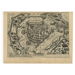
Antique Plan of Grave, The Netherlands, Showing the Siege of Grave in 1602
Located in Langweer, NL
Antique map titled 'Die Stat Grave' Bird's eye view plan of Grave, The Netherlands, Holland. Showing the siege of Grave in the year 1602 by Prince Maurits of The Netherlands. Source ...
Category
16th Century Antique Paper Maps
Materials
Paper
$414 Sale Price
20% Off
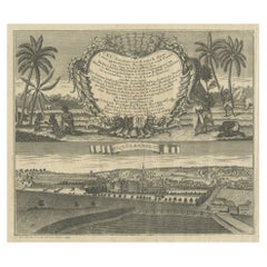
Large Title Cartouche and a View of Wilhermsdorf, Beieren, Germany, 1744
Located in Langweer, NL
Antique print titled 'Sauber und nach dem Leben gezeichnete Prospecten und Plans, von den wichtigsten der Holländisch-Ost-Indischen-Compagnie in Africa u: Asia (..)'. Frontispiece of...
Category
1740s Antique Paper Maps
Materials
Paper
$273 Sale Price
20% Off
Antique Map of Western Russia by Levasseur, '1875'
Located in Langweer, NL
Antique map titled 'Carte de la Russie Occidentale (..)'. Large map of Western Russia. This map originates from 'Atlas de Géographie Moderne Physique et Politique' by A. Levasseur. P...
Category
Late 19th Century Antique Paper Maps
Materials
Paper
$330 Sale Price
20% Off
Antique Political Map of the Japanese Empire, 1922
Located in Langweer, NL
Antique map of Japan titled 'Japanese Empire - Political Map'. Old map of Japan depicting Japan, Korea and surroundings. This map originates from 'The Ti...
Category
20th Century Paper Maps
Materials
Paper
Antique Map of Java, Madura, Bali and the Sunda Strait, Indonesia, c.1770
Located in Langweer, NL
Antique map Indonesia titled 'Nouvelle Carte de l'Isle de Java - Nieuwe kaart, van het Eiland Java'. Chart of the island of Java, depicting soun...
Category
18th Century Antique Paper Maps
Materials
Paper
$424 Sale Price
20% Off
Antique Map of Turkey and Greece, 1852
Located in Langweer, NL
Antique map titled 'Europisch Turkije en Griekenland'. Map of Turkey in Europe and Greece. This map originates from 'School-Atlas van alle deelen der Aar...
Category
19th Century Antique Paper Maps
Materials
Paper
$113 Sale Price
20% Off
Antique Map of Siberia by Lapie, 1842
Located in Langweer, NL
Antique map titled 'Carte de la Sibérie ou Russie d'Asie'. Map of Siberia. This map originates from 'Atlas universel de géographie ancienne et moderne (..)' by Pierre M. Lapie and Al...
Category
19th Century Antique Paper Maps
Materials
Paper
$330 Sale Price
20% Off
Antique Map of the Passage Between the Atlantic and Pacific Oceans, circa 1753
Located in Langweer, NL
Antique print, titled: 'Carte du Detroit de le Maire (…)' - This chart illustrates the important passage between the Atlantic and Pacific oceans. Jacob Le Maire and Willem Schouten d...
Category
18th Century Antique Paper Maps
Materials
Paper
$216 Sale Price
20% Off
Very Detailed Antique Map of the Jesuit Province of Bavaria, Germany, c.1700
Located in Langweer, NL
Antique map titled 'Provinciae Superior Germaniae Societatis.' Very detailed map of the Jesuit province of Bavaria, Germany. Source unknown, to be determined.
Artists and Engravers:...
Category
18th Century Antique Paper Maps
Materials
Paper
$565 Sale Price
20% Off
View of the City Banten or Bantam Near the Western End of Java, Indonesia, c1725
Located in Langweer, NL
Antique print titled 'La Ville de Bantam capitale du Roiaume de meme nom'.
A bird's eye view of the city Banten or Bantam near the western end of Java in Indonesia. Several tall ...
Category
1720s Antique Paper Maps
Materials
Paper
$697 Sale Price
20% Off
Antique Map of the Extension of the Russian Empire in the XIXth Century, 1806
Located in Langweer, NL
Antique map titled 'L'Empire Russe en Europe et en Asie'.
Map showing the extension of the Russian Empire at the beginning of the XIXth century. Several letterpress notations are...
Category
Early 1800s Antique Paper Maps
Materials
Paper
$528 Sale Price
20% Off
Antique Plan of Batavia and the Castle in the Dutch East Indies, 1763
Located in Langweer, NL
Antique map titled 'Grundriss von der Stadt und dem Schlosse Batavia.' Plan of the city and the castle of Batavia in the Dutch East Indies / Indonesia. From 'Algemeine Welthistorie (...
Category
18th Century Antique Paper Maps
Materials
Paper
$367 Sale Price
20% Off
Print of the British Parliament & an Assembly before the King of England, 1732
Located in Langweer, NL
Antique print titled 'Representation du Parlement d'Angletrre (..)'.
Series of scenes, which include from the British Parliament and an assembly...
Category
1730s Antique Paper Maps
Materials
Paper
$697 Sale Price
20% Off
Original Map of the Military Situation After the Dutch Blockade of Antwerp, 1648
Located in Langweer, NL
Antique map titled 'Tabula Castelli ad Sandflitam (..)'.
This map depicts the complex military situation that had developed after the Dutch blockade of Antwerp. All entrenchment'...
Category
1640s Antique Paper Maps
Materials
Paper
$631 Sale Price
20% Off
Antique Map of Batavia 'Jakarta', Indonesia by Montanus, circa 1669
Located in Langweer, NL
Antique map Batavia titled 'Ware Affbeeldinge wegens het Casteel ende Stadt Batavia'. Antique print of the castle and city of Batavia on the Island of Java'. Rare edition with Englis...
Category
17th Century Antique Paper Maps
Materials
Paper
$1,178 Sale Price
20% Off
Antique Map of the Region of Étampes and Sens by Janssonius, c.1650
Located in Langweer, NL
Antique map titled 'Gastinois et Senonois'. Old map of the region of Étampes and Sens, France. It shows the cities of Sens, Melun, Étampes, Orleans, Fontainebleau, Montargis and othe...
Category
17th Century Antique Paper Maps
Materials
Paper
$334 Sale Price
20% Off
Antique French Map of the Pacific Ocean with Australia and Polynesia, 1806
Located in Langweer, NL
Antique map titled 'Australasie et Polynesie'. Old map of Oceania and the Pacific Ocean. Originates from 'Atlas Portatif contenant la Géographie Universelle Ancienne et Moderne' by H...
Category
19th Century Antique Paper Maps
Materials
Paper
$113 Sale Price
20% Off
Antique Map of the Westerkwartier Region, a Region in Groningen, 1791
Located in Langweer, NL
Antique map titled 'Das Wester Quartier'. Original antique map of Westerkwartier, a region in the province of Groningen, the Netherlands. This map orginates from 'Schauplatz der fünf...
Category
18th Century Antique Paper Maps
Materials
Paper
Antique Print of Batavia Castle in Nowadays Jakarta, Indonesia, circa 1770
Located in Langweer, NL
Antique print titled 'Vue a Batavie du côte de la Courtine du Château - Prospect zu Batavia längst der Courtine des Castels'. Scarce view of Batavia Castle, present day Djakarta, Ind...
Category
18th Century Antique Paper Maps
Materials
Paper
$518 Sale Price
20% Off
Antique Map of the United Kingdom and Ireland, c.1873
Located in Langweer, NL
Antique map titled 'Groot Brittanje en Ierland'. Old map depicting the United Kingdom and Ireland, with inset maps of London and factory districts of the UK. This map originates from...
Category
19th Century Antique Paper Maps
Materials
Paper
$117 Sale Price
20% Off
Antique Map of the Region of Nivernais by Janssonius, 1657
Located in Langweer, NL
Antique map of France titled 'Carte du Païs et Duché de Nivernois'. Decorative map of the Nivernais region, part of Burgundy, France. This map originates from 'Atlas Novus, Sive Thea...
Category
17th Century Antique Paper Maps
Materials
Paper
$366 Sale Price
20% Off
Eason's War Map of Europe, circa 1914
Located in Langweer, NL
Antique map titled 'Eason's War Map of Europe'. Printed in Ireland. Source unknown, to be determined.
Artists and Engravers: Anonymous.
Condition: Good, ...
Category
20th Century Paper Maps
Materials
Paper
$518 Sale Price
20% Off
Antique Map of the Area around the Abbey in Soligny-la-Trappe 'c.1710'
Located in Langweer, NL
Antique map titled 'La nouvelle Thebaide ou la Carte tres particuliere et exacte de l'Abbaye de la Maison Dieu Nostre Dame de la Trappe (..)'. Rare, original map of the area around t...
Category
Early 18th Century Antique Paper Maps
Materials
Paper
$754 Sale Price
20% Off
Vintage Barrister's Map of London, English, Framed, Inner, Middle Temple, C.1970
Located in Hele, Devon, GB
Our Stock # 24730
This is a vintage barrister's map of London. An English, annotated Inner and Middle Temple lithograph framed behind glass, dating to the late 20th century, circa 1...
Category
Late 20th Century British Mid-Century Modern Paper Maps
Materials
Glass, Wood, Paper
Antique Print with Coastal Views of Kamchatka in The Russian Far East, c.1784
Located in Langweer, NL
Antique print titled 'Views of the Coast of Kamtschatka (..)'. Print with coastal views of Kamchatka including volcanoes. Originates from an edition of Cook's Voyages.
Artists and ...
Category
18th Century Antique Paper Maps
Materials
Paper
$301 Sale Price
20% Off
Antique Print of Zihuatanejo and the harbour of Acapulco in South America, 1749
Located in Langweer, NL
Antique print titled 'Vue de l'entree de Chequetan ou Seguataneo, restant au N.E. a la distance de 5 milles.' 'Vue de l'entree du port d'Acapulco.' View of Zihuatanejo and the harbou...
Category
18th Century Antique Paper Maps
Materials
Paper
$207 Sale Price
20% Off
Architectural Antique Print of Various Garden Temples by Le Rouge, c.1785
Located in Langweer, NL
Untitled antique print showing various garden temples. This print originates from 'Jardins Anglo-Chinois à la Mode' by Georg Louis le Rouge. Artists and ...
Category
18th Century Antique Paper Maps
Materials
Paper
Large Antique Map of Gaul under Roman Rule, ca.1760
Located in Langweer, NL
Antique map titled 'Gallia Augustiniana in suas provincias divisa (..)'. Large antique map of Roman Gaul, it refers to Gaul under provincial rule in ...
Category
1760s Antique Paper Maps
Materials
Paper
$396 Sale Price
20% Off
Antique Print of the Palace of Justice in Leeuwarden by Terwen, 1858
Located in Langweer, NL
Antique print titled 'Leeuwarden. Het Paleis van Justitie.' Old print of the city of Leeuwarden showing the Palace of Justice. This print originates from 'Het koningrijk der Nederlan...
Category
19th Century Antique Paper Maps
Materials
Paper
Large Original Antique Map of New York, USA, 1894
Located in St Annes, Lancashire
Fabulous map of New York.
Original color.
By Rand, McNally & Co.
Published, 1894
Unframed
Free shipping.
Category
1890s American Antique Paper Maps
Materials
Paper
Copper Engraving Showing the Neptune Fountain of Versailles, Paris, France, 1785
Located in Langweer, NL
Antique print titled 'Plan de la décoration du Bassin de Neptune à Versailles'.
Copper engraving showing parts of the Neptune fountain of Versaill...
Category
1780s Antique Paper Maps
Materials
Paper
$367 Sale Price
20% Off
Antique Map of the Admiralty Islands, Bismarck Archipelago
Located in Langweer, NL
Antique map titled 'Trois Vues des Isles de l'Amirauté'. Several coastal views of the Admiralty Islands, Bismarck Archipelago, to the north of New Guinea in the South Pacific Ocean.
...
Category
Late 18th Century Antique Paper Maps
Materials
Paper
$358 Sale Price
20% Off
Antique Lithograph of a Japanese Junk, a Type of Sailing Ship, 1856
Located in Langweer, NL
Antique print titled ‘Japanese Junk'.
Lithograph of a Japanese junk, a type of sailing ship. This print originates from 'Narrative of the expedition of an A...
Category
1850s Antique Paper Maps
Materials
Paper
$358 Sale Price
20% Off
Large Antique Map of England and Wales
Located in Langweer, NL
Antique map titled 'An Accurate Map of England and Wales'. Original old map of England and Wales. Engraved by John Cary. Originates from 'New British Atlas' by John Stockdale, publis...
Category
Early 19th Century Antique Paper Maps
Materials
Paper
$311 Sale Price
20% Off
Antique Map of Peru and Bolivia by Thierry, 1836
Located in Langweer, NL
Antique map titled 'Pérou et Bolivia'. Decorative map of Peru and Bolivia with outline coloring. Originates from 'Atlas Complet Du Precis De La Geographie ...
Category
19th Century Antique Paper Maps
Materials
Paper
$122 Sale Price
20% Off
Antique Map of the Region of Fréjus, France
Located in Langweer, NL
Title: "Golf de Fréjus"
Description: This antique map, titled "Golf de Fréjus," is an original depiction of the region of Fréjus, France. It is part of the work "Le Petit Atlas Mari...
Category
Mid-18th Century Antique Paper Maps
Materials
Paper
$280 Sale Price
30% Off
Large Original Antique City Plan of Baltimore, USA, 1894
Located in St Annes, Lancashire
Fabulous colorful map of Baltimore
Original color
By Rand, McNally & Co.
Published, 1894
Unframed
Free shipping.
Category
1890s American Antique Paper Maps
Materials
Paper
Antique Map of the Region of Winschoten, Groningen in The Netherlands, 1862
Located in Langweer, NL
Groningen: Gemeente Arrondisement Winschoten. These scarse detailed maps of Dutch Towns originate from the 'Gemeente atlas van de Provincie Groningen in 62 kaarten.' by C. Fehse. Thi...
Category
19th Century Antique Paper Maps
Materials
Paper
$179 Sale Price
20% Off
Antique Map of Mauritania, Massaesylia, Numidia, Tunisia, Cyrenaica & Marmarica
Located in Langweer, NL
Three maps on one sheet showing Mauritania, Massaesylia, Numidia, Tunisia, Cyrenaica and Marmarica (ancient Libya). This map originates from 'Schul-Atlas für die alte Erdbeschreibung...
Category
Early 19th Century Antique Paper Maps
Materials
Paper
$339 Sale Price
20% Off
Old Engraving of Volcano Piton de la Fournaise on Reunion Island, c.1750
Located in Langweer, NL
Antique print titled 'Eiland van St. Filippus, of van Fuego, met zyn vuurberg'. Old print of Piton de la Fournaise, a shield volcano on the eastern side of Reunion island...
Category
18th Century Antique Paper Maps
Materials
Paper
$226 Sale Price
20% Off
Map of East Friesland, The Netherlands & the Area Emden & Norden, Germany, 1635
Located in Langweer, NL
Antique map titled 'Typus Frisiae Orientalis.'
Map of East Friesland and the area around Emden and Norden. Large inset map of the mouth of the Amasis River. The map is decorated with a large title cartouche and two large coats of arms...
Category
1630s Antique Paper Maps
Materials
Paper
$1,744 Sale Price
20% Off
Antique Map of the Region Around the Nile and the City of Carthage
Located in Langweer, NL
Antique map titled 'Aegypti recentior descriptio - Carthaginis Celeberrimi sinus typus'. Two detailed regional maps by Ortelius. One map shows the region around the Nile, as far as A...
Category
16th Century Antique Paper Maps
Materials
Paper
$546 Sale Price
20% Off
Antique Map of the Eastern Part of Germany, with Parts of Poland and Slovakia
Located in Langweer, NL
Antique map titled 'A New Map of the Circle of Upper Saxony: with the Duchy of Silesi and Lusatia, from the latest authorities'. Clear and accurate map of what is now the eastern par...
Category
Early 19th Century Antique Paper Maps
Materials
Paper
$414 Sale Price
20% Off
Antique Print with Coastal Views of Kamchatka in Russia by Cook, 1803
Located in Langweer, NL
Antique print Russia titled 'Gezigten der Kust van Kamtchatka'. Print with coastal views of Kamchatka including volcanoes. Originates from 'Reizen...
Category
19th Century Antique Paper Maps
Materials
Paper
$273 Sale Price
20% Off
Old Map of the British Isles with the Faroes and Shetlands, Showing Cock Fights
Located in Langweer, NL
Antique map titled 'Les Isles Britaniques ou sont les Royaumes d'Angleterre (..)'. Original old map of the British Isles with inset maps of the Faroes and Shetlands. The title cartouche depicts dog...
Category
Early 18th Century Antique Paper Maps
Materials
Paper
$433 Sale Price
20% Off
Antique Map of Moldova to Thessaly and from the Adriatic to the Black Sea, 1880
Located in Langweer, NL
Antique map titled 'Turquie d'Europe'.
Map of the european parts of Turkey. The map covers from Moldova to Thessaly and from the Adriatic to the Black Sea. Greece and the island ...
Category
1880s Antique Paper Maps
Materials
Paper
$132 Sale Price
20% Off
Antique Print of a Chestnut by Knoop, 1758
Located in Langweer, NL
Antique print of a chestnut. Originates from 'Pomologia' by J. H. Knoop.
Artists and Engravers: Published by Johann Hermann Knoop (c.1700-1769).
Condition: Good, general age-re...
Category
18th Century Antique Paper Maps
Materials
Paper
$311 Sale Price
20% Off
Antique Map of India, the East Indies and the Philippines
Located in Langweer, NL
Antique map titled 'Les Indes Orientales et leur Archipel'. Original antique map of India, the East Indies and the Philippines. Source unknown, to be determined. Published circa 1760.
Category
Mid-18th Century Antique Paper Maps
Materials
Paper
$358 Sale Price
20% Off
Antique Map of Madagascar by N. Sanson, circa 1680
Located in Langweer, NL
Antique map titled 'Isle de Madagascar ou de St. Laurens. Tiree de Sanutu &c'. Antique map of Madagascar, first published by Sanson in 1657. Sanson n...
Category
Late 17th Century Antique Paper Maps
Materials
Paper
$235 Sale Price
20% Off
Antique Map of Berkshire, South East England
Located in Langweer, NL
Antique map titled 'Bercheria vernacule Barkshire'. Original old map of Berkshire, a historic county in South East England. Published circa 1665 by J. Blaeu. Willem Jansz. Blaeu and ...
Category
Mid-17th Century Antique Paper Maps
Materials
Paper
$1,131 Sale Price
20% Off
Antique Map of the Islands of Iwo Jima and Sulfur
Located in Langweer, NL
Untitled Antique Map of the islands of Iwo Jima and Sulfur, with a view of Sulphur with the hill. This map originates from 'A new, authentic, and complete collection of voyages round...
Category
Late 18th Century Antique Paper Maps
Materials
Paper
$245 Sale Price
20% Off
Antique Print with Views of Tinian Island, the Northern Mariana Islands, 1749
Located in Langweer, NL
Antique print titled 'Le cote du sud-ouest de l'Ile de Tinian' and 'Vue de la rade de Tinian, ou le Centurion fit de l'eau.' Views of the south-west side of the island of Tinian and a view of the anchorage of Tinian, where the Centurion got water. This print originates from 'Reize rondsom de Werreld (..)' by George Anson, published 1749.
Tinian is one of the three principal islands of the Commonwealth of the Northern Mariana Islands...
Category
18th Century Antique Paper Maps
Materials
Paper
$176 Sale Price
66% Off
Antique Map of the Niederrhein region, Germany
Located in Langweer, NL
Antique map titled 'Circulus Electorum Rheni sive Rhenanus Inferior (..)'. Original antique map of the Niederrhein region, Germany. By F. de Wit, circa 1690.
Frederick de Wit (1629-...
Category
Late 17th Century Antique Paper Maps
Materials
Paper
$424 Sale Price
20% Off
Original Antique Map of Peru in South America, 1875
Located in Langweer, NL
Antique map titled 'Carte générale du Pérou'. Large map of Peru. This map originates from 'Atlas de Géographie Moderne Physique et Politique' by A. Levasse...
Category
Late 19th Century Antique Paper Maps
Materials
Paper
$330 Sale Price
20% Off
Original Antique Map of the Township of Winschoten in The Netherlands, 1862
Located in Langweer, NL
Groningen: Gemeente Winschoten-St. Vitus Holt. These scarse detailed maps of Dutch Towns originate from the 'Gemeente atlas van de Provincie Groningen in 62 kaarten.' by C. Fehse. Th...
Category
19th Century Antique Paper Maps
Materials
Paper
$150 Sale Price
20% Off
Antique Map of Kollumerland, a Township in Friesland, The Netherlands, 1868
Located in Langweer, NL
Antique map titled 'Provincie Friesland - Gemeente Kollumerland en Nieuw-Kruisland'.
Map of the township of Kollumerland including Kollum, Westergeest, Burum and many other villa...
Category
19th Century Antique Paper Maps
Materials
Paper
$122 Sale Price
20% Off
Recently Viewed
View AllMore Ways To Browse
Antique Wellington Chests
Antonio Cassi Ramelli
Archimede Seguso Birds
Art Deco Coasters
Art Deco Footballer
Art Deco Music Cabinet
Art Deco Waterfall Bedroom Furniture
Art Deco Waterfall Bedroom
Art Deco Whisky
Art Foulard
Art Nouveau Sunflower
Arts And Crafts Silver Coffee Pot
Asian Pink Bowl
Avesn Vase
Baccarat Carafe
Bakelite Bird
Bakelite Cocktail Picks
Bamboo Ikebana Vase
