18th Century and Earlier Maps
to
2,336
2,869
64
2,936
26
12
1
1
2,936
2,266
475
3
290
34
10
126
10
37
9
2
5
4
3
3
2,922
30
20
3
3
307
111
81
53
52
2,936
2,936
2,936
59
21
13
12
12
Period: 18th Century and Earlier
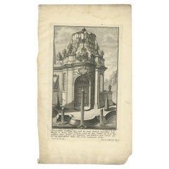
Pl. 2 Antique Print of a Garden Pavilion by Schübler, c.1724
Located in Langweer, NL
Antique print titled 'Scenographische Vorstellung eines nach der neuen Methode eingerichteten Lust Hausses (..)'. Copper engraving showing a garden pavilion...
Category
Antique 18th Century and Earlier Maps
Materials
Paper
$88 Sale Price
20% Off
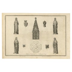
Figures & Ornaments on Northampton Cross, Basire, 1791
Located in Langweer, NL
Antique print titled 'Figures & Ornaments on Northampton Cross'. Antique print depicting the Eleanor cross near Northampton. Artists and Engravers: Made by J. Basire after Schnebbeli...
Category
Antique 18th Century and Earlier Maps
Materials
Paper
$142 Sale Price
20% Off
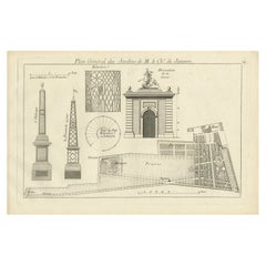
Pl. 24 Antique Print of various Garden Elements by Le Rouge, c.1785
Located in Langweer, NL
Antique print titled 'Plan général des Jardins de M. le Chr. de Janseen'. Copper engraving showing various garden elements. This print originates from 'Jardins Anglo-Chinois à la Mod...
Category
Antique 18th Century and Earlier Maps
Materials
Paper
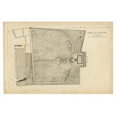
Pl. 9 Antique Print of the Park and Pavilion of Taverny by Le Rouge, c.1785
Located in Langweer, NL
Antique print titled 'Parc et Pavillon de Taverny'. Copper engraving of the park and pavilion of Taverny. This print originates from 'Jardins Anglo-Chinois à la Mode' by Georg Louis ...
Category
Antique 18th Century and Earlier Maps
Materials
Paper
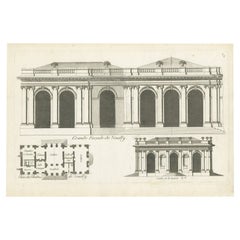
Pl. 6 Antique Print of Château De Neuilly by Le Rouge, C.1785
Located in Langweer, NL
Antique print titled 'Grande Facade de Neuilly'. Copper engraving showing part of Château de Neuilly. This print originates from 'Jardins Anglo-Chinois à la Mode' by Georg Louis le R...
Category
Antique 18th Century and Earlier Maps
Materials
Paper
Antique Print of Kedleston Hall by Gandon, c.1770
Located in Langweer, NL
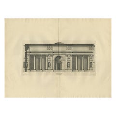
Antique print titled 'Section of the Hall (..)'. Old engraving with a cross section of (most likely) Kedleston Hall. This print originates from 'Vitruvius Britannicus' by Colen Campb...
Category
Antique 18th Century and Earlier Maps
Materials
Paper
Antique Print of Palazzo Chigi by De Rossi, c.1710
Located in Langweer, NL
Antique print titled 'Finestra del piano terreno del Palazzo (..)'. Old print of a ground floor window of Palazzo Chigi, Rome. This print originates from 'Studio d'architettura civil...
Category
Antique 18th Century and Earlier Maps
Materials
Paper
Cowdray Court from the Lodging House – Antique Engraving of Sussex Estate, 1796
Located in Langweer, NL
Cowdray Court from the Lodging House – Antique Engraving of Sussex Estate, 1796
This finely executed antique engraving presents a view of the inner court of Cowdray House, the histo...
Category
English Antique 18th Century and Earlier Maps
Materials
Paper
$151 Sale Price
20% Off
Pl. 2 Antique Architecture Print of a Dining Room and Lounge by Neufforge
Located in Langweer, NL
Antique print titled 'Decoration pour une Salle a Manger - Decoration pour un Salon'. Old print showing the design of a dining room and lounge. This print originates from 'Recueil Él...
Category
Antique 18th Century and Earlier Maps
Materials
Paper
Pl. 12 Antique Print of a Chinese Boat, Gothic Tower and Other Building
Located in Langweer, NL
Antique print titled 'Batiment Neuf - Barque Chinoise - Tour Gothique à Whitton (..)'. Copper engraving showing a Chinese boat, a new building and a gothi...
Category
Antique 18th Century and Earlier Maps
Materials
Paper
Antique Print of Three Temples by Shaw, 1773
Located in Langweer, NL
Untitled Print of three Temples in Tunisia. Originates from the first Dutch editon of an interesting travel account of Northern Africa titled 'Reizen en Aanmerkingen door en over Bar...
Category
Antique 18th Century and Earlier Maps
Materials
Paper
$104 Sale Price
20% Off
Pl. 20 Antique Print of the Bridge of Nogent Chapel and a Chinese Bridge by Le R
Located in Langweer, NL
Antique print titled 'Pont Ruiné à la Chapelle-Nogent (..)'. Copper engraving of the bridge of Nogent Chapel and a Chinese bridge. This print originates...
Category
Antique 18th Century and Earlier Maps
Materials
Paper
Pl. 15 Antique Print of the Garden of Maupertuis and Chaville by Le Rouge
Located in Langweer, NL
Antique print titled 'Tour dans les Jardins de Maupertuis (..)'. Copper engraving with a view of the garden of Maupertuis and Chaville. This print originates from 'Jardins Anglo-Chin...
Category
Antique 18th Century and Earlier Maps
Materials
Paper
Pl. 13 Antique Print of Tombs by Le Rouge, c.1785
Located in Langweer, NL
Antique print titled 'Autre Cote du Tombeau en retour'. Copper engraving of tombs. This print originates from 'Jardins Anglo-Chinois à la Mode' by Georg Louis le Rouge. Artists and E...
Category
Antique 18th Century and Earlier Maps
Materials
Paper
Antique Print of the Duke of York's Palace by Woolfe, c.1770
Located in Langweer, NL
Antique print titled 'Elevation of his Royal Highness the Duke of York's Palace in Pall Mall (..)'. View of the Duke of York's Palace in Pall Mall, London. This print originates from...
Category
Antique 18th Century and Earlier Maps
Materials
Paper
Antique Print of the Holy Sepulchre at Heckington, England, 1795
Located in Langweer, NL
Antique print titled 'The Holy Sepulchre at Heckington, in the county of Lincoln'. Antique print depicting the Holy Sepulchre at Heckington. Artists and...
Category
Antique 18th Century and Earlier Maps
Materials
Paper
Antique Print of Santa Bibiana by De Rossi, c.1710
Located in Langweer, NL
Antique print titled 'Facciata e Portico della Chiesa di Santa Bibiana (..)'. Old engraving of Santa Bibiana. Santa Bibiana is a small Baroque style, Roman Catholic church in Rome devoted to Saint Bibiana. The church façade was designed and built by Gian Lorenzo Bernini, who also produced a sculpture of the saint holding the palm leaf of martyrs. Originates from the folio of Domenico de Rossi...
Category
Antique 18th Century and Earlier Maps
Materials
Paper
Antique Print of the Great Hall of Houghton Hall, England, 1725
Located in Langweer, NL
Antique print titled 'Section of the great Hall of Houghton in Norfolk (..)'. Section of the Great Hall for Houghton Hall, Norfolk. This print originates...
Category
Antique 18th Century and Earlier Maps
Materials
Paper
Antique Print of the East Front of Beddington Place by Campbell, 1717
Located in Langweer, NL
Antique print titled 'The East Prospect to the Gardens of Beddington Place in Surrey (..)'. Elevation of Beddington Place (also known as Boddington or Carew Manor), England. This pri...
Category
Antique 18th Century and Earlier Maps
Materials
Paper
Antique Map of France under the reign of Henry III by Zannoni, 1765
Located in Langweer, NL
Antique map France titled 'Carte de la réunion des Comtés d'Evreux et d'Alencon (..)'. Beautiful old map of France. This map originates from 'Atlas Historique de la France Ancienne e...
Category
Antique 18th Century and Earlier Maps
Materials
Paper
$140 Sale Price
20% Off
Antique Map of France under the Reign of Louis XI by Zannoni, 1765
Located in Langweer, NL
Antique map France titled 'La Provence et la Bourgogne (..)'. Beautiful old map of France. This map originates from 'Atlas Historique de la France Ancienne et Moderne' by M. Rizzi Za...
Category
Antique 18th Century and Earlier Maps
Materials
Paper
$140 Sale Price
20% Off
Antique Map of France under the Reign of Louis XV by Zannoni, 1765
Located in Langweer, NL
Antique map titled 'La France renaissante sous le Règne heureux de Louis XV le Bien-Aimé (..)'. Beautiful old map of France. This map originates from 'Atlas Historique de la France A...
Category
Antique 18th Century and Earlier Maps
Materials
Paper
$151 Sale Price
20% Off
Antique Map of France under the Reign of Henry III by Zannoni, 1765
Located in Langweer, NL
Antique map France titled 'Etat de la France pendant le Règne d'Henri III (..)'. Beautiful old map of France. This map originates from 'Atlas Historique de l...
Category
Antique 18th Century and Earlier Maps
Materials
Paper
$145 Sale Price
20% Off
Antique Map of France under the Reign of Henry IV by Zannoni, 1765
Located in Langweer, NL
Antique map France titled 'Carte de la réunion de la Basse Navarre (..)'. Beautiful old map of France. This map originates from 'Atlas Historique de la France Ancienne et Moderne' by...
Category
Antique 18th Century and Earlier Maps
Materials
Paper
$145 Sale Price
20% Off
Antique Map of the Region of Weida by Schreiber, 1749
By Schreiber
Located in Langweer, NL
Antique map titled 'Das Amt Weida (..)'. Map of the region of Weida, Germany. This map originates from 'Atlas Selectus von allen Konigreichen und Landern der Welt' by Johann Georg Sc...
Category
Antique 18th Century and Earlier Maps
Materials
Paper
$133 Sale Price
20% Off
Antique Map of the Region of Utingeradeel in Friesland, The Netherlands, 1664
By B. Schotanus
Located in Langweer, NL
Antique map titled 'De Grietenye van Utingeradeel (..)'. Map of the Grietenij of Utingeradeel, Friesland, The Netherlands. Multiple cartouches, key and coat of arms. "Beschrijvinge e...
Category
Antique 18th Century and Earlier Maps
Materials
Paper
$275 Sale Price
20% Off
Antique Map of the Province of Limburg by Coronelli, 1692
Located in Langweer, NL
Antique map titled 'Ducea di Limburgo (..)'. Beautiful map of the Dutch province of Limburg. Originates from 'Corso Geographico Universale'.
Artists and Engravers: Published in Ven...
Category
Antique 18th Century and Earlier Maps
Materials
Paper
$637 Sale Price
20% Off
Antique Map of the Region of Zutphen in The Netherlands by Janssonius, 1647
Located in Langweer, NL
Antique map titled 'Ducatus Gelriae pars tertia Quae est Comitatus Zutphaniensis'. Antique map of the region of Zutphen, Gelderland, the Netherlands. This map originates from 'Atlas ...
Category
Antique 18th Century and Earlier Maps
Materials
Paper
$523 Sale Price
20% Off
Antique Map of the Region of Zutphen in Overijssel, The Netherlands, 1683
Located in Langweer, NL
Antique map titled 'Ducatus Gelriae pars prima Quae est Neomagensis'. Antique map of the region of Zutphen, Gelderland, the Netherlands. This map originates from 'The English Atlas' ...
Category
Antique 18th Century and Earlier Maps
Materials
Paper
$694 Sale Price
20% Off
Antique Map of the Rhine and Moselle River Region in Germany and France, c.1680
Located in Langweer, NL
Antique map titled 'Tabula Geographica qui Pars Meridionalis sive Superior Rheni, Mosae et Mosellae (..).'
Detailed map of the Rhine and Moselle River regions and contigous parts...
Category
Antique 18th Century and Earlier Maps
Materials
Paper
$523 Sale Price
20% Off
Antique Map of the Region of Weißensee by Schreiber, 1749
By Schreiber
Located in Langweer, NL
Antique map titled 'Die Chursaechsischen Aemter in Thüringen gelegen Sachsenburg, Weissensee (..)'. Map of the region of Weißensee, Germany. This map originates from 'Atlas Selectus von allen...
Category
Antique 18th Century and Earlier Maps
Materials
Paper
$371 Sale Price
20% Off
Antique Map of the Region of Wonseradeel, Friesland in the Netherlands, 1664
By B. Schotanus
Located in Langweer, NL
Antique map titled 'De Grietenije van Wonsera-deel (..).' Map of the Grietenij of Wonseradeel, Friesland, The Netherlands. Multiple cartouches, key and coat of arms. "Beschrijvinge e...
Category
Antique 18th Century and Earlier Maps
Materials
Paper
$180 Sale Price
20% Off
Antique Map of the Region of Zutphen, Netherlands by Janssonius, c.1680
Located in Langweer, NL
Antique map titled 'Ducatus Gelriae pars tertia Quae est Comitatus Zutphaniensis.'
Map of region around Zutphen in the historic Duchy Gelre in the Netherlands. Cities included in...
Category
Antique 18th Century and Earlier Maps
Materials
Paper
$428 Sale Price
20% Off
Antique County Map of Cheshire, Dutch, Framed, Cartography, Janssonius, C.1660
Located in Hele, Devon, GB
This is an antique county map of Cheshire. A Dutch, framed atlas engraving by Johannes Janssonius, dating to the 17th century and later.
A treat for the collector or county native,...
Category
Dutch Charles II Antique 18th Century and Earlier Maps
Materials
Glass, Wood, Paper
Original Antique Map of the Northwestern Part of Russia in Europe, 1753
Located in Langweer, NL
Antique map titled 'Partie septentrionale de la Russie Européenne'.
Detailed map of the Northwestern part of Russia, from the Gulf of Finland and Poland, to the western part of Asian Russia.
Artists and Engravers: Gilles Robert de Vaugondy (1688-1766) was the head of a leading family of geographers in eighteenth century France. Gilles got his start when he jointly inherited the shop of Pierre-Moullart Sanson, grandson of the famous geographer Nicholas Sanson. The inheritance included the business, its stock of plates, and a roller press...
Category
Antique 18th Century and Earlier Maps
Materials
Paper
$561 Sale Price
20% Off
Old Portrait of Henry Frederick, Prince of Wales, c.1750
Located in Langweer, NL
Antique portrait titled 'Henry, Prince of Wales, Son of K. James I'.
Old portrait of Henry Frederick. Henry Frederick, Prince of Wales (1594-1612) was the elder son of James VI and I, King of England and Scotland, and his wife, Anne of Denmark. Prince Henry was widely seen as a bright and promising heir to his father's thrones. However, at the age of 18, he predeceased his father when he died of typhoid fever. His younger brother Charles succeeded him as heir apparent to the English, Irish and Scottish thrones...
Category
Antique 18th Century and Earlier Maps
Materials
Paper
$342 Sale Price
20% Off
Antique Map of Hangzhou, Capital of the Province of Zheijang, China, c.1750
Located in Langweer, NL
Antique map titled ‘Plan de la ville de Hang-Tcheou-Fou ou Hang-Chew-Fu Capitale de la Province de Che-Kiang’. This original print shows a map of the city of Hangzhou, capital of the...
Category
Antique 18th Century and Earlier Maps
Materials
Paper
$323 Sale Price
20% Off
Sea Chart of Part of the Southwestern Coast of Sumatra & Nias, Indonesia, C1775
Located in Langweer, NL
Antique map titled 'Carte de la Côte Occidentale de l'Isle Sumatra'. Sea chart of the part of the south-western coast of Sumatra with the Nassau (Nias) and Fortune isles.
Artists ...
Category
Antique 18th Century and Earlier Maps
Materials
Paper
$481 Sale Price
25% Off
Uncommon Antique Map of the English Channel Coastline, ca.1709
Located in Langweer, NL
Antique map titled 'Partie de L'Angleterre' Uncommon map of the English Channel coastline with many boats on the sea. Source unknown, to be determined.
Artists and Engravers: Made...
Category
Antique 18th Century and Earlier Maps
Materials
Paper
$513 Sale Price
20% Off
Uncommon Rare Map Showing The Louisiade Archipelago, Papua New Guinea, ca.1798
Located in Langweer, NL
Antique map titled 'Carte de la Partie Septentrionale de l'Archipel de la Louisiade'.
Uncommon map showing the area around the Louisiade Archipelago, named for Louis XV by Louis ...
Category
Antique 18th Century and Earlier Maps
Materials
Paper
$799 Sale Price
20% Off
Decorative Original Antique Map of the North of Flanders, Belgium, 1697
Located in Langweer, NL
Antique map titled 'Fiandra Parte Occidentale (..)'.
Depicts northern part of Flanders, from North Sea, extends through the northern region of France to the cities of Douai and V...
Category
Antique 18th Century and Earlier Maps
Materials
Paper
$875 Sale Price
20% Off
Map of Friesland with Terschelling, Vlieland, Ameland En Schiermonnikoog, C.1670
Located in Langweer, NL
Antique print, titled: 'Tabula Comitatus Frisiae …'
Map of Friesland with the island Terschelling, Vlieland, Ameland en Schiermonnikoog. With a cartouche and a compass rose. Publ...
Category
Antique 18th Century and Earlier Maps
Materials
Paper
$520 Sale Price
40% Off
Old Map of the Province of Groningen, the Netherlands & inset of Islands, C.1680
Located in Langweer, NL
Antique map titled 'Tabulae dominii Groeningae quae et complecitur maximam partem Drentiae Emendata'.
Old map of the province of Groningen, the Netherlands. With an inset map of ...
Category
Antique 18th Century and Earlier Maps
Materials
Paper
$1,189 Sale Price
20% Off
Rare Chart of Indonesia Including Borneo, Java, Celebes, Ceram and More, 1779
Located in Langweer, NL
Antique map titled 'Carte de la Navigation de Batavia a Amboina'.
Rare chart of Indonesia including Borneo, Java, Celebes, Ceram and more. This map originates from 'Voyage par le Cap...
Category
Antique 18th Century and Earlier Maps
Materials
Paper
$846 Sale Price
20% Off
Palace & Gardens of Shah Shuja, Prince of Rajmahal & Munger, India, 1757
Located in Langweer, NL
Antique print titled 'Paleis en Tuynen van Cha-Sousa Prins van Ragi Mohol - Grondtekening der Stad Mongheer‘.
This print depicts the palace and gardens of Shah Shuja, Prince of R...
Category
Antique 18th Century and Earlier Maps
Materials
Paper
$228 Sale Price
20% Off
Old Print of an Oriental Man in a Small Carriage Pulled by Oxen, 1782
Located in Langweer, NL
Untitled print of an oriental man, possible an Indian, in a small carriage pulled by oxen. This print originates from: 'Voyage aux Indes Orientales et a...
Category
Antique 18th Century and Earlier Maps
Materials
Paper
$304 Sale Price
20% Off
Old Print of a Large Procession of the Emperor's Niece in Japan, 1669
Located in Langweer, NL
Antique print titled 'Groote Staatsie der Kaisarlyke Nicht.'
This print shows a large procession of the Emperor's Niece. It shows a small carriage d...
Category
Antique 18th Century and Earlier Maps
Materials
Paper
$304 Sale Price
20% Off
Old Print of Japanese Noblewoman Transported in a Rickshaw or Jinrikisha, 1669
Located in Langweer, NL
Untitled antique print of a Japanese noblewoman transported in a pushed rickshaw or jinrikisha.
This print originates from Arnoldus Montanus' "Gedenkwaerdige Gesantschappen der O...
Category
Antique 18th Century and Earlier Maps
Materials
Paper
$304 Sale Price
20% Off
Antique Print of a Cottage in an English Garden by Le Rouge, c.1785
Located in Langweer, NL
Antique print titled 'Exterieur de la Chaumiere du Jardin Anglais'.
Copper engraving of a cottage in an English garden. This print originates from '...
Category
Antique 18th Century and Earlier Maps
Materials
Paper
$352 Sale Price
20% Off
Antique Print of the Southern Facade of Coombank in Kent, England, c.1770
Located in Langweer, NL
Antique print titled 'South Front of Coombank'. Southern facade of Coombank, Duke of Argyle's mansion.
This print originates from 'Vitruvius Britannicus' by Colen Campbell. Artis...
Category
Antique 18th Century and Earlier Maps
Materials
Paper
$371 Sale Price
20% Off
Original Antique Plan of Rouffach, France, with Chateau d'Isenbourgh, 1588
Located in Langweer, NL
Antique map titled 'Die Statt Rufach mit sampt dem Schloss Isenburg (..)'.
Original antique bird's-eye view plan of Rouffach, France, with Chateau d'Isenbourg. This map originate...
Category
Antique 18th Century and Earlier Maps
Materials
Paper
$456 Sale Price
20% Off
Splendid Detailed Map of the Province of Overijssel in the Netherlands, ca.1692
Located in Langweer, NL
Antique map titled 'Tran-siselana'. Splendid detailed and decorative map of the province of Overijssel in the Netherlands by Vincenzo Coronelli. An elaborate title cartouche garlande...
Category
Antique 18th Century and Earlier Maps
Materials
Paper
$1,454 Sale Price
24% Off
Antique Bird's-eye View Plan of Zierikzee in Zeeland, The Netherlands, 1649
Located in Langweer, NL
Antique print, titled: 'Zirizea.' - A bird's-eye view plan of Zierikzee in The Netherlands, with key to locations and coats of arms. After Matheo Rollando and Stephano Bellemo. Latin tekst on verso. From the city Atlas: 'Toneel der Steeden' published by Joan Blaeu...
Category
Antique 18th Century and Earlier Maps
Materials
Paper
$1,094 Sale Price
20% Off
Detailed Map of the South of the The Netherlands & The North of Belgium, ca.1680
Located in Langweer, NL
Antique map titled 'Tabula Ducatus Brabantiae.' - Detailed map of the southern part of The Netherlands and the northern part of Belgium with Antwerp and Brussels. In the corner top l...
Category
Antique 18th Century and Earlier Maps
Materials
Paper
$637 Sale Price
20% Off
Antique Map of the Gulf of Bothnia, the Northernmost Arm of the Baltic, 1759
Located in Langweer, NL
Antique map titled 'Suite du Golphe de Bothnie'.
Original antique map of the Gulf of Bothnia, the northernmost arm of the Baltic Sea. It is situated between Finland's west coast ...
Category
Antique 18th Century and Earlier Maps
Materials
Paper
$228 Sale Price
20% Off
Antique Print of Longleat in Wiltshire, England, 1725
Located in Langweer, NL
Antique print titled 'Long Leate in Wiltshire (..)'.
Old engraving of Longleat, Wiltshire. Longleat is an English stately home and the seat of the Marquesses of Bath. It is a lea...
Category
Antique 18th Century and Earlier Maps
Materials
Paper
$799 Sale Price
20% Off
Gironde, Where Rivers Dordogne & Garonne Meet Near Bordeaux, France, ca.1770
Located in Langweer, NL
Antique map titled 'Carte des Entrées et Cours de la Gironde'.
Large map of the region of the Gironde estuary. It is formed from the meeting of the rivers Dordogne and Garonne ju...
Category
Antique 18th Century and Earlier Maps
Materials
Paper
$989 Sale Price
20% Off
Old Chart of the North-Eastern Coast of Australia Discovered by Cook, 1774
Located in Langweer, NL
Antique print titled Carte d'une Partie de la Cote de la N.le Galles Merid etc.
An interesting chart of the north-eastern coast of Australia discovered by Cook in 1770, showing th...
Category
Antique 18th Century and Earlier Maps
Materials
Paper
$723 Sale Price
20% Off
Frisian Cities Bolsward, Stavoren, Harlingen & Hindelopen, The Netherlands, 1598
Located in Langweer, NL
Antique map titled ‘Bolzvardia, Stavria, Harlinga, Hindelopia’. Four maps on one sheet. This map depicts the cities Bolsward, Stavoren, Harlingen and Hindeloopen (Friesland, The Neth...
Category
Antique 18th Century and Earlier Maps
Materials
Paper
$1,094 Sale Price
20% Off
Map of the Shire of Westergo in the Province of Friesland, the Netherlands, 1664
Located in Langweer, NL
Antique map titled 'Westergoa Olim Westrachia.'
Map of the shire of Westergo in the province of Friesland in the Netherlands, including Stavoren, Bolswar...
Category
Antique 18th Century and Earlier Maps
Materials
Paper
$799 Sale Price
20% Off
