18th Century Maps
to
1,512
1,848
17
1,867
26
1
1
2,936
2,283
475
3
290
34
10
126
10
37
9
2
5
4
3
3
1,854
19
11
3
1
170
52
47
38
35
1,867
1,867
1,867
21
13
12
11
11
Period: 18th Century
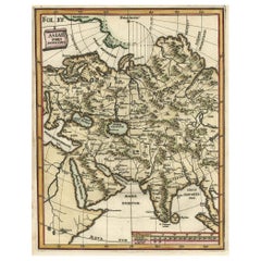
Antique Map of Central Asia Wiht Nova Zembla as an Island, C.1700
Located in Langweer, NL
Antique map titled 'Asiae Pars Potissima.' Attractive map focusing on the central part of Asia but extending to include much of Eastern Europe and Northeastern Africa. The Caspian Se...
Category
Antique 18th Century Maps
Materials
Paper
$522 Sale Price
20% Off
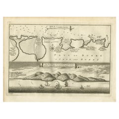
Antique Map and View of the Bay of Sierra Leone in Africa, C.1750
Located in Langweer, NL
Antique print titled 'Baye de Sierra Leona (..) - Baai van Sierra Leona (..)'. Map and view of the bay of Sierra Leone. This print originates from 'Historische beschryving der Reizen...
Category
Antique 18th Century Maps
Materials
Paper
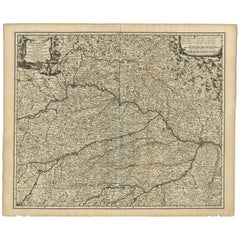
Antique Map of Bavaria ‘Bayern, Germany’ by N. Visscher, circa 1700
Located in Langweer, NL
Antique map titled 'Bavariae pars inferior cum insertis et adjacentibus regionibus (..)'. Published circa 1700 in N. Visscher's World Atlas.
The map "Bavariae pars inferior cum inse...
Category
Dutch Antique 18th Century Maps
Materials
Paper
$579 Sale Price
20% Off
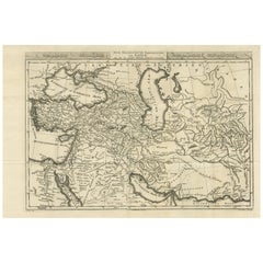
Antique Map of Western Asia by Van Dùren '1752'
Located in Langweer, NL
Antique map titled 'Neue Geographische Vorstellung von Asien'. Original antique map of Western Asia. This map originates from 'Neue Sammlung der merkwürdigsten Reisegeschichten, inso...
Category
Antique 18th Century Maps
Materials
Paper
$427 Sale Price
20% Off
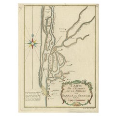
Antique Map of The Senegal River by Bellin, 1746
Located in Langweer, NL
Antique map titled 'Carte de l'Entrée de la Rivière de Sanaga ou Senegal'. Map of the mouth of the Senegal River. This map originates from Prevost's 'Histoire Generale des Voyages'. ...
Category
Antique 18th Century Maps
Materials
Paper
$223 Sale Price
20% Off
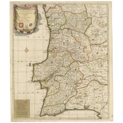
Antique Map of Portugal by P. Schenk, circa 1700
Located in Langweer, NL
Antique map titled 'Portugalliae et Algarbia'. Striking example of Schenk's rare map of Portugal, with the coats of arms of Portugal, Algarbia and a Spanish sailing vessell in the ca...
Category
Antique 18th Century Maps
Materials
Paper
$822 Sale Price
20% Off
Antique Map of the Siege of Batavia by Van Schley 'c.1750'
Located in Langweer, NL
Antique map titled 'Batavia assiecé en 1629 - Batavia 1629 belegerd'. Bird's eye view map of the siege of Batavia in 1629, Jakarta, Indonesia. This print originates from the Dutch ed...
Category
Antique 18th Century Maps
Materials
Paper
$237 Sale Price
20% Off
Antique Map of the Straits of Gibraltar by J. Gascoyne, circa 1716
Located in Langweer, NL
Antique map titled 'A Chart of the Straits of Gibraltar'. This chart shows the tides running through the Straits of Gibraltar, between southern Spain and northern Africa. Tide tables...
Category
Antique 18th Century Maps
Materials
Paper
$617 Sale Price
20% Off
Antique Map of the Region Centered on the Malay Peninsula by Tirion 'c.1760'
Located in Langweer, NL
Antique map titled 'Nuova Carta dell' India (..)'. Decorative map of the region centered on the Malay Peninsula and extending from the Straits of Singapore, Malacca and Borneo in the South to China in the east and the Bay of Bengal...
Category
Antique 18th Century Maps
Materials
Paper
$926 Sale Price
20% Off
Antique Map of the Island of Java, Indonesia by P. Van Der Aa, 1713
Located in Langweer, NL
This rare map shows the Indonesian island of Java. With compass rose and scale. From: Nouvel Atlas, très exact et fort commode pour toutes sortes de personnes, Contenant Les Principa...
Category
Antique 18th Century Maps
Materials
Paper
$646 Sale Price
20% Off
Antique Map of the Region of Boulogne-sur-Mer by Bellin '1764'
Located in Langweer, NL
Antique map titled 'Plan de Boulogne et des Environs'. Original antique map of the region of Boulogne-sur-Mer, France. This map originates from 'Le petit atlas maritime: recueil de c...
Category
Antique 18th Century Maps
Materials
Paper
Antique Map of Asia by Tirion 'c.1760'
Located in Langweer, NL
Antique map titled 'Nuova Carta dell Asia'. Decorative map of Asia. Published by I. Tirion, circa 1760.
Category
Antique 18th Century Maps
Materials
Paper
$1,045 Sale Price
20% Off
Antique Map of the Arabian Peninsula by Bellin 'c.1740'
Located in Langweer, NL
Antique map titled 'Carte de la Coste d'Arabie, Mer Rouge et Golfe de Perse'. Original antique map of the Arabian Peninsula, labes both Mecca and Med...
Category
Antique 18th Century Maps
Materials
Paper
$475 Sale Price
20% Off
Antique Map of the West Coast of North America & North East Coast of Asia '1772'
Located in Langweer, NL
Antique map titled 'Carte des nouvelles decouvertes/ Extrait d'une Carte Japonoise de l'Universe'. Map of the West Coast of North America and North-East Coast of Asia, based upon Buache's report of the various Russian Discoveries between 1731 and 1742 including the various explorers routes and notes. The lower map is based upon a Japanese map...
Category
Antique 18th Century Maps
Materials
Paper
$617 Sale Price
20% Off
Antique Plan of the Kungur Ice Cave by Bellin, '1768'
Located in Langweer, NL
Antique map titled 'Plan de la Grotte de Kungur'. Original plan of the Kungur Ice Cave, a karst cave located in the Urals, near the town Kungur in Perm Krai, Russia, on the right ban...
Category
Antique 18th Century Maps
Materials
Paper
$190 Sale Price
20% Off
Antique Bible Plan of Jerusalem by Covens & Mortier, 1743
Located in Langweer, NL
This plan originates from ‘Biblia Sacra, dat is, de H. Schriftuer van het Oude, en het Nieuwe Testament, naer de laetste Roomsche keure der gemeine Latijnsche overzettinge, in nederd...
Category
Antique 18th Century Maps
Materials
Paper
$522 Sale Price
20% Off
Antique Plan of the Residence of the Mayor of Amsterdam by H. de Leth circa 1732
Located in Langweer, NL
Antique print titled 'Plattegrond van de Hofstede en het huis te Spyk. Behorende de Edelen van Grootambacht. Heere en Mr. Ian van de Poll Burgermeester der stad Amsterdam'. Rare plan...
Category
Antique 18th Century Maps
Materials
Paper
$456 Sale Price
20% Off
Stunning Antique Map of Northern Italy by J.B. Homann, circa 1745
Located in Langweer, NL
This beautiful hand-colored map covers from Bergamo east as far as Albona (Labin) and from Vipiteno Sterzing south as far as Florence.
The map is exceptionally detailed, noting towns, rivers, lakes, cities and a host of additional topographical features. Includes neighboring Parma, Modena, Mantua and Mirandol. The map depicts the Veneto region and its vicinity during the decline of the Republic of Venice. A key in included in the top left quadrant of the map, while a beautifully engraved title cartouche adorns the lower right quadrant. This map was issued in Homann Heirs circa 1745 edition of Atlas Novus Terrarum Orbis.
Category
Antique 18th Century Maps
Materials
Paper
$618 Sale Price
25% Off
Antique Map of Spain by N. de Fer, circa 1700
Located in Langweer, NL
Antique map of Spain and Portugal with a title cartouche. Nicolas de Fer was the youngest son of the Paris printer and publisher Antoine de Fer. At the ...
Category
Antique 18th Century Maps
Materials
Paper
$152 Sale Price
20% Off
Antique Map of Malabar Coast by Valentijn, 1726
By F. Valentijn
Located in Langweer, NL
Untitled sea chart of the coast of Malabar, India. This print originates from 'Oud en Nieuw Oost-Indiën' by F. Valentijn.
Category
Dutch Antique 18th Century Maps
Materials
Paper
$427 Sale Price
20% Off
Antique Map of the Cape of Good Hope by J.N. Bellin, 1748
Located in Langweer, NL
Early plan of the Cape of Good Hope, includng a town plan and illustrations of the fortificatons. This map originates from Tome V of Abbe Prevost's Histoire generale du voyages.
Category
Antique 18th Century Maps
Materials
Paper
$327 Sale Price
20% Off
Interesting Antique Engraving of the World in Hemispheres with 6 Diagrams, 1788
Located in Langweer, NL
Antique map titled 'De Nieuwe en Ouden oppervlakke en doorzigtkundige Aardrykes Bollen (..)'. Twin hemispheres surrounded by six diagrams showing various divisions of the globe. Cali...
Category
Antique 18th Century Maps
Materials
Paper
$475 Sale Price
20% Off
Antique Map of Manilla Bay Philippines by P. van der Aa, 1719
Located in Langweer, NL
Rare antique map titled 'La Baie de Manille (..)'. Map of Manilla Bay, the map is oriented with southwest at the top and includes a small town plan for Manilla and other places. This...
Category
Antique 18th Century Maps
Materials
Paper
$494 Sale Price
20% Off
Antique Map of the Strait Between Nova Zembla and the Mainland of Russia
Located in Langweer, NL
Antique map titled 'Carte du Detroit de Waeigats ou de Nassau'. Detailed regional map of the Strait of Waeigats in the Arctic Sea. Includes a decorative title cartouche. One of the m...
Category
Antique 18th Century Maps
Materials
Paper
$346 Sale Price
20% Off
Antique Map of Swabia by Clouet, '1787'
Located in Langweer, NL
Antique map titled 'Cercle de Souabe'. Antique map of Swabia, Germany. Originates from 'Geographie moderne avec une introduction' by J.B.L. Clouet.
Category
Antique 18th Century Maps
Materials
Paper
$285 Sale Price
20% Off
Antique Map of France in Ancient Roman Times by d'Anville, c.1795
Located in Langweer, NL
Antique map titled 'Gallia Antiqua ex Aevi Romani Monumentis (..)'. Original, large, map of France in ancient Roman times. Bottom left, a large inset shows Gallia's southern most Rom...
Category
French Antique 18th Century Maps
Materials
Paper
$665 Sale Price
30% Off
Antique Map of France by Faden '1792'
Located in Langweer, NL
Antique map titled 'France divided into Metropolitan Circles (..)'. Large, original antique map of France, with a small inset of the island of Co...
Category
Antique 18th Century Maps
Materials
Paper
$617 Sale Price
20% Off
Large Sea Chart of the Zuyder Zee & The Northsea with the Wadden Islands, 1773
By H. van Loon
Located in Langweer, NL
The copper engraving by Herman van Loon, published by Pieter Mortier in 'Le Neptune François' in Amsterdam, is a remarkable piece within the realm of seventeenth-century cartography....
Category
Antique 18th Century Maps
Materials
Paper
$1,164 Sale Price
30% Off
Antique Map of the Languedoc Region 'France' by D. Weege, 1753
Located in Langweer, NL
Antique map titled 'Caart van Languedoc'. Map of the Languedoc-Rousillion region in Southern France. Flanked by miniature plans and views of cities of the region like Montpellier, N...
Category
Antique 18th Century Maps
Materials
Paper
$251 Sale Price
20% Off
Antique Map of Europe by R. Bonne, 1780
Located in Langweer, NL
A fine example of Rigobert Bonne and Guilleme Raynal’s 1780 map of Europe. Drawn by R. Bonne for G. Raynal’s Atlas de Toutes les Parties Connues du Globe Terrestre, Dressé pour l'His...
Category
French Antique 18th Century Maps
Materials
Paper
$149 Sale Price
30% Off
Antique Map of Leicester and Rutland by Tinney & Sayer, 'circa 1756'
Located in Langweer, NL
Antique map titled 'An Accurate Map of the Counties of Leicester and Rutland (..)'. Large map of Leicester and Rutland with dedications to the Most Noble John Duke of Rutland, and to...
Category
Antique 18th Century Maps
Materials
Paper
$760 Sale Price
20% Off
Antique Map of Turkey in Europe by Russell, circa 1795
Located in Langweer, NL
Antique map titled 'Turkey in Europe and Hungary'. Original map of Turkey in Europe. Covers present day Northern Turkey, Greece, Albania, Romania, Hungary, Croatia, Bosnia Herzogovin...
Category
Antique 18th Century Maps
Materials
Paper
$332 Sale Price
20% Off
Antique Map of Spain and Portugal by Keizer & de Lat, 1788
Located in Langweer, NL
Antique map titled 'Nouvelle Carte du Royaume d'Espagne (..)'. Uncommon original antique map of Spain and Portugal. This map originates from 'Nieuwe Natuur- Geschied- en Handelkundig...
Category
Antique 18th Century Maps
Materials
Paper
$332 Sale Price
20% Off
Antique Map of the World in two Hemispheres by Keizer & de Lat, 1788
Located in Langweer, NL
Antique map titled 'Kaart van de Twee platte Warelds Bollen (..)'. Interesting world map in two hemispheres. California shown as a labeled island with place names and an indented nor...
Category
Antique 18th Century Maps
Materials
Paper
$623 Sale Price
30% Off
Antique Map of the Kingdom of Hungary by Keizer & de Lat, 1788
Located in Langweer, NL
Antique map titled 't Koninkryk Hongarien (..)'. Uncommon original antique map of the Kingdom of Hungary. This map originates from 'Nieuwe Natuur- Geschied- en Handelkundige Zak- en ...
Category
Antique 18th Century Maps
Materials
Paper
$332 Sale Price
20% Off
Antique Map of Greece by Keizer & de Lat, 1788
Located in Langweer, NL
Antique map titled 't Zuider Deel van Turks Europe genaamt Griekenland (..)'. Uncommon original antique map of Greece. This map originates from 'Nieuwe Natuur- Geschied- en Handelkun...
Category
Antique 18th Century Maps
Materials
Paper
$332 Sale Price
20% Off
Antique Map and Views of Batavia by Homann Heirs, '1733'
Located in Langweer, NL
Antique map titled 'Der Hollaendisch-Ostindianischen Compagnie weltberuhmte Haupt-Handels und Niederlags-Stadt Batavia, in Asien auf dem grossen Eyland Iava in dem konigreich Iacatra...
Category
Antique 18th Century Maps
Materials
Paper
$2,227 Sale Price
25% Off
Antique Map of Kamtchatka by Didot, '1759'
Located in Langweer, NL
Antique map titled 'Carte du Kamtchatka'. Antique map of the Kamchatka Peninsula. The map includes the island of Ouiakous Atch ou Anfinogen, Schoumctchou, and Sirinki ou Dilkon. Orig...
Category
Antique 18th Century Maps
Materials
Paper
$285 Sale Price
20% Off
Antique Map of the Tonkin River ‘Vietnam’ by J.N. Bellin, 1764
Located in Langweer, NL
One of the maps produced by Bellin for Prevost d'Exiles' influential travel book, ‘L'Histoire Generale des Voyages’. This map depicts part of Southeast Asia, most likely northern Vie...
Category
Antique 18th Century Maps
Materials
Paper
$232 Sale Price
20% Off
Antique Print of Frederiksborg Castle by Probst, circa 1760
Located in Langweer, NL
Antique print titled 'Prospectus arcis Fridericoburgensis (..)'. View on Frederiksborg Castle, in Hillerød, Denmark. This is an optical print, also called 'vue optique' or 'vue d'opt...
Category
Antique 18th Century Maps
Materials
Paper
$427 Sale Price
20% Off
Antique Map: Estuaries of the Somme & Bresle, Northern France & Netherlands
By Jacobus Harrewijn
Located in Langweer, NL
Antique Map: Les Embouchures de la Somme et de Bresle (Estuaries of the Somme and Bresle)
This beautifully detailed antique map, titled *Les Embouchures de la Somme et de Bresle*, showcases the coastline of northern France, specifically focusing on the estuaries of the Somme and Bresle rivers. Part of a larger series of maps that collectively depict a significant portion of the Southern Netherlands, this engraving captures the intricate geography of the region with remarkable precision.
The map provides a detailed view of the coastal towns, rivers, and natural features that define the area. Notable locations such as Dieppe and St. Valery are highlighted, reflecting their historical significance as key port towns and hubs of trade and navigation. The surrounding rivers and estuaries are meticulously rendered, showing the natural waterways that played a crucial role in the development of the region.
This engraving is enhanced by the inclusion of charming decorative elements, such as sailing ships in the surrounding waters, adding a sense of movement and life to the map. The inclusion of forests and topographical details in the inland areas demonstrates the mapmaker's commitment to providing a comprehensive representation of the region.
The map's historical context lies in its origin as part of a series that aimed to document the territories of the Southern Netherlands and northern France during a period of significant political and geographical change in Europe. Such maps were invaluable tools for navigation, trade, and territorial administration, making them both functional and artistic.
Keywords: antique map of Northern France, Somme estuary map, Bresle estuary, Dieppe historical map, Southern Netherlands cartography, French coastline map, 17th-century map engraving, historical geography, decorative antique map, rare European maps, maritime history.
This map is an exceptional piece for collectors of antique cartography...
Category
Antique 18th Century Maps
Materials
Paper
$570 Sale Price
43% Off
Antique Map of the City of Antwerpen ‘Belgium’ by A. Deur, 1729
Located in Langweer, NL
Copper-engraving by A. Deur. Published by I. van der Kloot in Den Haag, 1729. With French and Dutch title-cartouches and explanatory notes, several ships o...
Category
Antique 18th Century Maps
Materials
Paper
$731 Sale Price
20% Off
Antique Map of Si-Ngan-fu and Tchang Lan 'China' by Bellin '1748'
Located in Langweer, NL
Antique map China titled ‘Villes de la Province de Chensi’. Interesting set of two local town plans of "Si-Ngan-Fu: Capitale, Hoofdstad." and "Tchang...
Category
Antique 18th Century Maps
Materials
Paper
$142 Sale Price
20% Off
Antique Map of Germany by Clouet, 1787
Located in Langweer, NL
Antique map titled 'L'Allemagne'. Antique map of Germany. Originates from 'Geographie moderne avec une introduction' by J.B.L. Clouet.
Category
Antique 18th Century Maps
Materials
Paper
$380 Sale Price
20% Off
Antique Map of Boero in Indonesia by Valentijn, 1726
By F. Valentijn
Located in Langweer, NL
Antique map titled 'Boero-Amblauw'. Detailed map of the Island Ambelau and Buru, Maluku Islands, Indonesia. With an inset of the lake on the Buru mountains. This print originates fro...
Category
Dutch Antique 18th Century Maps
Materials
Paper
$475 Sale Price
20% Off
Antique Map of the Journey from Zhe-Hol in Tartary to Beijing and Hang-Tchoo Foo
Located in Langweer, NL
Antique map of China titled 'A Sketch of a Journey from Zhe-Hol in Tartary by land to Pekin and from thence by water to Hang-Tchoo-Foo in China'. Detailed map showing the route taken...
Category
Antique 18th Century Maps
Materials
Paper
$570 Sale Price
20% Off
Denmark and Baltic Region – Antique Map by Guillaume de l’Isle, c.1730
Located in Langweer, NL
Denmark and Baltic Region – Antique Map by Guillaume de l’Isle, c.1730
This antique map titled Carte du Royaume de Danemark is a detailed 18th-century depiction of Denmark and its surrounding regions. Originally created by renowned French cartographer Guillaume de l’Isle, the map was published around 1730 by the Dutch publishers Covens...
Category
Antique 18th Century Maps
Materials
Paper
$560 Sale Price
20% Off
Antique Map of Ambon and Surroundings by Valentijn '1726'
By F. Valentijn
Located in Langweer, NL
Antique map titled 'De landvoogdy van Amboina met de elf onderhoorige Eylanden'. Decorative map of the eastern tip of the islands of Ambon, Indonesia. This print originates from 'Oud...
Category
Dutch Antique 18th Century Maps
Materials
Paper
$522 Sale Price
20% Off
Antique Print of a River in Madagascar by Valentijn, 1726
By F. Valentijn
Located in Langweer, NL
Antique print titled 'Rivier van Maningaar op Madagascar'. Text on verso. This print originates from 'Oud en Nieuw Oost-Indiën' by F. Valentijn. According to Valentijn, there was a D...
Category
Dutch Antique 18th Century Maps
Materials
Paper
$142 Sale Price
20% Off
Antique Print of the Battle of Oudenard by I. Basire, 1751
Located in Langweer, NL
Plan of the Battle of Oudenard, fought during the war of the Spanish Succession (1701-1714), in which the Allies, led by Marlborough and Prince Eugene of Savoy, beat the French under the leadership of Louis Joseph, duc de Vendôme, and Louis, duc de Bourgogne (later the Dauphin, but died of measles at 29). The French commanders had quarrelled, resulting in a divided force that was easily beaten. Nicholas Tindal (1687-1774), at one time Chaplain to Greenwich Hospital...
Category
Antique 18th Century Maps
Materials
Paper
$228 Sale Price
20% Off
Antique Map of the Course of the Amazon River by E. Van Harrevelt, 1773
Located in Langweer, NL
Detailed regional map, showing the course of the Amazon River from the Andes to the Atlantic. This map originates from 'Atlas portatif pour servir à l'intelligence de l'histoire phil...
Category
Antique 18th Century Maps
Materials
Paper
$327 Sale Price
20% Off
Antique Map of the Lorraine 'North-East France' by J. B. Homann, circa 1720
Located in Langweer, NL
Antique map of Lorraine in north-east France by J. B. Homann. Covering the area around Metz, Nancy and Sarrebruck with Luxembourg in the North and Mulhouse in Southeast. With a decor...
Category
Antique 18th Century Maps
Materials
Paper
$608 Sale Price
20% Off
Antique Map of Germany, Bohemia, Hungary and Part of Poland by R. Bonne ‘1780’
Located in Langweer, NL
Antique map titled "L'Allemagne, La Bohême, et la Hongrie avec une partie de la Pologne" by Rigobert Bonne (1729-1795) for "Atlas de toutes les parties connues du globe terrestre" by...
Category
French Antique 18th Century Maps
Materials
Paper
Hand-Colored Antique Map of part of Germany by M. Seutter, c. 1730
Located in Langweer, NL
Antique map titled 'Mappa Circuli Rhenani Superioris (..). Original map with hand coloring of part of Germany. It includes the region of Kassel, Göttingen, Eisenach, Schweinfurt, Wer...
Category
Antique 18th Century Maps
Materials
Paper
$560 Sale Price
20% Off
Antique Map of the City of Materan 'Indonesia' by P. van der Aa, circa 1725
Located in Langweer, NL
Antique map titled 'La Ville de Materan, capitale de Roiaume de meme nom, avec ses environs. Le tout environne de Montagnes qui lui serve de murailles.' The city of Materan, capital ...
Category
Antique 18th Century Maps
Materials
Paper
$375 Sale Price
20% Off
Historical Map of Holstein - Copperplate Engraving by Matthias Seutter, ca. 1730
Located in Langweer, NL
Historical Map of Holstein - Copperplate Engraving by Matthias Seutter, ca. 1730
This impressive historical map, titled Holsatiae. Mappa universalis in suos ducatus nimirum Holsat...
Category
Antique 18th Century Maps
Materials
Paper
$513 Sale Price
20% Off
Antique Coach Road Map, East Devon, English, Framed, Cartography, Georgian, 1720
Located in Hele, Devon, GB
This is an antique coach road map of East Devon. An English, framed lithograph engraving of regional interest, dating to the early 18th century and later.
Fascinating 18th century h...
Category
British Georgian Antique 18th Century Maps
Materials
Wood
Antique Coaching Road Map, Devon, English, Regional Cartography, Georgian, 1720
Located in Hele, Devon, GB
This is an antique coaching road map of Devon. An English, framed lithograph engraving of regional interest, dating to the early 18th century and later.
Fascinating 18th century hig...
Category
British Georgian Antique 18th Century Maps
Materials
Wood
1751 Map of Spain Castilla Robert De Vaugondy 1st Edition, Ric.a001
Located in Norton, MA
Large Spain Castilla Robert De Vaugondy
1751 1st Edition
-Colored- Ric.a001
Coming from a family of cartographers, a descendant of the famous Nicolas Sanson and ordinary geographer of the king, Gilles Robert de Vaugondy makes himself known by his maps of the French provinces.
He published an Essay on the History of Geography (1755) from which he excluded the physical geography "too systematic". After a Small Atlas (1748), he draws a universal Atlas (1758), a portable Atlas (1762).
His Atlas of the revolutions of the globe remains unpublished. His warnings and prefaces, his book reviews reveal a Cartesian mind and solid knowledge.
Very early, he associates with his works his son Didier who publishes, since 1742, the methodical tables of Nicolas Sanson, two Globes, one terrestrial, the other celestial (1752).
He is credited with a map of Poland...
Category
Unknown Antique 18th Century Maps
Materials
Paper
Detailed Plan of the City of Zutphen, The Netherlands – Hendrik de Leth, c.1740
Located in Langweer, NL
Title: Detailed Plan of the City of Zutphen – Hendrik de Leth, ca. 1740
This hand-colored engraving, created by Hendrik de Leth and published around 1740, presents a detailed and ...
Category
Antique 18th Century Maps
Materials
Paper
