19th Century Maps
to
1,677
2,158
72
2,233
73
9
5
4
2
1
1
1
2,974
2,233
473
3
288
34
9
126
8
36
9
2
5
4
3
2
2,195
65
28
12
10
291
167
102
98
98
2,233
2,233
2,233
104
23
9
8
7
Period: 19th Century
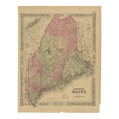
Maine County Map – Johnson, Hand-Colored, USA c.1864
Located in Langweer, NL
Johnson’s Maine Map, USA Published c.1864 – Hand-Colored County Map
This is a finely engraved and hand-colored map titled Johnson’s Maine, published by Johnson and Ward in New York ...
Category
American Antique 19th Century Maps
Materials
Paper
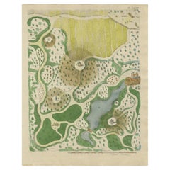
18th-Century Dutch Garden Design by Gijsbert van Laar, Published in 1802
Located in Langweer, NL
18th-Century Dutch Garden Design by Gijsbert van Laar – Magazijn van tuin-sieraaden, 1802
This exquisite hand-colored engraving is from the renowned work 'Magazijn van tuin-sieraa...
Category
Antique 19th Century Maps
Materials
Paper
$132 Sale Price
20% Off
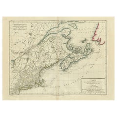
Antique Map of the Northeastern United States and Canada by Tardieu, 1802
Located in Langweer, NL
This antique map titled "Carte de la Partie Septentrionale des Etats Unis," created by Pierre Antoine Tardieu, depicts the northeastern part of the United States and parts of Canada....
Category
Antique 19th Century Maps
Materials
Paper
$529 Sale Price
20% Off
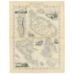
Old Map of British Mediterranean Territories with Images of Historic Sites, 1851
Located in Langweer, NL
John Tallis & Company was a British map-making firm that gained widespread acclaim in the 19th century, particularly known for their detailed and artistically embellished maps. The f...
Category
Antique 19th Century Maps
Materials
Paper
$340 Sale Price
20% Off
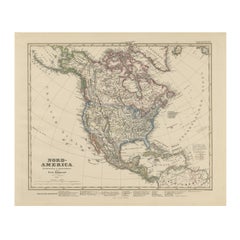
United States, Canada & Mexico – 1857 North America Map
Located in Langweer, NL
North America Map – United States, Canada, Mexico 1857
This impressive antique print shows “Nord-America” meaning “North America,” published in 1857 by Justus Perthes in Gotha as pa...
Category
German Antique 19th Century Maps
Materials
Paper
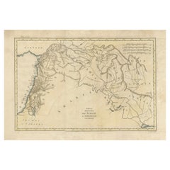
Antique 19th Century Map of Ancient Syria & Assyria - Historical Regions, c.1802
Located in Langweer, NL
19th Century Map of Ancient Syria and Assyria: 'Tabula Regiones inter Syriam et Assyriam continens'"*
This beautifully detailed 18th-century map, titled...
Category
Antique 19th Century Maps
Materials
Paper
$293 Sale Price
20% Off
Small Map of the United States
Located in Langweer, NL
Antique map titled 'Amérique septe. Physique'. Small map of the United States. lithographed by C. Callewaert brothers in Brussels circa 1870.
Category
Antique 19th Century Maps
Materials
Paper
$70 Sale Price
20% Off
Antique Map of South Carolina, North Carolina, and Virginia by Tardieu, 1802
Located in Langweer, NL
This is an original antique map titled "Carte de la Caroline Méridionale et Septentrionale et de la Virginie," depicting the regions of South Carolina, North Carolina, and Virginia in the early 19th century. Created by Pierre Antoine Tardieu, this map provides a detailed view of the geographical and political landscape of these southeastern United States areas.
Map Details:
- **Title**: Carte de la Caroline Méridionale et Septentrionale et de la Virginie
- **Creator**: Pierre Antoine Tardieu (1784-1869)
- **Publication Date**: Early 19th century
- **Dimensions**: Approximately 34.5 x 43.5 cm (13.5 x 17.25 inches)
- **Features**: The map includes detailed representations of South Carolina, North Carolina, and Virginia, highlighting political boundaries, major cities, rivers, and other geographical features. The title cartouche is located in the lower right corner, and the outlines are hand-colored to distinguish different regions.
Key Geographic Features and Areas:
1. **South Carolina**:
- Major cities such as Charleston and Columbia are marked.
- The map details the rivers and topography, including the Savannah River and various inland features.
2. **North Carolina**:
- Key locations such as Raleigh and New Bern...
Category
Antique 19th Century Maps
Materials
Paper
$529 Sale Price
20% Off
French Colonies in the Caribbean: Maps of Martinique and Guadeloupe (1852)
Located in Langweer, NL
This pair of maps, published in 1852, provides a detailed representation of the French Caribbean colonies, specifically Martinique and Guadeloupe. They were part of the *Atlas Univer...
Category
Antique 19th Century Maps
Materials
Paper
$311 Sale Price / set
20% Off
An Ornate and Historical Tallis Map of Jamaica with Decorative Vignettes, 1851
Located in Langweer, NL
This original antique map of Jamaica is part of the renowned series created by the Tallis Company, known for their detailed and decorative maps ...
Category
Antique 19th Century Maps
Materials
Paper
$274 Sale Price
20% Off
Antique Map of North and South America by Pierre Antoine Tardieu (1784-1869)
Located in Langweer, NL
This is an original antique map titled "Carte Générale et Politique de l'Amérique," depicting the political and geographical features of North and South America. This map, created by Pierre Antoine Tardieu, illustrates the continent's boundaries, major regions, and significant features as understood in the early 19th century.
Map Details:
- **Title**: Carte Générale et Politique de l'Amérique
- **Creator**: Pierre Antoine Tardieu (1784-1869)
- **Publication Date**: Early 19th century
- **Dimensions**: Approximately 34.5 x 43.5 cm (13.5 x 17.25 inches)
- **Features**: The map includes detailed representations of North and South America, highlighting political boundaries, major cities, rivers, and mountain ranges. The title cartouche is located in the lower right corner, and the outlines are hand-colored to distinguish different regions and countries.
Condition Overview:
1. Paper Quality: The paper shows typical signs of aging, such as slight yellowing, but remains in good condition without major tears or damage.
2. Edges and Corners: The edges are slightly worn, with minor fraying and small tears, particularly near the center fold. These imperfections do not significantly impact the overall readability or aesthetic value.
3. Center Fold: A center fold is present, which is common for maps of this period that were often folded for storage or publication. The fold appears intact without significant separation or damage, except for a small split at the lower end.
4. Color and Print Quality: The hand-colored outlines remain vibrant and clear, highlighting the borders of different regions. The print quality is excellent, with sharp, legible text and detailed illustrations.
5. Staining and Spots: There are a few spots and stains, particularly near the edges and along the fold. These do not obscure any critical details of the map.
Historical Context
Around the year 1800, the Americas were a region of significant political change and exploration. Here’s an overview of the region during that period:
Political Landscape
1. North America:
- United States: The United States was a young nation, having gained independence from Great Britain in 1776. The early 19th century was a period of westward expansion and the establishment of new states.
- Canada: Canada was divided into British colonies, including Upper Canada (Ontario) and Lower Canada (Quebec). The British maintained control over these territories following the American Revolution.
- Mexico: Mexico was part of the Spanish Empire, known as New Spain. It would gain independence from Spain in 1821.
2. Central and South America:
- Spanish Colonies: Much of Central and South America was under Spanish colonial rule. Significant regions included New Granada (Colombia), Peru, and the Viceroyalty of the Rio de la Plata (Argentina).
- Portuguese Brazil: Brazil was a Portuguese colony and the largest territory in South America. It would gain independence from Portugal in 1822.
- Independence Movements: The early 19th century was marked by independence movements across Latin America, led by figures such as Simón Bolívar and José de San Martín, which resulted in the creation of new nations.
3. Caribbean:
- The Caribbean islands were controlled by various European powers, including Spain, France, Great Britain, and the Netherlands. These islands were significant for their sugar plantations and as hubs of the Atlantic slave trade.
Socio-Economic Conditions
1. Trade and Commerce:
- The Americas were integral to global trade, exporting commodities such as sugar, tobacco, cotton, and coffee. The port cities of Havana, Veracruz, and Buenos Aires were crucial trade...
Category
Antique 19th Century Maps
Materials
Paper
$491 Sale Price
20% Off
Texas California Mexico Map – Antique Tallis Map with Gold Region, c.1850
Located in Langweer, NL
Texas California Mexico Map – Antique Tallis Map with Gold Region, c.1850
This highly decorative and historically rich map titled 'Mexico, California and Texas' was published around...
Category
Antique 19th Century Maps
Materials
Paper
Antique Map of North America with Vignette of the Statue of Liberty, New York
Located in Langweer, NL
Antique map titled 'Amérique du Nord'. Original antique map of North America. Meticulous information from the new Alaska Territory and through the Caribbean Windward Islands. Very go...
Category
Antique 19th Century Maps
Materials
Paper
$434 Sale Price
20% Off
Antique Map of California, Utah, Nevada, Colorado, New Mexico & Arizona '1872'
Located in Langweer, NL
Antique map titled 'Johnson's California (..)'. Original map of California, Utah, Nevada, Colorado, New Mexico and Arizona. This map originates from ...
Category
Antique 19th Century Maps
Materials
Paper
$236 Sale Price
20% Off
Antique Map of Algeria, 1880
Located in Langweer, NL
Antique map titled 'Algérie. Old map of Algeria. This map originates from 'Géographie Universelle Atlas-Migeon' by J. Migeon.
Artists and Engravers: Published by J. Migeon. Review...
Category
Antique 19th Century Maps
Materials
Paper
$207 Sale Price
20% Off
Antique Map of the United States by Titus '1871'
Located in Langweer, NL
Antique map titled 'The United States of America'. Original antique map of the United States. This map originates from 'Atlas of Prebl...
Category
Antique 19th Century Maps
Materials
Paper
$756 Sale Price
20% Off
Dresden Germany, Old Town Plan by Baldwin & Cradock 1833
Located in Langweer, NL
Dresden, depicted in this antique map by Baldwin & Cradock from 1833, was a historically significant city in Saxony, Germany. This map, published under the supervision of the Society...
Category
Antique 19th Century Maps
Materials
Paper
Map of the Hawaiian Islands with a Large Inset of Karakakooa Bay, 1803
Located in Langweer, NL
Antique map titled 'Kaart van de Sandwich Eilanden'.
Map of the Hawaiian Islands with a large inset of Karakakooa Bay, including soundings and anchorages. Originates from 'Reizen R...
Category
Antique 19th Century Maps
Materials
Paper
$2,126 Sale Price
20% Off
Original Antique Map of North America by Dower, circa 1835
Located in St Annes, Lancashire
Nice map of North America
Drawn and engraved by J.Dower
Published by Orr & Smith. C.1835
Unframed.
Free shipping
Category
English Antique 19th Century Maps
Materials
Paper
Scotland Map – Highlands, Islands, and Northern England 1858
Located in Langweer, NL
Scotland Map – Highlands, Islands, and Northern England 1858
This attractive antique print shows Scotland and its surroundings titled “Schotland mit der nördlichen Spitze von Englan...
Category
German Antique 19th Century Maps
Materials
Paper
Large Original Antique Map of Ireland. C.1900
Located in St Annes, Lancashire
Fabulous map of Ireland
Original color.
Engraved and printed by the George F. Cram Company, Indianapolis.
Published, C.1900.
Unframed.
Free shipping.
Category
American Antique 19th Century Maps
Materials
Paper
Original Antique Map or City Plan of Rome, Italy. Circa 1835
Located in St Annes, Lancashire
Nice map of Rome
Drawn and engraved by J.Dower
Published by Orr & Smith. C.1835
Unframed.
Free shipping
Category
English Antique 19th Century Maps
Materials
Paper
Large Antique Map of the State of Texas, 1861
Located in Langweer, NL
Antique map titled 'Johnson's New Map of the State of Texas' Large map of Texas, shows railroads, wagon roads, the U.S. Mail Route, rivers, ports, ...
Category
American Antique 19th Century Maps
Materials
Paper
$463 Sale Price
20% Off
Antique Lithography Map, Huntingdonshire, English, Framed Cartography, Victorian
Located in Hele, Devon, GB
This is an antique lithography map of Huntingdonshire. An English, framed atlas engraving of cartographic interest, dating to the mid 19th century and later.
Superb lithography of ...
Category
British Victorian Antique 19th Century Maps
Materials
Glass, Wood, Paper
Johnson’s Illinois Map, USA c.1864 – Hand-Colored with Chicago Courthouse View
Located in Langweer, NL
Johnson’s Illinois Map, USA c.1864 – Hand-Colored with Chicago Courthouse View
This is a finely engraved and hand-colored map titled Johnson’s Illinois, published by Johnson and War...
Category
American Antique 19th Century Maps
Materials
Paper
1816 Large Southern Hindostan Map by J. Thomson – New General Atlas
Located in Langweer, NL
Title: 1816 Southern Hindostan Map by J. Thomson – New General Atlas
This map, titled "Southern Hindostan," was published in 1816 as part of J. Thomson’s *New General Atlas*. The ma...
Category
Antique 19th Century Maps
Materials
Paper
$500 Sale Price
20% Off
Original Antique Map of Hawaii And Adjacent Islands. C.1900
Located in St Annes, Lancashire
Fabulous map of Hawaii. With a vignette of Honolulu
Original color.
Engraved and printed by the George F. Cram Company, Indianapolis.
Published, C.1900.
Unframed.
Free shipping.
Category
American Antique 19th Century Maps
Materials
Paper
The Highlands and Lowlands of Scotland as Mapped in 1882
Located in Langweer, NL
Title: 1882 Blackie Atlas Maps of Scotland: Northern and Southern Regions
Description: These two maps from the 1882 Blackie Atlas provide a detailed representation of Scotland, spli...
Category
Antique 19th Century Maps
Materials
Paper
Antique Map of the Kingdoms of Sweden and Norway by Wyld '1845'
Located in Langweer, NL
Antique map titled 'Kingdoms of Sweden and Norway'. Original antique map of the Kingdoms of Sweden and Norway. This map originates from 'An Atlas of the World, Comprehending Separate...
Category
Antique 19th Century Maps
Materials
Paper
$141 Sale Price
40% Off
Antique Map of Bourbon, or Reunion, Colony of France
Located in Langweer, NL
Original antique map titled 'Ile de la Réunion'. This is a fascinating map of the French department of Ile. Bourbon or Reunion. Bourbon, or Reunion, is a volcanic island off the coas...
Category
Antique 19th Century Maps
Materials
Paper
$321 Sale Price
20% Off
Antique Map of The Regions of Italy and Sicily during the Roman Empire, 1880
Located in Langweer, NL
This map is an original antique engraving titled "ITALIAE REGIONES IIII SICILIA," which translates to "The Regions of Italy and Sicily." This detailed historical map portrays the reg...
Category
Antique 19th Century Maps
Materials
Paper
$349 Sale Price
20% Off
Levasseur's 1852 Cartographic Portrait of Gironde: Celebrating the Bordeaux Wine
Located in Langweer, NL
This original hand-colored map is from the "Atlas National Illustré," a work by Victor Levasseur, a French geographer and cartographer known for his richly illustrated maps.
The map is a steel engraving, which was a common and precise method for creating maps at the time. The inclusion of the publisher's name, A. Combette from Paris, and the addresses of the various contributors to the map's creation, like the engravers Laguillermie and Rainaud, adds to the historical context of the piece.
The margins of the map are adorned with detailed illustrations that serve as a visual encyclopedic reference to the region's geography, economy, and notable figures. The use of color along the boundaries makes the map not only a tool for navigation but also an educational resource, providing insights into the department's landscape, economy, and cultural significance.
The text included in the map's design provides statistical information, a map legend, and discussions about the land, local curiosities, notable personalities, products, and commerce, which would have been invaluable for education and reference at the time.
The 'Atlas National Illustré' is celebrated for its combination of cartographic detail and artistic embellishment, making it a valuable cultural artifact. It represents the height of decorative map-making in the 19th century, alongside the works of John Tallis and Archibald Fullarton.
This uploaded image is a detailed and colored map of the Département de la Gironde from Victor Levasseur's "Atlas National Illustré." Similar to the other maps from this series, it features a central map with the title 'Dépt. de la Gironde' at the bottom.
Surrounding the map are decorative vignettes and elements that bring to life the cultural and economic aspects of the Gironde department. On the left, there is likely statistical information about the department and its subdivisions, reflecting the population and administrative details. This is framed by images that may represent the local industries and natural resources, such as wine, which is a central feature of the Bordeaux region located within Gironde.
The right side of the map contains a textual history and descriptions of the region, coupled with portraits of notable figures, possibly historic personages or contributors to the region's cultural and economic development. The illustrations often include agricultural products, symbols of commerce, and scenes of daily life, as well as architectural landmarks.
The presence of wine bottles, barrels, and vineyards in the illustrations would be indicative of the Gironde's prominence in wine production, particularly Bordeaux wines, which are esteemed worldwide. These engravings serve to emphasize the richness of the land and the sophistication of its products.
Maps from this era, especially those by Levasseur, are notable for their combination of art and education, providing a snapshot not only of the geography but also of the societal and economic conditions of the time. The detailed engravings also suggest that this map was as much a decorative piece as it was a functional one, intended for display and reference by those interested in the illustrated region.
The Gironde department in France is renowned for its significant contribution to the wine industry, particularly through the Bordeaux wine region. A bit more about the important places within Gironde and the types of wine the area is known for:
1. **Bordeaux**: The capital city of the department and the heart of the wine region. It's not only an urban center but also a hub for the wine trade.
2. **Médoc**: North of Bordeaux, known for prestigious châteaux and wines like Margaux, Saint-Julien, Pauillac, and Saint-Estèphe.
3. **Saint-Émilion**: East of Bordeaux, recognized for its full-bodied red wines and the picturesque medieval town.
4. **Pomerol**: Also near Saint-Émilion, smaller than its neighbor but equally renowned, particularly for Château Pétrus...
Category
Antique 19th Century Maps
Materials
Paper
$321 Sale Price
20% Off
Persia Unveiled: Antique Map of Iran, Afghanistan, and Beyond, 1852
Located in Langweer, NL
The antique map titled 'Royaumes de Perse Herat & Kaboul' is an attractive map of Persia. Here are the key details and features of the map:
1. **Geographic Coverage**:
- The map ...
Category
Antique 19th Century Maps
Materials
Paper
$151 Sale Price
20% Off
Map of Italy and Neighboring Regions by Delamarche – Antique Map, c.1800
Located in Langweer, NL
Antique Map of Italy and Surrounding Regions by Delamarche, circa 1800
This elegant and detailed antique map titled Carte Générale de l’Italie was drawn and engraved by the French g...
Category
French Antique 19th Century Maps
Materials
Paper
Ireland Map – Provincial and County Divisions 1851
Located in Langweer, NL
Ireland Map – Provincial and County Divisions 1851
This fine antique print shows Ireland titled simply “Ireland,” published in 1851 by Justus Perthes in Gotha as part of Adolf Stiel...
Category
German Antique 19th Century Maps
Materials
Paper
Rare 1864 Civil War Era Map of Michigan and Wisconsin with Great Lakes Detail
Located in Langweer, NL
Title: Rare 1864 Civil War Era Map of Michigan and Wisconsin with Great Lakes Detail
Description: This beautifully crafted antique map, titled "Johnson's Michigan and Wisconsin," wa...
Category
Antique 19th Century Maps
Materials
Paper
Large Original Antique Map of the Environs of Cork, Ireland, circa 1880
Located in St Annes, Lancashire
Great map of The Environs of Cork
Published circa 1880
Unframed
Free shipping.
Category
Scottish Antique 19th Century Maps
Materials
Paper
Large Original Antique Map of the World, Fullarton, circa 1870
Located in St Annes, Lancashire
Great map of the World.
From the celebrated Royal Illustrated Atlas
Lithograph. Original color.
Published by Fullarton, Edinburgh, circa 1870.
Unframed.
Category
Scottish Antique 19th Century Maps
Materials
Paper
Original Antique Map or City Plan of Venice, Italy. Circa 1835
Located in St Annes, Lancashire
Nice map of Venice
Drawn and engraved by J.Dower
Published by Orr & Smith. C.1835
Unframed.
Free shipping
Category
English Antique 19th Century Maps
Materials
Paper
Original Antique Map or City Plan of Amsterdam, Netherlands. Circa 1835
Located in St Annes, Lancashire
Nice map of Amsterdam
Drawn and engraved by J.Dower
Published by Orr & Smith. C.1835
Unframed.
Free shipping
Category
English Antique 19th Century Maps
Materials
Paper
Historic 1864 Civil War Map of Pennsylvania and New Jersey with Coastal Focus
Located in Langweer, NL
Title: Historic 1864 Civil War Map of Pennsylvania and New Jersey with Coastal Focus
Description: This meticulously crafted antique map, titled "Johnson's Pennsylvania and New Jerse...
Category
Antique 19th Century Maps
Materials
Paper
1834 Mexico & Guatemala Framed Map by H.S. Tanner
Located in Stamford, CT
1834 Mexico & Guatemala map of published by H.S. Tanner, Philadelphia, Pennsylvania. Engraved by J. Knight.
As found high end custom framing with carved wood frame, custom matting a...
Category
American American Classical Antique 19th Century Maps
Materials
Glass, Wood, Paper
Rare 1864 Ohio Civil War Era Map with State Capitol Illustration
Located in Langweer, NL
Title: Johnson's Ohio Antique Map by Johnson and Ward, 1864
Description: This exquisite antique map, titled "Johnson's Ohio," was published in 1864 by Johnson and Ward, a prominent ...
Category
Antique 19th Century Maps
Materials
Paper
1877 Satirical Map of the Eastern War: Europe's Powers as Caricatured Characters
Located in Langweer, NL
Title: 1877 Caricature Map of the Eastern War - "Carte de la Guerre en Orient" by H. Demare
Description: This 1877 satirical map, titled "Carte de la Guerre en Orient," was publis...
Category
Antique 19th Century Maps
Materials
Paper
Antique Map of South Africa by Lowry, 1852
Located in Langweer, NL
Antique map titled 'South Africa'. Two individual sheets of South Africa. This map originates from 'Lowry's table Atlas constructed and engraved from the most recent authorities' by ...
Category
Antique 19th Century Maps
Materials
Paper
$141 Sale Price / set
20% Off
1846 "North America" Map, Engraved by I. Dower
Located in Colorado Springs, CO
Presented is an original 1846 map of “North America.” The map was drawn and engraved by I. Dower and published in London by Orr & Company. The map depicts North America, to include G...
Category
English Victorian Antique 19th Century Maps
Materials
Paper
1874 Map of Western United States – Detailed Atlas by Keith Johnston
Located in Langweer, NL
1874 Map of Western United States by Keith Johnston – Detailed Atlas
This is an original antique map titled “United States of North America (Western States)” by Alexander Keith John...
Category
Scottish Antique 19th Century Maps
Materials
Paper
Large Original Antique Map of Massachusetts, USA, circa 1900
Located in St Annes, Lancashire
Fabulous map of Massachusetts
In 2 sheets. They can be joined but I have not done it
Original color
Engraved and printed by the George F. Cram ...
Category
American Antique 19th Century Maps
Materials
Paper
Antique Map of Spain and Portugal by Barlow, 1809
Located in Langweer, NL
"Antique map titled 'Spain and Portugal from the best Authorities'. Detailed antique map of Spain and Portugal. This map originates from 'The Gen...
Category
Antique 19th Century Maps
Materials
Paper
$75 Sale Price
20% Off
Antique Map of Arkansas
Located in Langweer, NL
Antique map titled 'Arkansas'. Original antique map of Arkansas, United States. This print originates from 'Encyclopaedia Britannica', Ninth Edition. P...
Category
Antique 19th Century Maps
Materials
Paper
$274 Sale Price
20% Off
Antique Map of the Township of Zuidlaren, Drenthe in the Netherlands, 1865
Located in Langweer, NL
Drenthe: Gemeente Zuidlaren, Midlaren, Plankersloot. These scarse detailed maps of Dutch Towns originate from the 'Gemeente-atlas' of Jacob Kuyper. This atlas of all towns in the Net...
Category
Antique 19th Century Maps
Materials
Paper
$179 Sale Price
20% Off
Mexico City by Braun & Hogenberg c. 1590
Located in Stamford, CT
Mexico by Braun & Hogenberg c. 1590
Category
European Spanish Colonial Antique 19th Century Maps
Materials
Glass, Wood, Paper
Antique Map of Asia, Vignette of Benares 'Varanasi' Showing Ganges River, 1892
Located in Langweer, NL
Antique map titled 'Asie'. Color map of Asia. With decorative vignette of Benares (Varanasi) showing Ganges River. This map originates from 'Nouvel Atlas Illustre Geographie Universe...
Category
Antique 19th Century Maps
Materials
Paper
$226 Sale Price
20% Off
Map of Charente-Inférieure France with La Rochelle and Coastal Vineyards, c.1850
Located in Langweer, NL
Map of Charente-Inférieure France with La Rochelle and Coastal Vineyards, 19th c
Description:
This decorative 19th-century map of the former department of Charente-Inférieure, now k...
Category
French Antique 19th Century Maps
Materials
Paper
Antique Print of Decorative Art in the 16th and 17th Century, 1869
Located in Langweer, NL
Old print of decorative art in the 16th and 17th century. This print originates from 'L'Ornement polychrome'. A beautiful work containing about 2000 patterns of all the styles of Art...
Category
Antique 19th Century Maps
Materials
Paper
$141 Sale Price
20% Off
Antique Map of Pennsylvania and New Jersey by Johnson, 1872
Located in Langweer, NL
Antique map titled 'Johnson's Pennsylvania and New Jersey'. Original map showing Pennsylvania and New Jersey. This map originates from 'Johnson's New Illustrated Family Atlas of the ...
Category
Antique 19th Century Maps
Materials
Paper
$236 Sale Price
20% Off
Nautical Chart of Cape Verde Islands by J.W. Norie, 1824 Coastal Map
Located in Langweer, NL
Nautical Chart of Cape Verde Islands by J.W. Norie, 1824 Coastal Map
This beautifully engraved nautical chart, titled “A New Chart of the Cape Verde Islands,” was drawn by J.W. Nori...
Category
English Antique 19th Century Maps
Materials
Paper
Antique Map of Cuba, Haiti and Porto Rico by W. G. Blackie, 1859
Located in Langweer, NL
Antique map titled 'The Leeward or North Caribbean Islands'. Original antique map of Cuba, Haiti and Porto Rico. This map originates from ‘The Imperial Atla...
Category
Antique 19th Century Maps
Materials
Paper
$236 Sale Price
20% Off
1882 Antique Map of Mexico Highlighting Geographical and Political Boundaries
Located in Langweer, NL
This 1882 map of Mexico, published by Blackie and Son as part of the 'Comprehensive Atlas and Geography of the World,' provides a highly detailed representation of the country's geog...
Category
Antique 19th Century Maps
Materials
Paper
Rare 1864 Civil War Era Map of Illinois with Lake Michigan Detail
Located in Langweer, NL
Title: Rare 1864 Civil War Era Map of Illinois with Lake Michigan Detail
Description: This intricately detailed antique map, titled "Johnson's Illinois," was published in 1864 by Jo...
Category
Antique 19th Century Maps
Materials
Paper
