19th Century Maps
to
1,670
2,184
70
2,257
72
9
5
4
2
2
1
1
2,928
2,257
475
3
290
34
10
126
10
37
9
2
5
4
3
3
2,219
66
28
12
10
330
173
105
101
97
2,257
2,257
2,257
104
23
9
8
7
Period: 19th Century
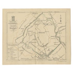
Antique Map of The Dutch Township Rauwerderhem, 1861
Located in Langweer, NL
Antique map titled 'Gemeente Rauwerderhem'. Old map depicting the Rauwerderhem township including cities and villages like Deersum, Poppingawier, Rauwerd and Irnsum. This map orginat...
Category
Antique 19th Century Maps
Materials
Paper
$114 Sale Price
20% Off
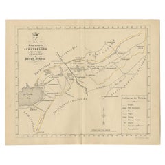
Antique Map of the Schoterland Township in Friesland, the Netherlands, 1861
Located in Langweer, NL
Antique map titled 'Gemeente Schoterland'. Old map depicting the Schoterland township including cities and villages like Rotsterhaule, Delfstrahuizen, Nieuweschoot, Mildam, Katlijk, ...
Category
Antique 19th Century Maps
Materials
Paper
$190 Sale Price
20% Off
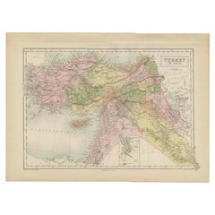
Antique Map of Turkey in Asia by A & C. Black, 1870
Located in Langweer, NL
Antique map titled 'Turkey in Asia'. Original antique map of Turkey in Asia with inset Ruins of Babylon. This map originates from ‘Black's General Atlas of The World’. Published by A...
Category
Antique 19th Century Maps
Materials
Paper
$166 Sale Price
20% Off
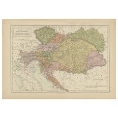
Antique Map of Austrian Dominions by A & C. Black, 1870
Located in Langweer, NL
Antique map titled 'Austrian Dominions'. Original antique map of Austrian Dominions. This map originates from ‘Black's General Atlas of The Worl...
Category
Antique 19th Century Maps
Materials
Paper
$166 Sale Price
20% Off
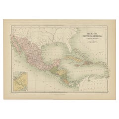
Antique Map of Mexico, Central America and West Indies by A & C. Black, 1870
Located in Langweer, NL
Antique map titled 'Mexico, Central America and West Indies'. Original antique map of Mexico, Central America and West Indies with inset map of Panama railway. This map originates fr...
Category
Antique 19th Century Maps
Materials
Paper
$166 Sale Price
20% Off
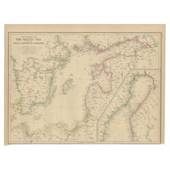
Antique Map of the Shores of The Baltic Sea by W. G. Blackie, 1859
Located in Langweer, NL
Antique map titled 'The shores of The Baltic sea and of the Gulfs of Bothnia & Finland'. Original antique map of the Shores of the Baltic Sea. This map originates from ‘The Imperial ...
Category
Antique 19th Century Maps
Materials
Paper
$166 Sale Price
20% Off
1859 Antique Swiss Panorama: Blackie's Detailed Map of Switzerland
Located in Langweer, NL
The "Antique Map of Switzerland" is a distinguished piece from 'The Imperial Atlas of Modern Geography', published in 1859 by the renowned cartographer W. G. Blackie. This map presen...
Category
Antique 19th Century Maps
Materials
Paper
$208 Sale Price
30% Off
Antique Map of China by W. G. Blackie, 1859
Located in Langweer, NL
Antique map titled 'China'. Original antique map of China. This map originates from ‘The Imperial Atlas of Modern Geography’. Published by W. G. Blackie, 1859.
Category
Antique 19th Century Maps
Materials
Paper
$237 Sale Price
20% Off
Antique Map of Peru and Bolivia by W. G. Blackie, 1859
Located in Langweer, NL
Antique map titled 'Peru and Bolivia'. Original antique map of Peru and Bolivia. This map originates from ‘The Imperial Atlas of Modern Geography’. Publish...
Category
Antique 19th Century Maps
Materials
Paper
$237 Sale Price
20% Off
Antique Map of Asia by A & C, Black, 1870
Located in Langweer, NL
Antique map titled 'Asia'. Original antique map of Asia. This map originates from ‘Black's General Atlas of The World’. Published by A & C. Black, 1870.
Category
Antique 19th Century Maps
Materials
Paper
$237 Sale Price
20% Off
Antique Map of Turkey in Europe by A & C. Black, 1870
Located in Langweer, NL
Antique map titled 'Turkey in Europe'. Original antique map of Turkey in Europe with inset maps of the Bosporus and Crete or Candia. This map originates from ‘Black's General Atlas o...
Category
Antique 19th Century Maps
Materials
Paper
$166 Sale Price
20% Off
Set of 2 Antique Maps of Russia in Europe by W. G. Blackie, 1859
Located in Langweer, NL
Antique map titled 'Russia in Europe'. Original antique map of Russia in Europe with inset maps of the Russian Empire in Europe, Asia and America and the acquisition of Russia since ...
Category
Antique 19th Century Maps
Materials
Paper
$380 Sale Price / set
20% Off
1859 Vintage Maps of England and Wales: Blackie's Imperial Geographic Detail
Located in Langweer, NL
The "Antique Map of England & Wales" from 'The Imperial Atlas of Modern Geography', published by W. G. Blackie in 1859, is an original antique map that provides a detailed depiction ...
Category
Antique 19th Century Maps
Materials
Paper
$380 Sale Price / set
20% Off
1859 Detailed Map of North West Germany with Bavaria Inset - Blackie's Atlas
Located in Langweer, NL
The "Antique Map of North West Germany" with an inset map of Bavaria is a distinguished piece from 'The Imperial Atlas of Modern Geography', published i...
Category
Antique 19th Century Maps
Materials
Paper
$208 Sale Price
30% Off
Antique Map of Australia and New Zealand by W. G. Blackie, 1859
Located in Langweer, NL
Antique map titled 'Australia and New Zealand'. Original antique map of Australia and New Zealand with inset map of the Torres Strait. This map originates from ‘The Imperial Atlas of...
Category
Antique 19th Century Maps
Materials
Paper
$237 Sale Price
20% Off
Antique Map of La Plata, Chili, by W. G. Blackie, 1859
Located in Langweer, NL
Antique map titled 'La Plata, Chili, Paraguay, Uruguay and Patagonia'.
Original antique map of La Plata, Chili, Paraguay, Uruguay and Patagonia with inset m...
Category
Antique 19th Century Maps
Materials
Paper
$237 Sale Price
20% Off
Antique Map of South Pacific Ocean by W. G. Blackie, 1859
Located in Langweer, NL
Antique map titled 'South Pacific Ocean'. Original antique map of South Pacific Ocean with inset Map of Tahiti. This map originates from ‘The Imperial Atlas of Modern Geography’. Pub...
Category
Antique 19th Century Maps
Materials
Paper
$237 Sale Price
20% Off
Antique Map of Asia by Balbi '1847'
Located in Langweer, NL
Antique map titled 'Asie'. Original antique map of Asia. This map originates from 'Abrégé de Géographie (..)' by Adrien Balbi. Published 1847.
Category
Antique 19th Century Maps
Materials
Paper
$190 Sale Price
20% Off
Antique Map of India and Southeast Asia by Balbi '1847'
Located in Langweer, NL
Antique map titled 'India en deçà et au delà du Gange'. Original antique map of India and Souteast Asia. This map originates from 'Abrégé de Géographie (..)' by Adrien Balbi. Publish...
Category
Antique 19th Century Maps
Materials
Paper
$142 Sale Price
20% Off
Antique Map of the British Isles by Balbi '1847'
Located in Langweer, NL
Antique map titled 'Iles Britanniques'. Original antique map of the British Isles. This map originates from 'Abrégé de Géographie (..)' by Adrien Balbi. ...
Category
Antique 19th Century Maps
Materials
Paper
$142 Sale Price
20% Off
1856 U.S. Coast Survey Map of Chesapeake Bay and Delaware Bay
Located in Colorado Springs, CO
Presented is U.S. Coast Survey nautical chart or maritime map of Chesapeake Bay and Delaware Bay from 1856. The map depicts the region from Susquehanna, Maryland to the northern Outer Banks in North Carolina. It also shows from Richmond and Petersburg, Virginia to the Atlantic Ocean. The map is highly detailed with many cities and towns labeled throughout. Rivers, inlets, and bays are also labeled. Various charts illustrating more specific parts of the region are marked on the map using dotted lines. The lines form boxes, and the corresponding chart number and publication date are given. Extensive triangulation surveys were conducted the length of Chesapeake Bay and are illustrated here. Hampton Roads, Virginia is labeled, along with the James, York, and Rappahannock Rivers, which were all extensively surveyed.
The chart was published under the supervision of A. D. Bache, one of the most influential and prolific figures in the early history of the U.S. Coast Survey, for the 1856 Report of the Superintendent of the U.S. Coast Survey. Alexander Dallas Bache (1806-1867) was an American physicist, scientist, and surveyor. Bache served as the Superintendent of the U.S. Coast Survey from 1843 to 1865. Born in Philadelphia, Bache toured Europe and composed an important treatise on European Education. He also served as president of Philadelphia's Central High School and was a professor of natural history and chemistry at the University of Pennsylvania. Upon the death of Ferdinand Rudolph Hassler, Bache was appointed Superintendent of the United States Coast Survey.
The Office of the Coast Survey, founded in 1807 by President Thomas Jefferson and Secretary of Commerce Albert Gallatin...
Category
American Antique 19th Century Maps
Materials
Paper
Antique Map Showing the Division and Distribution of Birds by Johnston '1850'
Located in Langweer, NL
Antique map titled 'Geographical division and distribution of birds over the world and birds of Europe'. Original antique map showing the geographical ...
Category
Antique 19th Century Maps
Materials
Paper
$190 Sale Price
20% Off
Antique Map Showing the Division and Distribution of Mammals by Johnston '1850'
Located in Langweer, NL
Antique map titled 'Geographical division and distribution of mammiferous animals of the orders quadrumana, edentata, marsupialia & pachydermata'. Original antique map showing the ge...
Category
Antique 19th Century Maps
Materials
Paper
$154 Sale Price
35% Off
Antique Map Showing the Distribution of the Currents of Air by Johnston '1850'
Located in Langweer, NL
Antique map titled 'Geographical Distribution of the Currents of Air'. Original antique map showing the distribution of the currents of air. This map originates from 'The Physical At...
Category
Antique 19th Century Maps
Materials
Paper
$190 Sale Price
20% Off
Antique Physical Chart of the Indian Ocean by Johnston '1850'
Located in Langweer, NL
Antique map titled 'Physical Chart of the Indian Ocean showing the temperature of the water'. Original antique chart of the Indian Ocean. This map originates from 'The Physical Atlas...
Category
Antique 19th Century Maps
Materials
Paper
$237 Sale Price
20% Off
Antique Tidal Chart of the British Seas by Johnston, '1850'
Located in Langweer, NL
Antique map titled 'Tidal Chart of the British Seas showing the progress of the wave of high water'. Original antique tidal chart of the British Seas. This map originates from 'The P...
Category
Antique 19th Century Maps
Materials
Paper
$190 Sale Price
20% Off
Antique Map of Loire ‘France’ by V. Levasseur, 1854
Located in Langweer, NL
Antique map titled 'Dépt. de la Loire'. Map of the French department of Loire, France. This area of France is part of the Loire Valley wine growing region...
Category
Antique 19th Century Maps
Materials
Paper
$190 Sale Price
20% Off
Antique Map of the Mountain Chains of Europe and Asia by Johnston '1850'
Located in Langweer, NL
Antique map titled 'The Mountain chains of the Europe and Asia '. Original antique map of the mountain chains of Europe and Asia. This map originates from 'The Physical Atlas of Natu...
Category
Antique 19th Century Maps
Materials
Paper
$190 Sale Price
20% Off
Antique Map Showing the Division and Distribution of Mammals by Johnston '1850'
Located in Langweer, NL
Antique map titled 'Geographical division and distribution of mammiferous animals of the orders rodentia and ruminantia over the globe'. Original antique map showing geographical div...
Category
Antique 19th Century Maps
Materials
Paper
$190 Sale Price
20% Off
Antique Map Showing the Division & Distribution of Carnivora by Johnston '1850'
Located in Langweer, NL
Antique map titled 'Geographical division and distribution of carnivorous animals'. Original antique map showing the geographical division and distribution of carnivora. This map ori...
Category
Antique 19th Century Maps
Materials
Paper
$190 Sale Price
20% Off
Antique Rain Map of the World by Johnston '1850'
Located in Langweer, NL
Antique map titled 'Hyetographic or Rain Map of the World'. Original antique rain map of the world. This map originates from 'The Physical Atlas of Natural Phenomena' by A.K. Johnsto...
Category
Antique 19th Century Maps
Materials
Paper
$190 Sale Price
20% Off
Antique Map of the River Systems of America by Johnston, '1850'
Located in Langweer, NL
Antique map titled 'The River Systems of America showing the boundaries and comparative extent of the river basins'. Original antique map of the river systems of America. This map or...
Category
Antique 19th Century Maps
Materials
Paper
$190 Sale Price
20% Off
Antique Map of the River Systems of Europe and Asia by Johnston '1850'
Located in Langweer, NL
Antique map titled 'The River Systems of Europe and Asia showing the boundaries and comparative extent of the river basins'. Original antique map of the river systems of Europe and A...
Category
Antique 19th Century Maps
Materials
Paper
$190 Sale Price
20% Off
Antique Map of Bas-Rhin ‘France’ by V. Levasseur, 1854
Located in Langweer, NL
Antique map titled 'Dépt. du Bas Rhin'. Map of the French department of Bas-Rhin, France. Part of the Alsace wine region surrounding Strasbourg. This mountainous area on the west ban...
Category
Antique 19th Century Maps
Materials
Paper
$166 Sale Price
20% Off
Antique Map of China and Japan by Wyld '1845'
Located in Langweer, NL
Antique map titled 'Map of the Empires of China and Japan'. Original antique map of China and Japan. This map originates from 'An Atlas of the World, Comprehending Separate Maps of i...
Category
Antique 19th Century Maps
Materials
Paper
$214 Sale Price
40% Off
Antique Map of France in Departments by Wyld '1845'
Located in Langweer, NL
Antique map titled 'France in Departments'. Original antique map of France. This map originates from 'An Atlas of the World, Comprehending Separate Maps of its...
Category
Antique 19th Century Maps
Materials
Paper
$190 Sale Price
20% Off
Antique Map of Turkey in Europe by Wyld, '1845'
Located in Langweer, NL
Antique map titled 'Turkey in Europe'. Original antique map of Turkey in Europe. This map originates from 'An Atlas of the World, Comprehending S...
Category
Antique 19th Century Maps
Materials
Paper
$190 Sale Price
20% Off
Antique Map of New South Wales 'Australia' by Wyld '1845'
Located in Langweer, NL
Antique map titled 'British Settlements in New South Wales'. Original antique map of New South Wales, Australia. This map originates from 'An Atlas of ...
Category
Antique 19th Century Maps
Materials
Paper
$237 Sale Price
20% Off
Antique Map of Turkey in Asia by Wyld '1845'
Located in Langweer, NL
Antique map titled 'Map of Turkey in Asia'. Original antique map of Turkey in Asia. This map originates from 'An Atlas of the World, Comprehendin...
Category
Antique 19th Century Maps
Materials
Paper
$190 Sale Price
20% Off
Antique Map of the Kingdom of the Netherlands by Wyld '1845'
Located in Langweer, NL
Antique map titled 'Holland & Belgium formerly Kingdom of the Netherlands'. Original antique map of the Kingdom of the Netherlands. This map originates from 'An Atlas of the World, C...
Category
Antique 19th Century Maps
Materials
Paper
$190 Sale Price
20% Off
Antique 1803 Italian Map of Asia Including China Indoneseia India
Located in Amsterdam, Noord Holland
Antique 1803 Italian Map of Asia Including China Indoneseia India
Very nice map of Asia. 1803.
Additional information:
Type: Map
Country of Manufacturing: Europe
Period: 19th centu...
Category
European Antique 19th Century Maps
Materials
Paper
$584 Sale Price
20% Off
Antique Map of the Lanier Township of Ohio by Titus, 1871
Located in Langweer, NL
Antique map titled 'Lanier'. Original antique map of Lanier, Ohio. This map originates from 'Atlas of Preble County Ohio' by C.O. Titus. Published, 1871.
Category
Antique 19th Century Maps
Materials
Paper
$237 Sale Price
20% Off
Antique Map of New Westville, Gettysburg, New Hope & Fair Haven, 1871
Located in Langweer, NL
Antique map titled 'New Westville, Gettysburg, New Hope, Fair Haven'. Original antique map of villages and communities of Ohio. This map originates from 'Atlas of Preble County Ohio'...
Category
Antique 19th Century Maps
Materials
Paper
$237 Sale Price
20% Off
Antique Map of West Alexandria, Manchester & Enterprise, 1871
Located in Langweer, NL
Antique map titled 'West Alexandria, Manchester, Enterprise'. Original antique map of villages and communities of Ohio. This map originates from 'Atlas of Preble County Ohio' by C.O....
Category
Antique 19th Century Maps
Materials
Paper
$237 Sale Price
20% Off
Antique Map of Euphemia, Lewisburg & West Florence, 1871
Located in Langweer, NL
Antique map titled 'Euphemia, Lewisburg, West Florence'. Original antique map of villages and communities of Ohio. This map originates from 'Atlas of Preble County Ohio' by C.O. Titu...
Category
Antique 19th Century Maps
Materials
Paper
$237 Sale Price
20% Off
Antique Map of Egypt and Arabia Petraea by Lowry, '1852'
Located in Langweer, NL
Antique map titled 'Egypt and Arabia Petrea'. Original map of Egypt and Arabia Petraea. This map originates from 'Lowry's Table Atlas constructed and engraved from the most recent Au...
Category
Antique 19th Century Maps
Materials
Paper
$95 Sale Price
20% Off
Antique Map of India, Afghanistan, Balochistan and surroundings by Lowry, '1852'
Located in Langweer, NL
Antique map titled 'India, Afghanistan, Beloochistan, Birmah & C'. Four individual sheets of India, Afghanistan, Baluchistan and surroundings. This map originates from 'Lowry's Table...
Category
Antique 19th Century Maps
Materials
Paper
$237 Sale Price / set
20% Off
Antique Map of West Africa by Lowry, 1852
Located in Langweer, NL
Antique map titled 'West Africa'. Three individual sheets of West Africa. This map originates from 'Lowry's table Atlas constructed and engraved from the most recent authorities' by ...
Category
Antique 19th Century Maps
Materials
Paper
$237 Sale Price / set
20% Off
Antique Map of Asia by Johnson, 1872
Located in Langweer, NL
Antique map titled 'Johnson's Asia'. Original map of Asia. This map originates from 'Johnson's New Illustrated Family Atlas of the World' by A.J. Johnson. Published, 1872.
Category
Antique 19th Century Maps
Materials
Paper
$333 Sale Price
20% Off
Four Physical Maps of the World on One Sheet , 1872
Located in Langweer, NL
Four physical maps of the world on one sheet. The upper map shows lowlands, highlands and highest lands. The other maps show world's races, ocean current and volcanoes, and magnetic ...
Category
Antique 19th Century Maps
Materials
Paper
$333 Sale Price
20% Off
Antique Map of New South Wales by Lowry, '1852'
Located in Langweer, NL
Antique map titled 'New South Wales north'. Original map of New South Wales, Australia. This map originates from 'Lowry's Table Atlas constructed and e...
Category
Antique 19th Century Maps
Materials
Paper
$95 Sale Price
20% Off
Antique Map of Nubia and Abyssina by Lowry, 1852
Located in Langweer, NL
Antique map titled 'Nubia and Abyssina'. Two individual sheets of Nubia and Abyssina. This map originates from 'Lowry's Table Atlas constructed and engraved from the most recent auth...
Category
Antique 19th Century Maps
Materials
Paper
$142 Sale Price / set
20% Off
Antique Map of the Region of the Bay of Bengal by Lowry, 1852
Located in Langweer, NL
Two individual sheets of the region of the Bay of Bengal. This map originates from 'Lowry's table Atlas constructed and engraved from the most recent aut...
Category
Antique 19th Century Maps
Materials
Paper
$142 Sale Price / set
20% Off
Antique Map of Turkey in Asia by Lowry '1852'
Located in Langweer, NL
Antique map titled 'Turkey in Asia, Georgia & Western Persia'. Two individual sheets of Turkey in Asia. This map originates from 'Lowry's Table Atlas constructed and engraved from th...
Category
Antique 19th Century Maps
Materials
Paper
$142 Sale Price / set
20% Off
Antique Map of the Southern Hemipshere by Lowry '1852'
Located in Langweer, NL
Antique map titled 'Perspective Projection of The World on the horizon of London'. Original map of the southern hemisphere.
This map originates from 'Lowry's Table Atlas constructe...
Category
Antique 19th Century Maps
Materials
Paper
$142 Sale Price
20% Off
Antique Map of Northern Asia by Lowry, 1852
Located in Langweer, NL
Antique map titled 'North Asia'. Original map of Northern Asia. This map originates from 'Lowry's Table Atlas constructed and engraved from the most recent authorities' by J.W. Lowry...
Category
Antique 19th Century Maps
Materials
Paper
$95 Sale Price
20% Off
Pl. 36A Antique Chart of US Farms, Agriculture and Crops '1874'
Located in Langweer, NL
Antique chart titled 'Improved land in farms. Total agricultural production. Corn. Dairy products.. Chart of US crops, farms and total agricultural production. Originates from 'Stati...
Category
Antique 19th Century Maps
Materials
Paper
$571 Sale Price
20% Off
Pl. 36 Antique Chart of US Crops, Wheat, Rice, Tobacco, Hops, Oats '1874'
Located in Langweer, NL
Antique chart titled 'Maps showing the range, and within the range, the degree of cultivation of certain principal crops. Compiled from the statistics of agriculture, ninth census 18...
Category
Antique 19th Century Maps
Materials
Paper
$571 Sale Price
20% Off
Antique Chart of the US Foreign Parentage Proportion in 1870, '1874'
Located in Langweer, NL
Antique chart titled 'Map showing the proportion to the aggregate population, of persons having one or both parents of foreign birth. Compiled from the returns of population at the n...
Category
Antique 19th Century Maps
Materials
Paper
$428 Sale Price
20% Off
Pl. 22 Antique Chart of the US Colored Population Proportion in 1870, '1874'
Located in Langweer, NL
Antique chart titled 'Map showing the proportion of the colored to the aggregate population. Compiled from the returns of population at the ninth census of the United States, 1870'. ...
Category
Antique 19th Century Maps
Materials
Paper
$428 Sale Price
20% Off
