1850s Collectibles and Curiosities

to
90
154
49
203
20
3
3
1
1
1
4,371
6,583
13,312
2,711
3,518
4,606
3,012
518
314
588
735
464
896
874
893
655
565
131
45
28
12
12
79
51
30
26
25
203
203
203
1
1
1
1
1
Period: 1850s
Original Antique Map of the Channel Islands, Incl. Decorative Vignettes, 1851
Located in Langweer, NL
Antique map titled ‘Channel Islands’. Includes decorative vignettes titled St. Peters Port, Castle Cornet, Druidical altar near Lancresse, Mont Orgueil Castle and Jersey. Originates from 'The Illustrated Atlas, And Modern History Of The World Geographical, Political, Commercial & Statistical, Edited By R. Montgomery Martin'. Published; John Tallis London, New York, Edinburgh & Dublin. 1851. Drawn and Engraved by J. Rapkin. Artists and engravers: John Tallis (1817-1876) was a British map...
Category

Antique 1850s Collectibles and Curiosities

Materials

Paper

Neatly Framed Decorative Hand-Colored View of Zierikzee, the Netherlands, 1858
Located in Langweer, NL
Antique print titled 'Zierikzee'. View of the city of Zierikzee, the Netherlands. This print originates from 'Het koningrijk der Nederlanden voorgesteld in eene reeks van 136 naa...
Category

Antique 1850s Collectibles and Curiosities

Materials

Paper

A Tallis Map of British Guiana with Colonial Vignettes and Other Landmarks, 1851
Located in Langweer, NL
This Tallis map of British Guiana (now known as Guyana) is a richly decorated document, much like other maps from the esteemed cartographic publisher John Tallis & Company. The firm,...
Category

Antique 1850s Collectibles and Curiosities

Materials

Paper

Pair of Marquess of Clanricarde De Burgh-Canning Carriage Badges
Located in Lymington, Hampshire
A Pair of Marquess of Clanricarde de Burgh-Canning carriage badges, each gilt metal armorial designed as the coat of arms de Burgh-Canning for Ullick John de ...
Category

English Antique 1850s Collectibles and Curiosities

Materials

Metal

Guadeloupe and Dependencies: Mid-19th Century Map from France Pittoresque Series
Located in Langweer, NL
This map titled "Guadeloupe et Dépendances" is part of the France Pittoresque series and provides a detailed view of the island of Guadeloupe and its surrounding dependencies. Features: - The map shows the two main landmasses of Guadeloupe: Basse-Terre and Grande-Terre, separated by a narrow channel. - Several smaller islands, including Marie-Galante, Les Saintes, and La Désirade, are also depicted. - The main cities, towns, and geographical features are labeled, with emphasis on the island's mountain ranges and rivers, particularly on Basse-Terre. - An inset at the bottom right provides a detailed plan of Pointe-à-Pitre, a major city and port on the island. The grid layout of the streets is clearly shown, reflecting urban planning of the time. Artistic and Cartographic Details: - The map uses clear linework to differentiate between the different islands and the sea, with significant natural features such as mountains and rivers carefully depicted. - The map was drawn by Monin and engraved by Jacqueline and Barrière, whose names appear in the lower right corner. - The scale in the lower left corner is measured in leagues, showing distances both by land and sea. Historical Context: - This map likely dates to the mid-19th century, a period when Guadeloupe was a key French colony in the Caribbean. Guadeloupe was known for its sugar and coffee plantations, which played a significant role in France's colonial economy. - Maps like this were often used for administrative, military, and educational purposes to give a comprehensive view of France's overseas territories. The map of Guadeloupe et Dépendances from the France Pittoresque series likely dates to the mid-19th century, around 1840 to 1860. This period corresponds to the height of French colonial influence in Guadeloupe, and the map's style, detailed urban planning, and cartographic techniques are consistent with maps produced in that era. The specific publication date could be further narrowed down if the map was part of a known edition of the France Pittoresque atlas, but based on the cartographic style and historical context, 1840–1860 is a reasonable estimate. Here are some relevant keywords people might use when searching for a map of Guadeloupe and its surrounding areas: 1. Guadeloupe map 2. Basse-Terre and Grande-Terre map 3. French Caribbean islands map...
Category

Antique 1850s Collectibles and Curiosities

Materials

Paper

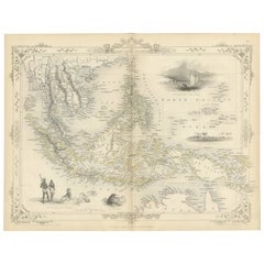
Map of Russia with Vignettes of the Neoskoi Prospect, St. Petersburg, ca.1851
Located in Langweer, NL
Antique map titled 'Russia in Europe'. Map of European Russia. Showing vignettes of the Neoskoi Prospect, St. Petersburg, Polish Captives on their way to Siberia, a Russian Bear...
Category

Antique 1850s Collectibles and Curiosities

Materials

Paper

Map of Western Australia & Swan River, insets of Perth, Aboriginals, Sheep, 1851
Located in Langweer, NL
Antique map titled 'Western Australia, Swan River'. Map of Western Australia and Swan River, surrounded by illustrations of Perth, Aborigines and sheep shea...
Category

Antique 1850s Collectibles and Curiosities

Materials

Paper

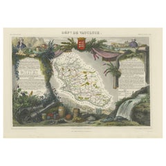
Old Map of Vaucluse, France: A Cartographic Celebration of Viticulture, 1852
Located in Langweer, NL
This original hand-colored map is from the "Atlas National Illustré," a work by Victor Levasseur, a French geographer and cartographer known for his richly illustrated maps. The map...
Category

Antique 1850s Collectibles and Curiosities

Materials

Paper

19th Century Wooden Barometer Signed Burlinson Ripon Antique Instrument Weather
Located in Milan, IT
Wooden barometer signed Burlinson Ripon made in the mid 19th century. Silver-plated brass dial engraved with weather indications and the name of the m...
Category

British Antique 1850s Collectibles and Curiosities

Materials

Wood

Mid-19th Century Decorative Map of Asia with Cultural and Natural Vignettes
Located in Langweer, NL
John Tallis & Company, known for their decorative mid-19th-century maps, created this map of Asia. These maps were distinctive for their elaborate borders and detailed vignettes. The...
Category

Antique 1850s Collectibles and Curiosities

Materials

Paper

Antique Print of Tokyo Bay 'or Edo Bay', Located in Southern Kantō, Japan, 1856
Located in Langweer, NL
Antique print titled 'To-Ri-Ga-Sa-Ki, Yedo Bay'. View of Tokyo Bay (or Edo Bay), a bay located in the southern Kanto region of Japan, and spans the coasts of Tokyo, Kanagawa Prefectu...
Category

Antique 1850s Collectibles and Curiosities

Materials

Paper

Anitque Print of a Fire Station in Yokohama, Japan, 1856
Located in Langweer, NL
Description: Antique print titled ‘Fire Companys House & Engine Yokuhama‘. View of a fire station in Yokohama, Japan. This print originates from 'Narrat...
Category

Antique 1850s Collectibles and Curiosities

Materials

Paper

Mid-19th Century Map of Australasia by Carl Flemming - 1855
Located in Langweer, NL
Title: "Mid-19th Century Map of Australasia by Carl Flemming - 1855" Description: This original 1855 antique map from the Sohr-Berghaus Atlas, created by Carl Flemming, is a detaile...
Category

Antique 1850s Collectibles and Curiosities

Materials

Paper

French Original Cased Pair Silver Baptismal Oil Containers
Located in Bishop's Stortford, Hertfordshire
A very fine and scarce French pair silver Baptismal oil containers in its original leather fitted travelling case dating from 1850. The two cylindrical shaped oil containers are conjoined and both have tight fitting covers mounted with crosses. The oil containers have engraved initials OC and SC probably denoting oil and incense which would have been used in the baptismal ceremony. The identical lids too are similarly marked to ensure that these are not mixed up. The containers appear to have a slightly gilded finish to the interior and the oil containers are engraved to the bases and date 1850. They come in their original leather case with a small brass hook...
Category

French Napoleon III Antique 1850s Collectibles and Curiosities

Materials

Silver

Antique Lithograph of a Japanese Junk, a Type of Sailing Ship, 1856
Located in Langweer, NL
Antique print titled ‘Japanese Junk'. Lithograph of a Japanese junk, a type of sailing ship. This print originates from 'Narrative of the expedition of an A...
Category

Antique 1850s Collectibles and Curiosities

Materials

Paper

19th Century Hand Carved Gold Gilt Cherub/Putti Fragment
Located in London, GB
19th century hand carved gold gilt cherub/putti fragment A high-quality hand carved 19th century gold gilt paint over sectioned pine example. This wonderful piece details realistic human features, which suggests it was carved for a special interior section of sorts. Likely to have been part of a larger collective at some point. It would look delightful and highly decorative positioned over a doorway entrance. Size in inches: H 10” x W 15” x D 5” Origin: France Material: Pine Date: 1850 - 1880 Completely solid in structure and form without any breaks. Detail loss across the painted surface as shown. We sell antique...
Category

French Early Victorian Antique 1850s Collectibles and Curiosities

Materials

Pine

Detailed German Map of Australia Including Statistics of 1841, Published in 1854
Located in Langweer, NL
Title: "Detailed Map of Austral Land - 1854" This historic map, titled "Australland," was published in Glogau in 1854 by cartographer Carl Flemming. It's an intricately detailed dep...
Category

Antique 1850s Collectibles and Curiosities

Materials

Paper

Original Antique English County Map, Staffordshire, J & C Walker, 1851
Located in St Annes, Lancashire
Great map of Staffordshire Original colour By J & C Walker Published by Longman, Rees, Orme, Brown & Co. 1851 Unframed.
Category

English Other Antique 1850s Collectibles and Curiosities

Materials

Paper

Original Antique English County Map, Herefordshire, J & C Walker, 1851
Located in St Annes, Lancashire
Great map of Herefordshire Original colour By J & C Walker Published by Longman, Rees, Orme, Brown & Co. 1851 Unframed.
Category

English Other Antique 1850s Collectibles and Curiosities

Materials

Paper

Mapping History: The Decorative Cartography of Indre-et-Loire by Levasseur, 1856
Located in Langweer, NL
An original hand-colored map of the Département d'Indre-et-Loire created by Victor Levasseur in 1856. As an antique steel engraved map, it showcases the detailed craftsmanship and technology of mid-19th century map making. The method of steel engraving allowed for precise and intricate details to be captured, making this map not only a navigational tool but also a work of art. The addition of outline hand colouring is particularly noteworthy. This technique, where colours are applied by hand to the engraved map, was a common practice at the time to highlight certain features such as boundaries, rivers, and cities. The hand colouring on this map would have been done meticulously, adding vibrancy and clarity to the engraved lines and making it easier to differentiate various geographical and political demarcations. The map's wide margins are characteristic of the period's presentation style, offering space for additional annotations or simply serving to frame the map aesthetically when displayed. Such margins also suggest that the map was intended for a discerning audience, possibly for educational or decorative purposes in a library or study. Victor Levasseur was renowned for his decorative maps, often embellished with artistic elements that went beyond mere geographical information. These elements could include vignettes, allegorical figures, and detailed illustrations surrounding the map itself, reflecting the cultural, historical, and economic aspects of the depicted area. While the description does not detail these decorative aspects, it's common for Levasseur's works to feature such embellishments, making his maps highly prized among collectors and historians for both their artistic value and cartographic accuracy. This map of Département d'Indre-et-Loire, with its combination of technical precision in steel engraving and the beauty of hand colouring, represents a fascinating intersection of art and science in the 19th century. It is a testament to the era's dedication to detail, craftsmanship, and the aesthetic presentation of information. The Département d'Indre-et-Loire, located in the central part of France within the region known as the Centre-Val de Loire, is rich in historical and cultural significance, with numerous important places highlighted on a map from 1856 by Victor Levasseur. Based on the region's known historical sites and cities, the following places are likely to be featured or of importance: 1. **Tours**: As the capital city of the Département d'Indre-et-Loire, Tours is a central hub of history, culture, and architecture. It is known for its old town, the Place Plumereau, Tours Cathedral, and its proximity to the Loire River, making it a likely focal point on the map. 2. **Amboise**: This town is famous for the Château d'Amboise, which is closely linked to French royal history and offers panoramic views of the Loire River. Leonardo da Vinci is buried here in the Chapel of Saint-Hubert, associated with the château. 3. **Chinon**: Known for its medieval fortress, the Château de Chinon, this town has deep historical roots, including connections to Joan of Arc and King Charles VII. The fortress and town would be significant landmarks. 4. **Villandry**: The Château de Villandry is renowned for its beautiful Renaissance gardens, which are some of the most impressive in France. While the château might be less emphasized in an 1856 map compared to cities and towns, it's an important site in the region. 5. **Loches**: This town features the Château de Loches, a medieval castle, and the Royal Lodge, noted for its Renaissance architecture. The town's history and architectural landmarks make it a place of interest. 6. **Azay-le-Rideau**: The Château d'Azay-le-Rideau is set on an island in the middle of the Indre River, showcasing the French Renaissance architectural...
Category

Antique 1850s Collectibles and Curiosities

Materials

Paper

Original Antique English County Map, Kent. J & C Walker, 1851
Located in St Annes, Lancashire
Great map of Kent Original colour By J & C Walker Published by Longman, Rees, Orme, Brown & Co. 1851 Unframed.
Category

English Other Antique 1850s Collectibles and Curiosities

Materials

Paper

Original Antique English County Map - Middlesex. J & C Walker. 1851
Located in St Annes, Lancashire
Great map of Middlesex Original colour By J & C Walker Published by Longman, Rees, Orme, Brown & Co. 1851 Unframed.
Category

English Other Antique 1850s Collectibles and Curiosities

Materials

Paper

Original Old Map Northeast India, incl Part of Himalayas and China, 1853
Located in Langweer, NL
Antique map titled 'India X'. Old map of the the northeast region of India, including part of Himalayas and China. Great detail of landforms, rivers and water bodies, cities, towns...
Category

Antique 1850s Collectibles and Curiosities

Materials

Paper

Antique Print of a Battle Scene in Early 19th Century Europe, ca.1857
Located in Langweer, NL
Description: original antique print of a battle scene. Source unknown, to be determined. Artists and Engravers: Engraved by P. Wunster. Condition: Good, general age-related ton...
Category

Antique 1850s Collectibles and Curiosities

Materials

Paper

Original Antique English County Map - Monmouthshire. J & C Walker. 1851
Located in St Annes, Lancashire
Great map of Monmouthshire Original colour By J & C Walker Published by Longman, Rees, Orme, Brown & Co. 1851 Unframed.
Category

English Other Antique 1850s Collectibles and Curiosities

Materials

Paper

Original Antique English County Map, Huntingdonshire, J & C Walker, 1851
Located in St Annes, Lancashire
Great map of Huntingdonshire Original colour By J & C Walker Published by Longman, Rees, Orme, Brown & Co. 1851 Unframed.
Category

English Other Antique 1850s Collectibles and Curiosities

Materials

Paper

Northern Germany incl Hanover, Oldenburg, Lippe, Bremen, Hamburg & Lubeck, 1854
Located in Langweer, NL
Antique map titled 'Map of the Kingdom of Hanover, with the Grand Duchy of Oldenburg, the principalities of Lippe Detmold and Schauenburg Lippe (..)'. Map of Northern Germany inclu...
Category

Antique 1850s Collectibles and Curiosities

Materials

Paper

Original Antique English County Map, Buckinghamshire, J & C Walker, 1851
Located in St Annes, Lancashire
Great map of Buckinghamshire Original colour By J & C Walker Published by Longman, Rees, Orme, Brown & Co. 1851 Unframed.
Category

English Other Antique 1850s Collectibles and Curiosities

Materials

Paper

Original Antique English County Map, Warwickshire, J & C Walker, 1851
Located in St Annes, Lancashire
Great map of Warwickshire Original colour By J & C Walker Published by Longman, Rees, Orme, Brown & Co. 1851 Unframed.
Category

English Other Antique 1850s Collectibles and Curiosities

Materials

Paper

Original Antique English County Map, Cambridgeshire, J & C Walker, 1851
Located in St Annes, Lancashire
Great map of Cambridgeshire Original colour By J & C Walker Published by Longman, Rees, Orme, Brown & Co. 1851 Unframed.
Category

English Other Antique 1850s Collectibles and Curiosities

Materials

Paper

Original Antique English County Map, Derbyshire, J & C Walker, 1851
Located in St Annes, Lancashire
Great map of Derbyshire Original colour By J & C Walker Published by Longman, Rees, Orme, Brown & Co. 1851 Unframed.
Category

English Other Antique 1850s Collectibles and Curiosities

Materials

Paper

Print of Ice Skating Scene on the River Maas in Rotterdam, the Netherlands, 1855
Located in Langweer, NL
Antique print titled 'De Schaatsenrijdersbaan op de Maas'. Old print depicting an ice skating scene in the Netherlands. This print originates from 'Het ijs vermaak op de Maas te ...
Category

Antique 1850s Collectibles and Curiosities

Materials

Paper

Nicely Framed View of Muiden Castle, the Netherlands, 1858
Located in Langweer, NL
Antique print titled 'Muiden'. View of Muiden Castle, the Netherlands. This print originates from 'Het koningrijk der Nederlanden voorgesteld in eene reeks van 136 naar de natuur get...
Category

Antique 1850s Collectibles and Curiosities

Materials

Paper

Large 1856 Mexico & Guatemala Framed Map by Charles Desilver
Located in Stamford, CT
Large 1856 Mexico & Guatemala Framed map. Published by Charles Desilver, Philadelphia, Pennsylvania. As found high end custom framing with black giltwood frame, custom matting and UV...
Category

American American Classical Antique 1850s Collectibles and Curiosities

Materials

Glass, Wood, Paper

Early French Nautical Chart of the Northern Coast of of Java, Indonesia, C.1850
Located in Langweer, NL
Antique map titled Carte de la côte Nord de Java. Early French nautical chart of the northern coast of the island of Java, Indonesia. It includes Ci...
Category

Antique 1850s Collectibles and Curiosities

Materials

Paper

Antique Print of Dutch Prince Willem of Orange at the Battle of Waterloo, c.1855
Located in Langweer, NL
Antique print titled 'Slag bij Waterloo (De Kroonprins gekwetst)'. Old print of Willem Frederik George, Prince of Orange, wounded during the Battle of Waterloo...
Category

Antique 1850s Collectibles and Curiosities

Materials

Paper

Large Italian Map of Islands of Oceania, incl Papua, Timor, Banda, Ceram, 1855
Located in Langweer, NL
Description: Antique map titled 'Carta di una parte dell'Oceania'. Beautiful large map of the (Spice) islands of Oceania. Depicting Papua, Timor, Ceram, Gilolo and many more. Source ...
Category

Antique 1850s Collectibles and Curiosities

Materials

Paper

Old Map of Holstein with the Imperial Towns Hamburg & Lubeck, Germany, 1854
Located in Langweer, NL
Antique map titled 'Map of the Duchy of Holstein with the territories of the Imperial Towns Hamburg & Lubeck (..) Based on a map by Fischer.' Map of the Duchy of Holstein. From Jam...
Category

Antique 1850s Collectibles and Curiosities

Materials

Paper

Antique Plan of Turkey in Europe with Inset Map of the Bosporus, ca.1850
Located in Langweer, NL
Antique map titled 'Turkey in Europe'. A map of European Turkey and the surrounding countries. With an inset map of the Bosporus. This includes Macedonia, Bulgaria, Croatia, Bosn...
Category

Antique 1850s Collectibles and Curiosities

Materials

Paper

Old Print of 'Beugelen', One of the Oldest Ball Sports in The Netherlands, 1857
Located in Langweer, NL
Antique print titled 'Plate IV 'De Beugelbaan - Le Jeu de Passe.' This plate shows a 19th century scene in Noord-Brabant, The Netherlands. Men are playing the Dutch game 'beugelen'. This original antique print was published in 1857 by Frans Buffa & Zonen Amsterdam as part of the publication 'Nederlandsche Kleederdrachten naar de natuur' (Dutch folk costume, illustrated using real-life models) by Valentyn Bing. 'Beugelen' is a popular sport in which a heavy sphere is moved with a wooden shovel...
Category

Antique 1850s Collectibles and Curiosities

Materials

Paper

Engraved Large Map of The Kingdom of Portugal Original Handcolored, 1854
Located in Langweer, NL
Antique map titled 'Mappa Corografica do Reino de Portugal - Chorographical map of the Kingdom of Portugal divided into its Grand Provinces.' Large map of...
Category

Antique 1850s Collectibles and Curiosities

Materials

Paper

Map of West Germany Incl Regions Wurtemberg, Bavaria, Hanover, Etc, c.1850
Located in Langweer, NL
Antique map titled '(Deutschland) Germany, Western States'. Map of West Germany depicting many regions including Wurtemberg, Bavaria, Hanover and others. This map originates from...
Category

Antique 1850s Collectibles and Curiosities

Materials

Paper

Rare Old Lithograph of the Assault of a Fort in Borneo, Indonesia, ca.1850
Located in Langweer, NL
Incredible action view of a rare German lithograph showing a massive assault on Fort Claurang in Borneo. Published by Hartwich, A. Hölzer and TH. Lemke in Berlin around 1850. ...
Category

Antique 1850s Collectibles and Curiosities

Materials

Paper

Religious Old Print of Moses Making Water & The Crossing of the Red Sea, ca.1850
Located in Langweer, NL
Large antique print with two religious engravings. The upper image depicts the crossing of the Red Sea. The lower image depicts Moses makes the water spring out from the rock. This print originates from a work illustrating the complete series of Vatican frescos painted...
Category

Antique 1850s Collectibles and Curiosities

Materials

Paper

Antique Map of Part of the Chinese Coast, Explored by the French, Ca.1852
Located in Langweer, NL
Antique map titled 'Plan du Golfe D'Anville (Côte de Tartarie)'. Old map of part of the Chinese coast, explored with the French corvette 'Caprieuse'. The Capricieuse was a late 2...
Category

Antique 1850s Collectibles and Curiosities

Materials

Paper

Ice Skating Activities Near Katendrecht and Rotterdam, The Netherlands, 1855
Located in Langweer, NL
Antique print titled 'De Stad van Katendrecht gezien'. Old print depicting an ice skating scene in the Netherlands. This print originates from 'Het ijs vermaak op de Maas te Rott...
Category

Antique 1850s Collectibles and Curiosities

Materials

Paper

Print of An Ice Skating Scene on the River Maas, Rotterdam, Netherlands, 1855
Located in Langweer, NL
Antique print titled 'Gezicht van het Bolwerk op de Maas'. Old print depicting an ice skating scene in the Netherlands. This print originates from 'Het ijs vermaak op de Maas te ...
Category

Antique 1850s Collectibles and Curiosities

Materials

Paper

Original Antique Map of Austria from an Old Dutch School Atlas, 1852
Located in Langweer, NL
Antique map titled 'Het Keizerrijk Oostenrijk'. Map of the Austrian Empire. This map originates from 'School-Atlas van alle deelen der Aarde' by Otto Petri...
Category

Antique 1850s Collectibles and Curiosities

Materials

Paper

Beautiful Decorative Hand-Colored Antique Map of West Canada, 1851
Located in Langweer, NL
Description: Antique map of Canada titled 'West Canada'. With decorative vignettes titled Kingston and Falls of Niagara. Originates from 'The Illustrated Atlas, And Modern History Of The World Geographical, Political, Commercial & Statistical, Edited By R. Montgomery Martin'. Published; John Tallis London, New York, Edinburgh & Dublin. 1851. Drawn and Engraved by J. Rapkin. Artists and Engravers: John Tallis (1817-1876) was a British map...
Category

Antique 1850s Collectibles and Curiosities

Materials

Paper

A Decorative Detailed Map of the Crimea, with an Inset Map of Sebastopol, c 1851
Located in Langweer, NL
Date: 1851 Artist and Engraver: J Rapkin Vingettes: Artist and Engraver: H. Winkles Paper Size: 350 x 270mms Condition: good Technique: original steel engraving Description: ...
Category

Antique 1850s Collectibles and Curiosities

Materials

Paper

18th Century Naples, Italy nativity figure
Located in London, GB
18th Century Naples, Italy nativity figure An exceptional example of a late 18th Century Italian nativity figure. Hand carved articulated pine joint l...
Category

Italian Early Victorian Antique 1850s Collectibles and Curiosities

Materials

Pine

"San Francisco, Upper California” 1851 Antique Map of San Francisco
Located in Colorado Springs, CO
This is a pictorial lettersheet view of the city and harbor of San Francisco. This lithograph was printed on grey wove paper, across a double sheet, by famed lithographers Britton & ...
Category

American Antique 1850s Collectibles and Curiosities

Materials

Paper

Antique realistic wooden crucifix, France ca. 1850
Located in Meulebeke, BE
France / 1850 / crucifix / wood / Antique / Baroque / Rustic A beautiful small wooden crucifix made in France around 1850. This crucifix features a meticulously detailed figure of ...
Category

French Rustic Antique 1850s Collectibles and Curiosities

Materials

Wood

Ornate Hand-Colored Map of Germany by John Tallis with Vignettes, ca. 1850
Located in Langweer, NL
Title: Hand-Colored Map of Germany by J. Tallis, ca. 1850 This beautifully hand-colored map of Germany, published by John Tallis & Co. around 1850, provides a comprehensive depictio...
Category

Antique 1850s Collectibles and Curiosities

Materials

Paper

Fanny Burney, Diary & Letters of Madame D'arblay, in a Full Leather Binding 1854
Located in Hillsborough, NJ
Author: BURNEY, Fanny - Madame D'arblay. Title: Diary and Letters of Madame D'arblay. Publisher: London: for Henry Colburn, 1854. Description: NEW EDITION. 7 vols., 6-11/16...
Category

British Antique 1850s Collectibles and Curiosities

Materials

Leather

Very Rare 19th Century Italian Trompe L'oeil Panels
Located in London, GB
19th century Italian trompe l'oeil panels We are proud to offer a spectacular pair of highly decorative 19th century Italian trompe l'oeil panels, each depicting an architectural b...
Category

Italian Early Victorian Antique 1850s Collectibles and Curiosities

Materials

Wrought Iron

19th Century, J. Florenz Wien Chrome Steel Austrian Balance, 11 Brass Weights
Located in Vigonza, Padua
19th century, chrome steel Austrian balance, by J. Florenz Wien, 11 brass weights, 5 kg. This precious antique table scale was from the famous Caffè Florian in Venice Caffè Florian is a historic café in the city of Venice, located under the arcades of the Procuratie Nuove in Piazza San Marco. It is the oldest Italian coffee and the oldest coffee in the world. It was inaugurated on December 29, 1720 by Floriano Francesconi with the name of Alla Venezia Trionfante, but immediately the Venetians simply said “andemo da Florian-let's go to Florian”, from the name of the owner in the Venetian dialect. Since then it has continued its daily coffee business uninterruptedly to the present day, becoming a favorite destination for Venetians, Italians and foreigners. Floriano Francesconi inspired the character of Ridolfo in Carlo Goldoni's coffee shop. Giacomo Casanova courted the ladies there and Carlo Goldoni entered as a boy. Famous people such as Gasparo Gozzi, Giuseppe Parini, Silvio Pellico, Lord Byron, Ugo...
Category

Austrian Baroque Antique 1850s Collectibles and Curiosities

Materials

Steel

Surtees, Handley Cross, First Illustrated Edition in the Original 17 Parts 1853
Located in Hillsborough, NJ
Author: SURTEES, Robert Smith. Title: Handley Cross; or Mr. Jorrocks's Hunt. Publsiher: London: Bradbury and Evans, 1853-54. First Illustrated Edition In The Original 17 Parts, 17 hand-coloured etched plates by John Leech...
Category

British Antique 1850s Collectibles and Curiosities

Materials

Paper

Read More

Medal-Worthy Memorabilia from Epic Past Olympic Games

Get into the games! These items celebrate the events, athletes, host countries and sporting spirit.

Ahoy! You’ve Never Seen a Collection of Sailor Art and Kitsch Quite Like This

French trendsetter and serial collector Daniel Rozensztroch tells us about his obsession with objects related to seafaring men.

Pamela Shamshiri Shares the Secrets behind Her First-Ever Book and Its Effortlessly Cool Interiors

The sought-after designer worked with the team at Hoffman Creative to produce a monograph that beautifully showcases some of Studio Shamshiri's most inspiring projects.

Moroccan Artworks and Objects Take Center Stage in an Extraordinary Villa in Tangier

Italian writer and collector Umberto Pasti opens the doors to his remarkable cave of wonders in North Africa.

Montecito Has Drawn Royalty and Celebrities, and These Homes Are Proof of Its Allure

Hollywood A-listers, ex-pat aristocrats and art collectors and style setters of all stripes appreciate the allure of the coastal California hamlet — much on our minds after recent winter floods.

Whaam! Blam! Pow! — a New Book on Pop Art Packs a Punch

Publishing house Assouline and writer Julie Belcove have teamed up to trace the history of the genre, from Roy Lichtenstein, Andy Warhol and Yayoi Kusama to Mickalene Thomas and Jeff Koons.

The Sparkling Legacy of Tiffany & Co. Explained, One Jewel at a Time

A gorgeous new book celebrates — and memorializes — the iconic jeweler’s rich heritage.

What Makes a Gem-Encrusted Chess Set Worth $4 Million?

The world’s most opulent chess set, weighing in at 513 carats, is literally fit for a king and queen.

Recently Viewed

View All