18th Century and Earlier Collectibles and Curiosities

to
2,707
3,891
557
4,483
216
93
41
35
29
14
10
7
4
2
2
2
1
1
1
6,827
13,521
2,736
3,516
4,718
3,084
511
298
603
745
486
907
907
906
659
593
3,383
600
526
139
127
1,367
277
267
225
186
4,483
4,483
4,483
58
21
14
13
12
Period: 18th Century and Earlier
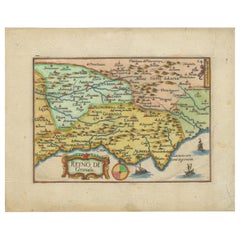
Antique Map of Granada Spain – Hand-Coloured Tassin Engraving 1651
Located in Langweer, NL
Antique Map of Granada Spain – Hand-Coloured Tassin Engraving 1651 This beautiful hand-coloured engraved map depicts the historic Kingdom of Granada in southern Spain, created by th...
Category

French Antique 18th Century and Earlier Collectibles and Curiosities

Materials

Paper

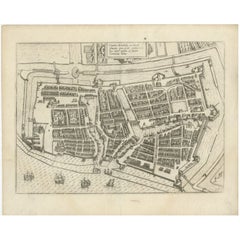
Antique Plan of Emden in Germany by Guicciardini, 1612
Located in Langweer, NL
Antique map Emden titled 'Civitas Embda, eo modo situata cum essit controversia inter ipsam et suum Comitem anno'. Small plan of the city of Emden, Germany, Also depicted is part of ...
Category

Antique 18th Century and Earlier Collectibles and Curiosities

Materials

Paper

Antique Map of Greece, Albania, Macedonia and Parts of Turkey and Cyprus, c.1745
Located in Langweer, NL
Antique map titled 'Accurata Totius Archipelagi Et Graeciae Universae Tabula'. Detailed map of Greece. Includes Albania, Macedonia and parts of Turkey and Cyprus. With compass rose...
Category

Antique 18th Century and Earlier Collectibles and Curiosities

Materials

Paper

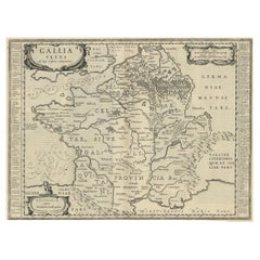
Antique Map of France by Janssonius, c.1650
Located in Langweer, NL
Antique map titled 'Gallia Vetus'. Beautiful map of France based on Caesar's De Bello Gallico. In the columns to the left and right important tribes and people are described. Art...
Category

Antique 18th Century and Earlier Collectibles and Curiosities

Materials

Paper

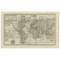
Antique Map of the World on Mercator's Projection, 1788
Located in Langweer, NL
Antique map titled 'Kaart van de Geheele Wereld (..)'. Uncommon small world map on Mercator's projection. Nice detail of the islands throughout the wor...
Category

Antique 18th Century and Earlier Collectibles and Curiosities

Materials

Paper

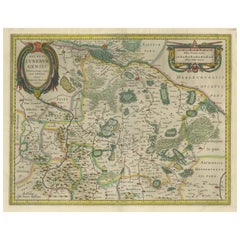
Antique Map of the Duchy of Lüneburg, Lower Saxony, Germany
Located in Langweer, NL
Antique map titled 'Ducatus Luneburgensis (..)'. Map of the Duchy of Lüneburg in Lower Saxony, Germany. Published by J. Janssonius, circa 1664. Jan Janssonius (also known as Johann ...
Category

Antique 18th Century and Earlier Collectibles and Curiosities

Materials

Paper

Original Antique Map of Hungary and Transylvania 'Modern Day Romania', C.1710
Located in Langweer, NL
Antique map titled 'Hungary and Transilvania'. Original antique map of Hungary and Transylvania (modern day Romania), centered on Budapest. Artists and Engravers: Herman Moll ...
Category

Antique 18th Century and Earlier Collectibles and Curiosities

Materials

Paper

Prehistoric Mimbres Corrugated Bowl
Located in Coeur d'Alene, ID
Prehistoric Mimbres prehistoric pottery bowl in as found condition. The Mimbres region of the American Southwest is celebrated for the beautiful and expressive black-on-white pottery...
Category

American Prehistoric Antique 18th Century and Earlier Collectibles and Curiosities

Materials

Pottery

The Forest of Hermits / 't Bosh der Ermyten by Abraham Bloemaert
Located in Middletown, NY
Bloemaert, Abraham and Rosweyde, Héribert 't Bosch der Eremyten ende Eremytinnen van Aegypten ende Palestinen (...) [The Forest of Hermits of Egypt and Palestine... Hantvverpen (Antwerp): Hieronymus Verdussen, 1619. Illustrated by Abraham Bloemart. First Edition in book form. 4to, 8 7/8 x 6 3/4 inches (251 x 171 mm). ix pp, 51 sheets on cream laid paper, text in Dutch (gothic letters). 50 numbered full page copperplate engravings of Christian hermit saints (25 male, 25 female), printed recto with text pages on verso. Full-page frontispiece for the work and with an additional full-page frontispiece for each of the two sections. Full contemporary vellum, untitled, with some handling discoloration but the vellum remains supple and the binding is tight. Pages clean and bright with a couple of foxing spots and a small brown stain on the 2nd frontis titled "Sacra Eremus ascetarum"; toned page edges. Previous owner's name and date in ink on front flyleaf and small pencil and ink notations inside back cover; bookplate of Buijnsters Smets pasted inside front cover. [De Backer...
Category

Dutch Antique 18th Century and Earlier Collectibles and Curiosities

Materials

Leather, Paper

Finely Rendered English Victorian Brass Ornamental Cannon on Cast Iron Carriage
Located in San Francisco, CA
A finely rendered English Victorian brass ornamental signal cannon on cast iron carriage; with solid brass tilting barrel resting on a heavy weight carriage with working wheels; fine...
Category

English Victorian Antique 18th Century and Earlier Collectibles and Curiosities

Antique Print of the City of Kinnungam in China, 1668
Located in Langweer, NL
Antique print China titled 'Kinnungam'. Old print depicting a view of the Chinese city of Kinnungam with its ramparts. This print originates from t...
Category

Antique 18th Century and Earlier Collectibles and Curiosities

Materials

Paper

Antique Map of the Province of Friesland, The Netherlands, c.1760
Located in Langweer, NL
Antique map titled 'Frisiae Dominium vernacule Friesland, verdeeld in de Hoofd-deelen van Oostergoo, Westergoo en Sevenwolden, Als ook der XI Steden Zynde noch onderscheiden in XXX G...
Category

Antique 18th Century and Earlier Collectibles and Curiosities

Materials

Paper

Antique Print of the Fortress at the Nile 'Damietta, Egypt' by C. Niebuhr, 1774
Located in Langweer, NL
Antique print titled 'Castelle an dem Ausflus des Nîls nicht weit von Damiât'. Translated: 'Fort at the estuary of the Nile near Damietta, Egypt'. This print originates from 'Reisebe...
Category

Antique 18th Century and Earlier Collectibles and Curiosities

Materials

Paper

Limburg Cityscape 1580: Historical Copper Engraving by Braun and Hogenberg
Located in Langweer, NL
Title: Limburgum Oppidum Galliae Belgicae, vulgo Lympurch, gallicè, Lembor Dr. Type: Print (Copper Engraving) Circa 1580 Technique: Colored Copper Engraving Medium: Handmade Paper S...
Category

German Antique 18th Century and Earlier Collectibles and Curiosities

Materials

Paper

Antique Map of Westfalia, Germany by Mercator/Hondius, circa '1620'
Located in Langweer, NL
Antique map titled 'Westfalia cum dioecelsi Bremensi'. Original antique map of Germany. Published by Mercator/Hondius, circa '1620' 17th Century antique detailled map of Westphali...
Category

Antique 18th Century and Earlier Collectibles and Curiosities

Materials

Paper

Antique Map of the Lorraine Region 'France' (c.1735)
Located in Langweer, NL
Antique map titled 'Carte du Duche de Lorraine - Kaart van Lotharingen'. A detailed map of the Duchy of Lorraine. The map is surrounded by thirteen vignette bird-eye view of fortifie...
Category

Antique 18th Century and Earlier Collectibles and Curiosities

Materials

Paper

Greece 1660 Jan Jansson Watercolour Map Peloponesus Sive Morea I Laurenbergio
Located in West Sussex, Pulborough
We are delighted to offer for sale this Jan Jansson Date: 1660 (published) Amsterdam map of Greece. This is an authentic antique map of Peloponnese or...
Category

Danish Dutch Colonial Antique 18th Century and Earlier Collectibles and Curiosities

Materials

Copper

Antique 18th Century Gilt Gothic Art Carved Wood Angel Sculpture Candlestick
Located in Lisse, NL
Beautiful and sizeable Church altar candelabra in the form of a winged Angel. This hand-carved Church altar piece is carved out of wood and the gilt finishing gives this piece it's ...
Category

Dutch Gothic Antique 18th Century and Earlier Collectibles and Curiosities

Materials

Wood

Antique Map of Scandinavia by T. Jefferys, circa 1750
Located in Langweer, NL
Antique map titled 'Sweden, Denmark, Norway & Finland'. An original mid-18th century copper engraved antique map of Scandinavia by Thomas Jefferys....
Category

Antique 18th Century and Earlier Collectibles and Curiosities

Materials

Paper

18th Century French Oil on Canvas Painting "Sixth Station of the Cross"
Located in Dallas, TX
Decorate a wall with this colorful religious antique painting. Created in France, circa 1780, the artwork is set in the original frame and depicts the 6th station of the cross " Vero...
Category

French Antique 18th Century and Earlier Collectibles and Curiosities

Materials

Canvas

Old Map Showing Info Related to the Ottoman Wars including Conflict Dates, c1690
Located in Langweer, NL
"Corso del Danubio da Vienna Sui a Vicopoli, e Paesi Adiacenti - Northwestern Sheet", Coronelli, Vincenzo Maria Subject: Central Europe, Danube River Period: 1690 (circa) Publicatio...
Category

Italian Antique 18th Century and Earlier Collectibles and Curiosities

Materials

Paper

Old Engraving of the Trarbach Battle in Rhineland-Palatinate, Germany, c.1710
Located in Langweer, NL
Rare antique print titled 'Plan de la Ville et Chateau Traarbach (..)'. Battle plan of Trarbach, Rhineland-Palatinate, Germany. Published circa 1710 b...
Category

Antique 18th Century and Earlier Collectibles and Curiosities

Materials

Paper

Rare Hand-Colored Map of Franche-Comté and Burgundy by Frederik De Wit c. 1688
Located in Langweer, NL
Title: Rare Hand-Colored Map of Franche-Comté and Burgundy by Frederik De Wit c. 1688 Description: This stunning 17th-century map, titled "Comitatus Burgundiae vulgo La Franche Comt...
Category

Antique 18th Century and Earlier Collectibles and Curiosities

Materials

Paper

Antique Map of Madagascar by N. Sanson, circa 1680
Located in Langweer, NL
Antique map titled 'Isle de Madagascar ou de St. Laurens. Tiree de Sanutu &c'. Antique map of Madagascar, first published by Sanson in 1657. Sanson n...
Category

Antique 18th Century and Earlier Collectibles and Curiosities

Materials

Paper

Cartographic Elegance of Touraine: A 17th-Century Map Showing French Heritage
Located in Langweer, NL
"Ducatus Turonensis - Touraine," is a original antique historical map of the Touraine region, which is located in the heart of France, centered...
Category

Antique 18th Century and Earlier Collectibles and Curiosities

Materials

Paper

Antique Map of the Philippines and Guam by Scherer, circa 1702
Located in Langweer, NL
Antique map titled 'Nova et Vera Exhibitio Geographica Insularum Marianarum (..)'. Rare and very attractive map of the Mariana Islands, Philippines, Ko...
Category

Antique 18th Century and Earlier Collectibles and Curiosities

Materials

Paper

Pl. 10 Antique Print of various Garden Temples by Le Rouge, c.1785
Located in Langweer, NL
Untitled antique print showing various garden temples. This print originates from 'Jardins Anglo-Chinois à la Mode' by Georg Louis le Rouge. Artists and ...
Category

Antique 18th Century and Earlier Collectibles and Curiosities

Materials

Paper

Old Map of Ceylon 'Sri Lanka' with The North Oriented to The Left, 1731
Located in Langweer, NL
Description: Antique map Ceylon titled 'Nieuwe Kaart van t Eland Ceilon'. Old map of present-day Sri Lanka with north oriented to the left. The ...
Category

Antique 18th Century and Earlier Collectibles and Curiosities

Materials

Paper

Antique Map of the Lorraine Region, c.1760
Located in Langweer, NL
Untitled antique map of the Lorraine region, France. A cultural and historical region in north-eastern France, now located in the administrative region of Grand Est. Lorraine's name ...
Category

Antique 18th Century and Earlier Collectibles and Curiosities

Materials

Paper

Friesland, Groningen, Drenthe, Overijssel – Antique Map by Seb. Münster, 1574
Located in Langweer, NL
Friesland, Groningen, Drenthe, Overijssel – Antique Map by Sebastian Münster, 1574 This rare and finely colored woodcut map of Northern Netherlands depicts the provinces of Friesl...
Category

Antique 18th Century and Earlier Collectibles and Curiosities

Materials

Paper

Superb Antique Map of the Province of Gelderland, the Netherlands, ca.1575
Located in Langweer, NL
Antique map titled 'Gelriae, Cliviae, Finitimorumque Locorum Verissima Descriptio Christiano Schrot. Auctore'. This superb map is Ortelius' first plate covering Gelderland. It is b...
Category

Antique 18th Century and Earlier Collectibles and Curiosities

Materials

Paper

Map of the Margraviate and Electorate of Brandenburg by de Beaurain - ca.1750
Located in Langweer, NL
Historical Map of the Margraviate and Electorate of Brandenburg by Chevalier de Beaurain - Circa 1750 This impressive historical map, titled "Carte du Marquisat et Electorat de Br...
Category

Antique 18th Century and Earlier Collectibles and Curiosities

Materials

Paper

Antique City View and Map of IJlst, City in Friesland, Holland, Framed, 1664
Located in Langweer, NL
Antique map titled 'Ylst'. Old map and city view of the city of IJlst, Friesland. This map originates from 'Beschrijvinge van de Heerlyckheydt van Frieslandt' by B. Schotanus à Sterr...
Category

Antique 18th Century and Earlier Collectibles and Curiosities

Materials

Paper

Antique Map of the Holy Land, with vignette of the Garden of Eden
Located in Langweer, NL
Antique map titled 'Hondius his Map of Paradise'. Beautiful map of the region bounded by the Holy Land. Syria, Mesopotamia, Chaldea and part of Arabia. W...
Category

Antique 18th Century and Earlier Collectibles and Curiosities

Materials

Paper

An Italian 18th Century Leaf with Megillah Blessings
Located in New York, NY
An Italian 18th Century Vellum Leaf with Megillah Blessings – Hand-Scribed Liturgical Manuscript This rare and beautifully preserved 18th-century Italian manuscript leaf, meticulous...
Category

Italian Antique 18th Century and Earlier Collectibles and Curiosities

Materials

Hide

Old Map of the Margraviate of Brandenburg by Giacomo Cantelli da Vignola, 1687
Located in Langweer, NL
Historical Map of the Margraviate of Brandenburg by Giacomo Cantelli da Vignola - 1687 This magnificent map, titled Marchesato, et Elettorato di Brandeburgo con una gran Porzione ...
Category

Antique 18th Century and Earlier Collectibles and Curiosities

Materials

Paper

Antique Print of Harlingen, Stavoren and Sneek in Friesland, 1680
Located in Langweer, NL
Antique print titled 'Harlingen, Staveren, Sneck'. Views of the cities of Harlingen, Stavoren and Sneek, Friesland, the Netherlands. This print originates from 'Thooneel der Steden e...
Category

Antique 18th Century and Earlier Collectibles and Curiosities

Materials

Paper

Antique Map of the Gironde, part of the Dordogne and the Garonne, France
Located in Langweer, NL
Antique map titled 'Cours de la riviere de Gironde et parties de la Dordogne et de la Garonne depuis Bourdeaux jusqu'au banc de Bey'. Original old map of the Gironde, part of the Dor...
Category

Antique 18th Century and Earlier Collectibles and Curiosities

Materials

Paper

Martinique Map by Rigobert Bonne – French Antique Map, c.1768
Located in Langweer, NL
Map of Martinique by Rigobert Bonne, circa 1768 This is a detailed antique map of Martinique titled “Isle de la Martinique,” engraved by Rigobert Bonne around 1768 for the Atlas Encyclopédique. Bonne, a renowned French hydrographer and successor to Bellin, is celebrated for his scientifically precise and elegantly engraved maps. The map shows Martinique with its mountainous interior, rivers, and settlements labelled, including Fort Royal, Fort St. Pierre, Le Marin, and Le Prêcheur. Coastal features, bays, and capes are marked, along with anchorages important for maritime navigation in the 18th century. The depiction includes relief shown pictorially, characteristic of Bonne’s cartographic style, enhancing both geographic understanding and aesthetic appeal. This copperplate engraving retains original hand colouring outlining the coastlines in delicate blue and brown tones, typical for the period. It served as a key reference for scholars, navigators, and colonial administrators during France’s colonial presence in the Caribbean. Condition: Good condition overall. A strong impression with bright, original hand-colour outlines. General age toning, faint offsetting, and a vertical fold as issued in the atlas. Margins ample all around for framing. Framing suggestions: This historic Caribbean map...
Category

French Antique 18th Century and Earlier Collectibles and Curiosities

Materials

Paper

1758 Bellin Map of Guadeloupe and Marie-Galante – Caribbean Islands
Located in Langweer, NL
Thank you for noting the correct date on the map. Here is your **updated plain text catalog listing**: --- **Title (under 80 characters):** 1758 Bellin Map of Guadeloupe and Marie-Galante – Caribbean Islands **Description:** Original antique map titled *Carte de l’Isle de la Guadeloupe* by Jacques Nicolas Bellin, engraved for the *Histoire Générale des Voyages*, published in Paris in 1758. This finely engraved copperplate map depicts the French Caribbean island of Guadeloupe, showing its distinctive butterfly-shaped division into Basse-Terre and Grande-Terre. The surrounding smaller islands include Marie-Galante (bottom right) and Les Saintes. The map details numerous place names, parishes, rivers, bays, mountains, and anchorages. A decorative rococo title cartouche graces the upper right corner, complemented by a scale bar cartouche in the upper left. Jacques Nicolas Bellin (1703-1772) served as Hydrographer to the King and was one of the most prominent French cartographers of the 18th century, producing maps noted for their accuracy, elegance, and clarity. This map was created for the influential *Histoire Générale des Voyages* by Abbé Prévost. Condition report: Excellent condition. Strong and clean impression on fine laid paper with wide margins. Original hand coloring in outline and wash, highlighting coastlines and cartouches. Minor age toning at edges; verso blank. Framing suggestion: Frame with a classic gold or dark wood moulding and a neutral cream archival mat to emphasize the fine engraving and delicate color washes. Museum glass is recommended to preserve this 18th-century Caribbean map...
Category

French Antique 18th Century and Earlier Collectibles and Curiosities

Materials

Paper

Large Set of Old Dutch Books about the Rise of the Dutch Republic, 1782
Located in Langweer, NL
Title: Vaderlandsche historie, vervattende de geschiedenissen der nu Vereenigde Nederlanden, inzonderheid die van Holland, van de vroegste tyden af [...]. 21 vol., 8vo (1 sm. tear in map in vol. II; normal minor browning or spotting). - Reissue of the 2nd Tirion ed. (1770, 1st 1749-1759) of the account of the rise of the Dutch Republic with historical notes and references by the Dutch historian J. Wagenaar (1709-1773), until the year 1751. Engr. ill. by J. Folkema, P. Tanjé, J.C. Philips, J. Houbraken, S. Fokke, etc.: front. by J. Punt, 5 large folding maps (e.g. "Naaukeurige kaart van het Oude Nederland en eenige aangrenzende gewesten", "Oude kaart der nu Vereenigde Nederlanden", "Nieuwe kaart van het oostelijkste deel der weereld diendende tot aanwijzing van de scheepstogten der Nederlanderen naar Oostindië"), 1 city-plan of Leiden, 105 full-page portraits (e.g. of Erasmus, Philips of Marnix of St Aldegonde, Prince Maurice, Albert & Isabella, Kenau, Hugo De Groot, Piet Hein, Michiel de Ruyter...
Category

European Antique 18th Century and Earlier Collectibles and Curiosities

Materials

Paper

Antique Hand-Colored Map of Northern Portugal, 1756
Located in Langweer, NL
Antique map Portugal titled 'Parte Sepentrional del Reyno de Portugal'. Antique map of Northern Portugal. This map originates from 'Atlas Port...
Category

Antique 18th Century and Earlier Collectibles and Curiosities

Materials

Paper

Original Antique Map of the East Indies (Indonesia) by Janssonius, c.1644
Located in Langweer, NL
Antique map titled 'India quae Orientalis dicitur, et Insulae adiacentes'. Old map of the East Indies and Southeast Asia showing the area between India in the West and parts of Japan...
Category

Antique 18th Century and Earlier Collectibles and Curiosities

Materials

Paper

Antique Map of the Holy Land, showing the travels of Abraham, Isaac and Jacob
Located in Langweer, NL
Antique map titled 'Tabula Itineraria Patriarcharum Abrahami, Isaaci et Iacobi'. Decorative regional map of the Holy Land, showing the travels of Abraham, Isaac and Jacob. Published ...
Category

Antique 18th Century and Earlier Collectibles and Curiosities

Materials

Paper

Antique Town Plan Map, Poole, English, Framed Cartography, Georgian, Circa 1780
Located in Hele, Devon, GB
This is an antique town plan map of Poole in Dorset. An English, framed atlas engraving, dating to the 18th century and later. Fascinating cartography with annotated streets and pl...
Category

British George III Antique 18th Century and Earlier Collectibles and Curiosities

Materials

Glass, Wood, Paper

Bay of Saint Helena: French Naval Chart by N.B. Ingénieur de la Marine, ca.1770
Located in Langweer, NL
Bay of Saint Helena: French Naval Chart by N.B. Ingénieur de la Marine, 18th Century This meticulously detailed copper engraving, titled 'Carte de la Baye de Sainte Helene' (Map of the Bay of Saint Helena), was drawn by N.B., an engineer of the French Navy (*Ingénieur de la Marine*). The map was created based on the navigational observations of mariners and published in the 18th century, most likely in France. It offers a precise and practical representation of Saint Helena Bay, a crucial anchorage point in the South Atlantic Ocean. Saint Helena Bay, located on the island of Saint Helena, was an important stopover for ships sailing between Europe and Asia, particularly for Dutch and British vessels during the Age of Exploration and the later colonial period. Its significance was further heightened when the island became the final exile location of Napoleon Bonaparte from 1815 to 1821. The map shows the bay with impressive attention to detail, depicting the coastline with numerous soundings marked in French and English leagues (*Lieues Marines de France et d'Angleterre*), allowing navigators to gauge the water depth and avoid hazards. The bay’s natural topography, including hills and coastal elevations, is rendered in delicate engraving lines. A large central peak dominates the landscape, surrounded by rugged terrain, while a smaller inlet and river (*Riviere*) are also shown, highlighting the complex geography of the bay. A decorative fleur-de-lis compass rose marks the left side of the chart, indicating orientation and providing a clear sense of direction for mariners. The map's clean and elegant design reflects the French cartographic tradition of combining functional navigation aids with aesthetic appeal. The chart includes practical features such as scale indicators and coastal profiles that help sailors recognize the bay from a distance. The detailed soundings marked throughout the bay make this map an invaluable tool for understanding the navigational challenges of the area, particularly for large, heavily laden ships. This rare chart belongs to a series of marine maps...
Category

Antique 18th Century and Earlier Collectibles and Curiosities

Materials

Paper

Torquato TASSO, Gerusalemme Liberata
Located in Middletown, NY
An early illustrated edition of Jerusalem Delivered by Torquato Tasso (1544 – 1595) "La Gerusalemme Liberata; Di Torquato Tasso – Figurata da Bernardo Castello – con le annotationi ...
Category

Italian Antique 18th Century and Earlier Collectibles and Curiosities

Materials

Leather, Paper

Captain Hood’s Gold and Hardstone Armorial Fob Seal
Located in Lymington, Hampshire
The openwork gold fluted pendent mount is channel set with an oval cornelian seal engraved with the coat of arms and crest of Hood with the arms of Periam in pretence for Captain Alexander Hood RN (1758-1798) who married Elizabeth Periam of Butleigh. English, circa 1790. Captain Hood (1758-1798) was a cousin of Samuel Hood, Viscount Hood, and of Alexander Hood, Viscount Bridport. His younger brother was Sir Samuel Hood who captained Zealous at the Battle of the Nile...
Category

English Antique 18th Century and Earlier Collectibles and Curiosities

Materials

Gold

Print of Leopold I, Holy Roman Emperor, King of Hungary, Croatia & Bohemia, 1695
Located in Langweer, NL
Antique print, titled: 'Leopoldus Romanorum Imperator Semper Augustus.' This original antique plate shows a portrait of Leopold I (9 June 1640 – 5 May 1705), he was Holy Roman Emperor...
Category

Antique 18th Century and Earlier Collectibles and Curiosities

Materials

Paper

Antique Print of Forts and Views of the East Indies by Chatelain (1719)
Located in Langweer, NL
Antique print titled 'Vue et Description de Quelques-Uns des Principaux Forts des Hollandois dans les Indes'. Interesting sheet with seven detailed views illustrating the most import...
Category

French Antique 18th Century and Earlier Collectibles and Curiosities

Materials

Paper

Antique Print of a Maritime Building in Copenhagen in Denmark, 1746
Located in Langweer, NL
Antique print titled 'Opstalt af Søeetatens General-Commissariat - Facade du Commissariat General de la Marine (..)'. Old print of a building in Copenhagen, Denmark. This print origi...
Category

Antique 18th Century and Earlier Collectibles and Curiosities

Materials

Paper

Antique Print of a Design for The Great Temple in Eastbury Park, England, 1725
Located in Langweer, NL
Antique print titled 'Plan and Elevation of the great Temple in the garden at Eastbury'. Design for Eastbury Park, England. This print originates from 'Vitruvius Britannicus' by ...
Category

Antique 18th Century and Earlier Collectibles and Curiosities

Materials

Paper

Antique Print with Views of Sir Charles Saunders Island and Other Islands, 1774
Located in Langweer, NL
Explore the captivating world of the 18th century with this exquisite antique print titled 'Isles de Sir Charles Saunder Latitude (...)'. I A journey through time as you delve into t...
Category

Antique 18th Century and Earlier Collectibles and Curiosities

Materials

Paper

Rare Engraved City Plan of Nuremberg, Bavaria by Christoph Weigel, 1718
Located in Langweer, NL
Title: Rare Engraved City Plan of Nuremberg, Bavaria by Christoph Weigel, 1718 Description: This detailed city plan of Nuremberg, Bavaria was crafted by Christoph Weigel in 1718 an...
Category

Antique 18th Century and Earlier Collectibles and Curiosities

Materials

Paper

Authentic Map of the Coast from Cape Formosa to the Dony River, Africa, 1732
Located in Langweer, NL
Antique map titled 'The New Correct Mapp of Calbar River vulgarly call'd Calabar (..)'. An interesting map of the coast from Cape Formosa to the Dony River stated on the map to be ...
Category

Antique 18th Century and Earlier Collectibles and Curiosities

Materials

Paper

Portrait of Fernando Alvarez de Toledo y Pimentel, Grand duke of Alba, c.1690
Located in Langweer, NL
Antique print, titled: 'Ferdinand de Tolede. Duc d'Albe.' Portrait of Fernando Alvarez de Toledo y Pimentel, Grand duke of Alba (1507-1582). Source un...
Category

Antique 18th Century and Earlier Collectibles and Curiosities

Materials

Paper

1990s Style Open Armchair
Located in New York, NY
1990s style open armchair made in Italy Size H. 29 .5" x W. 21.5, sold as is in raw unfinished beechwood Only one left.  
Category

Italian Chippendale Antique 18th Century and Earlier Collectibles and Curiosities

Materials

Beech

Original Antique Map of England with Decorative Cartouche
Located in Langweer, NL
Antique map titled 'l'Angleterre (..)'. Original antique map of England, with beautiful hand coloring and decorative cartouche. This map originates from 'Nouvel Atlas Portatif destin...
Category

Antique 18th Century and Earlier Collectibles and Curiosities

Materials

Paper

Map of India and Ceylon with Inset of Calcutta and the Ganges, by Bonne, 1780
Located in Langweer, NL
The map on offer is an antique copperplate engraving of India and Ceylon (Sri Lanka), created by Rigobert Bonne (1727-1794), a prominent French cartographer. Here is a breakdown of t...
Category

Antique 18th Century and Earlier Collectibles and Curiosities

Materials

Paper

Antique Map of Holstein, Germany
Located in Langweer, NL
Antique map titled 'Holsatia Ducatus'. Original old map of Holstein, Germany. By Petrus Kaerius, published circa 1650. Pieter van den Keere (Latin: Petrus Kaerius 1571 – circa 1646) ...
Category

Antique 18th Century and Earlier Collectibles and Curiosities

Materials

Paper

Antique Map of Holstein, Germany
$362 Sale Price
20% Off

Read More

Medal-Worthy Memorabilia from Epic Past Olympic Games

Get into the games! These items celebrate the events, athletes, host countries and sporting spirit.

Ahoy! You’ve Never Seen a Collection of Sailor Art and Kitsch Quite Like This

French trendsetter and serial collector Daniel Rozensztroch tells us about his obsession with objects related to seafaring men.

Pamela Shamshiri Shares the Secrets behind Her First-Ever Book and Its Effortlessly Cool Interiors

The sought-after designer worked with the team at Hoffman Creative to produce a monograph that beautifully showcases some of Studio Shamshiri's most inspiring projects.

Moroccan Artworks and Objects Take Center Stage in an Extraordinary Villa in Tangier

Italian writer and collector Umberto Pasti opens the doors to his remarkable cave of wonders in North Africa.

Montecito Has Drawn Royalty and Celebrities, and These Homes Are Proof of Its Allure

Hollywood A-listers, ex-pat aristocrats and art collectors and style setters of all stripes appreciate the allure of the coastal California hamlet — much on our minds after recent winter floods.

Whaam! Blam! Pow! — a New Book on Pop Art Packs a Punch

Publishing house Assouline and writer Julie Belcove have teamed up to trace the history of the genre, from Roy Lichtenstein, Andy Warhol and Yayoi Kusama to Mickalene Thomas and Jeff Koons.

What Makes a Gem-Encrusted Chess Set Worth $4 Million?

The world’s most opulent chess set, weighing in at 513 carats, is literally fit for a king and queen.

Tauba Auerbach’s Geometric Pop-Up Book Is Mighty Rare, Thanks to a Hurricane

This sculptural art book has an epic backstory of its own.
Recently Viewed

View All