18th Century and Earlier Collectibles and Curiosities

to
2,711
3,888
557
4,480
215
93
41
35
30
13
10
7
4
2
2
2
1
1
1
6,809
13,505
2,734
3,521
4,709
3,082
514
299
604
745
482
907
904
902
661
595
3,383
601
523
139
127
1,351
273
265
222
182
4,480
4,480
4,480
58
21
14
13
12
Period: 18th Century and Earlier
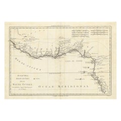
18th Century Map of Upper Guinea: Kingdoms and Coastal Regions of West Africa
Located in Langweer, NL
This is an antique map depicting the coastal regions of West Africa, specifically the Gulf of Guinea and surrounding areas, including parts of what is now Senegal, Guinea, Sierra Leo...
Category

Antique 18th Century and Earlier Collectibles and Curiosities

Materials

Paper

18th Century Antique Conrad Lotter Septentrionalis Meridionalis American Maps
Located in Dayton, OH
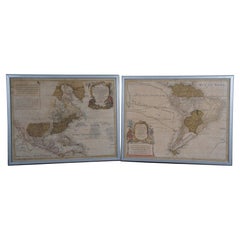
Pair of rare hand colored maps from the 1770's, depicting "America Septentrionalis" (North America), engraved by Georg Friedrich Lotter and America Meridionalis (South America), engr...
Category

Antique 18th Century and Earlier Collectibles and Curiosities

Materials

Paper

Choir Stalls – Rochester Cathedral Gothic Architecture Engraving, 1790
Located in Langweer, NL
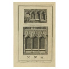
Choir Stalls – Rochester Cathedral Gothic Architecture Engraving, 1790 This finely executed antique print depicts the intricately carved wooden stalls in the choir of Rochester Cath...
Category

English Antique 18th Century and Earlier Collectibles and Curiosities

Materials

Paper

Decorative Engraving of VOC Battle Ships Attacking Palembang in Sumatra, ca.1700
Located in Langweer, NL
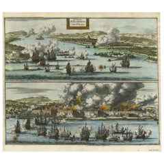
Antique print titled 'La Ville de Palimbang dans L’Ile de Sumatra.' A very decorative, impressive engraving of Palembang in Sumatra. Two views on one sheet. In the upper part the...
Category

Antique 18th Century and Earlier Collectibles and Curiosities

Materials

Paper

Extremele Rare, Original Miniature Map of Prussia, ca.1640
Located in Langweer, NL
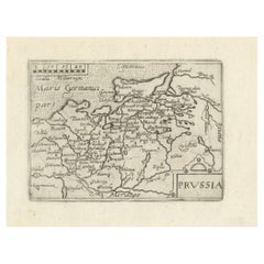
Antique map titled 'Prussia'. Extremele rare, original miniature map of Prussia, a historically prominent German state that originated in 1525 with a du...
Category

Antique 18th Century and Earlier Collectibles and Curiosities

Materials

Paper

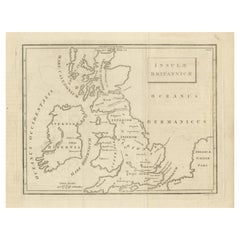
Antique Map of the British Isles According to the Geography of the Roman Empire
Located in Langweer, NL
Antique map titled 'Insulae Britannicae'. Interesting map of Britain, Scotland, and Ireland. It shows a rudimentary outline of the islands according to the geography of the Roman Emp...
Category

Antique 18th Century and Earlier Collectibles and Curiosities

Materials

Paper

Antique Map of Portugal by Placide, c.1700
Located in Langweer, NL
Antique map titled 'Le Portugal dedié au Roy (..)'. Large and detailed map of Portugal. With a small inset map of Porto. Artists and Engravers: Publish...
Category

Antique 18th Century and Earlier Collectibles and Curiosities

Materials

Paper

Rare Antique Copper Engraving of a Map of Pegu and Arakan, Burma (Myanmar), 1714
Located in Langweer, NL
Antique map Myanmar (Birma) titled 'Les Royaumes de Pegu et d'Aracan'. Rare map of Pegu and Arakan made after a map engraved by Pieter van den Keere and published in the 1628 edi...
Category

Antique 18th Century and Earlier Collectibles and Curiosities

Materials

Paper

Circa 1659 Willem Blaeu Map: Southwestern Switzerland with Geneva & Lakes
Located in Langweer, NL
Circa 1659 Willem Blaeu Map: Southwestern Switzerland with Geneva & Lakes This detailed map from circa 1659 by Willem Blaeu, titled "Das Wiflispurgergow," highlights the southwestern region of Switzerland. It features significant landmarks such as Geneva, Lake Geneva (Lacus Lemannus), Lake Neuchatel, Lake Biel, Bern, Freiburg, and Lake Thuner. Based on the work of Gerard Mercator, this map is published with Spanish text on the verso, dating from the period between 1659 and 1672. Measuring 19.9 inches wide by 15.1 inches high, the map is rendered in full contemporary color on a bright sheet that bears a large watermark of the god Atlas. The condition is excellent, with a sharp impression, short centerfold separations at the top and bottom margins, and an archivally repaired tear in the right margin. Keywords: - Willem Blaeu map - Gerard Mercator - 17th-century Switzerland map...
Category

Antique 18th Century and Earlier Collectibles and Curiosities

Materials

Paper

Antique Map of Europe by Hederichs, circa 1740
Located in Langweer, NL
Antique map titled 'Europa Christiani Orbis Domina'. Rare miniature map of Europe. This map originates from 'Anleitung Zu den fürnehmsten Historischen Wissenschaften, Benanntlich Der...
Category

Antique 18th Century and Earlier Collectibles and Curiosities

Materials

Paper

Rare Antique Print of a Fountain by Delsenbach, c.1730
Located in Langweer, NL
Antique print titled 'Veue de la grotte de Thetis et de la haute gerbe (..)'. View of a fountain, most likely in the Gardens of Versailles. Source unknown, to be determined. Artists ...
Category

Antique 18th Century and Earlier Collectibles and Curiosities

Materials

Paper

Antique Engraving of Circus Flaminius, a Circular Area in Ancient Rome, 1704
Located in Langweer, NL
Description: Antique print, titled: 'Circus Flaminius (…)' - This original old antique print shows a reconstruction of Circus Flaminius, a large, circular area in ancient Rome, l...
Category

Antique 18th Century and Earlier Collectibles and Curiosities

Materials

Paper

Rare Town Plan of Jerusalem, Includes an Extensive Key to Locations etc, 1708
Located in Langweer, NL
Antique map titled 'Eigentliche Vorstellung der Statt Jerusalem und derselben umliegenden Gegenden zu Salomonis auch zu und kurtz nach Christi Zeiten.' Rare town plan...
Category

Antique 18th Century and Earlier Collectibles and Curiosities

Materials

Paper

Old Print of Reformer Philipp Melanchthon, Collaborator with Martin Luther, 1701
Located in Langweer, NL
Antique portrait titled 'Melanchton'. Portrait of Philipp Melanchthon. Philipp Melanchthon (1497-1560), born Philipp Schwartzerdt, was a German reformer, collaborator with Martin Luther, the first systematic theologian of the Protestant Reformation, intellectual leader of the Lutheran Reformation, and an influential designer of educational systems. He stands next to Luther and Calvin as a reformer, theologian, and molder of Protestantism. As much as Luther, he is the primary founder of Lutheranism. This print originates from 'Historie der kerken en ketteren van den beginne des Nieuwen Testaments tot aan het jaar onses Heeren 1688 ... In het Neederduyts vertaald' by G. Arnold. Artists and Engravers: Gottfried Arnold (1666 – 1714) was a German Lutheran...
Category

Antique 18th Century and Earlier Collectibles and Curiosities

Materials

Paper

Original Antique Map of Brecknockshire, Wales
Located in Langweer, NL
Antique map titled 'Brecknoc comitaus pars olim silurum'. Original old map of Brecknockshire, Wales. Engraved by R. Vaughan after Christopher Saxton. Published circa 1640.
Category

Antique 18th Century and Earlier Collectibles and Curiosities

Materials

Paper

Antique Miniature Map of New Guinea by Bertius, '1618'
Located in Langweer, NL
Antique miniature map titled 'Nova Guinea et Ins. Salomonis'. Rare miniature map of New Guinea (Solomon Islands). This map originates from 'Tabularum Geo...
Category

Antique 18th Century and Earlier Collectibles and Curiosities

Materials

Paper

Rare Antique Map of the Region of Franekeradeel, The Netherlands 1664
Located in Langweer, NL
Antique map titled 'De Grietenije van Franeker deel (..)'. Map of the Grietenij of Franekeradeel, Friesland, The Netherlands. Multiple cartouches, key and coat of arms. Originates fr...
Category

Antique 18th Century and Earlier Collectibles and Curiosities

Materials

Paper

Antique Print of Batavia 'Jakarta', in the Dutch East Indies, 1744
Located in Langweer, NL
Two views on one plate titled 'A Prospect of The Town of Batavia (and) A View of the Citadel of Batavia'. Beautiful views of Batavia (Jakarta), Indonesia. The upper view shows the ci...
Category

Antique 18th Century and Earlier Collectibles and Curiosities

Materials

Paper

Antique Map of the German Empire, Johannes Janssonius van Waesbergen, circa 1670
Located in Langweer, NL
Antique map titled 'Nova Totius Germaniae Descriptio'. Uncommon map of the German Empire including the Netherlands, Germany, Switzerland, Austria, Bohemia,...
Category

Antique 18th Century and Earlier Collectibles and Curiosities

Materials

Paper

Dutch 18th Century Fob seal with coat of arms
Located in Delft, NL
Dutch 18th Century Fob seal with coat of arms A Dutch 18th Century silver (unmarked) fob seal pendant in shape of two dolphins connected around their necks. The signet has a Dutch coat of arms...
Category

Dutch Antique 18th Century and Earlier Collectibles and Curiosities

Materials

Silver

Elaborately Carved Antique Beggar's Bowl Kashkul
Located in Atlanta, GA
A fine Kashkul carved from half of the giant nutshell of Coco-de-mer likely from Persian Qajar Dynasty circa 18-19th century. Kashkul is a container known as the beggar's bowl, carri...
Category

Persian Islamic Antique 18th Century and Earlier Collectibles and Curiosities

Materials

Wood

Gallipoli Fortifications: A 1688 Engraved Bird’s-Eye Map by Mattheus Merian
Located in Langweer, NL
Gallipoli Fortifications: A 1688 Bird’s-Eye Map by Mattheus Merian Description: This exquisitely detailed map of Gallipoli, crafted by the renowned engraver Mattheus Merian, offers ...
Category

German Antique 18th Century and Earlier Collectibles and Curiosities

Materials

Paper

Chile Coast Bay Map – Antique 1749 Chart by Anson from Voyage Around the World
Located in Langweer, NL
Antique map titled 'Plan van een Baai en Haven aan de Kust van Chili (..) - Plan d'une Baye de la Côte du Chili (..)'. Original antique map of a bay on the coast of Chile discovered ...
Category

Antique 18th Century and Earlier Collectibles and Curiosities

Materials

Paper

Biblical Map of the Region from the Mediterranean through the Persian Gulf, 1720
Located in Langweer, NL
Antique map titled 'Carte de la Situation du Paradis Terrestre, Et des Pais Habitez par les Patriarches Dressee pour bien entendre l'Histoire Sainte, Par Messire Pierre Daniel Huet.' This interesting map covers the region from the Mediterranean through the Persian Gulf. Detail is omitted in favor of Biblical depictions including the Sermon on the Mount...
Category

Antique 18th Century and Earlier Collectibles and Curiosities

Materials

Paper

Antique Print of Bantam, Java, Indonesia by De Bry, c.1610
Located in Langweer, NL
Untitled print of Bantam, former city and sultanate of Java, Indonesia. It lay near the site of the present-day city of Banten, on Banten Bay, at the extreme northwest of the island....
Category

Antique 18th Century and Earlier Collectibles and Curiosities

Materials

Paper

Antique Map of Switzerland by J.B. Homann, 1751
Located in Langweer, NL
Decorative example of Homann's map of Switzerland, with decorative cartouche and the coat of arms of each of the 13 Cantons.
Category

Antique 18th Century and Earlier Collectibles and Curiosities

Materials

Paper

Antique Print of Weapons of the Tartar Tanguts and the Samoyeds, 1768
Located in Langweer, NL
Antique print titled 'Armes des Tatares Tunguts et des Samojedes'. Copper engraving of weapons, like arrowheads, of the Tartar Tanguts and the Samoyeds. This print originates from vo...
Category

Antique 18th Century and Earlier Collectibles and Curiosities

Materials

Paper

Antique Map of Nisari, Le Simie, Carchi Elimoia and Piscopia, Greece, 1687
Located in Langweer, NL
Antique map titled 'Carchi Elimoia, Nisari, Le Simie, Piscopia.' Sheet with four maps on one page showing Nisyros, Simi and other islands, Greece. Source unknown, to be determined. A...
Category

Antique 18th Century and Earlier Collectibles and Curiosities

Materials

Paper

Antique Print of Althorp, Previous Home of Lady Diana Spencer in England, 1725
Located in Langweer, NL
Antique print titled 'Althrop in Northamptonshire (..)'. Old engraving of Althorp, Northamptonshire. Althorp is a Grade I listed stately home and estate in the civil parish of Althorp, in West Northamptonshire, England of about 13,000 acres (5,300 ha). By road it is about 6 miles (9.7 km) northwest of the county town of Northampton and about 75 miles (121 km) northwest of central London, situated between the villages of Great Brington and Harlestone. It has been held by the prominent aristocratic Spencer family for more than 500 years, and has been owned by Charles Spencer, 9th Earl Spencer since 1992. It was also the home of Lady Diana Spencer...
Category

Antique 18th Century and Earlier Collectibles and Curiosities

Materials

Paper

Original Antique Map of Leros and Kalimnos, and other islands, Greece, 1687
Located in Langweer, NL
Antique map titled 'Lero, Calamo, Zanara e Levita, Amorgo.' heet with four maps on one page showing the islands Leros, Kalimnos, and other islands, Greece. Source unknown, to be de...
Category

Antique 18th Century and Earlier Collectibles and Curiosities

Materials

Paper

The Tunning of Elinor Rumming, a Poem by John Skelton
Located in Middletown, NY
Skelton, John The Tunning of Elinor Rumming, a Poem London: Printed for Isaac Dalton, and sold by W. Boreham at the Angel in Pater-Noster-Row, 1718. Second Edition. Octavo, 7 5/8 x 4 5/8 in. (194 x 117 mm). pp. [8], 31, [1]. From the title page: by Skelton Laureat. Original unbound, rebound in modern pink paper over boards, leather spine label with gilt title. Some toning to last few leaves.boards All text is legible, some spot tanning throughout. In near fine condition. Rare. [ESTC N46064 ] ESTC shows two U.S. copies only: Henry E. Huntington Library and Yale University Beinecke Rare Book and Manuscript Library; and two British Isles copies only: Oxford University Bodleian Library (both copies). This poem was printed multiple times in the 16th century, including by William Caxton's successor, Wynken de Worde. Rare as a separate volume. John Skelton (c.1463 - 1529) was a remarkable, unusual poet and priest, who had been the tutor of the Tudors, Prince Arthur...
Category

English Antique 18th Century and Earlier Collectibles and Curiosities

Materials

Gold Leaf

Antique Engraving of Greek Religious Ceremonies, ca.1730
Located in Langweer, NL
Antique print of various Greek religious ceremonies. With French description. Artists and Engravers: Anonymous Condition: Very good. Stamp on ...
Category

Antique 18th Century and Earlier Collectibles and Curiosities

Materials

Paper

Old Antique Print of Fort Noordwijk, Batavia 'Jakarta, Indonesia', 1739
Located in Langweer, NL
Antique print titled 'Ein Prospect des Forts Nortweijck, wie sich dasselbe wan man von Jacatra komt, mit seiner Gegend präsentiret'. Old print of Fort Noordwijk, Batavia (Jakarta)....
Category

Antique 18th Century and Earlier Collectibles and Curiosities

Materials

Paper

Antique Map of the Brazilian Coast by A. Van Krevelt
Located in Langweer, NL
Uncommon edition of this accurate map of part of Brazil, from San Salvador till Rio de Janeiro and S.Paulo. In lower right engraved "29b." Originates from 'Atlas Portatif pour servir...
Category

Brazilian Antique 18th Century and Earlier Collectibles and Curiosities

Materials

Paper

Rare Antique Map of 'Barbarie' or Northern Africa, 1655
Located in Langweer, NL
Antique map titled 'Partie de la Coste de Barbarie en Africque ou sont les Royaumes de Tunis et Tripoli et Pays Circomvoisins'. This map depicts North Africa with Malta and originate...
Category

Antique 18th Century and Earlier Collectibles and Curiosities

Materials

Paper

Antique Engravings of Japan incl a Map and the Arrival of the Dutch, 1732
Located in Langweer, NL
Original antique print titled 'Succession des Empereurs du Japon avec une Description de Meurtre de l'Empereur Cubo et la Reception des Ambassadeurs Hollandois en ce Pays la'. It sho...
Category

Antique 18th Century and Earlier Collectibles and Curiosities

Materials

Paper

Antique Map of Lower Saxony by Clouet, 1787
Located in Langweer, NL
Antique map titled 'Basse Saxe'. Antique map of Lower Saxony, Germany. Originates from 'Geographie moderne avec une introduction' by J.B.L. Clouet.
Category

Antique 18th Century and Earlier Collectibles and Curiosities

Materials

Paper

Antique Map of Dutch & Belgium Provinces Limburg, Namen and Ardennes, ca.1635
Located in Langweer, NL
Antique print, titled: 'Leodiensis Dioecesis.' Detailed map including the Dutch and Belgium provinces Limburg and the Belgium province of Namen and Ardennes. Exquisitely engraved...
Category

Antique 18th Century and Earlier Collectibles and Curiosities

Materials

Paper

Antique Map of Bavaria, Bayern, with original Hand Coloring
Located in Langweer, NL
Antique map titled 'Bavariae Circulus atq Electoratus tam cum Adiacentibus quam insertis Regionibus'. Original old map of Bavaria, Bayern, Germany. The map stretches south to Innsbru...
Category

Antique 18th Century and Earlier Collectibles and Curiosities

Materials

Paper

Antique Map of the City of Gorinchem by Merian, 1659
Located in Langweer, NL
Antique map titled 'Gorckum'. This print depicts the city of Gorinchem (or Gorcum/Gorkum, The Netherlands). This print originates from 'Topographia Germaniae Inferioris (..)' by C. M...
Category

Antique 18th Century and Earlier Collectibles and Curiosities

Materials

Paper

Antique Map: Carte du Détroit du Sond with Copenhagen Inset, 1693
Located in Langweer, NL
Antique Map: Carte du Détroit du Sond with Copenhagen Inset, Jaillot/Mortier, 1693 This rare and striking antique map, titled *Carte du détroit du Sond contenant les costes de l’Is...
Category

Antique 18th Century and Earlier Collectibles and Curiosities

Materials

Paper

A Voyage Round the World, In the Years MDCCXL, I, II, III, IV, By George Anson
Located in Middletown, NY
The Most Popular Book of Maritime Adventure of the Eighteenth Century Anson, Lord George and Richard Walter A Voyage Round the World, In the Years MDCCXI, I, II, III, IV, By George ...
Category

English Antique 18th Century and Earlier Collectibles and Curiosities

Materials

Gold Leaf

Original Antique Map of the Philippines, Malaysia, Indonesia, Singapore, c.1690
Located in Langweer, NL
Antique map titled 'Isole dell' Indie, diuise in Filippine, Molucche e della Sonda'. Old map of the Philippines, Malaysia, Indonesia, Singapore, Northern Australia and contiguous i...
Category

Antique 18th Century and Earlier Collectibles and Curiosities

Materials

Paper

Antique Map of the Adour River, Near Bayonne, France
Located in Langweer, NL
Antique map titled 'Cours de la riviere de l'Adour depuis la mer jusqua Bayonne'. Original old map of the Adour river, near Bayonne, France. This map originates from 'Le Petit Atlas ...
Category

Antique 18th Century and Earlier Collectibles and Curiosities

Materials

Paper

Original Antique Print of a Machine for Boring Pipes, ca.1760
Located in Langweer, NL
Antique print titled 'A machine for boring Pipes'. Print of a machine for boring pipes. This print originates from 'The Universal Magazine of Kn...
Category

Antique 18th Century and Earlier Collectibles and Curiosities

Materials

Paper

Decorative Original Antique Map of Normandy, France
Located in Langweer, NL
Original antique map titled 'Ducato D'Normandie Scala di Miglia d'Italia'. Very decorative map of Normandy, with a fine title cartouche featuring Leda ...
Category

Italian Antique 18th Century and Earlier Collectibles and Curiosities

Materials

Paper

Old Map of The Southern Part of Norway, Covering the Region Around Bergen, c1650
Located in Langweer, NL
Antique map titled 'Nova et Accurata Tabula Episcopatuum Stavangriensis et Asloiensis'. Old map of the southern part of Norway, it covers the region around Bergen. Decorated with...
Category

Antique 18th Century and Earlier Collectibles and Curiosities

Materials

Paper

Mid-18th Century French Alabaster Sculpture Depicting a Female Nude with Anchor
Located in Milan, IT
Alabaster sculpture depicting a female nude with cloak and hat, with clasped hands and resting her foot on an anchor, as if to invoke protection for the sailors; French manufacture o...
Category

French Antique 18th Century and Earlier Collectibles and Curiosities

Materials

Alabaster

Antique Map of the Maluku Islands by Bellin, c.1750
Located in Langweer, NL
Antique map titled 'Carte Particuliere des Isles Moluques'. This map depicts the islands of Herij, Ternate, Tidor, Pottebackers, Timor, Machian and Bachian. The Moluccan islands were...
Category

Antique 18th Century and Earlier Collectibles and Curiosities

Materials

Paper

Sebastian Münster's 16th Century Map of the British Isles, ca.1590
Located in Langweer, NL
GREAT BRITAIN -- "ENGELLANDT mit dem anstossenden Reich Schottlandt so vorzeiten Albion und Britannia haben geheissen". (Basel, c. 1590). Partly handcolored woodcut double-page map from S. Munster's 'Cosmographey'. 330 x 408 mm. (Lower margin cut short (touching the line), tiny hole in upper margin, sl. foxed/browned, lower right corner a bit thumbed). Sebastian Münster's 16th Century Map of the British Isles from 'Cosmographia Universalis...
Category

Antique 18th Century and Earlier Collectibles and Curiosities

Materials

Paper

Charming Miniature Map of Thrace or Thrake in Southeast Europe, 1685
Located in Langweer, NL
Antique map titled 'Thraciae Descriptio.' Charming miniature map of Thrace, from the pocket atlas 'Introductionis in Universam Geographiam tam Veterem quam novam .. Acessit P. Be...
Category

Antique 18th Century and Earlier Collectibles and Curiosities

Materials

Paper

Antique Map of Java in The Dutch East Indies, Now Indonesia, c.1690
Located in Langweer, NL
Antique map titled 'Insulae Iavae cum parte insularum Boreno Sumatrae (..)'. Beautiful map of the Island of Java and part of Borneo, Bali, Madura and Sumatra. Artists and Engrave...
Category

Antique 18th Century and Earlier Collectibles and Curiosities

Materials

Paper

Antique Map of a Bay of Borneo, Indonesia, c.1760
Located in Langweer, NL
Antique map titled 'La Baye de l'isle et Ville de Borneo'. Small map depicting a Bay of Borneo. Artists and Engravers: Anonymous. Condition: Good, general age-related toning. ...
Category

Antique 18th Century and Earlier Collectibles and Curiosities

Materials

Paper

Original Old Map of the Environs of Batavia in the Dutch East Indies (Indonesia)
Located in Langweer, NL
Antique map titled 'Carte des Environs de Batavia'. Map of the environs of Batavia (now Jakarta), Indonesia. This print originates from volume 8 of 'Histoire générale des voyages'. P...
Category

Antique 18th Century and Earlier Collectibles and Curiosities

Materials

Paper

Antique Map of Essex by Overton, circa 1710
Located in Langweer, NL
Antique map titled 'Essex, devided into Hundreds, with the most antient and fayre Towne Colchester (..)'. Map of Essex, England. Includes an inset town pl...
Category

Antique 18th Century and Earlier Collectibles and Curiosities

Materials

Paper

Antique County Map, Hampshire, English, Framed Cartography, Robert Morden, 1700
Located in Hele, Devon, GB
This is an antique county map of Hampshire. An English, framed atlas engraving of cartographic interest By Robert Morden, dating to the late 17th century and later. Superb lithogra...
Category

British Other Antique 18th Century and Earlier Collectibles and Curiosities

Materials

Glass, Wood, Paper

Antique Map of the Tunquin River and Bay to Cacho, the Capital City, Siam, 1758
Located in Langweer, NL
Antique map titled ‘Kaart van den Loop der Rivier van Tonkin van Cacho tot aan de Zee / Carte du Cours de la Riviere de Tunquin Depuis Cacho jusqu'à la Mer J. v. Schley direx.’ Detailed map of the Tunquin River and Bay, extending north to Cacho, the capital...
Category

Antique 18th Century and Earlier Collectibles and Curiosities

Materials

Paper

Bird’s-Eye View Map of Gallipoli: Fortified Ionian Gem by Mattheus Merian, 1688
Located in Langweer, NL
Bird’s-Eye View Map of Gallipoli: Fortified Ionian Gem by Mattheus Merian Description: This exquisitely detailed map of Gallipoli, crafted by the renowned engraver Mattheus Merian,...
Category

German Antique 18th Century and Earlier Collectibles and Curiosities

Materials

Paper

Interesting Original Antique Hemisphere Map Showing the Latest Discoveries
Located in Langweer, NL
Antique world map titled 'A Map of the World from the best Authorities'. Detailed map of the World, showing tracks of Captain James Cook in his 3 voyages in great detail. The map is ...
Category

Antique 18th Century and Earlier Collectibles and Curiosities

Materials

Paper

Original Antique Map of Egypt in Frame by C. Weigel, circa 1720
Located in Langweer, NL
The map is an antique depiction of ancient Egypt, divided into its regions and nomes, also including areas like Troglodytica, Marmarica, and Ethiopia above Egypt. Christophorus Weige...
Category

Antique 18th Century and Earlier Collectibles and Curiosities

Materials

Paper

Read More

Medal-Worthy Memorabilia from Epic Past Olympic Games

Get into the games! These items celebrate the events, athletes, host countries and sporting spirit.

Ahoy! You’ve Never Seen a Collection of Sailor Art and Kitsch Quite Like This

French trendsetter and serial collector Daniel Rozensztroch tells us about his obsession with objects related to seafaring men.

Pamela Shamshiri Shares the Secrets behind Her First-Ever Book and Its Effortlessly Cool Interiors

The sought-after designer worked with the team at Hoffman Creative to produce a monograph that beautifully showcases some of Studio Shamshiri's most inspiring projects.

Moroccan Artworks and Objects Take Center Stage in an Extraordinary Villa in Tangier

Italian writer and collector Umberto Pasti opens the doors to his remarkable cave of wonders in North Africa.

Montecito Has Drawn Royalty and Celebrities, and These Homes Are Proof of Its Allure

Hollywood A-listers, ex-pat aristocrats and art collectors and style setters of all stripes appreciate the allure of the coastal California hamlet — much on our minds after recent winter floods.

Whaam! Blam! Pow! — a New Book on Pop Art Packs a Punch

Publishing house Assouline and writer Julie Belcove have teamed up to trace the history of the genre, from Roy Lichtenstein, Andy Warhol and Yayoi Kusama to Mickalene Thomas and Jeff Koons.

What Makes a Gem-Encrusted Chess Set Worth $4 Million?

The world’s most opulent chess set, weighing in at 513 carats, is literally fit for a king and queen.

Tauba Auerbach’s Geometric Pop-Up Book Is Mighty Rare, Thanks to a Hurricane

This sculptural art book has an epic backstory of its own.
Recently Viewed

View All