18th Century Collectibles and Curiosities

to
1,807
2,455
324
2,798
115
92
40
34
29
12
7
5
1
1
1
1
1
4,439
6,815
13,476
2,732
3,520
4,693
3,077
514
301
603
744
481
903
895
901
659
592
2,180
386
282
92
82
779
194
165
142
131
2,798
2,798
2,798
21
14
13
12
11
Period: 18th Century
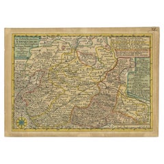
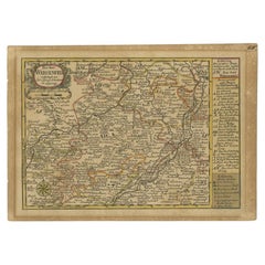
Antique Map of the Region of Weißenfels by Schreiber, 1749
Located in Langweer, NL
Antique map titled 'Das Amt Weissenfels (..)'. Map of the region of Weißenfels, Germany. This map originates from 'Atlas Selectus von allen Konigreichen und Landern der Welt' by Joha...
Category

Antique 18th Century Collectibles and Curiosities

Materials

Paper

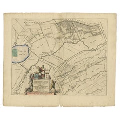
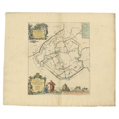
Antique Map of the Schoterland Township, Friesland by Halma, 1718
Located in Langweer, NL
Antique map Friesland titled 'Schooterlandt de Vijfde Grietenije van de Sevenwolden (..)'. Old map of Friesland, the Netherlands. This map depicts the region of Schoterland and inclu...
Category

Antique 18th Century Collectibles and Curiosities

Materials

Paper

Antique Map of the Region of Schwarzburg by Schreiber, 1749
Located in Langweer, NL
Antique map titled 'Die Südliche Fürstenthum Schwartzburg (..)'. Map of the region of Schwarzburg, Germany. This map originates from 'Atlas Selectus von allen Konigreichen und Lander...
Category

Antique 18th Century Collectibles and Curiosities

Materials

Paper

Antique Map of the Rauwerderhem Township, Friesland by Halma, 1718
Located in Langweer, NL
Antique map Friesland titled 'Rauwerderhem de Elfde Grietenije van Ooster Goo (..)'. Old map of Friesland, the Netherlands. This map depicts the region of Rauwerderhem and includes c...
Category

Antique 18th Century Collectibles and Curiosities

Materials

Paper

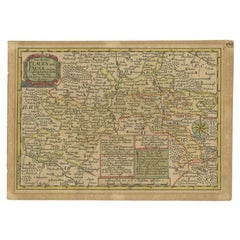
Antique Map of the Region of Plauen by Schreiber '1749'
Located in Langweer, NL
Antique map titled 'Die Aemter Plauen und Pausa (..)'. Map of the region of Plauen, Germany. This map originates from 'Atlas Selectus von allen Konigreichen und Landern der Welt' by ...
Category

Antique 18th Century Collectibles and Curiosities

Materials

Paper

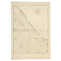
Antique Map of the South-Western Coast of Sumatra by De la Haye, c.1780
Located in Langweer, NL
Antique map titled 'Carte de la Côte Occidentale de l'Isle Sumatra'. Sea chart of the part of the south-western coast of Sumatra with the Nassau (Nias) and Fortune isles. Artists ...
Category

Antique 18th Century Collectibles and Curiosities

Materials

Paper

Antique Map of the Region of Voigtsberg by Schreiber, 1749
Located in Langweer, NL
Antique map titled 'Das Amt Voigtsberg (..)'. Map of the region of Voigtsberg, Germany. This map originates from 'Atlas Selectus von allen Konigreichen und Landern der Welt' by Johan...
Category

Antique 18th Century Collectibles and Curiosities

Materials

Paper

Antique Map of the Southern Netherlands by Bowles, c.1780
Located in Langweer, NL
Antique map titled ‘Bowles's New Pocket Map of the ten Catholick Provinces of the Lower Countries, or Netherlands’. Original antique map of the Southern Netherlands. The Southern Netherlands, also called the Catholic Netherlands, was the part of the Low Countries largely controlled by Spain (1556–1714), later Austria (1714–1794), and occupied then annexed by France (1794–1815). With English legend explaining the ten provinces. Artists and Engravers: Thomas Bowles, born around 1712, was map publisher and seller in London...
Category

Antique 18th Century Collectibles and Curiosities

Materials

Paper

Antique Map of the Dongeradeel Township in Friesland, The Netherlands, 1718
Located in Langweer, NL
Antique map Friesland titled 'Donger Deel West Zyde der Pasens (..)'. Old map of Friesland, the Netherlands. This map depicts the region of Dongeradeel and includes cities and villag...
Category

Antique 18th Century Collectibles and Curiosities

Materials

Paper

Antique Map of the Region of Kennemerland and Eems by Halma, 1718
Located in Langweer, NL
Antique map Friesland titled 'Descriptio Frisiae Liberae (..)'. Old map of Friesland, the Netherlands. This map depicts the region between Kennemerland and Eems. Originates from 'Uit...
Category

Antique 18th Century Collectibles and Curiosities

Materials

Paper

Antique Map of the Region of Hainaut and Cambrésis by Reinhardt, c.1784
Located in Langweer, NL
Antique map titled 'Theatre de la Guerre ou Carte Topographique tres exacte des Pais-Bas (..)'. Detailed map showing the county of Hainaut and Cambrésis, France. Inludes the cities o...
Category

Antique 18th Century Collectibles and Curiosities

Materials

Paper

Antique Map of the Coromandel Peninsula, 1754
Located in Langweer, NL
Antique map titled 'A map of Coromandel shewing the Seat of War on that coast'. Rare map of Coromandel printed for the London Magazine. Artists and Engr...
Category

Antique 18th Century Collectibles and Curiosities

Materials

Paper

Antique Map of the Coast of Guinea, Africa, c.1780
Located in Langweer, NL
Antique map Africa titled 'Carte de la Haute et de la Basse Guinée'. Map of the Coast of Guinea, Africa. Represents modern day Liberia, Ivory Coast, Ghana, Nigeria, Cameroon, Gabon, Congo, and Equatorial Guinea...
Category

Antique 18th Century Collectibles and Curiosities

Materials

Paper

Antique Map of the City of Leeuwarden by Harrewijn, 1743
Located in Langweer, NL
Antique map titled 'La Ville de Lewarde'. Old map of the city of Leeuwarden, Friesland. Originates from 'Les Délices des Pays-Bas' by Widow Foppens. Artists and Engravers: Engrav...
Category

Antique 18th Century Collectibles and Curiosities

Materials

Paper

Antique Map of the Coast of Juan Fernandez by Van Schley, 1757
Located in Langweer, NL
Antique map titled 'Cote du Nord Est de l'Isle de Juan Fernandez (..).' Map of the Chilean South Pacific archipelago of the Juan Fernandez Islands. This island was made famous by Dan...
Category

Antique 18th Century Collectibles and Curiosities

Materials

Paper

The Cape Verde Islands Coast Antique Engraving by Van Schley, 1747
Located in Langweer, NL
Antique map titled ‘Carte Exacte de la cote du Cap Verd (..) - Naauwkeurige Kaart van de Kust van Kabo Verde (..)'. Original antique map of the coast of the Cape Verde Islands. This ...
Category

Antique 18th Century Collectibles and Curiosities

Materials

Paper

Antique Map of the Dongeradeel Township 'Friesland' by Halma, 1718
Located in Langweer, NL
Antique map Friesland titled 'Donger Deel West Zyde der Pasens (..)'. Old map of Friesland, the Netherlands. This map depicts the region of Dongeradeel and includes cities and villag...
Category

Antique 18th Century Collectibles and Curiosities

Materials

Paper

Antique Map of the Danube River and Surroundings by Homann Heirs, c.1730
Located in Langweer, NL
Antique map titled 'Danubii Fluminus (a fontibus prope Doneschingam usq Posonium urbem defignati) Pars Superior, in qua Suevia, Bavaria, Asutria, Stiria, Carinthia, Carniola, Tyrolis...
Category

Antique 18th Century Collectibles and Curiosities

Materials

Paper

Antique Map of the Region of Gaasterland, Friesland, The Netherlands, 1791
Located in Langweer, NL
Antique map titled 'Der Provinz Westergo zwey südliche Grietenyen mit dem Gaasterland und der Stadt Staveren, Sloten, Workum, Ylst und Hindelopen'. Map of the region of Gaasterland, ...
Category

Antique 18th Century Collectibles and Curiosities

Materials

Paper

Antique Map of the German Empire by De Leth, 1749
Located in Langweer, NL
Antique map Germany titled 'L'Empire d'Allemagne divisé en ses dix cercles et Autres Estats'. Detailed map of the German Empire divided in the ten ...
Category

Antique 18th Century Collectibles and Curiosities

Materials

Paper

Antique Map of the Region of Batavia by Conrade, 1782
Located in Langweer, NL
Antique map titled 'Carte des environs de Batavia.' (Map of Batavia and its surroundings.) Map of the Batavia area (Jakarta) in Indonesia. With cartouche, scale and compass rose. Thi...
Category

Antique 18th Century Collectibles and Curiosities

Materials

Paper

Antique Map of the Ooststellingwerf Township Friesland by Halma, 1718
Located in Langweer, NL
Antique map titled 'Stellingwerf Oost-Eynde, de negende Grietenije van de Sevenwolden'. This regional map of the Oost Stellingwerf Grietenij, part of the Province of Friesland, The N...
Category

Antique 18th Century Collectibles and Curiosities

Materials

Paper

Antique Map of the Region of Dauphiné by Zatta, 1779
Located in Langweer, NL
Antique map titled 'Li Governi del Delfinato e di Provenza la Contea Venaissin ed il Princie d'Orange'. Old map of France showing the province of Dauphiné. This map originates from '...
Category

Antique 18th Century Collectibles and Curiosities

Materials

Paper

Antique Map of the Region of Hohenstein by Schreiber, 1749
Located in Langweer, NL
Antique map titled 'Aemter Stolpen, Hohenstein mit Lohmen'. Map of the region of Hohenstein, Germany. This map originates from 'Atlas Selectus von allen Konigreichen und Landern der ...
Category

Antique 18th Century Collectibles and Curiosities

Materials

Paper

Antique Map of the City of Woerden by Tirion, c.1750
Located in Langweer, NL
Antique map titled 'Nieuwe Grondtekening van de Stad Woerden'. Plan of the city of Woerden, the Netherlands. Published circa 1750. Artists and Engravers: Published by I. Tirion. ...
Category

Antique 18th Century Collectibles and Curiosities

Materials

Paper

Antique Map of the Region of Franeker and Harlingen by Von Reilly, 1791
Located in Langweer, NL
Antique map titled 'Der Provinz Westergo vier nördliche Grietenyen mit der Stadt Franeker und Harlingen'. Map of the region of Franeker and Harlingen, Friesland, the Netherlands. Thi...
Category

Antique 18th Century Collectibles and Curiosities

Materials

Paper

Antique Map of the Region of Grossenhain by Schreiber, 1749
Located in Langweer, NL
Antique map titled 'Das Amt Grossen-Hayn mit Zabeltitz'. Map of the region of Großenhain, Germany. This map originates from 'Atlas Selectus von allen Konigre...
Category

Antique 18th Century Collectibles and Curiosities

Materials

Paper

Antique Map of the Course of the Sanaga River by Van Schley, 1747
Located in Langweer, NL
Antique map titled 'Cours de la Riviere de Senegal (..) - Loop der Riviere Sanaga (..)'. Original antique map of the course of the Sanaga River that forms the border between Senegal ...
Category

Antique 18th Century Collectibles and Curiosities

Materials

Paper

Antique Map of the Expedition of Govert Knol by Valentijn, 1726
Located in Langweer, NL
Antique map titled 'Aftekening der Expeditie van de Hr. Commissaris Govert Cnoll uyt Soerabaja, tot afhalinge van Pangerang Adepati Anom'. Map showing the expedition...
Category

Antique 18th Century Collectibles and Curiosities

Materials

Paper

Antique Map of the Huguang Province of China by Du Halde, 1738
Located in Langweer, NL
Antique map titled 'Province VI Hu-Quang'. Old map depicting the Huguang province of China. Originates from 'A description of the Empire of China and Chinese-Tartary' by by J.B. du H...
Category

Antique 18th Century Collectibles and Curiosities

Materials

Paper

Antique Map of the Region of Annaburg by Schreiber, 1749
Located in Langweer, NL
Antique map titled 'Die Aemter Annaburg, Schweinitz (..)'. Map of the region of Annaburg, Germany. This map originates from 'Atlas Selectus von allen Konigreichen und Landern der Wel...
Category

Antique 18th Century Collectibles and Curiosities

Materials

Paper

Antique Map of the Region of Beauvais in France, 1737
Located in Langweer, NL
Untitled map of the region of Beauvais, France. This map originates from 'Nieuw en beknopt Kaart-Boekje vertoonende de XVII. Nederlandse Provintien (..)'. Artists and Engravers: Au...
Category

Antique 18th Century Collectibles and Curiosities

Materials

Paper

Antique Map of the Franekeradeel Township 'Friesland' by Halma, 1718
Located in Langweer, NL
Antique map Friesland titled 'De Grietenije van Franeker Deel (..) '. Old map of Friesland, the Netherlands. This map depicts the region of Franekeradeel and includes cities and vill...
Category

Antique 18th Century Collectibles and Curiosities

Materials

Paper

Antique Map of the Gaasterland Township 'Friesland' by Halma, 1718
Located in Langweer, NL
Antique map Friesland titled 'Gaasterland de Zevende Grietenije van de Zevenwolden (..)'. Old map of Friesland, the Netherlands. This map depicts the region of Gaasterland and includ...
Category

Antique 18th Century Collectibles and Curiosities

Materials

Paper

Antique Map of the Fortifications of Demak and Jepara by Valentijn, 1726
Located in Langweer, NL
Antique print titled 'Kaarte van de Nieuw ontworpen Pagger op de Qual of Cawala. Kaarte van de Oude en Nieuwe ontworpen Pagger tot Japara'. Plans of the newly designed fortifications...
Category

Antique 18th Century Collectibles and Curiosities

Materials

Paper

Antique Map of the Netherlands and Belgium by Bowen, 1747
Located in Langweer, NL
Antique map Belgium titled 'A New and Accurate Map of the Netherlands or Low Countries'. Detailed map of South of the Netherlands and Belgium. With large inset of the city of Mons, B...
Category

Antique 18th Century Collectibles and Curiosities

Materials

Paper

Antique Map of the Island of Java by Van Der Aa, 1725
Located in Langweer, NL
Antique map titled 'Map: 'L'Ile de Java'. (The island of Java.) This map shows the Indonesian island of Java. With compass rose and scale. This plate originates from the very scarse:...
Category

Antique 18th Century Collectibles and Curiosities

Materials

Paper

Antique Map of the Northern Part of Brazil by Raynal, 1784
Located in Langweer, NL
Antique map titled 'Kaart van het Noordlijk gedeelte van Bresil'. Rare antique map of the northern part of Brazil, with the basin of the Amazon and the cities of Manaus, Recife and S...
Category

Antique 18th Century Collectibles and Curiosities

Materials

Paper

Antique Map of the Establishment of the French Monarchy by Zannoni, 1765
Located in Langweer, NL
Antique map France titled 'Carte de l'Etablissement de la Monarchie Francoise (..)'. Beautiful old map of France. This map originates from 'Atlas Historique de la France Ancienne et ...
Category

Antique 18th Century Collectibles and Curiosities

Materials

Paper

Antique Map of the Hennaarderadeel Township 'Friesland' by Halma, 1718
Located in Langweer, NL
Antique map of Friesland titled 'Hennaardera Deel de Vyfde Grietenije van Wester Goo (..)'. Old map of Friesland, the Netherlands. This map depicts the region...
Category

Antique 18th Century Collectibles and Curiosities

Materials

Paper

Antique Map of the Old Lands of Friesland by Halma, 1718
Located in Langweer, NL
Antique map Friesland titled 'Descriptio Agri Frisii (..)'. Old map of Friesland, the Netherlands. This map depicts the old lands of Friesland. Originates from 'Uitbeelding van de He...
Category

Antique 18th Century Collectibles and Curiosities

Materials

Paper

Antique Print of the Ruins of Kalbassin in Siberia, 1768
Located in Langweer, NL
Antique print titled 'Ruines de Kalbassin (..)'. Copper engraving of the ruins of Kalbassin near that of Sem Palat (now Semipalatinsk / Semey). This print originates from volume 18 o...
Category

Antique 18th Century Collectibles and Curiosities

Materials

Paper

Antique Map of the Region of Bolsward and Sneek by Von Reilly, 1791
Located in Langweer, NL
Antique map titled 'Der Provinz Westergo drey mittlere Grietenyen mit der Stadt Bolsward und Sneek'. Map of the region of Bolsward and Sneek, Friesland, the Netherlands. This map org...
Category

Antique 18th Century Collectibles and Curiosities

Materials

Paper

Antique Map of the Netherlands by Zannoni, 1765
Located in Langweer, NL
Antique map titled 'Carte Historique, Geographique et Militaire des Campagnes de Louis XIV dans les Pays Bas (..)'. Beautiful old map of the Netherlands...
Category

Antique 18th Century Collectibles and Curiosities

Materials

Paper

Antique Map of the Holy Land by Danckerts, c.1710
Located in Langweer, NL
Antique map titled 'Afbeeldinge van de Veertich-Iaarige Reyse der Kinderen Israëls uyt Egypten door de Roode Zee en de Woestyne tot in 't Beloofde Landt Canaan'. Map of the Holy Land...
Category

Antique 18th Century Collectibles and Curiosities

Materials

Paper

Antique Map of the Maluku Islands by Le Rouge, c.1750
By George Louis Le Rouge
Located in Langweer, NL
Antique map Moluccas/Spice Islands titled 'Isles Moluques'. Detailed map of the famous Spice Islands (Maluku Islands or the Moluccas). Includes also Sulawesi, Bali, Timor, part of Bo...
Category

Antique 18th Century Collectibles and Curiosities

Materials

Paper

Antique Map of the Province of Quang-Si by Du Halde, 1738
Located in Langweer, NL
Antique map titled 'Province XIII Quang-Si. Drawn on the spot by ye Peres de Tartre & Cordoso in the year 1714'. Old map of the Chinese province Quang-Si. Originates from the Edward ...
Category

Antique 18th Century Collectibles and Curiosities

Materials

Paper

Antique Map of the Province of Quey-Chew by Du Halde, 1738
Located in Langweer, NL
Antique map titled 'Province XV Quey-Chew drawn on the spot by the Peres Fridelli and Regis in the year 1716'. Old map of the Chinese province Quey-Chew. Originates from the Edward C...
Category

Antique 18th Century Collectibles and Curiosities

Materials

Paper

Antique Map of the Old Land of Batavia and Friesland by Halma, 1718
Located in Langweer, NL
Antique map Friesland titled 'Descriptio veteris Agri Batavi et Frisii (..)'. Old map of Friesland, the Netherlands. This map depicts the old land of Batavia and Friesland. Originate...
Category

Antique 18th Century Collectibles and Curiosities

Materials

Paper

Antique Map of the Jiangxi Province of China by Du Halde, 1738
Located in Langweer, NL
Antique map titled 'Province III Kyang-Si'. Old map depicting the Jiangxi province of China. Originates from 'A description of the Empire of China and Chinese-Tartary' by J.B. du Hal...
Category

Antique 18th Century Collectibles and Curiosities

Materials

Paper

Antique Map of the Region Between the Caspian and the Sea of China by Toms, 1799
Located in Langweer, NL
Antique map titled 'Scythia et Serica'. Old map of the region between the Caspian and the Sea of China. Originates from 'Geographia Antiqua (..)'. Artists and Engravers: Engraved ...
Category

Antique 18th Century Collectibles and Curiosities

Materials

Paper

Antique Map of the Haskerland Township 'Friesland' by Halma, 1718
Located in Langweer, NL
Antique map Friesland titled 'Haskerland, de vierde Grietenije van de Zevenwolden (..)'. Old map of Friesland, the Netherlands. This map depicts the region of Haskerland and includes...
Category

Antique 18th Century Collectibles and Curiosities

Materials

Paper

Antique Map of the Old Land of Batavia and Friesland by Halma, 1718
Located in Langweer, NL
Antique map Friesland titled 'Descriptio veteris Agri Batavi et Frisii (..)'. Old map of Friesland, the Netherlands. This map depicts the old land of Batavia and Friesland. Originate...
Category

Antique 18th Century Collectibles and Curiosities

Materials

Paper

Antique Map of the Netherlands and Belgium by Lapie, 1842
Located in Langweer, NL
Antique map titled 'Carte des Royaumes de Belgique et de Hollande'. Map of the Netherlands and Belgium. This map originates from 'Atlas universel de géographie ancienne et moderne (....
Category

Antique 18th Century Collectibles and Curiosities

Materials

Paper

Antique Map of the Hennaarderadeel Township 'Friesland' by Halma, 1718
Located in Langweer, NL
Antique map Friesland titled 'Hennaardera Deel de Vyfde Grietenije van Wester Goo (..)'. Old map of Friesland, the Netherlands. This map depicts the region of...
Category

Antique 18th Century Collectibles and Curiosities

Materials

Paper

Antique Map of the Haskerland Township 'Friesland' by Halma, 1718
Located in Langweer, NL
Antique map Friesland titled 'Haskerland, de vierde Grietenije van de Zevenwolden (..)'. Old map of Friesland, the Netherlands. This map depicts the region of Haskerland and includes...
Category

Antique 18th Century Collectibles and Curiosities

Materials

Paper

Antique Map of the Province of Overijssel by Keizer & De Lat, 1788
Located in Langweer, NL
Antique map titled 'Seigneurie d'Over-Ysel'. Uncommon antique map of the province of Overijssel, the Netherlands. This map originates from 'Nieuwe Natuur- Geschied- en Handelkundige ...
Category

Antique 18th Century Collectibles and Curiosities

Materials

Paper

Antique Map of the Mouth of the Chiang River by Bellin, 1764
Located in Langweer, NL
Antique map titled ‘Carte de la Baye d'Hocsieu et des Entrees de la Riviere de Chang, Dans la Province de Fokyen en Chine’. This impressive map or sea chart d...
Category

Antique 18th Century Collectibles and Curiosities

Materials

Paper

Antique Map of the Province of Groningen by Keizer & De Lat, 1788
Located in Langweer, NL
Antique map titled 'Groningen en Ommelanden'. Uncommon antique map of the province of Groningen, the Netherlands. This map originates from 'Nieuwe Natuur- Geschied- en Handelkundige ...
Category

Antique 18th Century Collectibles and Curiosities

Materials

Paper

Antique Map of the Region of Bolsward and Sneek by Von Reilly, 1791
Located in Langweer, NL
Antique map titled 'Der Provinz Westergo drey mittlere Grietenyen mit der Stadt Bolsward und Sneek'. Map of the region of Bolsward and Sneek, Friesland, the Netherlands. This map org...
Category

Antique 18th Century Collectibles and Curiosities

Materials

Paper

Read More

Medal-Worthy Memorabilia from Epic Past Olympic Games

Get into the games! These items celebrate the events, athletes, host countries and sporting spirit.

Ahoy! You’ve Never Seen a Collection of Sailor Art and Kitsch Quite Like This

French trendsetter and serial collector Daniel Rozensztroch tells us about his obsession with objects related to seafaring men.

Pamela Shamshiri Shares the Secrets behind Her First-Ever Book and Its Effortlessly Cool Interiors

The sought-after designer worked with the team at Hoffman Creative to produce a monograph that beautifully showcases some of Studio Shamshiri's most inspiring projects.

Moroccan Artworks and Objects Take Center Stage in an Extraordinary Villa in Tangier

Italian writer and collector Umberto Pasti opens the doors to his remarkable cave of wonders in North Africa.

Montecito Has Drawn Royalty and Celebrities, and These Homes Are Proof of Its Allure

Hollywood A-listers, ex-pat aristocrats and art collectors and style setters of all stripes appreciate the allure of the coastal California hamlet — much on our minds after recent winter floods.

Whaam! Blam! Pow! — a New Book on Pop Art Packs a Punch

Publishing house Assouline and writer Julie Belcove have teamed up to trace the history of the genre, from Roy Lichtenstein, Andy Warhol and Yayoi Kusama to Mickalene Thomas and Jeff Koons.

What Makes a Gem-Encrusted Chess Set Worth $4 Million?

The world’s most opulent chess set, weighing in at 513 carats, is literally fit for a king and queen.

Tauba Auerbach’s Geometric Pop-Up Book Is Mighty Rare, Thanks to a Hurricane

This sculptural art book has an epic backstory of its own.
Recently Viewed

View All