Early 18th Century Collectibles and Curiosities

to
255
333
48
382
20
13
2
2
1
1
4,375
6,573
13,234
2,709
3,469
4,581
3,008
515
315
588
736
464
887
860
890
655
567
306
50
27
14
13
111
25
24
20
16
382
382
382
11
10
3
2
2
Period: Early 18th Century
Antique Map of India during the height of the Mughal Imperial Expansion, 1713
Located in Langweer, NL
Antique map titled 'L'Inde de ca le Gange (..)'. Beautiful original antique map embracing most of India, made during the height of the Mughal imperial expansion. The map encompasses ...
Category

Antique Early 18th Century Collectibles and Curiosities

Materials

Paper

Antique Ming Dynasty Wood-Carved Buddha and Soapstone Plinth
Located in Vienna, AT
In this listing you will find a rare original piece of historical craftsmanship. On sale is a religious statue of the Buddha. The figurine was attentivel...
Category

Chinese Ming Antique Early 18th Century Collectibles and Curiosities

Materials

Soapstone

Original Hand-colored Antique Map of the Southern Part of India
Located in Langweer, NL
Antique map titled 'Orarum Malabariae, Coromandelae &c Tabula Accuratissima - Carte des Cotes de Malabar et de Coromandel'. Beautiful map of the southern part of India. It focuses on trade routes within India, as well as the Coromandel and Malabar Coasts...
Category

Antique Early 18th Century Collectibles and Curiosities

Materials

Paper

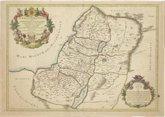
1709 Map of the Holy Land - Twelve Tribes of Israel, Hand-Colored, Antique Map
Located in Langweer, NL
This is a beautiful 1709 map of the Holy Land, titled "Iudaea seu Terra Sancta quae Hebraeorum sive Israelitarum in suas duodecim Tribus divisa," by Guillaume Sanson and Alexis Huber...
Category

Antique Early 18th Century Collectibles and Curiosities

Materials

Paper

1720 Weigel Engraving of Jerusalem: A Biblical View from Josephus' Perspective
Located in Langweer, NL
1720 Weigel Map of Jerusalem Based on Josephus' Writings This intricate 1720 bird's-eye view map of ancient Jerusalem by I.H. Coccejo, engraved by Christoph Weigel, offers a fasc...
Category

Antique Early 18th Century Collectibles and Curiosities

Materials

Paper

Antique Map of Tartary, Also Showing the Great Wall of China
Located in Langweer, NL
Antique map titled 'Carte de Tartarie'. Detailed map of Tartary, consisting of the Eastern part of Russia, Central Asia, China and Korea, first published by Guillaume De L'Isle in 1706. The map extends from the Peninsula of Korea in the east to the Caspian and Black Seas. The Great Wall of China...
Category

Antique Early 18th Century Collectibles and Curiosities

Materials

Paper

19th Century Album Containing Drawings, Memorabilia, and Botanical Samples
Located in Middletown, NY
A lovely example of an intimate 19th century memorabilia album illustrating the era's sensibilities for nature and antiquities, and bound in an exquisite blank album with miniature v...
Category

Italian Antique Early 18th Century Collectibles and Curiosities

Materials

Gold Leaf

Spectacular Antique Original Engraving of a Town Plan of Jerusalem, 1708
Located in Langweer, NL
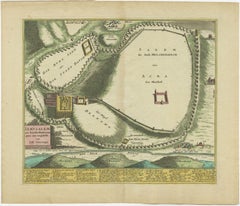
Description: Antique map titled 'Erster Abriss der Stadt Jerusalem wie sie Furnemblich zur Zeit des Hernn Christi beschaffen (..).' Spectacular town plan...
Category

Antique Early 18th Century Collectibles and Curiosities

Materials

Paper

Iron Germany Early 1700s Hourglass
Located in Firenze, IT
Shipping policy No additional costs will be added to this order. Shipping costs will be totally covered by the seller (customs duties included). The hourglass cage displays hexago...
Category

British Georgian Antique Early 18th Century Collectibles and Curiosities

Materials

Iron

Early 18th Century English Framed Indenture Document, Framed
Located in Bradenton, FL
A Large Early 18th Century Framed Indenture Document. The document (deed) is written in lengthy hand-written detail. Issued in three parts, indentures were legal documents cut with w...
Category

English George II Antique Early 18th Century Collectibles and Curiosities

Materials

Animal Skin, Wood

Antique Map of India during the height of the Mughal Imperial Expansion, 1713
Located in Langweer, NL
Antique map titled 'L'Inde de ca le Gange (..)'. Beautiful original antique map embracing most of India, made during the height of the Mughal imperial expansion. The map encompasses ...
Category

Antique Early 18th Century Collectibles and Curiosities

Materials

Paper

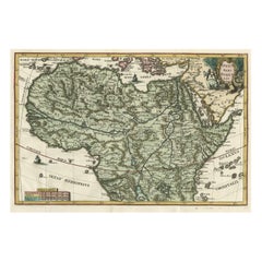
Very Decorative Rare Antique Map of the Northern Part of Africa, 1702
Located in Langweer, NL
Antique map titled 'Africae Pars Borealis.' Very decorative antique map of the northern part of Africa by Heinrich Scherer. The map is full of the spurious geography of the perio...
Category

Antique Early 18th Century Collectibles and Curiosities

Materials

Paper

Original Antique Map of Jerusalem Based on Josephus' Writings by Weigel, ca.1720
Located in Langweer, NL
1720 Weigel Map of Jerusalem Based on Josephus' Writings This intricate 1720 bird's-eye view map of ancient Jerusalem by I.H. Coccejo, engraved by Christoph Weigel, offers a fasc...
Category

Antique Early 18th Century Collectibles and Curiosities

Materials

Paper

Rider's British Merlin 1726; Adorned with many delightful Varieties and Useful.
Located in Middletown, NY
A precursor of Benjamin Franklin's famous and popular POOR RICHARD's ALMANAC Rider, Cardanus Rider's (1726) British Merlin; Adorned with many delightful Varieties and Useful Veritie...
Category

English Antique Early 18th Century Collectibles and Curiosities

Materials

Gold Leaf

Chinoiserie by Dawn Jacobson (Book)
Located in North Yorkshire, GB
A hardback book with original dust jacket. Chinoiserie is one of the strongest, mostt consistent strains in western taste. It has affected every area of decor and design from Chippen...
Category

Antique Early 18th Century Collectibles and Curiosities

Materials

Paper

Antique Map of Ukraine, Bulgaria, Romania, Servia & Surroundings by N. Visscher
Located in Langweer, NL
Antique map titled 'Exactissima Tabula qua tam Danubii Fluvii Pars Inferior, a Belgrado Urbe usq ad ejus ostia, et minores in eum influentes, Fluvii quam Regiones adjacentes, ut Tran...
Category

Antique Early 18th Century Collectibles and Curiosities

Materials

Paper

Antique Map of the World in 12 Globe Gores by Scherer, 'circa 1702'
Located in Langweer, NL
Antique map titled 'Typus Totius Orbis Terraquei Geographice Delineatus, Et Ad Usum Globo Materiali Superinducendus'. Beautiful example of Scherer's map of the World, configured in 12 globe gores. California is shown as an island. Fascinating Northwest Passage...
Category

Antique Early 18th Century Collectibles and Curiosities

Materials

Paper

Antique World Map by P. Schenk '1706'
By Peter Schenk
Located in Langweer, NL
Antique map titled 'Diversa Orbis Terrae. Visu Incedente per Coluros Tropicorum, Ambos Ejus Polos, et Parciularis Sphaerae Zenith, in Planum Orthographica Projectio (..) Plat Ontwerp van verscheyde Aert-klooten (..)'. One of the earliest Dutch World Maps to focus on a more modern cartographic style, based on Carel Allard's map of 1696. This map represented a noteworthy shift from the traditional decorative Dutch 17th century maps where the margins would be full of classical mythological...
Category

Antique Early 18th Century Collectibles and Curiosities

Materials

Paper

Stunning Antique Gothic Revival Hand Carved Elm Wood Blanket Chest / Trunk 1750
Located in Lisse, NL
Great looking and patina antique Gothic trunk, made of solid elmwood. This impressive looking and practical size chest shows a number of deep and...
Category

Spanish Gothic Revival Antique Early 18th Century Collectibles and Curiosities

Materials

Wrought Iron

IMPORTANT PORTUGUESE ORATORY WITH CALVARY 18th Century
Located in Madrid, ES
IMPORTANT PORTUGUESE ORATORY WITH CALVARY 18th Century Portuguese, from the 18th century in carved Brazilian rosewood. Decoration with interrupted pediments, volutes, floral motifs...
Category

Portuguese Baroque Antique Early 18th Century Collectibles and Curiosities

Materials

Silver

The 'Brazen Sea' in Solomon's Temple and a Cross Section of the Brazen Sea, 1725
Located in Langweer, NL
Two religious images on one sheet titled 'Kopere Zee in den Tempel van Salomon' and 'Doorsnede van de Kopere Zee des Tempels van Salomon'. The 'Brazen Sea' in Solomon's Temple an...
Category

Antique Early 18th Century Collectibles and Curiosities

Materials

Paper

Dutch VOC Silver Shipwreck Treasure Coins From The Akerendam Shipwreck 1724
Located in AMSTERDAM, NH
Origin: Holland Value: 2 pennies / 2 stuiver Date: 1724 A VOC Akerendam shipwreck treasure of nine 2 stuivers minted by the Province of Holland ...
Category

Dutch Antique Early 18th Century Collectibles and Curiosities

Materials

Silver

C Plinii Caecilii Secundi Epistolae Et Panegyricus, 1712
Located in Dallas, TX
Presenting a very rare and ‘old’ antiquarian book, C Plinii Caecilii Secundi Epistolae et Panegyricus dated 1712. Published by Johannus Minellii in 1712. Covered and bound in v...
Category

Italian Classical Roman Antique Early 18th Century Collectibles and Curiosities

Materials

Leather, Paper

Antique Miniature Map of France and the Low Countries by Mallet, circa 1719
Located in Langweer, NL
Antique map titled 'France - Païs-Bas'. Miniature Map of France and the Low Countries. Published by A.M. Mallet, circa 1719. Frame included. We carefully pack our framed items to ...
Category

Antique Early 18th Century Collectibles and Curiosities

Materials

Paper

18th Century Russian Carved Oak Figure of a Saint
Located in Stamford, CT
A very interesting Baroque period carved oak figure of a saint or prophet said to come from a demolished Russian Orthodox church. This compelling figure is ...
Category

Russian Baroque Antique Early 18th Century Collectibles and Curiosities

Materials

Oak

Antique Engraving of One of the Ten Brass Lavers in Solomon's Temple, 1725
Located in Langweer, NL
Antique religion print titled 'Een der tien Kopere Waschvaten in den Tempel van Salomon'. This print depicts one of the ten Brass Lavers in Solomon's Temple. This print originate...
Category

Antique Early 18th Century Collectibles and Curiosities

Materials

Paper

Antique Engraving of the Brass Laver in Solomon's Temple, Jerusalem, ca.1725
Located in Langweer, NL
Antique religion print titled 'Het kopere Waschvat, Tusschen de Tente der t'zamenkomst en den altaar'. Antique print of the Brass Laver in Solomon's Tem...
Category

Antique Early 18th Century Collectibles and Curiosities

Materials

Paper

[MISSAL]. L'Office De La Semaine Sainte. GILT ARMS OF PHILIPPE II DUC D'ORLEANS
Located in Hillsborough, NJ
AUTHOR: [MISSAL]. TITLE: The Office of Holy Week, According to the Messel & Roman Breviary;... PUBLISHER: Paris: By the Company of Booksellers assigned to the Book of Holy Week, 1...
Category

British Antique Early 18th Century Collectibles and Curiosities

Materials

Leather

Scarce Latin Edition of Guillaume Delisle's 1700 Map of North America
Located in Langweer, NL
Scarce German Edition of Guillaume Delisle's 1700 Map of North America This beautifully colored and highly detailed map is a rare Latin edition of Guillaume Delisle's influential 17...
Category

Antique Early 18th Century Collectibles and Curiosities

Materials

Paper

Antique Map of European Russia with Picture Frame Border
Located in Langweer, NL
Antique map titled 'La Moscovie Septentrionale (..)'. Decorative example of van der Aa's map of the northern part of European Russia. With the picture frame border, which appeared in...
Category

Antique Early 18th Century Collectibles and Curiosities

Materials

Paper

Antique Map of Spain by N. de Fer, circa 1700
Located in Langweer, NL
Antique map of Spain and Portugal with a title cartouche. Nicolas de Fer was the youngest son of the Paris printer and publisher Antoine de Fer. At the ...
Category

Antique Early 18th Century Collectibles and Curiosities

Materials

Paper

Antique Map of the Holy Land with Picture Frame Border
Located in Langweer, NL
Antique map titled 'Terre Sainte Suivant les Nouvelles Observations (..)'. Original old map of the Holy Land with the picture frame border. The term "Holy Land" usually refers to a t...
Category

Antique Early 18th Century Collectibles and Curiosities

Materials

Paper

1705 Sanson Map of Southern India and Malabar with an Inset Map
Located in Langweer, NL
Title: 1705 Sanson Map of Southern India and Malabar with an Inset Map Description: This finely engraved and beautifully hand-colored antique map, published in 1705, depicts south...
Category

Antique Early 18th Century Collectibles and Curiosities

Materials

Paper

Detailed Antique Map of the Windward Islands in the Caribbean
Located in Langweer, NL
Antique map titled 'Carte des Antilles Francoises et des Isles Voisines'. Original antique map of the French Antilles, covering an area stretching from Guadeloupe in the north to Gre...
Category

Antique Early 18th Century Collectibles and Curiosities

Materials

Paper

18th Century Giltwood and Polychrome Painted Shield ECCE NUNCDIES SALUTIS
Located in Hastings, GB
Stunning 18th century carved wooden religious shield, Italian early 1700’s, in gilt and green with the words ECCE NUNCDIES SALUTIS (This is the Day of Salvation) to the centre. Hist...
Category

Italian Baroque Antique Early 18th Century Collectibles and Curiosities

Materials

Gesso, Wood

1711 Star Chart of Southern Sky with Mythical Constellations and Exotic Animals
Located in Langweer, NL
1711 Star Chart of the Southern Sky - "Mappa Stellarum Australium quae in Altitudine Poli Borei Graduum" This beautiful star chart, engraved by Arnold van Westerhout in 1711, shows ...
Category

Antique Early 18th Century Collectibles and Curiosities

Materials

Paper

Theatrum Machinarum Generale. by Jacob Leupold - FIRST EDITION
Located in Middletown, NY
The most complete compendium on the technical sciences of the era. Leupold, Jacob Theatrum Machinarum Generale. Schau-Platz des Grundes Mechanischer Wissenschaften, das ist: Deutlich...
Category

German Antique Early 18th Century Collectibles and Curiosities

Materials

Gold Leaf

Antique World Map by P. Schenk '1706'
By Peter Schenk
Located in Langweer, NL
Antique map titled 'Diversa Orbis Terrae. Visu Incedente per Coluros Tropicorum, Ambos Ejus Polos, et Parciularis Sphaerae Zenith, in Planum Orthographica Projectio (..) Plat Ontwerp van verscheyde Aert-klooten (..)'. One of the earliest Dutch World Maps to focus on a more modern cartographic style, based on Carel Allard's map of 1696. This map represented a noteworthy shift from the traditional decorative Dutch 17th century maps where the margins would be full of classical mythological...
Category

Antique Early 18th Century Collectibles and Curiosities

Materials

Paper

19th Century Giltwood and Gesso Catholic Processional Crown
Located in Hastings, GB
A beautiful and very rare early 19th century Catholic processional Crown, hand crafted in wood with applied gesso and gilt, with rich, dark jewel adornments, (some missing) in wonder...
Category

German Baroque Antique Early 18th Century Collectibles and Curiosities

Materials

Gesso, Wood

Theatri statici universalis by Jacob Leupold - FIRST EDITION
Located in Middletown, NY
THE MOST COMPLETE COMPENDIUM ON THE TECHNICAL SCIENCES OF THE ERA Leupold, Jacob Theatri statici universalis, sive Theatrum staticum, Das ist: Schau-Platz der Gewicht-Kunst und Waag...
Category

German Antique Early 18th Century Collectibles and Curiosities

Materials

Gold Leaf

Biblical Map and Family Trees of the Holy Land by Chatelain, ca. 1720
Located in Langweer, NL
Title: 1720 Chatelain Map of the Holy Land with Biblical Family Trees and Chronology Description: This fascinating 18th-century folio map by Henry Abraham Chatelain combines geo...
Category

Antique Early 18th Century Collectibles and Curiosities

Materials

Paper

Antique Map of Southeast Asia from Persia to the Timor Island, 1712
Located in Langweer, NL
Antique map titled 'A New Map of the East Indies'. Old map covering all of Southeast Asia from Persia to the Timor Island, inclusive of the modern day nations of India, Ceylon, T...
Category

Antique Early 18th Century Collectibles and Curiosities

Materials

Paper

18th Century Walnut Miniature Bureau
Located in Bedfordshire, GB
A very attractive and charming 18th century, George II Period, walnut and oak miniature bureau, having elegant inlaid decoration and original brasswea...
Category

English George II Antique Early 18th Century Collectibles and Curiosities

Materials

Walnut

18th-Century Map of the Eastern Roman Empire by Henri Chatelain, c. 1719
Located in Langweer, NL
Title: 18th-Century Map of the Eastern Roman Empire by Henri Chatelain, c. 1719 Description: This intricately detailed map, titled *Nouvelle Carte pour Servir à l'Histoire de l'Empi...
Category

Antique Early 18th Century Collectibles and Curiosities

Materials

Paper

Royal circa 1707-1714 Hand Carved Polychrome Painted Armorial Crest Coat of Arms
Located in West Sussex, Pulborough
We are delighted to offer for sale this very rare, large for its type, Royal coat of arms / Armorial Crest circa 1707-1714 with original Polychrome paint This is an exceptionally we...
Category

English Queen Anne Antique Early 18th Century Collectibles and Curiosities

Materials

Wood

Map Holy Land La Terre Sainte Engraved van Loon Published N de Fer 1703 French
Located in BUNGAY, SUFFOLK
La Terre Sainte, The Holy Land, Tiree Des Memoires De M.De.La Rue. Par N. de Fer. Geographe de Sa Majeste Catoliq et de Monseigneur le Dauphin. Avec Privil du Roi 1703 Detailed map of the Holy Land from Nicholas de Fer's L'Atlas Curieux ou le Monde. East is oriented at the top. MAKER Nicolas de Fer 1646-1720 The French cartographer and engraver, Nicolas de Fer, was a master at creating maps that were works of art. The maps that he published were printed during the Baroque period when the decorative arts were characterized by ornate detail. De Fer’s detailed maps and atlases were valued more for their decorative content than their geographical accuracy. Nicolas de Fer was born in 1646. His father, Antoine de Fer, owned a mapmaking firm. At the age of twelve, Nicolas was apprenticed to a Parisian engraver named Louis Spirinx. The family business was starting to decline when his father died in 1673. Nicolas de Fer’s mother, Genevieve, took over the business after the death of her husband. In 1687 the business was passed on to Nicolas and the profits increased after he took over the firm. Nicolas de Fer was a prolific cartographer who produced atlases and hundreds of single maps. He eventually became the official geographer to King Louis XIV of France and King Philip V...
Category

French Louis XIV Antique Early 18th Century Collectibles and Curiosities

Materials

Paper

Antique Map of Portugal by Nolin '1704'
Located in Langweer, NL
Antique map titled 'Le Royaume de Porutgal divisé en cinq grandes Provinces (..)'. Rare and very decorative map of Portugal. It shows the territory of ...
Category

Antique Early 18th Century Collectibles and Curiosities

Materials

Paper

Antique Map of Tartary, Also Showing the Great Wall of China
Located in Langweer, NL
Antique map titled 'Carte de Tartarie'. Detailed map of Tartary, consisting of the Eastern part of Russia, Central Asia, China and Korea, first published by Guillaume De L'Isle in 1706. The map extends from the Peninsula of Korea in the east to the Caspian and Black Seas. The Great Wall of China...
Category

Antique Early 18th Century Collectibles and Curiosities

Materials

Paper

Antique Map of Northeastern India, Nepal, Bhutan, Assam and Bangladesh
Located in Langweer, NL
Antique map titled 'De Land-Reyse door Benedictus Goes, van Lahor gedaan, door Tartaryen na China'. Interesting map showing the region of northeastern India, Nepal, Bhutan, Assam and...
Category

Antique Early 18th Century Collectibles and Curiosities

Materials

Paper

Important Early 18th Century Italian Carved Monstrance Reliquary Tabernacle
Located in Forney, TX
Important and historic, acquired from the estate of legendary American businessman, the late T. Boone Pickens, we're proud to offer this exceptional carved giltwood reliquary - monstrance from the early 18th century. Elaborately hand carved in period Rococo - Rocaille taste, with superb scrollwork, openwork, fanciful acanthus leaf and shell, ornate detailing, polychrome painted warm pastel colors, now beautifully distressed, muted tones, with remnants of gold gilded accents. Pieces such as this were used in early churches for convenient exhibition or public display of some object of piety and other important religious relics...
Category

Italian Rococo Antique Early 18th Century Collectibles and Curiosities

Materials

Giltwood

Hand-Colored City Plan of Cologne by Nicolas de Fer, 1705
Located in Langweer, NL
Title: Hand-Colored City Plan of Cologne by Nicolas de Fer, 1705 This hand-colored map, titled "Cologne Ville Considerable Situee sur le Bord Occidentale du Rhein Capit. de l'Electo...
Category

Antique Early 18th Century Collectibles and Curiosities

Materials

Paper

Original Antique Map of Greece and part of Turkey
Located in Langweer, NL
Original antique map titled 'La Grece ou partie meridionale de la Turquie d'Europe'. Small map of Greece and part of Turkey. This map originates from 'Le nouveau et curieux Atlas Geo...
Category

Antique Early 18th Century Collectibles and Curiosities

Materials

Paper

Old Print of Aztec deities Vitzliputsli, Tlaloch or Tescalipuca, Mexico, 1723
Located in Langweer, NL
Antique print titled 'Vitzliputsli (..)'. Old print of the Aztec deities Vitzliputsli, Tlaloch or Tescalipuca. Also depicted are Mexican priests. Originates from 'Ceremonies et coutu...
Category

Antique Early 18th Century Collectibles and Curiosities

Materials

Paper

Original Antique Map of Canaan, Armenia, Syria, Mesopotamia and Arabia, 1709
Located in Langweer, NL
Antique map titled 'Descriptio Paradisi et Terrae Canaan'. Original antique map of Canaan, Armenia, Syria, Mesopotamia and Arabia. It displays the Middle East from the eastern Mediterranean Sea to the Persian Gulf...
Category

Antique Early 18th Century Collectibles and Curiosities

Materials

Paper

Senex Map of Castile, Leon & La Mancha in The Spanish Heartland, 1714
Located in Langweer, NL
This antique map, titled "A Map of Old & New Castile from the Observations of Rodrigo Mendes Silva and others," depicts the regions of Old Castile and New Castile in Spain, along with the Kingdom of Leon, Estremadura, La Mancha, among others. The map dates back to the early 18th century, a period marked by significant political shifts and territorial changes in Europe, particularly illustrated by the War of the Spanish Succession (1701–1714) that reshaped Spain’s governance and regional boundaries. The map itself was published in 1714 by John Senex, a prominent English mapmaker, surveyor, globemaker, and geographer of the early eighteenth century. He was apprenticed as a young man to bookseller Robert Clavell and collaborated with notable mapmakers such as Jeremiah Seller and Charles Price. In 1728, Senex's contributions to geography and mapping were recognized when he was elected a Fellow of the Royal Society, an exceptional honor for a mapmaker, underlining his significant role as the Society's engraver and a publisher of maps by Edmund Halley and other notable figures. John Senex is renowned for his English Atlas, first published in the same year as this map, 1714, and continued to be printed until the 1760s. Following his death in 1740, his widow Mary Senex managed the business until 1755. Afterward, the stock passed to William Herbert and Robert Sayer for maps, and to James Ferguson for globes. The map serves not just as a geographical record but also as a historical document, reflecting the territorial divisions significant to Spain's political and economic structure at the time. The focus on Old and New Castile underscores their importance during a transformative era in Spanish history. Here are some potentially significant places and features of this map: 1. **Old Castile (Castilla la Vieja)**: Historically significant as part of the former Kingdom of Castile, this region includes major cities such as Burgos and Valladolid. These cities could be popular search...
Category

Antique Early 18th Century Collectibles and Curiosities

Materials

Paper

Grand Carved Wooden Niche – Italian Baroque, 18th Century
Located in PARIS, FR
A magnificent example of 18th-century Italian Baroque craftsmanship, this grand polychrome and gilded wooden niche embodies the opulence and theatricality of the period. At its cente...
Category

Italian Baroque Antique Early 18th Century Collectibles and Curiosities

Materials

Wood

Moullart-Sanson Map of the Holy Land and Sacred Geography of the Old Testament
Located in Langweer, NL
"1716 Moullart-Sanson Map of the Holy Land and Sacred Geography of the Old Testament" This engraved map, created by Pierre Moullart-Sanson and reissued by Robert de Vaugondy in 1740...
Category

Antique Early 18th Century Collectibles and Curiosities

Materials

Paper

19th Century Antique Chinese Hetian Jade Hand Carved Dragon Bangle Bracelet
Located in Van Nuys, CA
Immerse yourself in the allure of history with this captivating Antique Chinese Hand Carved Jade Bangle Bracelet. Crafted with skill and precision, the jade bangle boasts an enchanti...
Category

Antique Early 18th Century Collectibles and Curiosities

Materials

Jade

Antique Map of Mecklenburg-Vorpommern in Germany by J.B. Homann, c.1720
Located in Langweer, NL
Antique Map of Mecklenburg-Vorpommern by J.B. Homann, c.1720 Old colored antique map of Mecklenburg-Vorpommern by Johann Baptist Homann. This stunning map, titled "Ducatus Meklenbur...
Category

Antique Early 18th Century Collectibles and Curiosities

Materials

Paper

Large Baroque Noble Coat of Arms Italy Late 17th Early 18th Century
By Non-Standard Furniture and Lighting
Located in Milano, IT
Large aristocratic coat of arms placed within crumpled, symmetrically unfolding, made of polychromatically painted and partially gilded wood. The frame is decorated with scrolls and ...
Category

Italian Baroque Antique Early 18th Century Collectibles and Curiosities

Materials

Wood

The Tunning of Elinor Rumming, a Poem by John Skelton
Located in Middletown, NY
Skelton, John The Tunning of Elinor Rumming, a Poem London: Printed for Isaac Dalton, and sold by W. Boreham at the Angel in Pater-Noster-Row, 1718. Second Edition. Octavo, 7 5/8 x 4 5/8 in. (194 x 117 mm). pp. [8], 31, [1]. From the title page: by Skelton Laureat. Original unbound, rebound in modern pink paper over boards, leather spine label with gilt title. Some toning to last few leaves.boards All text is legible, some spot tanning throughout. In near fine condition. Rare. [ESTC N46064 ] ESTC shows two U.S. copies only: Henry E. Huntington Library and Yale University Beinecke Rare Book and Manuscript Library; and two British Isles copies only: Oxford University Bodleian Library (both copies). This poem was printed multiple times in the 16th century, including by William Caxton's successor, Wynken de Worde. Rare as a separate volume. John Skelton (c.1463 - 1529) was a remarkable, unusual poet and priest, who had been the tutor of the Tudors, Prince Arthur...
Category

English Antique Early 18th Century Collectibles and Curiosities

Materials

Gold Leaf

Antique Map of Bavaria ‘Bayern, Germany’ by N. Visscher, circa 1700
Located in Langweer, NL
Antique map titled 'Bavariae pars inferior cum insertis et adjacentibus regionibus (..)'. Published circa 1700 in N. Visscher's World Atlas. The map "Bavariae pars inferior cum inse...
Category

Antique Early 18th Century Collectibles and Curiosities

Materials

Paper

Antique Map of the North Sea and Dunkirk
Located in Langweer, NL
Untitled map of the North Sea, top left a large compass rose, bottom right Dunkirk (Duinkerke / Dunkerque), France. Part of a bundled collection of plans of battles and cities renown...
Category

Antique Early 18th Century Collectibles and Curiosities

Materials

Paper

Original Antique Map of England, Showing the Most Memorable Battles
Located in Langweer, NL
Antique map titled 'Carte d'Angleterre ou l'on fait observer les Batailes les plus Memorables de ce Royaume'. Original antique map of England, showing the most memorable battles. Thi...
Category

Antique Early 18th Century Collectibles and Curiosities

Materials

Paper

Antique Engraving of Thomas Müntzer, a Reformation-Era German Theologian, 1701
Located in Langweer, NL
Antique portrait titled 'Thomas Muntzer'. Portrait of Thomas Müntzer. Thomas Müntzer was an early Reformation-era German theologian, who became a rebel leader during the Peasants' War. He turned against Luther with several anti-Lutheran writings, and supported the Anabaptists. In the Battle of Frankenhausen, Müntzer and his followers were defeated. He was captured, tortured and decapitated. This print originates from 'Historie der kerken en ketteren van den beginne des Nieuwen Testaments tot aan het jaar onses Heeren 1688 ... In het Neederduyts vertaald' by G. Arnold. Artists and Engravers: Gottfried Arnold (1666 – 1714) was a German Lutheran...
Category

Antique Early 18th Century Collectibles and Curiosities

Materials

Paper

Antique Map of the Netherlands and Belgium by Homann, circa 1710
Located in Langweer, NL
Antique map titled 'Tabula Generalis Totius Belgii Provinciae XVII. Infer. Germaniae (..)'. Map of the Benelux countries by Johann Baptist Homann. Shows the area between the Seine es...
Category

German Antique Early 18th Century Collectibles and Curiosities

Materials

Paper

JESUS CHRIST CRUCIFIED Indo-Portuguese sculpture from the 18th Century
Located in Madrid, ES
JESUS CHRIST CRUCIFIED Indo-Portuguese sculpture from the 18th Century in ivor..... The figure is represented in agony, with cendal draped around the waist. Cross in rosewood wood ...
Category

Portuguese Baroque Antique Early 18th Century Collectibles and Curiosities

Materials

Wood

(NIVARDUS) - The Crafty Courtier: Or the fable of Reinard the Fox - 1706
Located in Hillsborough, NJ
AUTHOR: [NIVARDUS, Hartmann Schopper]. TITLE: The Crafty Courtier: Or the fable of Reinard the Fox: Newly done into English Verse, from the Antient Latin Iambics of Hartm. Schopper...
Category

British Antique Early 18th Century Collectibles and Curiosities

Materials

Leather

Decorative Antique Map of Cyprus and Asia Minor by Christoph Weigel, Circa 1720
Located in Langweer, NL
Title: Asiae Peninsula sive Asia Intra Taurum by Christoph Weigel, Circa 1720 – Decorative Antique Map of Cyprus and Asia Minor Description: Thi...
Category

Antique Early 18th Century Collectibles and Curiosities

Materials

Paper

Antique Map of the Holy Land, Showing the Location of the Various Tribes
Located in Langweer, NL
Antique map titled 'Judaea seu Terra Sancta quae Hebraeorum sive Israelitarum (..)'. Map of The Holy Land, showing the location of the various tribes, in two kingdoms, Judah and Isra...
Category

Antique Early 18th Century Collectibles and Curiosities

Materials

Paper

Antique Print of the Dutch VOC Bombing Palembang, Sumatra (Indonesia), ca.1700
Located in Langweer, NL
Antique print titled 'La Ville de Palimbang dans L’Ile de Sumatra.' A very decorative, impressive engraving of Palembang in Sumatra. Two views on one sheet. In the upper part the ove...
Category

Antique Early 18th Century Collectibles and Curiosities

Materials

Paper

Early 18th Century Portuguese Carved Giltwood Church Torchère, Candleholder
Located in Frankfurt am Main, DE
Tall early 18th century Portuguese gilt oak church torchère with deep foliate carvings on a tripod base. This torchère can easily be converted into a ...
Category

Portuguese Baroque Antique Early 18th Century Collectibles and Curiosities

Materials

Giltwood

Original Old Map East of Stockholm, the Island Ljusterö and Värmdö, Sweden, 1720
Located in Langweer, NL
Antique map titled 'Accurate Carte der Upländischen Scheren mit der Situation und Gegend umb die Konigle Schwedisch Haupt und Residentz Stadt Stockholm.' Map of the area east of ...
Category

Antique Early 18th Century Collectibles and Curiosities

Materials

Paper

Read More

Medal-Worthy Memorabilia from Epic Past Olympic Games

Get into the games! These items celebrate the events, athletes, host countries and sporting spirit.

Ahoy! You’ve Never Seen a Collection of Sailor Art and Kitsch Quite Like This

French trendsetter and serial collector Daniel Rozensztroch tells us about his obsession with objects related to seafaring men.

Pamela Shamshiri Shares the Secrets behind Her First-Ever Book and Its Effortlessly Cool Interiors

The sought-after designer worked with the team at Hoffman Creative to produce a monograph that beautifully showcases some of Studio Shamshiri's most inspiring projects.

Moroccan Artworks and Objects Take Center Stage in an Extraordinary Villa in Tangier

Italian writer and collector Umberto Pasti opens the doors to his remarkable cave of wonders in North Africa.

Montecito Has Drawn Royalty and Celebrities, and These Homes Are Proof of Its Allure

Hollywood A-listers, ex-pat aristocrats and art collectors and style setters of all stripes appreciate the allure of the coastal California hamlet — much on our minds after recent winter floods.

Whaam! Blam! Pow! — a New Book on Pop Art Packs a Punch

Publishing house Assouline and writer Julie Belcove have teamed up to trace the history of the genre, from Roy Lichtenstein, Andy Warhol and Yayoi Kusama to Mickalene Thomas and Jeff Koons.

The Sparkling Legacy of Tiffany & Co. Explained, One Jewel at a Time

A gorgeous new book celebrates — and memorializes — the iconic jeweler’s rich heritage.

What Makes a Gem-Encrusted Chess Set Worth $4 Million?

The world’s most opulent chess set, weighing in at 513 carats, is literally fit for a king and queen.
Recently Viewed

View All