Early 18th Century Collectibles and Curiosities

to
255
333
48
382
20
13
2
2
1
1
4,376
6,575
13,270
2,711
3,491
4,590
3,013
515
314
588
736
463
892
864
892
656
567
306
50
27
14
13
111
25
24
20
16
382
382
382
11
10
3
2
2
Period: Early 18th Century
Danube River Incl Serbia, Moldavia, Transylvania, Romania, Bulgaria Etc, ca.1720
Located in Langweer, NL
Antique map titled 'Danubii Fluminis (..)'. Regional map of the Donau river, Shows the Danube river from Belgrade in Serbia, along the border between ...
Category

Antique Early 18th Century Collectibles and Curiosities

Materials

Paper

Set of 2 Antique Maps covering part of modern-day Czech Republic
Located in Langweer, NL
Set of two antique maps titled 'Marchionatus Moraviae circulus Preroviensis'. Two individual sheets covering part of modern-day Czech Republic. Cities included are Opava, Fulnek, Lip...
Category

Antique Early 18th Century Collectibles and Curiosities

Materials

Paper

Antique Map of the Nassau Region in Western Germany
Located in Langweer, NL
Antique map titled 'Nassovia Principatus (..)'. Detailed map of the Nassau region in western Germany between Koblenz, Hadamar, Giessen, Frankfurt and Mainz. The map is filled with in...
Category

Antique Early 18th Century Collectibles and Curiosities

Materials

Paper

Original Hand-colored Antique Map of the Southern Part of India
Located in Langweer, NL
Antique map titled 'Orarum Malabariae, Coromandelae &c Tabula Accuratissima - Carte des Cotes de Malabar et de Coromandel'. Beautiful map of the southern part of India. It focuses on trade routes within India, as well as the Coromandel and Malabar Coasts...
Category

Antique Early 18th Century Collectibles and Curiosities

Materials

Paper

Antique Ming Dynasty Wood-Carved Buddha and Soapstone Plinth
Located in Vienna, AT
In this listing you will find a rare original piece of historical craftsmanship. On sale is a religious statue of the Buddha. The figurine was attentivel...
Category

Chinese Ming Antique Early 18th Century Collectibles and Curiosities

Materials

Soapstone

Highly Decorative Map of The Eastern Mediterranean and The Middle East, ca.1700
Located in Langweer, NL
Antique map titled 'Byzondere Kaart van de Landen Daar de Apostelen Het Evangelium Gepredikt Hebben (..).' Highly decorative map of the eastern Mediterranean...
Category

Antique Early 18th Century Collectibles and Curiosities

Materials

Paper

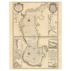
Fabulous Original Antique two-sheet Map of the Caspian Sea, ca.1723
Located in Langweer, NL
Carte Marine de la Mer Caspiene... [and] Coste de Perse sur la Mer Caspiene et Partie de Celles de Tartarie", Delisle, Guillaume (2 maps) Subject: Caspian Sea ...
Category

Antique Early 18th Century Collectibles and Curiosities

Materials

Paper

Early Bird's-Eye View of Rio Di Janeiro and Guanabara Bay, Brazil, 1702
Located in Langweer, NL
Antique print titled 'Rio Janeiro'. Bird's-eye view of Rio di Janeiro and Guanabara Bay, Brazil. From the French edition (translation by Renneville) of Commelin's 'Recueil des Vo...
Category

Antique Early 18th Century Collectibles and Curiosities

Materials

Paper

Antique Map of the Rhine centered on Cologne, Germany, with original coloring
Located in Langweer, NL
Antique map titled 'Archiepsiscopatus et Electoratus Coloniensis (..)'. Original antique map of the Rhine river, centered on Cologne, Germany. The Rhine River cuts across this map fr...
Category

Antique Early 18th Century Collectibles and Curiosities

Materials

Paper

Original Old Map with Many Details Around Manilla in the Philippine Islands
Located in Langweer, NL
Original antique map titled 'Carte du Canal des Iles Philippines (..) - Kaart van het Kanaal in de Filippynsche Eilanden (..)'. Striking and highly detailed chart of the Islands of the Philippines. Shows Islands, bays, reefs, soundings tracks of the Manila Galleon route, etc. Published 1724-1726 by Joannes van Braam...
Category

Antique Early 18th Century Collectibles and Curiosities

Materials

Paper

Antique Map of the Area centered on the Rhine River, Germany
Located in Langweer, NL
Antique map titled 'Uterque Rheni Circulus Superior (..)'. Fine old color map of the area centered on the Rhine River, from Strassbourg to Wesel and Duisburg, Germany. With cities hi...
Category

Antique Early 18th Century Collectibles and Curiosities

Materials

Paper

Antique Engraving of Brahma, the Hindu Creator God, 1723
Located in Langweer, NL
Description: Antique religion print titled 'Brama ou Bruma'. This print depicts Brahma, the Hindu creator god. He is also known as the Grandfather and as a later equivalent of Prajap...
Category

Antique Early 18th Century Collectibles and Curiosities

Materials

Paper

Antique Map of the Area centered on the Rhine River with original coloring
Located in Langweer, NL
Antique map titled 'Uterque Rheni Circulus Superior (..)'. Fine old color map of the area centered on the Rhine River, from Strassbourg to Wesel and Duisburg, Germany. The map also c...
Category

Antique Early 18th Century Collectibles and Curiosities

Materials

Paper

Scarce Middle East and Arabia Map Showing The Exodus of the Israelites, 1725
Located in Langweer, NL
Antique map titled 'Kaarte van de reize en togten der Israeliten in de woestyne, sedert der zelver uytgang uyt Egypten, tot den overtogt over de Jordaane.' Scarce map of the Middle East and Arbabia. It shows the exodus...
Category

Antique Early 18th Century Collectibles and Curiosities

Materials

Paper

Antique Map of Southeast Asia by J. Ottens, 1710
Located in Langweer, NL
Antique map titled 'Le Royaume de Siam avec Les Royaumes Qui Luy sont Tributaries'. Influential map of Southeast Asia. Ottens incorporated information provided by the French Jesuits ...
Category

Antique Early 18th Century Collectibles and Curiosities

Materials

Paper

Small Antique Map of England, Wales, Scotland and Ireland with Original Coloring
Located in Langweer, NL
Antique map titled 'Les Royaumes d'Angleterre d'Escosse et d'Irlande (..)'. A lovely, small map of England, Wales, Scotland and Ireland with a portion of the coastline of France and ...
Category

Antique Early 18th Century Collectibles and Curiosities

Materials

Paper

Set of 2 Costume Prints and a Map of Spain and Portugal, circa 1720
Located in Langweer, NL
Set of two costume prints and a map of Spain and Portugal. The costume prints show costumes of Portugal and Spain and originate from Nouvelle méthode pour apprendre la géographie uni...
Category

Antique Early 18th Century Collectibles and Curiosities

Materials

Paper

Antique Map of Southern Asia with India, the Maldives, Ceylon and Arabia, c.1700
Located in Langweer, NL
Stunning Old Map of Asia. Description: Two-sheet map of Asia, joined. The left part of this antique map is titled 'Partie occidentale d'une partie d'Asie ou sont les Isles de Zoco...
Category

Antique Early 18th Century Collectibles and Curiosities

Materials

Paper

Antique Map of the Islands of Banda, Indonesia from a Very Rare Edition, 1725
Located in Langweer, NL
Antique map titled 'Les Iles de Banda (..).' (The islands of Banda, Indonesia.) Extremely rare in this edition. This plate originates from the very scarse: 'La galerie agreable d...
Category

Antique Early 18th Century Collectibles and Curiosities

Materials

Paper

Antique Map of the Moluccas or the Famed Spice Islands of Indonesia, 1724
Located in Langweer, NL
Antique map Spice Islands titled 'De landvoogdy van Amboina met de elf onderhoorige Eylanden'. This map depicts the central islands of the Maluku Arc...
Category

Antique Early 18th Century Collectibles and Curiosities

Materials

Paper

Antique Map of Peru by van der Aa, 'circa 1720'
Located in Langweer, NL
Antique map titled 'Le Perou, Grand Pays de l Amerique Meridionale (..)'. Decorative map of Peru including portions of Ecuador and northern Chile and Boliv...
Category

Antique Early 18th Century Collectibles and Curiosities

Materials

Paper

Spectacular Large Map of Upper and Lower Austria between Passau and Wien, c.1700
Located in Langweer, NL
Antique map titled 'Austriae Archiducatus pars superior in omnes ejusdem (..).' Spectacular large map of Upper and Lower Austria between Passau and Wien with figurative cartouche a...
Category

Antique Early 18th Century Collectibles and Curiosities

Materials

Paper

Original Antique Map of the Coast of Part of Greece, with Athens and Thebes
Located in Langweer, NL
Original antique map titled 'Achaia quae et Hellas hodie Livadia'. Detailed map of the coast of part of Greece. With inset maps of Athens and Thebes. This map originates from 'Philippi Cluveri Introductionis in universam geographiam (..)' by P. Clüver. Published 1729. Philipp Clüver was an Early Modern German geographer and historian. Cluver's Geography was one of the most enduring works of the 17th & 18th Centuries, issued by several different publishers with many different sets of maps...
Category

Antique Early 18th Century Collectibles and Curiosities

Materials

Paper

Antique Religion Print of Six Roman Catholic Habits, Rituals, Ceremonies, 1723
Located in Langweer, NL
Antique religion print depicting six Roman Catholic habits, rituals and ceremonies. Procession with holy oil, benediction of same, the Bishop's hand...
Category

Antique Early 18th Century Collectibles and Curiosities

Materials

Paper

Beautiful Old View of Spice Island Banda Neira with Fort Nassau, Indonesia, 1726
Located in Langweer, NL
Antique print titled 'Het Eyland Neira, en het Casteel Nassau mitsgaders Belgica'. Beautiful view of Banda Neira with Fort Nassau, Indonesia. This print originates from 'Oud en Nie...
Category

Antique Early 18th Century Collectibles and Curiosities

Materials

Paper

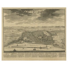
Bird's Eye View of Dabhol as Seen from the Sea, North of Goa, India, 1727
Located in Langweer, NL
Antique print titled 'De Bay ende Stadt Dabul'. Bird's eye view of Dabhol as seen from the sea. The city is situated on the Vashishti river, north of Goa in India, on the Malabar...
Category

Antique Early 18th Century Collectibles and Curiosities

Materials

Paper

Old Antique Map of the Sumbawa, Flores, Timor in the Banda Region of Indonesia
Located in Langweer, NL
Original antique map titled 'Kaart der Zuyd-Wester Eylanden van Banda'. A fascinating map of the islands in the southwestern part of the Banda Sea including Sumba, Flores and Timor. Published 1724-1726 by Joannes van Braam...
Category

Antique Early 18th Century Collectibles and Curiosities

Materials

Paper

Original Antique Map of England, Showing the Most Memorable Battles
Located in Langweer, NL
Antique map titled 'Carte d'Angleterre ou l'on fait observer les Batailes les plus Memorables de ce Royaume'. Original antique map of England, showing the most memorable battles. Thi...
Category

Antique Early 18th Century Collectibles and Curiosities

Materials

Paper

Interesting Small Map of the British Isles with Hand Coloring
Located in Langweer, NL
Antique map titled 'Insularum Britannicarum Tabula'. Interesting small map of the British Isles by Wells. This map originates from 'Oikumenes Periegesis, sive, Dionysii Geographia em...
Category

Antique Early 18th Century Collectibles and Curiosities

Materials

Paper

Old Print of a Religious Ceremony for Corpus Christi Day and Palm Sunday, 1725
Located in Langweer, NL
Two images on one sheet titled 'La Procession des Palmes le Dimanche des Rameaux' and 'La Procession du Saint Sacrement le jour de la Dête-Dieu'. The upper image depicts Palm Sunday...
Category

Antique Early 18th Century Collectibles and Curiosities

Materials

Paper

Beautiful Antique Handcolored Map of Switzerland with 33 Coats of Arms, ca.1705
Located in Langweer, NL
Antique map Switerzland titled 'La Suisse Divisee en ses Treze Cantons, ses Alliez & ses Sujets (..)'. Beautiful map of Switzerland with 33 coats of arms. The map is dedicated to t...
Category

Antique Early 18th Century Collectibles and Curiosities

Materials

Paper

Map of the Electorate of Bavaria, Incl Lake Constance, by Jesuit Scherer, c.1700
Located in Langweer, NL
Antique map titled 'Electorat Bavariae.' Map of the Electorate of Bavaria by the Jesuit Heinrich Scherer. The lower map shows the Lake Constance. Source unknown, to be determined. ...
Category

Antique Early 18th Century Collectibles and Curiosities

Materials

Paper

Beautiful Antique Map of the French Coast, from St. Valeri to Dieppe, 1720
Located in Langweer, NL
Antique map France titled 'Les Embouchures de la Somme et de Bresle Riv. ou est St. Valeri, Eu et Dieppe'. Beautiful map of the French coast, fr...
Category

Antique Early 18th Century Collectibles and Curiosities

Materials

Paper

Rare Old English Sea Chart of Part of Indonesia with Java, Madura and Bali, 1711
Located in Langweer, NL
Antique map titled 'A Large Draught of the East End of Java and Madura shewing the Streights of Bally.' Rare early example of this working English Sea Chart of part of Indonesia ...
Category

Antique Early 18th Century Collectibles and Curiosities

Materials

Paper

VOC Ships, Native People & Coastal Views of Islands near Papua New Guinea, 1726
Located in Langweer, NL
Antique print titled 'Het Eylandt Takel, als gy daar langhs seylt (..)'. Five engravings on one sheet showing the native boats and peoples and coastal views of islands near New Gui...
Category

Antique Early 18th Century Collectibles and Curiosities

Materials

Paper

Original Antique Copper Engraving of a Portrait of John the Evangelist, 1708
Located in Langweer, NL
Antique print, titled: 'Das Bildnus des H. Evangelisten Johannis (…).' - This original antique plate shows a portrait of John the Evangelist. From: Biblia : das ist die gantze He...
Category

Antique Early 18th Century Collectibles and Curiosities

Materials

Paper

Original Antique Map of Hungary and Transylvania 'Modern Day Romania', C.1710
Located in Langweer, NL
Antique map titled 'Hungary and Transilvania'. Original antique map of Hungary and Transylvania (modern day Romania), centered on Budapest. Artists and Engravers: Herman Moll ...
Category

Antique Early 18th Century Collectibles and Curiosities

Materials

Paper

Large Antique Detailed Map of a Part of the Spice Islands, Indonesia, 1726
Located in Langweer, NL
Antique matitled 'De Landvoogdy der Moluccos met de aangrenzende Eylanden'. Large detailed map of a part of the Spice Islands. It includes Baru (Boero), Ambon, Seram and part of Ma...
Category

Antique Early 18th Century Collectibles and Curiosities

Materials

Paper

Framed View of the Brouwersgracht in Amsterdam, the Netherlands, 1708
Located in Langweer, NL
Antique print titled 'Societatis Indiae Occident (..) - West Indisch Huys op Raapenburg (..)'. Despite the title suggesting this print is a view of the West-Indisch House in Amst...
Category

Antique Early 18th Century Collectibles and Curiosities

Materials

Paper

Colourful Antique Map Centered on Nuremberg and Bamberg in Germany, ca.1703
Located in Langweer, NL
Antique map titled 'Circuli Franconiae pars Occidentalis, exhibes simul integrum fere Electoratum Moguntinum (..)'. Antique map centered on Nuremberg and Bamberg. Extends from th...
Category

Antique Early 18th Century Collectibles and Curiosities

Materials

Paper

Engraving of the Entrance Facade of the Royal Exchange, Cornhill, London, 1725
Located in Langweer, NL
Antique print titled 'The Elevation of the Royal Exchange (..)'. Old engraving of the entrance facade of the Royal Exchange, Cornhill. This print originates from 'Vitruvius Brita...
Category

Antique Early 18th Century Collectibles and Curiosities

Materials

Paper

Antique Print Depicting the Divorce Customs of the Jews, ca.1725
Located in Langweer, NL
Description: Antique religion print titled 'Gewoonten der Jooden wegens de brieven van Echtscheiding'. This print depicts divorce customs of the Jews. This print originates from ...
Category

Antique Early 18th Century Collectibles and Curiosities

Materials

Paper

Antique Design for a New Bridge Across the Thames at Westminster, London, 1725
Located in Langweer, NL
Antique print titled 'This new Design for a Bridge over the River Thames at London (..)'. Print of the design for a new bridge across the Thames at Westminster. This print originates from 'Vitruvius Britannicus...
Category

Antique Early 18th Century Collectibles and Curiosities

Materials

Paper

Religious Antique Print of The Ten Divine Transformation, 1727
Located in Langweer, NL
Description: Untitled print, ten images on one plate. This plate deals with the ten divine transformations according to Indian religion. This print originates from 'Naaukeurige b...
Category

Antique Early 18th Century Collectibles and Curiosities

Materials

Paper

Regional Map of Germany, inc Hamburg, Luneberg, Hannover, Braunsweig etc, c.1720
Located in Langweer, NL
Antique map titled 'Ducatus Luneburgici et Comitatus Dannebergensis accurata Descriptio.' This detailed regional map includes Hamburg, Luneberg, and as far south as Hannover, Bra...
Category

Antique Early 18th Century Collectibles and Curiosities

Materials

Paper

Beautiful Original Print of The Creation of the World According to Moses, 1725
Located in Langweer, NL
Antique map, titled: 'De Schepping der Wereldt volgens de Beschryving van Mozes.' Two separate maps on one sheet showing the creation of the world according to Moses. The upper dep...
Category

Antique Early 18th Century Collectibles and Curiosities

Materials

Paper

Map of the Southeastern Part of the Banda Islands, Incl Northern Australia, 1726
Located in Langweer, NL
Antique map titled 'Kaart van de Zuyd-Ooster Eylanden van Banda.' Map of the southeastern part of the Banda islands. This map originates from 'Oud en Nieuw Oost-Indiën' by Franço...
Category

Antique Early 18th Century Collectibles and Curiosities

Materials

Paper

Rare Theodore Danckerts Map of the Lower Rhine and Moselle River Regions
Located in Langweer, NL
Original antique map titled 'Accuratissima Rheni Inferioris Mosae et Mosellae Tabula'. Rare Theodore Danckerts map of the Lower Rhine and Moselle River Regions. The map covers the lo...
Category

Antique Early 18th Century Collectibles and Curiosities

Materials

Paper

Rare Sea Chart of the East Frisian Islands or Watten and the North Sea, c.1700
Located in Langweer, NL
Description: Antique map titled 'Paskaarte van de rievier de Elve streckende van Oldenbroek tot Hamburgh.' Rare and interesting chart of the East Frisian Islands (or Watten) and ...
Category

Antique Early 18th Century Collectibles and Curiosities

Materials

Paper

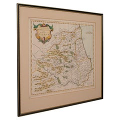
Antique County Map, Cambridgeshire, English, Framed Cartography, Robert Morden
Located in Hele, Devon, GB
This is an antique county map of Cambridgeshire. An English, framed atlas engraving of cartographic interest By Robert Morden, dating to the late 17th century and later. Superb lit...
Category

British Other Antique Early 18th Century Collectibles and Curiosities

Materials

Glass, Wood, Paper

Antique Map of the Banda Islands and the Route of Abel Tasman, Indonesia, 1726
Located in Langweer, NL
Antique print Indonesia with an image on each side. The first image depicts Ontong Java, one of the largest atolls on earth. On verso: antique map of the Banda Islands. With the rout...
Category

Antique Early 18th Century Collectibles and Curiosities

Materials

Paper

Italian 18th Century Gilt Bronze Reliefs Christ and Virgin Mary after Girardon
Located in Milano, MI
Pair of Gilt bronze reliefs of early 18th century, after François Girardon (1628-1715) The original model for these two profiles of the Virgin and Christ dates from 1691. These works...
Category

Italian Louis XIV Antique Early 18th Century Collectibles and Curiosities

Materials

Bronze

Large Antique Lithography Map of Kent, English, Cartography, Robert Morden, 1700
Located in Hele, Devon, GB
This is a large antique lithography map of Kent. An English, framed atlas engraving of cartographic interest by Robert Morden, dating to the early 18th century and later. Superb li...
Category

British Queen Anne Antique Early 18th Century Collectibles and Curiosities

Materials

Glass, Wood, Paper

Framed Scene of the Alteration of Amsterdam, Dam square, The Netherlands, c.1720
Located in Langweer, NL
Antique print titled 'd'Afbeelding hoe men de Magistraet en Geestelykheyt der stadt Amsterdam heeft uytgeleydt en t'scheep gebraght den 26 May 1578'. Scene of the Alteration of Amsterdam on the Dam square...
Category

Antique Early 18th Century Collectibles and Curiosities

Materials

Paper

Antique Map of Ukraine, Bulgaria, Romania, Servia & Surroundings by N. Visscher
Located in Langweer, NL
Antique map titled 'Exactissima Tabula qua tam Danubii Fluvii Pars Inferior, a Belgrado Urbe usq ad ejus ostia, et minores in eum influentes, Fluvii quam Regiones adjacentes, ut Tran...
Category

Antique Early 18th Century Collectibles and Curiosities

Materials

Paper

Original Copper Engraving Depicting Dutch Merchants visting China, ca.1700
Located in Langweer, NL
Title: 'The departure of the Empirour Hockflieuw to the Emprial Court at Peking' with further description in Dutch. The Dutch man Pieter van Hoorn, his son...
Category

Antique Early 18th Century Collectibles and Curiosities

Materials

Paper

Antique Map of Spain by N. de Fer, circa 1700
Located in Langweer, NL
Antique map of Spain and Portugal with a title cartouche. Nicolas de Fer was the youngest son of the Paris printer and publisher Antoine de Fer. At the ...
Category

Antique Early 18th Century Collectibles and Curiosities

Materials

Paper

Beautiful Large Scale Map of Spain and Portugal Published by Herman Moll in 1711
Located in Langweer, NL
Title: A New and Exact Map of Spain & Portugal Author: Herman Moll Date: 1711 Medium: Hand-colored copperplate engraving Herman Moll (c. 1654-1732) was one of the most important London mapmakers in the first half of the eighteenth century. Moll was probably born in Bremen, Germany, around 1654. He moved to London to escape the Scanian Wars. His earliest work was as an engraver for Moses Pitt on the production of the English Atlas, a failed work which landed Pitt in debtor's prison. Moll also engraved for Sir Jonas Moore, Grenville Collins, John Adair, and the Seller & Price firm. He published his first original maps in the early 1680s and had set up his own shop by the 1690s. Moll's work quickly helped him become a member of a group which congregated at Jonathan's Coffee House at Number 20 Exchange Alley, Cornhill, where speculators met to trade stock. Moll's circle included the scientist Robert Hooke...
Category

Antique Early 18th Century Collectibles and Curiosities

Materials

Paper

Read More

Medal-Worthy Memorabilia from Epic Past Olympic Games

Get into the games! These items celebrate the events, athletes, host countries and sporting spirit.

Ahoy! You’ve Never Seen a Collection of Sailor Art and Kitsch Quite Like This

French trendsetter and serial collector Daniel Rozensztroch tells us about his obsession with objects related to seafaring men.

Pamela Shamshiri Shares the Secrets behind Her First-Ever Book and Its Effortlessly Cool Interiors

The sought-after designer worked with the team at Hoffman Creative to produce a monograph that beautifully showcases some of Studio Shamshiri's most inspiring projects.

Moroccan Artworks and Objects Take Center Stage in an Extraordinary Villa in Tangier

Italian writer and collector Umberto Pasti opens the doors to his remarkable cave of wonders in North Africa.

Montecito Has Drawn Royalty and Celebrities, and These Homes Are Proof of Its Allure

Hollywood A-listers, ex-pat aristocrats and art collectors and style setters of all stripes appreciate the allure of the coastal California hamlet — much on our minds after recent winter floods.

Whaam! Blam! Pow! — a New Book on Pop Art Packs a Punch

Publishing house Assouline and writer Julie Belcove have teamed up to trace the history of the genre, from Roy Lichtenstein, Andy Warhol and Yayoi Kusama to Mickalene Thomas and Jeff Koons.

The Sparkling Legacy of Tiffany & Co. Explained, One Jewel at a Time

A gorgeous new book celebrates — and memorializes — the iconic jeweler’s rich heritage.

What Makes a Gem-Encrusted Chess Set Worth $4 Million?

The world’s most opulent chess set, weighing in at 513 carats, is literally fit for a king and queen.

Recently Viewed

View All