Items Similar to Set of 2 Antique Maps covering part of modern-day Czech Republic
Want more images or videos?
Request additional images or videos from the seller
1 of 6
Set of 2 Antique Maps covering part of modern-day Czech Republic
About the Item
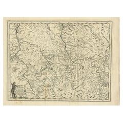
Set of two antique maps titled 'Marchionatus Moraviae circulus Preroviensis'. Two individual sheets covering part of modern-day Czech Republic. Cities included are Opava, Fulnek, Lipnik (Leipnik), Přerov (Prerau) and many more. Published by Johann Baptist Homann, circa 1720.
Johann Baptist Homann (20 March 1664 – 1 July 1724) was a German geographer and cartographer.
- Dimensions:Height: 20.87 in (53 cm)Width: 24.81 in (63 cm)Depth: 0.02 in (0.5 mm)
- Sold As:Set of 2
- Materials and Techniques:
- Period:
- Date of Manufacture:c.1720
- Condition:General age-related toning. Original folding line. Shows some wear and soiling. Blank verso. Please study images carefully.
- Seller Location:Langweer, NL
- Reference Number:
About the Seller
5.0
Platinum Seller
These expertly vetted sellers are 1stDibs' most experienced sellers and are rated highest by our customers.
Established in 2009
1stDibs seller since 2017
1,929 sales on 1stDibs
Typical response time: <1 hour
- ShippingRetrieving quote...Ships From: Langweer, Netherlands
- Return PolicyA return for this item may be initiated within 14 days of delivery.
More From This SellerView All
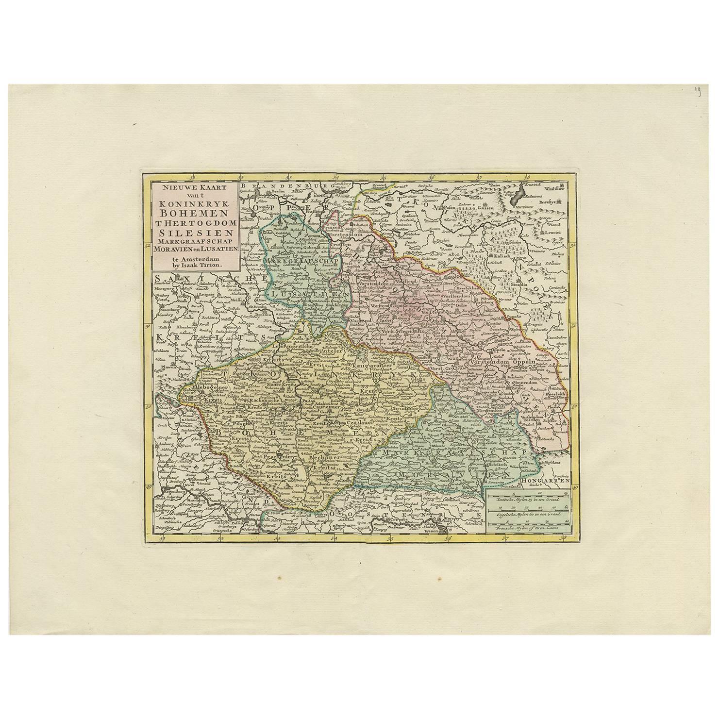
- Antique Map of Czech Republic by I. Tirion, 1747Located in Langweer, NLAntique map titled 'Nieuwe Kaart van t Koninkryk Bohemen t Hertogdom Silesien markgraafschap Moravien en Lusatien'. Including the towns of Berlin, Vienna, Regensburg.Category
Antique Mid-18th Century Maps
MaterialsPaper
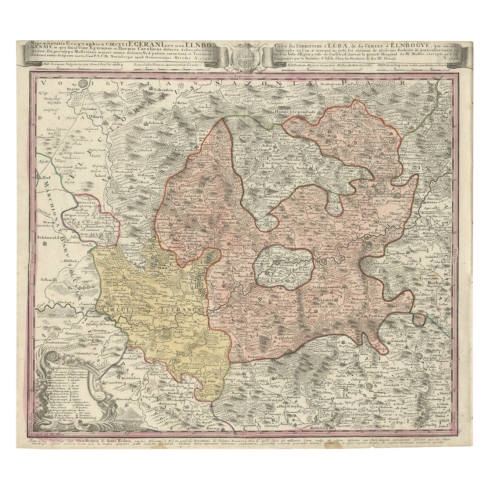
- Antique Map of the Region of Elbogen & Eger, Czech Republic & Hungary, 1742Located in Langweer, NLAntique map titled 'Repraesentatio Geographica Circuli Egerani, nec non Elnbogensis : in quo simul viae Egeranae in Thermas Carolinas distincta delineatio conspicitur (..)'. Orig...Category
Antique 1740s Maps
MaterialsPaper
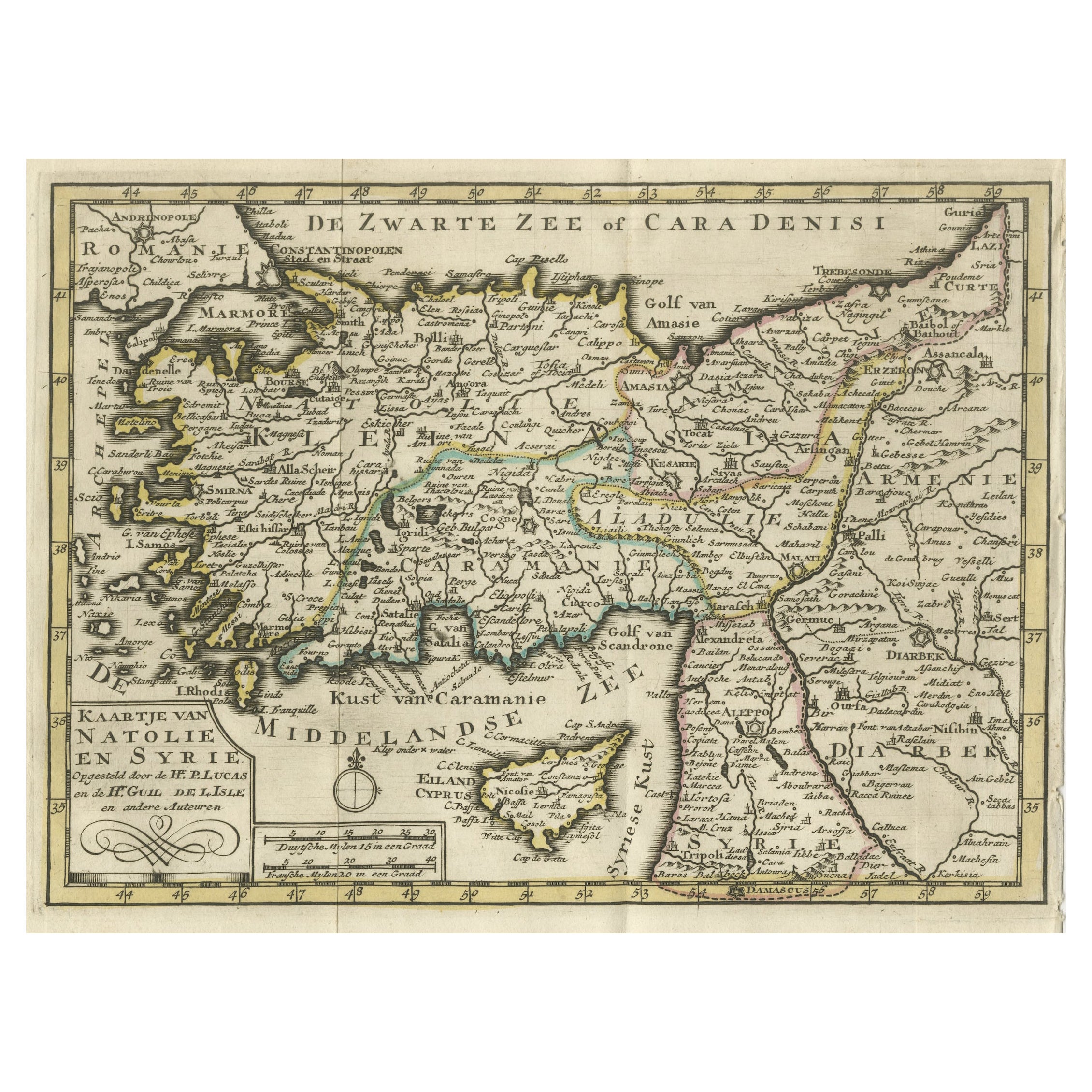
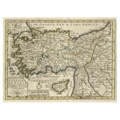
- Old Map of Anatolia, part of modern-day Turkey, Armenia and Syria, 1745Located in Langweer, NLTitle: "Kaartje van Natolie en Syrie opgesteld door de Hr. Lucas en de Hr. Guil de L'Isle en andere auteuren" The title "Kaartje van Natolie en Syrie opgesteld door de Hr. Lucas en...Category
Antique 1740s Maps
MaterialsPaper
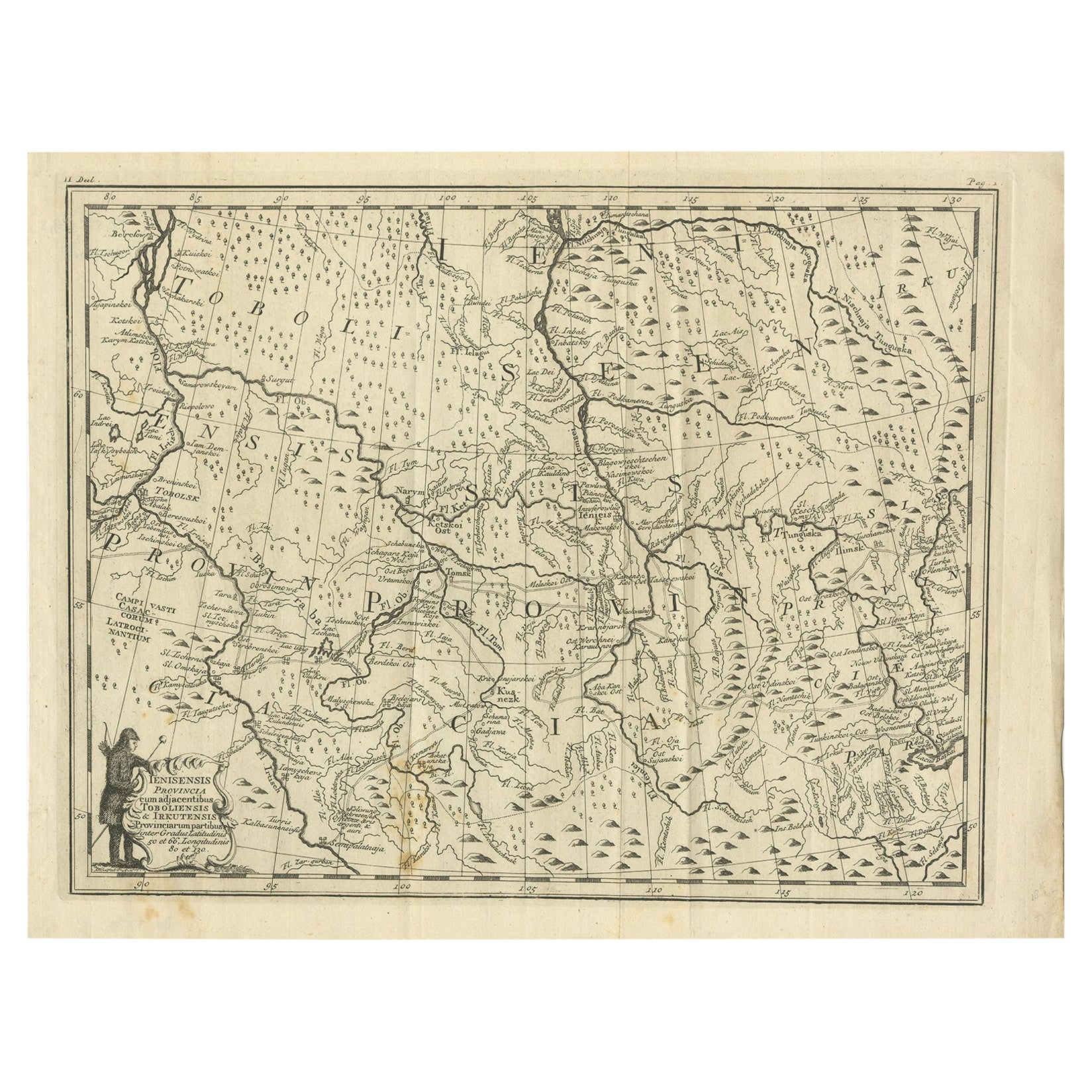
- Antique Map of Part of Russia, c.1740Located in Langweer, NLAntique map titled 'Ienisensis Provinicia cum adjacentibus Toboliensis & Irkutensis'. Old map of part of Russia including the city of Tobolsk and others. Source unknown, to be determ...Category
Antique 18th Century Maps
MaterialsPaper
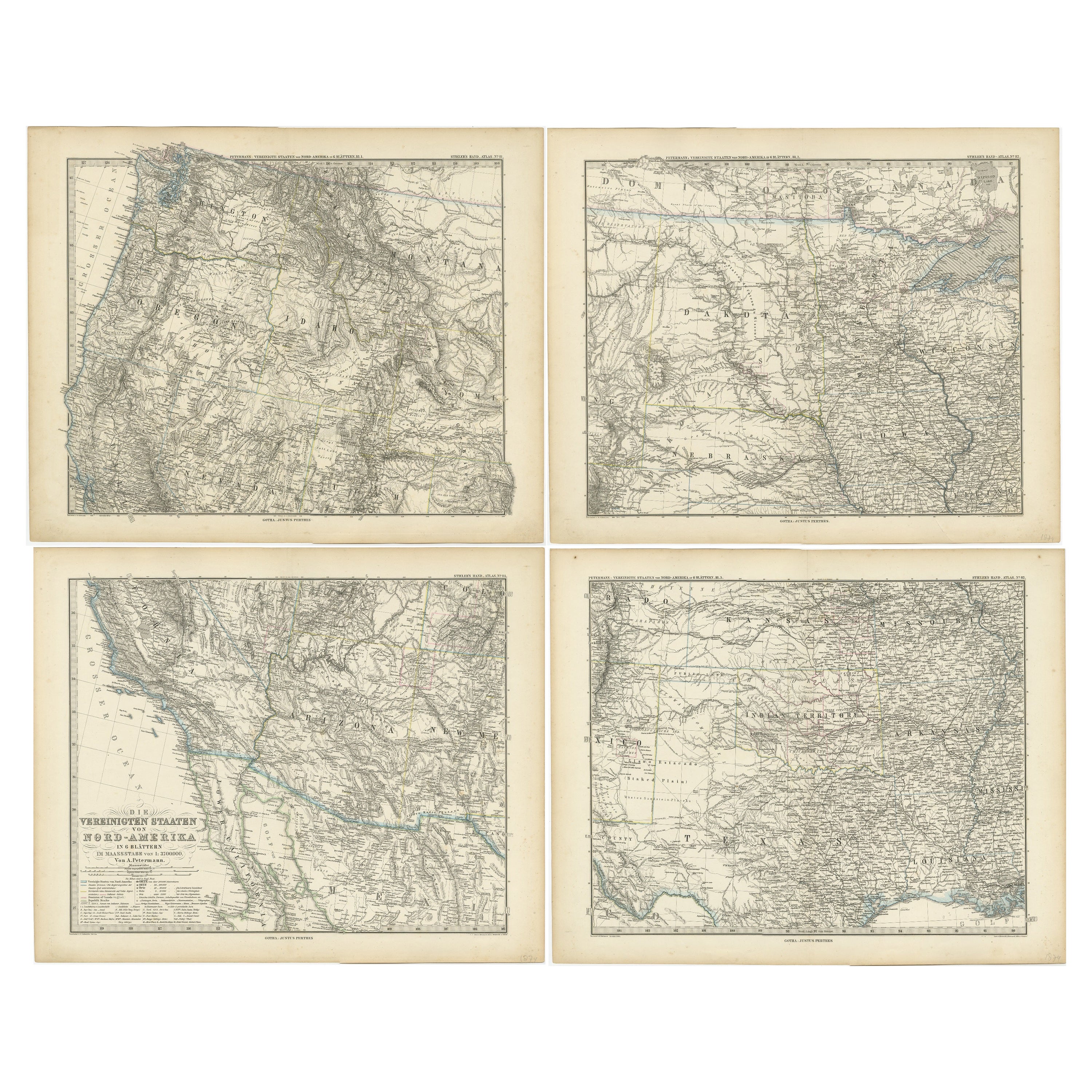
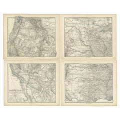
- Set of 4 Antique Maps of part of the United States of AmericaLocated in Langweer, NLSet of four individual antique maps of part of the United States. Published as part of a set of six individual maps. These maps originate from Stielers Handatlas, published circa 1...Category
Antique Mid-19th Century Maps
MaterialsPaper
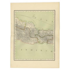
- Antique Map of Part of Java, Indonesia, 1900Located in Langweer, NLAntique map of West Java. This map originates from 'Atlas van Nederlandsch Oost- en West-Indië' by I. Dornseiffen. Artists and Engravers: Published by Seyffardt's Boekhandel, Amste...Category
20th Century Maps
MaterialsPaper
You May Also Like
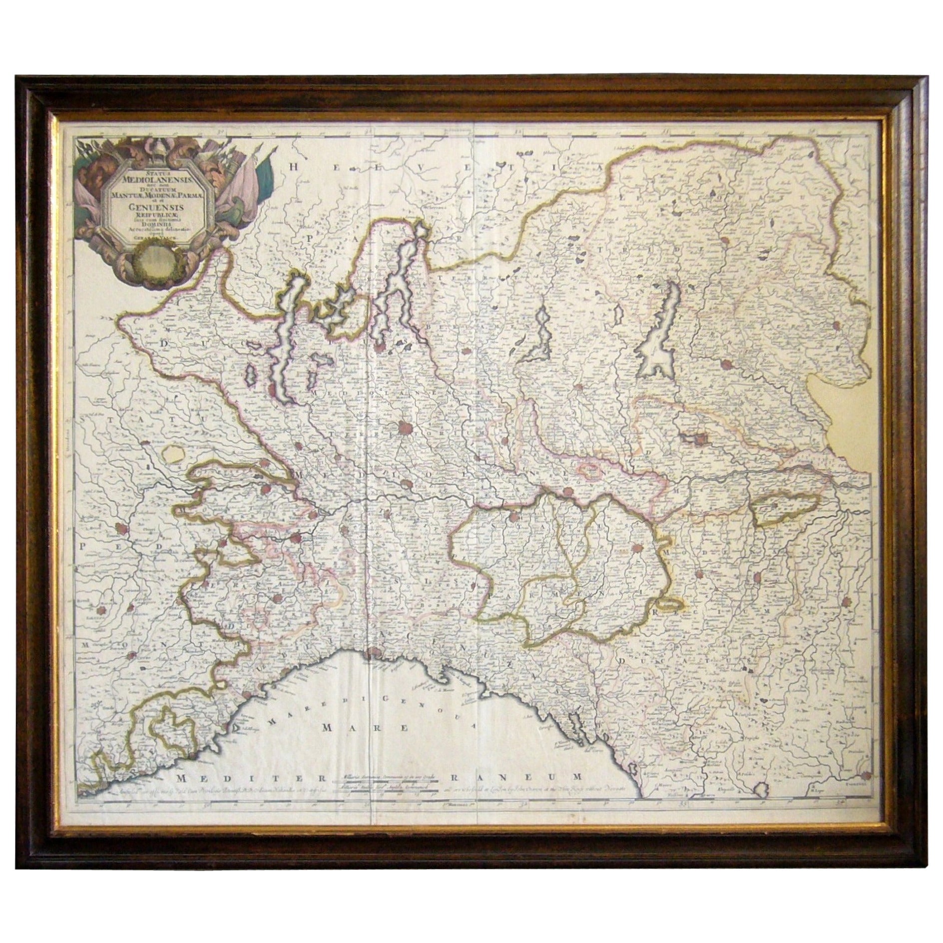
- Map of the Republic of GenoaLocated in New York, NYFramed antique hand-coloured map of the Republic of Genoa including the duchies of Mantua, Modena, and Parma. Europe, late 18th century. Dimension: 25...Category
Antique Late 18th Century European Maps
- 1844 Map "Russia in Eurpoe, Part II to Part VIII", 7 Maps Ric.r023Located in Norton, MA1844 Map "Russia in Eurpoe, Part II to Part VIII" 7 Maps Ric.r023 Fine, original, steel-engraved Map of Russia in Europe Part II t oPart VIII, by the Society for the Diffusion of Useful Knowledge. Detailed map of the regions to the northeast of Moscow. Including Arkhangel, Vologda, Viatka, Perm, Olonetz, Iaroslavl. The SDUK began its map publishing project under the leadership of Captain Francis Beaufort R.N. in 1829, and published the maps in parts, haltingly, over the next 15 years, completing the series in 1844, finally permitting the publication of a whole atlas. Many of the maps were actually drawn by Beaufort, who at the time was the Hydrographer to the Royal Navy, and all were closely supervised by him. J. & C. Walker worked closely with Beaufort in engraving the maps. Finely engraved, carefully researched, the maps set...Category
Antique 19th Century Unknown Maps
MaterialsPaper
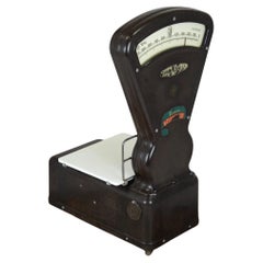
- Semi-Automatic Large Bakelite Grocery Scale, Czech Republic, 1930sLocated in Żory, PLOld shop scale from the 1930s/1940s, manufactured in the Czech Republic by Zbrojovka Brno. Semi-automatic scale, with internal weights. The scale is set with stylish metal buttons. A...Category
Early 20th Century Industrial Scientific Instruments
MaterialsMetal
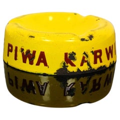
- Collectible Karwinskie Brewery Metal Enamel Ashtray, Poland/Czech Republic, 1930Located in Żory, PLCollectible advertising enamel ashtray with the inscription in Polish "Pijcie Piwa Karwińskie" ("Drink Beer Karwińskie") from the brewery Dr. Jan Hr. Larusch-Monnicha in Karvina (now...Category
Early 20th Century Tobacco Accessories
MaterialsMetal
- Antique Map of Principality of MonacoBy Antonio Vallardi EditoreLocated in Alessandria, PiemonteST/619 - "Old Geographical Atlas of Italy - Topographic map of ex-Principality of Monaco" - ediz Vallardi - Milano - A somewhat special edition ---Category
Antique Late 19th Century Italian Other Prints
MaterialsPaper
- Vintage 1930s Black Leather Medicine Ball from a Gym, Czech Republic, 1930sLocated in Vienna, ATA decorative handcrafted medicine ball from a Czech gym, dated circa 1930s. Made of thick black saddle leather in good vintage condition with charming patina...Category
Vintage 1930s Czech Art Deco Sports Equipment and Memorabilia
MaterialsLeather


Recently Viewed
View AllMore Ways To Browse
Maps Of Sea
Pakistan Antique Map
Johannes Janssonius On Sale
Bolivia Antique Map
Albania Map
Wyld Globes
Ecuador Antique Map
Stock Charts
Antique Arkansas Maps
Antique Barbie Furniture
Carte Egypte Antique
La Syrie Antique
Antique Map Of Puerto Rico
Map Of Wyoming
Antique Citroen
Staffordshire Antique Map
Staffordshire Map
Nicolas De Fer