Early 18th Century Collectibles and Curiosities

to
255
333
48
382
20
13
2
2
1
1
4,376
6,575
13,270
2,711
3,491
4,590
3,013
515
314
588
736
463
892
864
892
656
567
306
50
27
14
13
111
25
24
20
16
382
382
382
11
10
3
2
2
Period: Early 18th Century
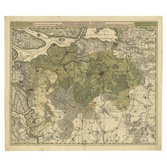
Antique Map of the City of Materan 'Indonesia' by P. van der Aa, circa 1725
Located in Langweer, NL
Antique map titled 'La Ville de Materan, capitale de Roiaume de meme nom, avec ses environs. Le tout environne de Montagnes qui lui serve de murailles.' The city of Materan, capital ...
Category

Antique Early 18th Century Collectibles and Curiosities

Materials

Paper

Antique Map of Ambon and Boero by Valentijn, 1726
Located in Langweer, NL
Untitled map of the western part of the island Amboina with Boero, Indonesia. This print originates from 'Oud en Nieuw Oost-Indiën' by F. Valentijn.
Category

Dutch Antique Early 18th Century Collectibles and Curiosities

Materials

Paper

Antique Map of Manilla Bay Philippines by P. van der Aa, 1719
Located in Langweer, NL
Rare antique map titled 'La Baie de Manille (..)'. Map of Manilla Bay, the map is oriented with southwest at the top and includes a small town plan for Manilla and other places. This...
Category

Antique Early 18th Century Collectibles and Curiosities

Materials

Paper

Antique Engraving of the Story of Jephthah’s Daughter, 1728
Located in Langweer, NL
Antique religion print titled 'Jephthah's daughter meets him at the door of his house'. The story of Jephthah’s Daughter (Judges 11) tells us that Jephthah the Gileadite made a vow to the Lord before going into battle with the Ammonites. This print originates from 'Figures de la Bible'. Artists and Engravers: Published by P. de Hondt. Illustrated by Gerard Hoet...
Category

Antique Early 18th Century Collectibles and Curiosities

Materials

Paper

Detailed Antique Map of the Province of Overijssel in the Netherlands, ca.1700
Located in Langweer, NL
Antique map titled 'La Seigneurie d'Over-Yssel subdivisee en Trois Parties, Sallant, Twente, et Drente.' Detailed map of the province of Overijssel in the Netherlands. From Jaill...
Category

Antique Early 18th Century Collectibles and Curiosities

Materials

Paper

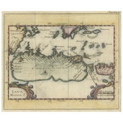
Beautiful Hand-Coloured Miniature Map of the Island of Java, Indonesia, ca.1702
Located in Langweer, NL
Antique map of Java titled‚ Iava Maior‘. Beautiful hand-coloured miniature map of the island of Java. This map originates from ‘Recueil des Voyages qui ont servi a l'etablissemen...
Category

Antique Early 18th Century Collectibles and Curiosities

Materials

Paper

Old Print of Nature Godess Sibyl and Puzza of China on a Lotus Flower, ca.1725
Located in Langweer, NL
Antique print, titled: 'Puzza ou la Cybele des Chinois (…)' - This plates hows Puzza, Sibyl of China and Puzza sitting on a Lotus flower. Source unknown, to be determined. Artists...
Category

Antique Early 18th Century Collectibles and Curiosities

Materials

Paper

Regional Antique Map of the Baltic, Extending from Stralsund to Dantzig, ca.1720
Located in Langweer, NL
Antique map titled 'Ducatus Pomeraniae (..)'. Regional map of the Baltic, extending from Stralsund and Rugia in the west to Dantzig and Culman on the Vistula in the east. Large carto...
Category

Antique Early 18th Century Collectibles and Curiosities

Materials

Paper

Highly Detailed Antique Map of Brabant, Province of the Netherlands, ca.1700
Located in Langweer, NL
Antique print, titled: 'Brabantiae Batavae Pars Occidentalis : sive Antuerpiensis Tetrarchiae Pars Septentrionalis comprehendens Baroniam Bredanam, Marchionatum Bergensem ad Zoman al...
Category

Antique Early 18th Century Collectibles and Curiosities

Materials

Paper

Calvalcade of the Great Lord & Celebration of Weights of the Mughal Empire, 1727
Located in Langweer, NL
Antique print titled 'Calvalcade du Grand Seigneur' and 'La Féte du poids au Mogol'. The upper image depicts the Calvalcade of the Great Lord, the lower image depicts The celebra...
Category

Antique Early 18th Century Collectibles and Curiosities

Materials

Paper

Decorative View of the Indonesian Town of Bantam 'Banten', Java, 1726
Located in Langweer, NL
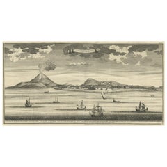
Decorative town-view of the town of Bantam (Banten). In lower margin key a-z to the principal places in town. The Banten Sultanate was founded in the 16th century and centred in ...
Category

Antique Early 18th Century Collectibles and Curiosities

Materials

Paper

Attractive Original Map of the Province of Overijssel, the Netherlands, Ca.1700
Located in Langweer, NL
Antique print, titled: 'Transisalania Provincia vulgo Over-yssel.' Attractive original handcoloured map of the province of Overijssel, The Netherlands. With beautiful title cartouc...
Category

Antique Early 18th Century Collectibles and Curiosities

Materials

Paper

Detailed Original Antique Map of India, Southeast Asia and the Far East, 1719
Located in Langweer, NL
Antique map titled 'Carte des Indes, de la Chine & des Iles de Sumatra, Java & c'. Detailed map of India, Southeast Asia and the Far East, extending from Gujerat to the supposed "T...
Category

Antique Early 18th Century Collectibles and Curiosities

Materials

Paper

Decorative Print of Scheveningen in Holland, before the All Saints Flood, 1720
Located in Langweer, NL
Antique print titled 'In 't jaer van t'seventich ende vijftienhondert ghebeurdet hier t'Schevelinge (..)'. View of the city of Scheveningen, the Netherlands, before the All Saint...
Category

Antique Early 18th Century Collectibles and Curiosities

Materials

Paper

Antique Engraving Depicting the Confession & the Anointing of the Sick, 1724
Located in Langweer, NL
Two religious images on one sheet. The upper images depicts the confession and the lower image depicts the anointing of the sick. This print originates from 'Ceremonies et costumes R...
Category

Antique Early 18th Century Collectibles and Curiosities

Materials

Paper

Rare Antique English SeaChart of Bali, Lombok, Floris, Borneo, Celebes etc, 1711
Located in Langweer, NL
Antique map titled 'A Large Draught from Benjar on the Island of Borneo To Macasser on the Island of Celebes Shewing the Streight of Bally with the Islands to the Eastward thereof.' ...
Category

Antique Early 18th Century Collectibles and Curiosities

Materials

Paper

View of the Great Dining Room of The Wilton House in Salisbury, Wiltshire, 1717
Located in Langweer, NL
Antique print titled 'Section of the Great Dining Room at Wilton (..)'. View of the great dining room of Wilton House, also known as the 'Double Cube Room' this room was part of a design for a series of state rooms by the architects Inigo Jones (1573-1652) and his niece's husband John Webb (1611-1672) in the southern wing of Wilton House after a fire in c.1653; The room was built to house the family portraits of the Earls of Pembroke...
Category

Antique Early 18th Century Collectibles and Curiosities

Materials

Paper

Old Map Covering All of Southeast Asia from Persia to the Timor Island, 1712
Located in Langweer, NL
Description: Antique map titled 'A New Map of the East Indies'. Old map covering all of Southeast Asia from Persia to the Timor Island, inclusive of the modern day nations of India, ...
Category

Antique Early 18th Century Collectibles and Curiosities

Materials

Paper

Antique Print Stating That Law is Given by Moses, Mercy and Truth by Jesus, 1725
Located in Langweer, NL
Antique print titled 'De wet is door Mozes gegeven, de genade en de waarheid is door Jesus Christus geworden.' The law is given by Moses, Mercy and Truth established by Jesus Christ....
Category

Antique Early 18th Century Collectibles and Curiosities

Materials

Paper

Antique Miniature Map of the Maluku Islands by Lasor a Varea, 1713
Located in Langweer, NL
Antique map titled 'Isole Molucche'. Rare miniature map of the Maluku Islands or the Moluccas, Indonesia. This map originates from 'Universus Terrarum Orbis...
Category

Antique Early 18th Century Collectibles and Curiosities

Materials

Paper

Antique Map of the Seventeen Provinces by Halma '1705'
Located in Langweer, NL
Antique map titled 'De zeventien Nederlantsche Provintiën'. Original antique map of the Seventeen Provinces, the Imperial states of the Habsburg Netherlands in the 16th century. This...
Category

Antique Early 18th Century Collectibles and Curiosities

Materials

Paper

2 Iron-Red and Gilt Chinese Miniature Porcelain Vases, Kangxi
Located in Delft, NL
2 iron-red and gilt Chinese miniature porcelain Vases, Kangxi Kangxi (1662-1722) The bottles has minuscule chips The measurements are 4 cm high and 2.7 cm diagonal The weight i...
Category

Chinese Antique Early 18th Century Collectibles and Curiosities

Materials

Porcelain

Antique Map of the City of Antwerpen ‘Belgium’ by A. Deur, 1729
Located in Langweer, NL
Copper-engraving by A. Deur. Published by I. van der Kloot in Den Haag, 1729. With French and Dutch title-cartouches and explanatory notes, several ships o...
Category

Antique Early 18th Century Collectibles and Curiosities

Materials

Paper

Antique Map of the Diocese of Toul by Covens & Mortier, circa 1720
Located in Langweer, NL
Antique map titled 'Civitas Leucorum sive Pagus Tullensis'. Detailed map of the Diocese of Toul, France. Centered on the cities of Nancy and Toul and including Metz, Verdun, S. Dizie...
Category

Antique Early 18th Century Collectibles and Curiosities

Materials

Paper

Antique Map of Ambon and Surroundings by Valentijn '1726'
Located in Langweer, NL
Antique map titled 'De landvoogdy van Amboina met de elf onderhoorige Eylanden'. Decorative map of the eastern tip of the islands of Ambon, Indonesia. This print originates from 'Oud...
Category

Dutch Antique Early 18th Century Collectibles and Curiosities

Materials

Paper

Antique Print of a River in Madagascar by Valentijn, 1726
Located in Langweer, NL
Antique print titled 'Rivier van Maningaar op Madagascar'. Text on verso. This print originates from 'Oud en Nieuw Oost-Indiën' by F. Valentijn. According to Valentijn, there was a D...
Category

Dutch Antique Early 18th Century Collectibles and Curiosities

Materials

Paper

Antique Map of Boero in Indonesia by Valentijn, 1726
Located in Langweer, NL
Antique map titled 'Boero-Amblauw'. Detailed map of the Island Ambelau and Buru, Maluku Islands, Indonesia. With an inset of the lake on the Buru mountains. This print originates fro...
Category

Dutch Antique Early 18th Century Collectibles and Curiosities

Materials

Paper

Antique Map of Malabar Coast by Valentijn, 1726
Located in Langweer, NL
Untitled sea chart of the coast of Malabar, India. This print originates from 'Oud en Nieuw Oost-Indiën' by F. Valentijn.
Category

Dutch Antique Early 18th Century Collectibles and Curiosities

Materials

Paper

Antique Lithography Map, Durham, English, Framed, Cartography, Early Georgian
Located in Hele, Devon, GB
This is an antique lithography map of Durham. An English, framed engraving of cartographic interest, dating to the early 18th century and later, circa 1720. Superb lithography of Du...
Category

British Georgian Antique Early 18th Century Collectibles and Curiosities

Materials

Wood

Antique Map of Herefordshire 'England' by R. Morden, 1708
Located in Langweer, NL
This antique County map of Herefordshire by Robert Morden was first published in 1701 in a work entitled 'The New Description and State of England'...
Category

Antique Early 18th Century Collectibles and Curiosities

Materials

Paper

Antique Map of Russia by N. Sanson, 1705
Located in Langweer, NL
A strongly engraved map of European Russia showing its political divisions, major topographical features, cities and towns. Extends to the Sea of Azov and the tip of the Caspian Sea ...
Category

Antique Early 18th Century Collectibles and Curiosities

Materials

Paper

Antique Map of Sweden and Norway by H. Moll, circa 1715
Located in Langweer, NL
Beautiful and rare map of Sweden and Norway including English text. This map most likely originates from 'The Compleat geographer, or, The chorography and topography of all the known...
Category

Antique Early 18th Century Collectibles and Curiosities

Materials

Paper

Antique Map: Estuaries of the Somme & Bresle, Northern France & Netherlands
By Jacobus Harrewijn
Located in Langweer, NL
Antique Map: Les Embouchures de la Somme et de Bresle (Estuaries of the Somme and Bresle) This beautifully detailed antique map, titled *Les Embouchures de la Somme et de Bresle*, showcases the coastline of northern France, specifically focusing on the estuaries of the Somme and Bresle rivers. Part of a larger series of maps that collectively depict a significant portion of the Southern Netherlands, this engraving captures the intricate geography of the region with remarkable precision. The map provides a detailed view of the coastal towns, rivers, and natural features that define the area. Notable locations such as Dieppe and St. Valery are highlighted, reflecting their historical significance as key port towns and hubs of trade and navigation. The surrounding rivers and estuaries are meticulously rendered, showing the natural waterways that played a crucial role in the development of the region. This engraving is enhanced by the inclusion of charming decorative elements, such as sailing ships in the surrounding waters, adding a sense of movement and life to the map. The inclusion of forests and topographical details in the inland areas demonstrates the mapmaker's commitment to providing a comprehensive representation of the region. The map's historical context lies in its origin as part of a series that aimed to document the territories of the Southern Netherlands and northern France during a period of significant political and geographical change in Europe. Such maps were invaluable tools for navigation, trade, and territorial administration, making them both functional and artistic. Keywords: antique map of Northern France, Somme estuary map, Bresle estuary, Dieppe historical map, Southern Netherlands cartography, French coastline map, 17th-century map engraving, historical geography, decorative antique map, rare European maps, maritime history. This map is an exceptional piece for collectors of antique cartography...
Category

Antique Early 18th Century Collectibles and Curiosities

Materials

Paper

Antique Coaching Road Map, Devon, English, Regional Cartography, Georgian, 1720
Located in Hele, Devon, GB
This is an antique coaching road map of Devon. An English, framed lithograph engraving of regional interest, dating to the early 18th century and later. Fascinating 18th century hig...
Category

British Georgian Antique Early 18th Century Collectibles and Curiosities

Materials

Wood

Antique Coaching Road Map, South Devon, English, Framed, Cartography, Georgian
Located in Hele, Devon, GB
This is an antique coach road map of South Devon. An English, framed lithograph engraving of regional interest, dating to the early 18th century and later. Delightful early 18th cen...
Category

British Georgian Antique Early 18th Century Collectibles and Curiosities

Materials

Wood

Antique Lithography Map, Cumbria, English, Framed Cartography Interest, Georgian
Located in Hele, Devon, GB
This is an antique lithography map of Cumbria. An English, framed engraving of cartographic interest, dating to the early 18th century and later. ...
Category

British Georgian Antique Early 18th Century Collectibles and Curiosities

Materials

Wood

18th Century Pastiglia Decorated Baroque Bible Box
Located in Hastings, GB
This truly exceptional 18th century bible box, formed as a book and profusely decorated in pastiglia throughout, in silver and gold gilt, at it's c...
Category

German Baroque Antique Early 18th Century Collectibles and Curiosities

Materials

Gesso, Pine

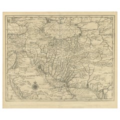
1718 Ides & Witsen Map "Route D'amsterdam a Moscow Et De La Ispahan Et Gamron
Located in Norton, MA
1718 Ides & Witsen map, entitled "Route D'Amsterdam A Moscow Et De La Ispahan Et Gamron," Ric.b005 Subject: Eastern Europe and Central Asia Period: 1718 (published) Publicati...
Category

Dutch Antique Early 18th Century Collectibles and Curiosities

Materials

Paper

A Brass Butterfield Type Dial French Early 18th Century
Located in Firenze, IT
signed Buterfield A Paris., the octagonal dial with hinged gnomon and bird pointer, inset compass and engraved with hour scales, the reverse engraved with towns and their latitudes, ...
Category

French Napoleon III Antique Early 18th Century Collectibles and Curiosities

Materials

Brass

Early 18th Century, Italian Santos Figure
Located in Los Angeles, CA
Hand-painted, parcel-gilt, wood statue of the Virgin Mary mounted on a circa 1725, old-wood base.
Category

Italian Antique Early 18th Century Collectibles and Curiosities

Materials

Paint, Wood

Hand-Colored 18th Century Homann Map of Denmark and Islands in the Baltic Sea
Located in Alamo, CA
An 18th century copper plate hand-colored map entitled "Insulae Danicae in Mari Balthico Sitae utpote Zeelandia, Fionia, Langelandia, Lalandia, Falstria, Fembria Mona" created by Joh...
Category

German Antique Early 18th Century Collectibles and Curiosities

Materials

Paper

Dutch Silver Miniature Samovar/Coffee Urn - Antique 1722
Located in Jesmond, Newcastle Upon Tyne
This exceptional, fine and impressive antique 18th century miniature silver samovar/coffee urn has a circular baluster shaped form. The body of this Dutch silver samovar is plain and unembellished, with an applied border to the upper rim. This antique silver samovar...
Category

Dutch Antique Early 18th Century Collectibles and Curiosities

Materials

Silver, Sterling Silver

Antique Engraving of the Island Nzwani or Anzuany of the Comoros Islands, 1726
Located in Langweer, NL
Historical titles: Ansjouan, Ansuany, Anjouan, Anzuani, Anzuany Country: Comoros The map is taken from: 'Oud en Nieuw Oost-Indiën' van François Valentyn. 1) Ottens, Frederik (engraver / etcher) 2) Braam, J. van (publisher) 3) Linden, Gerard onder de (publisher) Anjouan is an island to the north-west of Madagascar. It is one of the Comoros Islands. The Company made regular voyages from Cape of Good Hope to Madagascar, Anjouan and the east coast of Africa to take slaves. These slaves were used as labourers in the Cape colony and Batavia. Anjouan was also employed as a staging post; it supplied VOC ships...
Category

Antique Early 18th Century Collectibles and Curiosities

Materials

Paper

Antique Carved and Painted Statue of St. Florian, Austria, circa 1700
Located in Dallas, TX
St. Florian (250 A.D. – 304 A.D.), was a the patron saint of firefighters, brewers, chimney sweeps, and the town of Linz, Austria. He served in the Roman army and part of his duties included organizing fire fighting brigades. He was secretly a Christian and became famous for miraculously saving a town from being destroyed by fire; after he prayed and threw a single bucket of water on the blaze, it was extinguished. This beautifully carved and painted statue dates to approximately the end of the 1600s or early 1700s. It clearly depicts St. Florian with a bucket in hand and a flag in the other. At his feet, is a miniature building...
Category

Austrian Antique Early 18th Century Collectibles and Curiosities

Materials

Gesso, Giltwood, Wood

Scandinavia & Portions of Eastern Europe: 18th Century Hand-Colored Homann Map
Located in Alamo, CA
An early 18th century hand-colored copper-plate map entitled "Regni Sueciae in omnes suas Subjacentes Provincias accurate divisi Tabula Generalis" by Johann Baptist Homann (1663-1724...
Category

German Antique Early 18th Century Collectibles and Curiosities

Materials

Paper

An apothecary bronze mortar and pestle, Italy 1700.
Located in Milan, IT
Bronze Apothecary mortar, fitted with mortar pestle. Italy early 18th century.
Category

Italian Antique Early 18th Century Collectibles and Curiosities

Materials

Bronze

Antique Map of Cyprus and Asia Minor with Medallions and Vignettes
Located in Langweer, NL
Antique map titled 'Asiae Peninsula sive Asia intra Taurum'. Decorative map of Cyprus and Asia Minor, featuring the geographical features known to the ancients and decorated with a v...
Category

Antique Early 18th Century Collectibles and Curiosities

Materials

Paper

Antique Map of the French Coast at Boulogne and Picardy
Located in Langweer, NL
Antique map titled 'Les Costes du Boulenois et de la Picardie'. Map of the French coast at Boulogne and Picardy. Left a large wind rose. Part of a bundled collection of plans of batt...
Category

Antique Early 18th Century Collectibles and Curiosities

Materials

Paper

Antique Map of the Rhine centered on Cologne, Germany, with outline coloring
Located in Langweer, NL
Antique map titled 'Archiepsiscopatus et Electoratus Coloniensis (..)'. Original antique map of the Rhine river, centered on Cologne, Germany. The Rhine River cuts across this map fr...
Category

Antique Early 18th Century Collectibles and Curiosities

Materials

Paper

Antique Map of the Rhine centered on Cologne, Germany
Located in Langweer, NL
Antique map titled 'Archiepsiscopatus et Electoratus Coloniensis (..)'. Original antique map of the Rhine river, centered on Cologne, Germany. The Rhine River cuts across this map fr...
Category

Antique Early 18th Century Collectibles and Curiosities

Materials

Paper

18th Century French Map and City View of Joppe/Jaffa 'Tel Aviv' by Sanson
Located in Alamo, CA
An original antique engraving entitled "Joppe; in ’t Hebreeusch by ouds Japho; hedendaags Japha, of Jaffa; volgens d’aftekening gedaan 1668", by Nicholas Sanson d'Abbeville (1600 - 1667). This is a view of the city of Joppe (in Hebrew Japho), now called Japha or Jaffa, the harbor portion of modern day Tel Aviv, Israel as it appeared in 1668 . It depicts a very busy harbor with numerous boats. A large ship on the left appears to be firing its canons and a small ship on the right appears to be sitting very low in the water, either heavily loaded with cargo or sinking. The town is seen on the far shore with a fortress on a hill across in the background. The map is printed from the original Sanson copperplate and was published in 1709 by his descendants. The map is presented in an ornate brown wood frame embellished by gold-colored leaves and gold inner trim with a double mat; the outer mat is cream-colored and the inner mat is black. There is a central vertical fold, as issued. There are two small spots in the lower margin and one in the upper margin, as well as two tiny spots adjacent to the central fold. 1717 is written below the date 1668 in the inscription. The map is otherwise in very good condition. Another map of the "Holy Land" (by Claes Visscher in 1663), with an identical style frame and mat is available. This pair of maps would make a wonderful display grouping. Please see Reference #LU5206220653552. A discount is available for the purchase of the pair of maps. Artist: Nicholas Sanson d'Abbeville (1600-1667) and his descendents were important French cartographer's active through the 17th century. Sanson started his career as a historian and initially utilized cartography to illustrate his historical treatises. His maps came to the attention of Cardinal Richelieu and then King Louis XIII of France, who became a supporter and sponsor. He subsequently appointed Sanson 'Geographe Ordinaire du Roi' the official map maker to the king. Sanson not only created maps for the king, but advised him on geographical issues and curated his map collection...
Category

French Antique Early 18th Century Collectibles and Curiosities

Materials

Paper

Attractive Small Map of the British Isles with Decorative Cartouche
Located in Langweer, NL
Antique map titled 'Isles Britaniques ou sont les Royaumes d'Angleterre, D'Escosse et d'Irlande'. Attractive small map of the British Isles with decorative cartouche. Published circa...
Category

Antique Early 18th Century Collectibles and Curiosities

Materials

Paper

Antique Map of European Russia with Picture Frame Border
Located in Langweer, NL
Antique map titled 'La Moscovie Septentrionale (..)'. Decorative example of van der Aa's map of the northern part of European Russia. With the picture frame border, which appeared in...
Category

Antique Early 18th Century Collectibles and Curiosities

Materials

Paper

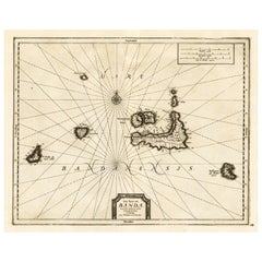
Old Antique Map of the Banda Islands (Southeast), Indonesia & Northern Australia
Located in Langweer, NL
Original antique map titled 'Kaart van de Zuyd-Ooster Eylanden van Banda'. Important map of the seas and islands surrounding the Banda Islands, Indonesia, extending south to northern Australia, east to Papua New Guinea and north to Ceram. Published 1724-1726 by Joannes van Braam...
Category

Antique Early 18th Century Collectibles and Curiosities

Materials

Paper

Uncommon Antique Map of the English Channel Coastline, ca.1709
Located in Langweer, NL
Antique map titled 'Partie de L'Angleterre' Uncommon map of the English Channel coastline with many boats on the sea. Source unknown, to be determined. Artists and Engravers: Made...
Category

Antique Early 18th Century Collectibles and Curiosities

Materials

Paper

Original Antique Print Showing the Prophet Killed by a Lion 'I Kings XII', 1728
Located in Langweer, NL
Antique print, titled: 'The Man of God slain by a Lion for his disobedience (…)' - Original antique print showing the prophet killed by a lion...
Category

Antique Early 18th Century Collectibles and Curiosities

Materials

Paper

Copper Engraving with a View on the Volga River in Russia, 1714
Located in Langweer, NL
Antique print titled 'Gezicht op de Rivier'. Copper engraving with a view on the Volga river. This print originates from 'Reizen over Moskovie, door Persie en Indie (..)' by C. d...
Category

Antique Early 18th Century Collectibles and Curiosities

Materials

Paper

'Waste Paper is Burned to Ashes', a Satire Print on the South Sea Bubble, 1720
Located in Langweer, NL
Antique print titled 'Des Kladpapieren Waerelds vuur in as verkeerd'. 'The world of waste paper is burned to ashes', a satire on the South Sea Bubble. The oval central image shows a group containing kings, churchmen, rich and poor surrounding a globe. The four corner images are: (TL) the death of Adonis; (TR) the death of Bacchus; (BL) King Midas sitting at a table with his food turning into gold...
Category

Antique Early 18th Century Collectibles and Curiosities

Materials

Paper

Read More

Medal-Worthy Memorabilia from Epic Past Olympic Games

Get into the games! These items celebrate the events, athletes, host countries and sporting spirit.

Ahoy! You’ve Never Seen a Collection of Sailor Art and Kitsch Quite Like This

French trendsetter and serial collector Daniel Rozensztroch tells us about his obsession with objects related to seafaring men.

Pamela Shamshiri Shares the Secrets behind Her First-Ever Book and Its Effortlessly Cool Interiors

The sought-after designer worked with the team at Hoffman Creative to produce a monograph that beautifully showcases some of Studio Shamshiri's most inspiring projects.

Moroccan Artworks and Objects Take Center Stage in an Extraordinary Villa in Tangier

Italian writer and collector Umberto Pasti opens the doors to his remarkable cave of wonders in North Africa.

Montecito Has Drawn Royalty and Celebrities, and These Homes Are Proof of Its Allure

Hollywood A-listers, ex-pat aristocrats and art collectors and style setters of all stripes appreciate the allure of the coastal California hamlet — much on our minds after recent winter floods.

Whaam! Blam! Pow! — a New Book on Pop Art Packs a Punch

Publishing house Assouline and writer Julie Belcove have teamed up to trace the history of the genre, from Roy Lichtenstein, Andy Warhol and Yayoi Kusama to Mickalene Thomas and Jeff Koons.

The Sparkling Legacy of Tiffany & Co. Explained, One Jewel at a Time

A gorgeous new book celebrates — and memorializes — the iconic jeweler’s rich heritage.

What Makes a Gem-Encrusted Chess Set Worth $4 Million?

The world’s most opulent chess set, weighing in at 513 carats, is literally fit for a king and queen.

Recently Viewed

View All