Items Similar to Calvalcade of the Great Lord & Celebration of Weights of the Mughal Empire, 1727
Want more images or videos?
Request additional images or videos from the seller
1 of 5
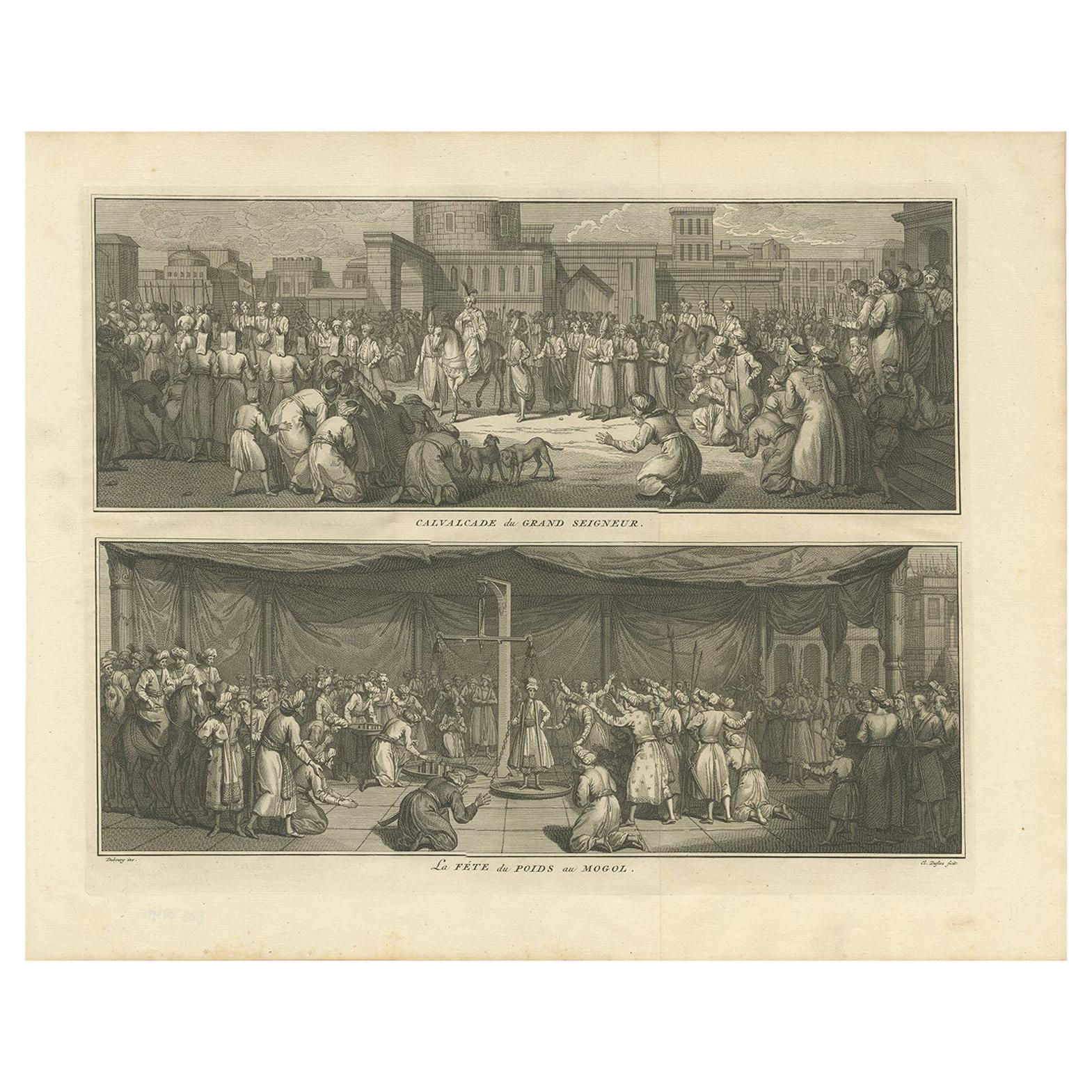
Calvalcade of the Great Lord & Celebration of Weights of the Mughal Empire, 1727
About the Item
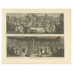
Antique print titled 'Calvalcade du Grand Seigneur' and 'La Féte du poids au Mogol'.
The upper image depicts the Calvalcade of the Great Lord, the lower image depicts The celebration of the weights of the Mughal Empire. This print originates from 'Naaukeurige beschryving der godtsdienst-plichten, kerk-zeden en gewoontens van alle volkeren der waereldt'.
Artists and engravers: Bernard Picart (1673-1733), a French painter and engraver.
- Dimensions:Height: 14.77 in (37.5 cm)Width: 18.51 in (47 cm)Depth: 0 in (0.02 mm)
- Materials and Techniques:
- Period:1720-1729
- Date of Manufacture:1727
- Condition:Wear consistent with age and use. Condition: Very good, stamp on verso. Please study image carefully.
- Seller Location:Langweer, NL
- Reference Number:
About the Seller
5.0
Platinum Seller
These expertly vetted sellers are 1stDibs' most experienced sellers and are rated highest by our customers.
Established in 2009
1stDibs seller since 2017
1,929 sales on 1stDibs
Typical response time: <1 hour
- ShippingRetrieving quote...Ships From: Langweer, Netherlands
- Return PolicyA return for this item may be initiated within 14 days of delivery.
More From This SellerView All
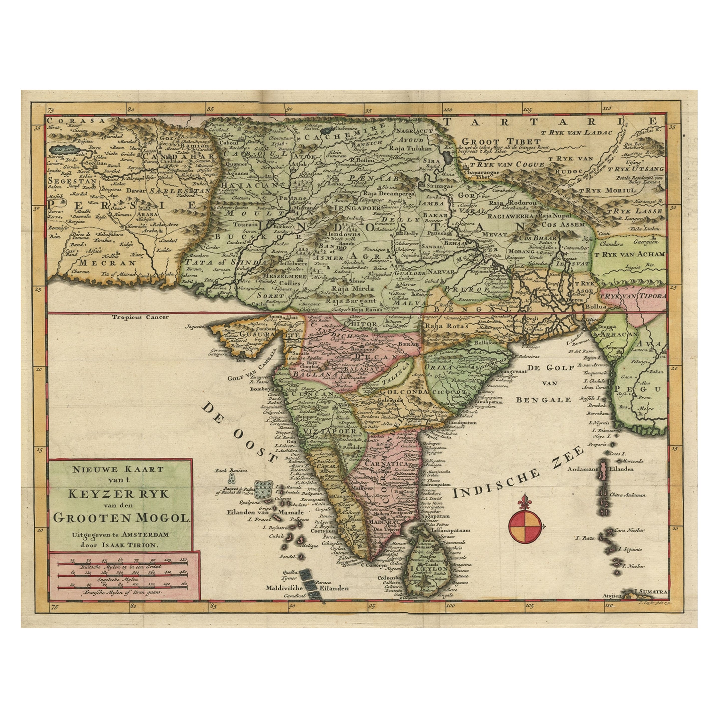
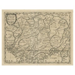
- Attractive Detailed Map of the Empire of the Great Mogul, Incl India, 1731Located in Langweer, NLAntique map titled 'Nieuwe Kaart van t Keyzer Ryk Grooten Mogol.' Attractive detailed map of the Empire of the Great Mogul, which included India, Sri Lanka, Pakistan and Banglade...Category
Antique 1730s Maps
MaterialsPaper
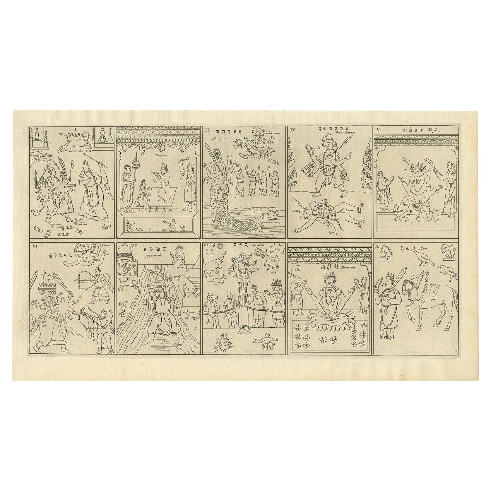
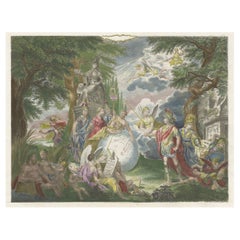
- Religious Antique Print of The Ten Divine Transformation, 1727Located in Langweer, NLDescription: Untitled print, ten images on one plate. This plate deals with the ten divine transformations according to Indian religion. This print originates from 'Naaukeurige b...Category
Antique 1720s Prints
MaterialsPaper
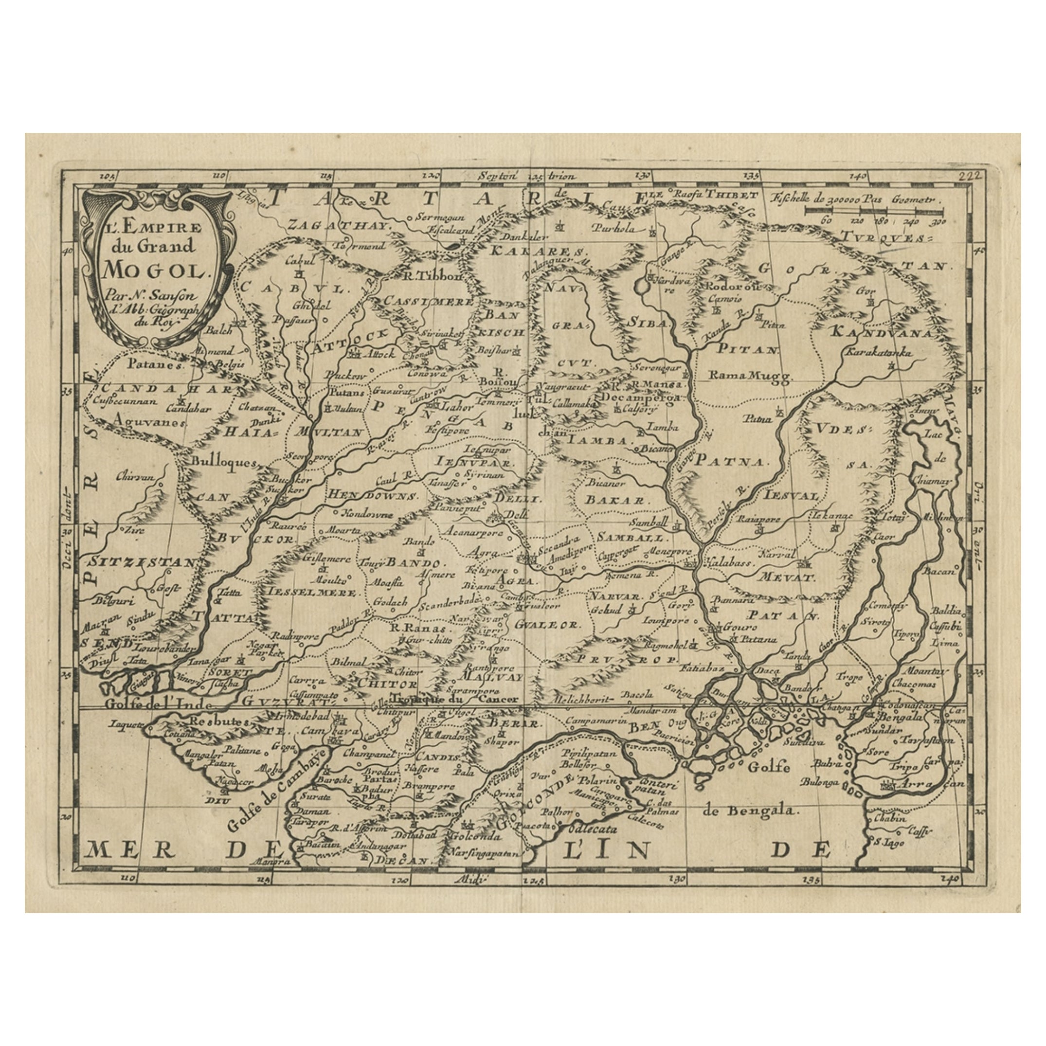
- Old Map of the Mughal Empire, Persia in the West to Lake Chimay etc., ca.1685Located in Langweer, NLAntique map titled 'L'Empire du Grand Mogol'. Old map of India and Central Asia. The map extends from Persia in the West to Lake Chimay and the Bay of Bengal...Category
Antique 1680s Maps
MaterialsPaper
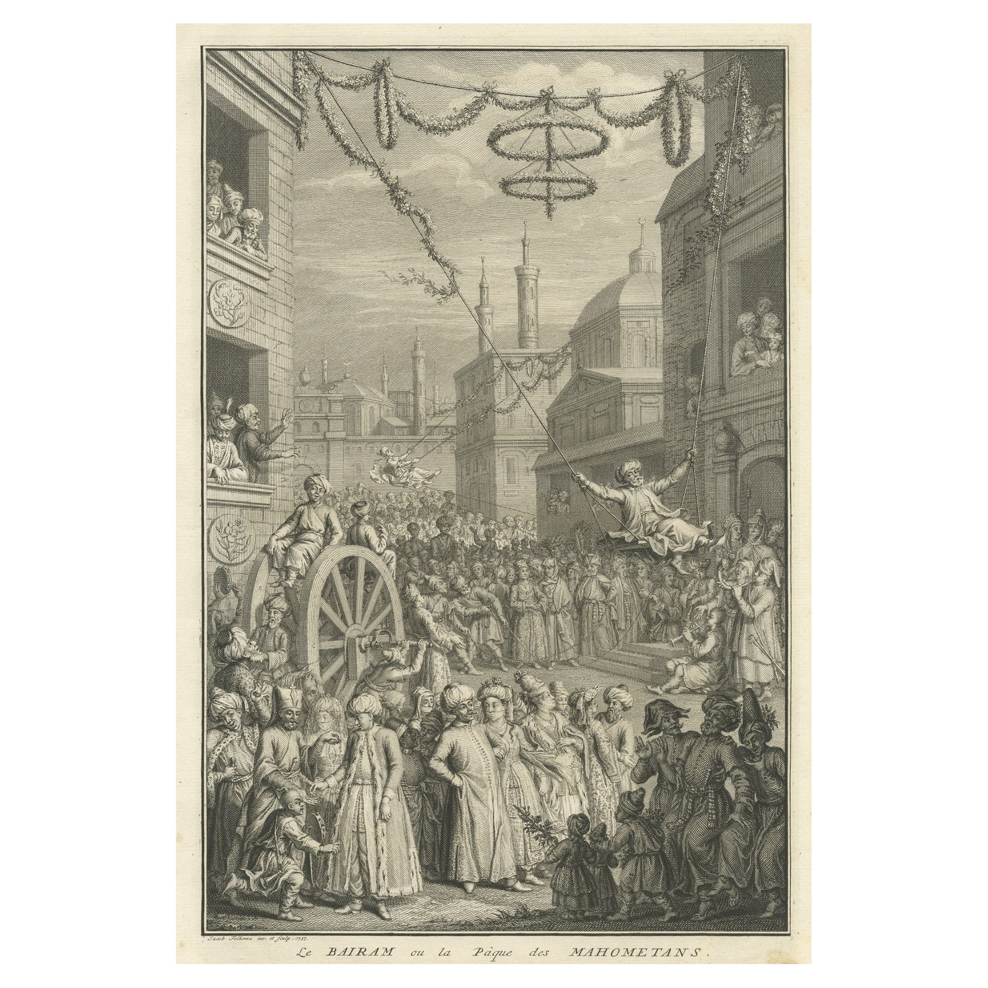
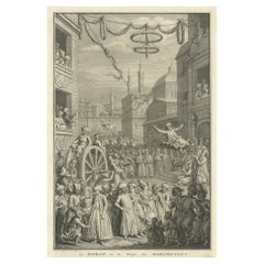
- Old Engraving of the Bairam Celebration, the Easter of the Muslims, 1737Located in Langweer, NLAntique print titled 'Le Bairam ou la Paque des Mahometans'. Old print of the Bairam celebration, the Easter of the Muslims. Originates from 'Ceremonies et coutumes Religieuses.....Category
Antique 1730s Prints
MaterialsPaper
- Antique Print of Religious Ceremonies by Picart, 1727By Bernard PicartLocated in Langweer, NLAntique print depicting depicts the Calvalcade of the Great Lord, the lower image depicts the celebration of the weights of the Mughal Empire. This print originates from 'Ceremonies ...Category
Antique Mid-18th Century French Prints
MaterialsPaper
- Engraving of Allegorical Celebrations of the British Victories in America, 1880Located in Langweer, NLAntique print, untitled. Wonderful allegorical antique hand colored engraving depicting the celebrations of the British victories in America at the conclusion of the French & Indian ...Category
Antique 1880s Maps
MaterialsPaper
You May Also Like
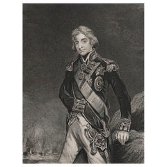
- Original Antique Print, Portrait of Lord Nelson, circa 1850Located in St Annes, LancashireGreat image of Lord Nelson Fine steel engraving by H.Robinson After J.Hoppner Published circa 1850 Unframed.Category
Antique 1850s English Prints
MaterialsPaper
- England, Scotland & Ireland: A Hand Colored Map of Great Britain by TirionBy Isaak TirionLocated in Alamo, CAThis is a hand-colored double page copperplate map of Great Britain entitled "Nieuwe Kaart van de Eilanden van Groot Brittannien Behelzende de Kon...Category
Antique Mid-18th Century Dutch Maps
MaterialsPaper
- Set of Twelve Colored Engravings of the Defeat of the Spanish Armada by J. PineLocated in Essex, MABy John Pine considered the foremost heraldic and decorative engraver of his generation. Depicting the defeat of the Spanish by the English Fleet in 1588. These are after a set of tapestries that hung in the House of Commons...Category
Antique 1740s English Prints
MaterialsPaper
- Map of the Republic of GenoaLocated in New York, NYFramed antique hand-coloured map of the Republic of Genoa including the duchies of Mantua, Modena, and Parma. Europe, late 18th century. Dimension: 25...Category
Antique Late 18th Century European Maps
- “The Restaurant of the House of Representatives” Engraving by Harper's WeeklyLocated in Colorado Springs, COThis original wood engraving is titled “The Restaurant of the House of Representatives, Washington, DC.” It was published as a double-page image, in the August 12, 1893 issue of the famous 19th century newspaper Harper’s Weekly. The print was illustrated by Charles Stanley Reinhardt. The House Restaurant, a unique part of life in the Capitol, has been in the same location since the 1857 Capitol Expansion. Congressional members’ busy work schedule made the availability of food on site a necessity. But the restaurant also served as an informal meeting spot for members to continue conversations and deal making. This 1893 print illustrates the convivial atmosphere. Details including elegantly dressed tables...Category
Antique 1890s American Prints
MaterialsPaper
- Vintage "View of the Center of Paris Taken from the Air" Lithograph MapLocated in San Diego, CAA very stylish "View of the Center of Paris Taken from the Air" lithograph map published by the Paris Ministry of Tourism, circa early 1950s. The piece measures 27" x 43" and shows...Category
20th Century French Mid-Century Modern Prints
MaterialsPaper


Recently Viewed
View AllMore Ways To Browse
La Fete
En Fete
Designer Tapestry
Jere Metal Wall Sculpture
Wall Mounted Head
Very Large Wall Sculptures
Set Of Display Cabinets
Art Deco Enamelled Metal
Kitchen Cabinet Handles Retro
Vintage Tall Cabinet With Doors
Kitchen Cabinet Regency
Oval 1920s
Canadian Dealers
Modern Glam
Pair Of Kitchen Shelves
Antique Gothic Door
Lacquer Cabinet With Glass Doors
Antique Gothic Doors