Early 18th Century Collectibles and Curiosities

to
255
333
48
382
20
13
2
2
1
1
4,376
6,575
13,270
2,711
3,491
4,590
3,013
515
314
588
736
463
892
864
892
656
567
306
50
27
14
13
111
25
24
20
16
382
382
382
11
10
3
2
2
Period: Early 18th Century
17th/18th Century Baroque Period Carved Polychrome Santo Altar Statue
Located in Forney, TX
A scarce Baroque period Spanish or Italian hand carved polychrome painted wood Santo sculpture with inset colored glass eyes, original white robe garb and later wood rosary. Intrica...
Category

European Baroque Antique Early 18th Century Collectibles and Curiosities

Materials

Gesso, Wood, Paint

An apothecary bronze mortar and pestle, Italy 1700.
Located in Milan, IT
Bronze Apothecary mortar, fitted with mortar pestle. Italy early 18th century.
Category

Italian Antique Early 18th Century Collectibles and Curiosities

Materials

Bronze

Rare Anthropological Diorama of Carib Indigenous by Hendrik Schouten
Located in Amsterdam, NL
Hendrik Samuel Schouten (1785-1840) A unique diorama depicting Carib Indigenous at the river side Wood, paint on paper, twigs and dried moss Measures: H. 51 x W. 69.5 x D. 20 cm Note: This is the only known diorama by Hendrik Schouten. He became a planter and inherited the Jagtlust plantation from his grandfather Samuel Loske. His older brother Gerrit Schouten...
Category

Antique Early 18th Century Collectibles and Curiosities

Materials

Paper, Paint, Giltwood, Wood, Twig

Crucifix on Calvary, Called Plague of Christ, France, Early 18th Century
Located in Milan, IT
Crucifix on Calvary, called 'Pestis Christi' or Crucifiix Pestis 'Plague of Christ' or Plague Crucifix). The sculpture is composite, made with heterogeneous materials: wax, wood, papier-mâché. The octagonal base is slightly raised and supports the calvary, symbolized by rocks, from which the crucifix rises, made with intentionally unfinished boards and with marked veins. The depicted Christ is peculiar: he shows scarified skin all over his body. Masterfully crafted in wax. They are the plagues of the plague that Christ, 'Agnus Dei' takes charge of with salvific value, for the salvation of the world. At his feet the ordeal full of symbols: evil (snake) with the apple, the 'Memento mori' of human bones...
Category

French Antique Early 18th Century Collectibles and Curiosities

Materials

Wood, Paper

1732 Henri Chatelain Map of the Holy Land Divided Among the Tribes of Israel
Located in Langweer, NL
Title: 1732 Henri Chatelain Map of the Holy Land Divided Among the Tribes of Israel This exquisite 18th-century map by Henri Chatelain, published in 1732, offers a detailed depict...
Category

Antique Early 18th Century Collectibles and Curiosities

Materials

Paper

Original Antique Engraving of a Greek Inscription, 1717
Located in Langweer, NL
Untitled print of a Greek inscription. Source unknown, to be determined.
Category

Antique Early 18th Century Collectibles and Curiosities

Materials

Paper

Diorama Showing Ten Gun Royal Navy Vessel "Entreprenante"
Located in Norwell, MA
Clear water diorama showing the Ten Gun Royal Navy Cutter, Entreprenante Circa 1790. The model is built to a scale of one sixteenth inch equals one foot. The vessel appears to be sai...
Category

English Antique Early 18th Century Collectibles and Curiosities

Materials

Wood

Original Antique Engraving of A Jewish Priest, 1709
Located in Langweer, NL
Antique print titled 'La Representation du Grand Pontise'. Old print depicting a Jewish Priest. This print originates from 'Introduction à l'écriture sainte, où l'on traite tout ...
Category

Antique Early 18th Century Collectibles and Curiosities

Materials

Paper

Louis XIII Walnut Miniature Armchair
Located in Essex, MA
With fine needlepoint upholstery and a nicely carved frame.
Category

French Louis XIII Antique Early 18th Century Collectibles and Curiosities

Materials

Walnut

Map of Choromandel & Malabar, Incl Kerala, Tamil Nadu & Part of Sri Lanka, 1726
Located in Langweer, NL
Antique map titled 'Nieuwe kaart van Choromandel ende Malabar.' Original antique map of Southern India documenting the VOC's areas of influence. Included is Kerala, Tamil Nadu...
Category

Antique Early 18th Century Collectibles and Curiosities

Materials

Paper

A GERMAN ANATOMICAL MODEL OF a PREGNANT WOMAN STEPHEN ZICK
Located in Madrid, ES
A GERMAN ANATOMICAL MODEL OF A PREGNANT WOMAN STEPHEN ZICK The woman with articulated arms, removable torso revealing internal organs, lying on a couch with cushion incised and modelled with simulated lace.On a later wood box. Stephen Zick was one of a dynasty of carvers active from the late 16th to the 18th century in Nuremberg, . Such models, as well as carved skulls, were conceived as teaching tools and were inspired by the drawings of Andrea Vesalius...
Category

Antique Early 18th Century Collectibles and Curiosities

Materials

Wood

Antique Map of the County of Burgundy by Johann Baptist Homann circa 1710
Located in Langweer, NL
Antique Map of the County of Burgundy by Johann Baptist Homann circa 1710 Hand-Colored This finely detailed antique map titled Comitatus Burgundia depicts the historic region of t...
Category

Antique Early 18th Century Collectibles and Curiosities

Materials

Paper

Tripod Apothecary Skillet Late 17th-Early 18th Century, England
Located in Brussels, Brussels
Apothecary tripod skillet from the end of the 17th century beginning of the 18th century From England. The skillet is in superb condition and has not undergone any restorations. Br...
Category

British Georgian Antique Early 18th Century Collectibles and Curiosities

Materials

Bronze

Germany and the Borders of Empire: Bodenehr’s Map of the Holy Roman World, 1710
Located in Langweer, NL
Title: Germany and Surrounding Realms by Gabriel Bodenehr, circa 1710 This striking copperplate engraving, titled "S. Imperium Romano-Germanicum, Teutschland mit Seinen Angräntzende...
Category

Antique Early 18th Century Collectibles and Curiosities

Materials

Paper

1705 Golfe de Mexico and Florida Framed Map
Located in Stamford, CT
Framed map of Mexico & Florida circa 1705, Paris. Small map with Mexico and the Gulf Coast. Inset text indicating Panama, Acapulco, Mexico City and the Mississippi. Extends North to ...
Category

French Spanish Colonial Antique Early 18th Century Collectibles and Curiosities

Materials

Glass, Wood, Paper

Antique Engraving of Majorinus, Bishop of Carthage of the Donatist Sect, 1701
Located in Langweer, NL
Antique print, titled: 'Majorinus Numida' Majorinus was a bishop of Carthage in dispute with Ceacilianus. He favored the so-called Donatist sect. Het died ca. 329 AD. The background to the controversy was the wave of persecutions of Christians by the Roman Emperor Diocletian. At that time some Church leaders - unwilling to endure torture or death and become martyrs - had been ready to take such acts as worshipping the gods of the old pantheon, considered idols by Christians, or surrendering church books and property to the imperial authorities. Such people became known as 'traditors' ("surrenderers"). One of these "traditors", named Caecilian, had returned to the fold of the Church once the persecutions ended, and was consecrated Bishop of Carthage and Primate of North Africa. Those of the faithful who refused to accept the authority of such a spiritual leader raised Majorinus as a rival bishop; however, Majorinus died shortly after being consecrated, and it fell to Donatus to take his place and continue the struggle. This rare print originates from: 'Historie der Kerken en Ketteren van den beginne des Nieuwen Testaments tot aan het Jaar onses Heeren 1688. Onzydig in 't Hoogduytsch beschreeven, door den Hoog-geleerden Heer Godfried Arnold, Voor deezen Hoog-Leeraar in de Historien tot Giesen. In het Neederduyts vertaald. Vercierd met verscheyde Koopere Plaaten door den Heer Romeyn de Hooghe.' (transl.: History of Churches and Heretics from the start of the New Testament until the year of our lord 1688 ...), by Godfried Arnold, Dutch edition published by Sebastiaan Petzold, Amsterdam 1701. This edition contains portraits of heretic figures, etched by the reknown Romeyn de Hooghe. Artists and Engravers: Made by 'Romeyn de Hooghe' after an anonymous artist. Gottfried Arnold (pseud. Christophorus Irenaeus) was an important representative of the so-called radical Pietism, publicist, church historian and chants writer (so he was believed to have written the well-known Church song 'O Durchbrecher aller Bande'). Arnold studied theology in Wittenberg. From the Lutheran Orthodoxy he converted, through writings of Spener, to Pietism, associating later into a circle around the court preacher Sprögel, who was influenced by Jakok Böhm. Many medieval mystics were later re-issued by him. In addition he was clearly influenced by Grotius and the early enlightenment. His quest for the 'true' Christianity rightly brought him in the early Church. So he arranged an edition containing the sermons of the desert father Macarius. Arnold was a skilled patristicus, although he did not escape from the creation of an ideal image of the Christian life in the early Church, in his view a flowering time which ended with the reign of Constantine. His first study of the early Church ('Die erste Liebe der Gemeinen Jesu Christi') provided him a professor position in Gießen, a post which he soon left, disappointed by what he called the 'Ruhmsachtige Vernunftwesen des akademischen Lebens'. He continued as an individual scientist and he published books and poems. His main work is 'Unparteiischen Kirchen- und Ketzerhistorie' (1699-1700), of which this is the Dutch translation. He adapts in this study the reformatory decay theory, where the censure lies no longer with Constantine, but the post-Apostolic time. The decay is temporarily lifted with the Reformation, but occurres again soon, so that even the contemporary institutional Protestantism lies under the fire of his criticism. On the other hand he favours the 'Church of the spirit' that existed in all times (invisible) and is characterised by avoiding the world and asceticism. Not the orthodoxy, but the subjectivity of religious man...
Category

Antique Early 18th Century Collectibles and Curiosities

Materials

Paper

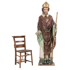
18thC Italian Oak & Polychrome Carved Bishop Statue
Located in Staffordshire, GB
Circa 1720 Large Early 18thC Italian Oak & Polychrome Carved Statue of a Bishop / Saint. Flat back with a secret panel which would have been used to hide gold. An exceptional exam...
Category

Italian Antique Early 18th Century Collectibles and Curiosities

Materials

Oak, Paint

1718 Holy Land Map - Twelve Tribes, Six Provinces, Hand-Colored, Antique Map
Located in Langweer, NL
Title: Terra Sancta in XII olim Tribus nunc VI Provincias Dispertita Cartographer: Christoph Weigel the Elder (1654–1725) Publisher: Johann Ernst Adelbulner Publication Locatio...
Category

Antique Early 18th Century Collectibles and Curiosities

Materials

Paper

18th Century Hand Colored Map of Spain and Portugal by Visscher
Located in Alamo, CA
This is an early 18th century map of Spain and Portugal, with attractive original hand-coloring, entitled "Hispaniae et Portugalliae Regna per Nicolaum Visscher cum Privilegio Ordinu...
Category

Dutch Antique Early 18th Century Collectibles and Curiosities

Materials

Paper

Original Normandy Map by Frederick de Wit, 1705, with Inset of Channel Islands
Located in Langweer, NL
Normandy Map by Frederick de Wit, 1705, with Inset of Channel Islands Description: This beautifully engraved and hand-colored map, titled Duché et Gouvernement General de Normandie,...
Category

Antique Early 18th Century Collectibles and Curiosities

Materials

Paper

Old Map of Ancient Assyria Divided into Syria, Mesopotamia, Babylonia & Assyria
Located in Langweer, NL
This map, "Assyria vetus diuisa in Syriam, Messopotamiam, Babyloniam, et Assyriam", by Pierre Mortier, is a late 17th-century depiction of the historical Middle East. Title: Ancie...
Category

Antique Early 18th Century Collectibles and Curiosities

Materials

Paper

Genuine Antique Engraved Map of Helvetia or Switzerland, 1729
Located in Langweer, NL
Decorative early 18th century engraved map of Switzerland. Title: Helvetia Conterminarumq terra rum antiqua. Translated from Latin: Switzerland is an ancient land Description: Switzerland, antique copperplate engraved map with hand coloring and a decorative title cartouche. Two figures greatly enhances visual appeal. Author: Phillip Cluver, or Philip Cluverius, Philipp Clüver, Latinized as Philippus Cluverius studied law in Leiden and settled over there in 1615. We only sell Guaranteed Absolutely Original authentic Maps and Prints. A Certificate of Authenticity ( COA ) will be supplied on request. We ship our antique maps and prints...
Category

Antique Early 18th Century Collectibles and Curiosities

Materials

Paper

1717 Johannes Van Keulen Sea Chart of the Eastern Atlantic - Amsterdam to Gambia
Located in Langweer, NL
1717 Johannes Van Keulen Sea Chart of the Eastern Atlantic - Amsterdam to Gambia This 1717 sea chart by Johannes Van Keulen, titled "Nieuwe Paskaert vande ...
Category

Antique Early 18th Century Collectibles and Curiosities

Materials

Paper

Old Antique Map of Borneo 'Kalimantan Indonesia, Sabah Malaysia & Brunei'
Located in Langweer, NL
Antique map titled 'Kaart van het Eyland Borneo'. Original antique map of the island of Borneo. Published 1724-1726 by Joannes van Braam and Gerard Onder de ...
Category

Antique Early 18th Century Collectibles and Curiosities

Materials

Paper

Map of Saint Helena Island: Early 18th-Century Copper Engraving by F. Bernard
Located in Langweer, NL
Map of Saint Helena Island: Early 18th-Century Copper Engraving by F. Bernard This rare and beautifully detailed copper engraving of Saint Helena Island dates from around 1722 and...
Category

Antique Early 18th Century Collectibles and Curiosities

Materials

Paper

1700 Guillaume Delisle Map: Western Mediterranean & Moorish North Africa
Located in Langweer, NL
1700 Guillaume Delisle Map: Western Mediterranean & Moorish North Africa This hand-colored map from 1700 by Guillaume Delisle, titled "In Notitiam Ecclesiasticam Africae Tabula Geographica," offers a detailed look at the regions under Moorish control during the later medieval period. It encompasses the northern African coast from Morocco to Libya, the Iberian Peninsula, and the western Mediterranean, including notable islands such as Sardinia, Corsica, Malta, the Balearics, and Sicily, where a smoking Mount Etna is depicted. The map is embellished with three decorative cartouches, adding artistic flair to the detailed geographical renderings. Engraved by Jean Baptiste Liebaux, the map measures 25.2 inches wide by 19.1 inches high. It features a sharp impression with contemporary outline color, later enhanced cartouches, and is printed on a bright sheet with a Society of Jesus watermark. The condition is very good, with an archivally repaired centerfold separation at the bottom and light toning along the edges. Keywords: - Guillaume Delisle map - Western Mediterranean historical map - Northern Africa map...
Category

Antique Early 18th Century Collectibles and Curiosities

Materials

Paper

1720 Maps of the Holy Land: Ancient and Modern by De Fer and Danet
Located in Langweer, NL
1720 Maps of the Holy Land: Ancient and Modern by De Fer and Danet This set of two 1720 maps, published by Nicolas de Fer and Danet in Paris, presents a unique juxtaposition of t...
Category

Antique Early 18th Century Collectibles and Curiosities

Materials

Paper

18th Century Carved And Painted Wooden Crucifix From France
Located in Haddonfield, NJ
An early 18th Century antique hand carved and polychromed hand painted table crucifix from France with its original patina preserved. This crucifix could possible date back as early ...
Category

French Baroque Antique Early 18th Century Collectibles and Curiosities

Materials

Fruitwood

18th-Century Map of Tyrol and Surrounding Regions by Johann Baptist Homann
Located in Langweer, NL
18th-Century Map of Tyrol and Surrounding Regions by Johann Baptist Homann Description: This striking 18th-century map by Johann Baptist Homann depicts the County of Tyrol (Tirol)...
Category

Antique Early 18th Century Collectibles and Curiosities

Materials

Paper

Old Map of Tartary with Persia, Siberia, the Mogul Territories & China, ca.1717
Located in Langweer, NL
Antique map titled 'A Map of Independent Tartary, containing the territories of Usbeck, Gasgar, Tibet, Lassa & c'. Old map depicting east of the Caspian Sea with parts of Persia, Siberia, the Mogul territories and on to western China...
Category

Antique Early 18th Century Collectibles and Curiosities

Materials

Paper

Original Antique Map of Egypt in Frame by C. Weigel, circa 1720
Located in Langweer, NL
The map is an antique depiction of ancient Egypt, divided into its regions and nomes, also including areas like Troglodytica, Marmarica, and Ethiopia above Egypt. Christophorus Weige...
Category

Antique Early 18th Century Collectibles and Curiosities

Materials

Paper

Antique Map of Lotharingia (Lorraine) by Danckerts, c. 1700 – Hand-Colored
Located in Langweer, NL
Antique Map of Lotharingia (Lorraine) by Theodorus Danckerts circa 1700 Hand-Colored This beautifully detailed antique map of Lotharingia, now the Lorraine region in northeastern ...
Category

Antique Early 18th Century Collectibles and Curiosities

Materials

Paper

Antique Map of the Location of the Garden of Eden and Travels of the Patriarchs
Located in Langweer, NL
Title: Map of the Location of the Garden of Eden and Travels of the Patriarchs Cartographer/Publisher: Pieter Mortier (1661–1711), published by Covens & Mortier (Amsterdam, 1725)...
Category

Antique Early 18th Century Collectibles and Curiosities

Materials

Paper

HOUSE OF LORDS. Remembrances for Order. 1712 - WITH THE GILT ARMS OF QUEEN ANNE
Located in Hillsborough, NJ
AUTHOR: HOUSE OF LORDS. TITLE: Remembrances for Order and decency to be kept in the Upper house of Parliament by the Lords, when His Majesty is not there. PUBLISHER: London, May 7...
Category

English Antique Early 18th Century Collectibles and Curiosities

Materials

Leather

Original Antique Bird's Eye View Plan of Hoorn, The Netherlands by Blaeu, c.1700
Located in Langweer, NL
Antique map titled 'Horna vulgo Hoorn'. Bird's eye view plan of Hoorn, The Netherlands. With title cartouche, coats of arms and key. From an atlas published by De Wit, ca. 1698-1...
Category

Antique Early 18th Century Collectibles and Curiosities

Materials

Paper

Antique Map of the North Sea and Dunkirk
Located in Langweer, NL
Untitled map of the North Sea, top left a large compass rose, bottom right Dunkirk (Duinkerke / Dunkerque), France. Part of a bundled collection of plans of battles and cities renown...
Category

Antique Early 18th Century Collectibles and Curiosities

Materials

Paper

Hibernia Regnum Map by Carel Allard, 1700: Hand-Colored Provinces of Ireland
Located in Langweer, NL
This is a historical map of Ireland created by Carel Allard around 1700, titled "Hibernia Regnum in Quatuor Provincias Ultoniam, Connaciam, Lageniam, et Momoniam". The map is hand-colored and engraved. It includes two large decorative cartouches. The map is part of an atlas by Carel Allard, an Amsterdam-based cartographer. Here are the detailed points about the map: Maker: Carel Allard - a prominent Dutch cartographer and publisher from Amsterdam. Atlas: Source Atlas - Likely part of an atlas published by Carel Allard, but specific title of the atlas isn't mentioned. Interesting Features 1. Decorative Cartouches: The map features two large, ornate cartouches. One in the upper left depicts a classical figure and British Royal arms...
Category

Antique Early 18th Century Collectibles and Curiosities

Materials

Paper

Original Antique Bird's Eye View of Banten or Bantam in Java, Indonesia, 1725
Located in Langweer, NL
Antique print titled 'La Ville de Bantam capitale du Roiaume de meme nom'. A bird's eye view of the city Banten or Bantam near the western end of Java in Indonesia. Several tall ...
Category

Antique Early 18th Century Collectibles and Curiosities

Materials

Paper

Antique Map of Java 'Indonesia' by Chatelain, 1719
Located in Langweer, NL
Antique map titled 'Carte de l'Ile de Java: Partie Occidentale, Partie Orientale, Dressee tout Nouvellement Sur Les Memoires Les Plus Exacts (..)'. This beautiful map of Java exists ...
Category

Antique Early 18th Century Collectibles and Curiosities

Materials

Paper

Extremely Rare Map of the East-Indies towards the South-East 'Indonesia', 1725
Located in Langweer, NL
Antique map titled 'La partie des Indes Orientales vers le Zud-Est, depuis Timor jusqu'a Midanao (...).' (The part of the East-Indies towards the South-East, from Timor to Mindanao.)...
Category

Antique Early 18th Century Collectibles and Curiosities

Materials

Paper

Antique Print of the Jewish Feast or Commemoration of the Passover, 1725
Located in Langweer, NL
Description: Antique print titled 'Het Pascha der Jooden'. Print of the Jewish Pesach / Passover. Pascha, Passover, Hebrew Pesa? or Pesach, in Judaism, holiday commemorating the ...
Category

Antique Early 18th Century Collectibles and Curiosities

Materials

Paper

Historical Map of the Black Sea and Surrounding Regions, 1705
Located in Langweer, NL
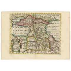
Title: "Map of Turcomania, Georgia, and Comania" This print presents an intricately detailed map of the Caucasus region, titled “Turcomania, Georgien Commanie,” by the esteemed cart...
Category

Antique Early 18th Century Collectibles and Curiosities

Materials

Paper

Imperii Persici Delineatio: A 1722 Cartographic Masterpiece of Persia by Schenk
Located in Langweer, NL
Title: IMPERII PERCICI delineatio ex scriptis potissimum geographicis Arabum et Persarum Cartographer: Petrus Schenk (Pieter Schenk), 1722 An original antique hand-colored engraved...
Category

Antique Early 18th Century Collectibles and Curiosities

Materials

Paper

View of the City Banten or Bantam Near the Western End of Java, Indonesia, c1725
Located in Langweer, NL
Antique print titled 'La Ville de Bantam capitale du Roiaume de meme nom'. A bird's eye view of the city Banten or Bantam near the western end of Java in Indonesia. Several tall ...
Category

Antique Early 18th Century Collectibles and Curiosities

Materials

Paper

Old Sea Chart of Northern Norway, also depicting Part of Lapland & Russia, 1702
Located in Langweer, NL
Antique map titled 'The Coast of Norway and Lapland, from North kyn to the River Kola'. Sea Chart of Northern Norway, also depicting part of Lapland and Russia. The map covers from the Kola river to what the map calls Fishers Island...
Category

Antique Early 18th Century Collectibles and Curiosities

Materials

Paper

Antique Map of the City of Ambon by Valentijn, 1726
Located in Langweer, NL
Antique map titled 'De Platte Grond van Amboina zoo als het was in den Jaare, 1718'. Antique map depicting the City of Ambon, Indonesia. This print originates from 'Oud en Nieuw Oost...
Category

Dutch Antique Early 18th Century Collectibles and Curiosities

Materials

Paper

Nice Antique Map of Asia Minor, Turkey, circa 1718
Located in Langweer, NL
Antique map titled 'Antiquae Asiae Minoris & C. Tabula' by Philippo Talbor. This rare antique map is published by Edward Wells, circa 1718.
Category

Antique Early 18th Century Collectibles and Curiosities

Materials

Paper

Rare Antique Copper Engraving of a Map of Pegu and Arakan, Burma (Myanmar), 1714
Located in Langweer, NL
Antique map Myanmar (Birma) titled 'Les Royaumes de Pegu et d'Aracan'. Rare map of Pegu and Arakan made after a map engraved by Pieter van den Keere and published in the 1628 edi...
Category

Antique Early 18th Century Collectibles and Curiosities

Materials

Paper

Antique Map of Manipa, Nusa-Laut, Saparua & Haruku 'Indonesia' by F. Valentijn
Located in Langweer, NL
Four maps of islands and two figures in native dress. The islands are: Manipa, Nusa-Laut (Noessa-Laoet), Saparua (Honimoa) and Haruku (Oma). These islands...
Category

Antique Early 18th Century Collectibles and Curiosities

Materials

Paper

Print of the Solemn Celebration Sapan Giacche in Pegu, Burma 'Myanmar', 1725
Located in Langweer, NL
Antique print, titled: 'Fete Solennelle de Pegu appelee Sapan Giacche' This plate shows the Solemn celebration called Sapan Giacche in Pegu or Bago, the capital of the Bago Regio...
Category

Antique Early 18th Century Collectibles and Curiosities

Materials

Paper

Antique French Map of Java, Indonesia by Chatelain, '1719'
Located in Langweer, NL
Antique map titled 'Carte de l'Ile de Java: Partie Occidentale, Partie Orientale, Dressee tout Nouvellement Sur Les Memoires Les Plus Exacts (..)'. This beautiful map of Java (Indone...
Category

Antique Early 18th Century Collectibles and Curiosities

Materials

Paper

Old Decorative Map of Austria, Centered on the Danube River and Vienna, Ca.1720
Located in Langweer, NL
Antique map titled 'Archiducatus Austriae inferioris (..).' Decorative map of Austria, centered on the course of the Danube River and Vienna. Shows the region from Enss and Steyr to ...
Category

Antique Early 18th Century Collectibles and Curiosities

Materials

Paper

Louis XVI Period Barometer
Located in Palm Beach, FL
Very charming carved and gilded acanthus leaf framed Louis XVI period wall barometer with glass covered central dial and glass thermostat beneath; bot...
Category

French Louis XVI Antique Early 18th Century Collectibles and Curiosities

Decorative Engraving of VOC Battle Ships Attacking Palembang in Sumatra, ca.1700
Located in Langweer, NL
Antique print titled 'La Ville de Palimbang dans L’Ile de Sumatra.' A very decorative, impressive engraving of Palembang in Sumatra. Two views on one sheet. In the upper part the...
Category

Antique Early 18th Century Collectibles and Curiosities

Materials

Paper

Detailed 18th-Century Map of Paris and Its Surrounding Regions by Johann Homann
Located in Langweer, NL
This map, titled “Agri Parisiensis Tabula particularis,” was created and published by the German cartographer Johann Baptist Homann (1664–1724), or his workshop, in Nuremberg. Homann...
Category

Antique Early 18th Century Collectibles and Curiosities

Materials

Paper

Antique Print of the Dutch VOC Bombing Palembang, Sumatra (Indonesia), ca.1700
Located in Langweer, NL
Antique print titled 'La Ville de Palimbang dans L’Ile de Sumatra.' A very decorative, impressive engraving of Palembang in Sumatra. Two views on one sheet. In the upper part the ove...
Category

Antique Early 18th Century Collectibles and Curiosities

Materials

Paper

Old Map of Persia, incl the Caspian Sea and Part of the Arabian Peninsula, 1726
Located in Langweer, NL
Antique map of Persia. It covers from the Gulf of Suez eastward to Ahmedabad (Amadabad) in modern day western India. This map, centered on Persia, includes the Caspian Sea and part of the Arabian...
Category

Antique Early 18th Century Collectibles and Curiosities

Materials

Paper

Late 18th Century Silver Dutch Perpetual Calender
Located in Lymington, Hampshire
A rare late 18th-early 19th century silver Dutch perpetual calendar.
Category

Dutch Antique Early 18th Century Collectibles and Curiosities

Materials

Silver

Read More

Medal-Worthy Memorabilia from Epic Past Olympic Games

Get into the games! These items celebrate the events, athletes, host countries and sporting spirit.

Ahoy! You’ve Never Seen a Collection of Sailor Art and Kitsch Quite Like This

French trendsetter and serial collector Daniel Rozensztroch tells us about his obsession with objects related to seafaring men.

Pamela Shamshiri Shares the Secrets behind Her First-Ever Book and Its Effortlessly Cool Interiors

The sought-after designer worked with the team at Hoffman Creative to produce a monograph that beautifully showcases some of Studio Shamshiri's most inspiring projects.

Moroccan Artworks and Objects Take Center Stage in an Extraordinary Villa in Tangier

Italian writer and collector Umberto Pasti opens the doors to his remarkable cave of wonders in North Africa.

Montecito Has Drawn Royalty and Celebrities, and These Homes Are Proof of Its Allure

Hollywood A-listers, ex-pat aristocrats and art collectors and style setters of all stripes appreciate the allure of the coastal California hamlet — much on our minds after recent winter floods.

Whaam! Blam! Pow! — a New Book on Pop Art Packs a Punch

Publishing house Assouline and writer Julie Belcove have teamed up to trace the history of the genre, from Roy Lichtenstein, Andy Warhol and Yayoi Kusama to Mickalene Thomas and Jeff Koons.

The Sparkling Legacy of Tiffany & Co. Explained, One Jewel at a Time

A gorgeous new book celebrates — and memorializes — the iconic jeweler’s rich heritage.

What Makes a Gem-Encrusted Chess Set Worth $4 Million?

The world’s most opulent chess set, weighing in at 513 carats, is literally fit for a king and queen.

Recently Viewed

View All