Late 18th Century Collectibles and Curiosities

to
325
454
123
584
45
24
19
10
10
4
2
1
1
1
1
1
4,465
6,707
13,457
2,701
3,496
4,683
3,084
510
299
604
746
484
901
883
905
661
591
387
133
88
34
32
254
84
76
64
39
584
584
584
3
2
1
1
1
Period: Late 18th Century
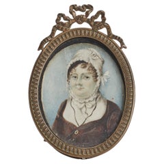
Ovale miniature painted on ivory, England end of XVIII century.
Located in Milan, IT
Oval miniature with brass gilt frame, painted watercolour on ivory, depicting a bust of a woman wearing a cap. England end of XVIII century. (SHIP TO EU ONLY)
Category

English Antique Late 18th Century Collectibles and Curiosities

Materials

Brass

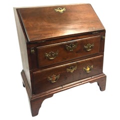
American Chippendale Rare Miniature Slant Front Desk w/ original Brasses c1780s
Located in Savannah, GA
This rare and important slant top desk is an exceptional example of a miniature piece of furniture. Bearing all the desirable features of a Chippendale, this desk has a dovetailed tw...
Category

American Chippendale Antique Late 18th Century Collectibles and Curiosities

Materials

Brass

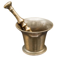
Antique Apothecary Mortar & Pestle, English, Bronze, Chemist Shop Aid, Georgian
Located in Hele, Devon, GB
This is an antique apothecary mortar and pestle. An English, bronze chemist's shop aid, dating to the Georgian period, circa 1800. Quality Georgian apothecary aid with superb finis...
Category

British Georgian Antique Late 18th Century Collectibles and Curiosities

Materials

Bronze

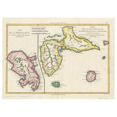
Map of Martinique, Guadeloupe, Marie-Galante, Désirade & Saintes by Bonne, 1788
Located in Langweer, NL
Map of Martinique, Guadeloupe, Marie-Galante, Désirade & Saintes by Bonne, 1788 This fine antique map, titled *Isle de la Martinique, Isles de la Guadeloupe, de Marie Galante, de la...
Category

French Antique Late 18th Century Collectibles and Curiosities

Materials

Paper

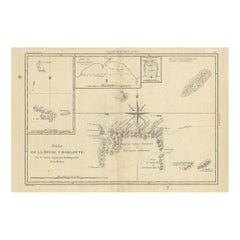
Antique Map of the Queen Charlotte Islands, Haida Gwaii
Located in Langweer, NL
Antique map titled 'Isles de la Reine Charlotte (..)'. Original old map of the Queen Charlotte Islands, based upon the explorations of James Cook, Juan Perez, and other contemporary European explorers. The map shows only partial coastal detail along the north end of the main island, and includes two insets of navigable bays and depth measurements. Now called Haida Gwaii, after the local native population, the islands situated off Canada’s coast, south of Vancouver played an important role in the late 18th and early 19th century maritime...
Category

Antique Late 18th Century Collectibles and Curiosities

Materials

Paper

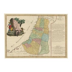
Original Rare Map of the Holy Land Showing the Twelve Tribes of Israel's, 1782
Located in Langweer, NL
Antique map titled 'Carte des Douze Tribus D'Israel (..).' Map of the Holy Land showing the twelve tribes of Israel's. Tribes are all named...
Category

Antique Late 18th Century Collectibles and Curiosities

Materials

Paper

Map of South America 1792 by Elwe – Hand-Colored Antique Dutch Engraving
Located in Langweer, NL
Map of South America 1792 by Elwe – Hand-Colored Antique Dutch Engraving This striking antique map of South America, titled "L'Amerique Meridionale," was published in 1792 by the Du...
Category

European Antique Late 18th Century Collectibles and Curiosities

Materials

Paper

Brazil Coastline Map – Broenner Carte du Bresil, 1772 Captaincies
Located in Langweer, NL
Carte du Bresil Map, Broenner Krefeld 1772 – Brazil Coastline Captaincies This is an engraved map titled Carte du Bresil Prem. Partie, published in Krefeld (Germany) by J.J. Broenne...
Category

French Antique Late 18th Century Collectibles and Curiosities

Materials

Paper

Captain Hood’s Gold and Hardstone Armorial Fob Seal
Located in Lymington, Hampshire
The openwork gold fluted pendent mount is channel set with an oval cornelian seal engraved with the coat of arms and crest of Hood with the arms of Periam in pretence for Captain Alexander Hood RN (1758-1798) who married Elizabeth Periam of Butleigh. English, circa 1790. Captain Hood (1758-1798) was a cousin of Samuel Hood, Viscount Hood, and of Alexander Hood, Viscount Bridport. His younger brother was Sir Samuel Hood who captained Zealous at the Battle of the Nile...
Category

English Antique Late 18th Century Collectibles and Curiosities

Materials

Gold

Batavia Market Scenes & Government House – Antique Prints VOC Period, c.1780
Located in Langweer, NL
Batavia Views – Government House and Market Scenes, circa 1780 This is an original late 18th-century engraving featuring two detailed views of Batavia (now Jakarta, Indonesia) under...
Category

Dutch Antique Late 18th Century Collectibles and Curiosities

Materials

Paper

Physical & Political Map of Switzerland: Late 18th Century - Mentelle Atlas
Located in Langweer, NL
Antique Map with Title: 'Carte Physique et Politique de la Suisse' **Publication Details:** - **Atlas Title:** Nouvel Atlas Universel de Géographie Ancienne et Moderne - **Purpose:...
Category

Antique Late 18th Century Collectibles and Curiosities

Materials

Paper

Compendio Historico De Los Arcabuceros De Madrid, Soler, Isidro, Madrid, 1795
By Isidro Soler
Located in Madrid, ES
Historical summary of the arcabuceros of Madrid ... Soler, Isidro (fl. circa 1795), Madrid, 1795. Original, leather binding. 86 pages perfect state of conservation. "Historical Comp...
Category

Spanish Neoclassical Antique Late 18th Century Collectibles and Curiosities

Materials

Other

Utrecht city plan
Located in UTRECHT, UT
“Platte grond der Stad Utrecht vertonende alle Gragten, Straaten, Stegen, Gangen, Markten, en plaatsen der openbare Gebouwen”, engraving published by Johannes van Schoonhoven in Amst...
Category

Dutch Other Antique Late 18th Century Collectibles and Curiosities

Materials

Paper

Antique Map of the Kingdom of Poland by Keizer & de Lat, 1788
Located in Langweer, NL
Antique map titled 't Koninkryk Polen (..)'. Uncommon original antique map of the Kingdom of Poland. This map originates from 'Nieuwe Natuur- Geschied- en Handelkundige Zak- en Reisa...
Category

Antique Late 18th Century Collectibles and Curiosities

Materials

Paper

Antique Map of the Philippines, Taiwan and Surroundings by Bonne '1780'
Located in Langweer, NL
Antique map titled 'Les Isles Philippines, celle de Formose, le Sud de la Chine, les Royaumes de Tunkin, de Cochinchine, de Cambode, de Siam des Laos, avec partie de Pegu et D'Ava'. ...
Category

Antique Late 18th Century Collectibles and Curiosities

Materials

Paper

Rare Antique Map of the Dutch East Indies 'Indonesia', 1774
Located in Langweer, NL
Rare decorative engraved map of the Dutch East Indies, or nowadays Indonesia. Title (in old Dutch): NIEUWE EN NAUKEURIGE KAART DER OOST-INDISCHE ...
Category

Antique Late 18th Century Collectibles and Curiosities

Materials

Paper

Antique Map of the Kingdom of Hungary and Transylvania, circa 1780
Located in Langweer, NL
Antique Map of the Kingdom of Hungary and Surrounding Regions by S. Robert, circa 1780 This beautifully engraved map titled Royaume de Hongrie, Principauté de Transilvanie, Esclavon...
Category

French Antique Late 18th Century Collectibles and Curiosities

Materials

Paper

Bonne Map of Philippines, Formosa, Siam, Indochina & South China, 1780
Located in Langweer, NL
Bonne Map of Philippines, Formosa, Siam, Indochina & South China, 1780 Les Isles Philippines, celle de Formose, le Sud de la Chine, les Royaumes de Tunkin, de Cochinchine, de Cambog...
Category

Antique Late 18th Century Collectibles and Curiosities

Materials

Paper

Historical Map of Northern Europe and Russia - Engraved for I. Harrison, 1788
Located in Langweer, NL
Historical Map of Northern Europe and Russia - Engraved for I. Harrison, 1788 This impressive historical map titled A New Map of Europe Containing Denmark, Norway, Sweden and Russ...
Category

Antique Late 18th Century Collectibles and Curiosities

Materials

Paper

The Valley of Inspruck: An 18th-Century Engraved Perspective, 1792
Located in Langweer, NL
Title: "The Valley of Inspruck: An 18th-Century Engraved Perspective" This elegant original antique engraving, titled "The Valley of Inspruck," showcases a serene view of the Innsbruck Valley. The artwork is delicately rendered, capturing the grandeur of the mountains and the pastoral tranquility of the valley. The print depicts a detailed landscape scene, replete with towering craggy peaks that loom over a peaceful settlement nestled in the valley. A striking feature is the contrast between the ruggedness of the natural environment and the cultivated lands and architecture, indicating a harmonious coexistence of humanity with nature. It was published as directed on January 1, 1792, by T & G Egerton of Whitehall for the author. Albanis Beaumont is credited with the original design ('Del.' for delineavit, indicating he drew the initial illustration), and Cornelis Apostool is noted for the engraving work ('Sculp.' for sculpsit, indicating he engraved the image). The publication of this print during the late 18th century aligns with a time when there was a heightened interest in natural beauty and the picturesque, reflected in the art and literature of the Romantic period. This print would have appealed to those with an appreciation for both the aesthetic and the sublime qualities of the European landscape. The publication by T & G Egerton, a reputable firm known for their work in the arts, and the involvement of a skilled artist and engraver like Beaumont and Apostool, respectively, underline the quality and desirability of the print. It is a piece that would attract collectors of fine engravings and admirers of European landscapes, offering a window into the aesthetic values and artistic endeavors of the late 18th century. As a historical piece, this print offers a view into the past, inviting contemplation of the rich cultural and natural heritage of the Innsbruck area. It is a valuable collectible for enthusiasts of antique maps and prints...
Category

Antique Late 18th Century Collectibles and Curiosities

Materials

Paper

Finest Detailed and Patina Antique Bronze Corpus of Christ for Wall Mounting
Located in Lisse, NL
Beautiful and meaningful religious art. If only the best quality and condition is good enough for you then this stunning and practical size corpus of Christ could be gracing your wall soon. Both the perfect anatomy and the amazing details in this antique corpus...
Category

Italian Renaissance Revival Antique Late 18th Century Collectibles and Curiosities

Materials

Bronze

Letter signed by the Count of Floridablanca – 1786
Located in Madrid, ES
Rare historical document: handwritten letter signed in 1786 by José Moñino y Redondo, better known as the Count of Floridablanca, a prominent 18th-century Spanish political figure an...
Category

Spanish Other Antique Late 18th Century Collectibles and Curiosities

Materials

Paper

18th Century French Oil on Canvas Painting "Sixth Station of the Cross"
Located in Dallas, TX
Decorate a wall with this colorful religious antique painting. Created in France, circa 1780, the artwork is set in the original frame and depicts the 6th station of the cross " Vero...
Category

French Antique Late 18th Century Collectibles and Curiosities

Materials

Canvas

Antique Map of the Brazilian Coast by A. Van Krevelt
Located in Langweer, NL
Uncommon edition of this accurate map of part of Brazil, from San Salvador till Rio de Janeiro and S.Paulo. In lower right engraved "29b." Originates from 'Atlas Portatif pour servir...
Category

Brazilian Antique Late 18th Century Collectibles and Curiosities

Materials

Paper

Antique George III Quality Mahogany Banjo Barometer
Located in Suffolk, GB
Antique George III quality mahogany banjo barometer having a swan neck pediment, original thermometer and an engraved circular silvered dial with original hands and brass bezel, qual...
Category

English George III Antique Late 18th Century Collectibles and Curiosities

Materials

Mahogany

Remarkable Antique Print of a Horse Drawn Float with Religious Figures, 1775
Located in Langweer, NL
Antique print of a horse drawn float with religious figures. Double page with joined sheets and original folding lines. This print originates fro...
Category

Antique Late 18th Century Collectibles and Curiosities

Materials

Paper

18th Century, Gilded, Bishop's Crest
Located in Los Angeles, CA
Relief carved, gessoed and 22-karat gold gilded, Italian bishop's crest featuring three bees amidst foliate scrolls, drapery swags, and tassles.
Category

Italian Antique Late 18th Century Collectibles and Curiosities

Materials

Gesso, Wood

18th Century French Carved Giltwood & Polychrome "Mother and Child" with Base
Located in Dallas, TX
Place this beautiful gilt statue with base in a living room or bedroom. Hand carved circa 1780, this elegant two-piece antique sculpture was found in a chapel in Southern France and ...
Category

French Baroque Antique Late 18th Century Collectibles and Curiosities

Materials

Giltwood

Finely Rendered English Victorian Brass Ornamental Cannon on Cast Iron Carriage
Located in San Francisco, CA
A finely rendered English Victorian brass ornamental signal cannon on cast iron carriage; with solid brass tilting barrel resting on a heavy weight carriage with working wheels; fine...
Category

English Victorian Antique Late 18th Century Collectibles and Curiosities

Bay of Saint Helena: French Naval Chart by N.B. Ingénieur de la Marine, ca.1770
Located in Langweer, NL
Bay of Saint Helena: French Naval Chart by N.B. Ingénieur de la Marine, 18th Century This meticulously detailed copper engraving, titled 'Carte de la Baye de Sainte Helene' (Map of the Bay of Saint Helena), was drawn by N.B., an engineer of the French Navy (*Ingénieur de la Marine*). The map was created based on the navigational observations of mariners and published in the 18th century, most likely in France. It offers a precise and practical representation of Saint Helena Bay, a crucial anchorage point in the South Atlantic Ocean. Saint Helena Bay, located on the island of Saint Helena, was an important stopover for ships sailing between Europe and Asia, particularly for Dutch and British vessels during the Age of Exploration and the later colonial period. Its significance was further heightened when the island became the final exile location of Napoleon Bonaparte from 1815 to 1821. The map shows the bay with impressive attention to detail, depicting the coastline with numerous soundings marked in French and English leagues (*Lieues Marines de France et d'Angleterre*), allowing navigators to gauge the water depth and avoid hazards. The bay’s natural topography, including hills and coastal elevations, is rendered in delicate engraving lines. A large central peak dominates the landscape, surrounded by rugged terrain, while a smaller inlet and river (*Riviere*) are also shown, highlighting the complex geography of the bay. A decorative fleur-de-lis compass rose marks the left side of the chart, indicating orientation and providing a clear sense of direction for mariners. The map's clean and elegant design reflects the French cartographic tradition of combining functional navigation aids with aesthetic appeal. The chart includes practical features such as scale indicators and coastal profiles that help sailors recognize the bay from a distance. The detailed soundings marked throughout the bay make this map an invaluable tool for understanding the navigational challenges of the area, particularly for large, heavily laden ships. This rare chart belongs to a series of marine maps...
Category

Antique Late 18th Century Collectibles and Curiosities

Materials

Paper

18th Century Spanish Colonial Carved Wood and Iron Stirrups
Located in Stamford, CT
Pair of late 18th early 19th century South American carved wooden stirrups. Known as estribos, each are carved from a solid block of wood. Decorated with wonderful carvings of horse heads and grape vines, these are truly charming pieces. With wrought iron stirrup rings and the original leather straps. Rich chocolate patina that only comes from age and use. Worn by Chilean huasos, highly skilled horsemen akin to America's cowboys. Prized by collectors of horse memorabilia...
Category

Chilean Spanish Colonial Antique Late 18th Century Collectibles and Curiosities

Materials

Wood

18th Century Italian Carved Giltwood Church Torchère Converted to Floor Lamp
Located in Frankfurt am Main, DE
Tall giltwood church torchère with deep foliate carvings, Italy late 18th century. This piece is finely hand carved in precise detail with deep foliate carvings decorated with acanth...
Category

Italian Louis XVI Antique Late 18th Century Collectibles and Curiosities

Materials

Silk, Giltwood

Antique Map of the Arabian Peninsula by Bonne 'c.1780'
Located in Langweer, NL
Antique map titled 'Carte de l'Arabie, du Golfe Persique, et de la Mer Rouge (..)'. Original antique map of the Arabian Peninsula, including the horn...
Category

Antique Late 18th Century Collectibles and Curiosities

Materials

Paper

Old Map of the UK & Ireland, Insets of Orkney, Shetland and Faroe Islands, 1786
Located in Langweer, NL
Title: "Les Isles Britanniques qui contiennent les Royaumes d'Angleterre, Escosse, et Irlande". Hand-colored engraved map with 2 (large) decorative cartouches, inset map of the Ork...
Category

Antique Late 18th Century Collectibles and Curiosities

Materials

Paper

Antique Map of the British Isles According to the Geography of the Roman Empire
Located in Langweer, NL
Antique map titled 'Insulae Britannicae'. Interesting map of Britain, Scotland, and Ireland. It shows a rudimentary outline of the islands according to the geography of the Roman Emp...
Category

Antique Late 18th Century Collectibles and Curiosities

Materials

Paper

Old Map of the Great Lakes and Upper Mississippi Valley, Northern America, c1780
Located in Langweer, NL
Antique map titled 'Partie Occidentale du Canada'. A fine example of Rigobert Bonne and Guilleme Raynal's 1780 map of the Great Lakes and upper Mississippi Valley. A map of c...
Category

Antique Late 18th Century Collectibles and Curiosities

Materials

Paper

Antique Somerset Map, Thomas Kitchin, English, Cartographic Reference, Georgian
Located in Hele, Devon, GB
This is a fine antique Somerset map. An 18th century English cartographic county reference engraving by Thomas Kitchin (1718–1784), dating to the Georgian period, circa 1780. A beaut...
Category

British Georgian Antique Late 18th Century Collectibles and Curiosities

Materials

Glass, Paper

Rare Engraving of New Caledonia & New Hebrides from Capt. Cook's Travels, 1777
Located in Langweer, NL
Antique map titled 'Chart of Discoveries made in the South Pacific Ocean'. Rare engraving from the official British Admiralty sanctioned edition of the accounts of Cook’s second voyage. All other later copies made of this image by other publishers were unauthorised, usually smaller and inferior in quality. Made after Cook's discovery of the island group on 4 September 1774, which he named New Caledonia...
Category

Antique Late 18th Century Collectibles and Curiosities

Materials

Paper

18th Century Gold French Gilded Wood Barometer, Antique Parisian Thermometer
Located in West Palm Beach, FL
A rare antique finely worked French barometer with lyre shaped crest thermometer above a large hexagonal framed barometer. The Parisian décor piece is m...
Category

French Empire Antique Late 18th Century Collectibles and Curiosities

Materials

Giltwood

Old Engraving of French Visiting Tomari, a Village in Far East Russia, 1797
Located in Langweer, NL
Plate: 'Costumes des Habitants de la Baie de Langle.' (Costumes of the inhabitants of Langle Bay, Russia). Tomari (Russian: ??????) is a coastal town and the administrative cente...
Category

Antique Late 18th Century Collectibles and Curiosities

Materials

Paper

Original Hand-Colored Antique Map of Africa by Elwe '1792'
Located in Langweer, NL
Antique map titled 'l'Afrique Divisée en ses Empires, Royaumes, et Etats'. Decorative large map of Africa. The cartography is typical for the 17th century with the Nile originating i...
Category

Antique Late 18th Century Collectibles and Curiosities

Materials

Paper

Interesting Original Antique Hemisphere Map Showing the Latest Discoveries
Located in Langweer, NL
Antique world map titled 'A Map of the World from the best Authorities'. Detailed map of the World, showing tracks of Captain James Cook in his 3 voyages in great detail. The map is ...
Category

Antique Late 18th Century Collectibles and Curiosities

Materials

Paper

Decorative Map of the French Regions of Picardy, Artois & French Flanders, c1780
Located in Langweer, NL
Antique map titled 'Carte des Gouvernements de Flandre Francoise, d'Artois, de Picardie et du Boulenois.' An attractive example of Rigobert Bonne's 1771 decorative map of the Fre...
Category

Antique Late 18th Century Collectibles and Curiosities

Materials

Paper

Occasus Ortus: An Astronomical Measuring Device for Angular Precision, c.1780
Located in Langweer, NL
This print, titled "Occasus Ortus", showcases a highly detailed engraving of an 18th-century measuring device, likely related to astronomy or navigation. The design features various components of the instrument arranged systematically, with each part labeled by figure numbers. The centerpiece is a large circular protractor...
Category

European Antique Late 18th Century Collectibles and Curiosities

Materials

Paper

Antique Map of the Malacca and Bangka Strait by De Mannevillette '1775'
Located in Langweer, NL
Antique map titled 'Carte de la Partie Comprise entre la Sortie du Detroit de Malac Le Detroit de Banca et L’Isle Borneo'. Chart of the Strait of Malacca and Bangka Strait. It shows ...
Category

Antique Late 18th Century Collectibles and Curiosities

Materials

Paper

Admiral Viscount Bridport’s Gold and Hardstone Armorial Swivel Fob Seal
Located in Lymington, Hampshire
The openwork gold pendent mount supports a three sided faceted quartz, each side seal engraved respectively with the crest of Hood within the motto ‘Tria Juncta in Uno for the Order ...
Category

English Antique Late 18th Century Collectibles and Curiosities

Materials

Quartz, Gold

"Green Frog Service" - Book about an Imperial Russian Dinner Service
Located in North Yorkshire, GB
This is number 111 from the limited edition of 1,000 copies. The first 25 are special leather bound copies, a further 25 were for collaborators on the publication, the next 350 were reserved for subscribers and 650 were for general sale. Therefore we know that this was one of the subscribers copies. With green cloth covers in a green slipcase with an embossed frog motif to the front. 424 pages with over 350 large detailed illustrations, 60 color plates and more than 1000 reference illustrations. This magnificent dinner and dessert service was the crowning achievement of the great English potter Josiah Wedgwood who made it between 1773-1774 as a commission from the Empress Catherine...
Category

Antique Late 18th Century Collectibles and Curiosities

Materials

Paper

Europe Divided into Principal States by Jean Denis Janvier, Paris, 1782
Located in Langweer, NL
This is a historical map of Europe titled "L'Europe divisee en ses Principaux Etats," created by Jean Denis Janvier in 1782. This beautiful map depicts the political boundaries and...
Category

Antique Late 18th Century Collectibles and Curiosities

Materials

Paper

Old Map of the Kingdom of Tonga, Also Known as the Friendly Islands, ca.1780
Located in Langweer, NL
Antique print, titled: 'Carte des Isles des Amis.' Map of the Kingdom of Tonga, also known as the Friendly Islands, and one of the last hereditary monarchies. Cook named this gro...
Category

Antique Late 18th Century Collectibles and Curiosities

Materials

Paper

Antique Map of the Russian Empire by R. Bonne, 1780
Located in Langweer, NL
Antique map titled 'Carte de l'Empire de Russie.' Drawn by R. Bonne for G. Raynal’s Atlas de Toutes les Parties Connues du Globe Terrestre, Dressé pour l'Histoire Philosophique et Po...
Category

French Antique Late 18th Century Collectibles and Curiosities

Materials

Paper

View of the Exchange and the Warehouses at Petersburg in Russia, ca.1790
Located in Langweer, NL
Description: antique print titled 'A view of the Exchange and the Warehouses at Petersburg in Russia / Vüe de la Bourse & du Magazin de Marchandises a Petersburg Russe'. Beautiful engraving of the Stock and Warehouses of St. Petersburg, Russia. Artists and Engravers: Robert Sayer...
Category

Antique Late 18th Century Collectibles and Curiosities

Materials

Paper

Engraving Print from the Panckoucke Encyclopédie Nautical Subject 1782-1832
Located in Milan, IT
Print by engraving on copper plate from the Panckoucke Encyclopédie méthodique, end of the 18th century, volume Marine Planches (more than 1,500 figures dealing with all subjects on ...
Category

French Antique Late 18th Century Collectibles and Curiosities

Materials

Paper

Good 18th Century Bronze Sundial By Miller And Adie, Edinburgh
Located in Lincolnshire, GB
A finely engraved 18th century, 15" diameter bronze sundial signed Miller & Adie, Edinburgh with good patina and the original gnomon.
Category

Scottish Antique Late 18th Century Collectibles and Curiosities

Materials

Bronze

Map of Europe Highlighting Ancient and Modern Geographical Divisions (1794)
Located in Langweer, NL
Map of Europe Highlighting Ancient and Modern Geographical Divisions (1794). Germany, France, Italy, Spain, and the British Isles – Map by D’Anville (1794). This detailed 18th-cent...
Category

Antique Late 18th Century Collectibles and Curiosities

Materials

Paper

Early Chart Identifying British Spice Trading Colony of Bencoolen, Sumatra, 1797
Located in Langweer, NL
Antique map titled 'A Chart of the West Coast of Sumatra'. Early nautical chart identifying the British spice trading colony of Bencoolen and F...
Category

Antique Late 18th Century Collectibles and Curiosities

Materials

Paper

Scarce Antique Map of the Island of Java, Indonesia
Located in Langweer, NL
Title: "Kaart van 't Eyland Groot Java: Antique Map of Java, Indonesia" Description: This antique map, titled "Kaart van 't Eyland Groot Java," offers a rare and valuable depiction ...
Category

Antique Late 18th Century Collectibles and Curiosities

Materials

Paper

Antique Map of the Santa Cruz Islands with Inset of Carteret and Gower Islands
Located in Langweer, NL
Antique map titled 'Isles de la Reine Charlotte (..)'. A detailed chart of the Santa Cruz islands, to the north of the New Hebrides, with Carteret's track in "Swallow"; including an ...
Category

Antique Late 18th Century Collectibles and Curiosities

Materials

Paper

Pair French Miniature Portraits Of Commander Jean-baptiste Raymond De Lacrosse
Located in Bilzen, BE
A Pair of Napoleonic Portrait Miniatures Commander of Jean-Baptiste Raymond de Lacrosse Jean-Baptiste Raymond de Lacrosse (1760-1829) Career Joined the French Navy in the 1780sPartic...
Category

French Empire Antique Late 18th Century Collectibles and Curiosities

Materials

Wood

Original Antique Engraved Map of the Russian Empire, 1778
Located in Langweer, NL
Description: Antique map titled 'A New and Correct Map of the Russian Empire'. Original antique map of the Russian Empire. This map originates from Moore's 'New and Complete Coll...
Category

Antique Late 18th Century Collectibles and Curiosities

Materials

Paper

Rare Map of the Philippines; Joseph Freewills Island & Mindanao South End, 1773
Located in Langweer, NL
Three charts on one sheet titled '1) A Dangerous Shoal 2) Joseph Freewills Island 3) The South End of Mindanao'. It shows Captain Carteret's voyage: Saint George's Channel to Min...
Category

Antique Late 18th Century Collectibles and Curiosities

Materials

Paper

Read More

Medal-Worthy Memorabilia from Epic Past Olympic Games

Get into the games! These items celebrate the events, athletes, host countries and sporting spirit.

Ahoy! You’ve Never Seen a Collection of Sailor Art and Kitsch Quite Like This

French trendsetter and serial collector Daniel Rozensztroch tells us about his obsession with objects related to seafaring men.

Pamela Shamshiri Shares the Secrets behind Her First-Ever Book and Its Effortlessly Cool Interiors

The sought-after designer worked with the team at Hoffman Creative to produce a monograph that beautifully showcases some of Studio Shamshiri's most inspiring projects.

Moroccan Artworks and Objects Take Center Stage in an Extraordinary Villa in Tangier

Italian writer and collector Umberto Pasti opens the doors to his remarkable cave of wonders in North Africa.

Montecito Has Drawn Royalty and Celebrities, and These Homes Are Proof of Its Allure

Hollywood A-listers, ex-pat aristocrats and art collectors and style setters of all stripes appreciate the allure of the coastal California hamlet — much on our minds after recent winter floods.

Whaam! Blam! Pow! — a New Book on Pop Art Packs a Punch

Publishing house Assouline and writer Julie Belcove have teamed up to trace the history of the genre, from Roy Lichtenstein, Andy Warhol and Yayoi Kusama to Mickalene Thomas and Jeff Koons.

The Sparkling Legacy of Tiffany & Co. Explained, One Jewel at a Time

A gorgeous new book celebrates — and memorializes — the iconic jeweler’s rich heritage.

What Makes a Gem-Encrusted Chess Set Worth $4 Million?

The world’s most opulent chess set, weighing in at 513 carats, is literally fit for a king and queen.
Recently Viewed

View All