Late 18th Century Collectibles and Curiosities

to
324
448
121
576
44
24
23
12
10
3
2
2
1
1
1
4,371
6,576
13,270
2,710
3,496
4,589
3,008
518
314
589
736
463
893
863
890
653
566
380
132
87
34
33
233
80
62
59
38
576
576
576
3
2
1
1
1
Period: Late 18th Century
Old Map of Indonesian Islands Borneo, Celebes, New Guinea & New Britain, 1792
Located in Langweer, NL
Antique map titled 'Partie de la Nouvelle Grande Carte des Indes Orientales, contenant les Isles de Borneo, Iava, Celebes, Mindanao (..)'. Detailed map of the Indonesian islands Bo...
Category

Antique Late 18th Century Collectibles and Curiosities

Materials

Paper

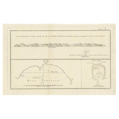
Old Sea Charts of Tourane Bay & the Con Dao Islands 'Pulo Condor', Vietnam, 1780
Located in Langweer, NL
Description: Two maps on one sheet titled 'Carte d'une partie de la Cote de Cochinchine [and] Plan de l'Isle Condor'. Sea charts of the coast of Vietnam around the Tourane Bay an...
Category

Antique Late 18th Century Collectibles and Curiosities

Materials

Paper

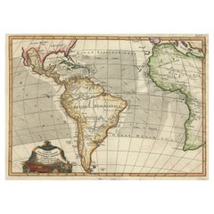
Antique Map of South America by Keizer & de Lat, 1788
Located in Langweer, NL
Antique map titled 'Kaartje van het Zuider-Deel van America'. Uncommon original antique map of South America. This map originates from 'Nieuwe Natuur- Geschied- en Handelkundige Zak-...
Category

Antique Late 18th Century Collectibles and Curiosities

Materials

Paper

Antique Map of The Bay of D'Estaing located on the Russian island Sakhalin, 1798
Located in Langweer, NL
Antique map titled 'Plan of La Baie d'Estaing'. This map shows the bay of D'Estaing located on the Russian island of Sakhalin. La Perouse was selected b...
Category

Antique Late 18th Century Collectibles and Curiosities

Materials

Paper

Large Antique Sea Chart of the South-Eastern Coast of Sumatra, Indonesia
Located in Langweer, NL
Antique map titled 'Carte pour aller du Détroit de la Sonde ou de Batavia, au Détroit de Banca'. This uncommon sea chart shows northern Java and eastern Sumatra along with an inset of the small islands in the Detroit Sound. The handsome chart provides detailed navigational information, including the route of Julien Crozet in April 1772, who led a French expedition to the South Pacific after the voyage's commander, Marion De Fresne, and 26 crew members were killed (and allegedly eaten) by a Maori tribe in the Bay of Islands off the coast of New Zealand. With title upper left corner and small inset map of the small isles nearby the south-eastern coast of Sumatra. J. B. d'Apres de Mannevillette, from his atlas "Neptune orientale". French sailor...
Category

Antique Late 18th Century Collectibles and Curiosities

Materials

Paper

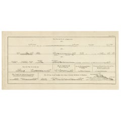
Antique Map of the Admiralty Islands, Bismarck Archipelago
Located in Langweer, NL
Antique map titled 'Trois Vues des Isles de l'Amirauté'. Several coastal views of the Admiralty Islands, Bismarck Archipelago, to the north of New Guinea in the South Pacific Ocean. ...
Category

Antique Late 18th Century Collectibles and Curiosities

Materials

Paper

Antique Map of the Mediterranean Sea and Surroundings by Keizer & de Lat, 1788
Located in Langweer, NL
Antique map titled 't Wester Deel van de Middelandse Zee (..)'. Uncommon original antique map of the Mediterranean Sea and surroundings. This map originates from 'Nieuwe Natuur- Gesc...
Category

Antique Late 18th Century Collectibles and Curiosities

Materials

Paper

Antique Map of Italy by Keizer & de Lat, 1788
Located in Langweer, NL
Antique map titled 'Kaart van Italie (..)'. Uncommon original antique map of Italy. This map originates from 'Nieuwe Natuur- Geschied- en Handelk...
Category

Antique Late 18th Century Collectibles and Curiosities

Materials

Paper

1797 Tardieu Map of Southeast Asia: The Malay Archipelago and Beyond
Located in Langweer, NL
An original historical map titled 'Presqu' Île Au Dela Du Gange et Archipel De L'Inde', created by Pierre Francois Tardieu and published in the "Atlas Universel" by Pierre Grégoire C...
Category

Antique Late 18th Century Collectibles and Curiosities

Materials

Paper

Antique Map of the Eastern Mediterranean and the Balkans
Located in Langweer, NL
Antique map titled 'La Turquie d'Europe et celle d'Asie'. Attractive double page map of the Eastern Mediterranean and the Balkans by R. Bonne. Originates from 'Atlas de Toutes les Pa...
Category

Antique Late 18th Century Collectibles and Curiosities

Materials

Paper

Antique Map of the Islands Within the Queen Charlotte's Islands
Located in Langweer, NL
Antique map titled 'Cote Septentrional de la plus grande des Isles de la Reine Charlotte (..)'. Map and coastal view of the islands within the Queen Charlotte's Islands (Santa Cruz I...
Category

Antique Late 18th Century Collectibles and Curiosities

Materials

Paper

Original Copper Engraved Map of France
Located in Langweer, NL
Antique map titled 'New and Accurate Map of France from the latest improvements'. Original copper engraved map of France. Engraved by T. Bowen, published circa 1771.
Category

Antique Late 18th Century Collectibles and Curiosities

Materials

Paper

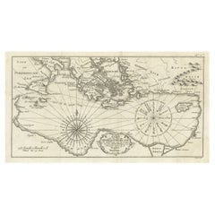
Map of the West African coast from the North of Mauretania to Guinee, 1788
Located in Langweer, NL
Antique map titled 'Particular Map of the Western Coast of Africa, from Cape Blanco to Cape de Verga, and of the Course of the Rivers Senega and Gambia.' Map of the African coast...
Category

Antique Late 18th Century Collectibles and Curiosities

Materials

Paper

Antique Map of of Bengal and the mouth of the Ganges River
Located in Langweer, NL
Antique map titled 'Carte du Bengale, avec la partie Septentrionale (..)'. Original antique map of Bengal and the mouth of the Ganges river. This map ori...
Category

Antique Late 18th Century Collectibles and Curiosities

Materials

Paper

Old Engraving of French Visiting Tomari, a Village in Far East Russia, 1797
Located in Langweer, NL
Plate: 'Costumes des Habitants de la Baie de Langle.' (Costumes of the inhabitants of Langle Bay, Russia). Tomari (Russian: ??????) is a coastal town and the administrative cente...
Category

Antique Late 18th Century Collectibles and Curiosities

Materials

Paper

Detailed Original Antique Map of the Turkish Empire with Arabia, 1778
Located in Langweer, NL
Title: Etats Due Grand-Seigneur En Asie, Empire De Perse, Pays Des Usbecs, Arabie et Egypte . . . 1753 Detailed map of the Turkish Empire, extending to the Black Sea, Georgia, the...
Category

Antique Late 18th Century Collectibles and Curiosities

Materials

Paper

Antique Map of Africa with Mountain Ranges and other details
Located in Langweer, NL
Antique map titled 'Carte générale et Politique de l'Afrique'. Original antique map of Africa. Highlights numerous mountain ranges, lakes and rivers, regions, countries and places. P...
Category

Antique Late 18th Century Collectibles and Curiosities

Materials

Paper

Original and Colourful Map of Northern India with Surrounding Regions, 1783
Located in Langweer, NL
Antique map titled 'Indes'. A map of Northern India with surrounding regions. From Lattre's 'Atlas moderne ou collection de cartes sur toutes les parties du globe terrestre...
Category

Antique Late 18th Century Collectibles and Curiosities

Materials

Paper

Antique Map of the World with Polar Projections by Keizer & de Lat, 1788
Located in Langweer, NL
Antique map titled 'Schuine Ronde Aard-Klooten (..)'. Interesting double hemisphere world map with polar projections. In North America, there is a...
Category

Antique Late 18th Century Collectibles and Curiosities

Materials

Paper

18th Century French Louis XVI Giltwood Barometer
Located in Sheffield, MA
A stunningly beautiful 18th century French gold gilt barometer is a weather instrument with mercury-filled glass thermometer still in working order...
Category

French Louis XVI Antique Late 18th Century Collectibles and Curiosities

Materials

Wood

Antique Map of the Russian Empire in Europe, ca.1780
Located in Langweer, NL
Description: Antique map titled 'Bowles's New Pocket Map of the Russian Empire in Europe, Comprehending the West Part of the Empire in Asia' Large and detai...
Category

Antique Late 18th Century Collectibles and Curiosities

Materials

Paper

Scarce Antique Map of the Island of Java, Indonesia
Located in Langweer, NL
Title: "Kaart van 't Eyland Groot Java: Antique Map of Java, Indonesia" Description: This antique map, titled "Kaart van 't Eyland Groot Java," offers a rare and valuable depiction ...
Category

Antique Late 18th Century Collectibles and Curiosities

Materials

Paper

Large Religious Mezzotint Print of Batsheba Bringing Abishag to David, 1779
Located in Langweer, NL
Description: Antique print titled 'Batsheba bringing Abishag to David'. Large mezzotint depicting David, naked to the waist and sitting up in a luxurious bed, holding up his right ha...
Category

Antique Late 18th Century Collectibles and Curiosities

Materials

Paper

Old Dutch Map of the City of Carthage and the Bay of Carthage, 1773
Located in Langweer, NL
Antique print titled 'Kaart van de Legging van het Oude Karthago'. Old map of the city of Carthage and the Bay of Carthage. It was the center or capital city of the ancient Carthagin...
Category

Antique Late 18th Century Collectibles and Curiosities

Materials

Paper

Antique Print with Views of Sir Charles Saunders Island and Other Islands, 1774
Located in Langweer, NL
Explore the captivating world of the 18th century with this exquisite antique print titled 'Isles de Sir Charles Saunder Latitude (...)'. I A journey through time as you delve into t...
Category

Antique Late 18th Century Collectibles and Curiosities

Materials

Paper

Antique Map of part of Central and Southern Asia
Located in Langweer, NL
Antique map titled 'Carte de la Partie Superieure de l'Inde en deca du Gange. Comprise entre la Cote du Concan et celle d'Orixa, avec l'Empire du Mogol, le Bengale, le R. d'Asham, pa...
Category

Antique Late 18th Century Collectibles and Curiosities

Materials

Paper

View of the Exchange and the Warehouses at Petersburg in Russia, ca.1790
Located in Langweer, NL
Description: antique print titled 'A view of the Exchange and the Warehouses at Petersburg in Russia / Vüe de la Bourse & du Magazin de Marchandises a Petersburg Russe'. Beautiful engraving of the Stock and Warehouses of St. Petersburg, Russia. Artists and Engravers: Robert Sayer...
Category

Antique Late 18th Century Collectibles and Curiosities

Materials

Paper

Large Antique Map of the Kingdom of France
Located in Langweer, NL
Antique map titled 'The Kingdom of France (..)'. Large antique map of the Kingdom of France. Engraved by T. Kitchin. Published J. Blair, circa 1779.
Category

Antique Late 18th Century Collectibles and Curiosities

Materials

Paper

1776 R.P. Vincentii Houdry, E Societate Jesu Bibliotheca (All 5 Vols Bound as 1)
Located in Victoria, BC
Bound in Vellum, here is a beautiful and oversized book by R.P. Vincentii Houdry entitled E Societate Jesu Bibliotheca Concionatoria Complectens Panegyricas Orationes Sanctorum. Roug...
Category

Italian Antique Late 18th Century Collectibles and Curiosities

Materials

Leather

Antique Map of the Islands of Iwo Jima and Sulfur
Located in Langweer, NL
Untitled Antique Map of the islands of Iwo Jima and Sulfur, with a view of Sulphur with the hill. This map originates from 'A new, authentic, and complete collection of voyages round...
Category

Antique Late 18th Century Collectibles and Curiosities

Materials

Paper

Antique Map of the Island of Java, Indonesia
Located in Langweer, NL
Antique map titled 'Nouvelle Carte de l'Isle de Java (..) - Nieuwe Kaart van het Eiland Java (..)'. Chart of the island of Java, depicting soundings around the coast, all principal h...
Category

Antique Late 18th Century Collectibles and Curiosities

Materials

Paper

Antique Map of New Ireland with 7 Coastal Profiles
Located in Langweer, NL
Antique print titled 'l'Isle St. Jean (..) - Cap St. George (..)'. Antique map of New Ireland, an island in the Bismarck Archipelago, New Guinea. Lying just north of New Britain, fro...
Category

Antique Late 18th Century Collectibles and Curiosities

Materials

Paper

Antique Map of the Santa Cruz Islands with Inset of Carteret and Gower Islands
Located in Langweer, NL
Antique map titled 'Isles de la Reine Charlotte (..)'. A detailed chart of the Santa Cruz islands, to the north of the New Hebrides, with Carteret's track in "Swallow"; including an ...
Category

Antique Late 18th Century Collectibles and Curiosities

Materials

Paper

Antique Map of the British Isles, Insets of the Shetland Islands and Hebrides
Located in Langweer, NL
Antique map titled 'Great Britain and Ireland with ye Judges Circuits'. A scarce map of the British Isles, with inset maps of the Shetland Islands and The Hebrides. Large triangular ...
Category

Antique Late 18th Century Collectibles and Curiosities

Materials

Paper

Original Antique Print of the 'Korenbeurs' in Amsterdam, the Netherlands, 1787
Located in Langweer, NL
Antique print titled 'De Nieuwe Koornbeurs, in 1786'. Original antique print of the 'Korenbeurs' in Amsterdam, the Netherlands. The Korenbeurs ("grain bourse") was a 17th-century commodity market in Amsterdam where grain was traded. The building stood on the banks of the Amstel, on the western side (Nieuwezijde) of the Damrak. It was directly south of the Oude Brug bridge, on a spot now occupied by the former stock and commodity exchange Beurs van Berlage...
Category

Antique Late 18th Century Collectibles and Curiosities

Materials

Paper

Miniature Map of England and Wales with Hand Coloring
Located in Langweer, NL
Antique map titled 'England and Wales'. An attractive miniature map of England and Wales enhanced with hand coloring. Originates from Cary's 'Traveller'...
Category

Antique Late 18th Century Collectibles and Curiosities

Materials

Paper

Map & Views of the Cape Verde Islands, in the Atlantic Ocean, West-Africa, 1775
Located in Langweer, NL
Various maps and views on one plate titled 'Praya Bay (..)', 'The Cape Verd Islands (..)' and 'A view of Praya Bay (..)'. Map and views of the Cape Verde islands, in the Atlantic Ocean west of Africa. Printed from two copper plates, published for Robert Sayer...
Category

Antique Late 18th Century Collectibles and Curiosities

Materials

Paper

Antique Map of England, Also Showing Calais
Located in Langweer, NL
Antique map titled 'Carte de l'Angleterre pour le Voyage dans les trois Royaumes'. Original old map of England, also showing Calais. This map originates from 'Voyage dans les trois r...
Category

Antique Late 18th Century Collectibles and Curiosities

Materials

Paper

Antique Map extending from the Spice Islands to the west of Papua New Guinea
Located in Langweer, NL
Antique map titled 'Kaart van de Papoasche Eilanden'. Beautiful original old map extending from the Spice Islands (Sallawatty, Patenta, Gammen, Land van Waigeeuw, Popo, Misool, and part of Seram) to the western end of Papua New Guinea. Many smaller islands are detailed, and depth soundings are shown near Seram and to the east of Misool. This map originates from 'Nieuwe en Beknopte Hand-Atlas, bestaande in eene Verzameling van eenige der algemeenste en nodigste Landkaarten' by I. Tirion. Published circa 1770. Tirion was born in Utrecht in 1705. He moved to Amsterdam in 1725 and set up shop on Damrak as a book publisher. Tirion quick rose in prominence by publishing pamphlets, historical works, and, most importantly...
Category

Antique Late 18th Century Collectibles and Curiosities

Materials

Paper

Uncommon Old Map of Lapland to Russia and Denmark to Kazan in the South, 1785
Located in Langweer, NL
Description: Antique map titled 'Kaart van het Noorderdeel van Europa, Bevattende Deenmarken, Noorwegen, Zweden, Lapland en het Grootste Gedeelte van Europeesch Rusland.' This un...
Category

Antique Late 18th Century Collectibles and Curiosities

Materials

Paper

Interesting Original Antique Hemisphere Map Showing the Latest Discoveries
Located in Langweer, NL
Antique world map titled 'A Map of the World from the best Authorities'. Detailed map of the World, showing tracks of Captain James Cook in his 3 voyages in great detail. The map is ...
Category

Antique Late 18th Century Collectibles and Curiosities

Materials

Paper

Original Antique Map of England with Decorative Cartouche
Located in Langweer, NL
Antique map titled 'l'Angleterre (..)'. Original antique map of England, with beautiful hand coloring and decorative cartouche. This map originates from 'Nouvel Atlas Portatif destin...
Category

Antique Late 18th Century Collectibles and Curiosities

Materials

Paper

Antique Map of the Coast of Guinea and the Cape Verde Islands
Located in Langweer, NL
Antique map titled 'Carte de la Guinée (..)'. This map was originally part of a 2 sheet larger map of Eastern Africa, showing the Cape Verde Islands and Senegal. This map originates ...
Category

Antique Late 18th Century Collectibles and Curiosities

Materials

Paper

Early Chart Identifying British Spice Trading Colony of Bencoolen, Sumatra, 1797
Located in Langweer, NL
Antique map titled 'A Chart of the West Coast of Sumatra'. Early nautical chart identifying the British spice trading colony of Bencoolen and F...
Category

Antique Late 18th Century Collectibles and Curiosities

Materials

Paper

Old Battle Print of Rossbach in Prussian Saxony, ca.1790
Located in Langweer, NL
Antique print titled 'The Battle of Rosbach in Saxony, fought on the 5th of November 1757 (..)'. Antique print depicting the Battle of Rossbach in Prussian Saxony. Frederick the Great defeated the allied armies of France and the Holy Roman/Austrian...
Category

Antique Late 18th Century Collectibles and Curiosities

Materials

Paper

Large and Detailed Map of the Russian Empire in Asia, ca.1780
Located in Langweer, NL
Description: Antique map titled 'Bowles's New Pocket Map of the East Part of the Russian Empire in Asia'. Large and detailed map of the Russian Empire in Asia. Source unknown, to be determined. Artists and Engravers: Made by 'Thomas & Carington Bowles' after 'D'Anville'. Thomas Bowles, born around 1712, was map publisher and seller in London...
Category

Antique Late 18th Century Collectibles and Curiosities

Materials

Paper

Antique Print with Charts of York's Bay and Surroundings
Located in Langweer, NL
Antique map titled 'Côte depuis la Baye d'York (..)'. Charts of York's Bay, Haven of the Three Islands, St. David's Bay, and Elizabeth's Bay. Published in an edition of John Hawk...
Category

Antique Late 18th Century Collectibles and Curiosities

Materials

Paper

Map of the Western Coast of South America from Ecuador into Chili, ca.1780
Located in Langweer, NL
Antique map titled 'Carte du Perou avec une partie des pays qui en sont a l'est.' Map of the western coast of South America extending from Ecuador, through Peru and present-day B...
Category

Antique Late 18th Century Collectibles and Curiosities

Materials

Paper

Antique Map of CAP Providence, St. David's Cove and Surroundings
Located in Langweer, NL
Antique map titled 'Baye du Cap Upright (..)'. Eight charts on one sheet of Cap Providence, St. David's Cove, the Bay of the Island, Swallow's Haven, Puzzlin...
Category

Antique Late 18th Century Collectibles and Curiosities

Materials

Paper

Antique Map of Cap Providence, St. David's Cove and Surroundings
Located in Langweer, NL
Antique map titled 'Baye du Cap Upright (..)'. Eight charts on one sheet of Cap Providence, St. David's Cove, the Bay of the Island, Swallow's Haven, Puzzlin...
Category

Antique Late 18th Century Collectibles and Curiosities

Materials

Paper

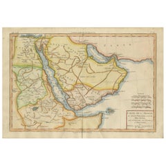
Original Antique Engraved Map of Part of the Red Sea, Arabia, 1775
Located in Langweer, NL
Antique map titled 'Carte de l'Entrée du Golfe de la Mer Rouge'. Uncommon sea chart of the entrance to the Red Seas as far as Mocha, with rhumb lines and soundings. Two insets of the...
Category

Antique Late 18th Century Collectibles and Curiosities

Materials

Paper

Antique Map of Southern India, the Maldives and Sri Lanka with Currents
Located in Langweer, NL
Antique map titled 'Carte de la Partie Inferieure De L'Inde En Deca Du Gange (..)'. Interesting map of Southern India, the Maldives and Sri Lanka. Includes a month by month charting ...
Category

Antique Late 18th Century Collectibles and Curiosities

Materials

Paper

Original Antique Map of England and Wales, with Decorative Cartouche
Located in Langweer, NL
Antique map titled 'England and Wales from the best Authorities'. Original antique map of England and Wales, with decorative cartouche. Engraved by T. Conder. Published circa 1790.
Category

Antique Late 18th Century Collectibles and Curiosities

Materials

Paper

Map of Spain & Portugal Incl. the islands of Ibiza, Minorque & Majorque, 1780
Located in Langweer, NL
Antique map titled 'Les Royaumes d'Espagne et de Portugal.' Map of Spain and Portugal. Includes the islands of Ibiza, Minorque, and Majorque. Shows towns, rivers, some topographi...
Category

Antique Late 18th Century Collectibles and Curiosities

Materials

Paper

Antique Map of France with Inset showing the Northern Departments
Located in Langweer, NL
Antique map titled 'The Republic of France divided according to its 103 Departments'. Decorative map of France. Includes a large cartouche and an in...
Category

Antique Late 18th Century Collectibles and Curiosities

Materials

Paper

Original Antique Map of the British Isles Surrounded by Text
Located in Langweer, NL
Antique map titled 'Des Isles Britanniques'. Original antique map of the British isles. This map is divided in to three major regions of the 18th century United Kingdom: England, Ire...
Category

Antique Late 18th Century Collectibles and Curiosities

Materials

Paper

Antique Map of Cordes Bay and Surroundings
Located in Langweer, NL
Antique map titled 'Baye et Havre de Cordes (..)'. Four maps on the one sheet of; Cordes Bay, Port Famine, Woods Pay, Port Gallant, Fortescue Bay, Chile based on the voyage of John B...
Category

Antique Late 18th Century Collectibles and Curiosities

Materials

Paper

Original Antique Engraved Map of the Russian Empire, 1778
Located in Langweer, NL
Description: Antique map titled 'A New and Correct Map of the Russian Empire'. Original antique map of the Russian Empire. This map originates from Moore's 'New and Complete Coll...
Category

Antique Late 18th Century Collectibles and Curiosities

Materials

Paper

Read More

Medal-Worthy Memorabilia from Epic Past Olympic Games

Get into the games! These items celebrate the events, athletes, host countries and sporting spirit.

Ahoy! You’ve Never Seen a Collection of Sailor Art and Kitsch Quite Like This

French trendsetter and serial collector Daniel Rozensztroch tells us about his obsession with objects related to seafaring men.

Pamela Shamshiri Shares the Secrets behind Her First-Ever Book and Its Effortlessly Cool Interiors

The sought-after designer worked with the team at Hoffman Creative to produce a monograph that beautifully showcases some of Studio Shamshiri's most inspiring projects.

Moroccan Artworks and Objects Take Center Stage in an Extraordinary Villa in Tangier

Italian writer and collector Umberto Pasti opens the doors to his remarkable cave of wonders in North Africa.

Montecito Has Drawn Royalty and Celebrities, and These Homes Are Proof of Its Allure

Hollywood A-listers, ex-pat aristocrats and art collectors and style setters of all stripes appreciate the allure of the coastal California hamlet — much on our minds after recent winter floods.

Whaam! Blam! Pow! — a New Book on Pop Art Packs a Punch

Publishing house Assouline and writer Julie Belcove have teamed up to trace the history of the genre, from Roy Lichtenstein, Andy Warhol and Yayoi Kusama to Mickalene Thomas and Jeff Koons.

The Sparkling Legacy of Tiffany & Co. Explained, One Jewel at a Time

A gorgeous new book celebrates — and memorializes — the iconic jeweler’s rich heritage.

What Makes a Gem-Encrusted Chess Set Worth $4 Million?

The world’s most opulent chess set, weighing in at 513 carats, is literally fit for a king and queen.
Recently Viewed

View All