Items Similar to Antique Map of York's Bay, Haven of the Three Islands and Surroundings
Want more images or videos?
Request additional images or videos from the seller
1 of 6
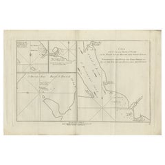
Antique Map of York's Bay, Haven of the Three Islands and Surroundings
About the Item
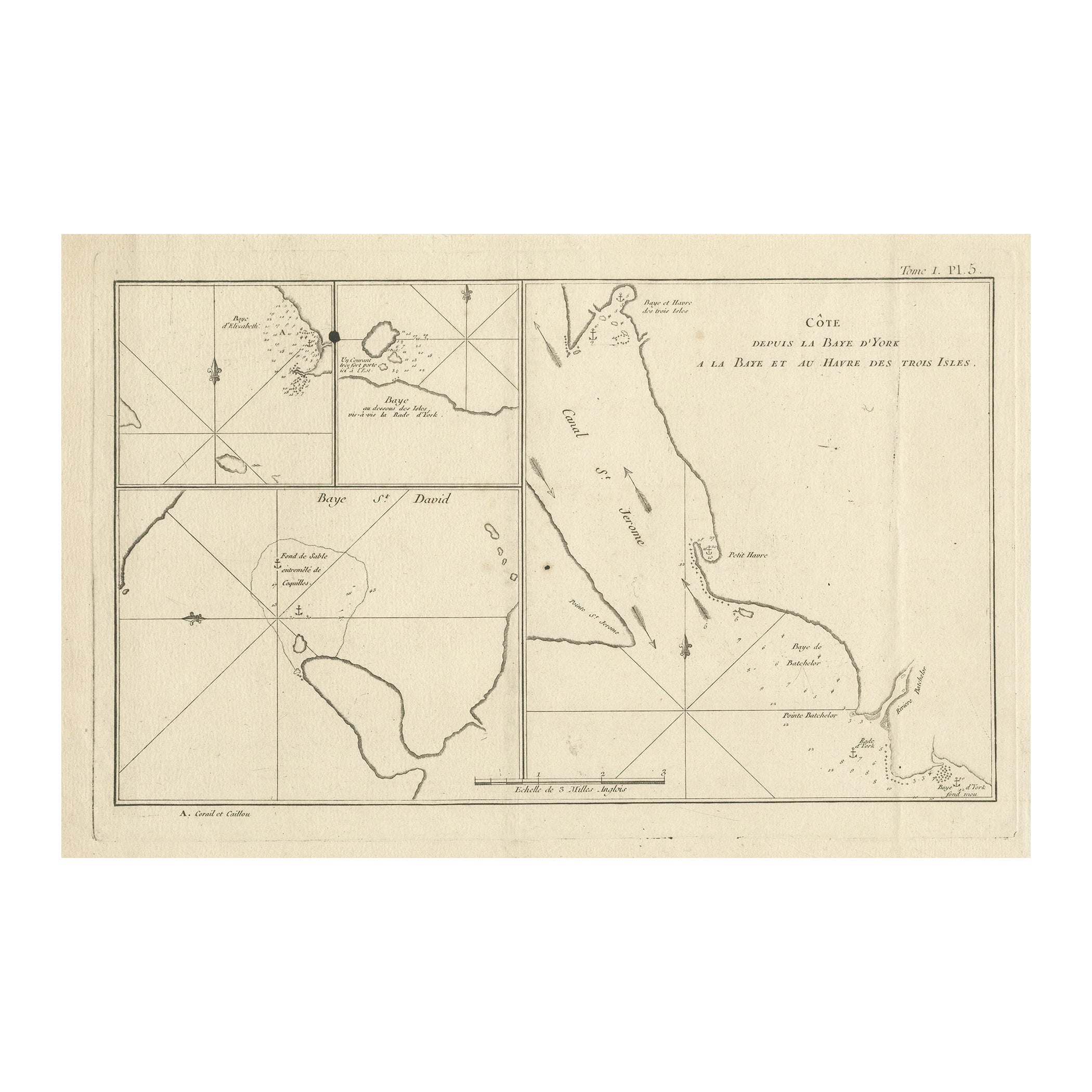
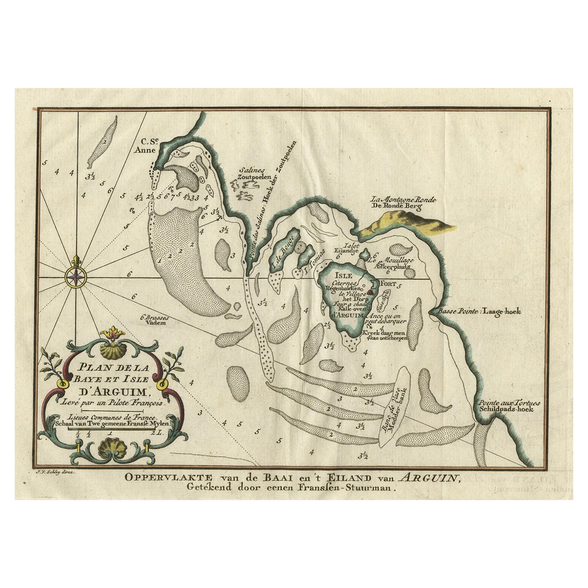
Antique map titled 'Baye St. David (..)'. Charts of York's Bay, Haven of the Three Islands, St. David's Bay, and Elizabeth's Bay. This map originates from the French edition of 'An Account of the Voyages Undertaken by the Order of His Present Majesty for Making Discoveries in the Southern Hemisphere' by John Hawkesworth. Published circa 1774.
- Dimensions:Height: 9.97 in (25.3 cm)Width: 15.52 in (39.4 cm)Depth: 0.02 in (0.5 mm)
- Materials and Techniques:
- Period:
- Date of Manufacture:c.1774
- Condition:General age-related toning. Shows wear, some staining and soiling, blank verso. Please study image carefully.
- Seller Location:Langweer, NL
- Reference Number:
About the Seller
5.0
Platinum Seller
These expertly vetted sellers are 1stDibs' most experienced sellers and are rated highest by our customers.
Established in 2009
1stDibs seller since 2017
1,929 sales on 1stDibs
Typical response time: <1 hour
- ShippingRetrieving quote...Ships From: Langweer, Netherlands
- Return PolicyA return for this item may be initiated within 14 days of delivery.
More From This SellerView All
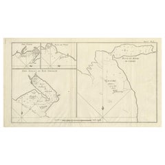
- Antique Print with Charts of York's Bay and SurroundingsLocated in Langweer, NLAntique map titled 'Côte depuis la Baye d'York (..)'. Charts of York's Bay, Haven of the Three Islands, St. David's Bay, and Elizabeth's Bay. Published in an edition of John Hawk...Category
Antique Late 18th Century Maps
MaterialsPaper
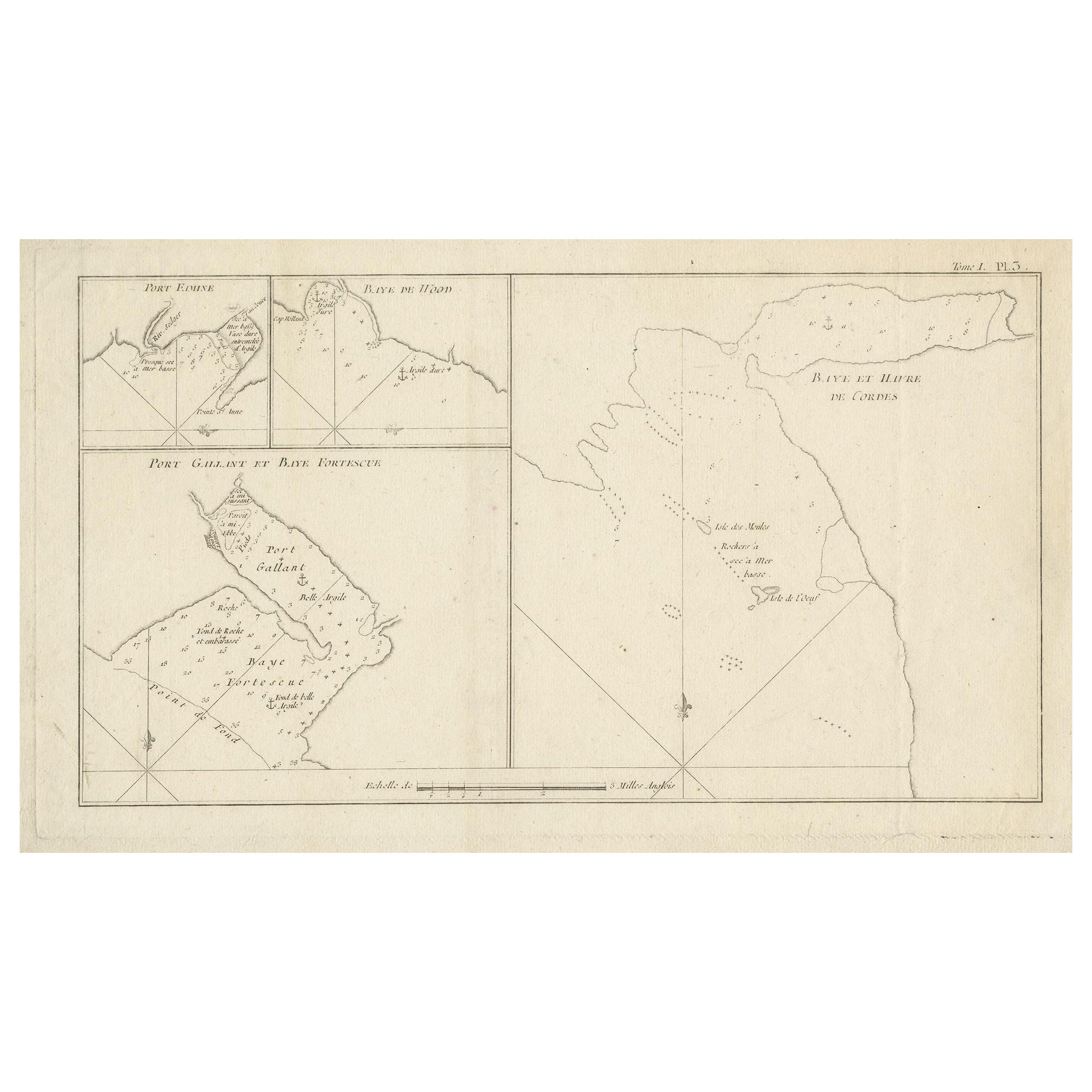
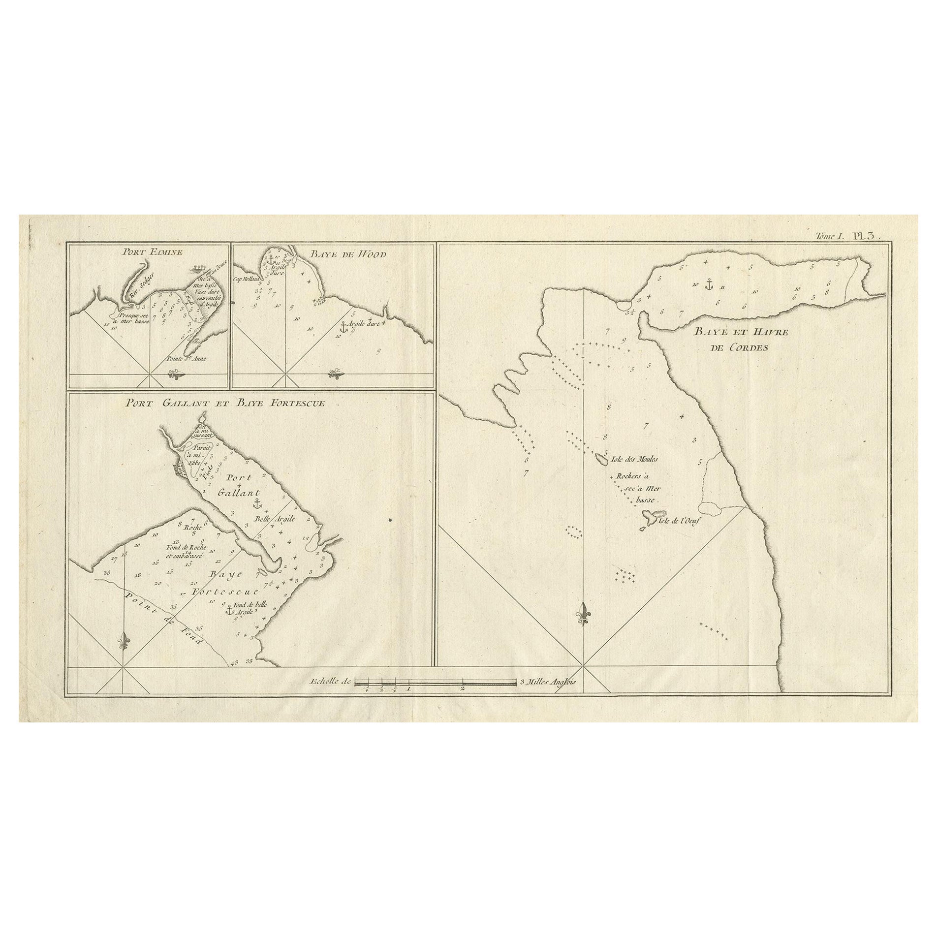
- Antique Map of Cordes Bay and SurroundingsLocated in Langweer, NLAntique map titled 'Baye et Havre de Cordes (..)'. Four maps on the one sheet of; Cordes Bay, Port Famine, Woods Pay, Port Gallant, Fortescue Bay, Chile based on the voyage of John B...Category
Antique Late 18th Century Maps
MaterialsPaper
- Antique Chart of York's Bay and Surroundings by Hawkesworth, 1774Located in Langweer, NLAntique print titled 'Baye St. David (..)'. Charts of York's Bay, Haven of the Three Islands, St. David's Bay, and Elizabeth's Bay. Originates from 'Geschichte der See-Reisen und Ent...Category
Antique 18th Century Prints
MaterialsPaper
- Antique Map of Cordes Bay, Port Famine, Woods Bay and SurroundingsLocated in Langweer, NLAntique map titled 'Baye et Havre de Cordes (..)'. Four maps on the one sheet of; Cordes Bay, Port Famine, Woods Bay, Port Gallant, Fortescue Bay, Chile based on the voyage of John B...Category
Antique Late 18th Century Maps
MaterialsPaper
- Antique Map of the Bay of Cordes and Surroundings by Hawkesworth, 1774Located in Langweer, NLAntique print titled 'Baye et Havre de Cordes (..)'. Four maps on the one sheet of; Cordes Bay, Port Famine, Woods Pay, Port Gallant, Fortescue Bay, Chile based on the voyage of John...Category
Antique 18th Century Maps
MaterialsPaper
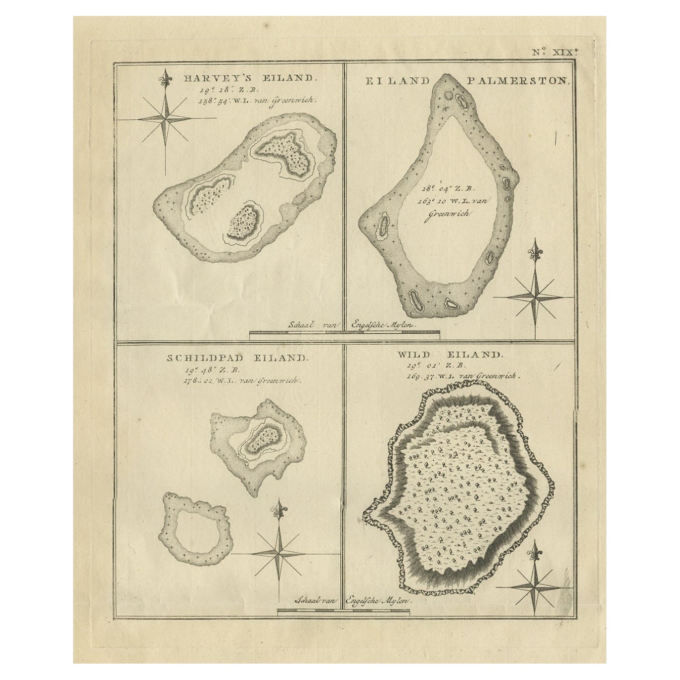
- Antique Map of Harvey Island and Surroundings by Cook, 1803Located in Langweer, NLAntique map Oceania titled 'Harvey's Eiland...''. This map originates from 'Reizen Rondom de Waereld door James Cook''. Old engraving by James Cook 1778. Engraved by Robert Bern...Category
Antique 19th Century Maps
MaterialsPaper
You May Also Like
- 1854 Map of Massachusetts, Connecticut and Rhode Island, Antique Wall MapLocated in Colorado Springs, COThis striking wall map was published in 1854 by Ensign, Bridgman & Fanning and has both full original hand-coloring and original hardware. This impression is both informative and highly decorative. The states are divided into counties, outlined in red, green, and black, and subdivided into towns. Roads, canals, and railroad lines are prominently depicted, although they are not all labeled. The mapmakers also marked lighthouses, banks, churches, and prominent buildings, with a key at right. The map is an informative and comprehensive overview of the infrastructural development of New England prior to the Civil War. Physical geographies depicted include elevation, conveyed with hachure marks, rivers and lakes. The impression features an inset map of Boston...Category
Antique 19th Century American Maps
MaterialsPaper
- Inside New York, Discovering New York's Classic Interiors, First EditionLocated in valatie, NYInside New York, Discovering New York's Classic interiors by Joe Friedman. New York: Harper Collins Publishers, 1992. Stated first US edition hardcover with dust jacket. 128 pp. An o...Category
20th Century American Books
MaterialsPaper
- 1856 U.S. Coast Survey Map of Chesapeake Bay and Delaware BayLocated in Colorado Springs, COPresented is U.S. Coast Survey nautical chart or maritime map of Chesapeake Bay and Delaware Bay from 1856. The map depicts the region from Susquehanna, Maryland to the northern Oute...Category
Antique 1850s American Maps
MaterialsPaper
- Large Original Antique Map of Rhode Island, USA, C.1900Located in St Annes, LancashireFabulous map of Rhode Island Original color Engraved and printed by the George F. Cram Company, Indianapolis. Published, C.1900 Unframed Free ...Category
Antique 1890s American Maps
MaterialsPaper
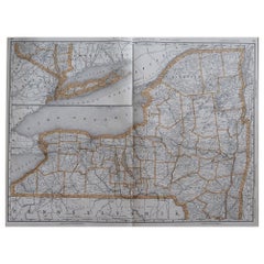
- Large Original Antique Map of New York, USA, 1894By Rand McNally & Co.Located in St Annes, LancashireFabulous map of New York. Original color. By Rand, McNally & Co. Published, 1894 Unframed Free shipping.Category
Antique 1890s American Maps
MaterialsPaper
- 1868 Map of the Upper Part of the Island of Manhattan Above 86th StreetBy Wm. Rogers Mfg. Co.Located in San Francisco, CAThis wonderful piece of New York City history is over 150 years old. It depicts 86th street and above. It was lithographed by WC Rogers and company. It was made to show what was the Battle of Harlem during the Revolutionary war...Category
Antique 1860s American American Colonial Maps
MaterialsPaper


Recently Viewed
View AllMore Ways To Browse
Vintage Bartholomews Maps
Old Sicily Map
Antique Maps Of Lithuania
Antique Map Louisiana
Babylon Map
Antique Minnesota Map
Antique Ornamental Map
Jordan Antique Map
La Syrie Antique
Map Lebanon
Map Of Ural
Map Of Washington Dc
Maps Rochester
Queensland Maps
Republic Of Texas Map
Washington Dc Map
Washington Dc Maps
Antique Map Of New Hampshire