Late 18th Century Collectibles and Curiosities

to
325
454
123
584
45
24
19
10
10
4
2
1
1
1
1
1
4,465
6,707
13,457
2,701
3,496
4,683
3,084
510
299
604
746
484
901
883
905
661
591
387
133
88
34
32
254
84
76
64
39
584
584
584
3
2
1
1
1
Period: Late 18th Century
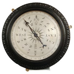
Very Rare Wind Vane Dial in the Manner of Whitehurst
Located in Lincolnshire, GB
A George III period carved mahogany wind vane dial. The silvered engraved dial with all the points of a compass housed in the finely carved mahogany frame, ...
Category

English Antique Late 18th Century Collectibles and Curiosities

Materials

Glass, Mahogany

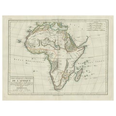
Antique Map of Africa with Mountain Ranges and other details
Located in Langweer, NL
Antique map titled 'Carte générale et Politique de l'Afrique'. Original antique map of Africa. Highlights numerous mountain ranges, lakes and rivers, regions, countries and places. P...
Category

Antique Late 18th Century Collectibles and Curiosities

Materials

Paper

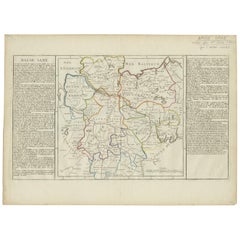
Antique Map of Lower Saxony by Clouet, 1787
Located in Langweer, NL
Antique map titled 'Basse Saxe'. Antique map of Lower Saxony, Germany. Originates from 'Geographie moderne avec une introduction' by J.B.L. Clouet.
Category

Antique Late 18th Century Collectibles and Curiosities

Materials

Paper

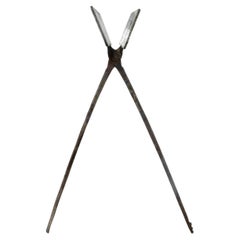
18th Century French Religious Fer a Hosties Eucharist Host Iron Waffle Press
Located in Forney, TX
A scarce antique, circa 1765, French fer a hosties (cast iron host press / host mold). Exquisitely hand forged in France in the 18th century, showcasing the blacksmith's high qual...
Category

French Medieval Antique Late 18th Century Collectibles and Curiosities

Materials

Iron

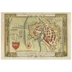
Decorative Map of Hanover, Lower Saxony by Lodge, ca. 1785
Located in Langweer, NL
Title: Decorative Map of Hanover, Lower Saxony by Lodge, ca. 1785 This decorative map, titled "A New & Correct Plan of Hanover, a City in the circle of Lower Saxony," was engraved b...
Category

Antique Late 18th Century Collectibles and Curiosities

Materials

Paper

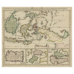
Old Map of the East Indonesian Islands Borneo, Celebes, New Guinea, Bali, 1792
Located in Langweer, NL
Antique map titled 'Partie de la Nouvelle Grande Carte des Indes Orientales, contenant les Isles de Borneo, Iava, Celebes, Mindanao (..)'. Detailed map of the Indonesian islands ...
Category

Antique Late 18th Century Collectibles and Curiosities

Materials

Paper

Original Antique Map of England and Wales, with Decorative Cartouche
Located in Langweer, NL
Antique map titled 'England and Wales from the best Authorities'. Original antique map of England and Wales, with decorative cartouche. Engraved by T. Conder. Published circa 1790.
Category

Antique Late 18th Century Collectibles and Curiosities

Materials

Paper

Map of Constantinople, Bosphorus, the Coasts of Greece and the Archipelago, 1785
Located in Langweer, NL
This is a large 1785 map titled "Carte de la Ville de Constantinople et du Bosphore de Thrace", which includes detailed maps of Constantinople (modern-day Is...
Category

Antique Late 18th Century Collectibles and Curiosities

Materials

Paper

18th Century Map of Upper Guinea: Kingdoms and Coastal Regions of West Africa
Located in Langweer, NL
This is an antique map depicting the coastal regions of West Africa, specifically the Gulf of Guinea and surrounding areas, including parts of what is now Senegal, Guinea, Sierra Leo...
Category

Antique Late 18th Century Collectibles and Curiosities

Materials

Paper

Decorative Map of the Empire of China, Korea, Japan, Taiwan, Lucon, Macau, 1780
Located in Langweer, NL
Antique map titled 'Carte de L'Empire de la Chine.' Decorative map of the Empire of China, depicting China, Corea ( Korea ), Japan, Tonquin and the Philippine island Lucon. Source unknown, to be determined. Artists and Engravers: Rigobert Bonne (1727-1795 ) was one of the most important cartographers of the late 18th century. In 1773 he succeeded Jacques Bellin as Royal Cartographer to France in the office of the Hydrographer at the Depôt de la Marine. Working in his official capacity Bonne compiled some of the most detailed and accurate maps of the period. Bonne's work represents an important step in the evolution of the cartographic ideology away from the decorative work of the 17th and early 18th century towards a more detail oriented and practical aesthetic. With regard to the rendering of terrain Bonne maps...
Category

Antique Late 18th Century Collectibles and Curiosities

Materials

Paper

Antique Map of Spain and Portugal by Tardieu, circa 1795
Located in Langweer, NL
The image is an antique map titled "Hispanie Betique et Lusitanie", which depicts the Iberian Peninsula during the Roman times, highlighting the provinces of Hispania Baetica (Betiqu...
Category

Antique Late 18th Century Collectibles and Curiosities

Materials

Paper

Two Engravings of an Florida King of the Indians in America, 1722
Located in Langweer, NL
Antique print titled 'Ceremonie, observée par un des Rois de la Floride (..)'. Two images on one sheet. 1. A ceremony that takes place before they set...
Category

Antique Late 18th Century Collectibles and Curiosities

Materials

Paper

Antique Map of the Gaspar Strait by Huddart, '1788'
Located in Langweer, NL
Antique map titled 'Sketch of the Straits of Gaspar'. Detailed sea chart of the Gaspar Strait, showing part of the Island of Banca on the east coast of Sumatra just to the south of S...
Category

Antique Late 18th Century Collectibles and Curiosities

Materials

Paper

Original Antique Plan of the Fortress of Charedsch in Persia or Iran, ca.1780
Located in Langweer, NL
Antique map, titled: 'Plan de la Citadelle de la Ville de Charedsch.' Plan of the fortress of Charedsch, Iran / Persia. This original antique print originates from 'Reize naar Ar...
Category

Antique Late 18th Century Collectibles and Curiosities

Materials

Paper

18th Century Giltwood and Polychrome Painted Putti / Cherub
Located in Hastings, GB
Hand carved winged German Baroque Putti, water gilded over applied gesso, the face and head polychrome painted. Small hanging loop to the back of the head. Width 26cm, Height 19cm, ...
Category

German Baroque Antique Late 18th Century Collectibles and Curiosities

Materials

Gesso, Wood, Giltwood

Antique Map of the World with Polar Projections by Keizer & de Lat, 1788
Located in Langweer, NL
Antique map titled 'Schuine Ronde Aard-Klooten (..)'. Interesting double hemisphere world map with polar projections. In North America, there is a...
Category

Antique Late 18th Century Collectibles and Curiosities

Materials

Paper

Decorative Antique Map of Central Asia
Located in Langweer, NL
Antique map titled 'Carte de la Tartarie Indépendante (..)'. Decorative map of Central Asia (Tartary). Covers from the Black Sea south to China, north to Russia, and south to Persia ...
Category

Antique Late 18th Century Collectibles and Curiosities

Materials

Paper

Circa 1800, Antique French Hand Carved Nutwood Putti Sculpture
Located in Lisse, NL
Lovely putti sculpture in typical Baroque Style. This beautiful and chubby putto sculpture was probably part of a larger Church ornament / sculpture o...
Category

French Baroque Antique Late 18th Century Collectibles and Curiosities

Materials

Nutwood

Uncommon Old Map of Lapland to Russia and Denmark to Kazan in the South, 1785
Located in Langweer, NL
Description: Antique map titled 'Kaart van het Noorderdeel van Europa, Bevattende Deenmarken, Noorwegen, Zweden, Lapland en het Grootste Gedeelte van Europeesch Rusland.' This un...
Category

Antique Late 18th Century Collectibles and Curiosities

Materials

Paper

Antique Town Plan Map, Poole, English, Framed Cartography, Georgian, Circa 1780
Located in Hele, Devon, GB
This is an antique town plan map of Poole in Dorset. An English, framed atlas engraving, dating to the 18th century and later. Fascinating cartography with annotated streets and pl...
Category

British George III Antique Late 18th Century Collectibles and Curiosities

Materials

Glass, Wood, Paper

Antique Map of of Bengal and the mouth of the Ganges River
Located in Langweer, NL
Antique map titled 'Carte du Bengale, avec la partie Septentrionale (..)'. Original antique map of Bengal and the mouth of the Ganges river. This map ori...
Category

Antique Late 18th Century Collectibles and Curiosities

Materials

Paper

Gerusalemme Liberata by Torquato Tasso – Elegant French 18th C "pocket" edition
Located in Middletown, NY
Paris: Prault, 1768 2 vols, 12mo, 5 3/8 x 3 1/8 inches (136 x 80 mm). Vol. 1: front. title, 2nd frontispiece, iii, 326; Vol. 2: title, 333 pp. Text in Italian. Frontispiece by Godefr...
Category

French Antique Late 18th Century Collectibles and Curiosities

Materials

Gold Leaf

Antique Plan of the City of Damietta Egypt by C. Niebuhr, 1774
Located in Langweer, NL
Antique print titled 'Grundris der Stadt Damiât'. This print originates from 'Reisebeschreibung nach Arabien und andern umliegenden Ländern' by C. Niebuhr, 1774.
Category

Antique Late 18th Century Collectibles and Curiosities

Materials

Paper

Alnmått (Cubit measure) in Birch with a Noble Crown. Gustavian, dated 1783
Located in Knivsta, SE
Rare Alnmått (Cubit measure) made in Birch with a Noble Crown. From the Gustavian period of the late 1700s, roughly corresponding to the Louis XVI period in France, made in Sweden an...
Category

Swedish Gustavian Antique Late 18th Century Collectibles and Curiosities

Materials

Brass

Antique Engraved Map of the Friendly Islands or Tonga, ca.1785
Located in Langweer, NL
Antique map titled 'Carte des Isles des Amis'. Map of the Friendly Islands / Tonga. The Tongan people first encountered Europeans in 1616 when the Dutch vessel Eendracht, captain...
Category

Antique Late 18th Century Collectibles and Curiosities

Materials

Paper

Antique Map of Asia by Dussy, 1778
Located in Langweer, NL
Antique map of Asia titled 'Indostan presqu'isles de l'Inde, Chine, Tartarie Independante'. Depicting South-East Asia including Hindustan, India an...
Category

French Antique Late 18th Century Collectibles and Curiosities

Materials

Paper

Antique Map of Peloponnesus, Greece by Pierre Antoine Tardieu, 1797
Located in Langweer, NL
This antique map, titled "Carte Ancienne d'Allemagne," represents ancient Germany and surrounding regions. It was published by the well-known Parisian mapmakers and publishers Jean-Baptiste-Louis Clouet and Alexandre Aimé Vuillemin in the late 18th century, specifically in 1787. The map covers the extensive geographical area of ancient Germany, highlighting various tribes and regions known at the time. Key features include: 1. **Geographical Boundaries**: The map outlines the territorial extents of ancient Germany, bordered by Gallia (France) to the west, Sarmatia (parts of Eastern Europe) to the east, and the Italian regions to the south. The northern boundary reaches the Oceanus Germanicus (North Sea) and the Sarmatian Sea (Baltic Sea). 2. **Tribal Regions**: It details numerous ancient Germanic...
Category

Antique Late 18th Century Collectibles and Curiosities

Materials

Paper

Antique Map of the Northern Hemisphere, 1782
Located in Langweer, NL
Antique map titled 'Hémisphère Septentrional pour voir plus distinctement les Terres Arctiques (..)'. Map of the Northern Hemisphere, originall...
Category

Antique Late 18th Century Collectibles and Curiosities

Materials

Paper

Antique Map of the West Coast of America with Island Views, ca.1784
Located in Langweer, NL
Antique print titled 'Views on the West Coast of America (..)'. Coastal views of various islands of the American coast. Originates from an edition of Cook's Voyages. Artists ...
Category

Antique Late 18th Century Collectibles and Curiosities

Materials

Paper

Antique Map of the course of the Don & Voga rivers
Located in Langweer, NL
Antique map titled 'Chart of the Course of The Don & the Volga through the Region of The Kosaks'. SW Russia & Ukraine: interesting map showing the course of th...
Category

Antique Late 18th Century Collectibles and Curiosities

Materials

Paper

Large Antique Map of the Kingdom of France
Located in Langweer, NL
Antique map titled 'The Kingdom of France (..)'. Large antique map of the Kingdom of France. Engraved by T. Kitchin. Published J. Blair, circa 1779.
Category

Antique Late 18th Century Collectibles and Curiosities

Materials

Paper

Large Decorative Antique Map of the Mediterranean, ca.1770
Located in Langweer, NL
Antique map titled 'Carte de la Mer Mediterranee en Douze Feuilles'. First map out of twelve fine engraved double-page and folding maps that join to create a large wall map...
Category

Antique Late 18th Century Collectibles and Curiosities

Materials

Paper

Antique Map of the East Indies by Bonne '1776'
Located in Langweer, NL
Antique map titled 'Indes IVe Feuille'. Very decorative original antique map of the East Indies. Covbers from the Gulf of Siam (Gulf of Thailand) and Malacca (Malaysia) eastward to i...
Category

Antique Late 18th Century Collectibles and Curiosities

Materials

Paper

Detailed Original Antique Map of the Turkish Empire with Arabia, 1778
Located in Langweer, NL
Title: Etats Due Grand-Seigneur En Asie, Empire De Perse, Pays Des Usbecs, Arabie et Egypte . . . 1753 Detailed map of the Turkish Empire, extending to the Black Sea, Georgia, the...
Category

Antique Late 18th Century Collectibles and Curiosities

Materials

Paper

Original Antique Map of England and Wales
Located in Langweer, NL
Antique map titled 'A New and Correct Map of England and Wales from the Latest and Best Improvements'. Original antique map of England and Wales. Printed by Alex Hogg, London for George Henry Millar's 'New, Complete and Universal System...
Category

Antique Late 18th Century Collectibles and Curiosities

Materials

Paper

Antique Optical View of The Coronation Ceremony of The Emperor of China, ca.1770
Located in Langweer, NL
Antique print China titled 'Vue perspective de la grande Ceremonie du couronnement de l'Empereur de la Chine'. Optical view of the coronation c...
Category

Antique Late 18th Century Collectibles and Curiosities

Materials

Paper

Anatomical model: a thyroid, Germany end of 18th century.
Located in Milan, IT
Coloured wax anatomic model depicting an human organ: Thyroid mounted on black painted wooden base. Germany end of XVIII sec.
Category

German Antique Late 18th Century Collectibles and Curiosities

Materials

Wood

Historical Map of Ancient Germany (1787): Tribes and Territories by Mentele
Located in Langweer, NL
This antique map, titled "Carte Ancienne d'Allemagne," represents ancient Germany and surrounding regions. It was published by the well-known Parisian mapmakers and publishers Jean-Baptiste-Louis Clouet and Alexandre Aimé Vuillemin in the late 18th century, specifically in 1787. The map covers the extensive geographical area of ancient Germany, highlighting various tribes and regions known at the time. Key features include: 1. **Geographical Boundaries**: The map outlines the territorial extents of ancient Germany, bordered by Gallia (France) to the west, Sarmatia (parts of Eastern Europe) to the east, and the Italian regions to the south. The northern boundary reaches the Oceanus Germanicus (North Sea) and the Sarmatian Sea (Baltic Sea). 2. **Tribal Regions**: It details numerous ancient Germanic...
Category

Antique Late 18th Century Collectibles and Curiosities

Materials

Paper

Large Antique Map of the German Empire
Located in Langweer, NL
Antique map titled 'A Map of Germany (..)'. Large antique map of the German Empire, highly detailed. Engraved by T. Kitchin. Published J. Blair, cir...
Category

Antique Late 18th Century Collectibles and Curiosities

Materials

Paper

Large Original Antique Folding Map of Manchester, England, Dated 1793
Located in St Annes, Lancashire
Superb map of Manchester and Salford Folding map. Printed on paper laid on to the original canvas Unframed. Published by C. Laurent, 1793. Free shippi...
Category

English Georgian Antique Late 18th Century Collectibles and Curiosities

Materials

Canvas, Paper

Map & Views of the Cape Verde Islands, in the Atlantic Ocean, West-Africa, 1775
Located in Langweer, NL
Various maps and views on one plate titled 'Praya Bay (..)', 'The Cape Verd Islands (..)' and 'A view of Praya Bay (..)'. Map and views of the Cape Verde islands, in the Atlantic Ocean west of Africa. Printed from two copper plates, published for Robert Sayer...
Category

Antique Late 18th Century Collectibles and Curiosities

Materials

Paper

Antique Folding London Map, English, Cartography, Historic, Georgian, Dated 1783
Located in Hele, Devon, GB
This is an antique folding London map. An English, paper on linen cartographical study of the London metropolis and the surrounding area, published in the mid Georgian period, dated ...
Category

British Georgian Antique Late 18th Century Collectibles and Curiosities

Materials

Linen, Paper

Original Antique Map of Africa with large decorative cartouche
Located in Langweer, NL
Original antique map titled 'L'Afrique divisée en ses principaux États'. Attractive and precise map of Africa, with large decorative cartouche. Engraved by Janvier. Published by Dela...
Category

Antique Late 18th Century Collectibles and Curiosities

Materials

Paper

Engraving Print from the Panckoucke Encyclopédie Nautical Subject, 1782-1832
Located in Milan, IT
Print by engraving on copper plate from the Panckoucke Encyclopédie méthodique, end of the 18th century, volume Marine Planches (more than 1,500 figures dealing with all subjects on the marina: planes, construction, carpentry, tree trunks, armaments of maneuvers, ropes, sails, artillery, ship maneuvers and combat tactics). This is the plate no. n. 26, pag. 70 fig. 350-353; with frame cm 38.3 x 31.5. Ship ropes are depicted. The Print has the "Benard direxit...
Category

French Antique Late 18th Century Collectibles and Curiosities

Materials

Paper

Charting the Course of Empire: Bonne's 1770 Masterpiece Maps of the Indian Ocean
Located in Langweer, NL
A voyage through history with an exquisite collection of Rigobert Bonne's 1770 maps, as featured in the coveted Atlas Moderne circa 1770. Each map, a cartographic treasure, captures ...
Category

Antique Late 18th Century Collectibles and Curiosities

Materials

Paper

Original Antique Map of the Virgin Islands with Insets of Caribbean Isles, 1787
Located in Langweer, NL
Antique map titled 'Supplément pour les Isles Antilles (..)'. Original old map of the Virgin Islands, with insets of Barbuda, St. Kits, Antigua, Dominica, St. Lucia, Barbados, St. Vi...
Category

Antique Late 18th Century Collectibles and Curiosities

Materials

Paper

Martinique Island in the Caribbean by Bellin Original Original Antique Map, 1780
Located in Langweer, NL
This mid-18th century map, "Carte de l'Isle de la Martinique pour servir a l'historie generale des voyages," was issued in 1780 by M. Bellin in Paris. It presents a detailed and visually captivating depiction of the Island of Martinique within the context of the Caribbean and the Lesser Antilles. **Title:** Carte de l'Isle de la Martinique pour servir a l'historie generale des voyages **Issuer:** M. Bellin **Date:** 1780 **Location Coverage:** North America, Caribbean, Martinique, Lesser Antilles This engraved map is notable for its pleasing aesthetics, featuring lovely hand coloring that enhances its visual appeal. The inclusion of a scroll cartouche, an ornamental frame, and measurement lines adds a distinctive and visually appealing quality to the map. Martinique, situated within the Lesser Antilles in the Caribbean, is presented with meticulous detail, showcasing geographical features, coastlines, settlements, and other notable landmarks. Bellin, known for his accuracy in cartography, crafted this map to serve as a geographical reference within the broader context of historical voyages and exploration. The combination of detailed cartographic information and artistic embellishments, such as hand coloring and decorative elements, makes this map not only a valuable geographical document but also a visually pleasing piece of cartographic art...
Category

Antique Late 18th Century Collectibles and Curiosities

Materials

Paper

Jonathan Dickenson, God's Protecting Providence, Cannibals of Florida, 1790
Located in Hillsborough, NJ
"inhuman Cannibals of Florida" AUTHOR: DICKENSON, Jonathan. TITLE: God's Protecting Providence, Man's Surest Help and Defence, in Times of Greatest Difficulty, and most eminent Danger, evidenced in the remarkable Deliverance of Robert Barrow,.. & the cruel devouring Jaws of the inhuman Cannibals of Florida. PUBLISHER: London: by James Phillips, 1790. DESCRIPTION: SEVENTH EDITION. 1 vol., 136pp., 12mo., 6-3/8" x 4-3/16", bound in 1/2 brown morocco, gilt decorated spine, blind stamp to front blank endleaf of "D Hicks & Co. Book Binders...
Category

British Antique Late 18th Century Collectibles and Curiosities

Materials

Leather

Detailed Antique Map of Santa Domingo, Puerto Rico, Eastern Bahamas, ca. 1780
Located in Langweer, NL
Description: Antique map titled 'L'Isle De St. Domingue, et celle De Porto-Rico.' Detailed map of Santa Domingo, Puerto Rico, etc. Includes substanti...
Category

Antique Late 18th Century Collectibles and Curiosities

Materials

Paper

Antique Map of Italy, Corsica, Sardinia and Sicily, ca.1780
Located in Langweer, NL
Description: Antique map titled 'L'Italie.' Map of Italy, Corsica, Sardinia and Sicily. Highly detailed, showing towns, rivers, some topographical features and political boundari...
Category

Antique Late 18th Century Collectibles and Curiosities

Materials

Paper

18th Century French Louis XVI Giltwood Barometer
Located in Sheffield, MA
A stunningly beautiful 18th century French gold gilt barometer is a weather instrument with mercury-filled glass thermometer still in working order...
Category

French Louis XVI Antique Late 18th Century Collectibles and Curiosities

Materials

Wood

Original Antique Map of Asia
Located in Langweer, NL
Antique map titled 'l'Asie'. Original antique map of Asia. Engraved by André after Bonne. Published circa 1780.
Category

Antique Late 18th Century Collectibles and Curiosities

Materials

Paper

Original Antique Map of Asia
$277 Sale Price
20% Off
Antique Map of India and Ceylon, along with the Maldives
Located in Langweer, NL
Antique map titled 'Stato del Mogol con l'Isole di Ceilan e Maldive'. Beautiful map of India and Ceylon, along with the Maldives. Includes a large decorative title cartouche. The map...
Category

Antique Late 18th Century Collectibles and Curiosities

Materials

Paper

1797 Tardieu Map of Southeast Asia: The Malay Archipelago and Beyond
Located in Langweer, NL
An original historical map titled 'Presqu' Île Au Dela Du Gange et Archipel De L'Inde', created by Pierre Francois Tardieu and published in the "Atlas Universel" by Pierre Grégoire C...
Category

Antique Late 18th Century Collectibles and Curiosities

Materials

Paper

Antique County Map, Rutlandshire, Framed Atlas Cartography, John Cary, Georgian
Located in Hele, Devon, GB
This is an antique county map of Rutlandshire. An English, framed atlas engraving of cartographic interest, dating to the Georgian period and later, circa 1790. Superb cartography ...
Category

British Georgian Antique Late 18th Century Collectibles and Curiosities

Materials

Glass, Wood, Paper

Antique Map of Bonthain Bay, Sulawesi, Celebes
Located in Langweer, NL
Antique map titled 'Vue de la Baye de Bonthain (..)'. Map of the island Sulawesi (Celebes), Indonesia that Philip Carteret rested his crew and made repairs to his ship the Swallow fo...
Category

Antique Late 18th Century Collectibles and Curiosities

Materials

Paper

Antique Map of the Coast of Guinea and the Cape Verde Islands
Located in Langweer, NL
Antique map titled 'Carte de la Guinée (..)'. This map was originally part of a 2 sheet larger map of Eastern Africa, showing the Cape Verde Islands and Senegal. This map originates ...
Category

Antique Late 18th Century Collectibles and Curiosities

Materials

Paper

Copper Engraving Showing the Neptune Fountain of Versailles, Paris, France, 1785
Located in Langweer, NL
Antique print titled 'Plan de la décoration du Bassin de Neptune à Versailles'. Copper engraving showing parts of the Neptune fountain of Versaill...
Category

Antique Late 18th Century Collectibles and Curiosities

Materials

Paper

Antique Hand-Colored Map of France by J.B. Elwe, 1792
Located in Langweer, NL
Antique map titled 'Carte Nouvelle du Royaume de France'. Beautiful antique map of France, including the Southern part of England. Decorated with cartouche and 12 coats of arms.  
Category

Antique Late 18th Century Collectibles and Curiosities

Materials

Paper

The Pennsylvania Journal and The Weekly Advertiser, Issued June 16, 1787
Located in Colorado Springs, CO
Presented is an June 16, 1787 issue of Philadelphia's "The Pennsylvania Journal, and The Weekly Advertiser," containing coverage of the Constitutional Convention. The magazine period...
Category

American Federal Antique Late 18th Century Collectibles and Curiosities

Materials

Leather, Fabric, Paper

Read More

Medal-Worthy Memorabilia from Epic Past Olympic Games

Get into the games! These items celebrate the events, athletes, host countries and sporting spirit.

Ahoy! You’ve Never Seen a Collection of Sailor Art and Kitsch Quite Like This

French trendsetter and serial collector Daniel Rozensztroch tells us about his obsession with objects related to seafaring men.

Pamela Shamshiri Shares the Secrets behind Her First-Ever Book and Its Effortlessly Cool Interiors

The sought-after designer worked with the team at Hoffman Creative to produce a monograph that beautifully showcases some of Studio Shamshiri's most inspiring projects.

Moroccan Artworks and Objects Take Center Stage in an Extraordinary Villa in Tangier

Italian writer and collector Umberto Pasti opens the doors to his remarkable cave of wonders in North Africa.

Montecito Has Drawn Royalty and Celebrities, and These Homes Are Proof of Its Allure

Hollywood A-listers, ex-pat aristocrats and art collectors and style setters of all stripes appreciate the allure of the coastal California hamlet — much on our minds after recent winter floods.

Whaam! Blam! Pow! — a New Book on Pop Art Packs a Punch

Publishing house Assouline and writer Julie Belcove have teamed up to trace the history of the genre, from Roy Lichtenstein, Andy Warhol and Yayoi Kusama to Mickalene Thomas and Jeff Koons.

The Sparkling Legacy of Tiffany & Co. Explained, One Jewel at a Time

A gorgeous new book celebrates — and memorializes — the iconic jeweler’s rich heritage.

What Makes a Gem-Encrusted Chess Set Worth $4 Million?

The world’s most opulent chess set, weighing in at 513 carats, is literally fit for a king and queen.
Recently Viewed

View All