Late 18th Century Collectibles and Curiosities

to
325
454
123
584
45
24
19
10
10
4
2
1
1
1
1
1
4,465
6,707
13,457
2,701
3,496
4,683
3,084
510
299
604
746
484
901
883
905
661
591
387
133
88
34
32
254
84
76
64
39
584
584
584
3
2
1
1
1
Period: Late 18th Century
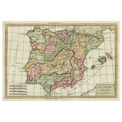
Map of Spain & Portugal Incl. the islands of Ibiza, Minorque & Majorque, 1780
Located in Langweer, NL
Antique map titled 'Les Royaumes d'Espagne et de Portugal.' Map of Spain and Portugal. Includes the islands of Ibiza, Minorque, and Majorque. Shows towns, rivers, some topographi...
Category

Antique Late 18th Century Collectibles and Curiosities

Materials

Paper

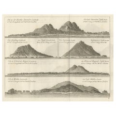
Views of Saunders, Osnaburg, Boscawens, Admiral Keppel's & Wallis Island, c.1774
Located in Langweer, NL
Antique print titled 'Isles de Sir Charles Saunder Latitude (..)'. Coastal views of Sir Charles Saunders Island ; Osnaburg Island [Mehetia, in French Polynesia] ; Boscawens Islan...
Category

Antique Late 18th Century Collectibles and Curiosities

Materials

Paper

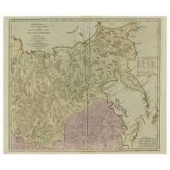
Large and Detailed Map of the Russian Empire in Asia, ca.1780
Located in Langweer, NL
Description: Antique map titled 'Bowles's New Pocket Map of the East Part of the Russian Empire in Asia'. Large and detailed map of the Russian Empire in Asia. Source unknown, to be determined. Artists and Engravers: Made by 'Thomas & Carington Bowles' after 'D'Anville'. Thomas Bowles, born around 1712, was map publisher and seller in London...
Category

Antique Late 18th Century Collectibles and Curiosities

Materials

Paper

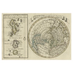
Nice Sheet of the Sangihe Archipelago in Indonesia & California Island, 1788
Located in Langweer, NL
Antique map titled 'De Noord Pool waar in aangetoont werd alle de Nieuwe Landen (..) De Eilanden van Sangir Sjauw en Pangasare (..)'. Interesting map that includes a map of the N...
Category

Antique Late 18th Century Collectibles and Curiosities

Materials

Paper

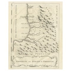
Old Dutch Map of Part of Syria and Phoenicia, 1773
Located in Langweer, NL
Antique print titled 'Gedeelte van Syriën en Phenicië'. Old map of part of Syria and Phoenicia. Originates from the first Dutch editon of an interesting travel account of Norther...
Category

Antique Late 18th Century Collectibles and Curiosities

Materials

Paper

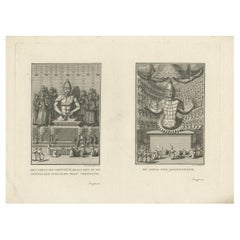
Religious Antique Engravings of Confucius and Buddha Amida in Japan, ca.1782
Located in Langweer, NL
Original (proof) engraving of two religions. Adoration of the statue of Confucius and Boeddha Amida in Japan. Title on the leaf: 1) Het beeld van Confucius, zo als het in de ope...
Category

Antique Late 18th Century Collectibles and Curiosities

Materials

Paper

Antique Map of France by T. Bowen, 1785
Located in Langweer, NL
Decorative antique map of France titled 'A new and accurate map of France, Drawn from the latest Authorities by T. Bowen'. Engraved for Moore’s new and complete collection of Voyages...
Category

Antique Late 18th Century Collectibles and Curiosities

Materials

Paper

18th Century Ship Decorated Liverpool Pearlware Plates
Located in Downingtown, PA
Liverpool Pearlware Plates decorated with Ships, Pair, Circa 1800. The Liverpool pottery pearlware plates with black rim are each printed with the i...
Category

English Georgian Antique Late 18th Century Collectibles and Curiosities

Materials

Creamware, Pottery

Antique Map of the Kingdom of Bohemia by Keizer & de Lat, 1788
Located in Langweer, NL
Antique map titled 't Koninkryk Bohemen (..)'. Uncommon original antique map of the Kingdom of Bohemia. This map originates from 'Nieuwe Natuur- Geschied- en Handelkundige Zak- en Re...
Category

Antique Late 18th Century Collectibles and Curiosities

Materials

Paper

Antique Map of South America by Keizer & de Lat, 1788
Located in Langweer, NL
Antique map titled 'Kaartje van het Zuider-Deel van America'. Uncommon original antique map of South America. This map originates from 'Nieuwe Natuur- Geschied- en Handelkundige Zak-...
Category

Antique Late 18th Century Collectibles and Curiosities

Materials

Paper

Antique Map of West Africa by R. Bonne, 1780
Located in Langweer, NL
Antique map titled 'Partie Occidentale De L'Ancien Continent Depuis Lisbonne Jusqua La Riviere De Sierra Leona Avec L'Isle de Madere, les Isles Canaries et celles Du Cap Verd'. Parts...
Category

French Antique Late 18th Century Collectibles and Curiosities

Materials

Paper

Engraving Print from the Panckoucke Encyclopédie Nautical Subject 1782-1832
Located in Milan, IT
Print by engraving on copper plate from the Panckoucke Encyclopédie méthodique, end of the 18th century,volume Marine Planches (more than 1,500 figures dealing with all subjects on the marina: planes, construction, carpentry, tree trunks, armaments of maneuvers, ropes, sails, artillery, ship maneuvers and combat tactics). This is the plate no. n. 24, pag. 69 fig. 341 ; with frame cm 38.3 x 31.5. Ship ropes are depicted. The Print has the "Benard direxit...
Category

French Antique Late 18th Century Collectibles and Curiosities

Materials

Paper

Antique Map of Italy by Keizer & de Lat, 1788
Located in Langweer, NL
Antique map titled 'Kaart van Italie (..)'. Uncommon original antique map of Italy. This map originates from 'Nieuwe Natuur- Geschied- en Handelk...
Category

Antique Late 18th Century Collectibles and Curiosities

Materials

Paper

The New Bridge and Arsenal of Kingston, Hull, Yorkshire, Great Britain, ca.1770
Located in Langweer, NL
Antique print, titled: 'Vue de l'Est du Pont et Nouvel-Arsenal de Kingiston sur l'Hull.' - View of the New Bridge and arsenal of Kingston, Hull, Yorkshire, Great Britain. This is an ...
Category

Antique Late 18th Century Collectibles and Curiosities

Materials

Paper

Antique Map of South America by J. Cook (1775)
Located in Langweer, NL
Antique map titled 'Kaart van het Zuidlyk Eind van Amerika'. Map of the sourthern part of South America, focusing on Cook's tracks around the Cape Horn and Tierra del Fuego in 1775. ...
Category

Antique Late 18th Century Collectibles and Curiosities

Materials

Paper

Antique Map of France by Faden '1792'
Located in Langweer, NL
Antique map titled 'France divided into Metropolitan Circles (..)'. Large, original antique map of France, with a small inset of the island of Co...
Category

Antique Late 18th Century Collectibles and Curiosities

Materials

Paper

Old Engraving of Foremarke Hall, a Manor House in Derbyshire, England, ca.1770
Located in Langweer, NL
Description: Antique print titled 'North Front of Foremark (..)'. Old engraving of Foremarke Hall, a Georgian-Palladian country house and manor house. This print originates from ...
Category

Antique Late 18th Century Collectibles and Curiosities

Materials

Paper

SAINT PAUL: Statuette in carved and gilded polychrome wood Late 18th century
Located in TEYJAT, FR
SAINT PAUL: Statuette in carved and gilded polychrome wood, Late 18th century. Saint Paul, also known as the Apostle Paul, was an important figure in early Christianity and is often...
Category

European Neoclassical Antique Late 18th Century Collectibles and Curiosities

Materials

Wood

Antique Engraving of Japanese People Riding a Bull, 1778
Located in Langweer, NL
Antique Engraving Print, Rustics of Japan, 1778, Plate : 'A Method of Riding & c. practised by the Rustics of Japan.' Copperplate engraving on a verge type of hand-laid paper. Description: This antique print originates from 'New Complete & Universal System...
Category

Antique Late 18th Century Collectibles and Curiosities

Materials

Paper

Copper Engraved Map of Tierra del Fuego and the Strait of Magellan, c1780
Located in Langweer, NL
Antique map titled 'Extremite Meridionale de l'Amerique.' Copper engraved map of Tierra del Fuego and the Strait of Magellan with five detailed insets of the region showing soundings, anchorages, etc. Engraved by Andre. This map originates from 'Atlas de Toutes les Parties Connues du Globe Terrestre'. Artists and Engravers: Rigobert Bonne (1727-1795 ) was one of the most important cartographers of the late 18th century. In 1773 he succeeded Jacques Bellin as Royal Cartographer to France in the office of the Hydrographer at the Depôt de la Marine. Working in his official capacity Bonne compiled some of the most detailed and accurate maps of the period. Bonne's work represents an important step in the evolution of the cartographic ideology away from the decorative work of the 17th and early 18th century towards a more detail oriented and practical aesthetic. With regard to the rendering of terrain Bonne maps...
Category

Antique Late 18th Century Collectibles and Curiosities

Materials

Paper

Antique Map of Northern Africa "Barbary Coast" by R. Bonne, circa 1780
Located in Langweer, NL
A fine example of Rigobert Bonne and Guilleme Raynal’s 1780 map of northwestern Africa or the Barbary Coast. Includes the modern day countries of Morocco, Algeria, Tunisia, Libya, and parts of adjacent Spain, Italy and Greece. This map was made in response to European interest in the region due to coastal attacks and incursions by the Barbary Pirates...
Category

French Antique Late 18th Century Collectibles and Curiosities

Materials

Paper

Antique Map of Part of the Korean Archipelago, 1798
Located in Langweer, NL
Antique map titled 'Plan of Part of the Islands or Archipellago of Corea'. This map depicts part of the Korean Archipelago and originates from Charts and Plates to La Pérouse...
Category

Antique Late 18th Century Collectibles and Curiosities

Materials

Paper

Copper Engraving of Kamchadal Men from Kamchatka, Russia, 1770
Located in Langweer, NL
Description: Antique print titled 'Habillemens des Kamtchadals'. Copper engraving of Kamchadal men. This print originates from volume 19 of 'Histoire generale des voyages (..)' by Antoine Francois Prevost d'Exile. Artists and Engravers: Published by Panckoucke. The Kamchadals inhabit Kamchatka, Russia. The name "Kamchadal" was applied to the descendants of the local Siberians and aboriginal peoples (the Itelmens, Ainu, Koryaks and Chuvans) who assimilated with the Russians. The descendants of the mixed-blood Russian settlers in 18th-19th century are called Kamchadals these days. The Kamchadals speak Russian with a touch of local dialects of the aboriginal languages of Kamchatka. The Kamchadals engage in fur trading...
Category

Antique Late 18th Century Collectibles and Curiosities

Materials

Paper

Antique Print of Two Japanese Vessels, 1799
Located in Langweer, NL
Description: Antique print titled 'Japanese boat'. Two views of Japanes boats. This print originates from 'Charts And Plates To La Perouse's Voyage'. Ar...
Category

Antique Late 18th Century Collectibles and Curiosities

Materials

Paper

Old Map of the East Coast of Honshu with an Inset, Japan, c.1785
Located in Langweer, NL
Antique map titled ‘Part of Japan or Nippon'. View of the Coast of Japan when we first saw it: The Hill a bearing West 3 miles distant. London Published by Allexer Hogg at the Kings Arms...
Category

Antique Late 18th Century Collectibles and Curiosities

Materials

Paper

Original Antique Engraved Map of Part of the Red Sea, Arabia, 1775
Located in Langweer, NL
Antique map titled 'Carte de l'Entrée du Golfe de la Mer Rouge'. Uncommon sea chart of the entrance to the Red Seas as far as Mocha, with rhumb lines and soundings. Two insets of the...
Category

Antique Late 18th Century Collectibles and Curiosities

Materials

Paper

Old Print of an Indian Nobleman and Noblewoman in a Sedan Chair, 1782
Located in Langweer, NL
Untitled print of an Indian nobleman and noblewoman in a sedan chair. This print originates from: 'Voyage aux Indes Orientales et a la Chine (..)', by Pierre Sonnerat, published in Paris in 1782. Artists and Engravers: Pierre M. Sonnerat (1745-1814) was a French naturalist...
Category

Antique Late 18th Century Collectibles and Curiosities

Materials

Paper

Antique Map of Northern Europe and European Russia, ca.1780
Located in Langweer, NL
Antique map titled 'Le Nord de L'Europe, Contenant Le Danemark, La Norwege; La Suede et La Laponie avec la Majeure Partie de al Russie Europeenne.' Map of Northern Europe and Eur...
Category

Antique Late 18th Century Collectibles and Curiosities

Materials

Paper

Old Sea Chart of the Tenasserim area, Myanmar 'Burma' in South East Asia, c.1790
Located in Langweer, NL
Antique map titled 'Coast of Tenasserim.' Sea chart of the Tenasserim area, Myanmar in South East Asia. Source unknown, to be determined. Artists and Engravers: Anonymous.
Category

Antique Late 18th Century Collectibles and Curiosities

Materials

Paper

Beautiful Antique Map of Southeastern France with Decorative Cartouche, ca.1790
Located in Langweer, NL
Antique map titled 'Languedoc, Dauphiné, Province'. Beautiful antique map of Southeastern France with decorative cartouche. Map includes topographical detail as well as a referen...
Category

Antique Late 18th Century Collectibles and Curiosities

Materials

Paper

Old Chart of the North-Eastern Coast of Australia Discovered by Cook, 1774
Located in Langweer, NL
Antique print titled Carte d'une Partie de la Cote de la N.le Galles Merid etc. An interesting chart of the north-eastern coast of Australia discovered by Cook in 1770, showing th...
Category

Antique Late 18th Century Collectibles and Curiosities

Materials

Paper

Antique Detailed Map of Papua New Guinea and the Regions to the West, ca.1780
Located in Langweer, NL
Antique map titled 'Carte des Decouvertes du Capite. Carteret dans La Nlle. Bretagne avec une parte du passage du Capite. Cook Par Le Detroit De L'Endeavor ...
Category

Antique Late 18th Century Collectibles and Curiosities

Materials

Paper

Original Antique Print of People Playing Games in Flanders, Belgium, 1774
Located in Langweer, NL
Antique print titled 'La récréation Flamande'. Original antique print of people playing games in Flanders, Belgium. Published 1774. Artists and En...
Category

Antique Late 18th Century Collectibles and Curiosities

Materials

Paper

Original Antique Chart of the Santa Cruz Islands, 1774
Located in Langweer, NL
Antique print titled 'Isles de la Reine Charlotte (..)'. A detailed chart of the Santa Cruz islands, to the north of the New Hebrides, with Carte...
Category

Antique Late 18th Century Collectibles and Curiosities

Materials

Paper

Print of Maps of Islands of the South Pacific, Incl. Pitcairn & Dusky Bay, 1788
Located in Langweer, NL
Antique map titled 'Esquisse de la Bay Dusky, Dans La Nouvelle Zeelande / I. Pitcairn / Isles de Wallis / I Turtle / I des Cocos and Traitres / Palmerston I. / I. Suavage / I. D'Hervey/ Havre Pickersgill / I de Pasques.' Detailed set of maps of the islands of the South Pacific...
Category

Antique Late 18th Century Collectibles and Curiosities

Materials

Paper

Attractive Original Hand-Colored Map of the Swabia Region of Germany, 1799
Located in Langweer, NL
Antique map titled 'A New Map of the Circle of Swabia, from the Latest Authorities'. Attractive example of John Cary's 1799 map of the Swabia region of Germany. Covers from the U...
Category

Antique Late 18th Century Collectibles and Curiosities

Materials

Paper

Antique Copper Engraving of an Italian Vineyard and a Farm, ca.1785
Located in Langweer, NL
Antique print titled 'Vue de la Vigne a l'Italienne (..)'. Copper engraving of an Italian vineyard and a farm. This print originates from 'Jardins ...
Category

Antique Late 18th Century Collectibles and Curiosities

Materials

Paper

Antique Architectural Elevation of Sandon Hall, Staffordshire in England, c.1770
Located in Langweer, NL
Antique print titled 'Principal Front of Sandon'. Architectural elevation of Sandon Hall, Staffordshire. This print originates from 'Vitru...
Category

Antique Late 18th Century Collectibles and Curiosities

Materials

Paper

Antique Old Hand-Coloured Print of Excavations found in Napels, Campania c.1790
Located in Langweer, NL
Untitled antique print of antiquities. This print most likely originates from an edition of 'Le Antichita di Ercolano Esposte' by Ottavio Antonio Bayardi. Published circa 1790. T...
Category

Antique Late 18th Century Collectibles and Curiosities

Materials

Paper

Antique Hand-Colored Engraved Map of Denmark, 1790
Located in Langweer, NL
Published by Russell (J. C.). Denmark. Divided into Dioceses and Prefectures compiled from the best Authorities, 1790, hand-coloured engraved map on handmade paper with watermark. 41...
Category

Antique Late 18th Century Collectibles and Curiosities

Materials

Paper

Antique Map of the West Coast of North America & North East Coast of Asia '1772'
Located in Langweer, NL
Antique map titled 'Carte des nouvelles decouvertes/ Extrait d'une Carte Japonoise de l'Universe'. Map of the West Coast of North America and North-East Coast of Asia, based upon Buache's report of the various Russian Discoveries between 1731 and 1742 including the various explorers routes and notes. The lower map is based upon a Japanese map...
Category

Antique Late 18th Century Collectibles and Curiosities

Materials

Paper

18th C. French Carved Walnut Figure of Saint John the Baptist with Lamb
Located in Dallas, TX
This evocative sculpture, hand-carved in France circa 1780 from solid walnut, depicts Saint John the Baptist, shown in youthful form holding an open book and accompanied by a lamb—hi...
Category

French Baroque Antique Late 18th Century Collectibles and Curiosities

Materials

Walnut

Interesting Antique Engraving of the World in Hemispheres with 6 Diagrams, 1788
Located in Langweer, NL
Antique map titled 'De Nieuwe en Ouden oppervlakke en doorzigtkundige Aardrykes Bollen (..)'. Twin hemispheres surrounded by six diagrams showing various divisions of the globe. Cali...
Category

Antique Late 18th Century Collectibles and Curiosities

Materials

Paper

Antique Chart of the Mid-Pacific Ocean by Anson, 'c.1784'
Located in Langweer, NL
Antique map titled 'Carte de la Mer du Sud ou Mer Pacifique'. Original chart of the mid-Pacific Ocean, includes voyage tracks of Anson’s Centurion and the ship he stalked, the Spanish treasure...
Category

Antique Late 18th Century Collectibles and Curiosities

Materials

Paper

Large Sea Chart of the Zuyder Zee & The Northsea with the Wadden Islands, 1773
Located in Langweer, NL
The copper engraving by Herman van Loon, published by Pieter Mortier in 'Le Neptune François' in Amsterdam, is a remarkable piece within the realm of seventeenth-century cartography....
Category

Antique Late 18th Century Collectibles and Curiosities

Materials

Paper

Antique Map of France in Ancient Roman Times by d'Anville, c.1795
Located in Langweer, NL
Antique map titled 'Gallia Antiqua ex Aevi Romani Monumentis (..)'. Original, large, map of France in ancient Roman times. Bottom left, a large inset shows Gallia's southern most Rom...
Category

French Antique Late 18th Century Collectibles and Curiosities

Materials

Paper

Antique Map of Europe by R. Bonne, 1780
Located in Langweer, NL
A fine example of Rigobert Bonne and Guilleme Raynal’s 1780 map of Europe. Drawn by R. Bonne for G. Raynal’s Atlas de Toutes les Parties Connues du Globe Terrestre, Dressé pour l'His...
Category

French Antique Late 18th Century Collectibles and Curiosities

Materials

Paper

Antique Map of Turkey in Europe by Russell, circa 1795
Located in Langweer, NL
Antique map titled 'Turkey in Europe and Hungary'. Original map of Turkey in Europe. Covers present day Northern Turkey, Greece, Albania, Romania, Hungary, Croatia, Bosnia Herzogovin...
Category

Antique Late 18th Century Collectibles and Curiosities

Materials

Paper

Antique Map of New Guinea and New Britain by P. Carteret, circa 1773
Located in Langweer, NL
Antique Map: A Chart of Captain Carteret's Discoveries at New Britain (1769) This rare and historically significant 18th-century map, titled *A Chart of Captn Carteret's Discoveries at New Britain,* offers a fascinating glimpse into early European explorations of the Pacific. Published in 1769, the map meticulously charts Captain Philip Carteret's 1767 voyage through New Guinea and the islands of New Britain and New Ireland, showcasing his contributions to the understanding of the Bismarck Archipelago. Adding to its significance, the map traces the paths of earlier explorer William Dampier...
Category

Antique Late 18th Century Collectibles and Curiosities

Materials

Paper

Antique Map of Spain by P.F. Tardieu, circa 1798
Located in Langweer, NL
Antique map titled 'Espagne carte comparative', showing river systems, the modern states of Spain and Portugal and the Roman provinces of Lusitania, Beatica & Hispania Tarraconensis....
Category

Antique Late 18th Century Collectibles and Curiosities

Materials

Paper

Antique Map of Spain and Portugal by Keizer & de Lat, 1788
Located in Langweer, NL
Antique map titled 'Nouvelle Carte du Royaume d'Espagne (..)'. Uncommon original antique map of Spain and Portugal. This map originates from 'Nieuwe Natuur- Geschied- en Handelkundig...
Category

Antique Late 18th Century Collectibles and Curiosities

Materials

Paper

Antique Map of the World in two Hemispheres by Keizer & de Lat, 1788
Located in Langweer, NL
Antique map titled 'Kaart van de Twee platte Warelds Bollen (..)'. Interesting world map in two hemispheres. California shown as a labeled island with place names and an indented nor...
Category

Antique Late 18th Century Collectibles and Curiosities

Materials

Paper

Antique Map of the Kingdom of Hungary by Keizer & de Lat, 1788
Located in Langweer, NL
Antique map titled 't Koninkryk Hongarien (..)'. Uncommon original antique map of the Kingdom of Hungary. This map originates from 'Nieuwe Natuur- Geschied- en Handelkundige Zak- en ...
Category

Antique Late 18th Century Collectibles and Curiosities

Materials

Paper

Antique Map of Greece by Keizer & de Lat, 1788
Located in Langweer, NL
Antique map titled 't Zuider Deel van Turks Europe genaamt Griekenland (..)'. Uncommon original antique map of Greece. This map originates from 'Nieuwe Natuur- Geschied- en Handelkun...
Category

Antique Late 18th Century Collectibles and Curiosities

Materials

Paper

Antique Map of Germany by Clouet, 1787
Located in Langweer, NL
Antique map titled 'L'Allemagne'. Antique map of Germany. Originates from 'Geographie moderne avec une introduction' by J.B.L. Clouet.
Category

Antique Late 18th Century Collectibles and Curiosities

Materials

Paper

Antique Map of Upper Saxony in Germany by Clouet, 1787
Located in Langweer, NL
Antique map titled 'Du Cercle de Haute Saxe'. Antique map of Upper Saxony, Germany. Originates from 'Geographie moderne avec une introduction' by J.B.L. Clouet.
Category

Antique Late 18th Century Collectibles and Curiosities

Materials

Paper

Antique Map of the Journey from Zhe-Hol in Tartary to Beijing and Hang-Tchoo Foo
Located in Langweer, NL
Antique map of China titled 'A Sketch of a Journey from Zhe-Hol in Tartary by land to Pekin and from thence by water to Hang-Tchoo-Foo in China'. Detailed map showing the route taken...
Category

Antique Late 18th Century Collectibles and Curiosities

Materials

Paper

Antique Map of the Course of the Amazon River by E. Van Harrevelt, 1773
Located in Langweer, NL
Detailed regional map, showing the course of the Amazon River from the Andes to the Atlantic. This map originates from 'Atlas portatif pour servir à l'intelligence de l'histoire phil...
Category

Antique Late 18th Century Collectibles and Curiosities

Materials

Paper

A Unique Pair of 18th-Century Polish Brass Candle Holders
Located in New York, NY
This pair of primitive 18th-century Polish brass candle holders originates from the Jewish shtetls of Eastern Europe, where they were used for Sabbath and holiday observances. Crafte...
Category

Polish Primitive Antique Late 18th Century Collectibles and Curiosities

Materials

Brass

Antique Map of Germany, Bohemia, Hungary and Part of Poland by R. Bonne ‘1780’
Located in Langweer, NL
Antique map titled "L'Allemagne, La Bohême, et la Hongrie avec une partie de la Pologne" by Rigobert Bonne (1729-1795) for "Atlas de toutes les parties connues du globe terrestre" by...
Category

French Antique Late 18th Century Collectibles and Curiosities

Materials

Paper

Read More

Medal-Worthy Memorabilia from Epic Past Olympic Games

Get into the games! These items celebrate the events, athletes, host countries and sporting spirit.

Ahoy! You’ve Never Seen a Collection of Sailor Art and Kitsch Quite Like This

French trendsetter and serial collector Daniel Rozensztroch tells us about his obsession with objects related to seafaring men.

Pamela Shamshiri Shares the Secrets behind Her First-Ever Book and Its Effortlessly Cool Interiors

The sought-after designer worked with the team at Hoffman Creative to produce a monograph that beautifully showcases some of Studio Shamshiri's most inspiring projects.

Moroccan Artworks and Objects Take Center Stage in an Extraordinary Villa in Tangier

Italian writer and collector Umberto Pasti opens the doors to his remarkable cave of wonders in North Africa.

Montecito Has Drawn Royalty and Celebrities, and These Homes Are Proof of Its Allure

Hollywood A-listers, ex-pat aristocrats and art collectors and style setters of all stripes appreciate the allure of the coastal California hamlet — much on our minds after recent winter floods.

Whaam! Blam! Pow! — a New Book on Pop Art Packs a Punch

Publishing house Assouline and writer Julie Belcove have teamed up to trace the history of the genre, from Roy Lichtenstein, Andy Warhol and Yayoi Kusama to Mickalene Thomas and Jeff Koons.

The Sparkling Legacy of Tiffany & Co. Explained, One Jewel at a Time

A gorgeous new book celebrates — and memorializes — the iconic jeweler’s rich heritage.

What Makes a Gem-Encrusted Chess Set Worth $4 Million?

The world’s most opulent chess set, weighing in at 513 carats, is literally fit for a king and queen.
Recently Viewed

View All