Items Similar to Antique Hand-Colored Map of France by J.B. Elwe, 1792


Want more images or videos?
Request additional images or videos from the seller
1 of 9
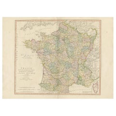
Antique Hand-Colored Map of France by J.B. Elwe, 1792
About the Item
Antique map titled 'Carte Nouvelle du Royaume de France'. Beautiful antique map of France, including the Southern part of England. Decorated with cartouche and 12 coats of arms.
- Dimensions:Height: 21.07 in (53.5 cm)Width: 25.99 in (66 cm)Depth: 0.02 in (0.5 mm)
- Materials and Techniques:Paper,Engraved
- Period:
- Date of Manufacture:1792
- Condition:Please study image carefully.
- Seller Location:Langweer, NL
- Reference Number:
About the Seller
5.0
Platinum Seller
These expertly vetted sellers are 1stDibs' most experienced sellers and are rated highest by our customers.
Established in 2009
1stDibs seller since 2017
1,922 sales on 1stDibs
Typical response time: <1 hour
- ShippingRetrieving quote...Ships From: Langweer, Netherlands
- Return PolicyA return for this item may be initiated within 14 days of delivery.
More From This SellerView All
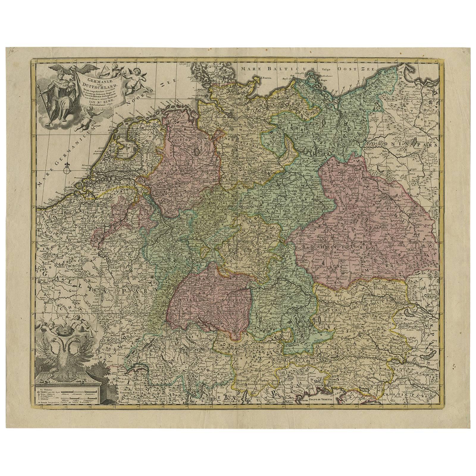
- Antique Map of Germany by J.B. Elwe, 1792Located in Langweer, NLAntique map titled 'Germanie vulgo Duitschland (..)'. Decorative map of Germany with Silesia, Bohemia , Netherlands, Belgium, Elzas, Switzerland, Tyrol and Austria. With two cartouch...Category
Antique Late 18th Century Maps
MaterialsPaper
- Original Hand-Colored Antique Map of Africa by Elwe '1792'Located in Langweer, NLAntique map titled 'l'Afrique Divisée en ses Empires, Royaumes, et Etats'. Decorative large map of Africa. The cartography is typical for the 17th century with the Nile originating i...Category
Antique Late 18th Century Maps
MaterialsPaper
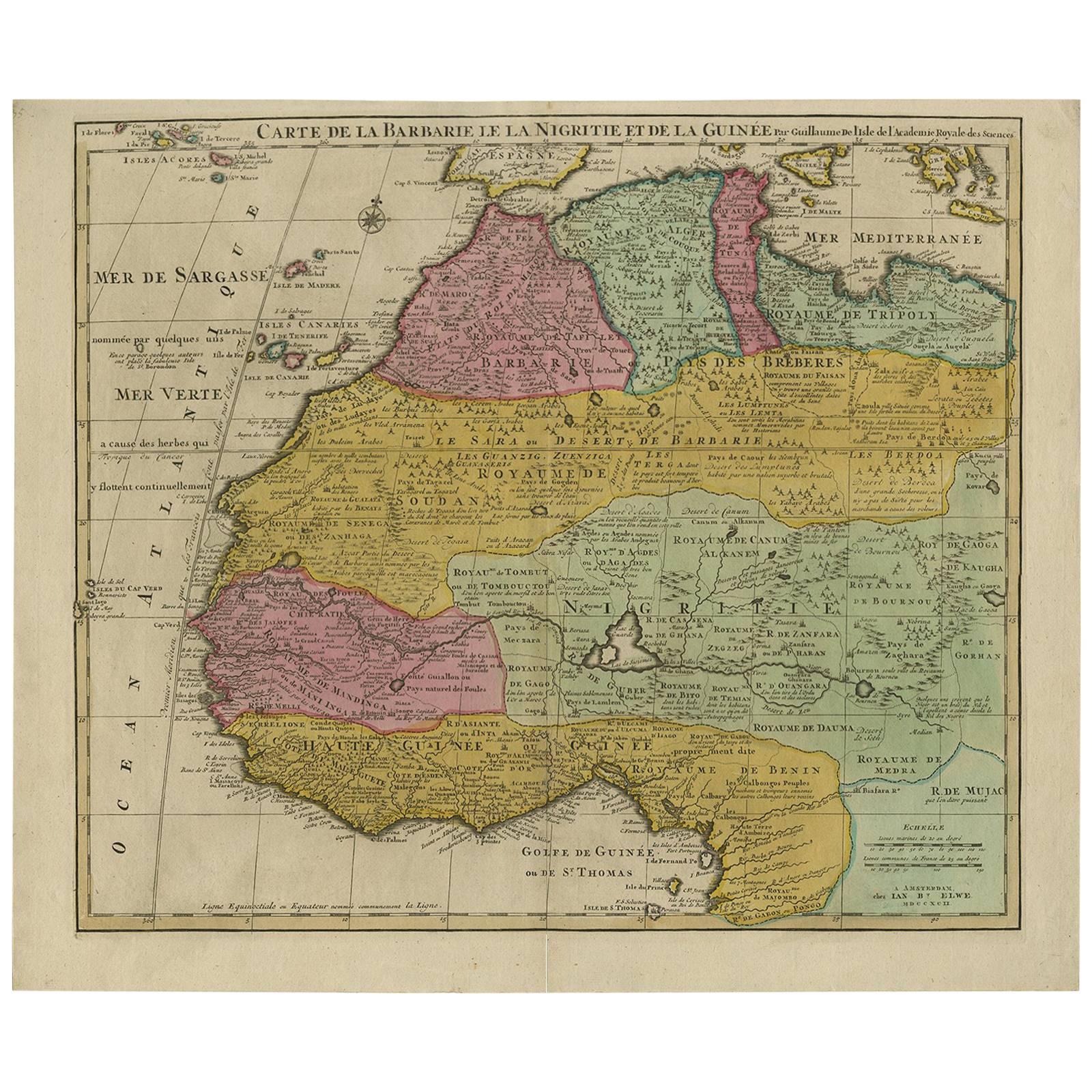
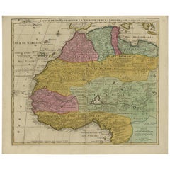
- Antique Map of North and West Africa by J.B. Elwe, 1792Located in Langweer, NLBeautiful richly engraved map of North and West Africa, based upon the earlier maps of De L'Isle. Richly annotated throughout and with excellent regional detail. Too much detail to d...Category
Antique Late 19th Century Maps
MaterialsPaper
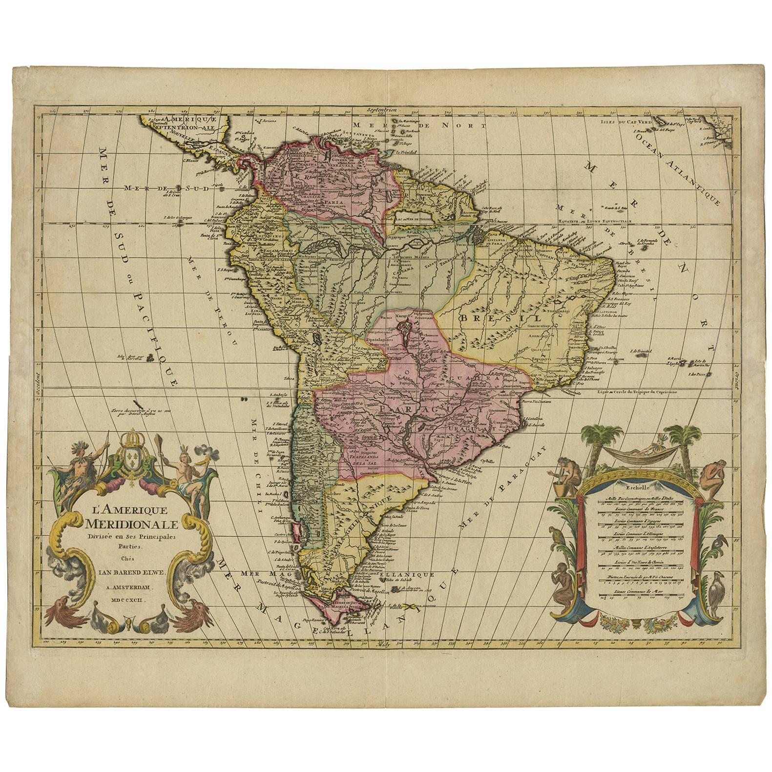
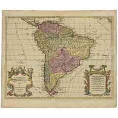
- Decorative Original HandColoredAntique Map of South America by J.B. Elwe, 1792By J.B. ElweLocated in Langweer, NLThis image depicts 'L'Amerique Meridionale', an antique map of South America. The map is carefully hand-colored, showcasing the diverse countries within the continent, including Braz...Category
Antique Late 18th Century Maps
MaterialsPaper
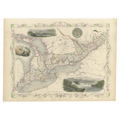
- Beautiful Decorative Hand-Colored Antique Map of West Canada, 1851Located in Langweer, NLDescription: Antique map of Canada titled 'West Canada'. With decorative vignettes titled Kingston and Falls of Niagara. Originates from 'The Illustrated Atlas, And Modern History Of The World Geographical, Political, Commercial & Statistical, Edited By R. Montgomery Martin'. Published; John Tallis London, New York, Edinburgh & Dublin. 1851. Drawn and Engraved by J. Rapkin. Artists and Engravers: John Tallis (1817-1876) was a British map...Category
Antique 1850s Maps
MaterialsPaper
- Antique Map of France by Faden '1792'Located in Langweer, NLAntique map titled 'France divided into Metropolitan Circles (..)'. Large, original antique map of France, with a small inset of the island of Co...Category
Antique Late 18th Century Maps
MaterialsPaper


You May Also Like
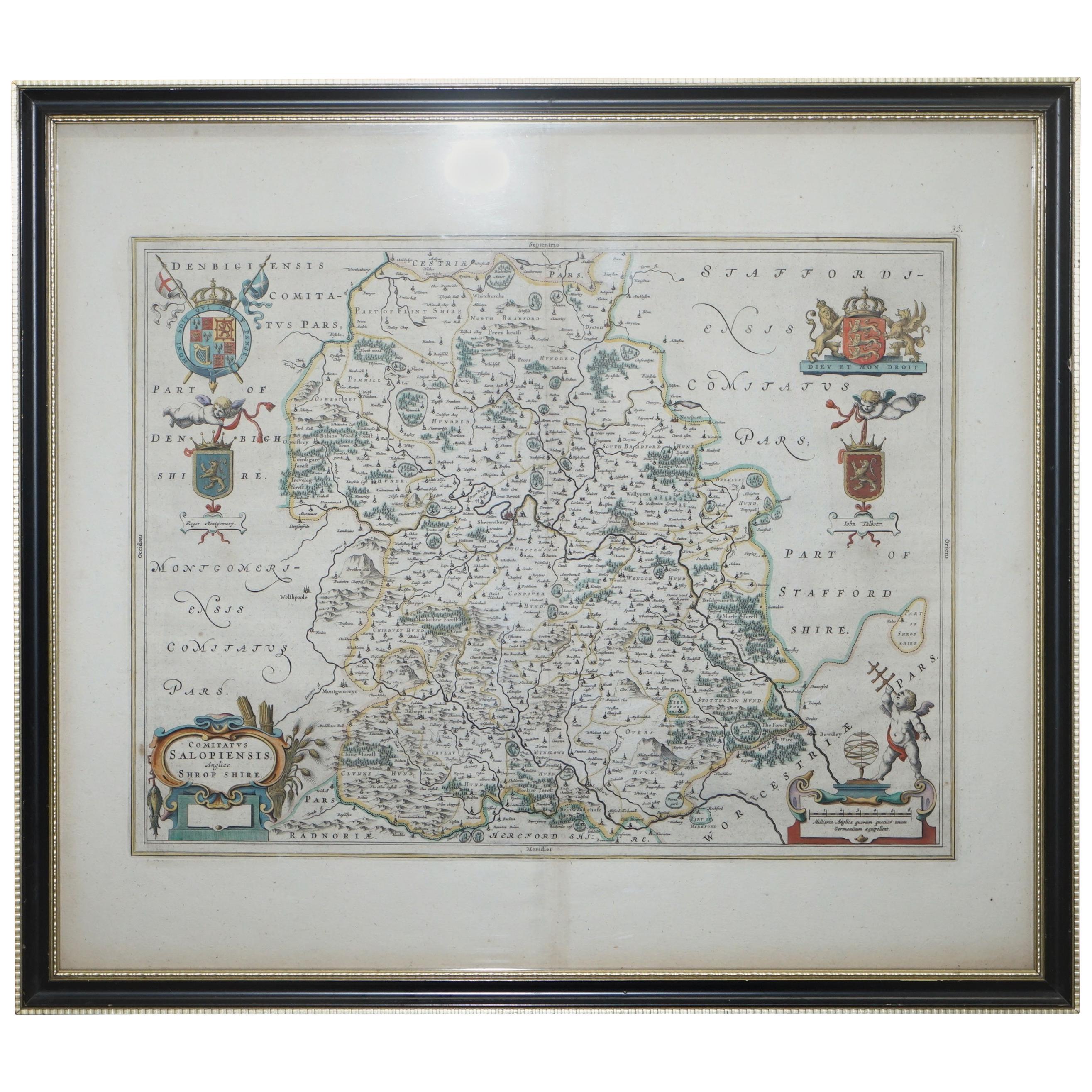
- Staffordshire 1645 Hand Colored Antique Print Staffordiensis Comitatvs MapLocated in GBWe are delighted to offer for sale this lovely antique Atlas page map of Staffordshire printed in 1645 Amsterdam Staffordiensis Comitatvs Vulgo This o...Category
Antique Early 1800s English Georgian Maps
MaterialsPaper
- Double Sided Northamptonshire 1645 Hand Colored Antique Print Map Rare FindLocated in GBWe are delighted to this lovely antique Atlas page map of Northamptonshire printed in 1645 Amsterdam Staffordiensis Comitatvs Vulgo I have three of th...Category
Antique Early 1800s English Georgian Maps
MaterialsPaper
- Double Sided and Glazed Cheshire 1645 Hand Colored Antique Print Map Rare FindLocated in GBWe are delighted to offer for sale this lovely antique Atlas page map of Cheshire printed in 1645 Amsterdam Staffordiensis Comitatvs Vulgo I have thre...Category
Antique Early 1800s English Georgian Maps
MaterialsPaper
- Fine French Antique 1856 Hand Watercolour Map of Dept Des Hautes PyreneesLocated in GBWe are delighted to offer for sale this stunning 1856 hand watercolour map of the Austrian Alps titled Dept Des Hautes Pyrenees taken from the Atlas Nat...Category
Antique 1850s French Early Victorian Maps
MaterialsPaper
- Beautiful Colour French Antique 1856 Hand Watercolour Map of Dept Des La CorseLocated in GBWe are delighted to offer for sale this stunning 1856 hand watercolour map of the Austrian Alps titled Dept Des La Course taken from the Atlas National ...Category
Antique 1850s French Early Victorian Maps
MaterialsPaper
- Original Large Antique Map of Paris, France by John Dower, 1861Located in St Annes, LancashireFabulous monochrome map of Paris. Vignettes of St Germain En Laye, Saint Cloud, Versailles and Fontainbleau. Unframed. Drawn by J.Dower. Lithography by Weller. 4 sheets j...Category
Antique 1860s English Victorian Maps
MaterialsPaper