Mid-19th Century Collectibles and Curiosities

to
760
1,182
368
1,572
169
24
22
9
6
5
5
4
4
2
2
2
1
4,385
6,579
13,259
2,713
3,470
4,599
3,015
515
315
588
736
465
886
874
893
655
567
978
312
259
89
88
586
324
180
141
135
1,572
1,572
1,572
104
7
6
2
2
Period: Mid-19th Century
Pair of Marquess of Clanricarde De Burgh-Canning Carriage Badges
Located in Lymington, Hampshire
A Pair of Marquess of Clanricarde de Burgh-Canning carriage badges, each gilt metal armorial designed as the coat of arms de Burgh-Canning for Ullick John de ...
Category

English Antique Mid-19th Century Collectibles and Curiosities

Materials

Metal

Early 19th Century Italian Hand-Carved and Polychromed Wood Crucifix "Cadore"
Located in Vigonza, Padua
Early 19th century Italian hand-carved and polychromed wood crucifix sculptural school "Cadore" Measure cm: H 70, W 37, D 8 About: The...
Category

Italian Neoclassical Antique Mid-19th Century Collectibles and Curiosities

Materials

Wood, Walnut

Guadeloupe and Dependencies: Mid-19th Century Map from France Pittoresque Series
Located in Langweer, NL
This map titled "Guadeloupe et Dépendances" is part of the France Pittoresque series and provides a detailed view of the island of Guadeloupe and its surrounding dependencies. Features: - The map shows the two main landmasses of Guadeloupe: Basse-Terre and Grande-Terre, separated by a narrow channel. - Several smaller islands, including Marie-Galante, Les Saintes, and La Désirade, are also depicted. - The main cities, towns, and geographical features are labeled, with emphasis on the island's mountain ranges and rivers, particularly on Basse-Terre. - An inset at the bottom right provides a detailed plan of Pointe-à-Pitre, a major city and port on the island. The grid layout of the streets is clearly shown, reflecting urban planning of the time. Artistic and Cartographic Details: - The map uses clear linework to differentiate between the different islands and the sea, with significant natural features such as mountains and rivers carefully depicted. - The map was drawn by Monin and engraved by Jacqueline and Barrière, whose names appear in the lower right corner. - The scale in the lower left corner is measured in leagues, showing distances both by land and sea. Historical Context: - This map likely dates to the mid-19th century, a period when Guadeloupe was a key French colony in the Caribbean. Guadeloupe was known for its sugar and coffee plantations, which played a significant role in France's colonial economy. - Maps like this were often used for administrative, military, and educational purposes to give a comprehensive view of France's overseas territories. The map of Guadeloupe et Dépendances from the France Pittoresque series likely dates to the mid-19th century, around 1840 to 1860. This period corresponds to the height of French colonial influence in Guadeloupe, and the map's style, detailed urban planning, and cartographic techniques are consistent with maps produced in that era. The specific publication date could be further narrowed down if the map was part of a known edition of the France Pittoresque atlas, but based on the cartographic style and historical context, 1840–1860 is a reasonable estimate. Here are some relevant keywords people might use when searching for a map of Guadeloupe and its surrounding areas: 1. Guadeloupe map 2. Basse-Terre and Grande-Terre map 3. French Caribbean islands map...
Category

Antique Mid-19th Century Collectibles and Curiosities

Materials

Paper

Antique Map of France by Lapie, 1842
Located in Langweer, NL
Antique map titled 'Carte de France'. Map of France. This map originates from 'Atlas universel de géographie ancienne et moderne (..)' by Pierre M. Lapie and Alexandre E. Lapie. Pier...
Category

Antique Mid-19th Century Collectibles and Curiosities

Materials

Paper

Original Antique Map of Ancient Asia, 1847
Located in Langweer, NL
Description: Antique map Asia titled 'Asie Ancienne'. This is an original antique map of Ancient Asia and originates from 'Atlas de la Geographie ...
Category

Antique Mid-19th Century Collectibles and Curiosities

Materials

Paper

Antique Map of Afghanistan and Surroundings, '1845'
Located in Langweer, NL
Antique map titled 'Map of Persia and Caubul'. Original antique map of Afghanistan and surroundings. This map originates from 'An Atlas of the World, Comprehending Separate Maps of...
Category

Antique Mid-19th Century Collectibles and Curiosities

Materials

Paper

Antique Map of Japan by W. G. Blackie, 1859
Located in Langweer, NL
Antique map titled 'Japan'. Original antique map of Japan. This map originates from ‘The Imperial Atlas of Modern Geography’. Published by W. G. B...
Category

Antique Mid-19th Century Collectibles and Curiosities

Materials

Paper

Sailor's Woolwork of Royal Navy on Checkerboard Sea
Located in Downingtown, PA
British Sailor's Woolwork of Royal Navy on Unusual Checkerboard Sea, circa 1865 The British sailor's woolie depicts a port side view of a three-masted ship with trapunto white sails on a rough sea depicted as a checkerboard in shades of blue. The ship flying the White Ensign. The sky still retains the original light blue. The woolie is in a wide medium dark wood frame. The wool is protected by Museum UV...
Category

English Folk Art Antique Mid-19th Century Collectibles and Curiosities

Materials

Wool

Large Original Antique Map of Afghanistan. Edward Weller, 1861
Located in St Annes, Lancashire
Great map of Afghanistan Lithograph engraving by Edward Weller Original colour Published, 1861 Unframed Good condition    
Category

English Victorian Antique Mid-19th Century Collectibles and Curiosities

Materials

Paper

Two Men in Civilian & Military Outfit from Cochinchine or Southern Vietnam, 1830
Located in Langweer, NL
Antique print titled 'Cochinchine'. Two portaits of Vietnamese men one showing in military attire and the second in civilian dress. Cochinchina or Cochin-China is a historical ex...
Category

Antique Mid-19th Century Collectibles and Curiosities

Materials

Paper

1850 Austrian Enamel Coin Purse
Located in Vienna, AT
For sale is a unique little Biedermeier coin purse. Its case is made of brass covered in royal blue enamel. The lid displays an oval gold colored frame filled with white enamel with ...
Category

Austrian Biedermeier Antique Mid-19th Century Collectibles and Curiosities

Materials

Brass, Enamel

Antique Map of Peru and Bolivia, 1836
Located in Langweer, NL
Antique map titled 'Pérou et Bolivia'. Decorative map of Peru and Bolivia with outline coloring. Originates from 'Atlas Complet Du Precis De La Geograp...
Category

Antique Mid-19th Century Collectibles and Curiosities

Materials

Paper

Antique Religious Print "No. 20" The Girls of Jerusalem, circa 1840
Located in Langweer, NL
Antique print titled ‘Histoire Sainte, Ancien Testament, Les Filles de Jérusalem captives.’ This plate shows a scene from the Old Testament; The Girls of Jerusalem.’ This print or...
Category

Antique Mid-19th Century Collectibles and Curiosities

Materials

Paper

Large Original Antique City Plan of Lucknow, India. Edward Weller, 1861
Located in St Annes, Lancashire
Great city plan of Lucknow Lithograph engraving by Edward Weller Original colour Published, 1861 Unframed Good condition / slight corner loss bottom right shown in last image ...
Category

English Victorian Antique Mid-19th Century Collectibles and Curiosities

Materials

Paper

Hand Colored Antique Map of the Department of Vaucluse, France
Located in Langweer, NL
Antique map titled 'Dépt de Vaucluse'. Map of the French department of Vaucluse, France. Vaucluse is the center of wine production in the southern Rhone. Some of the smartest wines in France can be found here. There is also a very strong movement towards the adoption of organic and biodynamic viticulture and natural wine making...
Category

Antique Mid-19th Century Collectibles and Curiosities

Materials

Paper

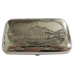
19th Century Dutch Silver Tobacco Box by J.J. Oosterbaan, Leeuwarden 1842
Located in Delft, NL
A 19th century Dutch silver tobacco box by J.J. Oosterbaan, Leeuwarden 1842 A beautifully decorated silver tobacco box with a Dutch scene ...
Category

Dutch Antique Mid-19th Century Collectibles and Curiosities

Materials

Silver

Rare Fish Print of the Norway Redfish 'Sebastes Viviparus' and the Sculpin, 1842
Located in Langweer, NL
Antique print, titled: 'Poissons Plate 9 - La Sebaste du Nord (Sebastes septentrionalis) - Le Cotte Scorpion (Cottus scorpius).' - This rare plate shows the Norway redfish (Sebastes ...
Category

Antique Mid-19th Century Collectibles and Curiosities

Materials

Paper

Antique Map of the World by A. Vuillemin, 1854
Located in Langweer, NL
This map originates from ‘Atlas National de la France Illustré’. Published by A. Combette, Paris, 1854.
Category

Antique Mid-19th Century Collectibles and Curiosities

Materials

Paper

Torricellian mahogany barometer signed Corton Lincoln mid-19th cent.
Located in Milan, IT
Torricellian mercury barometer in mahogany wood, signed Corton Lincoln of the mid 19th cent. complete with reading nonius for checking pressure variation, alcohol thermometer, hyg...
Category

Antique Mid-19th Century Collectibles and Curiosities

Materials

Wood

Antique Religious Print 'No. 13' Rebecca and Eliezer at the Well, circa 1840
Located in Langweer, NL
Antique print titled ‘Histoire Sainte, Ancien Testament, Éliezer et Rebecca.’ This plate shows a scene from the Old Testament; Rebecca and Elizer at the Well.’ This print originat...
Category

Antique Mid-19th Century Collectibles and Curiosities

Materials

Paper

Antique Map of Haute-Garonne ‘France’ by V. Levasseur, 1854
Located in Langweer, NL
Antique map titled 'Dépt. de la Hte. Garonne'. Map of the French department of Haute-Garonne, France. This area of France produces the delicious but lesser known Buzet wines, and ten...
Category

Antique Mid-19th Century Collectibles and Curiosities

Materials

Paper

Antique Map of the Islands of the Atlantic by J. Tallis
Located in Langweer, NL
A highly decorative and detailed mid-19th century map of the Islands of the Atlantic -- including the Azores, Madeira, Bermuda, the Canary Islands and the Cape Verde Islands -- which...
Category

Antique Mid-19th Century Collectibles and Curiosities

Materials

Paper

German Globe by C. Abel-Klinger, Nuremberg, circa 1860
Located in Milano, IT
Terrestrial globe Artistic company C. Abel - Klinger Nuremberg, circa 1860 H cm 31 x 22 cm (12.20 x 8.66 in); sphere 14 cm (5.51 in) in diameter lb 2.30 (kg 1.04) State of conservation: good. On the sphere there are slight visible signs of accidental bumping at the poles, as well as on New Guinea and England (vertical and more visible); some ink stains, especially at the South Pole and on the meridian that crosses North America. The globe is composed of twelve whole gores of printed paper, juxtaposed and glued on a sphere made with a chalky base mixture. The circle of the meridian, made of brass...
Category

German Other Antique Mid-19th Century Collectibles and Curiosities

Materials

Wood, Paper

Original Antique English County Map, Leicestershire, J & C Walker, 1851
Located in St Annes, Lancashire
Great map of Leicestershire Original colour By J & C Walker Published by Longman, Rees, Orme, Brown & Co. 1851 Unframed.
Category

English Other Antique Mid-19th Century Collectibles and Curiosities

Materials

Paper

Old Map of the French Department of Indre, France
Located in Langweer, NL
Antique map titled 'Dept. de l'Indre'. Map of the French department of Indre, France. Part of the Loire Valley wine region, this area is known for its production of Chinon wines, typically red, and production of Pouligny-Saint-Pierre, goats'-milk cheese. It is also the birthplace of the great philosopher Rene Descartes...
Category

Antique Mid-19th Century Collectibles and Curiosities

Materials

Paper

Antique Map of Germany with the Empire of Austria by Wyld '1845'
Located in Langweer, NL
Antique map titled 'The Confederated States of Germany with the Empire of Austria, and The Kingdoms of Prussia and Poland'. Original antique map of ...
Category

Antique Mid-19th Century Collectibles and Curiosities

Materials

Paper

Antique Map of the City of London by Balbi '1847'
Located in Langweer, NL
Antique map titled 'London'. Original antique map of the city of London. This map originates from 'Abrégé de Géographie (..)' by Adrien Balbi. Published 1847.
Category

Antique Mid-19th Century Collectibles and Curiosities

Materials

Paper

Hand Colored Antique Map of the department of Finistère, France
Located in Langweer, NL
Antique map titled 'Dépt. du Finistère'. Map of the French department of Finistere, Brittany, France. This area of France is known for its cider production and excellent boar hunting...
Category

Antique Mid-19th Century Collectibles and Curiosities

Materials

Paper

Antique Bible Print of the Children of Israel by Kronheim 'c.1860'
Located in Langweer, NL
Antique bible print titled 'The Children of Israel gathering Manna'. This print most likely originates from an illustrated bible, published by J.M. Kronheim & Co, circa 1860.
Category

Antique Mid-19th Century Collectibles and Curiosities

Materials

Paper

Antique Map of Turkey in Asia by A.K. Johnston, 1865
Located in Langweer, NL
Antique map titled 'Turkey in Asia (Asia Minor) and Transcaucasia'. This map originates from the ‘Royal Atlas of Modern Geography’ by Alexander Keith Johnston. Published by William B...
Category

Antique Mid-19th Century Collectibles and Curiosities

Materials

Paper

Antique Map of New South Wales in Australia, ca. 1850
Located in Langweer, NL
Antique map of Victoria, or Port Phillip (12.7 x 10.0") in Australia. Superb map of Victoria roughly centered on Melbourne. Vignettes of Aborigines, a ...
Category

European Antique Mid-19th Century Collectibles and Curiosities

Materials

Paper

Old Map of Vaucluse, France: A Cartographic Celebration of Viticulture, 1852
Located in Langweer, NL
This original hand-colored map is from the "Atlas National Illustré," a work by Victor Levasseur, a French geographer and cartographer known for his richly illustrated maps. The map...
Category

Antique Mid-19th Century Collectibles and Curiosities

Materials

Paper

Antique Map of Europe by Balbi '1847'
Located in Langweer, NL
Antique map titled 'Europe'. Original antique map of Europe. This map originates from 'Abrégé de Géographie (..)' by Adrien Balbi. Published 1847.
Category

Antique Mid-19th Century Collectibles and Curiosities

Materials

Paper

18th Century Naples, Italy nativity figure
Located in London, GB
18th Century Naples, Italy nativity figure An exceptional example of a late 18th Century Italian nativity figure. Hand carved articulated pine joint l...
Category

Italian Early Victorian Antique Mid-19th Century Collectibles and Curiosities

Materials

Pine

Beneath the Surface: James Wyld's 1844 Geological Map of the British Isles
Located in Langweer, NL
This superb original geological map of the United Kingdom of Great Britain and Ireland by James Wyld, produced in 1844, is a remarkable Victorian artifact. Description: Explore th...
Category

Antique Mid-19th Century Collectibles and Curiosities

Materials

Paper

Antique Map of Victoria, or Port Phillip in Australia, ca. 1850
Located in Langweer, NL
This antique map, measuring approximately 12.7 x 10.0 inches, showcases Victoria, specifically centered around Melbourne, Australia. Crafted by John Tallis around 1850, this map is p...
Category

European Antique Mid-19th Century Collectibles and Curiosities

Materials

Paper

Antique Map of Australia by Lowry, 1852
Located in Langweer, NL
Antique map titled 'Australia'. Two individual sheets of Australia. This map originates from 'Lowry's table Atlas constructed and engraved from the most recent authorities' by J.W. L...
Category

Antique Mid-19th Century Collectibles and Curiosities

Materials

Paper

1868 Map of the Upper Part of the Island of Manhattan Above 86th Street
Located in San Francisco, CA
This wonderful piece of New York City history is over 150 years old. It depicts 86th street and above. It was lithographed by WC Rogers and company. It was made to show what was the Battle of Harlem during the Revolutionary war...
Category

American American Colonial Antique Mid-19th Century Collectibles and Curiosities

Materials

Paper

Antique Print of a Vessel 'c.1850'
Located in Langweer, NL
Antique print titled Nave il Cesare l'Augusto'. Etching with hand coloring, published circa 1850. Signed Leveschi (?).
Category

Antique Mid-19th Century Collectibles and Curiosities

Materials

Paper

Antique Map of Siberia, Russia, 1859
Located in Langweer, NL
Antique map titled 'Siberia or Northern Asia'. Original antique map of Siberia or Northern Asia. This map originates from ‘The Imperial Atlas of Modern Geography’. Published by W. G....
Category

Antique Mid-19th Century Collectibles and Curiosities

Materials

Paper

Antique Map of Cairo and Surroundings by Balbi '1847'
Located in Langweer, NL
Antique map titled 'Le Kaire'. Original antique map of Cairo and surroundings, Egypt. This map originates from 'Abrégé de Géographie (..)' by Adrien Balbi. Published 1847.
Category

Antique Mid-19th Century Collectibles and Curiosities

Materials

Paper

Antique Map of Western Africa with Vignettes of Cape Coast Castle etc, ca.1851
Located in Langweer, NL
Antique map titled ‘Western Africa’. Includes decorative vignettes titled Christiansborg, Cape Coast Castle, Sierra Leone and Bakel. Originates from 'The Illustrated Atlas, And Modern History Of The World Geographical, Political, Commercial & Statistical, Edited By R. Montgomery Martin'. Published; John Tallis London, New York, Edinburgh & Dublin. 1851. Drawn and Engraved by J. Rapkin. Artists and Engravers: John Tallis (1817-1876) was a British map...
Category

Antique Mid-19th Century Collectibles and Curiosities

Materials

Paper

Hand Colored Antique Map of the Department of Oise, France
Located in Langweer, NL
Antique map titled 'Dept. de l'Oise'. Old map of the French department of Oise, France. The map proper is surrounded by elaborate decorative engravings designed to illustrate both th...
Category

Antique Mid-19th Century Collectibles and Curiosities

Materials

Paper

Hand Colored Antique Map of the Department of Doubs, France
Located in Langweer, NL
Antique map titled 'Dépt. du Doubs'. Map of the French department of Doubs, France. The whole is surrounded by elaborate decorative engravings designed to illustrate both the natural...
Category

Antique Mid-19th Century Collectibles and Curiosities

Materials

Paper

Original Antique Map of the Channel Islands, Incl. Decorative Vignettes, 1851
Located in Langweer, NL
Antique map titled ‘Channel Islands’. Includes decorative vignettes titled St. Peters Port, Castle Cornet, Druidical altar near Lancresse, Mont Orgueil Castle and Jersey. Originates from 'The Illustrated Atlas, And Modern History Of The World Geographical, Political, Commercial & Statistical, Edited By R. Montgomery Martin'. Published; John Tallis London, New York, Edinburgh & Dublin. 1851. Drawn and Engraved by J. Rapkin. Artists and engravers: John Tallis (1817-1876) was a British map...
Category

Antique Mid-19th Century Collectibles and Curiosities

Materials

Paper

Antique Map of Doubs ‘France’ by V. Levasseur, 1854
Located in Langweer, NL
Antique map titled 'Dépt. du Doubs'. Map of the French department of Doubs, France. The whole is surrounded by elaborate decorative engravings designed to illustrate both the natural...
Category

Antique Mid-19th Century Collectibles and Curiosities

Materials

Paper

Antique County Map, Kent, English, Framed, Lithography, Cartography, Victorian
Located in Hele, Devon, GB
This is an antique lithography map of Kent. An English, framed atlas engraving of cartographic interest, dating to the mid 19th century and later. Superb lithography of Kent and it...
Category

British Victorian Antique Mid-19th Century Collectibles and Curiosities

Materials

Paper

19th Century Hand Carved Gold Gilt Cherub/Putti Fragment
Located in London, GB
19th century hand carved gold gilt cherub/putti fragment A high-quality hand carved 19th century gold gilt paint over sectioned pine example. This wonderful piece details realistic human features, which suggests it was carved for a special interior section of sorts. Likely to have been part of a larger collective at some point. It would look delightful and highly decorative positioned over a doorway entrance. Size in inches: H 10” x W 15” x D 5” Origin: France Material: Pine Date: 1850 - 1880 Completely solid in structure and form without any breaks. Detail loss across the painted surface as shown. We sell antique...
Category

French Early Victorian Antique Mid-19th Century Collectibles and Curiosities

Materials

Pine

North & Central Africa & Arabia, Inset Map of Habesch 'Ethiopia & Eritrea', 1845
Located in Langweer, NL
Antique map titled 'Mittel- und Nord-Africa (östl. Theil) und Arabien'. This map depicts North and Central Africa and Arabia with an inset map of Habesch (Ethiopia and Eritrea). ...
Category

Antique Mid-19th Century Collectibles and Curiosities

Materials

Paper

Antique Map of European Turkey and Greece by Lowry '1852'
Located in Langweer, NL
Antique map titled 'European Turkey and Greece with the Ionian Islands'. Original map of European Turkey and Greece. This map originates from 'Lowry's table Atlas constructed and eng...
Category

Antique Mid-19th Century Collectibles and Curiosities

Materials

Paper

1859 Antique Arctic Vista: Greenland, Iceland and Faroe Islands, Blackie's Atlas
Located in Langweer, NL
The "1859 Antique Arctic Vista: Greenland, Iceland, and Faroe Islands" is an original antique map from 'The Imperial Atlas of Modern Geography', publishe...
Category

Antique Mid-19th Century Collectibles and Curiosities

Materials

Paper

Rare Print of the 'Corps Des Guides' of the Belgium Army Regiment, 1833
Located in Langweer, NL
One nicely hand coloured print of an original serie of 23 plates, showing officers and soldiers resting near a village. published in 1833. Rare. From a serie of beautiful lithographed plates with Belgian military...
Category

Antique Mid-19th Century Collectibles and Curiosities

Materials

Paper

19th Century Italian Nativity Female Figure
Located in Pymble, NSW
An Italian nativity figure from, circa 1840 with its original fabric costume. Carved from wood with articulated arms, gesso finished head, feet and h...
Category

Italian Renaissance Antique Mid-19th Century Collectibles and Curiosities

Materials

Fabric, Wood

Antique Map of the United States of North America by Wyld '1845'
Located in Langweer, NL
Antique map titled 'Map of The United States of North America'. Original antique map of the United States of North America. This map originates from 'An Atlas of the World, Comprehen...
Category

Antique Mid-19th Century Collectibles and Curiosities

Materials

Paper

Antique Geological Map of the World by Johnston '1850'
Located in Langweer, NL
Antique map titled 'The Geological Structure of the Globe'. Original antique geological map of the world. This map originates from 'The Physica...
Category

Antique Mid-19th Century Collectibles and Curiosities

Materials

Paper

Large Antique Map of New York State with Inset Maps
Located in Langweer, NL
Antique map titled 'Johnson's New York' Large map of New York State. With insets of Albany, Oswego, Buffalo, Rochester, Syracuse, Troy and NYC. Published by Johnson and Browning, 186...
Category

Antique Mid-19th Century Collectibles and Curiosities

Materials

Paper

Old Map of the French Department of Ardèche, France
Located in Langweer, NL
Antique map titled 'Dépt. de l'Ardèche'. Map of the Department of Ardèche, France. This region is known for its fine wines, agriculture, distilled spirits, and cheese. The capital ci...
Category

Antique Mid-19th Century Collectibles and Curiosities

Materials

Paper

Antique Map of the United States with inset map of the region of Mexico City
Located in Langweer, NL
Antique map titled 'Verein-Staaten von Nord-America, Mexico, Yucatan u.a.'. Very detailed map of the United States of America showing the Caribbean. With an inset map of the surround...
Category

Antique Mid-19th Century Collectibles and Curiosities

Materials

Paper

Read More

Medal-Worthy Memorabilia from Epic Past Olympic Games

Get into the games! These items celebrate the events, athletes, host countries and sporting spirit.

Ahoy! You’ve Never Seen a Collection of Sailor Art and Kitsch Quite Like This

French trendsetter and serial collector Daniel Rozensztroch tells us about his obsession with objects related to seafaring men.

Pamela Shamshiri Shares the Secrets behind Her First-Ever Book and Its Effortlessly Cool Interiors

The sought-after designer worked with the team at Hoffman Creative to produce a monograph that beautifully showcases some of Studio Shamshiri's most inspiring projects.

Moroccan Artworks and Objects Take Center Stage in an Extraordinary Villa in Tangier

Italian writer and collector Umberto Pasti opens the doors to his remarkable cave of wonders in North Africa.

Montecito Has Drawn Royalty and Celebrities, and These Homes Are Proof of Its Allure

Hollywood A-listers, ex-pat aristocrats and art collectors and style setters of all stripes appreciate the allure of the coastal California hamlet — much on our minds after recent winter floods.

Whaam! Blam! Pow! — a New Book on Pop Art Packs a Punch

Publishing house Assouline and writer Julie Belcove have teamed up to trace the history of the genre, from Roy Lichtenstein, Andy Warhol and Yayoi Kusama to Mickalene Thomas and Jeff Koons.

The Sparkling Legacy of Tiffany & Co. Explained, One Jewel at a Time

A gorgeous new book celebrates — and memorializes — the iconic jeweler’s rich heritage.

What Makes a Gem-Encrusted Chess Set Worth $4 Million?

The world’s most opulent chess set, weighing in at 513 carats, is literally fit for a king and queen.

Recently Viewed

View All