Scottish Prints

to
1
28
2
30
Height
to
Width
to
3
2
1
28
2
1
1
1
1
28
1
1
1
1
801
6,087
1,748
1,574
1,559
30
30
30
1
1
Place of Origin: Scottish
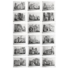
Set of 18 Gothic Architectural Prints ( Scotland ) After Robert Billings. 1848
Located in St Annes, Lancashire
Glorious set of 18 prints of Gothic Architecture in Scotland Steel engravings. After R.W. Billings Published by William Blackwood & Sons, Edinburgh. Dated 1848 Unframed.
Category

1840s Gothic Revival Antique Scottish Prints

Materials

Paper

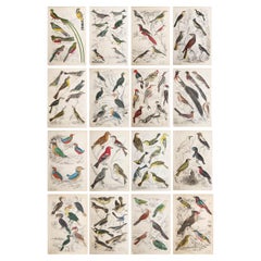
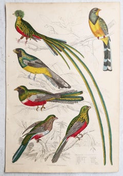
Set of 16 Large Original Antique Exotic Bird Prints, 1830s
Located in St Annes, Lancashire
Great set of bird prints Lithographs after the drawings by Cpt. brown. Original hand color. Unframed The measurement given below is for one print.
Category

1830s Folk Art Antique Scottish Prints

Materials

Paper

Set of 15 Large Original Antique Animal Prints, 1830s
Located in St Annes, Lancashire
Great set of animal prints Lithographs after the drawings by Cpt. brown. Original hand color. Unframed The measurement given below is for one print.
Category

1830s Folk Art Antique Scottish Prints

Materials

Paper

Set of 14 Original Antique Prints of Costumes of the Clans of Scotland, 1899
Located in Langweer, NL
Set of 14 original prints of 'McIan's Costumes of the Clans of Scotland'. Included are: Mac Arthur, Cameron, Skene, Buchanan, Forbes, Graeme, Ogilvie, Mac Nab, Mac Phee, Rose, Mac Dugal...
Category

Late 19th Century Antique Scottish Prints

Materials

Paper

Ethnographic Map of the World by A.K. Johnston – Races of Man Chart 1852
Located in Langweer, NL
Ethnographic Map of the World by A.K. Johnston – Races of Man Chart 1852 This antique map titled "Ethnographic Map of the World Showing the Present Distribution of the Leading Races...
Category

Mid-19th Century Antique Scottish Prints

Materials

Paper

Religious Belief Map by A.K. Johnston – Moral and Statistical Chart 1852
Located in Langweer, NL
Religious Belief Map by A.K. Johnston – Moral and Statistical Chart 1852 This antique chart titled "Moral & Statistical Chart Showing the Distribution of Man According to Prevailing...
Category

Mid-19th Century Antique Scottish Prints

Materials

Paper

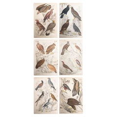
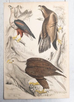
Set of 6 Large Original Antique Prints of Birds of Prey, C.1835
Located in St Annes, Lancashire
Great set of birds of prey Lithographs after the drawings by Turvey, A. Wilson and Cpt. Brown. Original color. Unframed The measurement given below is for one print.
Category

1830s Folk Art Antique Scottish Prints

Materials

Paper

“Stirling Castle Links” Antique Golf Etching by George Aikman, 1893
Located in Colorado Springs, CO
Presented is an original 1893 etching by George Aikman, after an original watercolor by John Smart. This composition depicts golfers, accompanied by young caddies and families, playi...
Category

1890s High Victorian Antique Scottish Prints

Materials

Paper

Alan Davie - Zurich, Improvisation XXXII, 1965 Signed Lithograph in Colors 20/25
By Alan Davie 1
Located in Keego Harbor, MI
A modern lithograph in colors titled "Zurich, Improvisation XXXII" by Scottish artist Alan Davie. Hand signed in pencil and dated 1965 on the lower right, titled lower mid, and annot...
Category

1960s Modern Vintage Scottish Prints

Materials

Paper

Pair of Original Antique Prints of Decorative Art- Japonisme. C.1880
Located in St Annes, Lancashire
Wonderful prints of Decorative Art, mainly Japonisme Chromo-lithographs Published by W.Mackenzie. C.1880 Original colour Unframed. Free shipping.
Category

1880s Japonisme Antique Scottish Prints

Materials

Paper

Geological Map of North America by A.K. Johnston – Mountains and Valleys 1852
Located in Langweer, NL
Geological Map of North America by A.K. Johnston – Mountains and Valleys 1852 This finely detailed and beautifully shaded antique map titled "The Mountains, Table Lands, Plains & Va...
Category

Mid-19th Century Antique Scottish Prints

Materials

Paper

Map of the Lakes of the Globe 1856 – Comparative Chart of Inland Seas
Located in Langweer, NL
Map of the Lakes of the Globe 1856 – Comparative Chart of Inland Seas Description: This remarkable 19th-century comparative chart is titled Comparative Form and Extent of the Inland...
Category

Mid-19th Century Antique Scottish Prints

Materials

Paper

Animal Distribution Map by A.K. Johnston – Fauna by Climate Zones 1852
Located in Langweer, NL
Animal Distribution Map by A.K. Johnston – Fauna by Climate Zones 1852 This beautifully engraved chart titled "The Distribution of Animals Including the Mammalia, Birds, Reptiles & ...
Category

Mid-19th Century Antique Scottish Prints

Materials

Paper

Botanical Map by A.K. Johnston – Global Plant Distribution Chart 1852
Located in Langweer, NL
Botanical Map by A.K. Johnston – Global Plant Distribution Chart 1852 This remarkable antique chart titled "The Distribution of the Most Important Trees, Shrubs, Grains, & Fruits Ac...
Category

Mid-19th Century Antique Scottish Prints

Materials

Paper

Geological Map of Africa by A.K. Johnston – Mountains and Valleys 1852
Located in Langweer, NL
Geological Map of Africa by A.K. Johnston – Mountains and Valleys 1852 This antique map titled "The Mountains, Table Lands, Plains & Valleys of Africa" was produced by the distingui...
Category

Mid-19th Century Antique Scottish Prints

Materials

Paper

Geological Map of the British Isles by A.K. Johnston – Highlands & Valleys 1852
Located in Langweer, NL
Geological Map of the British Isles by A.K. Johnston – Highlands & Valleys 1852 This antique topographic map titled "The Mountains, Table Lan...
Category

Mid-19th Century Antique Scottish Prints

Materials

Paper

Geological Map of Europe by A.K. Johnston – Mountains and Valleys 1852
Located in Langweer, NL
Geological Map of Europe by A.K. Johnston – Mountains and Valleys 1852 This elegant 1852 map titled "The Mountains, Table Lands, Plains & Valleys of Europe" was designed by the acclaimed Scottish geographer Alexander Keith Johnston and published by William Blackwood & Sons, Edinburgh and London. Issued as Plate 5 in Johnston’s pioneering work *The Physical Atlas of Natural Phenomena*, this map presents a physical topographic view of Europe with a focus on land elevation and terrain structure, rather than political borders. Rendered in soft shades of beige, green, and blue, the map clearly delineates Europe’s major mountain ranges, including the Alps, Pyrenees, Carpathians, Apennines, and the Scandinavian Mountains. Valleys, upland plateaus, and lowlands are carefully shaded and labeled, giving a three-dimensional sense of the landscape. The careful use of hachuring and color gradients creates a tactile impression of Europe’s relief, from the Scottish Highlands to the Ural Mountains. Rather than showing countries, the map categorizes the land by geological and geomorphological features. The title and key in the lower right explain the distinctions between highlands, tablelands, and low plains, emphasizing natural geography over human boundaries. This approach reflects the 19th-century scientific movement toward thematic cartography—maps made not to navigate or govern, but to understand physical phenomena. Alexander Keith Johnston (1804–1871), Geographer in Ordinary to the Queen for Scotland, was one of the most respected mapmakers of the Victorian era. His *Physical Atlas* was a groundbreaking work in visual science, and among the first to systematically map climate, geology, hydrology, and landforms across the globe. This plate is a beautifully executed example of early data visualization and remains highly relevant for collectors of antique scientific prints...
Category

Mid-19th Century Antique Scottish Prints
Materials

Paper

Earthquakes and Volcanoes Map by A.K. Johnston – Seismic Activity Atlas 1852
Located in Langweer, NL
Earthquakes and Volcanoes Map by A.K. Johnston – Seismic Activity Atlas 1852 This extraordinary 1852 scientific map titled "The Distribution of Earthquakes & Volcanoes Over the Glob...
Category

Mid-19th Century Antique Scottish Prints
Materials

Paper

World Map of Ocean Currents by A.K. Johnston, Educational Print 1852
Located in Langweer, NL
World Map of Ocean Currents by A.K. Johnston, Educational Print 1852 This detailed and scientifically rich chart titled 'Chart of the World Showing the Form & Direction of the Ocean...
Category

Mid-19th Century Antique Scottish Prints
Materials

Paper

Peter Howson Underground Series Framed Stratford Print, 1998
By Peter Howson
Located in Bishop's Stortford, Hertfordshire
A Peter Howson limited edition framed print titled 'Stratford' from The Underground Series derived from quick sketches which he drew while travelling around London. The print is numb...
Category

1990s Scottish Prints

Materials

Paper

Rain and Snow Map by A.K. Johnston – Global Precipitation Chart 1852
Located in Langweer, NL
Rain and Snow Map by A.K. Johnston – Global Precipitation Chart 1852 This antique meteorological chart titled "The Distribution of Rain and Snow over the Globe" was created by Alexa...
Category

Mid-19th Century Antique Scottish Prints
Materials

Paper

Wind and Hurricane Map by A.K. Johnston – Meteorological Chart 1852
Located in Langweer, NL
Wind and Hurricane Map by A.K. Johnston – Meteorological Chart 1852 This scientifically significant 1852 map titled "The Distribution of the Constant, Periodical & Variable Winds Ov...
Category

Mid-19th Century Antique Scottish Prints
Materials

Paper

Climatological Map by A.K. Johnston – Global Temperatures Chart 1852
Located in Langweer, NL
Climatological Map by A.K. Johnston – Global Temperatures Chart 1852 This exceptional antique map titled "Climatological Chart Showing by Lines & Figures the Mean Annual Temperature...
Category

Mid-19th Century Antique Scottish Prints
Materials

Paper

Geological Map of South America by A.K. Johnston – Mountains and Valleys 1852
Located in Langweer, NL
Geological Map of South America by A.K. Johnston – Mountains and Valleys 1852 This antique map titled "The Mountains, Table Lands, Plains & Valleys of South America" was produced by...
Category

Mid-19th Century Antique Scottish Prints
Materials

Paper

Geological Map of Asia by A.K. Johnston – Mountains and Valleys 1852
Located in Langweer, NL
Geological Map of Asia by A.K. Johnston – Mountains and Valleys 1852 This finely engraved and hand-colored map titled "The Mountains, Table Lands, Plains & Valleys of Asia" was crea...
Category

Mid-19th Century Antique Scottish Prints
Materials

Paper

River Systems Map of the World by A.K. Johnston – Educational Print 1852
Located in Langweer, NL
River Systems Map of the World by A.K. Johnston – Educational Print 1852 This striking 1852 map titled "The River Systems of the World" was created by the noted Scottish geographer ...
Category

Mid-19th Century Antique Scottish Prints
Materials

Paper

Antique Map of Italy Drawn & Engraved by R. Scott for Thomsons, Edinburgh 1814
Located in London, GB
This is a magnificent museum quality antique hand-coloured map of Italy, dating from 1814. This historic and very rare antique map was drawn and engraved by R. Scott for Thomsons, New General Atlas, Edinburgh. The map is very detailed and the various colours - yellow, grey and green - beautifully highlight the different natural and political divisions of Italy as it was before the Italian Unification...
Category

1810s Antique Scottish Prints

Materials

Other

Antique Map of England and Wales 'North' by A.K. Johnston, 1865
Located in Langweer, NL
Antique map titled 'England and Wales (Northern Sheet)'. This map originates from the ‘Royal Atlas of Modern Geography’ by Alexander Keith Johnston. Published by William Blackwood an...
Category

Mid-19th Century Antique Scottish Prints
Materials

Paper

Antique English Map – Southern England & Wales, Johnston’s Royal Atlas, 1865
Located in Langweer, NL
Antique Map of England & Wales (Southern Sheet) – Johnston’s Royal Atlas, 1865 This finely engraved antique map, titled *England and Wales (Southern Sheet)*, was published in 1865 i...
Category

Mid-19th Century Antique Scottish Prints
Materials

Paper

Antique Billiard Rules Pool Rules Pyramid Rules Victorian Framed Rules
Located in Radstock, GB
This framed and printed sheet Rule frame is very unusual because it actually features the rules of three games Billiards, Life Pool and Pyramid pool. Printed by the famous Glasgo...
Category

Late 19th Century Victorian Antique Scottish Prints

Materials

Pine

Recently Viewed

View All