Benelux - Collectibles and Curiosities

to
4,811
6,845
15,095
11,618
6,795
36
14
115
31
28
28
27
19
17
14
14
12
6
5
4
4
3
2
2
3,243
2,622
930
50
382
206
70
82
20
10
17
7
32
45
30
15
7
5,827
519
363
108
99
1,355
372
287
164
121
6,845
6,844
6,844
104
58
20
14
14
Item Ships From: Benelux
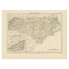
Antique Map of North Carolina, with inset map of the western part
Located in Langweer, NL
Antique map titled 'North Carolina'. Original antique map of North Carolina, United States. With inset map of the western part of North Carolina....
Category

Late 19th Century Antique Benelux - Collectibles and Curiosities

Materials

Paper

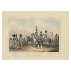
Rare Print of the 'Corps Des Guides' of the Belgium Army Regiment, 1833
Located in Langweer, NL
One nicely hand coloured print of an original serie of 23 plates, showing officers and soldiers resting near a village. published in 1833. Rare. From a serie of beautiful lithographed plates with Belgian military...
Category

1830s Antique Benelux - Collectibles and Curiosities

Materials

Paper

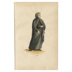
Antique Print of a Monk of the Alexians, 1845
Located in Langweer, NL
Antique print titled 'Alexien'. Print of a Monk of the Alexians. This print originates from 'Histoire et Costumes des Ordres Religieux'. Artists and Engravers: Author: Abbé Tiron....
Category

19th Century Antique Benelux - Collectibles and Curiosities

Materials

Paper

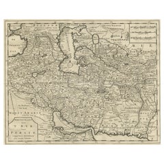
Map of Persia, the Caspian & India – Isaak Tirion, c.1730
Located in Langweer, NL
Map of Persia and Surrounding Regions – “Nieuwe Kaart van 't Ryck van Persie” by Isaak Tirion, Amsterdam, c. 1730 This finely detailed copperplate map titled “Nieuwe Kaart van 't Ry...
Category

Mid-18th Century Dutch Antique Benelux - Collectibles and Curiosities

Materials

Paper

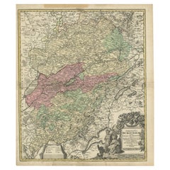
Antique Map of the County of Burgundy by Johann Baptist Homann circa 1710
Located in Langweer, NL
Antique Map of the County of Burgundy by Johann Baptist Homann circa 1710 Hand-Colored This finely detailed antique map titled Comitatus Burgundia depicts the historic region of t...
Category

1720s Antique Benelux - Collectibles and Curiosities

Materials

Paper

Antique Map of the Coast of China by Bellin, 1752
By Jacques-Nicolas Bellin
Located in Langweer, NL
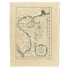
Antique map titled 'Carte des Costes de Cochinchine, Tunquin et Partie de celles de Chine'. Detailed map of the region from the Cambodia River to Macao, along the coast of China. ...
Category

18th Century Antique Benelux - Collectibles and Curiosities

Materials

Paper

Antique Map of West Africa, focused on the Congo and Angola
Located in Langweer, NL
Original antique map titled 'Regna Congo et Angola'. Decorative 17th Century English map of a portion of West Africa, focused on the Congo and Angola. The map is centered on the Zair...
Category

Late 17th Century Antique Benelux - Collectibles and Curiosities

Materials

Paper

Map of Shropshire, 1844: Telford, Shrewsbury, Oswestry, Bridgnorth & Wellington
Located in Langweer, NL
Old Map of Shropshire by Samuel Lewis, 1844: Telford, Shrewsbury, Oswestry, Bridgnorth, and Wellington This 1844 map of Shropshire is an antique engraving from Samuel Lewis' Topogr...
Category

1840s Antique Benelux - Collectibles and Curiosities

Materials

Paper

Antique Dutch silver bracket with embroidered sac, 1820
Located in Delft, NL
Antique Dutch silver bracket with embroidered sac, 1820 A Dutch silver bracket made in 1820 with an embroidered sac. The silver is Dutch silver hallmarked with the "Lion 2" for 833/...
Category

Early 19th Century Dutch Antique Benelux - Collectibles and Curiosities

Materials

Silver

Antique Print of Liège / Luik in Belgium by Braun & Hogenberg, 1575
Located in Langweer, NL
Antique print titled 'Leodium'. View of Liège / Luik, Belgium with surrounding hills and the city wall. With text explaining the origins of Liège, a cartouche expressing thanks to th...
Category

16th Century Antique Benelux - Collectibles and Curiosities

Materials

Paper

Antique Decorative Coloured Map Marocco, Algeria and Tunis, 1882
Located in Langweer, NL
The maps is from the 1882 atlas by Blackie & Son and offers a detailed view of the North African regions as understood in the late 19th century. **Map of Morocco, Algeria, and Tun...
Category

1880s Antique Benelux - Collectibles and Curiosities

Materials

Paper

Rare Patinated Antique Bronze Sculpture of the Immaculate Heart of Virgin Mary
Located in Lisse, NL
Marvelous quality, bronze Virgin Mary with the holy heart symbol on her chest. If you are a collector of antique and top-quality religious artefacts the...
Category

Early 20th Century European Gothic Revival Benelux - Collectibles and Curiosities

Materials

Bronze

Austria by Wolfgang Lazius – A Magnificent 16th-Century Map from Ortelius
Located in Langweer, NL
Title: Avstriae Descrip – Wolfgang Lazius’ Map of Austria, 16th Century Description: This extraordinary map of Austria pays homage to the Austrian humanist and cartographer Wo...
Category

16th Century Antique Benelux - Collectibles and Curiosities

Materials

Paper

1880 Belgian Leather Miners Hat
Located in Haarlem, NL
This early miners hat was made from leather. They used to make it wet before putting the hat on and going into the mine. First of all to correct the fit of ...
Category

19th Century Belgian Antique Benelux - Collectibles and Curiosities

Materials

Leather

1880 Belgian Leather Miners Hat
$448 Sale Price
20% Off
Hand-Colored 1750 Plan of Batavia, Colonial Jakarta, Indonesia by Jacques Bellin
Located in Langweer, NL
Hand-Colored 1750 Plan of Batavia, Colonial Jakarta by Jacques Bellin This finely detailed mid-18th century plan presents the fortified city of Batavia, now Jakarta, the capital of ...
Category

Mid-18th Century Antique Benelux - Collectibles and Curiosities

Materials

Paper

Crete Map 1749 – Homann Heirs Engraving of Candia with Aegean Islands
Located in Langweer, NL
Crete Map 1749 – Homann Heirs Engraving of Candia with Aegean Islands This fine 1749 map titled 'Insula Creta hodie Candia' presents an 18th-century cartographic portrait of the isl...
Category

1740s German Antique Benelux - Collectibles and Curiosities

Materials

Paper

German Antique Map of Australia and Polynesia, c.1870
Located in Langweer, NL
Antique map titled 'Inseln des Grossen Oceans, Australien und Polynesien'. Old map of Australia and Polynesia. This map originates from 'H. Kiepert's Kleiner Atlas der Neueren Geogra...
Category

19th Century Antique Benelux - Collectibles and Curiosities

Materials

Paper

Engraved 'Cape of Good Hope' Colonial Commemorative Glass, 18th Century
Located in Amsterdam, NL
A commemorating glass with an engraving of a farmer ploughing, an East Indiaman and a text reading: Het Lan’s Wel Varen An De Caap (the country’s prosperity at the Cape of Good Hope...
Category

18th Century South African Antique Benelux - Collectibles and Curiosities

Materials

Glass

Antique Map of the Province of Navarre with the City of Pamplona, Spain
Located in Langweer, NL
Antique map titled 'Royaume de Navarre (..)'. Decorative map of the province Navarre (Spanish: Navarra) in Northern Spain centered on the city of Pamplona. Published by N. Sanson, 16...
Category

Mid-17th Century Antique Benelux - Collectibles and Curiosities

Materials

Paper

Antique Plan of Turkey in Europe with Inset Map of the Bosporus, ca.1850
Located in Langweer, NL
Antique map titled 'Turkey in Europe'. A map of European Turkey and the surrounding countries. With an inset map of the Bosporus. This includes Macedonia, Bulgaria, Croatia, Bosn...
Category

1850s Antique Benelux - Collectibles and Curiosities

Materials

Paper

Antique Bird's Eye View of Scheveningen Near The Hague, the Netherlands, 1730
Located in Langweer, NL
Antique print titled 'Afbeeldinge van Schevelinge in den Jaare 1729'. Bird's eye view of Scheveningen near The Hague / Den Haag, the Netherlands. This print originates from 'Beschr...
Category

1730s Antique Benelux - Collectibles and Curiosities

Materials

Paper

Map of Batavia’s Surroundings with Early Reference to Jakarta, Indonesia, c.1770
Located in Langweer, NL
Map of Batavia’s Surroundings with Early Reference to Jakarta, circa 1770 Description: This finely engraved map titled "Carte des Environs de Batavia" offers a compelling and histor...
Category

Late 18th Century Dutch Antique Benelux - Collectibles and Curiosities

Materials

Paper

British Island Group Map 1695 – Morden’s Smaller Islands of the British Ocean
Located in Langweer, NL
British Island Group Map 1695 – Morden’s Smaller Islands of the British Ocean This rare and decorative late 17th-century map titled "The Smaller Islands in the British Ocean" was en...
Category

Late 17th Century English Antique Benelux - Collectibles and Curiosities

Materials

Paper

Map of Drôme France with Valence and Rhône Valley Wine Region, 19th Century
Located in Langweer, NL
Map of Drôme France with Valence and Rhône Valley Wine Region, 19th Century Description: This beautifully engraved 19th-century map of the Drôme department in southeastern France wa...
Category

Mid-19th Century French Antique Benelux - Collectibles and Curiosities

Materials

Paper

Antique Map of the Bay of Cordes and Surroundings by Hawkesworth, 1774
Located in Langweer, NL
Antique print titled 'Baye et Havre de Cordes (..)'. Four maps on the one sheet of; Cordes Bay, Port Famine, Woods Pay, Port Gallant, Fortescue Bay, Chile based on the voyage of John...
Category

18th Century Antique Benelux - Collectibles and Curiosities

Materials

Paper

Antique Print of a French Marshal, 1890
Located in Langweer, NL
Antique print titled 'Maréchal-des-Logis du Roi'. Old print of a French marshal. This print originates from 'Histoire de la maison militaire du roi de 1814 à 1830 : avec un résumé de...
Category

19th Century Antique Benelux - Collectibles and Curiosities

Materials

Paper

Lugo 1901: A Cartographic Chronicle of Galicia's Ancient Roman Walled City
Located in Langweer, NL
The map presents the province of Lugo, located in the autonomous community of Galicia in northwestern Spain, as it was in 1901. Notable features include: - **Topography**: The provi...
Category

Early 1900s Antique Benelux - Collectibles and Curiosities

Materials

Paper

Stunning Bird's-Eye View Plan of Hasselt by Blaeu in The Netherlands, 1649
Located in Langweer, NL
Antique print, titled: 'Hasselt.' Bird's-eye view plan of Hasselt in The Netherlands. With key to locations and coats of arms. Text in Dutch on verso. This plan originates from the famous city Atlas: 'Toneel der Steeden' published by Joan Blaeu...
Category

1640s Antique Benelux - Collectibles and Curiosities

Materials

Paper

Original Brendel Botanic Model
Located in Weesp, NL
Discover Botany's Finest: Original Brendel Botanic Models from the 1950s Unveil the beauty of botany with our exquisite collection of original Brendel botanic models: Spike, Raceme,...
Category

1950s German Mid-Century Modern Vintage Benelux - Collectibles and Curiosities

Materials

Wood

Old Original Handcoloured Map of the Former Province of Perche, France, ca.1640
Located in Langweer, NL
Antique map titled 'Perchensis Comitatus - La Perche compte'. Old map of the former province of Perche, France. Until the French Revolution, Perche was bounded by four ancient te...
Category

1640s Antique Benelux - Collectibles and Curiosities

Materials

Paper

Italia Antiqua Philippo Cluvero – 1603 Hondius Map of Ancient Italy, Handcolored
Located in Langweer, NL
Italia Antiqua Philippo Cluvero – 1603 Hondius Map of Ancient Italy with Hand Color This stunning early 17th-century map, *Italia Antiqua Philippo Cluvero Borusso Designatore*, wa...
Category

Early 1600s Antique Benelux - Collectibles and Curiosities

Materials

Paper

Historic Map of Poland and Lithuania – Tirion Edition c.1740
Located in Langweer, NL
Poland Map 1740s – Nieuwe Kaart van het Koninryk Poolen by Isaak Tirion This finely engraved and attractively hand-colored map of the Kingdom of Poland was published by Isaak Tirion...
Category

Mid-18th Century Antique Benelux - Collectibles and Curiosities

Materials

Paper

Steiff collection Cats, Germany, Mid 20th Century
By Steiff
Located in Delft, NL
Steiff collection Cats, Germany, Mid 20th Century Five cats, 4 of which are filled with straw. Two Tom-cats (1, the smallest is right hind leg defective) Black with arched back. 17 ...
Category

Mid-20th Century German Benelux - Collectibles and Curiosities

Materials

Fabric

Turkey in Asia: Biblical Regions and the Holy Land from The Royal Atlas (1856)
Located in Langweer, NL
This antique map titled "Turkey in Asia (Biblical Regions) The Holy Land and its Borders" comes from "The Royal Illustrated Atlas", which was published in 1856 by A. Fullarton & Co. ...
Category

Mid-19th Century Antique Benelux - Collectibles and Curiosities

Materials

Paper

Imperial map of Northern Russia with Archangel, Lapland and Permia, c.1730
Located in Langweer, NL
Imperial map of Northern Russia with Archangel, Lapland, and Permia, c.1730 Description: This intricately engraved and hand-colored map presents the northern reaches of the Russian ...
Category

Early 18th Century German Antique Benelux - Collectibles and Curiosities

Materials

Paper

Antique Street Map of the City of Edo 'Modern Tokyo' in Japan
Located in Langweer, NL
Antique map titled 'Plan de Jedo - Platte Grond van Jedo'. A detailed street map of the city of Edo (modern Tokyo) in Japan, originally engraved by Bellin and Schley and reissued for...
Category

Mid-18th Century Antique Benelux - Collectibles and Curiosities

Materials

Paper

Antique Map of the Location of the Garden of Eden and Travels of the Patriarchs
Located in Langweer, NL
Title: Map of the Location of the Garden of Eden and Travels of the Patriarchs Cartographer/Publisher: Pieter Mortier (1661–1711), published by Covens & Mortier (Amsterdam, 1725)...
Category

1720s Antique Benelux - Collectibles and Curiosities

Materials

Paper

Antique Map of Africa by Homann Heirs, '1804'
Located in Langweer, NL
Antique map titled 'Charte von Africa'. Large, original antique map of Africa by Franz Ludwig Güssefeld. Published by Homann Heirs, 1804.
Category

Early 19th Century Antique Benelux - Collectibles and Curiosities

Materials

Paper

19th Century Limestone Holy Water Font
Located in Zedelgem, BE
19th century Beautiful little holy water font in limestone (Italian church).
Category

Late 19th Century European Louis XV Antique Benelux - Collectibles and Curiosities

Materials

Limestone

Rare Engraving of Mount Sinai with St. Catherine's Monastery and Bedouins, 1680
Located in Langweer, NL
Rare antique print titled ‘Bergh Sinai of Sint Catryn’. This engraving shows Mount Sinai (also known as Mount Horeb) with St. Catherine's Monastery at the foot of the mountains a...
Category

1680s Antique Benelux - Collectibles and Curiosities

Materials

Paper

18th Century Antique Engraving of the Southern Hemisphere by G. de L'Isle
By Guillaume De L'Isle
Located in Langweer, NL
Antique map titled 'Hemisphere Meridional pour voir plus distinctement Les Terres Australes'. Hemispherical map of the southern hemisphere centered on ...
Category

Late 18th Century Antique Benelux - Collectibles and Curiosities

Materials

Paper

Antique Map of Eastern Mediterranean and Asia Minor by a Benedictine, c.1725
Located in Langweer, NL
Antique map titled 'Byzondere Afbeelding der Landschappen, van de Apostelen bevaren en doorwandelt om het Evangelium J. C. te Prediken.' Map of the lands travelled by the Apostles to...
Category

18th Century Antique Benelux - Collectibles and Curiosities

Materials

Paper

Detailed Map of Southeast Asia From the Tip of Cambodia to Java, 1739
Located in Langweer, NL
Antique map titled 'Nieuwe kaart van de Sundasche Eilanden als Borneo, Sumatra en Groot Iava & c'. Detailed map of Southeast Asia, extending from the tip of Cambodia to Java. Thi...
Category

1730s Antique Benelux - Collectibles and Curiosities

Materials

Paper

Historic Map of Missouri and Kansas Showing Railroads and Frontier Trails, 1864
Located in Langweer, NL
Antique 1864 Map of Missouri and Kansas by Johnson and Ward Description: This finely detailed and vibrantly hand-colored map of Missouri and Kansas, publ...
Category

1860s Antique Benelux - Collectibles and Curiosities

Materials

Paper

Antique Map of the Hainaut and Namur Region by Janssonius, 'circa 1640'
By Johannes Janssonius
Located in Langweer, NL
Antique map titled 'Comitatuum Hannoniae et Namurci Descriptio'. Old map of the region of Hainaut and Namur, France. Published by J. Janssonius, circa 1640.
Category

Mid-17th Century Antique Benelux - Collectibles and Curiosities

Materials

Paper

Antique World Map by Lesage, 1823
Located in Langweer, NL
Antique world map titled 'Mappe Monde Historique'. The map depicts both the Eastern and Western Hemispheres, with the hemispheres meeting in the midd...
Category

Early 19th Century Antique Benelux - Collectibles and Curiosities

Materials

Paper

Antique World Map by Lesage, 1823
$286 Sale Price
20% Off
Antique Print of Alexandria in Egypt, 1698
Located in Langweer, NL
Antique print with two views of Alexandria, Egypt. This print originates from 'Reizen van Cornelis de Bruyn, door de vermaardste deelen van Klein Asia, de eylanden Scio, Rhodus, Cypr...
Category

17th Century Dutch Antique Benelux - Collectibles and Curiosities

Materials

Paper

Historic 1690 Map of Lorraine in France by Allard - Cities of Toul, Nancy, Metz
Located in Langweer, NL
Exactissima Lotharingia - A Rare 17th Century Map of Lorraine by Carel Allard This fascinating map of Lorraine, created by Carel Allard around 1690, is a stunning example of coppe...
Category

1690s Antique Benelux - Collectibles and Curiosities

Materials

Paper

Thraciae Veteris Typus – 1618 Ortelius Map of Ancient Thrace with Hand Color
Located in Langweer, NL
Thraciae Veteris Typus – 1618 Ortelius Map of Ancient Thrace with Hand Color This striking early 17th-century map, Thraciae Veteris Typus, was published in 1618 by Abraham Orteliu...
Category

Early 1600s Antique Benelux - Collectibles and Curiosities

Materials

Paper

Gerrit Rietveld, designer and architect
By Gerrit Rietveld
Located in Waddinxveen, ZH
Gerrit Rietveld (1888 - 1964) was a Dutch designer and architect. This booklet gives an interesting insight of his life and struggles he had as an architect. The text is in Dutch,...
Category

Late 20th Century Dutch Mid-Century Modern Benelux - Collectibles and Curiosities

Materials

Paper

Antique Map of the Western Hemisphere by Lapie, France, circa 1830
Located in Langweer, NL
Antique Map of the Western Hemisphere by Lapie, France, circa 1830 This beautifully engraved and delicately hand-colored map, titled Hémisphère du Nouveau Continent (Ouest), depict...
Category

1830s Antique Benelux - Collectibles and Curiosities

Materials

Paper

Print Depicting a Bourgeoise in Folk Costume from Jászsági, Lower Hungary, 1850
Located in Langweer, NL
Antique costume print titled 'Bourgeois, Maite Tanneur de J'Azberény'. Old print depicting a Bourgeoise in folk costume from Jászsági, lower Hungary. ...
Category

1850s Antique Benelux - Collectibles and Curiosities

Materials

Paper

Hospitaler of the Order of the Holy Ghost, Roman Catholic Order, 1845
Located in Langweer, NL
Antique print titled 'Hospitalier du Saint-Esprit'. Print of a Hospitaler of the Order of the Holy Ghost, Hospitallers of the Holy Spirit, Roman Catholi...
Category

1840s Antique Benelux - Collectibles and Curiosities

Materials

Paper

A faceted bead necklace
Located in Delft, NL
A faceted bead necklace 43 facetted stone balls transparent with milky gray and light brown tones, varying from size 2 cm diagonal to 1 cm diag...
Category

Mid-20th Century European Benelux - Collectibles and Curiosities

Materials

Glass

1857 Map of Northern South America – Brazil, Colombia, Peru by Stülpnagel
Located in Langweer, NL
1857 Map of Northern South America – Brazil, Colombia, Peru by Stülpnagel Antique map titled “Süd-America in zwei Blättern” (South America in Two Sheets), newly edited by V. v. Stül...
Category

Mid-19th Century German Antique Benelux - Collectibles and Curiosities

Materials

Paper

Old Map of Herefordshire 1844 – Hereford Leominster Ross-on-Wye Kington Bromyard
Located in Langweer, NL
Title: Old Map of Herefordshire by Samuel Lewis 1844 – Hereford Leominster Ross-on-Wye Kington Bromyard Description: This 1844 map of Herefordshire was drawn and engraved for Samuel Lewis’ Topographical Dictionary of England. It features major towns including Hereford, Leominster, Ross-on-Wye, Kington, and Bromyard. The map shows roads, rivers, topographical features, and surrounding counties such as Shropshire, Gloucestershire, and Monmouthshire. Hand-colored borders outline the county and a decorative compass rose enhances its historical charm. Condition: The map is in good antique condition with light even toning and wide margins. The engraving is sharp and the hand coloring remains bright. There are no tears or significant blemishes. Framing suggestions: Use an ivory or soft beige acid-free mat to complement the aged paper. A dark wood, antique gold, or soft black frame will bring out the map's classic style. UV-protective glass is recommended to preserve color and detail. A fine choice for traditional interiors, libraries, or heritage-themed décor. Keywords: Herefordshire map 1844 Samuel Lewis antique...
Category

1840s Antique Benelux - Collectibles and Curiosities

Materials

Paper

1858 Map of Hungary, Galicia & the Balkans – Justus Perthes Engraving
Located in Langweer, NL
1858 Map of Hungary, Galicia & the Balkans – Justus Perthes Engraving Antique map titled "Galizien, Ungarn, Slavonien und Croatien, Siebenbürgen und Dalmatien," published by Justus ...
Category

Mid-19th Century German Antique Benelux - Collectibles and Curiosities

Materials

Paper

Benelux Antique Map – Netherlands, Belgium & Luxembourg by Perthes, 1857
Located in Langweer, NL
1857 Map of Netherlands, Belgium & Luxembourg – Justus Perthes Engraving Antique map titled "Niederlande, Belgien und Luxemburg," published by Justus Perthes in Gotha in 1857. This...
Category

Mid-19th Century German Antique Benelux - Collectibles and Curiosities

Materials

Paper

Antique Habsburg Empire Map – Southeastern Germany to Venice, 1858
Located in Langweer, NL
Map of Southeastern Germany & Northern Italy – Antique Engraving, 1858 Antique map titled "Süd-Östliches Deutschland nebst einem Theil des nördlichen Italien," published by Justus P...
Category

Mid-19th Century German Antique Benelux - Collectibles and Curiosities

Materials

Paper

Antique Map of the Northeast USA - Vibrant 1903 Cartographic Detail
Located in Langweer, NL
Map of the Northeastern United States of North America, 1903 This striking antique map titled “United States of North America (North Eastern Sheet)” was created by the renowned Scot...
Category

Early 20th Century Benelux - Collectibles and Curiosities

Materials

Paper

Read More

Medal-Worthy Memorabilia from Epic Past Olympic Games

Get into the games! These items celebrate the events, athletes, host countries and sporting spirit.

Ahoy! You’ve Never Seen a Collection of Sailor Art and Kitsch Quite Like This

French trendsetter and serial collector Daniel Rozensztroch tells us about his obsession with objects related to seafaring men.

Pamela Shamshiri Shares the Secrets behind Her First-Ever Book and Its Effortlessly Cool Interiors

The sought-after designer worked with the team at Hoffman Creative to produce a monograph that beautifully showcases some of Studio Shamshiri's most inspiring projects.

Moroccan Artworks and Objects Take Center Stage in an Extraordinary Villa in Tangier

Italian writer and collector Umberto Pasti opens the doors to his remarkable cave of wonders in North Africa.

Montecito Has Drawn Royalty and Celebrities, and These Homes Are Proof of Its Allure

Hollywood A-listers, ex-pat aristocrats and art collectors and style setters of all stripes appreciate the allure of the coastal California hamlet — much on our minds after recent winter floods.

Whaam! Blam! Pow! — a New Book on Pop Art Packs a Punch

Publishing house Assouline and writer Julie Belcove have teamed up to trace the history of the genre, from Roy Lichtenstein, Andy Warhol and Yayoi Kusama to Mickalene Thomas and Jeff Koons.

What Makes a Gem-Encrusted Chess Set Worth $4 Million?

The world’s most opulent chess set, weighing in at 513 carats, is literally fit for a king and queen.

Tauba Auerbach’s Geometric Pop-Up Book Is Mighty Rare, Thanks to a Hurricane

This sculptural art book has an epic backstory of its own.
Recently Viewed

View All