Benelux - Collectibles and Curiosities

to
4,811
6,841
15,096
11,617
6,791
36
14
115
31
28
28
27
19
17
14
14
12
6
5
4
4
3
2
2
3,243
2,620
928
50
380
206
70
82
20
10
17
7
32
45
30
15
7
5,823
519
363
108
99
1,352
372
284
164
121
6,841
6,840
6,840
104
58
20
14
14
Item Ships From: Benelux
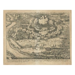
Battle of Wimpfen, 1622: Engraving by Matthäus Merian (ca. 1645)
Located in Langweer, NL
Title: Battle of Wimpfen, 1622: Engraving by Matthäus Merian (ca. 1645) Description: This antique copper engraving, created by the renowned Swiss-German engraver Matthäus Merian aro...
Category

1640s Antique Benelux - Collectibles and Curiosities

Materials

Paper

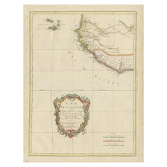
Antique Map of the Coast of Guinea and the Cape Verde Islands
Located in Langweer, NL
Antique map titled 'Carte de la Guinée (..)'. This map was originally part of a 2 sheet larger map of Eastern Africa, showing the Cape Verde Islands and Senegal. This map originates ...
Category

Late 18th Century Antique Benelux - Collectibles and Curiosities

Materials

Paper

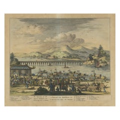
Original Copper Engraving Depicting Dutch Merchants visting China, ca.1700
Located in Langweer, NL
Title: 'The departure of the Empirour Hockflieuw to the Emprial Court at Peking' with further description in Dutch. The Dutch man Pieter van Hoorn, his son...
Category

Early 1700s Antique Benelux - Collectibles and Curiosities

Materials

Paper

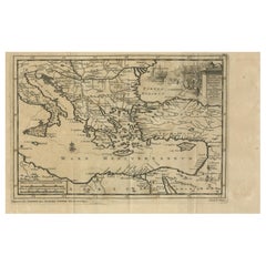
Venetian Trade Routes in the Levant – Antique Map by Pieter van der Aa, ca.1720
Located in Langweer, NL
Venetian Trade Routes in the Levant – Antique Map by Pieter van der Aa, Early 18th Century This finely engraved map, published by Pieter van der Aa in Leiden, provides a detailed d...
Category

1720s Antique Benelux - Collectibles and Curiosities

Materials

Paper

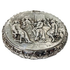
19th Century Dutch Silver Tobacco Box by J.J. Oosterbaan, Leeuwarden 1842
Located in Delft, NL
A 19th century Dutch silver tobacco box by J.J. Oosterbaan, Leeuwarden 1842 A beautifully decorated silver tobacco box with a Dutch scene ...
Category

Mid-19th Century Dutch Antique Benelux - Collectibles and Curiosities

Materials

Silver

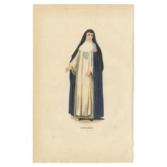
Antique Hand-Colored Engraving of a Conceptionist Nun, 19th Century
Located in Langweer, NL
Title: Antique Hand-Colored Engraving of a Conceptionist Nun, 19th Century Description: This finely detailed nineteenth-century hand-colored engraving depicts a Conceptionist nu...
Category

19th Century French Antique Benelux - Collectibles and Curiosities

Materials

Paper

Antique Map Plan of Town and Mole of CAP D'agde & Fort De Brescou, France, 1759
Located in Langweer, NL
Antique Plan titled 'Plan of the Town and Mole of Agde with the Fort de Brescou'. Antique town plan of Agde, engraved for the Geographical Dictionary, by Rol...
Category

Mid-18th Century Antique Benelux - Collectibles and Curiosities

Materials

Paper

PIRELLI calendar 1998 "Women that men live for" by Bruce Weber.
By Pirelli Tyres, Bruce Weber
Located in Linkebeek, BE
PIRELLI calendar 1998 "Women that men live for" by Bruce Weber. Limited numbered edition, this one numbered 34470 - Published by Pirelli Ltd, Royaume-Uni, 1998 With original box 2 a...
Category

20th Century Italian Benelux - Collectibles and Curiosities

Materials

Paper

Antique Map of the Djati 'teak wood' Forest Near Rembang, Java by Stemler, 1875
By Stemler
Located in Langweer, NL
Antique map titled 'Overzichtskaart van de Djatibosschen in de Residentie Rembang, Java.' This scarce map shows the Djati (teak) Forest on the indonesian island of Java. Originates f...
Category

19th Century Antique Benelux - Collectibles and Curiosities

Materials

Paper

Set of 2 Antique Prints of Decorated Knives, circa 1840
Located in Langweer, NL
Set of two antique prints. Plate 11 and 12 depicting decorated antique knives. Source unknown, to determined.
Category

Mid-19th Century Antique Benelux - Collectibles and Curiosities

Materials

Paper

Large & Wonderful Antique Bronze Sacred Heart of Christ Sculpture on Marble Base
Located in Lisse, NL
Mint condition, Serene and meaningful work of religious art. This beautifully hand-crafted bronze Sacred Heart of Christ statuette is another one of our recent great finds. In our v...
Category

Early 20th Century European Art Deco Benelux - Collectibles and Curiosities

Materials

Marble, Bronze

Antique Print of the Chief Temple in Hakodate in Japan, 1856
Located in Langweer, NL
Antique print titled ‘Chief Temple Hakodadi‘. View of the chief temple in Hakodate, Japan. This print originates from 'Narrative of the expedition of an American squadron to the Chin...
Category

19th Century Antique Benelux - Collectibles and Curiosities

Materials

Paper

Antique Map of the Region of Touraine in France by Janssonius, 1657
By Johannes Janssonius
Located in Langweer, NL
Antique map titled 'Touraine - Turonensis Ducatus'. Decorative map of the Touraine region. This map originates from 'Atlas Novus, Sive Theatrum Orbis Orbis Terrarum: In quo Galli...
Category

17th Century Antique Benelux - Collectibles and Curiosities

Materials

Paper

Antique Map of New Zealand by Arrowsmith '1844'
Located in Langweer, NL
Antique map titled 'Map of the colony of New Zealand from official documents'. A scarce map of New Zealand. First issued in the 1830s, this state sh...
Category

Mid-19th Century Antique Benelux - Collectibles and Curiosities

Materials

Paper

Annette Himstedt Doll Jule 1992/1993 and Steiff ride-on pull Poodle
By Steiff
Located in Delft, NL
Annette Himstedt Doll Jule 1992/1993 and Steiff ride-on pull Poodle "June" a vinyl doll made by Annette Himstedt, produced during 1992/1993. June in ori...
Category

20th Century German Benelux - Collectibles and Curiosities

Materials

Fabric, Plastic

Detailed 18th-Century Map of Paris and Its Surrounding Regions by Johann Homann
Located in Langweer, NL
This map, titled “Agri Parisiensis Tabula particularis,” was created and published by the German cartographer Johann Baptist Homann (1664–1724), or his workshop, in Nuremberg. Homann...
Category

1720s Antique Benelux - Collectibles and Curiosities

Materials

Paper

Original Antique Map of Italy with an Inset of Sardinia, 1882
Located in Langweer, NL
Embark on a historical odyssey with an original Antique Map of Italy from the esteemed 'Comprehensive Atlas and Geography of the World,' meticulously crafted in 1882. This captivatin...
Category

1880s Antique Benelux - Collectibles and Curiosities

Materials

Paper

Ciudad Real 1902: A Detailed Cartographic Survey of La Mancha in Spain
Located in Langweer, NL
This original antitque map presents the province of Ciudad Real, located in the autonomous community of Castilla-La Mancha in central Spain, as of 1902. It includes several notable f...
Category

Early 1900s Antique Benelux - Collectibles and Curiosities

Materials

Paper

Italian 19th Century male waistcoat and female top
Located in Delft, NL
Italian 19th Century male waistcoat and female top A 19th Century (ca 1845) Italian set of a male waistcoat and a female top. Both upholstery is made of silk and embroidered with m...
Category

Mid-19th Century Italian Antique Benelux - Collectibles and Curiosities

Materials

Silk

Ornate 1850s Map of the United States: Featuring Iconic Landmarks and Portrets
Located in Langweer, NL
Ornate 1850s Map of the United States: Featuring Iconic Landmarks and Historical Portraits This decorative 19th-century map of the United States, created by J. Rapkin and publishe...
Category

1850s Antique Benelux - Collectibles and Curiosities

Materials

Paper

Antique Map of Romania and Bulgaria Centered on the Danube River
Located in Langweer, NL
Antique map titled 'Vetus descriptio Daciarum nec non Moesiarum'. Impressive map of the area of Romania and Bulgaria centered on the Danube River. The map is based on Ortelius' map o...
Category

Mid-17th Century Antique Benelux - Collectibles and Curiosities

Materials

Paper

Hand Colored Antique Map of the Department of Cher, France
By Victor Levasseur
Located in Langweer, NL
Antique map titled 'Dépt. du Cher'. Map of the French department of Cher, France. This area of France is known for its production of Selles Sur Cher, a goats-milk cheese. The whole i...
Category

Mid-19th Century Antique Benelux - Collectibles and Curiosities

Materials

Paper

Rare City View of London and Westminster, Showing Many Battles Ships, 1804
Located in Langweer, NL
Title: The Cities of London & Westminster, accurately copied from the table of the Camera Obscura in the Royal Observatory at Greenwich This is a rare plate from a serie of 22 landmarks taken from Modern London, published in 1804 by Richard Phillips...
Category

Early 1800s Antique Benelux - Collectibles and Curiosities

Materials

Paper

20th Century Antique Porcelain Doll Heads
Located in Casteren, NL
20th century antique porcelain doll heads, various sizes and ages. 25 items in total. Originates France, dating, circa 1950-1960.
Category

1950s French Vintage Benelux - Collectibles and Curiosities

Materials

Porcelain

20th Century Antique Porcelain Doll Heads
$621 Sale Price / set
38% Off
Old Print of Farmers Harvesting Cinnamon on the Island Ceylon or Sri Lanka, 1672
Located in Langweer, NL
Antique print, titled: 'Hoe men de Caneel schilt opt Eyland Ceylon.' This rare original plate shows a group of farmers harvesting cinnamon on the island of Ceylon / Sri Lanka. Du...
Category

1670s Antique Benelux - Collectibles and Curiosities

Materials

Paper

Dutch Silver Miniature Table by Hooijkaas, Schoonhoven for a Doll's House
By Herman Hooijkaas
Located in Delft, NL
Dutch silver miniature table by Hooijkaas, Schoonhoven for a Doll's House Dutch silver miniature table with contoured top Dutch silver Hall marks of the "Sword, with 835" (used s...
Category

Mid-20th Century Dutch Benelux - Collectibles and Curiosities

Materials

Silver

Processional banner with Madonna and child
Located in 'S-HERTOGENBOSCH, NL
A processional banner from Kevelaar, a well-known pilgrimage site in Germany, near the Dutch boarder. The banner in silk and gold brocade hangs fro...
Category

Late 19th Century German Gothic Revival Antique Benelux - Collectibles and Curiosities

Materials

Canvas, Silk, Giltwood

Rare 16th Century Original Handcolored Miniature Map of Java, Indonesia, 1616
Located in Langweer, NL
Very handsome original old coloured copper engraving by Bertius of the island of Java in the early days of the Dutch colonisation - at that time named The Dutch East Indies or nowada...
Category

1610s Antique Benelux - Collectibles and Curiosities

Materials

Paper

French ear clips by Guy Laroche, 1980s
Located in Delft, NL
French ear clips by Guy Laroche, 1980s A set of earrings by Guy Laroche with clip system. Silver metal earrings with green enamel. Round earrings with an anchor in the middle surrou...
Category

20th Century French Benelux - Collectibles and Curiosities

Materials

Metal

Antique Terracotta Religious Wall Plaque / Sculpture of Christ in Deep Relief
Located in Lisse, NL
Impressive and all handcrafted, early 1900s sculpture of Christ suffering. Just like in the days when Christ lived on our planet, the truth (about who we are and how to best live o...
Category

Early 20th Century European Renaissance Revival Benelux - Collectibles and Curiosities

Materials

Terracotta

Antique 17th Century Map of the Islands Near Ceylon or Sri Lanka, 1672
Located in Langweer, NL
Antique map titled 'Eyland Ceylon.' Map of the islands near Ceylon or Sri Lanka. Dutch text on verso. Source unknown, to be determined. Artists and Engravers: Philip Baldaeus (1632-...
Category

17th Century Antique Benelux - Collectibles and Curiosities

Materials

Paper

Old German Map of the United States, Central America and the West Indies, c.1870
Located in Langweer, NL
Antique map titled 'Westindien, Mittelamerica und Vereinigte Staten'. Old map of the United States, Central America and the West Indies. This map originates from 'H. Kiepert's Kleine...
Category

19th Century Antique Benelux - Collectibles and Curiosities

Materials

Paper

Gateway to the Steppes: Tallis's Masterpiece Map of Indepent Tartary, 1851
Located in Langweer, NL
The map is of "Independent Tartary," a historical region in Central Asia that covered parts of what are now Kazakhstan, Uzbekistan, Turkmenistan, and surrounding areas. The map was p...
Category

1850s Antique Benelux - Collectibles and Curiosities

Materials

Paper

Antique Engraving of the Islands Wanooa, Wateeoo, Mangeea, Toobouai, Cook, 1803
Located in Langweer, NL
Antique map South Pacific Islands, Polynesia. Originates from 'Reizen Rondom de Waereld door James Cook (..)'. Artists and Engravers: Translated by J.D. Pasteur. Published by Hon...
Category

19th Century Antique Benelux - Collectibles and Curiosities

Materials

Paper

Antique Map of Menorca / Minorca by Homann Heirs '1757'
Located in Langweer, NL
Antique map titled 'Carte Topographique de l'Isle Minorque'. Scarce decorative map of Menorca (or Minorca), with two gorgeous views of Mahon and Fort St. Phillipe at the bottom. Publ...
Category

Mid-18th Century Antique Benelux - Collectibles and Curiosities

Materials

Paper

Antique Map of London Showing the Area from Essex to Surrey, England, 1741
Located in Langweer, NL
Antique map titled 'Regionis quae est circa Londinum specialis repraesentatio (..)' Very detailed map showing the area from Essex to Surrey and shows a lovely view of London with a high level of detail, stretching from Old London Bridge...
Category

18th Century Antique Benelux - Collectibles and Curiosities

Materials

Paper

Rare and Early Map of the Seventeen Provinces, Published in circa 1640
Located in Langweer, NL
Antique map titled 'Carte Generale des Dixsept Provinces des Pais Bas'. Rare and Early map of the Seventeen Provinces. The Seventeen Provinces were the Imperial states of the Habsbur...
Category

Mid-17th Century Antique Benelux - Collectibles and Curiosities

Materials

Paper

Antique Print with Coastal Views of Asia by Cook, c.1784
Located in Langweer, NL
Antique print titled 'Views of the Coast of Asia (..)'. Antique print depicting various coastal views of Asia including Kamchatka. Originates from an edition of Cook's Voyages. A...
Category

18th Century Antique Benelux - Collectibles and Curiosities

Materials

Paper

Mapping History: The Decorative Cartography of Indre-et-Loire by Levasseur, 1856
Located in Langweer, NL
An original hand-colored map of the Département d'Indre-et-Loire created by Victor Levasseur in 1856. As an antique steel engraved map, it showcases the detailed craftsmanship and technology of mid-19th century map making. The method of steel engraving allowed for precise and intricate details to be captured, making this map not only a navigational tool but also a work of art. The addition of outline hand colouring is particularly noteworthy. This technique, where colours are applied by hand to the engraved map, was a common practice at the time to highlight certain features such as boundaries, rivers, and cities. The hand colouring on this map would have been done meticulously, adding vibrancy and clarity to the engraved lines and making it easier to differentiate various geographical and political demarcations. The map's wide margins are characteristic of the period's presentation style, offering space for additional annotations or simply serving to frame the map aesthetically when displayed. Such margins also suggest that the map was intended for a discerning audience, possibly for educational or decorative purposes in a library or study. Victor Levasseur was renowned for his decorative maps, often embellished with artistic elements that went beyond mere geographical information. These elements could include vignettes, allegorical figures, and detailed illustrations surrounding the map itself, reflecting the cultural, historical, and economic aspects of the depicted area. While the description does not detail these decorative aspects, it's common for Levasseur's works to feature such embellishments, making his maps highly prized among collectors and historians for both their artistic value and cartographic accuracy. This map of Département d'Indre-et-Loire, with its combination of technical precision in steel engraving and the beauty of hand colouring, represents a fascinating intersection of art and science in the 19th century. It is a testament to the era's dedication to detail, craftsmanship, and the aesthetic presentation of information. The Département d'Indre-et-Loire, located in the central part of France within the region known as the Centre-Val de Loire, is rich in historical and cultural significance, with numerous important places highlighted on a map from 1856 by Victor Levasseur. Based on the region's known historical sites and cities, the following places are likely to be featured or of importance: 1. **Tours**: As the capital city of the Département d'Indre-et-Loire, Tours is a central hub of history, culture, and architecture. It is known for its old town, the Place Plumereau, Tours Cathedral, and its proximity to the Loire River, making it a likely focal point on the map. 2. **Amboise**: This town is famous for the Château d'Amboise, which is closely linked to French royal history and offers panoramic views of the Loire River. Leonardo da Vinci is buried here in the Chapel of Saint-Hubert, associated with the château. 3. **Chinon**: Known for its medieval fortress, the Château de Chinon, this town has deep historical roots, including connections to Joan of Arc and King Charles VII. The fortress and town would be significant landmarks. 4. **Villandry**: The Château de Villandry is renowned for its beautiful Renaissance gardens, which are some of the most impressive in France. While the château might be less emphasized in an 1856 map compared to cities and towns, it's an important site in the region. 5. **Loches**: This town features the Château de Loches, a medieval castle, and the Royal Lodge, noted for its Renaissance architecture. The town's history and architectural landmarks make it a place of interest. 6. **Azay-le-Rideau**: The Château d'Azay-le-Rideau is set on an island in the middle of the Indre River, showcasing the French Renaissance architectural...
Category

1850s Antique Benelux - Collectibles and Curiosities

Materials

Paper

Antique Print of a Member of the Congregation of the Mission, 1845
Located in Langweer, NL
Antique print titled 'Congregation des Prêtres de la Mission'. Print of a Member of the Congregation of the Mission. This print originates from 'Histoire et Costumes des Ordres Religieux'. The Congregation of the Mission (Latin: Congregatio Missionis) is a Roman Catholic society of apostolic life founded by Vincent de Paul...
Category

19th Century Antique Benelux - Collectibles and Curiosities

Materials

Paper

1645 Blaeu Map of Westmorland, Northern England – Hand Colored, Decorative
Located in Langweer, NL
This map, "Westmoria Comitatus; Anglice Westmorland", was created by the esteemed Dutch cartographer Willem Blaeu and was published around 1645 in 'Le Theatre du Monde ou Nouvel Atlas'. It provides a detailed look at Westmorland, a historic county in northern England, based on John Speed’s earlier map. The map features numerous place names, parks, and estates, including Brigster Park, Colnhead Park, Crosbye, and Midleton, along with a detailed depiction of Windermere (spelled Wynandermere) and the surrounding regions. Additional Features: - Hand-colored map, with vibrant and detailed colors that bring out the topographical and decorative features. - Includes intricate cartouches, such as the royal coat of arms, a decorative title cartouche topped with putti (cherubic figures), and six coats of arms (two left blank). - Depicts the region’s rich landscape, including the rolling hills and mountainous terrain of northern England. - French text on the verso, indicative of the publication period from 1645-1648, part of Blaeu’s highly sought-after atlases. - Map shows precise details of small towns, estates, and parks, such as Brigster Park, Colnhead Park, Crosbye, and Wynandermere (now Windermere Lake). This map would be of particular interest to collectors of English county maps, antique maps of northern England, 17th-century cartography, and the decorative works of Willem Blaeu. Blaeu's maps are renowned for their accuracy, artistic beauty, and historical significance. Keywords: Willem Blaeu, Westmorland map, northern England, 17th-century map, antique map, English county map, John Speed, Windermere, decorative cartography, hand-colored map, rare map, antique cartography...
Category

1640s Dutch Antique Benelux - Collectibles and Curiosities

Materials

Paper

Anrtique Map of the Province of Valladolid, Central Spain, 1902
Located in Langweer, NL
A historical or archival map of the province of Valladolid, Spain, from the year 1902. Valladolid is a province located in the central part of Spain, within the autonomous community ...
Category

Early 1900s Antique Benelux - Collectibles and Curiosities

Materials

Paper

Old Map of the Western Region of the Kingdom of Algiers, Algeria, 1773
Located in Langweer, NL
Antique map titled 'Kaart van het Westelyk Gedeelte van het Ryk van Algiers'. Old map of the western region of the Kingdom of Algiers, Algeria. Originates from the first Dutch ed...
Category

1770s Antique Benelux - Collectibles and Curiosities

Materials

Paper

Almería 1901: Coastal Contours and Landscapes in a Map of Southeastern Spain
Located in Langweer, NL
An original antique map of the province of Almería, Spain, from the year 1901. The Mediterranean Sea, labeled as "Mar Mediterraneo," forms the southeastern boundary of the province...
Category

Early 1900s Antique Benelux - Collectibles and Curiosities

Materials

Paper

Carved Wooden Antique French Barometer with Thermometer, Number 9432 1910s
By Black Forest
Located in Verviers, BE
Carved wooden antique French barometer with thermometer Unusual antique carved wooden barometer in a lovely carved case, working order. Number 9432 ...
Category

1910s French Art Nouveau Vintage Benelux - Collectibles and Curiosities

Materials

Fruitwood

Antique Map of Germany from a 17th Century Pocket Atlas, 1685
Located in Langweer, NL
Antique map titled 'Nova Totius Germaniae descriptio.' Miniature map of Germany, from the pocket atlas 'Introductionis in Universam Geographiam tam Veterem...
Category

17th Century Antique Benelux - Collectibles and Curiosities

Materials

Paper

Rare Theodore Danckerts Map of the Lower Rhine and Moselle River Regions
Located in Langweer, NL
Original antique map titled 'Accuratissima Rheni Inferioris Mosae et Mosellae Tabula'. Rare Theodore Danckerts map of the Lower Rhine and Moselle River Regions. The map covers the lo...
Category

Early 18th Century Antique Benelux - Collectibles and Curiosities

Materials

Paper

Álava in Northern Spain: The Geography of Basque Heritage and Terrain, 1902
Located in Langweer, NL
This original antique map is a historical depiction of the province of Álava (in Basque: Araba), which is one of the provinces of the Basque Country in northern Spain, as indicated b...
Category

Early 1900s Antique Benelux - Collectibles and Curiosities

Materials

Paper

Large Polychrome Masterpieces of Monumental Art in Italy 'V to XVI Century' 1883
Located in Langweer, NL
Six impressive full page colored chromolithographic plates of monumental art in Italy. Published in 1883. These are large-folio seized in a clamshell portfolio and include the 16 lea...
Category

1880s Antique Benelux - Collectibles and Curiosities

Materials

Paper

Gascogne and Guyenne Map - Hand-Colored 17th-Century Engraving by De Wit, c.1688
Located in Langweer, NL
Title: Gascogne and Guyenne Map - Hand-Colored 17th-Century Engraving by Frederik De Wit c. 1688 Description: This remarkable map, "Gouvernement de la Guyenne & Gascogne," captures ...
Category

1680s Antique Benelux - Collectibles and Curiosities

Materials

Paper

Old Engraving the City and Harbour of Pathmos, Patmos or Patimo in Greece, 1725
Located in Langweer, NL
Antique print, titled: 'Gezicht van het eiland en de haven van Pathmos (…).' This plate shows a view of the city and harbour of Pathmos, Patmos or Patimo in Greece. This plate or...
Category

1720s Antique Benelux - Collectibles and Curiosities

Materials

Paper

Antique Map of Asian Turkey, Levant, and Mesopotamia by Tardieu, circa 1802
Located in Langweer, NL
This is an original antique map titled "Carte de la Turquie Asiatique," depicting the Asian territories of the Ottoman Empire. Created by Pierre Antoine Tardieu, this map illustrates...
Category

Early 1800s French Antique Benelux - Collectibles and Curiosities

Materials

Paper

Collection of Dutch miniature dollhouse pewter, 17th - 18th century
Located in Delft, NL
Collection of Dutch miniature dollhouse pewter, 17th - 18th century A collection of 4 pieces of antique miniature pewter from the periods 17th century and 18th century A porringer ...
Category

17th Century Dutch Antique Benelux - Collectibles and Curiosities

Materials

Pewter

Antique Map of Great Britain and Ireland by Brion de la Tour, 1766
Located in Langweer, NL
Antique map titled 'Les Isles Britanniques (..).' Attractive map of Great Britain surrounded by an engraved border printed from a separate coppe...
Category

18th Century Antique Benelux - Collectibles and Curiosities

Materials

Paper

Old Genuine Antique Map of Tartary in the Russian Far East
Located in Langweer, NL
Original antique map titled 'Tartaria sive Magni Chami Imperium'. This great map of Tartary covers all of eastern Asia between the Caspian Sea and northern China and Manchuria. Being...
Category

Mid-17th Century Antique Benelux - Collectibles and Curiosities

Materials

Paper

Original Antique Engravings of Various Churches on Ceylon 'Sri Lanka', 1732
Located in Langweer, NL
Antique print titled 'The Church Poelepolay, The Church Mogommate, The church Tambamme, the Church Mulipatto'. Antique print with four views of the churches of Poelepolay, Mogommate,...
Category

18th Century Antique Benelux - Collectibles and Curiosities

Materials

Paper

Antique Map of the Arabian Peninsula by Bonne 'c.1780'
Located in Langweer, NL
Antique map titled 'Carte de l'Arabie, du Golfe Persique, et de la Mer Rouge (..)'. Original antique map of the Arabian Peninsula, including the horn...
Category

Late 18th Century Antique Benelux - Collectibles and Curiosities

Materials

Paper

Antique Map of Vermont
Located in Langweer, NL
Antique map titled 'Vermont'. Original antique map of Vermont, United States. This print originates from 'Encyclopaedia Britannica', Ninth Edition. Publ...
Category

Late 19th Century Antique Benelux - Collectibles and Curiosities

Materials

Paper

Antique Map of Vermont
$277 Sale Price
20% Off
Antique Map of the Region of Aigues-Mortes and Camargue, France
Located in Langweer, NL
Antique map titled 'Environs d'Aiguemortes de Peccais &a et la petite Camargue'. Original map of the region of Aigues-Mortes and Camargue, France. This map originates from 'Le Petit ...
Category

Mid-18th Century Antique Benelux - Collectibles and Curiosities

Materials

Paper

Gallipoli Fortifications: A 1688 Engraved Bird’s-Eye Map by Mattheus Merian
Located in Langweer, NL
Gallipoli Fortifications: A 1688 Bird’s-Eye Map by Mattheus Merian Description: This exquisitely detailed map of Gallipoli, crafted by the renowned engraver Mattheus Merian, offers ...
Category

1680s German Antique Benelux - Collectibles and Curiosities

Materials

Paper

Read More

Medal-Worthy Memorabilia from Epic Past Olympic Games

Get into the games! These items celebrate the events, athletes, host countries and sporting spirit.

Ahoy! You’ve Never Seen a Collection of Sailor Art and Kitsch Quite Like This

French trendsetter and serial collector Daniel Rozensztroch tells us about his obsession with objects related to seafaring men.

Pamela Shamshiri Shares the Secrets behind Her First-Ever Book and Its Effortlessly Cool Interiors

The sought-after designer worked with the team at Hoffman Creative to produce a monograph that beautifully showcases some of Studio Shamshiri's most inspiring projects.

Moroccan Artworks and Objects Take Center Stage in an Extraordinary Villa in Tangier

Italian writer and collector Umberto Pasti opens the doors to his remarkable cave of wonders in North Africa.

Montecito Has Drawn Royalty and Celebrities, and These Homes Are Proof of Its Allure

Hollywood A-listers, ex-pat aristocrats and art collectors and style setters of all stripes appreciate the allure of the coastal California hamlet — much on our minds after recent winter floods.

Whaam! Blam! Pow! — a New Book on Pop Art Packs a Punch

Publishing house Assouline and writer Julie Belcove have teamed up to trace the history of the genre, from Roy Lichtenstein, Andy Warhol and Yayoi Kusama to Mickalene Thomas and Jeff Koons.

What Makes a Gem-Encrusted Chess Set Worth $4 Million?

The world’s most opulent chess set, weighing in at 513 carats, is literally fit for a king and queen.

Tauba Auerbach’s Geometric Pop-Up Book Is Mighty Rare, Thanks to a Hurricane

This sculptural art book has an epic backstory of its own.
Recently Viewed

View All