Benelux - Collectibles and Curiosities

to
4,921
6,563
14,758
11,495
6,509
40
14
116
30
30
25
22
18
16
13
13
6
5
5
4
4
2
1
3,132
2,462
915
54
378
200
63
83
18
9
17
7
31
41
28
12
6
5,599
490
333
103
97
847
190
166
83
75
6,563
6,562
6,562
104
59
20
14
14
Item Ships From: Benelux
Antique Map of Japan by A.M. Mallet, 1683
Located in Langweer, NL
A charming late 17th century French map with a very decorative title cartouche showing trumpet-blowing cherubs, by Allain Manneson Mallet (1630-1706), a well traveled military engine...
Category

Late 17th Century Antique Benelux - Collectibles and Curiosities

Materials

Paper

Antique Engraving of Majorinus, Bishop of Carthage of the Donatist Sect, 1701
Located in Langweer, NL
Antique print, titled: 'Majorinus Numida' Majorinus was a bishop of Carthage in dispute with Ceacilianus. He favored the so-called Donatist sect. Het died ca. 329 AD. The background to the controversy was the wave of persecutions of Christians by the Roman Emperor Diocletian. At that time some Church leaders - unwilling to endure torture or death and become martyrs - had been ready to take such acts as worshipping the gods of the old pantheon, considered idols by Christians, or surrendering church books and property to the imperial authorities. Such people became known as 'traditors' ("surrenderers"). One of these "traditors", named Caecilian, had returned to the fold of the Church once the persecutions ended, and was consecrated Bishop of Carthage and Primate of North Africa. Those of the faithful who refused to accept the authority of such a spiritual leader raised Majorinus as a rival bishop; however, Majorinus died shortly after being consecrated, and it fell to Donatus to take his place and continue the struggle. This rare print originates from: 'Historie der Kerken en Ketteren van den beginne des Nieuwen Testaments tot aan het Jaar onses Heeren 1688. Onzydig in 't Hoogduytsch beschreeven, door den Hoog-geleerden Heer Godfried Arnold, Voor deezen Hoog-Leeraar in de Historien tot Giesen. In het Neederduyts vertaald. Vercierd met verscheyde Koopere Plaaten door den Heer Romeyn de Hooghe.' (transl.: History of Churches and Heretics from the start of the New Testament until the year of our lord 1688 ...), by Godfried Arnold, Dutch edition published by Sebastiaan Petzold, Amsterdam 1701. This edition contains portraits of heretic figures, etched by the reknown Romeyn de Hooghe. Artists and Engravers: Made by 'Romeyn de Hooghe' after an anonymous artist. Gottfried Arnold (pseud. Christophorus Irenaeus) was an important representative of the so-called radical Pietism, publicist, church historian and chants writer (so he was believed to have written the well-known Church song 'O Durchbrecher aller Bande'). Arnold studied theology in Wittenberg. From the Lutheran Orthodoxy he converted, through writings of Spener, to Pietism, associating later into a circle around the court preacher Sprögel, who was influenced by Jakok Böhm. Many medieval mystics were later re-issued by him. In addition he was clearly influenced by Grotius and the early enlightenment. His quest for the 'true' Christianity rightly brought him in the early Church. So he arranged an edition containing the sermons of the desert father Macarius. Arnold was a skilled patristicus, although he did not escape from the creation of an ideal image of the Christian life in the early Church, in his view a flowering time which ended with the reign of Constantine. His first study of the early Church ('Die erste Liebe der Gemeinen Jesu Christi') provided him a professor position in Gießen, a post which he soon left, disappointed by what he called the 'Ruhmsachtige Vernunftwesen des akademischen Lebens'. He continued as an individual scientist and he published books and poems. His main work is 'Unparteiischen Kirchen- und Ketzerhistorie' (1699-1700), of which this is the Dutch translation. He adapts in this study the reformatory decay theory, where the censure lies no longer with Constantine, but the post-Apostolic time. The decay is temporarily lifted with the Reformation, but occurres again soon, so that even the contemporary institutional Protestantism lies under the fire of his criticism. On the other hand he favours the 'Church of the spirit' that existed in all times (invisible) and is characterised by avoiding the world and asceticism. Not the orthodoxy, but the subjectivity of religious man...
Category

Early 1700s Antique Benelux - Collectibles and Curiosities

Materials

Paper

Antique Bible Print of the Little Captive Maid by Kronheim 'c.1860'
Located in Langweer, NL
Antique bible print titled 'The Little Captive Maid'. This print most likely originates from an illustrated bible, published by J.M. Kronheim & Co, c...
Category

Mid-19th Century Antique Benelux - Collectibles and Curiosities

Materials

Paper

Topographical and Infrastructure Map of the Province of Valencia, 1901
Located in Langweer, NL
A historical map of the province of Valencia, dated 1901. The map includes intricate details such as topographical features, with mountain ranges and river systems prominently marked...
Category

Early 1900s Antique Benelux - Collectibles and Curiosities

Materials

Paper

Rare 17th-Century Map of Dauphiné in Southeastern France by F. De Wit, ca.1688
Located in Langweer, NL
Title: Rare Hand-Colored 17th-Century Map of Dauphiné by Frederik De Wit c. 1688 Description: This captivating 17th-century map of Dauphiné, titled "Nova et Accurata Delphinatus Vul...
Category

1680s Antique Benelux - Collectibles and Curiosities

Materials

Paper

Old Antique Print of Fort Noordwijk, Batavia in the Dutch East Indies, 1739
Located in Langweer, NL
Antique print titled 'Ein Prospect des Forts Nortweijck, wie sich dasselbe wan man von Jacatra komt, mit seiner Gegend präsentiret'. Old print of Fort Noordwijk, Batavia (Jakarta). This print originates from from 'Allerneuester Geographische- und Topographischer Schau-platz, von Africa und Ost-Indien'. Artists and Engravers: Johann Wolfgang Heydt, a German artist who worked for the Dutch East India...
Category

1730s Antique Benelux - Collectibles and Curiosities

Materials

Paper

Rare Print of Genesis in the Old Testament; Adam and Eve Eating the Apple, 1674
Located in Langweer, NL
Antique print, titled: 'Lussa dei sumpto violantur ab arbore pomo, Efficit hoc tacitis vipera saeua dolis.' This original antique print shows a scene from Genesis in the Old Test...
Category

1670s Antique Benelux - Collectibles and Curiosities

Materials

Paper

Antique Map of France by Balbi '1847'
Located in Langweer, NL
Antique map titled 'France'. Original antique map of France. This map originates from 'Abrégé de Géographie (..)' by Adrien Balbi. Published 1847.
Category

Mid-19th Century Antique Benelux - Collectibles and Curiosities

Materials

Paper

Bicycle Figurine by Designer Marcel Wanders
By MARCEL WANDERS
Located in Waddinxveen, ZH
This small bicycle was designed by Marcel Wanders for Randstad Group. Randstad Group is big employment agency. Since 2018 Marcel Wanders designs a bicycl...
Category

2010s Dutch Modern Benelux - Collectibles and Curiosities

Materials

Bamboo

Original Antique Map of the Cape Verde Islands, 1746
Located in Langweer, NL
Antique map titled 'Carte Des Isles Du Cap Verd.' Original antique map of the Cape Verde Islands. Decorative cartouche and compass rose. Extends from Isle d...
Category

18th Century Antique Benelux - Collectibles and Curiosities

Materials

Paper

Antique Map of Flanders, France Incl the Cities Lille, Tournai, Douai, c.1730
Located in Langweer, NL
Antique map titled 'Flandriae comitatus pars Australis'. Decorative antique map of the southern portion of Flanders, France. It shows the cities of Lille (Rijsel), Douai, Tournai (Do...
Category

18th Century Antique Benelux - Collectibles and Curiosities

Materials

Paper

Large Antique Patinated Mercury Glass Madonna with Child
Located in Tilburg, NL
Antique patinated Mercury glass Madonna with child. Turn of the century / early 20th century. This is a wonderful and large mercury glass Madonna with child figurine...
Category

Early 20th Century Unknown Aesthetic Movement Benelux - Collectibles and Curiosities

Materials

Glass, Mercury Glass

African Malachite set pendants and bracelet, 1970s
Located in Delft, NL
African Malachite set pendants and bracelet, 1970s African Malachite pendants in various sizes and a brass bracelet with Malachite. Set of 11 pieces, of which 4 are mask shaped pen...
Category

20th Century African Benelux - Collectibles and Curiosities

Materials

Malachite

Original Engraved Map of Saint Lucia in the West Indies by Bellin, 1758
Located in Langweer, NL
The "Carte de L’Isle de Sainte Lucie" by Jacques Nicolas Bellin, a prominent figure as the Royal Hydrographer and engineer of the French Navy, is a remarkable antique map showcasing ...
Category

1750s Antique Benelux - Collectibles and Curiosities

Materials

Paper

Lifelike Replica of a Rhino Calf
Located in Eindhoven, NL
Lifelike replica of a rhino calf. The calf has all the details and cannot be distinguished from real.
Category

21st Century and Contemporary European Benelux - Collectibles and Curiosities

Materials

Polyester

19th C. Nickel Silver Métal Extra Blanc French Adjustable Book Chain Dog Collar
Located in Haarlem, NL
An impressive antique white metal or nickel silver adjustable book chain linked collar, probably from a posh French 'Chateau' dog. Measures: 49cm (19,3") long, adjustable in 7 holes from 48cm (18.9") to 37cm (14.6") circumference This antique item would be a perfect addition for an antique dog...
Category

19th Century French Victorian Antique Benelux - Collectibles and Curiosities

Materials

Nickel

Detailed Antique Map of Britain, Wales and the Coast of Ireland
Located in Langweer, NL
Antique map titled 'Carta d'Inghilterra e del Principato di Galles'. Detailed map of Britain, Wales and the coast of Ireland with a list of counties. This map originates from 'Nuovo ...
Category

Mid-19th Century Antique Benelux - Collectibles and Curiosities

Materials

Paper

Girona 1902: Geographic and Infrastructural Map of Catalonia’s Northern Province
Located in Langweer, NL
The map provided is of the province of Girona (in Catalan, Girona), located in the northeast of Spain, within the autonomous community of Catalonia, as of the year 1902. Here are the...
Category

Early 1900s Antique Benelux - Collectibles and Curiosities

Materials

Paper

19th Century Illustrated Map of Ceylon (Sri Lanka) with Notable Landmarks
Located in Langweer, NL
John Tallis & Company is known for producing maps and atlases that were highly regarded for their accurate cartographic detail and their distinctive style. They often included ornate...
Category

1850s Antique Benelux - Collectibles and Curiosities

Materials

Paper

17th-Century Antique Map of Jiangxi (Kiangsi) Province, China – by Blaeu
Located in Langweer, NL
Title: 17th-Century Antique Map of Jiangxi Province, China – "Kiangsi" by Blaeu, Detailed and Vibrantly Colored Description: This detailed 17th-century map of Jiangxi Province, historically referred to as "Kiangsi," was created by Johannes Blaeu and published in 1655 as part of the *Novus Atlas Sinensis*. Jiangxi, located in southeastern China, is known for its cultural heritage, scenic landscapes, and significant contributions to Chinese history. The map meticulously charts Jiangxi’s geography, including mountain ranges, rivers, and cities, with place names rendered in Latin. Poyang Lake, one of the largest freshwater lakes in China, is prominently depicted, emphasizing the region’s ecological and economic importance. The map also highlights key cities such as Nanchang, the provincial capital, which has long been a cultural and political center, and Jingdezhen, globally famous as the center of Chinese porcelain production. The decorative cartouche in the lower-right corner features traditional Chinese figures, adding cultural depth to the map. Blaeu’s craftsmanship is evident in the precise copperplate engraving and the vibrant hand-coloring, which enhances the boundaries and natural features, making this map both a functional document and a work of art. Condition: Nearly excellent. Sharp impression with vivid hand-coloring. Wide margins with minor age-toning appropriate for its age. Framing Tips: Use a neutral double mat and an ornate gilt or dark wood frame to highlight the map’s historical and artistic value. UV-protective glass is recommended to preserve the hand-coloring and intricate details. Jiangxi, historically referred to as "Kiangsi," is famous for its rich cultural history, stunning landscapes, and economic contributions. It has been a key region for porcelain production, with Jingdezhen renowned as the "Porcelain Capital" of the world. Poyang Lake, featured prominently on the map, is vital for fishing, transportation, and its ecological significance. The province’s location along the Gan River has historically made it an important transportation corridor. Nanchang, the provincial capital, is noted for its historical landmarks and political significance in modern Chinese history. Keywords include: antique map of Jiangxi, Kiangsi map, Poyang Lake, Jingdezhen porcelain, 17th-century China map...
Category

1650s Antique Benelux - Collectibles and Curiosities

Materials

Paper

Very Decorative Original Antique Map of the World, Published in France in c.1780
By Rigobert Bonne
Located in Langweer, NL
Antique map titled 'L'Ancien Monde Et Le Nouveau en Deux Hemispheres' - Double hemisphere map of the World, showing the contemporary geographical...
Category

18th Century Antique Benelux - Collectibles and Curiosities

Materials

Paper

Silver Jewish Torah Pointer or Yad
Located in Delft, NL
A silver Jewish Torah pointer or Yad A silver yad is a Jewish ritual pointer, known as a Torah pointer, used by the reader to follow the text during the Torah reading from the parchment Torah scrolls...
Category

Late 19th Century European Antique Benelux - Collectibles and Curiosities

Materials

Silver

Antique Print of 'The Ascension' Made after Perugino 'c.1890'
Located in Langweer, NL
Antique print titled 'The Ascension'. Original antique print on chine collé, made after the painting by Perugino. Source unknown, to be determined. P...
Category

Late 19th Century Antique Benelux - Collectibles and Curiosities

Materials

Paper

Map of Languedoc-Roussillon and Provence in France and Piedmont in Italy, c1680
Located in Langweer, NL
Title: Antique map titled 'La basse Partie du Gouvernement de Languedoc, environne des Frontiers des Gouverns de Provence, de Dauphine de Lyonnais et de Guienne et Gascogne ; Les Fro...
Category

1680s Antique Benelux - Collectibles and Curiosities

Materials

Paper

Antique Decorative French Map of Java, Indonesia, 1718
Located in Langweer, NL
Antique map of Java titled 'Carte de l'Ile de Java: Partie Occidentale, Partie Orientale, Dressee tout Nouvellement (..)'. Decorative large format map...
Category

18th Century Antique Benelux - Collectibles and Curiosities

Materials

Paper

Antique Map of the Region of Oldenburg, Germany
By Willem Blaeu
Located in Langweer, NL
Antique map titled 'Oldenburg Comitatus'. Detailed old map of Oldenburg, Germany. The map also shows Bremen and the Jade Bight. Published by W. Blaeu, circa 1640. Willem Jansz. Blaeu...
Category

Mid-17th Century Antique Benelux - Collectibles and Curiosities

Materials

Paper

Antique Map of the World by Ferrario '1831'
Located in Langweer, NL
Original antique map of the world. This print originates from 'Costume Antico e Moderno: Palestine, China, India, Oceania' by Ferrario. Publis...
Category

Mid-19th Century Antique Benelux - Collectibles and Curiosities

Materials

Paper

Lifelike Replica of a Hippo Calf
Located in Eindhoven, NL
Lifelike replica of a hippo calf. The calf has all the details and can not be distinguished from real.
Category

21st Century and Contemporary European Benelux - Collectibles and Curiosities

Materials

Polyester

Map of the West African coast from the North of Mauretania to Guinee, 1788
Located in Langweer, NL
Antique map titled 'Particular Map of the Western Coast of Africa, from Cape Blanco to Cape de Verga, and of the Course of the Rivers Senega and Gambia.' Map of the African coast...
Category

1780s Antique Benelux - Collectibles and Curiosities

Materials

Paper

Antique Dutch Silver Purse Mount by van der Ree, Schoonhoven, dated 1921
Located in Delft, NL
Antique Dutch Silver Purse Mount by van der Ree, Schoonhoven, dated 1921 An antique purse mount with chain with a typical Dutch scenes. One one side people at table with music instr...
Category

Early 20th Century Dutch Benelux - Collectibles and Curiosities

Materials

Silver

1882 Map of the North Atlantic Ocean Showing Cable Tracks and Trade Winds
Located in Langweer, NL
This 1882 map of the North Atlantic Ocean, published by Blackie and Son as part of the 'Comprehensive Atlas and Geography of the World,' provides an intricate depiction of one of the...
Category

1880s Antique Benelux - Collectibles and Curiosities

Materials

Paper

Antique 1882 Map of Venezuela, Colombia (New Granada), and Ecuador
Located in Langweer, NL
Title: 1882 Map of Venezuela, Colombia (New Granada), and Ecuador This map from 1882 provides a detailed representation of Venezuela, the United States of Colombia (historically ref...
Category

1880s Antique Benelux - Collectibles and Curiosities

Materials

Paper

1882 Map of Brazil: Historic Borders, River Systems, and Coastal Regions
Located in Langweer, NL
Title: 1882 Map of Brazil: Historic Borders, River Systems, and Coastal Regions Description: This 1882 map presents a detailed cartographic view of Brazil, the largest country in S...
Category

1880s Antique Benelux - Collectibles and Curiosities

Materials

Paper

Antique Map of Chile, La Plata and Part of Bolivia by A & C. Black, 1870
Located in Langweer, NL
Antique map titled 'Chili, La Plata & Bolivia'. Original antique map of Chile, La Plata and Part of Bolivia. This map originates from ‘Black's General Atlas o...
Category

Late 19th Century Antique Benelux - Collectibles and Curiosities

Materials

Paper

Dutch Mid-20th Century Silver Large Charms Bracelet
Located in Delft, NL
A Dutch mid-20th century silver large charms bracelet. A silver charm bracelet of silver, consisting of 835/1000 purity of silver. Dutch hallma...
Category

Mid-20th Century Dutch Benelux - Collectibles and Curiosities

Materials

Silver

Genuine Antique Engraved Map of Helvetia or Switzerland, 1729
Located in Langweer, NL
Decorative early 18th century engraved map of Switzerland. Title: Helvetia Conterminarumq terra rum antiqua. Translated from Latin: Switzerland is an ancient land Description: Switzerland, antique copperplate engraved map with hand coloring and a decorative title cartouche. Two figures greatly enhances visual appeal. Author: Phillip Cluver, or Philip Cluverius, Philipp Clüver, Latinized as Philippus Cluverius studied law in Leiden and settled over there in 1615. We only sell Guaranteed Absolutely Original authentic Maps and Prints. A Certificate of Authenticity ( COA ) will be supplied on request. We ship our antique maps and prints...
Category

1720s Antique Benelux - Collectibles and Curiosities

Materials

Paper

Antique Map of Guyenne, Gascony and Béarn, France
Located in Langweer, NL
Antique map titled 'Guyenne et Gascogne et Bearn'. Original old map of Guyenne (or Guienne), Gascony and Béarn, France. This map originates from 'Le Petit Atlas Maritime Recueil De C...
Category

Mid-18th Century Antique Benelux - Collectibles and Curiosities

Materials

Paper

Antique Map of the Eastern Part of the World by Tirion, 1755
By Isaak Tirion
Located in Langweer, NL
Antique map titled 'Nieuwe Kaart van het Oostelykste Deel der Weereld, dienende tot Aanwyzing van de Scheepstogten der Nederlanderen naar Oostindië'. Australia (Nieuw Holland) shown ...
Category

Mid-18th Century Dutch Antique Benelux - Collectibles and Curiosities

Materials

Paper

Antique Print of the Ophthalmology Hospital in Utrecht, the Netherlands, 1859
Located in Langweer, NL
Antique print titled 'Nederlandsch Gasthuis voor behoeftige en minvermogende ooglijders'. Lithograph of the Ooglijdersgasthuis in Utrecht, a former ophthalmology hospital. This print...
Category

19th Century Antique Benelux - Collectibles and Curiosities

Materials

Paper

1690 Frederick de Wit Sea Chart of Hudson Bay, Baffin Bay and Greenland
Located in Langweer, NL
Title: c. 1690 Frederick de Wit Sea Chart of Hudson Bay, Baffin Bay, and Greenland - Engraved by Romeyn de Hooghe This striking sea chart by Frederick de Wit, titled "Septemtrionali...
Category

1690s Antique Benelux - Collectibles and Curiosities

Materials

Paper

1876 Antique Map of New York State with Niagara and Hudson River Insets
Located in Langweer, NL
Title: Detailed Map of New York State - 1876 by Samuel Augustus Mitchell Jr. Description: This is a hand-colored map of the state of New York from 1876, created by Samuel Augustus ...
Category

1870s Antique Benelux - Collectibles and Curiosities

Materials

Paper

Antique Map of Epirus 'Albania, Greece' by J. Janssonius, circa 1650
Located in Langweer, NL
This map covers the northwestern coast of Greece and part of present-day Albania. The map was drawn by Johannes Wilhelm Laurenberg, a mathematician and historian who produced several...
Category

Mid-17th Century Antique Benelux - Collectibles and Curiosities

Materials

Paper

Antique Print of an Augustinian in White Habit of a Christian Religious Order
Located in Langweer, NL
Antique print titled 'Augustin en Habit Ordinaire dans la Maison'. Print of an Augustinian in white habit. This print originates from 'Histoire et Costumes des Ordres Religieux'. ...
Category

19th Century Antique Benelux - Collectibles and Curiosities

Materials

Paper

Antique 17th century carved wooden statue from Saint Joseph With The Child Jesus
Located in Bilzen, BE
Wooden statue representing Joseph and the child Jesus from the 17th century, carved in walnut. Aged patina Height 30 cm.
Category

17th Century Baroque Antique Benelux - Collectibles and Curiosities

Materials

Wood

Cuenca 1901: A Historical Cartographic Detailing of High Plains and Mountains
Located in Langweer, NL
The original antique map displays the province of Cuenca, located in the autonomous community of Castilla-La Mancha in central Spain, as of 1901. Here are some of its features: It i...
Category

Early 1900s Antique Benelux - Collectibles and Curiosities

Materials

Paper

Antique Map of India and the Gulf of Bengal by Mallet, c.1686
Located in Langweer, NL
Antique map titled ?Partie Orientale de la Terre Ferme de l'Inde Moderne. Small map of India and the Gulf of Bengal. This map originates from a German edition of 'Description de l' Univers'. Artists and Engravers: Alain Manesson Mallet (1630-1706) was a French cartographer and engineer. He started his career as a soldier in the army of Louis XIV, became a Sergeant-Major in the artillery and an Inspector of Fortifications. He also served under the King of Portugal, before returning to France, and his appointment to the court of Louis XIV. His military engineering and mathematical background led to his position teaching mathematics at court. His 'Description de L'Universe' contains a wide variety of information, including star maps...
Category

17th Century Antique Benelux - Collectibles and Curiosities

Materials

Paper

1849 Hand-Colored Map of Fort Smith to Santa Fe Route, Detailing Trails & Camps
Located in Langweer, NL
Map Title: Map, No. 3, Showing Continuation of Details of Fort Smith and Santa Fe Route, from Mounds Near the 100½ Degree of W. Longitude to Tucumcari Creek Cartographer: James H....
Category

1840s Antique Benelux - Collectibles and Curiosities

Materials

Paper

Antique Map of the Port of Zihuatanejo in Mexico, c.1740
Located in Langweer, NL
Antique map titled 'Plan du Port de Chequetan ou Seguataneo'. Map of the Mexican port of Zihuatanejo. This area was originally named Cihuatlán in Aztec, which means 'Place of Women,'...
Category

18th Century Antique Benelux - Collectibles and Curiosities

Materials

Paper

Map of French Guiana: 19th Century Atlas National Depiction of Guyane Française
Located in Langweer, NL
The map is titled "Guyane Française" (French Guiana) and is part of the Atlas National series. Here are the key details: Features: - The map focuses on French Guiana, a French overs...
Category

1890s Antique Benelux - Collectibles and Curiosities

Materials

Paper

Septarian Nodule Custom on stand
Located in MILL, NL
Beautiful Septaria Nodule cross-section on metal stand. Septaria Nodules are fossilized mud bubbles and are about 50 to 70 million years old. A major find site of these objects is Be...
Category

15th Century and Earlier Antique Benelux - Collectibles and Curiosities

Materials

Stone

Antique Map of South East Asia, Australia and the Indian Ocean, 1726
By F. Valentijn
Located in Langweer, NL
Antique map titled 'Tabula Indiae Orientalis'. Beautiful detailed map of Australia, Southeast Asia and the Indian Ocean. The map features a fine depiction of the outlines of the western two-thirds of Australia, based on the discoveries of explorers working for the Dutch East India Company (the VOC). These include Willem Jansz's discoveries in the Gulf of Carpentaria in 1606; the encounters of Dirk...
Category

Mid-18th Century Dutch Antique Benelux - Collectibles and Curiosities

Materials

Paper

Detailed Map of New South Wales, Australia from 1833 by SDUK
Located in Langweer, NL
Detailed Map of New South Wales, Australia from 1833 by SDUK This historical map of New South Wales, Australia, published in 1833 by the Society for the Diffusion of Useful Knowledg...
Category

1830s Antique Benelux - Collectibles and Curiosities

Materials

Paper

Antique Religion Print of Moses and the Burning Bush, 1913
Located in Langweer, NL
Large antique print of Moses and the Burning Bush. Published by Mosella-Verlag, 1913. This print originates from a series titled 'Kathol. Schulbibelwerk von Dr. Ecker'.
Category

Early 20th Century Benelux - Collectibles and Curiosities

Materials

Paper

Large Antique Map of England Hand Colored by Counties
Located in Langweer, NL
Antique map titled 'A New Map of England from the latest Authorities'. Large map of England, hand colored by counties. Published by John Cary, 1821. John Cary (1755-1835) was a B...
Category

Early 19th Century Antique Benelux - Collectibles and Curiosities

Materials

Paper

Roman Balkans: Pannonia, Illyricum, Dacia, Moesia, Thracia, Macedonia and Thyris
Located in Langweer, NL
This original antique map showcases the Roman provinces in the Balkan region and parts of Central and Eastern Europe. The title "PANNONIA, ILLYRICUM DACIA, MOESIA, THRACIA, MACEDONIA...
Category

1880s Antique Benelux - Collectibles and Curiosities

Materials

Paper

Old Print of Standia, a Greek Island 'Heraklion, Crete, Greece, Balkans', 1688
Located in Langweer, NL
Antique print Greece titled 'Het Eilant Standia'. Old print of the island Standia, near Crete, Greece. This print originates from 'Nauwkeurige Bes...
Category

17th Century Antique Benelux - Collectibles and Curiosities

Materials

Paper

Old Ptolemaic Map of the Region Between the Persian Gulf and Caspian Sea, 1598
Located in Langweer, NL
"Tabula Asiae V", Ptolemy/Ruscelli Subject: Persia - Iran Period: 1598 (published) Publication: Geografia di Claudio Tolomeo Allessadrino… Claudius Ptolemy was a mathematician, ast...
Category

16th Century Antique Benelux - Collectibles and Curiosities

Materials

Paper

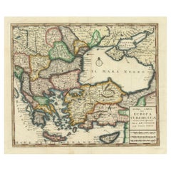
Antique Map of Greece with an Inset Map of the Upper Danube Region, c.1720
Located in Langweer, NL
Antique map titled 'Fluviorum in Europa principis Danubii cum adiacentibus Regnis.' Detailed map of Greece, the Balkans and contiguous parts of the Adriatic and Aegean Seas. The ma...
Category

18th Century Antique Benelux - Collectibles and Curiosities

Materials

Paper

Read More

Medal-Worthy Memorabilia from Epic Past Olympic Games

Get into the games! These items celebrate the events, athletes, host countries and sporting spirit.

Ahoy! You’ve Never Seen a Collection of Sailor Art and Kitsch Quite Like This

French trendsetter and serial collector Daniel Rozensztroch tells us about his obsession with objects related to seafaring men.

Pamela Shamshiri Shares the Secrets behind Her First-Ever Book and Its Effortlessly Cool Interiors

The sought-after designer worked with the team at Hoffman Creative to produce a monograph that beautifully showcases some of Studio Shamshiri's most inspiring projects.

Moroccan Artworks and Objects Take Center Stage in an Extraordinary Villa in Tangier

Italian writer and collector Umberto Pasti opens the doors to his remarkable cave of wonders in North Africa.

Montecito Has Drawn Royalty and Celebrities, and These Homes Are Proof of Its Allure

Hollywood A-listers, ex-pat aristocrats and art collectors and style setters of all stripes appreciate the allure of the coastal California hamlet — much on our minds after recent winter floods.

Whaam! Blam! Pow! — a New Book on Pop Art Packs a Punch

Publishing house Assouline and writer Julie Belcove have teamed up to trace the history of the genre, from Roy Lichtenstein, Andy Warhol and Yayoi Kusama to Mickalene Thomas and Jeff Koons.

The Sparkling Legacy of Tiffany & Co. Explained, One Jewel at a Time

A gorgeous new book celebrates — and memorializes — the iconic jeweler’s rich heritage.

What Makes a Gem-Encrusted Chess Set Worth $4 Million?

The world’s most opulent chess set, weighing in at 513 carats, is literally fit for a king and queen.

Recently Viewed

View All