Benelux Maps
to
4,180
5,131
5,516
200
5,130
1
1
2,836
1,982
312
1
180
8
68
3
3
3
1
2
5,121
10
8
2
2
468
186
99
80
57
5,131
5,131
5,131
104
58
20
14
13
Item Ships From: Benelux
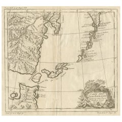
Old Map of The Kurile Islands, from Hokkaido, Japan to Kamchatka, Russia, c.1750
Located in Langweer, NL
Antique map titled 'Carte des Iles Kouriles'. Original antique map of the Kuril Islands.
The Kuril Islands or Kurile Islands are a volcanic archipelago that stretches approximate...
Category
1750s Antique Benelux Maps
Materials
Paper
$315 Sale Price
20% Off
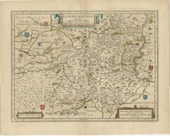
Historic Map of the Bishopric of Paderborn by Blaeu, a Masterpiece of 1645
Located in Langweer, NL
This hand-colored map, titled "Paderbornensis Episcopatus Descriptio Nova," depicts the Bishopric of Paderborn, a historical ecclesiastical territory within the Holy Roman Empire, lo...
Category
1640s Antique Benelux Maps
Materials
Paper
$496 Sale Price
20% Off
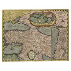
Scarce Antique Map of the Middle East, Surrounded by Latin Text, 1624
Located in Langweer, NL
Antique map titled 'Lumen Historium per Orientem (..).'
Scarce map of the Middle East, surrounded by Latin text. The two insets show Israel and an oval world map. This map (from the last edition of Ortelius Theatri Orbis Terrarum Parergon, 1624) was engraved by Franciscus Hareio. Later, this map was copied by Hornius for his World Atlas (1653).
Artists and Engravers: Franciscus Haraeus (Latinised form of Franciscus Verhaer; also known as Frans Verhaer), (Utrecht 1555? - Leuven, 11 January 1631), was a Dutch theologian, historian, and cartographer. He is best known for his history (from a Catholic point of view) of the Dutch Revolt...
Category
1620s Antique Benelux Maps
Materials
Paper
$907 Sale Price
20% Off
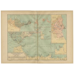
Crossroads of Continents: Spain's North African Enclaves in 1903
Located in Langweer, NL
The image for sale is a historical map of Spanish possessions in North Africa, dated 1903. The map includes the enclaves of Ceuta and Melilla, the Chafarinas Islands, the Alhucemas I...
Category
Early 1900s Antique Benelux Maps
Materials
Paper
$382 Sale Price
20% Off
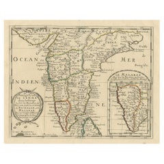
Original Antique Map showing Southern India, Northern Sri Lanka & Malabar, 1652
Located in Langweer, NL
Antique map titled 'Presqu'Isle de l'Inde deca le Gange (..)'.
Old map showing the southern part of India, including the northern part of Sri Lanka. With inset map of Southern India (Malabar). This map covers the subcontinent from the Bay of Bengal and the Gulf of Cambay to Ceylon. The Mogul Empire can be found in the north. Further south...
Category
1650s Antique Benelux Maps
Materials
Paper
$630 Sale Price
20% Off
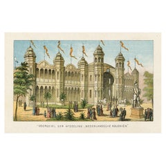
Voorgevel der Afdeeling Nederlandsche Kolonien - Emrik & Binger, 1885
Located in Langweer, NL
Antique Print 'Voorgevel der Afdeeling: Nederlandsche Kolonien.' (Front of the section: 'Dutch Colonies'.) This plate shows the building of the section 'Dutch Colonies' on the World ...
Category
19th Century Antique Benelux Maps
Materials
Paper
$56 Sale Price
20% Off
Antique Plan of Ancient Syracuse, Plan of ancient Syracuse, Sicily, Italy
Located in Langweer, NL
Antique print titled 'Plan de l'Ancienne Ville de Syracuse'. Plan of ancient Syracuse, Sicily, Italy. This print originates from 'Histoire Universelle (..)'.
Artists and Engravers...
Category
18th Century Antique Benelux Maps
Materials
Paper
$171 Sale Price
20% Off
Antique Print of a Bronze Cannon by Gibb, 1890
Located in Langweer, NL
Antique print titled 'Small Bronze Cannon'. Chromolithographic plate originating from 'The Royal House of Stuart. Illustrated By a Series of Forty Plates...
Category
19th Century Antique Benelux Maps
Materials
Paper
$81 Sale Price
20% Off
Antique Map of the Kingdom of Tunisia, Africa, 1773
Located in Langweer, NL
Antique map titled 'Kaart van het Koningryk van Tunis'. Old map of the Kingdom of Tunisia. Originates from the first Dutch editon of an interesting travel account of Northern Africa ...
Category
18th Century Antique Benelux Maps
Materials
Paper
$276 Sale Price
20% Off
Antique Print of a Fort on the Ivory Coast and Axim, Africa, 1748
By Jakob van der Schley
Located in Langweer, NL
Antique print titled 'Vue de la Cote pres de Rio San Andero - Gezigt van de Kust van Rio San Andero' and 'Fort St. Antoine a Axim - Fort St. Antoni, te Axim'. View of the Ivory coast...
Category
18th Century Antique Benelux Maps
Materials
Paper
$276 Sale Price
20% Off
Old Hand-Colored Print of Officers and Horses of the Belgium Army, 1833
Located in Langweer, NL
One nicely hand coloured print of an original serie of 23 plates, showing officers and soldiers discussing matters. published in 1833. Rare.
From a serie of beautiful lithographed...
Category
1830s Antique Benelux Maps
Materials
Paper
$171 Sale Price
20% Off
Antique Map of Russia in Europe by Lowry, 1852
Located in Langweer, NL
Antique map titled 'Russia in Europe'. Original map of Russia in Europe. This map originates from 'Lowry's Table Atlas constructed and engraved from the most recent Authorities' by J...
Category
Mid-19th Century Antique Benelux Maps
Materials
Paper
$95 Sale Price
20% Off
Antique Map of the Rethelois or Rethel Region in France by Janssonius, ca.1650
By Johannes Janssonius
Located in Langweer, NL
Antique map of France titled 'Dioecese de Rheims et le Païs de Rethel'.
Detailed map, centered on the River Ayne and the River Velle and sowing Reims, Chalons, Rethel, Sedan, Cha...
Category
17th Century Antique Benelux Maps
Materials
Paper
$334 Sale Price
20% Off
The Valley of Inspruck: An 18th-Century Engraved Perspective, 1792
Located in Langweer, NL
Title: "The Valley of Inspruck: An 18th-Century Engraved Perspective"
This elegant original antique engraving, titled "The Valley of Inspruck," showcases a serene view of the Innsbruck Valley. The artwork is delicately rendered, capturing the grandeur of the mountains and the pastoral tranquility of the valley.
The print depicts a detailed landscape scene, replete with towering craggy peaks that loom over a peaceful settlement nestled in the valley. A striking feature is the contrast between the ruggedness of the natural environment and the cultivated lands and architecture, indicating a harmonious coexistence of humanity with nature.
It was published as directed on January 1, 1792, by T & G Egerton of Whitehall for the author. Albanis Beaumont is credited with the original design ('Del.' for delineavit, indicating he drew the initial illustration), and Cornelis Apostool is noted for the engraving work ('Sculp.' for sculpsit, indicating he engraved the image).
The publication of this print during the late 18th century aligns with a time when there was a heightened interest in natural beauty and the picturesque, reflected in the art and literature of the Romantic period. This print would have appealed to those with an appreciation for both the aesthetic and the sublime qualities of the European landscape.
The publication by T & G Egerton, a reputable firm known for their work in the arts, and the involvement of a skilled artist and engraver like Beaumont and Apostool, respectively, underline the quality and desirability of the print. It is a piece that would attract collectors of fine engravings and admirers of European landscapes, offering a window into the aesthetic values and artistic endeavors of the late 18th century.
As a historical piece, this print offers a view into the past, inviting contemplation of the rich cultural and natural heritage of the Innsbruck area. It is a valuable collectible for enthusiasts of antique maps and prints...
Category
Late 18th Century Antique Benelux Maps
Materials
Paper
$706 Sale Price
20% Off
Antique Map of Java 'Indonesia' by Chatelain, 1719
Located in Langweer, NL
Antique map titled 'Carte de l'Ile de Java: Partie Occidentale, Partie Orientale, Dressee tout Nouvellement Sur Les Memoires Les Plus Exacts (..)'. This beautiful map of Java exists ...
Category
Early 18th Century Antique Benelux Maps
Materials
Paper
1606 Hand-Colored Woodcut Map of Sumatra from Ramusio’s Delle Navigationi
Located in Langweer, NL
This is a fascinating woodcut map titled Taprobana, depicting the island of Sumatra, hand-colored, and published in Venice in 1606. The map originates from Giovanni Battista Ramusio’...
Category
Early 1600s Italian Antique Benelux Maps
Materials
Paper
Two Charts of The English Channel, Each Adorned with Nice Compass Roses, ca.1700
Located in Langweer, NL
Antique map titled 'Hydrographia Canalis Marini Inter Angliam et Galiiam de Fluentis.'
Sheet with with two charts of the English Channel, each adorned with beautiful compass rose...
Category
Early 1700s Antique Benelux Maps
Materials
Paper
$534 Sale Price
20% Off
Original Copper Engraving Depicting Dutch Merchants visting China, ca.1700
Located in Langweer, NL
Title: 'The departure of the Empirour Hockflieuw to the Emprial Court at Peking' with further description in Dutch.
The Dutch man Pieter van Hoorn, his son...
Category
Early 1700s Antique Benelux Maps
Materials
Paper
$229 Sale Price
20% Off
Woodcut Map of the Rhine River Region Covering the Palatinate, Austria and Elsa
Located in Langweer, NL
Early Woodcut Map of the Rhine River Region Covering the Palatinate, Austria, and Elsass, ca. 1628
This early woodcut map, titled "Die ander Tafel des Rheinstromes/begriffen die Pfa...
Category
1620s Antique Benelux Maps
Materials
Paper
Antique Map of Japan, the Kurile Islands and Liu Kiu Islands, 1886
Located in Langweer, NL
The map is an exquisite piece, showcasing Japan's vibrant geography. Engraved by J. Bartholomew and published by George Philip & Son in London & Liverpool, it presents a detailed and...
Category
Late 19th Century Antique Benelux Maps
Materials
Paper
$114 Sale Price
20% Off
Antique Print with a Plan of Kunta Kinteh Island and views of Fort James, Gambia
Located in Langweer, NL
Antique print titled 'Plan of Iames Island in the Gambia - N.E. Prospect of Iames Fort - N.N.W. Prospect of Iames Fort'. Print with a plan of Kunta Kinteh I...
Category
Mid-18th Century Antique Benelux Maps
Materials
Paper
$210 Sale Price
20% Off
A Handsome & Detailed Map of the Duchy of Mecklenburg & Pomerania, Germany, 1680
Located in Langweer, NL
Antique map titled 'Ducatus Meklenburgicus in quo sunt Ducatus Vandaliae et Meklenburgi Ducatus et Comitatus Swerinensis.'
A handsome and detailed map of the Duchy of Mecklenburg...
Category
1680s Antique Benelux Maps
Materials
Paper
$706 Sale Price
20% Off
Antique Print of the Batavia Massacre 'Present-Day Jakarta', Indonesia
Located in Langweer, NL
Antique print titled 'Tableau de la Partie de Batavia, ou s'est fait proprement le terrible Massacre des Chinois (..)'. Original antique print of the Batavia massacre. The 1740 Batav...
Category
Mid-18th Century Antique Benelux Maps
Materials
Paper
$869 Sale Price
20% Off
Ornate Hand-Colored Map of Germany by John Tallis with Vignettes, ca. 1850
Located in Langweer, NL
Title: Hand-Colored Map of Germany by J. Tallis, ca. 1850
This beautifully hand-colored map of Germany, published by John Tallis & Co. around 1850, provides a comprehensive depictio...
Category
1850s Antique Benelux Maps
Materials
Paper
Antique Map of Friesland Also Know as the Peacock Map, C.1580
Located in Langweer, NL
Antique map titled ?Frisia Occidentalis?. Original antique map of the province of Friesland, the Netherlands. Includes a fascinating inset of ancient Friesland with a peacock and myt...
Category
18th Century Antique Benelux Maps
Materials
Paper
$1,575 Sale Price
20% Off
Striking Antique View of Kozhikode, also known as Calicut, in Kerala, India
Located in Langweer, NL
Antique print titled 'Calechut'. Wonderful, miniature copper engraving depicting Arion riding on a very cheerful looking sea monster in the important tradi...
Category
Mid-17th Century Antique Benelux Maps
Materials
Paper
$420 Sale Price
20% Off
Antique Map of Italy, Corsica, Sardinia and Sicily, ca.1780
Located in Langweer, NL
Description: Antique map titled 'L'Italie.'
Map of Italy, Corsica, Sardinia and Sicily. Highly detailed, showing towns, rivers, some topographical features and political boundaries...
Category
1780s French Antique Benelux Maps
Materials
Paper
$229 Sale Price
40% Off
Antique Map of France by Covens & Mortier, c.1730
Located in Langweer, NL
Antique map titled 'Nova regni Galliae (..) La France'. Old map of France with large decorative title cartouche. With great detail.
Artists and Engravers: Pieter und David Mortie...
Category
18th Century Antique Benelux Maps
Materials
Paper
$620 Sale Price
20% Off
Original Hand-colored Antique Map of the Southern Part of India
Located in Langweer, NL
Antique map titled 'Orarum Malabariae, Coromandelae &c Tabula Accuratissima - Carte des Cotes de Malabar et de Coromandel'. Beautiful map of the southern part of India. It focuses on trade routes within India, as well as the Coromandel and Malabar Coasts...
Category
Early 18th Century Antique Benelux Maps
Materials
Paper
$869 Sale Price
20% Off
Antique Map of the Palaeontology of the British Isles by Johnston '1850'
Located in Langweer, NL
Antique map titled 'Palaeontological Map of the British Islands'. Original antique map showing the palaeontology of the British Isles. This map originates from 'The Physical Atlas of...
Category
Mid-19th Century Antique Benelux Maps
Materials
Paper
$429 Sale Price
20% Off
Antique Chart of the Mid-Pacific Ocean by Anson, 'c.1784'
Located in Langweer, NL
Antique map titled 'Carte de la Mer du Sud ou Mer Pacifique'. Original chart of the mid-Pacific Ocean, includes voyage tracks of Anson’s Centurion and the ship he stalked, the Spanish treasure...
Category
Late 18th Century Antique Benelux Maps
Materials
Paper
$1,343 Sale Price
25% Off
Antique Map of South America by Conder, c.1775
Located in Langweer, NL
Antique map titled 'South America agreeable to the most approved maps and charts'. Rare map of South America depicting Chili, La Plata, Paraguay, Brazil, Peru, the Amazon and surroun...
Category
18th Century Antique Benelux Maps
Materials
Paper
$331 Sale Price
20% Off
Decorative Map of Hanover, Lower Saxony by Lodge, ca. 1785
Located in Langweer, NL
Title: Decorative Map of Hanover, Lower Saxony by Lodge, ca. 1785
This decorative map, titled "A New & Correct Plan of Hanover, a City in the circle of Lower Saxony," was engraved b...
Category
1780s Antique Benelux Maps
Materials
Paper
Antique Map of the Main Roads of Palembang by Stemler, c.1875
Located in Langweer, NL
Antique map titled 'Kaart van de voornaamste wegen in het zuidelijke deel der Residentie Palembang.' This scarce map shows the main roads in Palembang on the Indonesian island of Sum...
Category
19th Century Antique Benelux Maps
Materials
Paper
$71 Sale Price
20% Off
Antique Map of the Electorate of Brandenburg by Georges-Louis Le Rouge, 1768
Located in Langweer, NL
Antique Map of the Electorate of Brandenburg by Georges-Louis Le Rouge, 1748
This 1748 map by Georges-Louis Le Rouge, titled "Le Marquisat et Electorat de Brandenbourg," depicts the...
Category
1760s Antique Benelux Maps
Materials
Paper
Early Woodcut Bird's Eye View of Rouffach, France, by Sebastian Münster, 1554
Located in Langweer, NL
Early Woodcut Bird's Eye View of Rouffach, France, by Sebastian Münster, 1554
Description: This rare 1554 woodcut is a bird's eye view of Rouffach, a town in the Haut-Rhin departmen...
Category
16th Century Antique Benelux Maps
Materials
Paper
Antique Map of the Netherlands and Belgium by Homann, circa 1710
By Johann Baptist Homann
Located in Langweer, NL
Antique map titled 'Tabula Generalis Totius Belgii Provinciae XVII. Infer. Germaniae (..)'. Map of the Benelux countries by Johann Baptist Homann. Shows the area between the Seine es...
Category
Early 18th Century German Antique Benelux Maps
Materials
Paper
$764 Sale Price
20% Off
Cartographic Elegance of the Mughal Dominion in a Hand-Colored Antique Map, 1705
Located in Langweer, NL
This original antique map titled “'T Ryk van den Grooten Mogol” by Nicolas Sanson from 1705 is an interesting historical artifact. It depicts the extent of the Mughal Empire in North...
Category
Early 1700s Antique Benelux Maps
Materials
Paper
$630 Sale Price
20% Off
Antique Map of Asia from a German School Atlas, c.1870
Located in Langweer, NL
Antique map titled 'Asien'. Old map of the Asian continent. This map originates from 'H. Kiepert's Kleiner Atlas der Neueren Geographie für Schule und Haus'.
Artists and Engravers:...
Category
19th Century Antique Benelux Maps
Materials
Paper
$136 Sale Price
20% Off
Antique Map of the Pacific Ocean by Renneville, 1725
Located in Langweer, NL
Rare map of the Southern Pacific, illustrating Le Maire's tracks, extending from the La Maire Straits to Nova Guinea, with a large inset of the northern Coastline of New Guinea and a...
Category
18th Century Antique Benelux Maps
Materials
Paper
$429 Sale Price
20% Off
Antique Map of Cities Nanking and Suzhou in the Jiangsu Region, China, c.1758
Located in Langweer, NL
Antique map titled 'Plan de l' Enceinte de la Ville de Nan-King ou Kyang-Ning-Fou et plan de la ville de Su-Tcheou-Fou.' A map of the city of Nanking or Nanjing. A second map shows S...
Category
18th Century Antique Benelux Maps
Materials
Paper
$229 Sale Price
20% Off
Sea Chart of Central America and the Northwest Coast of South America, ca.1745
Located in Langweer, NL
Antique map titled 'Novae Hispaniae, Chili, Peruviae et Guatamala Littorae.'
Sea chart of Central America and the northwest coast of South America, oriented to the east, by Reinier & Joshua Ottens (after Frederick de Wit - 1675) in 1745 ('Atlas van de Zeevaart'). The map shows all or parts of the coasts of Peru, Chili, Honduras, Costa Rica and Mexico as well as the western Caribbean and the Galapagos...
Category
1740s Antique Benelux Maps
Materials
Paper
$2,340 Sale Price
20% Off
Antique Map of Preble County 'Ohio' by Titus, 1871
Located in Langweer, NL
Antique map titled 'Outline Plan of Prble County, Ohio'. Original antique map of Preble County, Ohio. This map originates from 'Atlas of Preble County Ohio' by C.O. Titus. Published ...
Category
Late 19th Century Antique Benelux Maps
Materials
Paper
$286 Sale Price
20% Off
Antique Map of Batavia 'Jakarta, Indonesia' by Montanus, 1679
Located in Langweer, NL
Fine early plan of Batavia (Jakarta), published by Arnoldus Montanus. This map has a vignette at the bottom showing Jakarta from the sea with the volcanoes Mount Gede, Mount Pangrnago and Mount Salak in the background. The plan is based on the earlier, much larger map of Batavia published by Clement de Jonghe...
Category
Late 17th Century Unknown Antique Benelux Maps
Materials
Paper
$1,017 Sale Price
20% Off
Antique Map of CAP Providence, St. David's Cove and Surroundings
Located in Langweer, NL
Antique map titled 'Baye du Cap Upright (..)'. Eight charts on one sheet of Cap Providence, St. David's Cove, the Bay of the Island, Swallow's Haven, Puzzlin...
Category
Late 18th Century Antique Benelux Maps
Materials
Paper
$343 Sale Price
20% Off
Large Antique County Map of Leicestershire, England, with Outline Coloring
Located in Langweer, NL
Antique map titled 'A Map of Leicestershire from the best Authorities'. Original old county map of Leicestershire, England. Engraved by John Cary. Originates from 'New British Atlas'...
Category
Early 19th Century Antique Benelux Maps
Materials
Paper
$162 Sale Price
20% Off
Antique Map of Australia by Johnston '1909'
Located in Langweer, NL
Antique map titled 'Australia'. Original antique map of Australia. With inset maps of Melbourne, Port Phillip, Adelaide, Perth, Sydney, Brisba...
Category
Early 20th Century Benelux Maps
Materials
Paper
$334 Sale Price
20% Off
Beautiful Antique Handcolored Map of Switzerland with 33 Coats of Arms, ca.1705
Located in Langweer, NL
Antique map Switerzland titled 'La Suisse Divisee en ses Treze Cantons, ses Alliez & ses Sujets (..)'.
Beautiful map of Switzerland with 33 coats of arms. The map is dedicated to t...
Category
Early 1700s Antique Benelux Maps
Materials
Paper
$1,528 Sale Price
20% Off
Imperial map of Northern Russia with Archangel, Lapland and Permia, c.1730
Located in Langweer, NL
Imperial map of Northern Russia with Archangel, Lapland, and Permia, c.1730
Description:
This intricately engraved and hand-colored map presents the northern reaches of the Russian ...
Category
Early 18th Century German Antique Benelux Maps
Materials
Paper
Old Map of North India From Kandahar East to Burma 'Pegu' and South to Goa, 1776
Located in Langweer, NL
Description: Antique map titled 'Indes Iere Feuille'.
Old map of northern India. Covers the subcontinent from Kandahar east as far as Burma (Pegu) and south to just past Goa. Names...
Category
1770s Antique Benelux Maps
Materials
Paper
$353 Sale Price
20% Off
Original Antique Map of the Ancient Netherlands and Belgium, c.1750
Located in Langweer, NL
Description: Antique map titled 'Naauwkeurige Kaart van het Oude Nederland (..)'.
Original antique map of the Netherlands and Belgium. This map originates from 'Vaderlandsche his...
Category
1750s Antique Benelux Maps
Materials
Paper
$334 Sale Price
20% Off
Antique Map of the Bahia Todos Santos 'Brazil' by Tirion, circa 1750
Located in Langweer, NL
Antique map titled 'Kaart Van De Aller-Heiligen Baay Waar aan de Hoofdstad legt van Brazil.', Detailed map of the Bahia Todos Santos in Brazil, with a lar...
Category
Mid-18th Century Antique Benelux Maps
Materials
Paper
$429 Sale Price
20% Off
Bishopric of Hildesheim Map in Northern Germany by Willem & Joan Blaeu, 1645
Located in Langweer, NL
This beautifully hand-colored map, titled "Episcopatus Hildesiensis Descriptio Novissima," depicts the Bishopric of Hildesheim, a historical ecclesiastical territory in present-day L...
Category
1640s Antique Benelux Maps
Materials
Paper
$496 Sale Price
20% Off
Antique Map of Northern Italy by Migeon, 1880
Located in Langweer, NL
Antique map titled 'Italie Septentrionale'. Old map of the northern part of Italy. This map originates from 'Géographie Universelle Atlas-Migeon' by J. Migeon. Artists and Engravers:...
Category
19th Century Antique Benelux Maps
Materials
Paper
$100 Sale Price
20% Off
Antique Map of The Nile, Egypt and the Red Sea by Bachiene, 1765
Located in Langweer, NL
Antique map titled 'De XIde Landkaart verbeeldende Egypte en de Woestyne der Schelf-Zee (..).' Map of Biblical Egypt and the Red Sea. With title cartouche, compass rose and scale. Th...
Category
18th Century Antique Benelux Maps
Materials
Paper
$167 Sale Price
20% Off
Large Chart of the island and sea of Java, Indonesia
Located in Langweer, NL
Antique map titled 'Carte Esférica de la Isla Y Mar de Java'. Large chart of the island and sea of Java, Indonesia. Beautiful nautical chart, published 1863 in Spain.
Category
Mid-19th Century Antique Benelux Maps
Materials
Paper
$2,387 Sale Price
20% Off
Old German Map of the United States, Central America and the West Indies, c.1870
Located in Langweer, NL
Antique map titled 'Westindien, Mittelamerica und Vereinigte Staten'. Old map of the United States, Central America and the West Indies. This map originates from 'H. Kiepert's Kleine...
Category
19th Century Antique Benelux Maps
Materials
Paper
Antique Map of Greece with Two Small Inset Maps of Athens, c.1870
Located in Langweer, NL
Antique map titled 'Graecia'. Old map of Greece with two small inset maps of Athens. This map originates from 'Atlas Antiquus, twaalf kaarten behoorende bij de Oude Geschiedenis'. Ar...
Category
19th Century Antique Benelux Maps
Materials
Paper
Antique Map of North America and the West Indies by Stieler, circa 1865
Located in Langweer, NL
Antique map titled 'Nord-America und West-Indien'. Old map of North America and the West Indies. This map originates from Stieler's 'Schul-Atlas'.
Category
Mid-19th Century Antique Benelux Maps
Materials
Paper
$114 Sale Price
20% Off
Rare Antique Print of the Famous Westminster Abbey, London, England, C.1800
Located in Langweer, NL
Antique print titled 'An ancient View of St. James's (..)'. Old print of Westminster, the old Westminster Abbey in the centre, with St James's Palace on the right.
Westminster Abb...
Category
18th Century Antique Benelux Maps
Materials
Paper
$401 Sale Price
20% Off
Recently Viewed
View AllMore Ways To Browse
Greek Key Dresser
Green Glass Bud Vase Vintage
Gucci Tray
Half Moon Shelves
Handblown Glass Decanter
Heart Shaped Glass Dish
Hepplewhite Drop Leaf Table
Herend Cup
Hermes Dish
Horse Head Barware
Horse Mantel Clock
Large Limoges Platter
Michelangelo David Statue
Michelin Guide
Persian Khatam
Royal Worcester Aesthetic
Russell Woodard Aluminum
Russian Silver Niello
