Benelux Maps
to
4,199
5,135
5,520
197
5,134
1
1
2,839
1,984
311
1
179
8
68
3
3
3
1
2
5,125
10
8
2
2
431
175
89
79
48
5,135
5,135
5,135
104
58
20
14
13
Item Ships From: Benelux
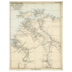
Northern Australia Map with The Routes of Explorers Ringwood and McMinn, 1878
Located in Langweer, NL
Antique map titled 'Neue Aufnahmen in Nord-Australien'.
Old map of Northern Australia showing the 'new routes' of the exploration of Ringwood and McMinn. Covers as far east as pa...
Category
1870s Antique Benelux Maps
Materials
Paper
$124 Sale Price
20% Off
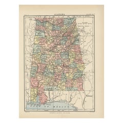
Antique Map of Alabama
Located in Langweer, NL
Antique map titled 'Alabama'. Original antique map of Alabama, United States. This print originates from 'Encyclopaedia Britannica', Ninth Editi...
Category
Late 19th Century Antique Benelux Maps
Materials
Paper
$276 Sale Price
20% Off
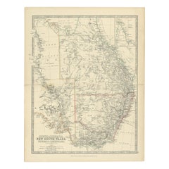
Antique Map of South Australia, Victoria, Queensland and New South Wales, c.1860
Located in Langweer, NL
Antique map Australia titled 'South Australia, New South Wales, Victoria & Queensland'. Old map depicting South Australia including New South Wal...
Category
19th Century Antique Benelux Maps
Materials
Paper
$324 Sale Price
20% Off
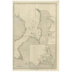
Antique Map of the British Islands to the White Sea by J. Imray
Located in Langweer, NL
Antique large nautical chart of the British Islands to the White Sea. With insets of Veshnyak Channel, Sosnovets and the Bay of Arkhangel. Published by James Irmay and Son, circa 1875.
Category
Late 19th Century Antique Benelux Maps
Materials
Paper
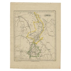
Antique Map of Limburg, The Southern Most Province in The Netherlands, c.1870
Located in Langweer, NL
Antique map titled 'Limburg'. Map of the province of Limburg, the Netherlands. This map originates from 'F. C. Brugsma's Atlas van het Koninkrijk der Nederlanden (..)'. Artists and E...
Category
19th Century Antique Benelux Maps
Materials
Paper
$124 Sale Price
20% Off
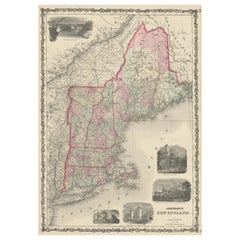
Large Antique Map of New England with decorative Vignettes
Located in Langweer, NL
Antique map titled 'Johnson's New England'. Large map of New England, comprising the states Connecticut, Maine, Massachusetts, New Hampshire, Rhode ...
Category
Mid-19th Century Antique Benelux Maps
Materials
Paper
$372 Sale Price
20% Off
Antique Map of Scandinavia by Lapie, 1842
Located in Langweer, NL
Antique map titled 'Carte de la Scandinavie comprenant les Royaumes de Suède de Norwege et de Danemark'. Map of Scandinavia including Sweden, Norway and Denma...
Category
Mid-19th Century Antique Benelux Maps
Materials
Paper
$525 Sale Price
20% Off
Print of Garden Pavilions of the Earl of Tilney and Knight Stevenson, c.1785
Located in Langweer, NL
Antique print titled 'Pavillon pour les jardins (..)'. Copper engraving showing the pavilions of the Earl of Tilney and Knight Stevenson.
Earl Tylney, of Castlemaine in the Count...
Category
18th Century Antique Benelux Maps
Materials
Paper
$276 Sale Price
20% Off
Antique Map of Westfriesland in Ancient Times by Alting, 1697
Located in Langweer, NL
Antique map titled 'Frisiae Liberae quae Westfresia Post eluviones seculi XIII'. Map of Westfriesland in ancient times. This copper engraved map shows part of Holland as it was in an...
Category
17th Century Antique Benelux Maps
Materials
Paper
$162 Sale Price
20% Off
Original Antique Map of England and Wales
Located in Langweer, NL
Antique map titled 'A New and Correct Map of England and Wales from the Latest and Best Improvements'. Original antique map of England and Wales. Printed by Alex Hogg, London for George Henry Millar's 'New, Complete and Universal System...
Category
Late 18th Century Antique Benelux Maps
Materials
Paper
$229 Sale Price
20% Off
Detailed Antique Map of Britain, Wales and the Coast of Ireland
Located in Langweer, NL
Antique map titled 'Carta d'Inghilterra e del Principato di Galles'. Detailed map of Britain, Wales and the coast of Ireland with a list of counties. This map originates from 'Nuovo ...
Category
Mid-19th Century Antique Benelux Maps
Materials
Paper
$248 Sale Price
20% Off
Large Antique Map of the Kingdom of France
Located in Langweer, NL
Antique map titled 'The Kingdom of France (..)'. Large antique map of the Kingdom of France. Engraved by T. Kitchin. Published J. Blair, circa 1779.
Category
Late 18th Century Antique Benelux Maps
Materials
Paper
$658 Sale Price
20% Off
Antique Map of Buckinghamshire in England, 1743
Located in Langweer, NL
Antique map titled 'Buckingham both shyre and shire towne describ'. Map of Buckinghamshire, England. With town plans of Buckingham and Redding. This map originates from Overton's atl...
Category
18th Century Antique Benelux Maps
Materials
Paper
$458 Sale Price
20% Off
Original Antique Map the Imperial States of the Habsburg Netherlands, 1609
Located in Langweer, NL
Antique map titled 'Belgii inferioris descriptio (..)'.
Old map of the Seventeen Provinces, the Imperial states of the Habsburg Netherlands in the 16th century. They roughly cove...
Category
Early 1600s Antique Benelux Maps
Materials
Paper
$1,193 Sale Price
20% Off
Antique Map of Eure ‘France’ by V. Levasseur, 1854
By Victor Levasseur
Located in Langweer, NL
Antique map titled 'Dépt. de l'Eure'. Map of the French department of Eure, France. This region of France is home to Giverny, where impressionist Claude Monet’s home and garden can b...
Category
Mid-19th Century Antique Benelux Maps
Materials
Paper
$171 Sale Price
20% Off
Antique Map of The German Empire (West Sheet), 1882
Located in Langweer, NL
Transport yourself to the heart of history with an original Antique Map of The German Empire (west sheet) from 'The Comprehensive Atlas and Geography of the World,' meticulously craf...
Category
1880s German Antique Benelux Maps
Materials
Paper
Original Antique Engraving of Sakai in the Osaka Prefecture, Japan, 1669
Located in Langweer, NL
Antique print, titled: 'De Stadt Saccai. La Ville de Saccai.' - ('The City Saccai').
This plate shows a view of Sakai in the Osaka Prefecture, Japan. Sakai has been one of the la...
Category
1660s Antique Benelux Maps
Materials
Paper
$620 Sale Price
20% Off
Antique Map of Borneo (Largely Kalimantan), the Largest Island of Asia, 1726
Located in Langweer, NL
Antique map Indonesia titled 'Kaart van het Eyland Borneo'. Early map of the Island of Borneo. This map originates from 'Oud en Nieuw Oost-Indië...
Category
18th Century Antique Benelux Maps
Materials
Paper
$4,058 Sale Price
20% Off
Original Antique Print of a Procession of Monks in Ceylon 'Sri Lanka', 1672
Located in Langweer, NL
Antique print, untitled. This original antique print shows a procession of monks in Ceylon. A group of dancing monks, beating drums, in front of the abbot, seated on an elephant. Dut...
Category
1670s Antique Benelux Maps
Materials
Paper
$257 Sale Price
20% Off
British Possessions on the North West Coast of South America, 1860
Located in Langweer, NL
The antique print is a page from an 1860 A Fullarton atlas, providing a comprehensive view of the British possessions on the northwest coast of South America during that time. It features a detailed map of the Island of Trinidad, as well as maps of British Guiana with routes by Sir Robert Schomburgk.
The print includes ornate vignettes that showcase both the region's rich biodiversity with illustrations of local birds such as the Scarlet Ibis and Hummingbirds of Trinidad, and the giant water lily known as Victoria Regia.
In addition to the natural history, the print also portrays cultural elements through depictions of the indigenous populations, specifically the Macusi and Caribisi Indians. It illustrates various aspects of their life, from the preparation of cassava and coffee to their dwellings, costumes, and idols. An image of a sugar mill...
Category
1860s Antique Benelux Maps
Materials
Paper
$324 Sale Price
20% Off
Uncommon Old Map of Lapland to Russia and Denmark to Kazan in the South, 1785
Located in Langweer, NL
Description: Antique map titled 'Kaart van het Noorderdeel van Europa, Bevattende Deenmarken, Noorwegen, Zweden, Lapland en het Grootste Gedeelte van Europeesch Rusland.'
This un...
Category
1780s Antique Benelux Maps
Materials
Paper
$525 Sale Price
20% Off
Old Map of the Chinese Empire and Japan, 1882
Located in Langweer, NL
An original antique map titled "The Chinese Empire and Japan," dating from an 1882 atlas by Blackie & Son. It is a color map with geographical features such as mountain ranges, river...
Category
1880s Antique Benelux Maps
Materials
Paper
$315 Sale Price
20% Off
Antique Map of the Islands in the Atlantic Ocean including Bermuda & Cape Verde
Located in Langweer, NL
Antique map titled 'Islands in the Atlantic'. Steel engraved map of the islands in the Atlantic Ocean. It shows 16 individual maps on one sheet. Covers the Azores or Western Isles, Faeroe Isles, Madeira Isles, Princes Island, Canary Islands, Fernando Po, Anno Bon, St. Thomas, Bermuda Isles, Trinidade Isles, Fernando Noronha, Cape Verde Isles, Ascension Island, St. Helena, Tristan d'Acunha Isles and the Falkland Isles.
Engraved by J. & C. Walker. Published by George Cox...
Category
Mid-19th Century Antique Benelux Maps
Materials
Paper
$276 Sale Price
20% Off
Antique Plan of Underground Area of Baths of Emperor Titus, Rome, Italy, 1786
Located in Langweer, NL
Antique print titled 'Plan des Thermes de Titus Partie Superieure'.
Plan of the underground areas of the Baths of Titus. The Baths of Titus or Thermae Titi were public baths (Thermae) built in 81 AD at Rome, by Roman emperor Titus...
Category
18th Century Antique Benelux Maps
Materials
Paper
$229 Sale Price
20% Off
Original Antique Map of the Area of Bremen and Lower Saxony
By Johannes Janssonius
Located in Langweer, NL
Antique map titled 'Ducatus olim Episcopatus Bremensis et ostiorum Albis et Visurgis Fluviorum novissima Descriptio'. Original old map of the area of ??Bremen and Lower Saxony. Uncom...
Category
Mid-17th Century Antique Benelux Maps
Materials
Paper
$630 Sale Price
20% Off
Antique Map of North America by Lapie '1842'
Located in Langweer, NL
Antique map titled 'Carte de l'Amérique septentrionale'. Map of North America, with an inset map of the Aleutian Islands. This map originates from 'Atlas universel de géographie anci...
Category
Mid-19th Century Antique Benelux Maps
Materials
Paper
$573 Sale Price
20% Off
Antique Map of the Northeast of England by Mercator 'circa 1620'
Located in Langweer, NL
Antique map titled 'Eboracum Lincolnia, Derbia, Staffordia, Notinghamia, Lecestria, Rutlandia, et Norfolcia'. Decorative early map of the northeast of England, comprising the countie...
Category
Early 17th Century Antique Benelux Maps
Materials
Paper
$525 Sale Price
20% Off
Antique Map of Asia from the Middle East to the Coast of Alaska, 1816
Located in Langweer, NL
Antique map titled ‘L’Asie‘. This is an original antique map of Asia, by Hérisson, taken from atlas ""Nouv. Abrége de Géographie"". An engraved map with coloring of Asia from the Mid...
Category
19th Century Antique Benelux Maps
Materials
Paper
$152 Sale Price
20% Off
Antique Map of Southern Syria by Fullarton & Co, circa 1860
Located in Langweer, NL
Antique map titled 'Syria south part'. Published by Fullarton & Co, Glasgow, circa 1860.
- Title: Syria South Part
- Publisher: Fullarton & Co, Glasgow
- Date of Publication: Circa ...
Category
Mid-19th Century English Antique Benelux Maps
Materials
Paper
Antique Map of Canada by Johnston '1909'
Located in Langweer, NL
Antique map titled 'Dominion of Canada'. Original antique map of Canada. With inset maps of Niagara, Montreal, Quebec. This map originates from t...
Category
Early 20th Century Benelux Maps
Materials
Paper
$238 Sale Price
20% Off
Antique Map of South America by Kelly, 1835
Located in Langweer, NL
Antique map titled 'South America'. Old map of South America engraved by A. Findley. With decorative border. Artists and Engravers: Published by Thomas Kelly, London.
Artist: Publ...
Category
19th Century Antique Benelux Maps
Materials
Paper
$68 Sale Price
20% Off
Antique Map of the City of Groningen by Merian, 1659
Located in Langweer, NL
Antique map titled 'Gröningen'. This print depicts the city of Groningen, the Netherlands. This print originates from 'Topographia Germaniae Inferioris (..)' by C. Merian.
Artist...
Category
17th Century Antique Benelux Maps
Materials
Paper
$87 Sale Price
20% Off
Old Map of Southern India and Ceylon 'Sri Lanka', 1882
Located in Langweer, NL
Antique map titled 'India (Southern Sheet)'.
Old map of Southern India and Ceylon (Sri Lanka). With an inset map of the South-Eastern Provinces of India. This map originates from...
Category
1880s Antique Benelux Maps
Materials
Paper
$276 Sale Price
20% Off
Colorful Detailed Antique Map of The World on Mercators Projection, 1882
Located in Langweer, NL
The 'World of Mercator's Projection' is a map with a stunning portrayal of global geography and maritime navigation from an era steeped in exploration and discovery. With meticulous detail and precision, this map showcases the world's continents on Mercator's famous projection, capturing the essence of a bygone era's cartographic expertise.
Illustrating the courses of chief ocean currents and key navigation tracks between major ports, this map doesn't just depict landmasses but also reveals the vital maritime routes that shaped global trade and exploration. Each line and curve represents the pathways of ancient voyages and modern seafaring, connecting distant shores and continents.
Crafted with the precision characteristic of Mercator's projection, this map offers a unique perspective on how sailors and explorers navigated the world's vast oceans. It stands as a testament to the artistry and scientific ingenuity of cartographers of that time, showcasing their commitment to accurate representation amid the challenges of mapping a spherical world on a flat surface.
This map isn't just a historical document; it's a captivating piece of cartographic art...
Category
1880s Antique Benelux Maps
Materials
Paper
$238 Sale Price
20% Off
Pl. 465 Antique Print of Roof Structures by Bell, c.1810
Located in Langweer, NL
Antique print titled 'Plate CCCCLXIV Roofs'. Old print depicting various roof structures. This print originates from 'Encyclopedia Britannica'. Artists and Engravers: Engraved by A. ...
Category
19th Century Antique Benelux Maps
Materials
Paper
$57 Sale Price
20% Off
Antique Map of Turkey in Europe with Bulgaria by Johnston '1909'
Located in Langweer, NL
Antique map titled 'Turkey in Europe with Bulgaria'. Original antique map of Turkey in Europe with Bulgaria. With inset maps of The Bosporus & Constantinople, and Crete (or Candia). ...
Category
Early 20th Century Benelux Maps
Materials
Paper
$238 Sale Price
20% Off
Antique Map of Part of Flanders 'Belgium' by F. de Wit 'circa 1680'
Located in Langweer, NL
Antique map titled 'Marchionatus Sacri Imperii et Dominii Mechelini Tabula'. Large folio size map of the region around Mechelen, Leuven, Brussels, Dendermonde and Antwerp. Published ...
Category
Late 17th Century Antique Benelux Maps
Materials
Paper
$549 Sale Price
20% Off
Villa à Fontainebleau – French Architectural Print from La Brique, c.1900
Located in Langweer, NL
Villa à Fontainebleau – French Architectural Print from La Brique, c.1900
Beautiful antique architectural print depicting a villa designed in Fontainebleau by architect Mr. Brunnari...
Category
20th Century French Benelux Maps
Materials
Paper
Antique Print of the Rialto Bridge in Venice in Italy, 1835
Located in Langweer, NL
Antique print titled 'The Rialto at Venice'. Old print of the Rialto Bridge (or Ponte di Rialto) in Venice, Italy. This print originates from 'One Hundred and Fifty Wood Cuts selecte...
Category
19th Century Antique Benelux Maps
Materials
Paper
$114 Sale Price
20% Off
Antique Map of the Northern Part of South America by J. Tallis, circa 1851
Located in Langweer, NL
A decorative and detailed mid-19th century map of the northern part of South America (including modern day Venezuela, Colombia, Ecuador, Guyana, Suriname and French Guiana) which was drawn and engraved by J. Rapkin (vignettes by H. Winkles & W. Lacey) and published in John Tallis & Co.'s The Illustrated Atlas (London & New York: circa 1851).
The Illustrated Atlas, published from 1849 onwards, was the last decorative world atlas. The 'Venezuela, New Granada...' map was typical of the many Fine ones which appeared in this work with its decorative border and attractive vignettes. Illustrated are views of Mount Chimborazo, Ecuador; the 'Fall of the Bagota' (Tequendama Falls, Colombia); Rheas and a prospect of Paramaribo Harbour (Dutch Guiana...
Category
Mid-19th Century Antique Benelux Maps
Materials
Paper
$262 Sale Price
20% Off
Old Map of the French department of Ariège, France
By Victor Levasseur
Located in Langweer, NL
Antique map titled 'Dépt. de l'Ariège'. Map of the French department of Ariege, France. This area of France is known for its production of semi-soft and mild cheeses, such as Bethmal...
Category
Mid-19th Century Antique Benelux Maps
Materials
Paper
$324 Sale Price
20% Off
Antique Map of the North Sea and Dunkirk
Located in Langweer, NL
Untitled map of the North Sea, top left a large compass rose, bottom right Dunkirk (Duinkerke / Dunkerque), France. Part of a bundled collection of plans of battles and cities renown...
Category
Early 18th Century Antique Benelux Maps
Materials
Paper
$420 Sale Price
20% Off
Antique Map of Africa by Lapie, 1842
Located in Langweer, NL
Antique map titled 'Carte d'Afrique'. Map of Africa. This map originates from 'Atlas universel de géographie ancienne et moderne (..)' by Pierre M. Lapie...
Category
Mid-19th Century Antique Benelux Maps
Materials
Paper
$573 Sale Price
20% Off
Antique Bird's Eye-view Atjien or Atjeh in Aceh in Northern Sumatra, Indonesia
Located in Langweer, NL
Description: Antique print Indonesia titled 'Atsjien'. Bird's eye-view of the Town of Atjien on the northernmost point of Sumatra. This print originates from 'Oud en Nieuw Oost-Indië...
Category
1720s Antique Benelux Maps
Materials
Paper
$439 Sale Price
20% Off
Antique Map Showing the Division and Distribution of Reptiles by Johnston '1850'
Located in Langweer, NL
Antique map titled 'Geographical division and distribution of reptilia and ophidia. Original antique map showing the geographical division and distribution of reptiles and serpents. ...
Category
Mid-19th Century Antique Benelux Maps
Materials
Paper
$191 Sale Price
20% Off
Antique German Map of India and Sri Lanka or Ceylon, 1902
By Meyer
Located in Langweer, NL
Antique map titled 'Ostindien.' (Map of India with an inset map of East-Bengal.) This attractive original old antique print / plate / map originates from 1885-1907 editions of a famous German encyclopedia: 'Meyers grosses Konversations-Lexikon.', published in Leipzig and Vienna. Meyers Konversations-Lexikon was a major German encyclopedia that existed in various editions from 1839 until 1984, when it merged with the Brockhaus encyclopedia. Several of the plates were also used in Dutch Encyclopedia's like Winkler Prins...
Category
20th Century Benelux Maps
Materials
Paper
$65 Sale Price
20% Off
Ancient Gaul: A Cartographic Overview of Gallic Tribes and Roman Provinces, 1880
Located in Langweer, NL
The print titled "GALLIA," is a historical map of ancient Gaul, which corresponds to modern-day France and parts of its surrounding countries. Here are the features and details noted...
Category
1880s Antique Benelux Maps
Materials
Paper
$353 Sale Price
20% Off
Old Original Antique German Map of North America, ca.1870
Located in Langweer, NL
Antique map titled 'Nord-America'.
Old map of North America. This map originates from 'H. Kiepert's Kleiner Atlas der Neueren Geographie für Schule und Haus'.
Artists and Engrave...
Category
1870s Antique Benelux Maps
Materials
Paper
$467 Sale Price
20% Off
Antique Map of the Gaspar Strait by Huddart, '1788'
Located in Langweer, NL
Antique map titled 'Sketch of the Straits of Gaspar'. Detailed sea chart of the Gaspar Strait, showing part of the Island of Banca on the east coast of Sumatra just to the south of S...
Category
Late 18th Century Antique Benelux Maps
Materials
Paper
$793 Sale Price
30% Off
Antique Print of Varanasi in India, c.1850
Located in Langweer, NL
Antique print titled 'Bénarès (Inde)'. View of Varanasi, also known as Benares, Banaras or Kashi. Varanasi a city on the banks of the river Ganges in Uttar Pradesh, India. Source unk...
Category
19th Century Antique Benelux Maps
Materials
Paper
$200 Sale Price
20% Off
Antique Map of Asia Showing Its Political Divisions, 1874
Located in Langweer, NL
Antique map titled 'Map of Asia showing its Gt. Political Divisions and also the various routes of Travel between London & India, China & Japan & c'. This map covers from the Arabian...
Category
19th Century Antique Benelux Maps
Materials
Paper
$85 Sale Price
20% Off
Antique Print of Garden Buildings from Garden Architecture by Van Laar, 1802
Located in Langweer, NL
Untitled print of garden architecture. It shows garden buildings. This print originates from 'Magazijn van tuin-sieraden'. The book is compiled by Gijs...
Category
19th Century Antique Benelux Maps
Materials
Paper
Colourful Antique Map Centered on Nuremberg and Bamberg in Germany, ca.1703
Located in Langweer, NL
Antique map titled 'Circuli Franconiae pars Occidentalis, exhibes simul integrum fere Electoratum Moguntinum (..)'.
Antique map centered on Nuremberg and Bamberg. Extends from th...
Category
Early 1700s Antique Benelux Maps
Materials
Paper
$706 Sale Price
20% Off
Original Map of Greece at the Time of the Dorian Migration, Published in 1880
Located in Langweer, NL
The map titled "GRAECIA TEMPORI MIGRATIONIS DORICAE," translates to "Greece at the Time of the Dorian Migration." This map showcases the regions of ancient Greece during the period f...
Category
1880s Antique Benelux Maps
Materials
Paper
$353 Sale Price
20% Off
Antique Map of the World by Johnson, '1872'
Located in Langweer, NL
Antique map titled 'Johnson's World. Original world map. This map originates from 'Johnson's New Illustrated Family Atlas of the World' by A.J. John...
Category
Late 19th Century Antique Benelux Maps
Materials
Paper
$447 Sale Price
25% Off
Antique Map of the World with Polar Projections by Keizer & de Lat, 1788
Located in Langweer, NL
Antique map titled 'Schuine Ronde Aard-Klooten (..)'. Interesting double hemisphere world map with polar projections. In North America, there is a...
Category
Late 18th Century Antique Benelux Maps
Materials
Paper
$447 Sale Price
25% Off
Antique Map of Asia Minor including part of the Greek Archipelago and Cyprus
Located in Langweer, NL
Antique map titled 'Chersonesi quae hodie Natolia Descriptio'. Decorative, smaller map of Asia Minor including part of the Greek Archipelago and Cyprus. The drape-style title cartouc...
Category
Mid-18th Century Antique Benelux Maps
Materials
Paper
$324 Sale Price
20% Off
Antique Plan of Alicante Bay, Spain
Located in Langweer, NL
Antique map titled 'Plan de la Baye d'Alicant'. Black and white harbor chart /port plan of Alicante Bay, Spain. This map originates from the scarce atlas 'Recueil de Plusiers Plans d...
Category
Mid-18th Century Antique Benelux Maps
Materials
Paper
$515 Sale Price
20% Off
Antique Map of Russia and Central Asia, showing the Northeast Passage
Located in Langweer, NL
Antique map titled 'Generalis Totius Imperii Moscovitici (..)'. Decorative map of Russia and Central Asia, showing the Northeast Passage. The map covers the entirety of the Russian Empire at the time, stretching from the Arctic Circle in the north to the "Oceanus Orientalis" and the northern parts China (Chinae Septentrionalis confinia), Mongolia and India in the south. Published by J.B. Homann, circa 1730.
Johann Baptist Homann was born 1664 in Oberkammlach. He founded his business 1702 in Nuremberg, Germany. After a long period of Dutch domination in map publishing, the Homann publishing house became the most important map...
Category
Mid-18th Century Antique Benelux Maps
Materials
Paper
$849 Sale Price
20% Off
Antique Map of the Iberian Peninsula with two decorative Cartouches
Located in Langweer, NL
Antique map titled 'Hispaniae et Portugalliae Regna'. Original old map of the Iberian peninsula showing Spain, Portugal and the Balearic Islands. Two beautiful cartouches with severa...
Category
Late 17th Century Antique Benelux Maps
Materials
Paper
$1,422 Sale Price
20% Off
Recently Viewed
View AllMore Ways To Browse
Greek Key Dresser
Green Glass Bud Vase Vintage
Gucci Tray
Half Moon Shelves
Handblown Glass Decanter
Heart Shaped Glass Dish
Hepplewhite Drop Leaf Table
Herend Cup
Hermes Dish
Horse Head Barware
Horse Mantel Clock
Large Limoges Platter
Michelangelo David Statue
Michelin Guide
Persian Khatam
Royal Worcester Aesthetic
Russell Woodard Aluminum
Russian Silver Niello
