Benelux Maps
to
4,203
5,135
5,521
200
5,134
1
1
2,839
1,984
311
1
179
8
68
3
3
3
1
2
5,125
10
8
2
2
418
168
85
78
47
5,135
5,135
5,135
104
59
20
14
13
Item Ships From: Benelux
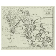
Antique Map of India, the East Indies and the Philippines
Located in Langweer, NL
Antique map titled 'Les Indes Orientales et leur Archipel'. Original antique map of India, the East Indies and the Philippines. Source unknown, to be determined. Published circa 1760.
Category
Mid-18th Century Antique Benelux Maps
Materials
Paper
$360 Sale Price
20% Off
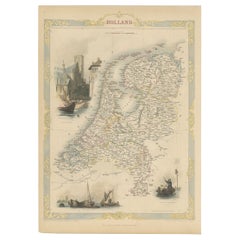
Antique Map of Holland with Colorful Vignettes, 1851
Located in Langweer, NL
Antique map titled 'Holland'.
Decorative map of Holland. Includes vignettes of Rotterdam, Dutch Peasants and a boating scene on the Dort, the Netherlands.
Originates from 'Th...
Category
19th Century Antique Benelux Maps
Materials
Paper
$156 Sale Price
20% Off
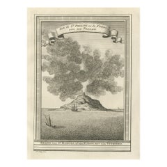
Old Engraving of Volcano Piton de la Fournaise on Reunion Island, c.1750
By Jakob van der Schley
Located in Langweer, NL
Antique print titled 'Eiland van St. Filippus, of van Fuego, met zyn vuurberg'. Old print of Piton de la Fournaise, a shield volcano on the eastern side of Reunion island...
Category
18th Century Antique Benelux Maps
Materials
Paper
$227 Sale Price
20% Off
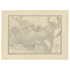
Antique Map of Siberia by Lapie, 1842
Located in Langweer, NL
Antique map titled 'Carte de la Sibérie ou Russie d'Asie'. Map of Siberia. This map originates from 'Atlas universel de géographie ancienne et moderne (..)' by Pierre M. Lapie and Al...
Category
19th Century Antique Benelux Maps
Materials
Paper
$331 Sale Price
20% Off
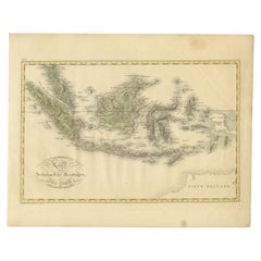
Antique Map of the Dutch East Indies by Van den Bosch '1818'
Located in Langweer, NL
Antique map titled 'Kaart der Nederlandsche Bezittingen in Oost-Indiën'.
Rare and attractive map of the Dutch East Indies, it shows the Dutch possessions in the 19th century. This ...
Category
Early 19th Century Antique Benelux Maps
Materials
Paper
$1,327 Sale Price
20% Off
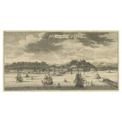
Antique Panoramic View of the Town of Malacca, Malaysia, 1726
Located in Langweer, NL
Antique print Malaysia titled 'De Stad Malacka'.
Decorative panoramic view of the town of Malacca with European vessels in the foreground. The old C...
Category
1720s Antique Benelux Maps
Materials
Paper
$705 Sale Price
30% Off
Antique Print with Coastal Views of Kamchatka in Russia by Cook, 1803
Located in Langweer, NL
Antique print Russia titled 'Gezigten der Kust van Kamtchatka'. Print with coastal views of Kamchatka including volcanoes. Originates from 'Reizen...
Category
19th Century Antique Benelux Maps
Materials
Paper
$274 Sale Price
20% Off
Antique Map of England and Wales, Also Including the Isle of Man
Located in Langweer, NL
Antique map titled 'England'. Original antique map of England and Wales from Northumberland to Cornwall from the St. George Channel east as far as the Strait of Dover. The Isle of Ma...
Category
Mid-19th Century Antique Benelux Maps
Materials
Paper
$369 Sale Price
20% Off
Antique Map of Tartary and Northeast Asia with Hand Coloring
Located in Langweer, NL
Antique map titled 'Carte de la Tartarie Occidentale'. An interesting map of Tartary and northeast Asia, from Lake Baykal, Partie du Siberia in the north, Pays des Kalkas at the cent...
Category
Mid-18th Century Antique Benelux Maps
Materials
Paper
$265 Sale Price
20% Off
Old Hand-Colored Map of Western Tartary with Focus on Present-Day Mongolia, 1749
Located in Langweer, NL
Antique map titled 'Carte de la Tartarie Occidentale pour Servir a l'Histoire Générale des Voyages. Tirée des Auteurs Anglois.'
This map covers western Tartary and focuses on the...
Category
1740s Antique Benelux Maps
Materials
Paper
$417 Sale Price
20% Off
Antique Map of Delfland, Schieland and Islands of Zuid-Holland, the Netherlands
Located in Langweer, NL
Antique map titled 'Delflandia, Schielandia, et Insulae (..)'. Original antique map of Delfland, Schieland and islands of Zuid-Holland, the Netherlands. The 'Zuid-Hollandse Eilanden'...
Category
Mid-17th Century Antique Benelux Maps
Materials
Paper
$654 Sale Price
20% Off
Old Print from Capt. Cooks Travels with Boats and a Ship in the South Sea, 1803
Located in Langweer, NL
Antique print titled 'Gezigt van eenen grooten Ys-klomp drijvende in de Zuid-Zee 9. jan. 1773'.
Antique print depicting boats and a ship near ice islands. Originates from 'Reizen...
Category
Early 1800s Antique Benelux Maps
Materials
Paper
$303 Sale Price
20% Off
Antique Map of the Region of Étampes and Sens by Janssonius, c.1650
Located in Langweer, NL
Antique map titled 'Gastinois et Senonois'. Old map of the region of Étampes and Sens, France. It shows the cities of Sens, Melun, Étampes, Orleans, Fontainebleau, Montargis and othe...
Category
17th Century Antique Benelux Maps
Materials
Paper
$336 Sale Price
20% Off
Original Antique Map of Northern India
Located in Langweer, NL
Antique map titled 'India. Northern Part'. Original antique map of Northern India. Drawn and engraved by J. Archer. Publishes by H.G. Collins, ci...
Category
Mid-19th Century Antique Benelux Maps
Materials
Paper
$322 Sale Price
20% Off
Old Copper Engraving of the City of Kajutsiu in China, 1668
By Johannes Nieuhof
Located in Langweer, NL
Antique print China titled ‘Kajutsiu'. This plate shows a view on the Chinese city of Kajutsiu. This print originates from the Latin edition of Nie...
Category
17th Century Antique Benelux Maps
Materials
Paper
$322 Sale Price
20% Off
Antique Map of Ijlst , Friesland in the Netherlands, 1865
Located in Langweer, NL
Friesland: Gemeente IjJlst. These scarse detailed maps of Dutch Towns originate from the 'Gemeente-atlas' of Jacob Kuyper. This atlas of all towns in the Netherlands was published fr...
Category
19th Century Antique Benelux Maps
Materials
Paper
$180 Sale Price
20% Off
Maps of the Ancient World and the Posterity of Noah, 1820
Located in Langweer, NL
Two maps on one sheet. Hhand colored engraved lithograph, depicting the world as known to the Ancients on Mercator's projection and the Posterity of Noah. The first showns the Empire...
Category
19th Century Antique Benelux Maps
Materials
Paper
$237 Sale Price
20% Off
Antique Map of the Region of Nivernais by Janssonius, 1657
By Johannes Janssonius
Located in Langweer, NL
Antique map of France titled 'Carte du Païs et Duché de Nivernois'. Decorative map of the Nivernais region, part of Burgundy, France. This map originates from 'Atlas Novus, Sive Thea...
Category
17th Century Antique Benelux Maps
Materials
Paper
$368 Sale Price
20% Off
View of the City Banten or Bantam Near the Western End of Java, Indonesia, c1725
Located in Langweer, NL
Antique print titled 'La Ville de Bantam capitale du Roiaume de meme nom'.
A bird's eye view of the city Banten or Bantam near the western end of Java in Indonesia. Several tall ...
Category
1720s Antique Benelux Maps
Materials
Paper
$701 Sale Price
20% Off
Print of the British Parliament & an Assembly before the King of England, 1732
Located in Langweer, NL
Antique print titled 'Representation du Parlement d'Angletrre (..)'.
Series of scenes, which include from the British Parliament and an assembly...
Category
1730s Antique Benelux Maps
Materials
Paper
$701 Sale Price
20% Off
Architectural Antique Print of Various Garden Temples by Le Rouge, c.1785
Located in Langweer, NL
Untitled antique print showing various garden temples. This print originates from 'Jardins Anglo-Chinois à la Mode' by Georg Louis le Rouge. Artists and ...
Category
18th Century Antique Benelux Maps
Materials
Paper
Antique Print of the Palace of Justice in Leeuwarden by Terwen, 1858
Located in Langweer, NL
Antique print titled 'Leeuwarden. Het Paleis van Justitie.' Old print of the city of Leeuwarden showing the Palace of Justice. This print originates from 'Het koningrijk der Nederlan...
Category
19th Century Antique Benelux Maps
Materials
Paper
Antique Map of Barbary and Biledulgerid by Sanson, 1705
Located in Langweer, NL
Antique map, titled: 'Gedeelte van Barbaryen (…).' - Decorative hand colored map of a part of Barbary (Algeria) and Biledulgerid (Tegoryn, Zeb etc.), North Africa. Source unknown, to...
Category
18th Century Antique Benelux Maps
Materials
Paper
$303 Sale Price
20% Off
Original Map of the Military Situation After the Dutch Blockade of Antwerp, 1648
Located in Langweer, NL
Antique map titled 'Tabula Castelli ad Sandflitam (..)'.
This map depicts the complex military situation that had developed after the Dutch blockade of Antwerp. All entrenchment'...
Category
1640s Antique Benelux Maps
Materials
Paper
$635 Sale Price
20% Off
Antique Map of Peru and Bolivia by Thierry, 1836
Located in Langweer, NL
Antique map titled 'Pérou et Bolivia'. Decorative map of Peru and Bolivia with outline coloring. Originates from 'Atlas Complet Du Precis De La Geographie ...
Category
19th Century Antique Benelux Maps
Materials
Paper
$123 Sale Price
20% Off
Antique Map of Java, Madura, Bali and the Sunda Strait, Indonesia, c.1770
Located in Langweer, NL
Antique map Indonesia titled 'Nouvelle Carte de l'Isle de Java - Nieuwe kaart, van het Eiland Java'. Chart of the island of Java, depicting soun...
Category
18th Century Antique Benelux Maps
Materials
Paper
$426 Sale Price
20% Off
Original Antique Map of the Holy Land with Decorative Cartouche
Located in Langweer, NL
Antique map titled 'Totius Terrae Sanctae'. Original old map of the Holy Land, with a large decorative cartouche. The term "Holy Land" usually refers to a territory roughly correspon...
Category
Late 17th Century Antique Benelux Maps
Materials
Paper
$369 Sale Price
20% Off
Very Detailed Antique Map of the Jesuit Province of Bavaria, Germany, c.1700
Located in Langweer, NL
Antique map titled 'Provinciae Superior Germaniae Societatis.' Very detailed map of the Jesuit province of Bavaria, Germany. Source unknown, to be determined.
Artists and Engravers:...
Category
18th Century Antique Benelux Maps
Materials
Paper
$568 Sale Price
20% Off
Antique Map of the City of Berlin in Germany, '1847'
Located in Langweer, NL
Antique map titled 'Berlin'. Original antique map of the city of Berlin, Germany. This map originates from 'Abrégé de Géographie (..)' by Adrien Balbi. Published 1847.
Category
Mid-19th Century Antique Benelux Maps
Materials
Paper
$142 Sale Price
20% Off
Large Antique Map of the Netherlands with Original Hand Coloring
Located in Langweer, NL
Original antique map titled 'Belgica Foederata complectens septem Provincias Ducatum Geldriae (..)". Large map of the Netherlands. Title a...
Category
Mid-18th Century Antique Benelux Maps
Materials
Paper
$777 Sale Price
20% Off
Antique Map of Brabant, the Netherlands, with Original Hand Coloring
Located in Langweer, NL
Original antique map titled 'Novissima et Accuratissima Brabantiae Ducatus Tabula'. Old map of Brabant, the Netherlands. North is to the right. Like all other maps of Brabantiae Duca...
Category
Mid-17th Century Antique Benelux Maps
Materials
Paper
$777 Sale Price
20% Off
Set of 2 Antique Maps covering part of modern-day Czech Republic
Located in Langweer, NL
Set of two antique maps titled 'Marchionatus Moraviae circulus Preroviensis'. Two individual sheets covering part of modern-day Czech Republic. Cities included are Opava, Fulnek, Lip...
Category
Early 18th Century Antique Benelux Maps
Materials
Paper
Large Antique Map of Gaul under Roman Rule, ca.1760
Located in Langweer, NL
Antique map titled 'Gallia Augustiniana in suas provincias divisa (..)'. Large antique map of Roman Gaul, it refers to Gaul under provincial rule in ...
Category
1760s Antique Benelux Maps
Materials
Paper
$398 Sale Price
20% Off
Original Antique Map of the Road from Andover to Crewkerne
Located in Langweer, NL
Antique map titled 'The Continuations of the Road from London to the Lands End'. Original antique map of the road from Andover to Crewkerne. Plate 26 from Ogilby's 'Britannia', the f...
Category
Late 17th Century Antique Benelux Maps
Materials
Paper
$730 Sale Price
20% Off
Copper Engraving Showing the Neptune Fountain of Versailles, Paris, France, 1785
Located in Langweer, NL
Antique print titled 'Plan de la décoration du Bassin de Neptune à Versailles'.
Copper engraving showing parts of the Neptune fountain of Versaill...
Category
1780s Antique Benelux Maps
Materials
Paper
$369 Sale Price
20% Off
Antique Lithograph of a Japanese Junk, a Type of Sailing Ship, 1856
Located in Langweer, NL
Antique print titled ‘Japanese Junk'.
Lithograph of a Japanese junk, a type of sailing ship. This print originates from 'Narrative of the expedition of an A...
Category
1850s Antique Benelux Maps
Materials
Paper
$360 Sale Price
20% Off
Antique French Map of the Pacific Ocean with Australia and Polynesia, 1806
Located in Langweer, NL
Antique map titled 'Australasie et Polynesie'. Old map of Oceania and the Pacific Ocean. Originates from 'Atlas Portatif contenant la Géographie Universelle Ancienne et Moderne' by H...
Category
19th Century Antique Benelux Maps
Materials
Paper
$113 Sale Price
20% Off
Antique Map of the War Situation in Europe and Asia, 1944
Located in Langweer, NL
Antique map titled 'Newsmap for the Armed Forces'. This "newsmap" was issued on Monday, December 18, 1944, and covers the news from December 6-13, 1945 - the 275th week of the war. T...
Category
20th Century Benelux Maps
Materials
Paper
$711 Sale Price
20% Off
Antique Map of the Netherlands and Belgium, circa 1880
Located in Langweer, NL
Antique map titled 'Hollande et Belgique'. Old map of the Netherlands and Belgium. With decorative vignette of the Antwerp cathedral. This map o...
Category
19th Century Antique Benelux Maps
Materials
Paper
$180 Sale Price
20% Off
Large Antique Sea Chart of the South-Eastern Coast of Sumatra, Indonesia
Located in Langweer, NL
Antique map titled 'Carte pour aller du Détroit de la Sonde ou de Batavia, au Détroit de Banca'. This uncommon sea chart shows northern Java and eastern Sumatra along with an inset of the small islands in the Detroit Sound. The handsome chart provides detailed navigational information, including the route of Julien Crozet in April 1772, who led a French expedition to the South Pacific after the voyage's commander, Marion De Fresne, and 26 crew members were killed (and allegedly eaten) by a Maori tribe in the Bay of Islands off the coast of New Zealand. With title upper left corner and small inset map of the small isles nearby the south-eastern coast of Sumatra.
J. B. d'Apres de Mannevillette, from his atlas "Neptune orientale". French sailor...
Category
Late 18th Century Antique Benelux Maps
Materials
Paper
$445 Sale Price
20% Off
Antique Map of the State of Ohio by Titus '1871'
Located in Langweer, NL
Antique map titled 'Railroad & Township Map of the State of Ohio'. Original antique map of the State of Ohio. This map originates from 'Atlas of Preble County Ohio' by C.O. Titus. Pu...
Category
Late 19th Century Antique Benelux Maps
Materials
Paper
$1,066 Sale Price
25% Off
Antique Print of the Interior of Lund Cathedral by Sandberg, c.1864
Located in Langweer, NL
Antique print titled 'Choret I Lunds Domkyrka'. View of the interior of Lund Cathedral (Swedish: Lunds domkyrka), a cathedral of the Lutheran Church of Sweden in Lund, Scania, Sweden...
Category
19th Century Antique Benelux Maps
Materials
Paper
$61 Sale Price
20% Off
Antique Plan of Santiago, Chili, 1747
By Jakob van der Schley
Located in Langweer, NL
Antique print titled 'Plan de la Ville et des Forts de St. Yago, Grondtekening van de Stad en Forten van St. Iago'. Plan of the forts and town of Santiago, the largest island of Cape...
Category
18th Century Antique Benelux Maps
Materials
Paper
$180 Sale Price
20% Off
Map of East Friesland, The Netherlands & the Area Emden & Norden, Germany, 1635
Located in Langweer, NL
Antique map titled 'Typus Frisiae Orientalis.'
Map of East Friesland and the area around Emden and Norden. Large inset map of the mouth of the Amasis River. The map is decorated with a large title cartouche and two large coats of arms...
Category
1630s Antique Benelux Maps
Materials
Paper
$1,754 Sale Price
20% Off
Antique Map of present-day North-Rhine Westphalia, Germany
Located in Langweer, NL
Antique map titled 'Nova et Accurata Ducatus Cliviae et Comitatus Marchiae (..)'. Detailed regional map of Germany showing the region bounded by the Maas River in the west and to par...
Category
Mid-18th Century Antique Benelux Maps
Materials
Paper
$502 Sale Price
20% Off
Antique Map of Nottinghamshire by Speed, 1676
Located in Langweer, NL
Antique map titled 'The Countie of Nottingham (..)'. Map of Nottinghamshire, England. Includes an inset town plan of Nottingham. This map originates from 'Theatre of Great Britaine' ...
Category
17th Century Antique Benelux Maps
Materials
Paper
$463 Sale Price
20% Off
Antique Map of Moldova to Thessaly and from the Adriatic to the Black Sea, 1880
Located in Langweer, NL
Antique map titled 'Turquie d'Europe'.
Map of the european parts of Turkey. The map covers from Moldova to Thessaly and from the Adriatic to the Black Sea. Greece and the island ...
Category
1880s French Antique Benelux Maps
Materials
Paper
Antique Map of the Northwest Coast of Masafuera Island or Selkirk Island
Located in Langweer, NL
Antique map titled 'Vue de Cote N.O. de Masafuero'. Profile view of the north-west coast of Masafuera Island (also called Alejandro Selkirk Island...
Category
Late 18th Century Antique Benelux Maps
Materials
Paper
$322 Sale Price
20% Off
Old Map of the French Department of Indre, France
By Victor Levasseur
Located in Langweer, NL
Antique map titled 'Dept. de l'Indre'. Map of the French department of Indre, France. Part of the Loire Valley wine region, this area is known for its production of Chinon wines, typically red, and production of Pouligny-Saint-Pierre, goats'-milk cheese. It is also the birthplace of the great philosopher Rene Descartes...
Category
Mid-19th Century Antique Benelux Maps
Materials
Paper
$322 Sale Price
20% Off
Antique Map of the City of Geldern by Blaeu, 1649
Located in Langweer, NL
Antique map titled 'Gelre'. Old map of the city of Geldern, Germany. This map originates from 'Toonneel der Steden van de Vereenighde Nederlanden' by J. Blaeu.
Artists and Engrav...
Category
17th Century Antique Benelux Maps
Materials
Paper
$376 Sale Price
20% Off
Original Italian Antique Map of Asia Minor and Cyprus and Neighboring Regions
Located in Langweer, NL
Antique map titled 'Natolia detta anticamente Asia Minor (..)'. Rare map of Asia Minor (Turkey) and Cyprus and neighboring regions. The map provides one of the most detailed and up t...
Category
Late 17th Century Antique Benelux Maps
Materials
Paper
$616 Sale Price
20% Off
Antique Print of the Ophthalmology Hospital in Utrecht, the Netherlands, 1859
Located in Langweer, NL
Antique print titled 'Nederlandsch Gasthuis voor behoeftige en minvermogende ooglijders'. Lithograph of the Ooglijdersgasthuis in Utrecht, a former ophthalmology hospital. This print...
Category
19th Century Antique Benelux Maps
Materials
Paper
$184 Sale Price
20% Off
Hand Colored Antique Map of the department of Finistère, France
By Victor Levasseur
Located in Langweer, NL
Antique map titled 'Dépt. du Finistère'. Map of the French department of Finistere, Brittany, France. This area of France is known for its cider production and excellent boar hunting...
Category
Mid-19th Century Antique Benelux Maps
Materials
Paper
$322 Sale Price
20% Off
Antique Map of York's Bay, Haven of the Three Islands and Surroundings
Located in Langweer, NL
Antique map titled 'Baye St. David (..)'. Charts of York's Bay, Haven of the Three Islands, St. David's Bay, and Elizabeth's Bay. This map originates from the French edition of 'An A...
Category
Late 18th Century Antique Benelux Maps
Materials
Paper
$312 Sale Price
20% Off
Antique Map of Christmas Island by Cook, 1784
Located in Langweer, NL
Antique map Kiribati titled 'Christmas Island (..)'. Antique map of Christmas Island, also known as Kiritimati. Originates from an edition of Cook's Voyages.
Artists and Engravers...
Category
18th Century Antique Benelux Maps
Materials
Paper
$104 Sale Price
20% Off
Antique Map of Kollumerland, a Township in Friesland, The Netherlands, 1868
Located in Langweer, NL
Antique map titled 'Provincie Friesland - Gemeente Kollumerland en Nieuw-Kruisland'.
Map of the township of Kollumerland including Kollum, Westergeest, Burum and many other villa...
Category
19th Century Antique Benelux Maps
Materials
Paper
$123 Sale Price
20% Off
Antique Map of the City of Groningen Made After Harrewijn, C.1750
Located in Langweer, NL
Antique map titled 'Groeningue'. Old map of the city of Groningen, the Netherlands. Source unknown, to be determined.
Artists and Engravers: Most likely made after J. Harrewijn.
...
Category
18th Century Antique Benelux Maps
Materials
Paper
$104 Sale Price
20% Off
Antique Print of a Ship Near the Coast of Sumatra, Indonesia, c.1845
Located in Langweer, NL
Antique print titled 'Gezigt aan de Westkust van Sumatra - Vue de la Côte Occidentale de Sumatra'. Lithograph on chine collé with a view of a ship near the coast of Sumatra, Indonesi...
Category
19th Century Antique Benelux Maps
Materials
Paper
$398 Sale Price
20% Off
Villa Weber – French Architectural Lithograph from La Brique by Sédille, 1900
Located in Langweer, NL
Villa Weber – French Architectural Lithograph from La Brique, Paul Sédille, c.1900
This beautifully colored antique lithograph presents Villa Weber, an elegant residence designed by...
Category
20th Century French Benelux Maps
Materials
Paper
Architectural Print of Villa Weber in France - Chabat, c.1900
Located in Langweer, NL
Villa Weber – Decorative French Architectural Lithograph from La Brique, c.1900
Striking antique architectural lithograph depicting design elements from Villa Weber, a residence cre...
Category
20th Century French Benelux Maps
Materials
Paper
Recently Viewed
View AllMore Ways To Browse
Greek Key Dresser
Green Glass Bud Vase Vintage
Gucci Tray
Half Moon Shelves
Handblown Glass Decanter
Heart Shaped Glass Dish
Hepplewhite Drop Leaf Table
Herend Cup
Hermes Dish
Horse Head Barware
Horse Mantel Clock
Large Limoges Platter
Michelangelo David Statue
Michelin Guide
Persian Khatam
Royal Worcester Aesthetic
Russell Woodard Aluminum
Russian Silver Niello
