Continental Europe Maps
to
4,202
5,133
5,486
200
5,132
1
2
2
2
1
2,808
2,006
318
1
179
12
1
68
3
3
3
2
3
1
5,114
17
11
10
8
408
147
81
80
52
5,133
5,133
5,133
104
59
20
14
13
Item Ships From: Continental Europe
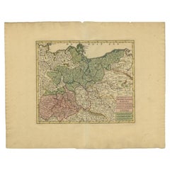
Antique Map of Upper Saxony in Germany by Tirion, circa 1740
By Isaak Tirion
Located in Langweer, NL
Antique map titled 'Nieuwe Kaart van de Opper Saxise Kreits (..).' Attractive detailed map showing Upper Saxony, Germany with Meissen, Thuringen, Anhalt, Brandenburg, Pommeren etc. S...
Category
18th Century Antique Continental Europe Maps
Materials
Paper
$457 Sale Price
20% Off
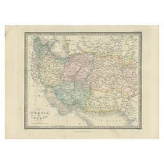
Antique Map of Afghanistan and Surroundings, '1845'
Located in Langweer, NL
Antique map titled 'Map of Persia and Caubul'. Original antique map of Afghanistan and surroundings.
This map originates from 'An Atlas of the World, Comprehending Separate Maps of...
Category
Mid-19th Century Antique Continental Europe Maps
Materials
Paper
$190 Sale Price
20% Off
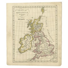
Antique Map of the United Kingdom and Ireland, circa 1825
Located in Langweer, NL
Antique map titled 'Insula Britannicae'. Old map of the United Kingdom and Ireland originating from 'Atlas der Oude Wereld'.
Artists and Engravers: Published by C. Ph. Funke and W. v...
Category
19th Century Antique Continental Europe Maps
Materials
Paper
$133 Sale Price
20% Off
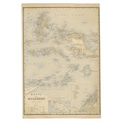
Antique Map of the Moluccas by Stemfoort, 1885
Located in Langweer, NL
Antique map titled 'Kaart der Molukken'. Old map of the southern tip of the Moluccas, or Maluku Islands. With an inset map of part of Ambon Island and an inset map of New Guinea. Thi...
Category
19th Century Antique Continental Europe Maps
Materials
Paper
$260 Sale Price
20% Off
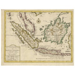
Antique Map of the Sunda Islands Sumatra, Java, Malay Peninsula & Borneo (1739)
By Isaak Tirion
Located in Langweer, NL
Antique map titled 'Nieuwe kaart van de Sundasche Eilanden als Borneo, Sumatra en Groot Iava & c'. Detailed map of the Sunda Islands, Southeast Asia, extending from the tip of Cambod...
Category
Mid-18th Century Antique Continental Europe Maps
Materials
Paper
$696 Sale Price
21% Off
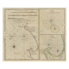
Early Chart Identifying British Spice Trading Colony of Bencoolen, Sumatra, 1797
Located in Langweer, NL
Antique map titled 'A Chart of the West Coast of Sumatra'.
Early nautical chart identifying the British spice trading colony of Bencoolen and F...
Category
1790s Antique Continental Europe Maps
Materials
Paper
$1,190 Sale Price
20% Off
Antique Print of a Design for Belton House, Lincolnshire, England, 1725
Located in Langweer, NL
Antique print titled 'Belton in Lincolnshire, the Seat of Sr. John Brownlow Bar'.
Belton House is a Grade I listed country house in the parish of Belton near Grantham in Lincolns...
Category
18th Century Antique Continental Europe Maps
Materials
Paper
$523 Sale Price
20% Off
Antique Map of South America by Wyld, '1845'
Located in Langweer, NL
Antique map titled 'South America'. Original antique map of South America. This map originates from 'An Atlas of the World, Comprehending ...
Category
Mid-19th Century Antique Continental Europe Maps
Materials
Paper
$285 Sale Price
20% Off
Antique Map of Australasia, New Zealand, Polynesia & the Pacific Ocean, 1840
Located in Langweer, NL
Antique map titled 'The Pacific Ocean'.
This map depicts Australasia, New Zealand, Polynesia and islands in the Pacific Ocean including the Sandwich Islands.
Artists and Engravers: Published by the Society for the Diffusion of Useful Knowledge, 1840. Engraved by J. & C. Walker.
Condition:
Good, general age-related toning. Few tiny tears...
Category
1840s Antique Continental Europe Maps
Materials
Abalone, Paper
$209 Sale Price
20% Off
Antique Map of Aube ‘France’ by V. Levasseur, 1854
Located in Langweer, NL
Antique map titled 'Dépt. de l'Aube'. Map of the French department of Aube, France. This area of France is known for its production of Chaource, a soft and salted cheese. Aube is par...
Category
Mid-19th Century Antique Continental Europe Maps
Materials
Paper
$171 Sale Price
20% Off
Beautiful Original Copper Engraved Map of Lake Geneva in Switzerland, 1613
Located in Langweer, NL
Description: Antique map titled 'Lacus Lemanus'.
Old map of Lake Geneva with good detail of surrounding towns and villages. Decorated with a large compass rose with two sailing boats and a sea monster in the lake. Originates from 'Atlas Minor'.
Artists and Engravers: Henricus Hondius...
Category
1610s Antique Continental Europe Maps
Materials
Paper
$619 Sale Price
20% Off
Antique Map of the West-Frisian Part of Independant Friesland by Halma, 1718
Located in Langweer, NL
Antique map Friesland titled 'Pars I Frisiae Liberae (..)'. Old map of Friesland, the Netherlands. This map depicts the West-Frisian part of independant Friesland. Originates from 'U...
Category
18th Century Antique Continental Europe Maps
Materials
Paper
Antique Map of Modern Day Ukraine and Russia Titled Moscovie 'Moscow', Ca.1683
Located in Langweer, NL
Antique map of modern day Ukraine and Russia titled ‚Moscovie‘. Miniature map of the Moscovia region by A.M. Mallet.
Artists and Engravers: Alain Manneson Mallet (1630-1706) spent...
Category
1680s Antique Continental Europe Maps
Materials
Paper
$438 Sale Price
20% Off
Antique Map of Martinique, Showing Roads, Houses, Sugar Plantations, etc. c.1750
Located in Langweer, NL
Antique map titled 'Carte de l'Isle de la Martinique'.
Detailed map of Martinique. Shows hilly terrain, forests, roads, houses, and even the sugar plantations. The island was to ...
Category
18th Century Antique Continental Europe Maps
Materials
Paper
$1,428 Sale Price
20% Off
Antique Map of Southern Greece, 1892
Located in Langweer, NL
Antique map of Greece titled 'Griechenland. Südlicher Theil'. Old map of Southern Greece with inset maps of the Acropolis of Athens, the region of Athens, Thermopylae and Olympia. So...
Category
19th Century Antique Continental Europe Maps
Materials
Paper
$80 Sale Price
20% Off
Pl. 20 Antique Print of a Garden Planted by Louis XV by Le Rouge, c.1785
Located in Langweer, NL
Antique print titled 'Nouveau Trianon planté par Louis XV'. Copper engraving showing a garden planted by Louis XV. This print originates from 'Jardins Anglo-Chinois à la Mode' by Geo...
Category
18th Century Antique Continental Europe Maps
Materials
Paper
Antique Map of Western and Eastern Barbary in Africa, c.1744
Located in Langweer, NL
Antique map titled 'A New & Accurate Map of the Western Parts of Barbary' and 'A New & Accurate Map of the Eastern Parts of Barbary'. Decorative maps of North Africa and the Southern...
Category
18th Century Antique Continental Europe Maps
Materials
Paper
Pl. 10 Antique Print of a Garden Casino and Repository by Le Rouge, c.1785
Located in Langweer, NL
Antique print titled 'Casine de Wilton à la Comtesse de Pembroke (..)'. Copper engraving showing the casino of Pembroke and repository of Mr. Hotham Baronet. This print originates fr...
Category
18th Century Antique Continental Europe Maps
Materials
Paper
Antique Plan of the Siege of Grave by Guicciardini, c.1608
Located in Langweer, NL
Antique map titled 'Hic est situs oppidi Grauiae (..)'. Bird's eye view plan of Grave, The Netherlands, Holland. Showing the siege of Grave in the year 1602. Source unknown, to be de...
Category
17th Century Antique Continental Europe Maps
Materials
Paper
$457 Sale Price
20% Off
Original Antique Map of England and Wales, with Decorative Cartouche
Located in Langweer, NL
Antique map titled 'England and Wales from the best Authorities'. Original antique map of England and Wales, with decorative cartouche. Engraved by T. Conder. Published circa 1790.
Category
Late 18th Century Antique Continental Europe Maps
Materials
Paper
$152 Sale Price
20% Off
Antique Hand-Colored Print of the Common Hazel, 1758
Located in Langweer, NL
Antique print of the common hazel. Originates from 'Pomologia' by J. H. Knoop.
Artists and Engravers: Published by Johann Hermann Knoop (c.1700-1769).
Condition: Good, general ...
Category
18th Century Antique Continental Europe Maps
Materials
Paper
$314 Sale Price
20% Off
Antique Map of Russia and Poland by Petri, 1852
Located in Langweer, NL
Antique map titled 'Europeesch Rusland en Polen'. Map of Russia in Europe and Poland. This map originates from 'School-Atlas van alle deelen der Aarde' by Otto Petri...
Category
19th Century Antique Continental Europe Maps
Materials
Paper
$114 Sale Price
20% Off
Antique Map of the River Systems of Europe and Asia by Johnston, c.1850
Located in Langweer, NL
Antique map titled 'The River Systems of Europe & Asia'. Old map depicting the river systems of Europe and Asia showing the boundaries & comparative extent of the river basins, and t...
Category
19th Century Antique Continental Europe Maps
Materials
Paper
$103 Sale Price
20% Off
Antique Map of South Australia by Johnston, 1882
By Thomas Kitchin
Located in Langweer, NL
Antique map titled 'South Australia, New South Wales, Victoria & Queensland'. Old map of Southern Australia, with an inset map of Cape York Peninsula. This map originates from 'The R...
Category
19th Century Antique Continental Europe Maps
Materials
Paper
$114 Sale Price
20% Off
Large Rhine River Map, Moselle and Meuse, by Willem Blaeu, Hand-coloured - 1640
Located in Langweer, NL
Rhine River & Tributaries Antique Map by Willem Blaeu, c.1640
This spectacular mid-seventeenth-century copper-engraved map, titled in Latin “Rhenus Fluvio...
Category
Mid-17th Century Dutch Antique Continental Europe Maps
Materials
Paper
$1,428 Sale Price
20% Off
Antique Map of South America by Walker, 1816
By Thomas Kitchin
Located in Langweer, NL
Antique map titled 'South America'. Old map of South America. This map originates from 'Walker's Universal Atlas'. Artists and Engravers: Printed by Barnard and Farley.
Artist: Pr...
Category
19th Century Antique Continental Europe Maps
Materials
Paper
$104 Sale Price
20% Off
Antique Map of Bourbon/Reunion 'France' by V. Levasseur, 1854
By Victor Levasseur
Located in Langweer, NL
Antique map titled 'Ile de la Réunion'. Map of the French department of Ile. Bourbon or Reunion. Bourbon, or Reunion, is a volcanic island off the coast of Africa. It is one of Franc...
Category
Mid-19th Century Antique Continental Europe Maps
Materials
Paper
$190 Sale Price
20% Off
Old Costume Print of a Peasant of Upper Carniola, Slovenia, Eastern Europe, 1804
Located in Langweer, NL
Old print of a peasant of upper Carniola, Slovenia.
This print originates from 'The Costume of the Hereditary States of the House of Austria' by William Miller.
Artists and Engravers: Engraved by William Ellis.
Category
Early 1800s Antique Continental Europe Maps
Materials
Paper
$266 Sale Price
20% Off
Map of Northern European Russia: Early 19th Century - 1802 Tardieu Atlas
Located in Langweer, NL
Title: Russie Européenne: Partie Septentrionale. Deuxieme Carte.
**Publication Details:**
- **Atlas Title:** Nouvel Atlas Universel de Géographie Ancienne et Moderne
- **Purpose:**...
Category
Early 1800s Antique Continental Europe Maps
Materials
Paper
$457 Sale Price
20% Off
Attractive Original Map of the Province of Overijssel, the Netherlands, Ca.1700
Located in Langweer, NL
Antique print, titled: 'Transisalania Provincia vulgo Over-yssel.'
Attractive original handcoloured map of the province of Overijssel, The Netherlands. With beautiful title cartouc...
Category
Early 1700s Antique Continental Europe Maps
Materials
Paper
$892 Sale Price
40% Off
Antique Map of Southeast Asia 'India, Indonesia' by N. Visscher, circa 1670
Located in Langweer, NL
Antique map titled 'Indiae Orientalis, nec non Insularum Adiacentium Nova Descriptio.' The map centers on the Strait of Malacca and Malay Peninsula. It extends from India and the Mal...
Category
Mid-17th Century Antique Continental Europe Maps
Materials
Paper
$1,857 Sale Price
20% Off
Very Attractive Map of North and South America and Western Part of Africa, 1744
Located in Langweer, NL
Antique map titled 'Nieuwe Kaart van America.' Very attractive map of North and South America, the western part of Africa and south west Europe. With full contemporary hand colouring...
Category
18th Century Antique Continental Europe Maps
Materials
Paper
$904 Sale Price
20% Off
Antique Copper Engraving of Folding Plan of London, Published in 1804
Located in Langweer, NL
This rare map comes originally from the publication: Modern London: Being the History and Present State of the British Metropolis.
It was published in London and Printed for Richard...
Category
Early 1800s Antique Continental Europe Maps
Materials
Paper
$714 Sale Price
20% Off
Antique Map of Venezuela, New Granada, Ecuador and Peru by a & C. Black, 1870
Located in Langweer, NL
Antique map titled 'Venezuela, New Granada, Ecuador and Peru & c'. Original antique map of Venezuela, New Granada, Ecuador and Peru & c. This map originates from ‘Black's General Atl...
Category
Late 19th Century Antique Continental Europe Maps
Materials
Paper
$166 Sale Price
20% Off
Antique Map of European Turkey and Greece by Lowry '1852'
Located in Langweer, NL
Antique map titled 'European Turkey and Greece with the Ionian Islands'. Original map of European Turkey and Greece. This map originates from 'Lowry's table Atlas constructed and eng...
Category
Mid-19th Century Antique Continental Europe Maps
Materials
Paper
$95 Sale Price
20% Off
Antique Hand-colored Map of Brandenburg, Germany
Located in Langweer, NL
Antique map titled 'Marchionatus Brandenburgicus'. Original antique map of Brandenburg, with Königsberg and Stettin, Germany. Published by J. Janssonius, circ 1650.
Jan Janssonius ...
Category
Mid-17th Century Antique Continental Europe Maps
Materials
Paper
$400 Sale Price
20% Off
Antique Map of New Zealand by Johnston '1909'
Located in Langweer, NL
Antique map titled 'New Zealand'. Original antique map of New Zealand. With inset maps of Chatham, Auckland, Wellington, Dunedin, and New Gu...
Category
Early 20th Century Continental Europe Maps
Materials
Paper
$333 Sale Price
20% Off
Original Antique Map Southeast of the Banda or Spice Islands, Indonesia, 1726
Located in Langweer, NL
Antique map titled 'Kaart van de Zuyd-Ooster Eylanden van Banda'.
Map of the southeastern part of the Banda islands. This map originates from 'Oud en Nieuw Oost-Indiën' by F. Valen...
Category
1720s Antique Continental Europe Maps
Materials
Paper
$733 Sale Price
20% Off
Original Antique Engraving of the Creation of the World According to Mozes, 1725
Located in Langweer, NL
Antique map titled 'De Schepping der Wereldt volgens de Beschryving van Mozes' - This plate shows the creation of the world according to Moses. The upper depiction shows the world wi...
Category
18th Century Antique Continental Europe Maps
Materials
Paper
$628 Sale Price
20% Off
Antique Map of Gard ‘France’ by V. Levasseur, 1854
By Victor Levasseur
Located in Langweer, NL
Antique map titled 'Dépt. du Gard'. Map of the French department of Gard, France. This area of France is known mainly for its red wine and production of Bleu des Causses, a soft and ...
Category
Mid-19th Century Antique Continental Europe Maps
Materials
Paper
$171 Sale Price
20% Off
Antique Map of Greece from Ortelius's Theatrum Orbis Terrarum, 1595
Located in Langweer, NL
Original antique map titled "Graecia Sophiani." This is a very detailed and decorative engraved map, with two decorative cartouches and a hand-colored initial on the verso, from Abra...
Category
16th Century Antique Continental Europe Maps
Materials
Paper
$1,638 Sale Price
20% Off
Antique Map of the Spice Islands 'Moluccas', Indonesia by W. Blaeu, circa 1640
By Willem Blaeu
Located in Langweer, NL
Antique map titled 'Moluccae Insulae Celeberrimae'. Highly decorative antique map of the Spice Islands (Moluccas) published by W. Blaeu (circa 1640). This map features a large inset ...
Category
Mid-17th Century Antique Continental Europe Maps
Materials
Paper
Vintage Road Map of the Netherlands '1928'
Located in Langweer, NL
Vintage map titled 'Volgens het vijfjarig Werkplan te verbeteren Rijkswegen en nieuw aan te leggen wegen welke voorkomen op het Rijkswegenplan'. Map of the Netherlands...
Category
20th Century Continental Europe Maps
Materials
Paper
$238 Sale Price
20% Off
Hand-colored Nautical Chart: St. George's Channel and the Irish Sea, 1744
Located in Langweer, NL
The map was engraved by Richard William Seale, a notable British engraver. This map is a fine example of 18th-century cartography, particularly focused on maritime navigation.
The m...
Category
1740s Antique Continental Europe Maps
Materials
Paper
$628 Sale Price
20% Off
Málaga 1901: A Cartographic Detailing of Andalusia's Coastal Jewel
Located in Langweer, NL
The map depicts the province of Málaga, located in the autonomous community of Andalusia in southern Spain, as it was in 1901. Here are the key features illustrated on the map:
- **...
Category
Early 1900s Antique Continental Europe Maps
Materials
Paper
$323 Sale Price
20% Off
Antique Map of the City of Rotterdam by Guicciardini, C.1600
Located in Langweer, NL
Antique map titled 'Rotterdam'. Bird's eye view plan of Rotterdam in the province of Zuid-Holland, The Netherlands, Holland. This map originates from one of the editions of 'Discritt...
Category
17th Century Antique Continental Europe Maps
Materials
Paper
$376 Sale Price
20% Off
Old Map Focusing on the Wine Region of Metz, the Moselle Region of France, 1657
Located in Langweer, NL
Antique map of France titled 'Territorium Metense'.
Old map focusing on the wine region surrounding Metz, in the Moselle region of France. This map originates from 'Atlas Novus, ...
Category
1650s Antique Continental Europe Maps
Materials
Paper
$600 Sale Price
20% Off
Original Engraved Map of Saint Lucia in the West Indies by Bellin, 1758
Located in Langweer, NL
The "Carte de L’Isle de Sainte Lucie" by Jacques Nicolas Bellin, a prominent figure as the Royal Hydrographer and engineer of the French Navy, is a remarkable antique map showcasing ...
Category
1750s Antique Continental Europe Maps
Materials
Paper
$323 Sale Price
20% Off
Black Sea & Eastern Mediterranean Map: Eastern Roman Empire, Tardieu Atlas, 1802
Located in Langweer, NL
Antique Map with Title: "Partie Orientale de l'Empire Romain ou du Monde connu des Anciens"
Publication Details:
- **Atlas Title:** Nouvel Atlas Universel de Géographie Ancienne e...
Category
Early 1800s Antique Continental Europe Maps
Materials
Paper
$495 Sale Price
20% Off
Beautiful Antique Map of the Moluccas or Spice Islands, Indonesia, ca.1650
Located in Langweer, NL
Antique map titled 'Insularum Moluccarum Nova Descriptio.'
Beautiful map of the Moluccas. The famous Spice Islands, the cornerstone of the Dutc...
Category
1650s Antique Continental Europe Maps
Materials
Paper
$704 Sale Price
20% Off
Original Antique Map of the City of Stavoren, Friesland, The Netherlands, 1649
Located in Langweer, NL
Antique map titled 'Staveren'. Original antique map of the city of Stavoren, Friesland, The Netherlands. This map originates from 'Toonneel der Steden van de Vereenighde Nederlanden'...
Category
1640s Antique Continental Europe Maps
Materials
Paper
$904 Sale Price
20% Off
Rare Fish Print of the Norway Redfish 'Sebastes Viviparus' and the Sculpin, 1842
Located in Langweer, NL
Antique print, titled: 'Poissons Plate 9 - La Sebaste du Nord (Sebastes septentrionalis) - Le Cotte Scorpion (Cottus scorpius).' - This rare plate shows the Norway redfish (Sebastes ...
Category
1840s Antique Continental Europe Maps
Materials
Paper
$723 Sale Price
20% Off
Antique Map of South America by Tirion 'circa 1765'
Located in Langweer, NL
Antique map titled 'Kaart van het Onderkoningschap van Peru, zig uitstrekkende over Chili, Paraguay en andere Spaansche Landen: als ook van Brazil en verdere Bezittingen van Portugal...
Category
Mid-18th Century Antique Continental Europe Maps
Materials
Paper
$476 Sale Price
20% Off
Antique Map of Asia Minor by Malte-Brun, 1847
Located in Langweer, NL
Antique map titled 'Asie Mineure Ancienne'. This is an original antique map of Asia Minor from Malte Brun's "" Atlas de Géographie Universelle"", revised by...
Category
19th Century Antique Continental Europe Maps
Materials
Paper
$76 Sale Price
20% Off
Antique Map of the Asian Continent by Levasseur, '1875'
Located in Langweer, NL
Antique map titled 'Carte générale de l'Asie'. Large map of the Asian Continent. This map originates from 'Atlas de Géographie Moderne Physique et Politique' by A. Levasseur. Publish...
Category
Late 19th Century Antique Continental Europe Maps
Materials
Paper
$416 Sale Price
30% Off
Original Antique Map of Switzerland, 1882
Located in Langweer, NL
Embark on a historical journey with an original Antique Map of Switzerland from the renowned 'Comprehensive Atlas and Geography of the World...
Category
1880s Antique Continental Europe Maps
Materials
Paper
$219 Sale Price
20% Off
An Antique Map of Extremadura: Crossroads of History and Nature, 1903
Located in Langweer, NL
The image is a historical map of Extremadura, an autonomous community of Spain, from an unspecified year. The map features the region's topography, including mountain ranges, river systems, and road networks. Extremadura is bordered by Portugal to the west and is situated to the southwest of Madrid. The map also includes the coat of arms of Lisbon (Lisboa), possibly indicating the historical connections between the two regions, as Lisbon is close to the border of Extremadura.
Extremadura is known for its:
1. **Natural Landscapes**: The region has diverse landscapes, including the mountainous areas in the north and the fertile plains (known as the dehesa) used for grazing pigs, which produce the famous Iberian ham.
2. **Historical Significance**: Extremadura was the birthplace of many famous conquistadors, such as Hernán Cortés...
Category
Early 1900s Antique Continental Europe Maps
Materials
Paper
$438 Sale Price
20% Off
Antique Map of the Russian Empire by R. Bonne, 1780
Located in Langweer, NL
Antique map titled 'Carte de l'Empire de Russie.' Drawn by R. Bonne for G. Raynal’s Atlas de Toutes les Parties Connues du Globe Terrestre, Dressé pour l'Histoire Philosophique et Po...
Category
Late 18th Century French Antique Continental Europe Maps
Materials
Paper
Facsimile with 30 VOC Nautical Charts, the Treasure of Corpus Christi
Located in Langweer, NL
Facsimile with 30 large format VOC nautical charts in limited and numbered edition. Sjoerd de Meer, Frits Loomeijer (The Treasure of Corpus Christi) - ...
Category
21st Century and Contemporary Continental Europe Maps
Materials
Paper
$476 Sale Price
20% Off
Antique Chart of the US Predominating Sex, 1874
Located in Langweer, NL
Antique chart titled 'Map of predominating sex showing the local excess of males or of females in the distribution of population over the territory of th...
Category
Late 19th Century Antique Continental Europe Maps
Materials
Paper
$476 Sale Price
20% Off
Recently Viewed
View AllMore Ways To Browse
Vintage Industrial Bins
Vintage Liquor Labels
Vintage Utensil Holders
Vintage Wicker Wine Bottles
Vintage Wrought Iron Fire Screen
Viso Porcelain
Wall Mount Water Fountains
Wedding Cabinets and Armoires
Wedgwood Green Jasperware
Wedgwood Portrait
West German Pot
White Ceramic Garden Stool
White Ironstone China
White Lacquer Bar Cart
Woman With Water Jug
Wooden Chest 1800
Wooden Tea Cart
Worcester Jug
