Continental Europe Maps
to
4,203
5,113
5,466
195
5,112
1
2
2
2
1
2,804
1,990
318
1
179
12
1
68
3
3
3
2
3
1
5,094
17
10
10
7
377
131
80
76
42
5,113
5,113
5,113
104
59
20
14
13
Item Ships From: Continental Europe
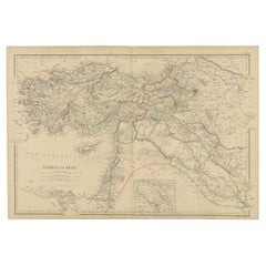
Old Map of Turkey in Asia with Mosul Environs and Assyrian Ruins Inset , 1859
Located in Langweer, NL
Turkey in Asia – Antique Map by W\.G. Blackie, 1859, with Inset of Assyrian Ruins
This finely detailed antique map titled *Turkey in Asia* is an original engraving from W\.G. Blacki...
Category
Mid-19th Century English Antique Continental Europe Maps
Materials
Paper
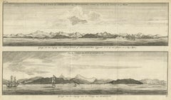
Antique Print of Zihuatanejo and the harbour of Acapulco in South America, 1749
Located in Langweer, NL
Antique print titled 'Vue de l'entree de Chequetan ou Seguataneo, restant au N.E. a la distance de 5 milles.' 'Vue de l'entree du port d'Acapulco.' View of Zihuatanejo and the harbou...
Category
18th Century Antique Continental Europe Maps
Materials
Paper
$209 Sale Price
20% Off
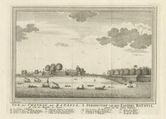
Antique Print of Capital Batavia in the Dutch East Indies 'Indonesia', C.1752
Located in Langweer, NL
Antique print Indonesia titled 'Vue Du Chateau De Batavia - Perspectief van het kasteel Batavia'. View of the Castle of Batavia, seen from the sugar warehouse. Originates from Antoin...
Category
18th Century Antique Continental Europe Maps
Materials
Paper
$342 Sale Price
20% Off
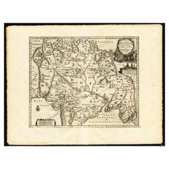
Antique Map of the Mughal Empire by Van der Aa, C.1725
By Pieter Van Der Aa
Located in Langweer, NL
Antique map titled 'Royaume de Grand Mogol (..).' This map shows the extend of the Mughal Empire, which includes northern India, from Golconda to Afghanistan and eastwards to Bengal....
Category
18th Century Antique Continental Europe Maps
Materials
Paper
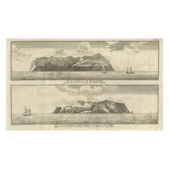
Engraving of Alejandro Selkirk Island, Juan Fernández-archipel, Chile, 1749
Located in Langweer, NL
Antique print titled 'Vue de la cote du N. E. de Masa-Fuero' - 'Vue de la cote occidentale de Masa-Fuero a la distance de quatre milles.' Views of Alejandro Selkirk Island...
Category
18th Century Antique Continental Europe Maps
Materials
Paper
$209 Sale Price
20% Off
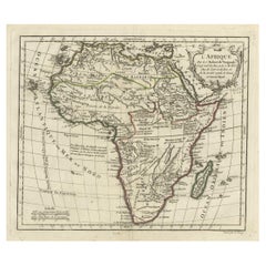
Antique Map of Africa with French Cartouche and Scale, c.1780
Located in Langweer, NL
Antique map titled 'L'Afrique'. Original antique map of Africa. With beautiful title cartouche and scale. Source unknown, to be determined.
Artists and Engravers: Gilles Robert de...
Category
18th Century Antique Continental Europe Maps
Materials
Paper
$333 Sale Price
20% Off
Antique Map of Eastern Tartary as Surveyed by the Jesuits, 1746
By Thomas Kitchin
Located in Langweer, NL
Antique map titled 'A Map of Eastern Tartary as Surveyed by the Jesuits in 1709, 10 & 11'. The map covers much of the course of the Amur River or Heilong Jiang, the world's tenth lon...
Category
18th Century Antique Continental Europe Maps
Materials
Paper
$275 Sale Price
20% Off
German Antique Map of Australia and Polynesia, c.1870
Located in Langweer, NL
Antique map titled 'Inseln des Grossen Oceans, Australien und Polynesien'. Old map of Australia and Polynesia. This map originates from 'H. Kiepert's Kleiner Atlas der Neueren Geogra...
Category
19th Century Antique Continental Europe Maps
Materials
Paper
$142 Sale Price
20% Off
Antique Map Showing the Ocean Currents and Temperature of Air, '1872'
Located in Langweer, NL
Two maps on one sheet titled 'Johnson's Oceans Currents (..)' and 'Johnson's World showing the Distribution of the Temperature of the Air'. Original world map...
Category
Late 19th Century Antique Continental Europe Maps
Materials
Paper
$333 Sale Price
20% Off
Antique Map of Spain and Portugal by Thomson, 1815
Located in Langweer, NL
Antique map titled 'Spain & Portugal.' Map of Spain and Portugal. From Thomson's 'New General Atlas', 1815. Artists and Engravers: Made by 'J. & G. Menzies'. Publisher: John Thomson ...
Category
19th Century Antique Continental Europe Maps
Materials
Paper
$166 Sale Price
20% Off
Antique Map of Swabia, 1685
Located in Langweer, NL
Antique map titled 'Sueviae quae cis Codanum fuit finum Antiqua defcriptio.' Miniature map of Swabia, a medieval Duchy in south-west Germany, that also included part of Poland, from ...
Category
17th Century Antique Continental Europe Maps
Materials
Paper
Antique Hand-Colored Map of France by J.B. Elwe, 1792
Located in Langweer, NL
Antique map titled 'Carte Nouvelle du Royaume de France'. Beautiful antique map of France, including the Southern part of England. Decorated with cartouche and 12 coats of arms.
Category
Late 18th Century Antique Continental Europe Maps
Materials
Paper
$808 Sale Price
20% Off
Antique Map of Germany by Walker, 1820
By R. Walker
Located in Langweer, NL
Antique map Germany titled 'Map of Germany as defined by the Peace of Paris'. Detailed antique map of Germany.
Artists and Engravers: Engrav...
Category
19th Century Antique Continental Europe Maps
Materials
Paper
$61 Sale Price
20% Off
Original Antique Print of a Street Scene in Naha, Okinawa in Japan, 1856
Located in Langweer, NL
Antique print titled ‘Street in Napha Lew-Chew'.
Antique print of a street scene in Naha, the capital city of the Okinawa Prefecture, Japan. Okinawa used to be called Great Lew C...
Category
1850s Antique Continental Europe Maps
Materials
Paper
$228 Sale Price
20% Off
Antique Map of the Islands Within the Queen Charlotte's Islands
Located in Langweer, NL
Antique map titled 'Cote Septentrional de la plus grande des Isles de la Reine Charlotte (..)'. Map and coastal view of the islands within the Queen Charlotte's Islands (Santa Cruz I...
Category
Late 18th Century Antique Continental Europe Maps
Materials
Paper
$313 Sale Price
20% Off
Antique Map of the Island of Djerba by Coronelli '1691'
Located in Langweer, NL
Antique map titled 'Isola e Castello di Gerbi'. Original antique map of the Island of Djerba, Tunisia, in Africa. Includes an inset of the Djerba Castle in upper right. This map orig...
Category
Late 17th Century Antique Continental Europe Maps
Materials
Paper
$333 Sale Price
20% Off
Antique Print with Views of Sir Charles Saunders Island and Other Islands, 1774
Located in Langweer, NL
Explore the captivating world of the 18th century with this exquisite antique print titled 'Isles de Sir Charles Saunder Latitude (...)'. I A journey through time as you delve into t...
Category
Late 18th Century Antique Continental Europe Maps
Materials
Paper
$304 Sale Price
20% Off
Antique Map of Europe by Keizer & de Lat, 1788
Located in Langweer, NL
Antique map titled 'Kaartje van Europa (..)'. Uncommon original antique map of Europe. This map originates from 'Nieuwe Natuur- Geschied- en Handelkundige Zak- en Reisatlas' by Gerri...
Category
Late 18th Century Antique Continental Europe Maps
Materials
Paper
$380 Sale Price
20% Off
Antique Hand-Coloured Map of India, Sri Lanka, Maldives, ca.1599
Located in Langweer, NL
Title: Tabula Asiae XI - 1599
Very old and decorative map of India, Sri Lanka and the Maledives. Put this map in a frame on the wall and amaze your visitors. This original engravi...
Category
16th Century Antique Continental Europe Maps
Materials
Paper
$532 Sale Price
20% Off
Old Sea Chart of Northern Norway, also depicting Part of Lapland & Russia, 1702
Located in Langweer, NL
Antique map titled 'The Coast of Norway and Lapland, from North kyn to the River Kola'.
Sea Chart of Northern Norway, also depicting part of Lapland and Russia. The map covers from the Kola river to what the map calls Fishers Island...
Category
Early 1700s Antique Continental Europe Maps
Materials
Paper
$466 Sale Price
20% Off
Antique Map of England, Also Showing Calais
Located in Langweer, NL
Antique map titled 'Carte de l'Angleterre pour le Voyage dans les trois Royaumes'. Original old map of England, also showing Calais. This map originates from 'Voyage dans les trois r...
Category
Late 18th Century Antique Continental Europe Maps
Materials
Paper
$133 Sale Price
20% Off
Old Map of Ceylon 'Sri Lanka' with The North Oriented to The Left, 1731
Located in Langweer, NL
Description: Antique map Ceylon titled 'Nieuwe Kaart van t Eland Ceilon'.
Old map of present-day Sri Lanka with north oriented to the left. The ...
Category
1730s Antique Continental Europe Maps
Materials
Paper
$618 Sale Price
20% Off
Print of the Solemn Celebration Sapan Giacche in Pegu, Burma 'Myanmar', 1725
Located in Langweer, NL
Antique print, titled: 'Fete Solennelle de Pegu appelee Sapan Giacche'
This plate shows the Solemn celebration called Sapan Giacche in Pegu or Bago, the capital of the Bago Regio...
Category
1720s Antique Continental Europe Maps
Materials
Paper
$323 Sale Price
20% Off
Detailed Antique Map of Western Belgium and Eastern France by Coronelli, 1690
By Vincenzo Coronelli
Located in Langweer, NL
Antique map titled 'Contado d'Hannonia (..)'. Map of western Belgium and eastern France, from south of Brussels (not shown) to Cambrai, France, generally centered around the towns of...
Category
17th Century Antique Continental Europe Maps
Materials
Paper
$466 Sale Price
20% Off
Decorative Antique Map of the Malay Archipelago or East Indies Island, 1851
Located in Langweer, NL
Antique map Indonesia titled 'Malay Archipelago, or East India Islands'. With vignettes of Victoria Mount, New Guinea, Nativaes of New Guinea an...
Category
1850s Antique Continental Europe Maps
Materials
Paper
$1,046 Sale Price
20% Off
Original Antique Map of England with Decorative Cartouche
Located in Langweer, NL
Antique map titled 'l'Angleterre (..)'. Original antique map of England, with beautiful hand coloring and decorative cartouche. This map originates from 'Nouvel Atlas Portatif destin...
Category
Late 18th Century Antique Continental Europe Maps
Materials
Paper
$275 Sale Price
20% Off
Antique Print with Charts of York's Bay and Surroundings
Located in Langweer, NL
Antique map titled 'Côte depuis la Baye d'York (..)'. Charts of York's Bay, Haven of the Three Islands, St. David's Bay, and Elizabeth's Bay.
Published in an edition of John Hawk...
Category
Late 18th Century Antique Continental Europe Maps
Materials
Paper
$418 Sale Price
20% Off
Antique Map of Italy with an Inset of Rome, 1812
Located in Langweer, NL
Antique map titled 'Italie Ancienne'.
Old map of ancient Italy, with an inset map of the region of Rome. This map originates from 'Atlas Supplementaire du Precis de la Geographie...
Category
19th Century Antique Continental Europe Maps
Materials
Paper
$152 Sale Price
20% Off
Original Hand-Colored Antique Print of Various Apples, 1758
Located in Langweer, NL
Antique print depicting apple variaties including the Syden Hemmetje, Somer-Erveling, Suiker-Appel, Princes-Appel, Witte Bloem-Soete, Swaan-Appel, Roode Gulderling, Rode Herfst-Cabri...
Category
18th Century Antique Continental Europe Maps
Materials
Paper
$164 Sale Price
20% Off
Antique Map of Denmark with Insets of Iceland and the Faroe Islands, c.1873
Located in Langweer, NL
Antique map titled 'Denemarken, Sleeswijk-Holstein en Lauenburg'. Old map depicting Denmark, with inset maps of Iceland and the Faroe Islands. This map originates from 'School-Atlas ...
Category
19th Century Antique Continental Europe Maps
Materials
Paper
$152 Sale Price
20% Off
Antique Map of the United States ' South East ' by Johnston '1909'
Located in Langweer, NL
Antique map titled 'United States of North America'. Original antique map of United States of North America ( South East Sheet ). With in...
Category
Early 20th Century Continental Europe Maps
Materials
Paper
$333 Sale Price
20% Off
Antique Map of the Region Between the Seine and Loire Rivers by Janssonius, 1657
Located in Langweer, NL
Antique map of France titled 'Gastinois et Senonois'. Regional map of central France, northeast of Orleans showing the area between the Seine and Loire Rivers. Includes Auxerre, Sens...
Category
17th Century Antique Continental Europe Maps
Materials
Paper
$274 Sale Price
20% Off
Large Antique Map of France with Original Hand Coloring
Located in Langweer, NL
Antique map titled 'France in Provinces'. Beautiful antique map of France. Drawn and engraved for John Thomson's 'New General Atlas' published circa 1814.
Category
Early 19th Century Antique Continental Europe Maps
Materials
Paper
$418 Sale Price
20% Off
Antique Print of the Battle of Camaret in the Nine Years War, Near Brest, France
Located in Langweer, NL
Antique print titled 'Plan of the Attack of Camaret Bay, on the Coast of Bretagne, thro which lies the Harbour of Brest'. Striking plan showing the details of the battle at the mouth of Cameret Bay. Includes a battle plan...
Category
Mid-18th Century Antique Continental Europe Maps
Materials
Paper
$618 Sale Price
20% Off
Antique Map of Rome and Athens by Perthes, 1848
Located in Langweer, NL
Antique map titled 'Roma Vetus, Athenae, Urbs, Campus Trojae'. Old map of Rome, Athens and surroundings originating from 'Orbis Terrarum Antiquus in usum S...
Category
19th Century Antique Continental Europe Maps
Materials
Paper
$94 Sale Price
20% Off
Old Original Handcoloured Map of the Former Province of Perche, France, ca.1640
Located in Langweer, NL
Antique map titled 'Perchensis Comitatus - La Perche compte'.
Old map of the former province of Perche, France. Until the French Revolution, Perche was bounded by four ancient te...
Category
1640s Antique Continental Europe Maps
Materials
Paper
$685 Sale Price
20% Off
Antique Map of the Barbary Coast by Lapie, 1842
Located in Langweer, NL
Antique map titled 'Carte de la Barbarie contenant l'Empire de Maroc (..)'. Map of the Barbary Coast. This map originates from 'Atlas universel de géographie ancienne et moderne (..)...
Category
19th Century Antique Continental Europe Maps
Materials
Paper
$232 Sale Price
20% Off
French Antique Map of Northern Africa and Libya, c.1840
Located in Langweer, NL
Antique map titled 'Marok, Alger et Tunis - Etat de Tripoli'. Map of Northern Africa and Libya. This map originates from 'Le globe Atlas classique Universel de géographie ancienne et...
Category
19th Century Antique Continental Europe Maps
Materials
Paper
Antique Map of the British Isles by Lotter, 1764
Located in Langweer, NL
Antique map titled 'Le Grand Bretagne ou les Royaumes d'Angleterre et d'Ecosse'. Old engraved map of the British Isles (main islands United Kingdom & Ire...
Category
18th Century Antique Continental Europe Maps
Materials
Paper
$318 Sale Price
20% Off
Antique Map of the Bay of Brusc, France
Located in Langweer, NL
Antique map titled 'Carte de la rade du Brusc'. Original map of the bay of Brusc, France. This map originates from 'Le Petit Atlas Maritime (..)' by J.N. Bellin. Published 1764.
...
Category
Mid-18th Century Antique Continental Europe Maps
Materials
Paper
$323 Sale Price
20% Off
Antique Map of England and Wales, Also Showing the English Channel
Located in Langweer, NL
Antique map titled 'England and Wales'. Original antique map of England and Wales. Drawn and engraved by J. Dower. Originates from 'A General Descriptive Atlas Of The Earth, Containi...
Category
Mid-19th Century Antique Continental Europe Maps
Materials
Paper
$142 Sale Price
20% Off
Original Hand-Colored Antique Print of Various Apples, 1758
Located in Langweer, NL
Antique print depicting apple variaties including the Rode Wijn-Appel, Geele Soete Silverling, Bellefleur, Oranje Appel, Bruindeling, Witte Renet, Groene Renet, Wildjes Appel (Reinet...
Category
18th Century Antique Continental Europe Maps
Materials
Paper
$179 Sale Price
20% Off
Original Antique Map of the Duchy of Holstein
By Willem Blaeu
Located in Langweer, NL
Antique map titled 'Ducatus Holsatiae Nova Tabula'. Original old map of the Duchy of Holstein, the northernmost territory of the Holy Roman Empire, from the mid-17th Century. To the ...
Category
Mid-17th Century Antique Continental Europe Maps
Materials
Paper
$1,046 Sale Price
20% Off
Steel Engraved Map of Ancient Britain
Located in Langweer, NL
Antique map titled 'Angleterre Ancienne'. Original old map of Ancient Britain. Source unknown, to be determined. Published circa 1880.
Category
Late 19th Century Antique Continental Europe Maps
Materials
Paper
$114 Sale Price
20% Off
Small Steel Engraved Map of England
Located in Langweer, NL
Antique map titled 'England'. Original steel engraved map of England. Drawn by A. Arrowsmith, engraved by S. Hall. Published 1829 by Longman & Co, London.
Category
Mid-19th Century Antique Continental Europe Maps
Materials
Paper
$123 Sale Price
20% Off
Antique Map of Russia in Europe, with Frame Style Border
Located in Langweer, NL
Antique map titled 'Russie d'Europe'. Attractive map of Russia in Europe, covers the European portions of Russia from the Arctic Sea south to the Black Sea and Caspian Sea. This map ...
Category
Mid-19th Century Antique Continental Europe Maps
Materials
Paper
$123 Sale Price
20% Off
Original Antique County Map of Derbyshire, England
Located in Langweer, NL
Antique map titled 'Darbyshire'. Original antique map of the country of Derbyshire, England. Engraved by Robert Morden. Sold by Abel Swale, Awnsham and John Churchill...
Category
Late 17th Century Antique Continental Europe Maps
Materials
Paper
$523 Sale Price
20% Off
Antique Map of the Netherlands, Belgium and Luxembourg
Located in Langweer, NL
Antique map titled 'Carte des Royaumes Hollande et Belgique'. Attractive map of the Netherlands, Belgium and Luxembourg. This map originates fro...
Category
Mid-19th Century Antique Continental Europe Maps
Materials
Paper
$114 Sale Price
20% Off
Antique Map of Northern India 'British Indies', C.1880
Located in Langweer, NL
Plate 56 : 'Britsch-Indie, Noord.' (British Indies, North). This lithographed map originates from: 'Wereld-atlas voor Kantoor en Huiskamer' (transl: World Atlas for the office and li...
Category
19th Century Antique Continental Europe Maps
Materials
Paper
$61 Sale Price
20% Off
Original Antique Map of England, Showing the Most Memorable Battles
Located in Langweer, NL
Antique map titled 'Carte d'Angleterre ou l'on fait observer les Batailes les plus Memorables de ce Royaume'. Original antique map of England, showing the most memorable battles. Thi...
Category
Early 18th Century Antique Continental Europe Maps
Materials
Paper
$209 Sale Price
20% Off
Antique Map of the Coastline Between Calais and Estaples and Northern France
Located in Langweer, NL
Antique map titled 'Caletensium et Bononiensium Ditionis Accurata Delinatio [on sheet with] Veromanduorum Eorumque Confinium Exactissima Discriptio'. Two maps on a folio sheet. Calentensium covers the coastline between Calais and Estaples based in part on a four-sheet map by Nicolas de Nicolay...
Category
Early 17th Century Antique Continental Europe Maps
Materials
Paper
$323 Sale Price
20% Off
Original Old & Rare View of the City of Workum, Friesland, The Netherlands, 1616
Located in Langweer, NL
Antique map titled 'Worcum'. This print depicts the city of Workum (Friesland, The Netherlands). With German captions. This print originates from 'Rerum Frisicarum Historia' publishe...
Category
1610s Antique Continental Europe Maps
Materials
Paper
$399 Sale Price
20% Off
Antique Map of Holstein, Germany
Located in Langweer, NL
Antique map titled 'Holsatia Ducatus'. Original old map of Holstein, Germany. By Petrus Kaerius, published circa 1650. Pieter van den Keere (Latin: Petrus Kaerius 1571 – circa 1646) ...
Category
Mid-17th Century Antique Continental Europe Maps
Materials
Paper
$361 Sale Price
20% Off
Antique Map of France with Inset showing the Northern Departments
Located in Langweer, NL
Antique map titled 'The Republic of France divided according to its 103 Departments'. Decorative map of France. Includes a large cartouche and an in...
Category
Late 18th Century Antique Continental Europe Maps
Materials
Paper
$627 Sale Price
20% Off
Large Antique County Map of Warwickshire, England
Located in Langweer, NL
Antique map titled 'A Map of Warwickshire from the best Authorities'. Original old county map of Warwickshire, England. Engraved by John Cary. Originates from 'New British Atlas' by ...
Category
Early 19th Century Antique Continental Europe Maps
Materials
Paper
$237 Sale Price
20% Off
Beautiful Lithograph of The Vulcano Gunung Lamongan, Java, Indonesia, c.1853
Located in Langweer, NL
Antique print titled 'G. Lamongan'. Beautiful lithograph of Gunung Lamongan. Gunung Lamongan or Mount Lamongan (1,651m - 5, 417 ft) is a small stratovolcano located between the massi...
Category
1850s Antique Continental Europe Maps
Materials
Paper
$399 Sale Price
20% Off
Antique Map of Russia in Asia by Tallis, c.1851
Located in Langweer, NL
Antique map titled 'Russia in Asia'. Map of Russia in Asia. Showing vignettes of a polar hunting scene, Skorskarskoi Pagost, Troitsk and Kamchatkan Dogs. Originates from 'The Illustrated Atlas, And Modern History Of The World Geographical, Political, Commercial & Statistical, Edited By R. Montgomery Martin'. Published; John Tallis London, New York, Edinburgh & Dublin. 1851. Drawn and Engraved by J. Rapkin. Artists and Engravers: John Tallis (1817-1876) was a British map...
Category
19th Century Antique Continental Europe Maps
Materials
Paper
Cross Erected in Memory of Queen Eleanor, Basire, 1791
Located in Langweer, NL
Antique print titled 'The Cross erected in memory of Queen Eleanor, near Northampton'. Antique print depicting the Eleanor cross near Northampton. Artists and Engravers: Made by J. B...
Category
18th Century Antique Continental Europe Maps
Materials
Paper
$142 Sale Price
20% Off
Pl. VI Habitations Ouvrières a Laeken, Chabat, c.1900
Located in Langweer, NL
Antique print titled 'Habitations Ouvrières a Laeken pour les ouvriers de l'usine a gaz de la Ville de Bruxelles, Mr. V. Jamaer, Architecte'. This print depicts the design of a buidl...
Category
20th Century Continental Europe Maps
Materials
Paper
$120 Sale Price
20% Off
Original Antique Regional Map of France with Orleans, Auxerre and Montargis
By Johannes Janssonius
Located in Langweer, NL
Original antique map titled 'Gastinois et Senonois'. Beautiful regional map of France. With Corbeil in the north, Pont sur Seyne in the east, Auxerre in the south, and Orleans in the...
Category
Mid-17th Century Antique Continental Europe Maps
Materials
Paper
$799 Sale Price
20% Off
Recently Viewed
View AllMore Ways To Browse
Vintage Industrial Bins
Vintage Liquor Labels
Vintage Utensil Holders
Vintage Wicker Wine Bottles
Vintage Wrought Iron Fire Screen
Viso Porcelain
Wall Mount Water Fountains
Wedding Cabinets and Armoires
Wedgwood Green Jasperware
Wedgwood Portrait
West German Pot
White Ceramic Garden Stool
White Ironstone China
White Lacquer Bar Cart
Woman With Water Jug
Wooden Chest 1800
Wooden Tea Cart
Worcester Jug
