Items Similar to Steel Engraved Map of Ancient Britain

Want more images or videos?
Request additional images or videos from the seller
1 of 6
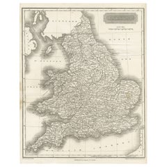
Steel Engraved Map of Ancient Britain
About the Item
Antique map titled 'Angleterre Ancienne'. Original old map of Ancient Britain. Source unknown, to be determined. Published circa 1880.
- Dimensions:Height: 10.24 in (26 cm)Width: 8.31 in (21.1 cm)Depth: 0.02 in (0.5 mm)
- Materials and Techniques:
- Period:
- Date of Manufacture:circa 1880
- Condition:Age-related toning. Some wear and soiling/foxing. Tiny hole near 'Metaris Aestuarium. Original folding lines. Blank verso. Please study image carefully.
- Seller Location:Langweer, NL
- Reference Number:
About the Seller
5.0
Platinum Seller
These expertly vetted sellers are 1stDibs' most experienced sellers and are rated highest by our customers.
Established in 2009
1stDibs seller since 2017
1,933 sales on 1stDibs
Typical response time: <1 hour
- ShippingRetrieving quote...Ships From: Langweer, Netherlands
- Return PolicyA return for this item may be initiated within 14 days of delivery.
More From This SellerView All
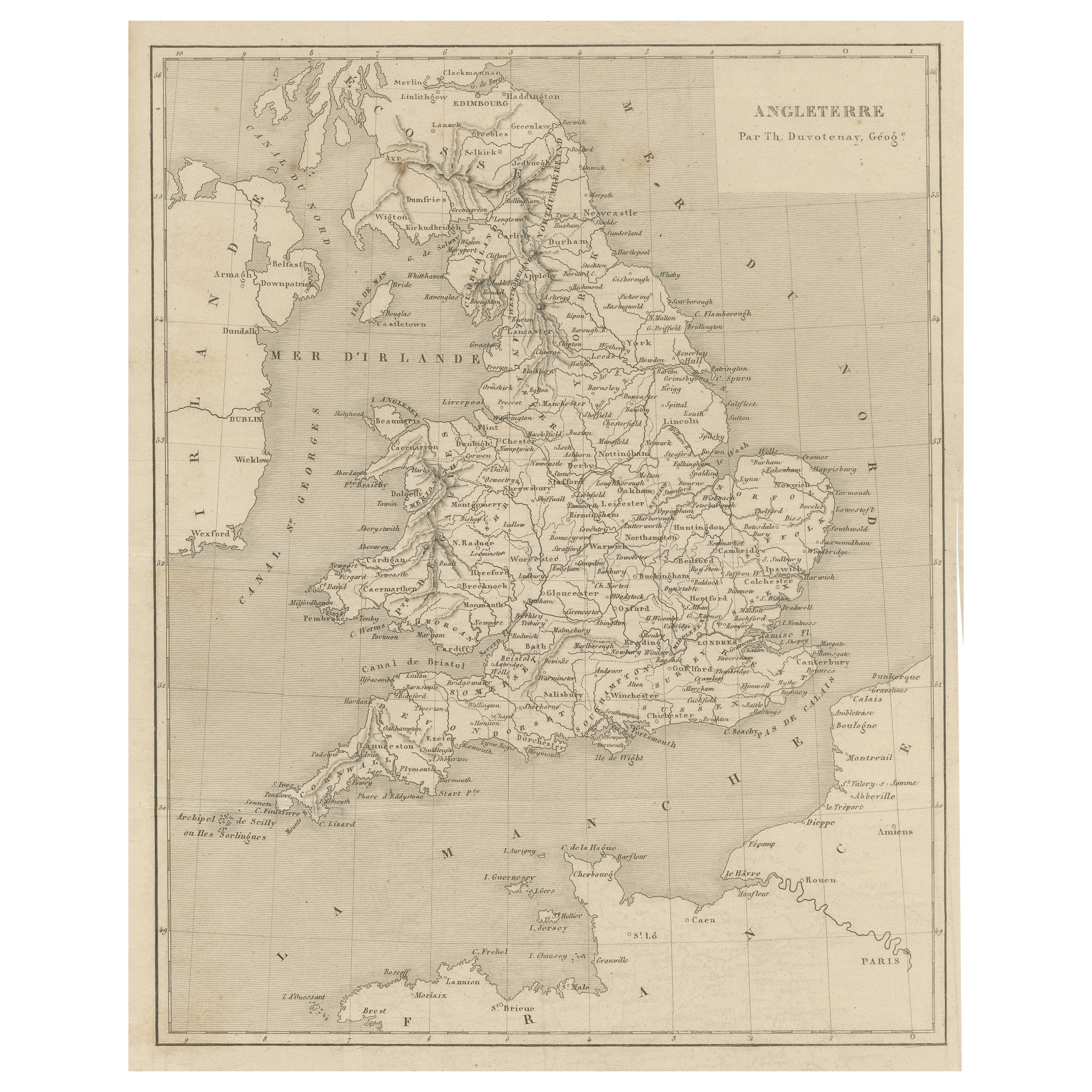
- Steel Engraved Antique Map of EnglandLocated in Langweer, NLAntique map titled 'Angleterre'. Original antique map of England. Engraved by Th. Duvotenay. Originates from 'Complement de L'Encyclopedie Mode...Category
Antique Late 19th Century Maps
MaterialsPaper
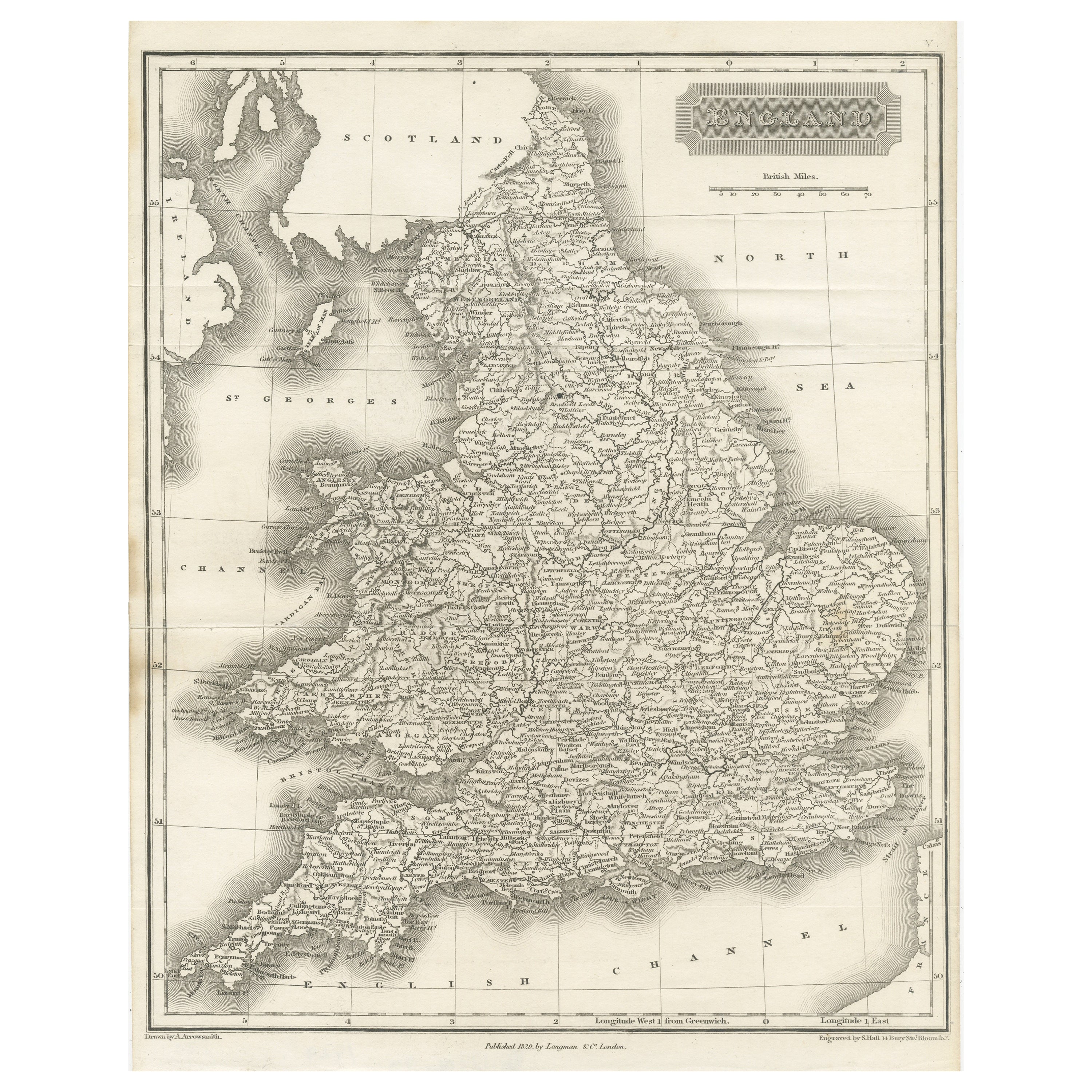
- Small Steel Engraved Map of EnglandLocated in Langweer, NLAntique map titled 'England'. Original steel engraved map of England. Drawn by A. Arrowsmith, engraved by S. Hall. Published 1829 by Longman & Co, London.Category
Antique Mid-19th Century Maps
MaterialsPaper
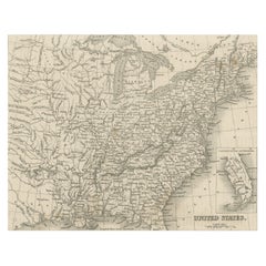
- Steel Engraved Map of the United States with Inset Map of FloridaLocated in Langweer, NLAntique map titled 'United States'. Steel engraved map of the United States. With small inset map of the continuation of Florida. Source unknown, to be determined. Published circa 1843.Category
Antique Mid-19th Century Maps
MaterialsPaper
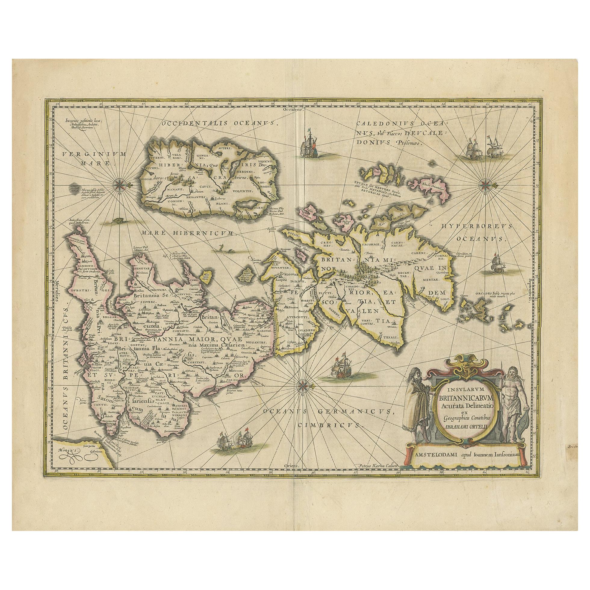
- Antique Map of the Ancient British Isles by Janssonius 'circa 1640'Located in Langweer, NLAntique map titled 'Insularum Britannicarum Acurata Delineatio'. Original antique map of the ancient British Isles. England and Wales are labelled as B...Category
Antique Mid-17th Century Maps
MaterialsPaper
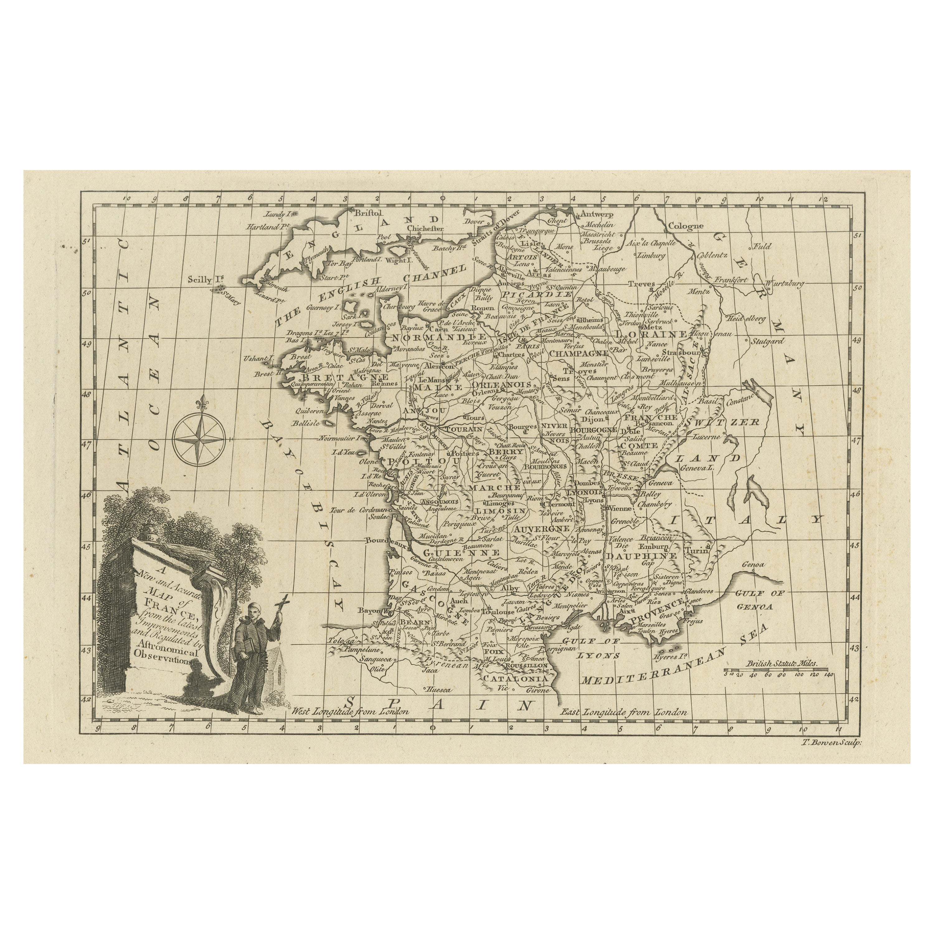
- Original Copper Engraved Map of FranceLocated in Langweer, NLAntique map titled 'New and Accurate Map of France from the latest improvements'. Original copper engraved map of France. Engraved by T. Bowen, published circa 1771.Category
Antique Late 18th Century Maps
MaterialsPaper
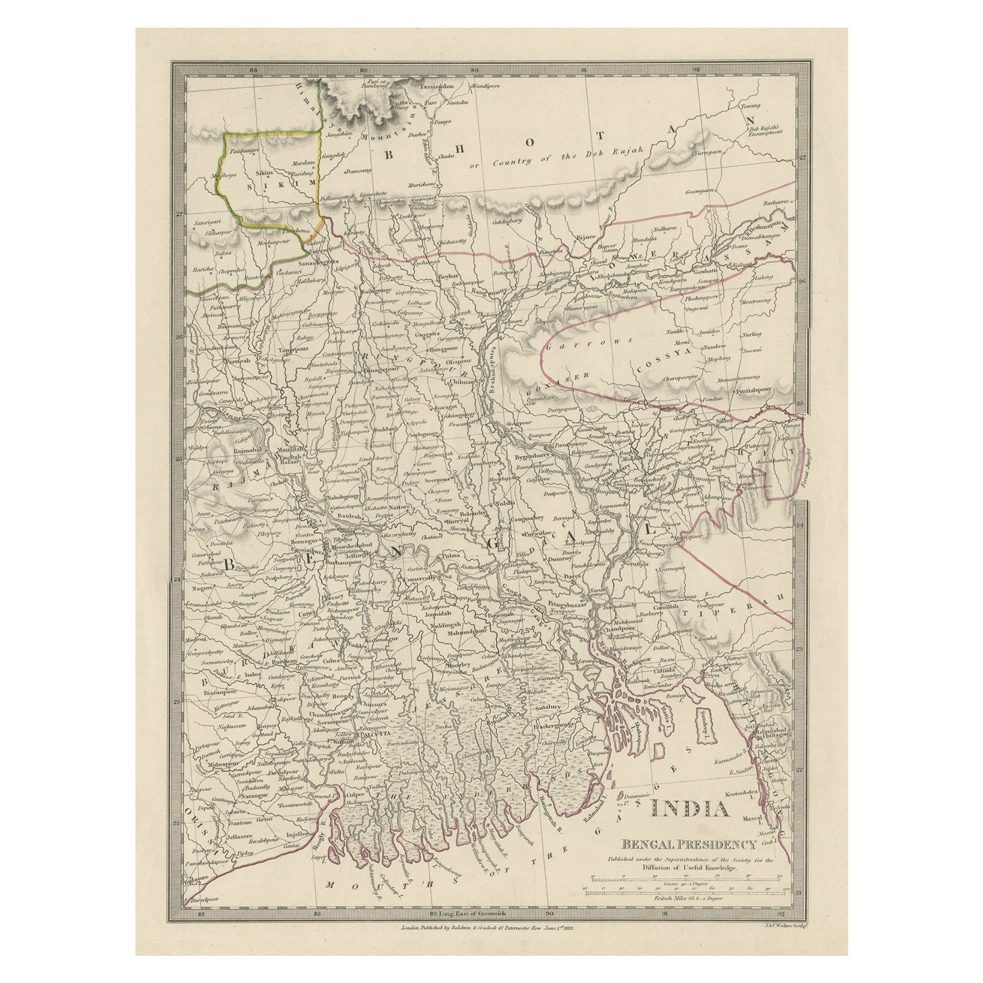
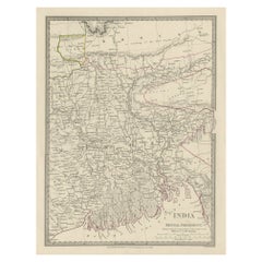
- Steel Engraved Map of Part of the Bengal Presidency 'India & Bangladesh', 1831Located in Langweer, NLAntique map titled 'India Bengal Presidency'. Old steel engraved map of part of the Bengal Presidency. The Bengal Presidency (1757–1912), later reorganized as the Bengal Province (19...Category
Antique 1830s Maps
MaterialsPaper


You May Also Like
- Original Antique Map of Ancient Greece- Boeotia, Thebes, 1787Located in St Annes, LancashireGreat map of Ancient Greece. Showing the region of Boeotia, including Thebes Drawn by J.D. Barbie Du Bocage Copper plate engraving by P.F T...Category
Antique 1780s French Other Maps
MaterialsPaper
- Original Antique Map of Ancient Greece, Achaia, Corinth, 1786Located in St Annes, LancashireGreat map of Ancient Greece. Showing the region of Thessaly, including Mount Olympus Drawn by J.D. Barbie Du Bocage Copper plate engraving by P.F Tardieu Original hand color...Category
Antique 1780s French Other Maps
MaterialsPaper
- Original Antique Map of Sweden, Engraved by Barlow, 1806Located in St Annes, LancashireGreat map of Sweden Copper-plate engraving by Barlow Published by Brightly & Kinnersly, Bungay, Suffolk. 1806 Unframed.Category
Antique Early 1800s English Maps
MaterialsPaper
- Original Antique Map of Ancient Greece, Phocis, Gulf of Corinth, 1787Located in St Annes, LancashireGreat map of Ancient Greece. Showing the region of Phocis, including the Gulf of Corinth Drawn by J.D. Barbie Du Bocage Copper plate engraving by P.F Tardieu Original hand c...Category
Antique 1780s French Other Maps
MaterialsPaper
- Original Antique Map of Switzerland, Engraved By Barlow, Dated 1807Located in St Annes, LancashireGreat map of Switzerland Copper-plate engraving by Barlow Published by Brightly & Kinnersly, Bungay, Suffolk. Dated 1807 Unframed.Category
Antique Early 1800s English Maps
MaterialsPaper
- Original Antique Map of Spain and Portugal, Engraved By Barlow, 1806Located in St Annes, LancashireGreat map of Spain And Portugal Copper-plate engraving by Barlow Published by Brightly & Kinnersly, Bungay, Suffolk. 1806 Unframed.Category
Antique Early 1800s English Maps
MaterialsPaper


Recently Viewed
View AllMore Ways To Browse
1681 Moses Pitt
Antique Cabbage Cutter
Antique Chesapeake Bay Map
Antique Handcrafted Model Sailboat
Antique Map Of Chesapeake Bay
Cartier 1730
Devonia Antique
Eso Antique Map
Eso Antique Maps
Formosa Vintage Map
M S Merian
Union Pacific Map
Ian Maguire
Map Scandinavia
Pakistan Antique Map
Antique Map Iceland
Antique Map Of Iceland
Antique Map Scandinavia