Netherlands - More Furniture and Collectibles

to
4,906
7,240
30,786
28,096
7,045
160
35
336
113
55
45
33
21
20
17
17
14
10
7
6
5
3
2
2
3,148
2,562
1,335
195
484
429
155
102
15
63
46
18
111
142
100
24
12
5,742
769
604
218
171
1,661
457
359
225
159
7,240
7,144
7,190
104
59
28
20
18
Item Ships From: Netherlands
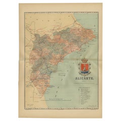
Alicante in a 1901 Antique Map: Maritime Gateway of Spain's Costa Blanca
Located in Langweer, NL
An original antique map of the province of Alicante, dated 1901. It is part of the atlas series by D. Benito Chias y Carbo, featuring cartographic elements. Here are some characteri...
Category

Early 1900s Antique Netherlands - More Furniture and Collectibles

Materials

Paper

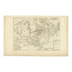
Detailed 1720s Map – Siege of Douay and Lines of Circumvallation, France
Located in Langweer, NL
Detailed 1720s Map – Siege of Douay and Lines of Circumvallation, France This engraved map shows the detailed fortifications and surrounding region of Douay (Douai) in northern Fran...
Category

Early 18th Century French Antique Netherlands - More Furniture and Collectibles

Materials

Paper

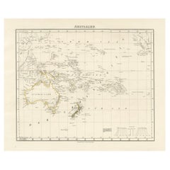
Mid-19th Century Map of Australasia by Carl Flemming - 1855
Located in Langweer, NL
Title: "Mid-19th Century Map of Australasia by Carl Flemming - 1855" Description: This original 1855 antique map from the Sohr-Berghaus Atlas, created by Carl Flemming, is a detaile...
Category

1850s Antique Netherlands - More Furniture and Collectibles

Materials

Paper

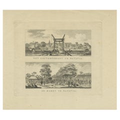
Batavia Market Scenes & Government House – Antique Prints VOC Period, c.1780
Located in Langweer, NL
Batavia Views – Government House and Market Scenes, circa 1780 This is an original late 18th-century engraving featuring two detailed views of Batavia (now Jakarta, Indonesia) under...
Category

Late 18th Century Dutch Antique Netherlands - More Furniture and Collectibles

Materials

Paper

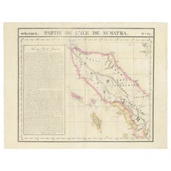
Detailed Antique Map of Northern Sumatra, Indonesia, circa 1825
Located in Langweer, NL
Antique map titled 'Partie de l'Ile de Sumatra'. Chart showing the northern part of Sumatra. Originates from 'Atlas Universel' by P.M. Vandermaelen. Artists and Engravers: Philip...
Category

19th Century Antique Netherlands - More Furniture and Collectibles

Materials

Paper

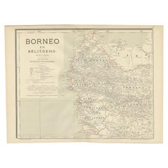
Antique Map of West Kalimantan, Borneo, Indonesia, 1900
Located in Langweer, NL
Antique map titled 'Borneo en Belitoeng'. Old map of West Kalimantan, Borneo. This map originates from 'Atlas van Nederlandsch Oost- en West-Indië' by I. Dornseiffen. Artists and...
Category

20th Century Netherlands - More Furniture and Collectibles

Materials

Paper

Original Antique Map of the Ancient Netherlands and Belgium, c.1750
Located in Langweer, NL
Description: Antique map titled 'Naauwkeurige Kaart van het Oude Nederland (..)'. Original antique map of the Netherlands and Belgium. This map originates from 'Vaderlandsche his...
Category

1750s Antique Netherlands - More Furniture and Collectibles

Materials

Paper

Historical Map of the Duchy of Lauenburg by Johann Baptist Homann - Circa 1720
Located in Langweer, NL
Historical Map of the Duchy of Lauenburg by Johann Baptist Homann - Circa 1720 This splendid historical map titled Ducatus Lauemburgicus is a highly detailed and beautifully engra...
Category

1720s Antique Netherlands - More Furniture and Collectibles

Materials

Paper

Old Print of the City of Anyer, West-Java Near Krakatau Volcano, Indonesia, 1833
Located in Langweer, NL
Antique print titled 'Vue d'Anger (Détroit de la Sonde)'. View of the city of Anyer, a coastal town in Banten, formerly West Java, Indonesia. This print originates from 'Voyage de la Corvette l'Astrolabe exécuté par ordre du Roi pendant les années 1826, 1827, 1828, 1829' by Jules Sebastien Cesar Dumont D'Urville. Artists and Engravers: Published by J. Tastu. Dumont was a French explorer and naval officer. For thirty-eight months he explored the south and western Pacific...
Category

19th Century Antique Netherlands - More Furniture and Collectibles

Materials

Paper

1732 Henri Chatelain Map of the Holy Land Divided Among the Tribes of Israel
Located in Langweer, NL
Title: 1732 Henri Chatelain Map of the Holy Land Divided Among the Tribes of Israel This exquisite 18th-century map by Henri Chatelain, published in 1732, offers a detailed depict...
Category

1710s Antique Netherlands - More Furniture and Collectibles

Materials

Paper

Copper-Engraved Map Showing the Algerian Coast of North Africa, Published 1683
Located in Langweer, NL
Antique map titled 'Partie de Barbarie, ou est le Royaume d'Alger (..)'. Copper-engraved map showing the Algerian coast of North Africa. Published 1683. Artists and Engravers:...
Category

1680s Antique Netherlands - More Furniture and Collectibles

Materials

Paper

Antique Map of The United States Southern Section by A & C. Black, 1870
Located in Langweer, NL
Antique map titled 'United States Southern Section'. Original antique map of Map of The United States Southern Section. This map originates from ‘Black's General Atlas of The World’....
Category

Late 19th Century Antique Netherlands - More Furniture and Collectibles

Materials

Paper

Antique Roman Battle Print of the Greater and Lesser Camp by Duncan, c.1753
Located in Langweer, NL
Antique battle map showing the greater and lesser camp. With detailed legend explaining the various elements of the print. This print most likely originates from an edition of 'The C...
Category

18th Century Antique Netherlands - More Furniture and Collectibles

Materials

Paper

Antique Map of France in Ancient Roman Times, 1880
Located in Langweer, NL
Antique map titled 'Gaule indépendante et Romaine'. Old map of Gaul or France in ancient Roman times. The map covers from the southern part of England (Britannia) to the north of S...
Category

19th Century Antique Netherlands - More Furniture and Collectibles

Materials

Paper

Antique Map of Africa by Johnston (1909)
Located in Langweer, NL
Antique map titled 'Africa'. Original antique map of Africa. This map originates from the ‘Royal Atlas of Modern Geography’. Published by W. & A....
Category

Early 20th Century Netherlands - More Furniture and Collectibles

Materials

Paper

Antique Map of North America from an Old Dutch School Atlas, 1852
Located in Langweer, NL
Antique map titled 'Noord-Amerika'. Map of North America. This map originates from 'School-Atlas van alle deelen der Aarde' by Otto Petri. Artists and Engra...
Category

19th Century Antique Netherlands - More Furniture and Collectibles

Materials

Paper

Old Map of the Eastern Region of the Kingdom of Algiers, Algeria, 1773
Located in Langweer, NL
Antique map titled 'Kaart van het Oostelyke Deel van het Ryk van Algiers'. Old map of the eastern region of the Kingdom of Algiers, Algeria. Originates from the first Dutch edito...
Category

1770s Antique Netherlands - More Furniture and Collectibles

Materials

Paper

Rare Engraving of Mount Sinai with St. Catherine's Monastery and Bedouins, 1680
Located in Langweer, NL
Rare antique print titled ‘Bergh Sinai of Sint Catryn’. This engraving shows Mount Sinai (also known as Mount Horeb) with St. Catherine's Monastery at the foot of the mountains a...
Category

1680s Antique Netherlands - More Furniture and Collectibles

Materials

Paper

Rare Pair of Antique Gothic Revival Bronze Wall Sconces with Dragon Sculptures
Located in Lisse, NL
Pair of gilt bronze, Gothic Revival sconces with fierce dragon heads. If you are a collector of Gothic antiques then this rare and top quality made pair of dragon sconces could be y...
Category

Early 20th Century French Gothic Revival Netherlands - More Furniture and Collectibles

Materials

Bronze

Genuine Antique Map of European Turkey by Pierre Antoine Tardieu (1784-1869)
Located in Langweer, NL
This is an original antique map titled "Carte de la Turquie d'Europe," which depicts the European territories of the Ottoman Empire. The map features detailed geographical and political boundaries, showcasing various regions, cities, rivers, and mountains within the Ottoman European territories. The map was created by Pierre Antoine Tardieu, a renowned French engraver, steel engraver, and cartographer known for his high-quality work. Map Details: - **Title**: Carte de la Turquie d'Europe - **Creator**: Pierre Antoine Tardieu (1784-1869) - **Publication Date**: Early 19th century - **Dimensions**: Approximately 34.5 x 43.5 cm (13.5 x 17.25 inches) - **Features**: The map includes a detailed representation of the European territories of the Ottoman Empire, with place names, rivers, mountains, and regions clearly marked. The title cartouche is located in the upper left corner, and the mile scale is presented in the lower left. Around the year 1800, the region referred to as "European Turkey" or "Ottoman Europe" was a significant part of the Ottoman Empire, which was one of the most powerful empires in the world at the time. Here are some key aspects of European Turkey during this period: ### Geographic Scope European Turkey included a large part of Southeastern Europe, encompassing modern-day: - Greece - Bulgaria - Romania (specifically the regions of Dobruja and parts of Wallachia) - Serbia - Albania - Montenegro - Bosnia and Herzegovina - Parts of Croatia, Macedonia, and Hungary Political Structure - **Ottoman Administration**: The region was governed by the Ottoman administrative system, which divided territories into provinces (vilayets) and smaller administrative units (sanjaks). Each province was overseen by a governor (pasha) appointed by the Sultan. - **Autonomy and Vassal States**: Some areas within European Turkey had varying degrees of autonomy or were vassal states. For example, Wallachia and Moldavia (in modern-day Romania) were vassal principalities that retained local rulers under Ottoman suzerainty. Society and Demographics - **Ethnic Diversity**: The region was extremely diverse, home to numerous ethnic groups, including Turks, Greeks, Bulgarians, Serbs, Albanians, Vlachs (Romanians), and Jews, among others. - **Religious Diversity**: There was significant religious diversity, with Islam being the dominant religion due to Ottoman rule, but large Christian (Eastern Orthodox, Roman Catholic) and Jewish populations coexisted. Economy - **Agriculture**: The economy was largely agrarian, with agriculture being the primary occupation. Key crops included grains, tobacco, and cotton. - **Trade and Commerce**: European Turkey was strategically important for trade, connecting the Mediterranean with Central Europe and the Black Sea. Major cities like Constantinople (modern-day Istanbul), Thessaloniki, and Belgrade were key commercial hubs. Culture - **Cultural Influence**: The region was a melting pot of various cultures, influenced by Byzantine, Slavic, and Ottoman traditions. This mix was reflected in architecture, cuisine, music, and customs. - **Education and Language**: The official language of administration was Ottoman Turkish, but many local languages were spoken. Education was often conducted in religious institutions, with different communities maintaining their own schools. Challenges and Conflicts - **Internal Strife**: The Ottoman Empire faced numerous internal challenges, including administrative inefficiency, corruption, and local uprisings. - **External Threats**: The empire was also under pressure from external forces, particularly from the Habsburg Empire, Russia, and later from nationalist movements within the Balkans, which sought independence or autonomy from Ottoman rule. Decline of Ottoman Power By 1800, the Ottoman Empire was experiencing a gradual decline, which would intensify throughout the 19th century. This period saw increasing nationalist sentiments among various ethnic groups within European Turkey, leading to uprisings and eventual wars of independence, such as the Serbian Revolution (1804-1835) and the Greek War of Independence (1821-1829). Overall, European Turkey around 1800 was a complex and diverse region under the Ottoman Empire's waning control, characterized by a rich tapestry of cultures, economic activities, and political structures. Condition Overview: 1. **Paper Quality**: The map exhibits signs of aging, such as yellowing along the edges, which is typical for documents of this age. The paper remains in good condition without major tears or damage. 2. **Edges and Corners**: The edges are slightly worn, with minor fraying and a few small tears that do not significantly impact the map's readability or aesthetic value. 3. **Center Fold**: There is a visible center fold, common for maps that were folded for storage or publication. The fold is in good condition without significant wear but with splits on both sidess. 4. **Color and Print Quality**: The colors used to outline the boundaries remain vibrant and clear. The print quality is excellent, with sharp, legible text and detailed illustrations. 5. **Staining and Spots**: There are a few spots and stains, particularly near the edges and along the fold. These do not obscure any critical details of the map. Historical and Artistic Value: Pierre Antoine Tardieu was known for his meticulous craftsmanship and contributions to cartography. His work drew the attention of prominent figures such as Alexander von Humboldt...
Category

Early 1800s French Antique Netherlands - More Furniture and Collectibles

Materials

Paper

Antique Map of Asia 'in Frame, circa 1739'
Located in Langweer, NL
Antique map titled 'Asia Dividida em suas Regioens & Principaes Estados'. Rare and uncommon map of Asia. Signed '1739'. Source unknown, to be determined. ...
Category

Mid-18th Century Antique Netherlands - More Furniture and Collectibles

Materials

Paper

Map of Western Australia & Swan River, insets of Perth, Aboriginals, Sheep, 1851
Located in Langweer, NL
Antique map titled 'Western Australia, Swan River'. Map of Western Australia and Swan River, surrounded by illustrations of Perth, Aborigines and sheep shea...
Category

1850s Antique Netherlands - More Furniture and Collectibles

Materials

Paper

Johannes Janssonius' 17th-Century Map of the Duchy of Bremen in Germany
Located in Langweer, NL
The map titled "Ducatus olim Episcopatus Bremensis et ostiorum Albis et Visurgis Fluviorum novissima Descriptio" by Johannes Janssonius provides a rich historical and geographical il...
Category

1650s Antique Netherlands - More Furniture and Collectibles

Materials

Paper

Colorful Detailed Antique Map of Europe, Published in 1882
Located in Langweer, NL
"The Antique Map of Europe from 'The Comprehensive Atlas and Geography of the World,' published in 1882 by Blackie & Son, is a testament to meticulous cartography and scholarly preci...
Category

1880s Antique Netherlands - More Furniture and Collectibles

Materials

Paper

Antique Architectural Print of Pavilions for English Gardens by Le Rouge, 1776
Located in Langweer, NL
Antique print titled 'Pavillons Grottes pour les Jardins Anglais'. Copper engraving showing pavilions for English gardens. This print originates from 'J...
Category

18th Century Antique Netherlands - More Furniture and Collectibles

Materials

Paper

Old Map of the French Department of Ardèche, France
By Victor Levasseur
Located in Langweer, NL
Antique map titled 'Dépt. de l'Ardèche'. Map of the Department of Ardèche, France. This region is known for its fine wines, agriculture, distilled spirits, and cheese. The capital ci...
Category

Mid-19th Century Antique Netherlands - More Furniture and Collectibles

Materials

Paper

Old Map of the Arabian Peninsula with Parts of Egypt, Sudan, Eritrea & Ethiopia
Located in Langweer, NL
"Carte de l'Arabie, du Golfe Persique, et de la Mer Rouge, avec l'Egypte, la Nubie et l'Abissinie", Bonne, Rigobert Subject: Arabia Period: 1780 (circa) Publication: Atlas de Toutes...
Category

1780s Antique Netherlands - More Furniture and Collectibles

Materials

Paper

Early Woodcut Map of Franconia and Surrounding Regions, 1628
Located in Langweer, NL
Title: Early Woodcut Map of Franconia and Surrounding Regions, 1628 Franconia (Franckenlande) is a region in Germany. Historically, Franconia was a significant part of the Holy Roma...
Category

1620s Antique Netherlands - More Furniture and Collectibles

Materials

Paper

Very Rare Antique Print of the Kings Celebrations in Pegu, Myanmar, 1682
Located in Langweer, NL
Plate: 'Konings feesten tot Pegu.' (Kings celebrations in Pegu.) On this plate: 1. The King. 2. And the Queen, sprinkling water on each other. 3. Their children. 4. Officers. 5. ...
Category

1680s Antique Netherlands - More Furniture and Collectibles

Materials

Paper

Thraciae Veteris Typus – 1618 Ortelius Map of Ancient Thrace with Hand Color
Located in Langweer, NL
Thraciae Veteris Typus – 1618 Ortelius Map of Ancient Thrace with Hand Color This striking early 17th-century map, Thraciae Veteris Typus, was published in 1618 by Abraham Orteliu...
Category

Early 1600s Antique Netherlands - More Furniture and Collectibles

Materials

Paper

Sculptural Painted Patinated Metal Umbrella Stand, 1960's
Located in Den Haag, NL
Sculptural painted patinated metal umbrella stand, 1960's Painted metal in patinated copper look.
Category

Mid-20th Century European Mid-Century Modern Netherlands - More Furniture and Collectibles

Materials

Metal

Antique Map of the City of Copenhagen in Denmark c.1720
Located in Langweer, NL
Antique map titled 'Copenhagen'. Original antique map of the city of Copenhagen, Denmark. This map originates from 'Unterschiedliche dieser Zeit Beruffene Laender, Gegenden, Staedte ...
Category

18th Century Danish Antique Netherlands - More Furniture and Collectibles

Materials

Paper

Antique Engravings of Mauritius and Indonesia, incl de Banda Islands, c.1730
Located in Langweer, NL
Title on page: "Ins. de Cerno a. Nostatibus Mauritius Nominata [on sheet with] Gunnanappi Labetacq [and] Civitas Gammelamme [and] Rex Tubatus", Le Clerc, Jean This sheet includes fo...
Category

1730s Antique Netherlands - More Furniture and Collectibles

Materials

Paper

Antique Map of Asian Turkey, Levant, and Mesopotamia by Tardieu, circa 1802
Located in Langweer, NL
This is an original antique map titled "Carte de la Turquie Asiatique," depicting the Asian territories of the Ottoman Empire. Created by Pierre Antoine Tardieu, this map illustrates...
Category

Early 1800s French Antique Netherlands - More Furniture and Collectibles

Materials

Paper

Set of 2 Night Stands by La Permanente Mobili Cantù, Italy, 1950's
By La Permanente Mobili Cantù
Located in Uithoorn, NL
Set of 2 Night Stands by La Permanente Mobili Cantù, Italy, 1950's Very elegantly executed set night stands by La Permanente Mobili Cantù in dark lacquered wood, cut glass and with ...
Category

Mid-20th Century Italian Mid-Century Modern Netherlands - More Furniture and Collectibles

Materials

Brass

Mathieu Matégot Wall-Mounted Coat Rack in White and Anthracite Metal
By Mathieu Matégot
Located in Den Haag, NL
Mathieu Matégot wall-mounted coat rack in white and dark anthracite metal. Manufactured in the early 1950s by Artimeta, the Netherlands. Matégot designed several rare models for this...
Category

1950s French Mid-Century Modern Vintage Netherlands - More Furniture and Collectibles

Materials

Metal

Antique Map of the Bahia Todos Santos 'Brazil' by Tirion, circa 1750
Located in Langweer, NL
Antique map titled 'Kaart Van De Aller-Heiligen Baay Waar aan de Hoofdstad legt van Brazil.', Detailed map of the Bahia Todos Santos in Brazil, with a lar...
Category

Mid-18th Century Antique Netherlands - More Furniture and Collectibles

Materials

Paper

Antique Architectural Print of a New Design for Robert Walpole, England, 1725
Located in Langweer, NL
Antique print titled 'This New Design of my Invention, is most humbly inscrib'd to the Rt. Honble Robert Walpole (..)'. Old print depicting a new de...
Category

18th Century Antique Netherlands - More Furniture and Collectibles

Materials

Paper

Antique Map of Herefordshire 'England' by R. Morden, 1708
Located in Langweer, NL
This antique County map of Herefordshire by Robert Morden was first published in 1701 in a work entitled 'The New Description and State of England'...
Category

Early 18th Century Antique Netherlands - More Furniture and Collectibles

Materials

Paper

Hello 2000 Good-Bye 1999, boxed bears, Steiff Limited Edition 1999
By Steiff
Located in Delft, NL
Hello 2000 Good-Bye 1999, boxed bears, Steiff Limited Edition 1999 A set of Steiff collectors bears, boxed in original box. The title of the Steiff Bears ...
Category

20th Century German Netherlands - More Furniture and Collectibles

Materials

Mohair

Ancient Cartography of Britannia and Hibernia, Published in 1880
Located in Langweer, NL
This map depicts the geographical area of Great Britain and Ireland, labeled "BRITANNIA et HIBERNIA." It is a historical map, as indicated by the Latin titles and the classical names of regions and tribes. In the main section of the map, Great Britain is depicted in fine detail, with topographical features such as mountains and rivers. The map is color-coded, to differentiate political or tribal boundaries. Various Roman place names are indicated, such as "Londinium" for London. To the left of Great Britain is Ireland, referred to as "Hibernia," similarly detailed with its own topographical features and ancient...
Category

1880s Antique Netherlands - More Furniture and Collectibles

Materials

Paper

Original Antique Map of the Maluku Islands or Moluccas, Indonesia
Located in Langweer, NL
Antique map titled 'Carte Particuliere des Isles Moluques'. This map depicts the islands of Herij, Ternate, Tidor, Pottebackers, Timor, Machian and Bachian. The Moluccan islands were...
Category

Mid-18th Century Antique Netherlands - More Furniture and Collectibles

Materials

Paper

Antique Map of the Island of Psara by Dapper, 1688
Located in Langweer, NL
Antique map titled 'Sara.' Map of Psara ( Psyra or Ipsera) Island (North East Aegean Islands), Greece. This map originates from 'Nauwkeurige Beschrijving der eilanden in de Archipel ...
Category

17th Century Antique Netherlands - More Furniture and Collectibles

Materials

Paper

Antique Map of the Region of Bengkulu in Indonesia, 1900
Located in Langweer, NL
Antique map of the region of Benkulu, Sumatra. Also depicting Enggano Island. This map originates from 'Atlas van Nederlandsch Oost- en West-Indië' by I. Dornseiffen. Artists and E...
Category

20th Century Netherlands - More Furniture and Collectibles

Materials

Paper

19th Century Brass and Gold Watch-Key with 2 Different Colored Stones
Located in Delft, NL
19th century brass and gold Watch-Key with each side a different stone A brass watch key , gold-plated with 2 different colors. An amber color transpare...
Category

Early 19th Century Dutch Antique Netherlands - More Furniture and Collectibles

Materials

Gold, Brass

Scarce Antique Map of the Middle East, Surrounded by Latin Text, 1624
Located in Langweer, NL
Antique map titled 'Lumen Historium per Orientem (..).' Scarce map of the Middle East, surrounded by Latin text. The two insets show Israel and an oval world map. This map (from the last edition of Ortelius Theatri Orbis Terrarum Parergon, 1624) was engraved by Franciscus Hareio. Later, this map was copied by Hornius for his World Atlas (1653). Artists and Engravers: Franciscus Haraeus (Latinised form of Franciscus Verhaer; also known as Frans Verhaer), (Utrecht 1555? - Leuven, 11 January 1631), was a Dutch theologian, historian, and cartographer. He is best known for his history (from a Catholic point of view) of the Dutch Revolt...
Category

1620s Antique Netherlands - More Furniture and Collectibles

Materials

Paper

A Stunning 1744 Bowen Map: South East Germany & Queen of Hungary’s Dominions
Located in Langweer, NL
Title: A New and Correct Map of the South East part of Germany, 1744 This map by Emanuel Bowen, dating to around 1744, beautifully captures the southeastern part of Germany. The det...
Category

1740s Antique Netherlands - More Furniture and Collectibles

Materials

Paper

Old Map of The Kurile Islands, from Hokkaido, Japan to Kamchatka, Russia, c.1750
Located in Langweer, NL
Antique map titled 'Carte des Iles Kouriles'. Original antique map of the Kuril Islands. The Kuril Islands or Kurile Islands are a volcanic archipelago that stretches approximate...
Category

1750s Antique Netherlands - More Furniture and Collectibles

Materials

Paper

Blaeu Map of Ottoman Balkans – Walachia Bulgaria Romania, circa 1665
Located in Langweer, NL
Blaeu Map of Ottoman Balkans – Walachia Bulgaria Romania, circa 1665 This is an original hand-coloured antique map titled “Walachia, Servia, Bulgaria, Romania,” published by Joan Bl...
Category

17th Century Dutch Antique Netherlands - More Furniture and Collectibles

Materials

Paper

17th Century Blaeu Map – Ottoman Balkans: Walachia, Bulgaria, Romania, ca. 1650
Located in Langweer, NL
Blaeu Map of Walachia, Servia, Bulgaria, Romania, circa 1640 This is an original antique map titled “Walachia, Servia, Bulgaria, Romania,” published by Joan Blaeu in Amsterdam betwe...
Category

17th Century Dutch Antique Netherlands - More Furniture and Collectibles

Materials

Paper

Original Antique Engraving of Algiers in Algeria, 1773
Located in Langweer, NL
Antique print titled 'Algiers'. Old print with a view of Algiers, Algeria. With Dutch legend. Originates from the first Dutch editon of an interesting travel account of Northern Afri...
Category

18th Century Antique Netherlands - More Furniture and Collectibles

Materials

Paper

Japanese Isles Map by Mallet, 1683 – Decorative Miniature Map
Located in Langweer, NL
1683 Map of Japan Isles by Mallet – Decorative Miniature Map This is an original antique map titled “Isles du Japon,” created by Alain Manesson Mallet and published in Paris in 1683...
Category

1680s French Antique Netherlands - More Furniture and Collectibles

Materials

Paper

17th-Century Original Antique Map of Hunan and Hubei Provinces, China – by Blaeu
Located in Langweer, NL
Title: 17th-Century Antique Map of Hunan and Hubei Provinces, China – "Hvqvang" by Blaeu, Richly Detailed and Illustrated Description: This beautiful 17th-century map of the regions that now comprise Hunan and Hubei Provinces, historically referred to as "Hvqvang," was created by Johannes Blaeu and published in 1655 as part of the *Novus Atlas Sinensis*. This map, drawn with input from Jesuit missionary Martino Martini, provides a meticulous representation of central China’s geography, capturing its rivers, towns, and mountainous terrain. The Yangtze River (Changjiang) is prominently featured, emphasizing the region’s importance as a vital waterway for trade and transportation. Wuhan, now a modern metropolis, and Changsha, the capital of Hunan Province, were historically significant cities that appear on the map. The area is also notable for its fertile lands and contributions to China’s agricultural prosperity, particularly in rice and tea production. The decorative cartouche in the lower-right corner features two figures in traditional Chinese attire standing amid bamboo, symbolizing the cultural and natural richness of the region. Blaeu’s map combines precision and artistry, with vibrant hand-coloring distinguishing boundaries and geographical features. The copperplate engraving ensures fine detail, making this map a remarkable historical artifact. Condition: Near excellent. Clean impression with vivid hand-coloring. Wide margins with minor age-toning appropriate for its age. Framing Tips: Use a neutral double mat and a gilt or dark wood frame to enhance the presentation. UV-protective glass is recommended to preserve the vivid hand-coloring and intricate engraving details. Hunan and Hubei, historically referred to as "Hvqvang," are known for their strategic location along the Yangtze River and their cultural and economic significance in Chinese history. The region’s fertile lands have supported extensive rice cultivation, earning it the title of one of China’s "breadbaskets." Hubei, with Wuhan at its center, has long been a hub of transportation and trade, owing to the convergence of the Yangtze and Han Rivers. Hunan, with Changsha as its capital, is known for its rich cultural heritage and contributions to Chinese literature and art. Important places in the region include Wuhan, an ancient trade center, and Changsha, known for its historical sites and cultural prominence. The Yangtze River, a key feature on the map, highlights the region’s historical importance as a major waterway for commerce and agriculture. Other notable features include Dongting Lake, a vital ecological and cultural landmark, and the surrounding mountainous areas that have shaped the region’s history and development. Keywords: antique map of Hunan, Hubei map, Hvqvang map, Yangtze River map, 17th-century Chinese map...
Category

1650s Antique Netherlands - More Furniture and Collectibles

Materials

Paper

Original Antique Map showing Southern India, Northern Sri Lanka & Malabar, 1652
Located in Langweer, NL
Antique map titled 'Presqu'Isle de l'Inde deca le Gange (..)'. Old map showing the southern part of India, including the northern part of Sri Lanka. With inset map of Southern India (Malabar). This map covers the subcontinent from the Bay of Bengal and the Gulf of Cambay to Ceylon. The Mogul Empire can be found in the north. Further south...
Category

1650s Antique Netherlands - More Furniture and Collectibles

Materials

Paper

Antique Print of Phineus, Son of Poseidon or Phoenix, 1733
Located in Langweer, NL
Antique print titled 'Phinée délivré des Harpyes (..)'. This print depicts Phineus delivered from the Harpies by Calais & Zethes. Phineas was said to be a son of Poseidon, or of Phoenix, and had the gift of prophecy. Zeus, angry that Phineas revealed too much of the plans of the gods, punished him by blinding him and setting him on an island with a buffet of food. However, he could eat none of it because the harpies, vicious, winged women, stole the food out of his hands right before he could eat. This continued until the arrival of Jason and the Argonauts...
Category

18th Century Antique Netherlands - More Furniture and Collectibles

Materials

Paper

Antique Print of a Bathroom Design for Hotel De Jansen in Paris, France, c.1785
Located in Langweer, NL
Antique print titled 'Projets d'une Salle de Bains'. Copper engraving showing the design of a bathroom. This print originates from 'Jardins Anglo-Chinois à la Mode' by Georg Louis le...
Category

18th Century Antique Netherlands - More Furniture and Collectibles

Materials

Paper

Antique Map of Vermont
Located in Langweer, NL
Antique map titled 'Vermont'. Original antique map of Vermont, United States. This print originates from 'Encyclopaedia Britannica', Ninth Edition. Publ...
Category

Late 19th Century Antique Netherlands - More Furniture and Collectibles

Materials

Paper

Antique Map of Vermont
$276 Sale Price
20% Off
Antique Architecture Print of a Composite Portico by Neufforge, c.1770
Located in Langweer, NL
Antique print titled 'Plan et Elevation d'un Portique Composite (..)'. Old print showing the design of a Composite portico. This print originates from 'Recueil Élémentaire d?Architec...
Category

18th Century Antique Netherlands - More Furniture and Collectibles

Materials

Paper

Antique Map of Romania and Bulgaria Centered on the Danube River
Located in Langweer, NL
Antique map titled 'Vetus descriptio Daciarum nec non Moesiarum'. Impressive map of the area of Romania and Bulgaria centered on the Danube River. The map is based on Ortelius' map o...
Category

Mid-17th Century Antique Netherlands - More Furniture and Collectibles

Materials

Paper

Architectural Building Design Print of Lycée Lakanal in France, Chabat, c.1900
Located in Langweer, NL
Antique print titled 'Lycée Lakanal a Sceaux (Seine) Mr. A. de Baudot Architecte'. This print depicts the design of a school in France. Originates from 'La Brique et La Terre Cuite' ...
Category

20th Century Netherlands - More Furniture and Collectibles

Materials

Paper

Read More

Medal-Worthy Memorabilia from Epic Past Olympic Games

Get into the games! These items celebrate the events, athletes, host countries and sporting spirit.

Ahoy! You’ve Never Seen a Collection of Sailor Art and Kitsch Quite Like This

French trendsetter and serial collector Daniel Rozensztroch tells us about his obsession with objects related to seafaring men.

39 Incredible Swimming Pools

It's hard to resist the allure of a beautiful pool. So, go ahead and daydream about whiling away your summer in paradise.

Pamela Shamshiri Shares the Secrets behind Her First-Ever Book and Its Effortlessly Cool Interiors

The sought-after designer worked with the team at Hoffman Creative to produce a monograph that beautifully showcases some of Studio Shamshiri's most inspiring projects.

Moroccan Artworks and Objects Take Center Stage in an Extraordinary Villa in Tangier

Italian writer and collector Umberto Pasti opens the doors to his remarkable cave of wonders in North Africa.

Montecito Has Drawn Royalty and Celebrities, and These Homes Are Proof of Its Allure

Hollywood A-listers, ex-pat aristocrats and art collectors and style setters of all stripes appreciate the allure of the coastal California hamlet — much on our minds after recent winter floods.

Whaam! Blam! Pow! — a New Book on Pop Art Packs a Punch

Publishing house Assouline and writer Julie Belcove have teamed up to trace the history of the genre, from Roy Lichtenstein, Andy Warhol and Yayoi Kusama to Mickalene Thomas and Jeff Koons.

What Makes a Gem-Encrusted Chess Set Worth $4 Million?

The world’s most opulent chess set, weighing in at 513 carats, is literally fit for a king and queen.
Recently Viewed

View All